ကြိုဆိုပါတယ်။ / Welcome to the Myanmar Portal 

Myanmar, officially the Republic of the Union of Myanmar and also known as Burma (the official name until 1989), is a country in Southeast Asia. It is the largest country by area in Mainland Southeast Asia and has a population of about 55 million. It is bordered by Bangladesh and India to its northwest, China to its northeast, Laos and Thailand to its east and southeast, and the Andaman Sea and the Bay of Bengal to its south and southwest. The country's capital city is Naypyidaw, and its largest city is Yangon (formerly Rangoon).
Myanmar is a member of the East Asia Summit, Non-Aligned Movement, ASEAN, and BIMSTEC, but it is not a member of the Commonwealth of Nations despite once being part of the British Empire. Myanmar is a Dialogue Partner of the Shanghai Cooperation Organization. The country is very rich in natural resources, such as jade, gems, oil, natural gas, teak and other minerals, as well as also endowed with renewable energy, having the highest solar power potential compared to other countries of the Great Mekong Subregion. However, Myanmar has long suffered from instability, factional violence, corruption, poor infrastructure, as well as a long history of colonial exploitation with little regard to human development. In 2013, its GDP (nominal) stood at US$56.7 billion and its GDP (PPP) at US$221.5 billion. The income gap in Myanmar is among the widest in the world, as a large proportion of the economy is controlled by cronies of the military junta. Myanmar is one of the least developed countries; as of 2020, according to the Human Development Index, it ranks 147 out of 189 countries in terms of human development, the lowest in Southeast Asia. Since 2021, more than 600,000 people were displaced across Myanmar due to the surge in violence post-coup, with more than 3 million people in dire need of humanitarian assistance. (Full article...)
Selected articles -
-

The Burmese–Siamese War (1547–1549) (Burmese: ယိုးဒယား-မြန်မာစစ် (၁၅၄၇–၄၉); Thai: สงครามพม่า-สยาม พ.ศ. 2090–2092), also known as the Shwehti war (Thai: สงครามพระเจ้าตะเบ็งชเวตี้) was the first war fought between the Toungoo dynasty of Burma and the Ayutthaya Kingdom of Siam, and the first of the Burmese–Siamese wars that would continue until the middle of the 19th century. The war is notable for the introduction of early modern warfare to the region. It is also notable in Thai history for the death in battle of Siamese Queen Suriyothai on her war elephant; the conflict is often referred to in Thailand as the War that Led to the Loss of Queen Suriyothai (สงครามคราวเสียสมเด็จพระสุริโยไท).
The casus belli have been stated as a Burmese attempt to expand their territory eastwards after a political crisis in Ayutthaya as well as an attempt to stop Siamese incursions into the upper Tenasserim coast. The war, according to the Burmese, began in January 1547 when Siamese forces conquered the frontier town of Tavoy (Dawei). Later in the year, the Burmese forces led by Gen. Saw Lagun Ein retook the Upper Tenasserim coast down to Tavoy. Next year, in October 1548, three Burmese armies led by King Tabinshwehti and his deputy Bayinnaung invaded Siam through the Three Pagodas Pass. The Burmese forces penetrated up to the capital city of Ayutthaya but could not take the heavily fortified city. One month into the siege, Siamese counterattacks broke the siege, and drove back the invasion force. But the Burmese negotiated a safe retreat in exchange for the return of two important Siamese nobles (the heir apparent Prince Ramesuan, and Prince Thammaracha of Phitsanulok) whom they had captured. (Full article...) -
The prehistory of Burma (Myanmar) spanned hundreds of millennia to about 200 BCE. Archaeological evidence shows that the Homo erectus had lived in the region now known as Burma as early as 750,000 years ago, and the Homo sapiens about 11,000 BCE, in a Stone Age culture called the Anyathian. Named after the central dry zone sites where most of the early settlement finds are located, the Anyathian period was when plants and animals were first domesticated and polished stone tools appeared in Burma. Though these sites are situated in fertile areas, evidence shows these early people were not yet familiar with agricultural methods.
The Bronze Age arrived c. 1500 BCE when people in the region were turning copper into bronze, growing rice, and domesticating chickens and pigs. The Iron Age arrived around 500 BCE when iron-working settlements emerged in an area south of present-day Mandalay. Evidence also shows rice growing settlements of large villages and small cities that traded with their surroundings and as far as China between 500 BCE and 200 CE. Bronze-decorated coffins and burial sites filled with the earthenware remains of feasting and drinking provide a glimpse of the lifestyle of their affluent society. (Full article...) -
The Burma Railway, also known as the Siam–Burma Railway, Thai–Burma Railway and similar names, or as the Death Railway, is a 415 km (258 mi) railway between Ban Pong, Thailand, and Thanbyuzayat, Burma (now called Myanmar). It was built from 1940 to 1943 by South East Asian civilians abducted and forced to work by the Japanese and a smaller group of captured Allied soldiers, to supply troops and weapons in the Burma campaign of World War II. It completed the rail link between Bangkok, Thailand, and Rangoon, Burma. The name used by the Japanese Government was Tai–Men Rensetsu Tetsudō (泰緬連接鉄道), which means Thailand-Burma-Link-Railway.
At least 250,000 Southeast Asian civilians were subjected to forced labour to ensure the construction of the Death Railway and more than 90,000 civilians died building it, as did around 12,000 Allied soldiers. The workers on the Thai side of the railway were Tamils, Malays, and fewer Chinese civilians from Malaya. (Full article...) -
Atula Thiri Maha Yaza Dewi (Burmese: အတုလသီရိ မဟာရာဇ ဒေဝီ [ʔətṵla̰ θìɹḭ məhà jàza̰ dèwì]; Pali: Atulasīrimahārājadevī; c. 1518–1568) was the chief queen consort of King Bayinnaung of Burma (Myanmar) from 1550 to 1568. The queen was of Toungoo royalty, daughter of King Mingyi Nyo and younger half-sister of King Tabinshwehti. She was the mother of King Nanda. Her 1534 marriage to Bayinnaung, a commoner, solidified an unfailing alliance between Tabinshwehti and Bayinnaung who together would go on to found the Toungoo Empire (or the Second Burmese Empire). (Full article...)
-
Nandar Hlaing (Burmese: နန္ဒာလှိုင်; also spelt Nanda Hlaing) is a Burmese film actress of Mon descent. She was one of the leading actresses of Myanmar from mid 90s to mid 2000s. She won the 1998 Myanmar Motion Picture Academy Awards for best supporting actress for her performance in Shwe Natha San-Ein. She also won the 2006 Academy Award for best actress.
In January 2012, Nandar Hlaing's company, Mahar Nandar Trading Company, became the exclusive authorized retailer of Missha cosmetics within Myanmar. (Full article...) -
Censorship in Myanmar (also called Burma) results from government policies in controlling and regulating certain information, particularly on religious, ethnic, political, and moral grounds.
Freedom of speech and the press are not guaranteed by law. Many colonial-era laws regulating the press and information continue to be used. Until August 2012, every publication (including newspaper articles, cartoons, advertisements, and illustrations) required pre-approval by the Press Scrutiny and Registration Division (PSRB) of the Ministry of Information. However, the 2011–2012 Burmese political reforms signalled significant relaxations of the country's censorship policies and in August 2012 the Ministry of Information lifted the requirement that print media organisations submit materials to the government prior to publication. (Full article...) -

Burmese nat statues in the shrine
The nats (နတ်; MLCTS: nat; IPA: [naʔ]) are god-like spirits venerated in Myanmar and neighbouring countries in conjunction with Buddhism. They are divided between the 37 Great Nats who were designated that status by King Anawrahta when he formalized the official list of nats. Most of the 37 Great Nats were human beings who met violent deaths.
There are two types of nats in Burmese Belief: nat sein (နတ်စိမ်း) which are humans that were deified after their deaths and all the other nats which are spirits of nature (spirits of water, trees etc.). (Full article...) -
The military history of Myanmar (Burma) spans over a millennium, and is one of the main factors that have shaped the history of the country, and to a certain degree, the history of Southeast Asia. At various times in history, successive Burmese kingdoms were also involved in warfare against their neighbouring states in the surrounding regions of modern Burmese borders—from Bengal, Manipur and Assam in the west, to Yunnan (the southern China) in the northeast, to Laos and Siam in the east and southeast.
The Royal Burmese Army was a major Southeast Asian armed force between the 11th and 13th centuries and between 16th and 19th centuries. It was the premier military force in the 16th century when the Toungoo dynasty built the largest empire in the history of Southeast Asia. The centuries-long warfare between Burma and Siam (1547–1855) shaped not only the history of both countries but also that of mainland Southeast Asia. In the 18th and early 19th centuries, highly militaristic Konbaung kings had built the largest empire in mainland Southeast Asia until they encountered the British in present-day northeast India. Prior to the three Anglo-Burmese wars (1824–1885), previous existential threats to the country had come from China in the form of Mongol invasions (1277–1301) and Manchu invasions (1765–1769). (Full article...) -

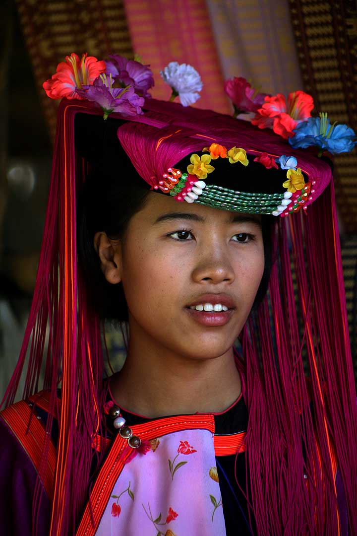

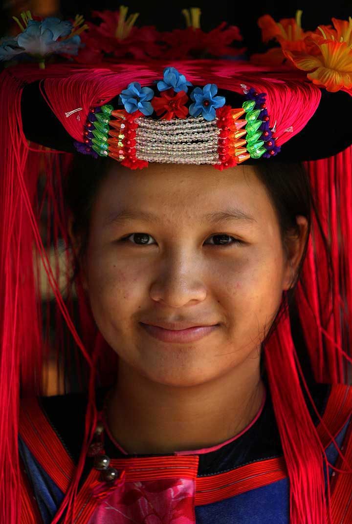
The Lisu people (Lisu: ꓡꓲ‐ꓢꓴ ꓫꓵꓽ; Burmese: လီဆူလူမျိုး, [lìsʰù]; Chinese: 傈僳族; pinyin: Lìsùzú; Thai: ลีสู่) are a Tibeto-Burman ethnic group who inhabit mountainous regions of Myanmar (Burma), southwest China, Thailand, and the Indian state of Arunachal Pradesh.
About 730,000 Lisu live in Lijiang, Baoshan, Nujiang, Dêqên and Dehong prefectures in Yunnan Province and Sichuan Province, China. The Lisu form one of the 56 ethnic groups officially recognized by China. In Myanmar, the Lisu are recognized as one of 135 ethnic groups and an estimated population of 600,000. Lisu live in the north of the country; Kachin State (Putao, Myitkyina, Danai, Waingmaw, Bhamo), Shan State (Momeik, Namhsan, Lashio, Hopang, and Kokang) and southern Shan State (Namsang, Loilem, Mongton), and Sagaing Division (Katha and Khamti), Mandalay Division (Mogok and Pyin Oo Lwin). Approximately 55,000 live in Thailand, where they are one of the six main hill tribes. They mainly inhabit remote mountainous areas. (Full article...) -
The State Administration Council (Burmese: နိုင်ငံတော်စီမံအုပ်ချုပ်ရေးကောင်စီ; abbreviated SAC or နစက) is the military junta currently governing Myanmar, established by Commander-in-Chief of Defence Services Min Aung Hlaing following the February 2021 coup d'état and the declaration of a state of emergency by the National Defence and Security Council. Under the constitution, the Commander-in-Chief holds absolute legislative, executive, and judicial power during a state of emergency. Min Aung Hlaing has delegated his legislative power to the SAC, which he chairs. It has formed a provisional administration, also led by Min Aung Hlaing as Prime Minister of Myanmar.
The Committee Representing Pyidaungsu Hluttaw (CRPH) has designated the SAC as a "terrorist group", and SAC's legitimacy is contested by the competing National Unity Government of Myanmar (NUG). (Full article...)


Did you know (auto-generated) -

- ... that Maw Htun Aung, a Shan Nationalities League for Democracy candidate in the 2020 Myanmar general election, is Kachin, not Shan?
- ... that one academic described the introduction of femboys to Myanmar as a tactic to achieve an "ideological revolution"?
- ... that the Burmese Buddhist monk Sagyo Thu-Myat successfully lobbied for the recalibration of the Burmese calendar?
- ... that the talabaw soup, which consists primarily of bamboo shoots, is the essential dish of Myanmar's Karen people, who use it to supplement rice?
- ... that Maung O, Prince of Salin, and his sister Nanmadaw Me Nu became de facto rulers of Burma when King Bagyidaw was suffering from depression?
- ... that the Myanmar Coast Guard was initially proposed as a civilian law enforcement agency before being established as a branch of the military three years later?
- ... that as part of the coronation of Mindon Min, the square yuzana around the capital was designated a sanctuary?
- ... that Esther Ze Naw, who appeared on the 2021 Time 100, was one of the few people in Myanmar who protested against Aung San Suu Kyi's defence of the military at the International Court of Justice in December 2019?
Related portals and projects
General images -
-
 Former US President Barack Obama poses barefoot on the grounds of Shwedagon Pagoda, one of Myanmar's major Buddhist pilgrimage sites. (from Culture of Myanmar)
 -
 Grandfather Island, Dawei (from Geography of Myanmar)
 -
 Vegetable stall on the roadside at the Madras Lancer Lines, Mandalay, January 1886. Photographer: Hooper, Willoughby Wallace (1837–1912). (from History of Myanmar)
 -
 Political Map of Burma (Myanmar) c. 1450 CE. (from History of Myanmar)
 -
 Two female musicians play the saung at a performance in Mandalay. (from Culture of Myanmar)
 -
 The paddle steamer Ramapoora (right) of the British India Steam Navigation Company on the Rangoon river having just arrived from Moulmein. 1895. Photographers: Watts and Skeen (from History of Myanmar)
 -
 19th-century funeral cart and spire, which would form part of the procession from the home to the place of cremation (from Culture of Myanmar)
 -
 The restored Taungoo or Nyaungyan dynasty c. 1650 CE. (from History of Myanmar)
 -
 A theatrical performance of the Mon dance (from Culture of Myanmar)
 -
 Portuguese ruler and soldiers mounting an Elephant. Philips, Jan Caspar (draughtsman and engraver) (from History of Myanmar)
 -
 A bull fight, 19th-century watercolour (from Culture of Myanmar)
 -
 A group of Buddhist worshipers at Shwedagon Pagoda, an important religious site for Burmese Buddhists (from Culture of Myanmar)
 -
 Mountains near Pindaya on the Shan Plateau (from Geography of Myanmar)
 -
 Salween river at Mae Sam Laep on the Thai-Myanmar border (from Geography of Myanmar)
 -
 Jade Mine in Hpakant (from Geography of Myanmar)
 -
 Boxing match, 19th-century watercolour (from Culture of Myanmar)
 -
 Protesters in Yangon carrying signs reading "Free Daw Aung San Suu Kyi" on 8 February 2021. (from History of Myanmar)
 -
 Saint Mary's Cathedral in Downtown Yangon is the largest Roman Catholic cathedral in Burma. (from Culture of Myanmar)
 -
 Pagan Kingdom during Narapatisithu's reign. Burmese chronicles also claim Kengtung and Chiang Mai. Core areas shown in darker yellow. Peripheral areas in light yellow. Pagan incorporated key ports of Lower Burma into its core administration by the 13th century. (from History of Myanmar)
 -
 Aung San Suu Kyi addresses crowds at the NLD headquarters shortly after her release. (from History of Myanmar)
 -
 Hlei pyaingbwè - a Burmese regatta (from Culture of Myanmar)
 -
 A wide range of Burmese lacquerware from Bagan (from Culture of Myanmar)
 -
 British soldiers on patrol in the ruins of the Burmese town of Bahe during the advance on Mandalay, January 1945. (from History of Myanmar)
 -
 Protesters in Yangon with a banner that reads non-violence: national movement in Burmese, in the background is Shwedagon Pagoda. (from History of Myanmar)
 -
 Temples at Mrauk U, was the capital of the Mrauk U Kingdom, which ruled over what is now Rakhine State. (from History of Myanmar)
 -
 Sculpture of Myanmar mythical lion (from Culture of Myanmar)
 -
 Aerial view of a burned Rohingya village in Rakhine state, Myanmar, September 2017 (from History of Myanmar)
 -
 A large fracture on the Mingun Pahtodawgyi caused by the 1839 Ava earthquake. (from Geography of Myanmar)
 -

-
 The shores of Irrawaddy River at Nyaung-U, Bagan (from Geography of Myanmar)
 -
 Recorder's Court on Sule Pagoda Road, with the Sule Pagoda at the far end, Rangoon, 1868. Photographer: J. Jackson. (from History of Myanmar)
 -
 Mount Popa, a dormant volcano in the Central Lowlands (from Geography of Myanmar)
 -

-

-
 A wedding procession, with the groom and bride dressed in traditional Burmese wedding clothes, reminiscent of royal attire (from Culture of Myanmar)
 -
 Myinhkin thabin - equestrian sport (from Culture of Myanmar)
 -

-
 British soldiers remove their shoes at the entrance of Shwedagon Pagoda. To the left, a sign reads "Foot wearing is strictly prohibited" in Burmese, English, Tamil, and Urdu. (from Culture of Myanmar)
 -
 Myanmar (Burma) map of Köppen climate classification (from Geography of Myanmar)
 -
 British soldiers dismantling cannons belonging to King Thibaw's forces, Third Anglo-Burmese War, Ava, 27 November 1885. Photographer: Hooper, Willoughby Wallace (1837–1912). (from History of Myanmar)


_headquarter.jpg)


Major topics
Categories

More topics
Associated Wikimedia
The following Wikimedia Foundation sister projects provide more on this subject:
-
 Commons
Free media repository -
 Wikibooks
Free textbooks and manuals -
 Wikidata
Free knowledge base -
 Wikinews
Free-content news -
 Wikiquote
Collection of quotations -
 Wikisource
Free-content library -
 Wikiversity
Free learning tools -
 Wikivoyage
Free travel guide -
 Wiktionary
Dictionary and thesaurus


