ကြိုဆိုပါတယ်။ / Welcome to the Myanmar Portal 

Myanmar, officially the Republic of the Union of Myanmar and also known as Burma (the official name until 1989), is a country in Southeast Asia. It is the largest country by area in Mainland Southeast Asia and has a population of about 55 million. It is bordered by Bangladesh and India to its northwest, China to its northeast, Laos and Thailand to its east and southeast, and the Andaman Sea and the Bay of Bengal to its south and southwest. The country's capital city is Naypyidaw, and its largest city is Yangon (formerly Rangoon).
Myanmar is a member of the East Asia Summit, Non-Aligned Movement, ASEAN, and BIMSTEC, but it is not a member of the Commonwealth of Nations despite once being part of the British Empire. Myanmar is a Dialogue Partner of the Shanghai Cooperation Organization. The country is very rich in natural resources, such as jade, gems, oil, natural gas, teak and other minerals, as well as also endowed with renewable energy, having the highest solar power potential compared to other countries of the Great Mekong Subregion. However, Myanmar has long suffered from instability, factional violence, corruption, poor infrastructure, as well as a long history of colonial exploitation with little regard to human development. In 2013, its GDP (nominal) stood at US$56.7 billion and its GDP (PPP) at US$221.5 billion. The income gap in Myanmar is among the widest in the world, as a large proportion of the economy is controlled by cronies of the military junta. Myanmar is one of the least developed countries; as of 2020, according to the Human Development Index, it ranks 147 out of 189 countries in terms of human development, the lowest in Southeast Asia. Since 2021, more than 600,000 people were displaced across Myanmar due to the surge in violence post-coup, with more than 3 million people in dire need of humanitarian assistance. (Full article...)
Selected articles -
-

Nyi Nyi Lwin (Burmese: ညီညီလွင်; MLCTS: Nyi Nyi Lwang; born 19 June 1979), more widely known by his monastic name U Gambira (Burmese: ရှင်ဂမ္ဘီရ), is a former Buddhist monk, activist and a leader of the All-Burma Monks' Alliance, a group which helped lead the 2007 protests against Burma's military government. Following the protests, he went into hiding and published two editorials critical of the Burmese government in The Washington Post and The Guardian on 4 November 2007. He was arrested the same day.
In November 2008, he was sentenced to 68 years in prison, including 12 years hard labour; the sentence was reduced to 65 years on appeal. Gambira reportedly protested his imprisonment by organising chanting with other imprisoned monks, boycotting his trial, and going on hunger strike. Human rights groups including Amnesty International and Human Rights Watch also protested his imprisonment. (Full article...) -

U Thaw (Burmese: ဦးသော်; 5 September 1893 – 25 June 1980), known honorifically as Baganset U Thaw (Burmese: ပန်းကန်စက် ဦးသော်), was a Burmese businessman, trader, administrator, and politician. He was the first manufacturer of porcelain products in Burma. He was a member of the Legislative Council of Burma, patron of the Young Men's Buddhist Association (YMBA), chairman of Myoma National High School Administration Board, and one of the leaders of the General Council of Burmese Associations. (Full article...) -
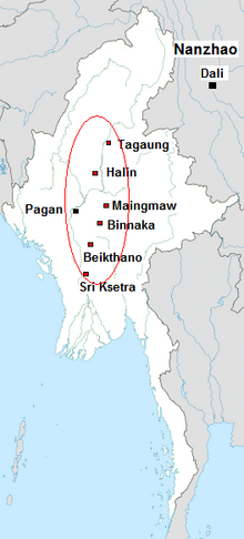
The Early Pagan Kingdom (Burmese: ခေတ်ဦး ပုဂံ ပြည်) was a city-state that existed in the first millennium CE before the emergence of the Pagan Empire in the mid 11th century. The Burmese chronicles state that the "kingdom" was founded in the second century CE. The seat of power of the small kingdom was first located at Arimaddana, Thiri Pyissaya, and Tampawaddy until 849 CE when it was moved to Pagan (Bagan).
Radiocarbon dating shows the earliest human settlement in the Pagan region dates only from the mid-7th century CE. It existed alongside Pyu city-states that dominated Upper Burma. The city-state of Pagan, according to mainstream scholarship, was founded in the mid 9th century by the Mranma of Nanzhao Kingdom. Burmans at Pagan expanded irrigation-based cultivation while borrowing extensively from the Pyus' predominantly Buddhist culture. It was one of many competing city-states in the Pyu realm until the late 10th century when the principality began absorbing its surrounding states. The expansion accelerated in the 1050s and 1060s when King Anawrahta founded the Pagan Empire, the first ever unification of the Irrawaddy valley and its periphery. (Full article...) -

Laphet, served in a traditional lacquer tray called laphet ok.
Burmese cuisine encompasses the diverse regional culinary traditions of Myanmar, which have developed through longstanding agricultural practices, centuries of sociopolitical and economic change, and cross-cultural contact and trade with neighboring countries at the confluence of Southeast Asia, East Asia, and South Asia, such as modern-day nations of Thailand, China, and India, respectively. Mohinga, a savory fish soup with lemongrass and banana leaves are eaten for breakfast with rice noodles, lunch is rice accompanied with small side dishes of vegetables, a small soup and a meat or fish dish. Dinner is consumed in a similar fashion to lunch. Burmese stews or curries are not Indian curries but milder with reliance on the trio of onion garlic and ginger to create savory gravies. Burmese food does not rely heavily on coconut such as in Thai cuisine. Burmese however enjoy spicy food with addition of chilis mixed into the dishes.
Burmese cuisine is typified by a wide-ranging array of dishes, including traditional stews Burmese curries, Burmese salads, accompanied by soups and a medley of vegetables that are traditionally eaten with white rice. Burmese cuisine also features Indian breads as well as noodles in many forms, such as fried, in soups, or as most popularly consumed as salads. Street food and snack culture has also nurtured the profuse variety of traditional Burmese fritters and modern savory and sweet snacks labeled under the umbrella of mont. (Full article...) -
The royal chronicles of Myanmar (Burmese: မြန်မာ ရာဇဝင် ကျမ်းများ [mjəmà jàzəwɪ̀ɰ̃ tɕáɰ̃ mjá]; also known as Burmese chronicles) are detailed and continuous chronicles of the monarchy of Myanmar (Burma). The chronicles were written on different media such as parabaik paper, palm leaf, and stone; they were composed in different literary styles such as prose, verse, and chronograms. Palm-leaf manuscripts written in prose are those that are commonly referred to as the chronicles. Other royal records include administrative treatises and precedents, legal treatises and precedents, and censuses.
The chronicle tradition was maintained in the country's four historical polities: Upper Burma, Lower Burma, Arakan and the Shan states. The majority of the chronicles did not survive the country's numerous wars as well as the test of time. The most complete extant chronicles are those of Upper Burma-based dynasties, with the earliest extant chronicle dating from the 1280s and the first standard national chronicle from the 1720s. (Full article...) -
The Padah-Lin Caves (Burmese: ဗဒလင်းဂူ, pronounced [bədəlíɰ̃ ɡù]; also Padalin or Badalin) are limestone caves located in Taunggyi District, Shan State, Burma (Myanmar). It is located near a path from Nyaunggyat to Yebock, on a spur of the Nwalabo mountains within the Panlaung Reserved Forest. There are two caves; the smaller of the two is a rock shelter while the larger cave comprises nine chambers connected by narrow passages in a north-south axis, three large sinkholes that let natural light in, and several active speleothem formations. (Full article...) -

Magway Region (Burmese: မကွေးတိုင်းဒေသကြီး, pronounced [məɡwé táiɰ̃ dèθa̰ dʑí]; formerly Magway Division) is an administrative division in central Myanmar. It is the second largest of Myanmar's seven divisions, with an area of 44,820 km2 (17,306 square miles). Pa Del Dam (ပဒဲဆည်) is one of the dams in Aunglan Township, Magway Division. The capital and second largest city of the Magway Division is Magway. The largest city is Pakokku. The major cities of Magway Division are Magway, Pakokku, Aunglan, Yenangyaung, Taungdwingyi, Chauk, Minbu, Thayet and Gangaw. (Full article...) -
Hkakaborazi National Park is a national park in northern Myanmar with an area of 1,472 sq mi (3,810 km2). It was established in 1998.
It surrounds Hkakabo Razi, the highest mountain in the country.
It ranges in elevation from 2,950 to 18,730 ft (900 to 5,710 m) comprising evergreen forest and mixed deciduous forests in Nogmung Township, Kachin State. It is managed by the Nature and Wildlife Conservation Division.
It is contiguous with Bumhpa Bum Wildlife Sanctuary and Hukaung Valley Wildlife Sanctuary. These protected areas together with Hponkanrazi Wildlife Sanctuary comprise the largest continuous expanse of natural forest called the Northern Forest Complex stretching over an area of 11,624 sq mi (30,110 km2). Its objective is to conserve the biodiversity of the Ayeyarwady and Chindwin river basins. (Full article...) -
On 2 July 2020, a major landslide at the Wai Khar jade mining site in the Hpakant area of Kachin State, Myanmar, killed between 175 and 200 miners in the country's deadliest-ever mining accident. At 06:30 local time (MMT) heavy rains triggered the collapse of a heap of mining waste, which came tumbling down into a lake. This generated a 6.1-meter (20 ft) wave of mud and water that buried those working at the Wai Khar mine. The miners killed or injured by the landslide were independent "jade pickers", who scavenge tailings from larger operators and who live in ramshackle quarters at the base of large mounds of rubble.
Myanmar's jade industry supplies 70% to 90% of the world jade supply. The industry had become known for its fatal accidents in the preceding years, with the previous deadliest accident in 2015 killing 116 people. While the government responded with promises to make reforms in the jade mining industry, activists claim that little has been done in practice since then. (Full article...) -
Win Myint (Burmese: ဝင်းမြင့်; MLCTS: wang: mrang. [wɪ́ɰ̃ mjɪ̰ɰ̃]; born 8 November 1951) is a Burmese politician who served as the tenth President of Myanmar from 2018 to 2021. Win Myint was removed from office in the 2021 military coup d'état. He was the Speaker of the House of Representatives of Myanmar from 2016 to 2018. He also served as a member of parliament in the House of Representatives (Pyithu Hluttaw) from 2012 to 2018. Win Myint was viewed as an important ally and of State Counsellor Aung San Suu Kyi, who served as the head of government. (Full article...)


.JPG)


Did you know (auto-generated) -

- ... that Aung Myo Min, Union Minister of Human Rights for the National Unity Government of Myanmar, is the country's first openly LGBT minister?
- ... that squatters in Myanmar were punished for protesting against the 2021 coup d'état by being evicted?
- ... that Thinzar Shunlei Yi hid in the Burmese jungle for a month and joined a rebel militia following the 2021 Myanmar coup d'état?
- ... that Rangoon kept its own time for more than two decades after Burma Standard Time first came into effect?
- ... that the talabaw soup, which consists primarily of bamboo shoots, is the essential dish of Myanmar's Karen people, who use it to supplement rice?
- ... that Esther Ze Naw, who appeared on the 2021 Time 100, was one of the few people in Myanmar who protested against Aung San Suu Kyi's defence of the military at the International Court of Justice in December 2019?
- ... that while defending Zaw Myint Maung following his arrest by the Myanmar junta, lawyer Ywet Nu Aung was herself arrested and charged?
- ... that the Burmese Buddhist monk Sagyo Thu-Myat successfully lobbied for the recalibration of the Burmese calendar?
Related portals and projects
General images -
-
 Mountains near Pindaya on the Shan Plateau (from Geography of Myanmar)
 -

-
 British soldiers dismantling cannons belonging to King Thibaw's forces, Third Anglo-Burmese War, Ava, 27 November 1885. Photographer: Hooper, Willoughby Wallace (1837–1912). (from History of Myanmar)
 -
 Recorder's Court on Sule Pagoda Road, with the Sule Pagoda at the far end, Rangoon, 1868. Photographer: J. Jackson. (from History of Myanmar)
 -
 A large fracture on the Mingun Pahtodawgyi caused by the 1839 Ava earthquake. (from Geography of Myanmar)
 -
 Sculpture of Myanmar mythical lion (from Culture of Myanmar)
 -
 Former US President Barack Obama poses barefoot on the grounds of Shwedagon Pagoda, one of Myanmar's major Buddhist pilgrimage sites. (from Culture of Myanmar)
 -
 Two female musicians play the saung at a performance in Mandalay. (from Culture of Myanmar)
 -
 The paddle steamer Ramapoora (right) of the British India Steam Navigation Company on the Rangoon river having just arrived from Moulmein. 1895. Photographers: Watts and Skeen (from History of Myanmar)
 -
 Saint Mary's Cathedral in Downtown Yangon is the largest Roman Catholic cathedral in Burma. (from Culture of Myanmar)
 -
 Vegetable stall on the roadside at the Madras Lancer Lines, Mandalay, January 1886. Photographer: Hooper, Willoughby Wallace (1837–1912). (from History of Myanmar)
 -
 A bull fight, 19th-century watercolour (from Culture of Myanmar)
 -
 Salween river at Mae Sam Laep on the Thai-Myanmar border (from Geography of Myanmar)
 -
 Political Map of Burma (Myanmar) c. 1450 CE. (from History of Myanmar)
 -
 Protesters in Yangon with a banner that reads non-violence: national movement in Burmese, in the background is Shwedagon Pagoda. (from History of Myanmar)
 -
 Myanmar (Burma) map of Köppen climate classification (from Geography of Myanmar)
 -
 A wide range of Burmese lacquerware from Bagan (from Culture of Myanmar)
 -
 Mount Popa, a dormant volcano in the Central Lowlands (from Geography of Myanmar)
 -
 Grandfather Island, Dawei (from Geography of Myanmar)
 -
 Portuguese ruler and soldiers mounting an Elephant. Philips, Jan Caspar (draughtsman and engraver) (from History of Myanmar)
 -

-
 A theatrical performance of the Mon dance (from Culture of Myanmar)
 -
 Temples at Mrauk U, was the capital of the Mrauk U Kingdom, which ruled over what is now Rakhine State. (from History of Myanmar)
 -
 A group of Buddhist worshipers at Shwedagon Pagoda, an important religious site for Burmese Buddhists (from Culture of Myanmar)
 -
 A wedding procession, with the groom and bride dressed in traditional Burmese wedding clothes, reminiscent of royal attire (from Culture of Myanmar)
 -
 Boxing match, 19th-century watercolour (from Culture of Myanmar)
 -
 19th-century funeral cart and spire, which would form part of the procession from the home to the place of cremation (from Culture of Myanmar)
 -
 The restored Taungoo or Nyaungyan dynasty c. 1650 CE. (from History of Myanmar)
 -

-
 Hlei pyaingbwè - a Burmese regatta (from Culture of Myanmar)
 -
 Aung San Suu Kyi addresses crowds at the NLD headquarters shortly after her release. (from History of Myanmar)
 -
 Myinhkin thabin - equestrian sport (from Culture of Myanmar)
 -
 Protesters in Yangon carrying signs reading "Free Daw Aung San Suu Kyi" on 8 February 2021. (from History of Myanmar)
 -
 British soldiers on patrol in the ruins of the Burmese town of Bahe during the advance on Mandalay, January 1945. (from History of Myanmar)
 -

-
 British soldiers remove their shoes at the entrance of Shwedagon Pagoda. To the left, a sign reads "Foot wearing is strictly prohibited" in Burmese, English, Tamil, and Urdu. (from Culture of Myanmar)
 -
 Aerial view of a burned Rohingya village in Rakhine state, Myanmar, September 2017 (from History of Myanmar)
 -
 Jade Mine in Hpakant (from Geography of Myanmar)
 -
 Pagan Kingdom during Narapatisithu's reign. Burmese chronicles also claim Kengtung and Chiang Mai. Core areas shown in darker yellow. Peripheral areas in light yellow. Pagan incorporated key ports of Lower Burma into its core administration by the 13th century. (from History of Myanmar)
 -
 The shores of Irrawaddy River at Nyaung-U, Bagan (from Geography of Myanmar)


_headquarter.jpg)


Major topics
Categories

More topics

Associated Wikimedia
The following Wikimedia Foundation sister projects provide more on this subject:
-
 Commons
Free media repository -
 Wikibooks
Free textbooks and manuals -
 Wikidata
Free knowledge base -
 Wikinews
Free-content news -
 Wikiquote
Collection of quotations -
 Wikisource
Free-content library -
 Wikiversity
Free learning tools -
 Wikivoyage
Free travel guide -
 Wiktionary
Dictionary and thesaurus


