The Indiana Portal
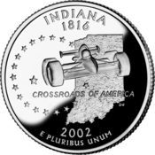
Various indigenous peoples inhabited what would become Indiana for thousands of years, some of whom the U.S. government expelled between 1800 and 1836. Indiana received its name because the state was largely possessed by native tribes even after it was granted statehood. Since then, settlement patterns in Indiana have reflected regional cultural segmentation present in the Eastern United States; the state's northernmost tier was settled primarily by people from New England and New York, Central Indiana by migrants from the Mid-Atlantic states and adjacent Ohio, and Southern Indiana by settlers from the Upland South, particularly Kentucky and Tennessee.
Indiana has a diverse economy with a gross state product of $352.62 billion in 2021. It has several metropolitan areas with populations greater than 100,000 and a number of smaller cities and towns. Indiana is home to professional sports teams, including the NFL's Indianapolis Colts and the NBA's Indiana Pacers. The state also hosts several notable competitive events, such as the Indianapolis 500, held at Indianapolis Motor Speedway. (Full article...)
Selected article -

Slavery in Indiana occurred between the time of French rule during the late seventeenth century and 1826, with a few traces of slavery afterward.
Opposition to slavery began to organize in Indiana around 1805, and in 1809 abolitionists took control of the territorial legislature and overturned many of the laws permitting retaining of slaves. By the time Indiana was granted statehood in 1816, the abolitionists were in firm control and slavery was banned in the constitution. In 1820, an Indiana Supreme Court ruling in Polly v. Lasselle freed Polly Strong and provided a precedent for other enslaved people. An additional Supreme Court ruling in 1821 freed indentured servant Mary Bateman Clark, helping to bring an end to indentured servitude. (Full article...)Selected image -
Did you know -
- ... that the 1938 film Road Demon contains footage of well-known accidents that occurred at Indianapolis Motor Speedway?
- ... that Gleaners Food Bank has served more than 700 million pounds (320 million kg) of food in Indiana?
- ... that Ganggang, an Indianapolis-based cultural development firm for Black artists, created a fine art fair called "Butter" that also included a dance party called "Melt"?
- ... that Citizens Square was almost named after Fort Wayne's Harry Baals?
- ... that William N. Salin was twice decorated with the Sagamore of the Wabash?
- ... that Indianapolis's 2023 gun control ordinance – which bans assault weapons, among other measures – is a trigger law that only goes into effect if Indiana's state preemption law is repealed or struck down?
Related portals
Selected geographic article -
Selected biography -

Thomas Riley Marshall (March 14, 1854 – June 1, 1925) was an American politician who served as the 28th vice president of the United States from 1913 to 1921 under President Woodrow Wilson. A prominent lawyer in Indiana, he became an active and well known member of the Democratic Party by stumping across the state for other candidates and organizing party rallies that later helped him win election as the 27th governor of Indiana. In office, he attempted to implement changes from his progressive agenda to the Constitution of Indiana, but his efforts proved controversial and were blocked by the Indiana Supreme Court.
Marshall's popularity as Indiana governor, and the state's status as a critical swing state, helped him secure the Democratic vice presidential nomination on a ticket with Wilson in 1912 and win the subsequent general election. An ideological rift developed between the two men during their first term leading Wilson to limit Marshall's influence in the administration. Marshall's brand of humor caused Wilson to move his office away from the White House, further isolating him. Marshall was targeted in an assassination attempt in 1915 for supporting intervention in World War I. During Marshall's second term he delivered morale-boosting speeches across the nation during the war and became the first U.S. vice president to hold cabinet meetings, which he did while Wilson was in Europe during peace negotiations. As he was president of the United States Senate, a small number of anti-war Senators kept it deadlocked by refusing to end debate. To enable critical wartime legislation to be passed, Marshall had the body adopt its first procedural rule allowing filibusters to be ended by a two-thirds majority vote—a variation of this rule remains in effect. (Full article...)Selected quote
General images
Topics
- Economy: AM General - ATA Airlines - Casinos - Cummins - Delta - ITT - JayC - Lilly - Limestone - Manufacturing - NiSource - Shoe Carnival - Simon Property Group - Soybeans - Studebaker - Vectren - WellPoint
- Geography: Caves - Lakes - Rivers - State forests - Watersheds
Categories
Attractions
 |
Recognized content
| This is a list of recognized content, updated weekly by JL-Bot (talk · contribs) (typically on Saturdays). There is no need to edit the list yourself. If an article is missing from the list, make sure it is tagged (e.g. {{WikiProject Indiana}}) or categorized correctly and wait for the next update. See WP:RECOG for configuration options. |
Good articles
- 1963 Indiana State Fairgrounds Coliseum gas explosion
- 2006 Brickyard 400
- 2011 South Bend mayoral election
- 2015 South Bend mayoral election
- 2019 South Bend mayoral election
- 2021 NCAA Division I men's basketball championship game
- Max Bielfeldt
- The Fault in Our Stars (film)
- Hurley Goodall
- Proposed South Shore Line station in South Bend
- WCAE
Featured pictures
-
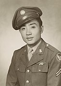
Kenje Ogata 1943
-
Kurt Vonnegut by Bernard Gotfryd (1965)
-
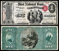
US-NBN-IL-Lebanon-2057-Orig-1-400-C
WikiProjects
State facts
Indiana | |
|---|---|
| Country | United States |
| Admitted to the Union | December 11, 1816 (19th) |
| Capital | Indianapolis |
| Largest city | Indianapolis |
| Largest metro and urban areas | Indianapolis-Carmel MSA |
| Government | |
| • Governor | Eric Holcomb (R) (2017) |
| • Lieutenant Governor | Suzanne Crouch (R) (2017) |
| Legislature | Indiana General Assembly |
| • Upper house | Senate |
| • Lower house | House of Representatives |
| U.S. senators | Todd Young (R) Mike Braun (R) |
| Population | |
| • Total | 6,080,485 |
| • Density | 169.5/sq mi (65.46/km2) |
| Language | |
| • Official language | English |
| Latitude | 37° 46′ N to 41° 46′ N |
| Longitude | 84° 47′ W to 88° 6′ W |
Things you can do
 |
Here are some tasks awaiting attention:
|
Associated Wikimedia
The following Wikimedia Foundation sister projects provide more on this subject:
-
Commons
Free media repository -
Wikibooks
Free textbooks and manuals -
Wikidata
Free knowledge base -
Wikinews
Free-content news -
Wikiquote
Collection of quotations -
Wikisource
Free-content library -
Wikiversity
Free learning tools -
Wikivoyage
Free travel guide -
Wiktionary
Dictionary and thesaurus
- ^ a b "Elevations and Distances in the United States". U.S Geological Survey. 29 April 2005. Retrieved 2006-11-06.
