The Indiana Portal
Various indigenous peoples inhabited what would become Indiana for thousands of years, some of whom the U.S. government expelled between 1800 and 1836. Indiana received its name because the state was largely possessed by native tribes even after it was granted statehood. Since then, settlement patterns in Indiana have reflected regional cultural segmentation present in the Eastern United States; the state's northernmost tier was settled primarily by people from New England and New York, Central Indiana by migrants from the Mid-Atlantic states and adjacent Ohio, and Southern Indiana by settlers from the Upland South, particularly Kentucky and Tennessee.
Indiana has a diverse economy with a gross state product of $352.62 billion in 2021. It has several metropolitan areas with populations greater than 100,000 and a number of smaller cities and towns. Indiana is home to professional sports teams, including the NFL's Indianapolis Colts and the NBA's Indiana Pacers. The state also hosts several notable competitive events, such as the Indianapolis 500, held at Indianapolis Motor Speedway. (Full article...)
Selected article -

Selected image -
 |
Did you know -
- ... that LGBT rights activist Kit Malone helped create the first transgender organized marching group in the Indianapolis Pride Parade's history?
- ... that William N. Salin was twice decorated with the Sagamore of the Wabash?
- ... that an "army" of women were congratulated by Pat Nixon for their fundraising efforts to bring public TV to Indianapolis?
- ... that Indianapolis's 2023 gun control ordinance – which bans assault weapons, among other measures – is a trigger law that only goes into effect if Indiana's state preemption law is repealed or struck down?
- ... that Gleaners Food Bank has served more than 700 million pounds (320 million kg) of food in Indiana?
- ... that Butt Drugs in Corydon, Indiana, had Butt Liquors and free parking in the rear?
Related portals
Selected geographic article -
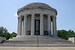
George Rogers Clark National Historical Park, located in Vincennes, Indiana, on the banks of the Wabash River at what is believed to be the site of Fort Sackville, is a United States National Historical Park. President Calvin Coolidge authorized a classical memorial and President Franklin D. Roosevelt dedicated the completed structure in 1936.
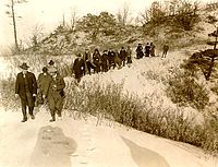
On February 25, 1779, Lieutenant Colonel George Rogers Clark, older brother of William Clark, led the capture of Fort Sackville and British Lt. Governor Henry Hamilton as part of the Illinois Campaign, which lasted from 1778 to 1779. The march of Clark's men from Kaskaskia on the Mississippi River in mid-winter and the subsequent victory over the British remains one of the most memorable feats of the American Revolution. (Full article...)Selected biography -
John Milton Hay (October 8, 1838 – July 1, 1905) was an American statesman and official whose career in government stretched over almost half a century. Beginning as a private secretary and an assistant for Abraham Lincoln, he became a diplomat. He served as United States Secretary of State under Presidents William McKinley and Theodore Roosevelt. Hay was also a biographer of Lincoln, and wrote poetry and other literature throughout his life.
Born in Salem, Indiana to an anti-slavery family that moved to Warsaw, Illinois, Hay showed great potential from an early age, and his family sent him to Brown University. After graduation in 1858, Hay read law in his uncle's office in Springfield, Illinois, adjacent to that of Lincoln. Hay worked for Lincoln's successful presidential campaign and became one of his private secretaries in the White House. Throughout the American Civil War, Hay was close to Lincoln and stood by his deathbed after the President was shot. In addition to his other literary works, Hay co-authored, with John George Nicolay, a ten-volume biography of Lincoln that helped shape the assassinated president's historical image. (Full article...)Selected quote
General images
Topics
- Economy: AM General - ATA Airlines - Casinos - Cummins - Delta - ITT - JayC - Lilly - Limestone - Manufacturing - NiSource - Shoe Carnival - Simon Property Group - Soybeans - Studebaker - Vectren - WellPoint
- Geography: Caves - Lakes - Rivers - State forests - Watersheds
Categories
Attractions
 |
Recognized content
| This is a list of recognized content, updated weekly by JL-Bot (talk · contribs) (typically on Saturdays). There is no need to edit the list yourself. If an article is missing from the list, make sure it is tagged (e.g. {{WikiProject Indiana}}) or categorized correctly and wait for the next update. See WP:RECOG for configuration options. |
Good articles
- 1963 Indiana State Fairgrounds Coliseum gas explosion
- 2006 Brickyard 400
- 2011 South Bend mayoral election
- 2015 South Bend mayoral election
- 2019 South Bend mayoral election
- 2021 NCAA Division I men's basketball championship game
- Max Bielfeldt
- The Fault in Our Stars (film)
- Hurley Goodall
- Proposed South Shore Line station in South Bend
- WCAE
Featured pictures
-
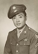
Kenje Ogata 1943
-
Kurt Vonnegut by Bernard Gotfryd (1965)
-
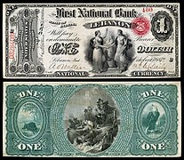
US-NBN-IL-Lebanon-2057-Orig-1-400-C
WikiProjects
State facts
Indiana | |
|---|---|
| Country | United States |
| Admitted to the Union | December 11, 1816 (19th) |
| Capital | Indianapolis |
| Largest city | Indianapolis |
| Largest metro and urban areas | Indianapolis-Carmel MSA |
| Government | |
| • Governor | Eric Holcomb (R) (2017) |
| • Lieutenant Governor | Suzanne Crouch (R) (2017) |
| Legislature | Indiana General Assembly |
| • Upper house | Senate |
| • Lower house | House of Representatives |
| U.S. senators | Todd Young (R) Mike Braun (R) |
| Population | |
| • Total | 6,080,485 |
| • Density | 169.5/sq mi (65.46/km2) |
| Language | |
| • Official language | English |
| Latitude | 37° 46′ N to 41° 46′ N |
| Longitude | 84° 47′ W to 88° 6′ W |
Things you can do
 |
Here are some tasks awaiting attention:
|
Associated Wikimedia
The following Wikimedia Foundation sister projects provide more on this subject:
-
Commons
Free media repository -
Wikibooks
Free textbooks and manuals -
Wikidata
Free knowledge base -
Wikinews
Free-content news -
Wikiquote
Collection of quotations -
Wikisource
Free-content library -
Wikiversity
Free learning tools -
Wikivoyage
Free travel guide -
Wiktionary
Dictionary and thesaurus
- ^ a b "Elevations and Distances in the United States". U.S Geological Survey. 29 April 2005. Retrieved 2006-11-06.


