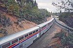
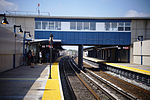
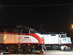
This is an archive of article summaries that have appeared in the Selected article section of Portal:Trains in 2016. For past archives, see the complete archive page.
- Week 52, 2016
- December 25, 2016 - January 1, 2017
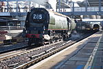
Patchway railway station (station code PWY) is on the South Wales Main Line, 6 miles (10 km) from Bristol Temple Meads, serving the Bristol suburbs of Patchway and Stoke Gifford in South Gloucestershire, England. As of 2015[update] it is managed by Great Western Railway, which is the third franchise to be responsible for the station since privatisation in 1997. They provide all train services at the station, mainly a train every hour in each direction between Cardiff Central and Taunton. The station was opened by the Bristol and South Wales Union Railway in 1863 with a single platform, 0.5 miles (0.8 km) west of the current location, but was resited in 1885 when the line was widened to double track. The station once had large buildings and a goods yard which were demolished in the late 20th century, with small brick shelters built in their place. The line through Patchway is due to be electrified as part of the 21st-century modernisation of the Great Western Main Line.
Recently selected: British Rail Class 86 - Othello station - North Philadelphia station
- Week 1
- January 2 - January 8
Pill railway station was a railway station on the Portishead Branch Line, 7.8 miles (12.6 km) west of Bristol Temple Meads, serving the village of Pill in North Somerset, England. The station was opened by the Bristol and Portishead Pier and Railway Company on 18 April 1867. It had two platforms, on either side of a passing loop, with a goods yard and signal box later additions. Services increased until the 1930s, at which point a half-hourly service operated. However the Portishead Branch was recommended for closure by the Beeching report, and the station was closed on 7 September 1964, although the line saw freight traffic until 1981. Regular freight trains through the station began to run again in 2002 when Royal Portbury Dock was connected to the rail network. The station is due to be reopened to passenger traffic in 2019 as part of MetroWest, a scheme to increase rail services in the Bristol area. The new station will have a single platform, an accessible footbridge and a car park, with trains running between Portishead and Bristol.
Recently selected: Patchway railway station - British Rail Class 86 - Othello station
- Week 2
- January 9 - January 15
Porter is an MBTA transfer station serving the rapid transit Red Line and the commuter rail Fitchburg Line, located at Porter Square in Cambridge, Massachusetts. Positioned at the intersection of Massachusetts and Somerville Avenues, the station provides rapid transit access to northern Cambridge and the western portions of Somerville. A series of commuter rail depots have been located at Porter Square under various names since the 1840s. The modern station with both subway and commuter rail levels was designed by Cambridge Seven Associates and opened on December 8, 1984. At 105 feet (32 m) below ground, the subway section is the deepest station on the MBTA system. The station originally had six artworks installed as part of the Arts on the Line program; five remain, including Gift of the Wind and Glove Cycle.
Recently selected: Pill railway station - Patchway railway station - British Rail Class 86
- Week 3
- January 16 - January 22
The Saverne Tunnel (French: Tunnel de Saverne), also known as the Ernolsheim-lès-Saverne Tunnel (French: Tunnel d'Ernolsheim-lès-Saverne), is a twin-bore, high-speed rail tunnel in western Bas-Rhin, France. It carries the LGV Est line of France's TGV high-speed rail network through the narrowest part of the Vosges mountain range, beneath Mont Saint-Michel and adjacent to the Saverne Pass. The tunnel consists of two bores, containing one railroad track each, that are connected by passageways every 500 metres (1,600 ft). The LGV Est crosses the 270 m (890 ft) Haspelbaechel viaduct near the western end of the tunnel. The tunnel was excavated by a tunnel boring machine between November 2011 and February 2013. Civil engineering work on the tunnel ended in April 2014 and it opened with the rest of the second phase of the LGV Est on 3 July 2016. The total cost of the tunnel was approximately €200 million.
Recently selected: Porter (MBTA station) - Pill railway station - Patchway railway station
- Week 4
- January 23 - January 29
Shore Line East (SLE) is a commuter rail service which operates along the Northeast Corridor through southern Connecticut, US. A fully owned subsidiary of the Connecticut Department of Transportation (ConnDOT), SLE provides service seven days a week along the Northeast Corridor from New London west to New Haven, with limited through service to Bridgeport and Stamford. Connecting service west of New Haven to New York City is available via Metro-North Railroad's New Haven Line. The service was introduced in 1990 as a temporary measure to reduce congestion during construction work on I-95. However, it proved more popular than expected, and service was continued after construction ended despite criticisms that the line was too expensive to operate. The service has been continually upgraded since its inception with rebuilt stations and new rolling stock as well as extensions to New London in 1996 and to Stamford in 2001. Around 1,900 to 2,100 riders use the service every weekday depending on the season.
Recently selected: Saverne Tunnel - Porter (MBTA station) - Pill railway station
- Week 5
- January 30 - February 5
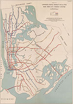
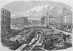
The Staten Island Tunnel is an abandoned, incomplete railway/subway tunnel in New York City. It was intended to connect railways on Staten Island (precursors to the modern-day Staten Island Railway) to the BMT Fourth Avenue Line of the New York City Subway, in Brooklyn, via a new crossing under the Narrows. Planned to extend 10,400 feet (3,200 m), the tunnel would have been among the world's longest at the time of its planning. Construction began in 1923, and the tunnel was excavated 150 feet (46 m) into the Narrows before New York City Mayor John Hylan, a former Brooklyn–Manhattan Transit Corporation (BMT) employee and initial proponent of the tunnel, canceled the project in 1925. The tunnel lies dormant under Owl's Head Park in Bay Ridge, Brooklyn. Later proposals to complete the tunnel, including the 1939 plans for the Independent Subway System's ambitious Second System, were never funded. Modern proposals for completion of the tunnel have come from New York City Councilman Lewis Fidler, who has proposed 0.33% tax for the tri-state region to pay for the construction. The tunnel was listed as one of many projects that could receive federal funds that were to have been allocated to the Access to the Region's Core tunnel, which was canceled in October 2010. State Senator Diane Savino was among the supporters of the tunnel; Savino stated that if built, the tunnel would cost $3 billion and would improve quality of life for Staten Islanders, reduce traffic, and increase the attractiveness of the borough for investment.
Recently selected: Shore Line East - Saverne Tunnel - Porter (MBTA station)
- Week 6
- February 6 - February 12
The Walt Disney World Railroad (WDWRR) is a 3 ft (914 mm) narrow gauge heritage railroad and attraction in the Walt Disney World Resort's Magic Kingdom theme park in Bay Lake, Florida, in the United States. Its route is 1.5 miles (2.4 km) in length and encircles the vast majority of the park, with stations in the Main Street, U.S.A., Frontierland, and Fantasyland sections. The rail line, which was built by Retlaw Enterprises (now Walt Disney Imagineering), is operated with four historic steam locomotives originally built by Baldwin Locomotive Works. Each of the four locomotives pulls a set of five passenger cars with seating capacity for 75 passengers per car, for a total of 375 passengers per train. The Walt Disney World Railroad opened to the public for the first time on October 1, 1971, the same day that the Magic Kingdom park first opened. Since then the WDWRR has become one of the world's most popular steam-powered railroads, with 3.7 million passengers served each year.
Recently selected: Staten Island Tunnel - Shore Line East - Saverne Tunnel
- Week 7
- February 13 - February 19
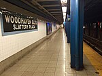
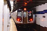
Woodhaven Boulevard is a local station on the IND Queens Boulevard Line of the New York City Subway, consisting of four tracks. Located in the Elmhurst neighborhood of Queens, it is served by the R train at all times except nights, when the E train takes over service. The M train provides additional service here on weekdays except nights. The station serves the adjacent Queens Center Mall, as well as numerous bus lines. Woodhaven Boulevard was opened on December 31, 1936, as Woodhaven Boulevard–Slattery Plaza. At the time, the station was part of the Independent Subway System. The plaza was demolished in the 1950s, but the name tablets displaying the station's original name were kept. In the 1980s, the Woodhaven Boulevard station was renamed after Queens Center, an adjacent shopping mall. The station was renovated in the 1990s after years of deterioration.
Recently selected: Walt Disney World Railroad - Staten Island Tunnel - Shore Line East
- Week 8
- February 20 - February 26
34th Street–Hudson Yards is a New York City Subway station in Manhattan's West Side on the IRT Flushing Line, and is the western (railroad south) terminus for the 7 local and <7> express services. It has two tracks and one island platform, with two levels of mezzanines: one directly above the platform and the other directly below street level. The station, originally part of the city's bid for the 2012 Summer Olympics and the failed attempt to build the West Side Stadium, was first scheduled to open in summer 2012. After a series of delays involving escalator, elevator, and fire and safety systems, the station finally opened on September 13, 2015. The 34th Street station is the first completely new station in the New York City Subway system since 1989, as well as the first such station funded by the government of New York City since 1950. The new construction, part of the city's and the MTA's master plan for the Far West Side, extended the IRT Flushing Line west from Times Square to Eleventh Avenue, then south to 34th Street. Although the West Side Stadium plan was rejected by city and state planning agencies, the 7 Subway Extension plan received approval to move ahead, as New York political leaders wanted to see the warehouse district west of Eighth Avenue and north of 34th Street redeveloped as part of the Hudson Yards Redevelopment Project, and subway service was to be an essential part of that effort. The extension also serves the Jacob K. Javits Convention Center, which was expanded in 2008–2014 and is located a block away from the station entrances.
Recently selected: Woodhaven Boulevard (IND Queens Boulevard Line) - Walt Disney World Railroad - Staten Island Tunnel
- Week 9
- February 27 - March 5
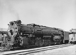
Under the Whyte notation for the classification of steam locomotives, a 2-10-4 locomotive has two leading wheels on one axle, usually in a bissel truck, ten coupled driving wheels on five axles, and four trailing wheels on two axles, usually in a bogie. These were referred to as the Texas type in most of the United States, the Colorado type on the Burlington Route and the Selkirk type in Canada.
Recently selected: 34th Street–Hudson Yards (IRT Flushing Line) - Woodhaven Boulevard (IND Queens Boulevard Line) - Walt Disney World Railroad
- Week 10
- March 6 - March 12
The Hatfield rail crash was a railway accident on 17 October 2000, at Hatfield, Hertfordshire, UK. It was caused by a metal fatigue induced derailment, killing four people and injuring more than 70. Though the accident did not result in a large number of deaths, it exposed major stewardship shortcomings of the privatised national railway infrastructure company Railtrack. Reports found there was a lack of communication and some staff were not aware of maintenance procedures. Railtrack subsequently went into administration and was replaced by Network Rail. The aftermath of the accident saw widespread speed limit reductions throughout the rail network and a tightening of health and safety procedures, the repercussions of which were still felt up to 15 years later. In 2005, both Network Rail and the contractor Balfour Beatty were found guilty of breaching health and safety laws.
Recently selected: 2-10-4 - 34th Street–Hudson Yards (IRT Flushing Line) - Woodhaven Boulevard (IND Queens Boulevard Line)
- Week 11
- March 13 - March 19
The IND Queens Boulevard Line is a line of the B Division of the New York City Subway in Manhattan and Queens, New York City, United States. The line, which is underground throughout its entire route, contains 23 stations. The core section between 50th Street in Hell's Kitchen, Manhattan, and 169th Street in Jamaica, Queens, was built by the Independent Subway System (IND) in stages between 1933 and 1940, with the Jamaica–179th Street terminus opening in 1950. The line's construction promoted housing growth along the Queens Boulevard corridor and stimulated the urbanization of central Queens, and there are multiple provisions for spur routes along the Queens Boulevard line that were never built. As of 2015[update], it is among the system's busiest lines, with a weekday ridership of over 460,000 people.
Recently selected: Hatfield rail crash - 2-10-4 - 34th Street–Hudson Yards (IRT Flushing Line)
- Week 12
- March 20 - March 26
Liverpool Street station, also known as London Liverpool Street, is a central London railway terminus and connected London Underground station in the north-eastern corner of the City of London, in the ward of Bishopsgate. It is one of the busiest railway stations in London, serving as the terminus of the West Anglia Main Line to Cambridge, the busier Great Eastern Main Line to Norwich, local and regional commuter trains serving east London and destinations in the East of England, and the Stansted Express service to Stansted Airport. The station opened in 1874 as a replacement for Bishopsgate station as the Great Eastern Railway's main London terminus. By 1895 it had the largest number of platforms on any terminal railway station in London. Liverpool Street was built as a dual-level station with provision for the Underground. A tube station opened in 1875 for the Metropolitan Railway, and the station today is served by the Central, Circle, Hammersmith & City and Metropolitan lines, and is in fare zone 1.
Recently selected: IND Queens Boulevard Line - Hatfield rail crash - 2-10-4
- Week 13
- March 27 - April 2
The Marshlink line is a railway line in South East England. It runs from Ashford, Kent via Romney Marsh, Rye and the Ore Tunnel to Hastings, connecting to the East Coastway Line towards Brighton. The line was constructed by the South Eastern Railway, settling a rivalry with the London, Brighton and South Coast Railway that led to disputes over the route and planning. It opened in 1851 after several false starts, followed by branch lines to Rye Harbour in 1854, Dungeness in 1881 and New Romney in 1884. The line struggled to be profitable and it seemed likely that it would close following the Beeching Report. All the branch lines were closed by 1967 but the main line was kept open because of poor road connections in the area. Services are currently being provided by Southern. The Marshlink line is one of the few in South East England that has not been electrified, and uses the British Rail Class 171 diesel rolling stock. Despite its relative unimportance in the national rail network, it is now considered politically significant as electrification of the line could allow High Speed 1 to be extended to Hastings and Eastbourne.
Recently selected: Liverpool Street station - IND Queens Boulevard Line - Hatfield rail crash
- Week 14
- April 3 - April 9
Union Station is an Amtrak railroad station and mixed-use commercial building in downtown Erie, in the U.S. state of Pennsylvania. The Lake Shore Limited provides passenger service between Chicago, New York City, and Boston; Erie is the train's only stop in Pennsylvania. The station's ground floor has been redeveloped into commercial spaces with offices in the remainder of the building. The first railroad station in Erie was established in 1851 but was replaced with the Romanesque Revival-style Union Depot in 1866. Through a series of mergers and acquisitions by competing railroad companies which started not long after the establishment of Erie's first railroads, Union Depot became jointly owned and operated by the New York Central and Pennsylvania railroads. To meet the changing needs of the rapidly growing city, planners designed a more modern structure to replace the original depot. The new Art Deco Union Station, dedicated on December 3, 1927, was the first railroad station of that style in the United States. Passenger rail service dwindled after World War II when air and highway travel became more popular. The New York Central and Pennsylvania Railroad were merged in 1968 to form Penn Central, and passenger rail was transferred from Penn Central to Amtrak in 1971. With reduced demand for train travel, Union Station was neglected and allowed to decay until Logistics Plus bought it in 2003. Since then it has been restored, with portions re-purposed as commercial and retail space.
Recently selected: Marshlink line - Liverpool Street station - IND Queens Boulevard Line
- Week 15
- April 10 - April 16
Grand Avenue–Newtown is a local station on the IND Queens Boulevard Line of the New York City Subway. Located under private property at the northeast corner of the intersection of Grand Avenue, Broadway, and Queens Boulevard in the neighborhood of Elmhurst, Queens, it is served by the R train at all times except nights, when the E train takes over service. The M train provides additional service here on weekdays except nights.
Recently selected: Union Station (Erie, Pennsylvania) - Marshlink line - Liverpool Street station
- Week 16
- April 17 - April 23
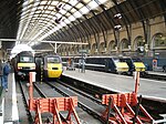
King's Cross railway station, also known as London King's Cross, is a Central London railway terminus on the northern edge of the city. It is one of the busiest railway stations in the United Kingdom, being the southern terminus of the East Coast Main Line to North East England and Scotland. The station was opened in 1852 by the Great Northern Railway It quickly grew and was expanded several times in the 19th century. It came under ownership of the London and North Eastern Railway as part of the Big Four grouping in 1923, who introduced famous services such as the Flying Scotsman and locomotives such as Mallard. The station complex was redeveloped in the 1970s, simplifying the layout and providing electric suburban services, and it became a major terminus for the high-speed InterCity 125. As of 2017, long-distance trains from King's Cross are run by Virgin Trains East Coast to Edinburgh Waverley and Glasgow Central via York and Newcastle; other long-distance operators include Hull Trains and Grand Central. In addition, Great Northern runs suburban commuter trains in and around north London. The station became well known for its association with the Harry Potter books and films, particularly the fictional Platform 9¾. Adjacent to King's Cross station is St. Pancras International, the London terminus for Eurostar services to continental Europe. Beneath both main line stations is King's Cross St. Pancras tube station on the London Underground, and combined they form one of the country's largest transport hubs.
Recently selected: Grand Avenue–Newtown (IND Queens Boulevard Line) - Union Station (Erie, Pennsylvania) - Marshlink line
- Week 17
- April 24 - April 30
Marylebone station is a Central London railway terminus and connected London Underground station in the Marylebone area of the City of Westminster. On the National Rail network it is also known as London Marylebone and is the southern terminus of the Chiltern Main Line to Birmingham. On the Underground it is on the Bakerloo line between Edgware Road and Baker Street. The station opened in 1899 as the London terminus of the Great Central Main Line (GCML), the last major railway to open in Britain in over 100 years, linking the capital to the cities of Nottingham, Sheffield and Manchester. Marylebone was the last of London's main line termini to be built, and is one of the smallest, having opened with half the number of platforms originally planned. Marylebone station suffered from a lack of traffic and after the GCML closed in 1966, it gradually declined in use. By the 1980s, it was threatened with closure, but was reprieved due to continued commuter traffic on the London to Aylesbury Line (a remaining part of the GCML) and from High Wycombe. In 1994 the station found a new role as the terminus of the Chiltern Main Line. Following the privatisation of British Rail, the station was expanded with two additional platforms in 2006 and improved services to Birmingham Snow Hill. In 2015 services began between Marylebone and Oxford Parkway via a new chord connecting the main line to the Oxford to Bicester Line, with an extension to Oxford following in 2016.
Recently selected: London King's Cross railway station - Grand Avenue–Newtown (IND Queens Boulevard Line) - Union Station (Erie, Pennsylvania)
- Week 18
- May 1 - May 7
Jamaica–179th Street is an express terminal station on the IND Queens Boulevard Line of the New York City Subway. Located under Hillside Avenue at 179th Street in the Jamaica neighborhood of Queens, it is served by the F train at all times, with a few rush-hour E trains also terminating here. The station has 15 entrances, including two at Midland Parkway in Jamaica Estates. Jamaica–179th Street was opened on December 11, 1950, although it had been planned to be built at 178th Street as early as 1928. At the time, the Queens Boulevard Line was part of the Independent Subway System (IND), but the original IND plans did not provide for constructing the 178th Street station until the line was extended even further to Queens Village. The line opened to 169th Street, the next station south, in 1937. Various changes in plans, as well as material shortages due to the Great Depression and World War II, delayed the project until 1946. Jamaica–179th Street became among Queens' busiest upon its 1950 opening. After a period of deterioration, the station was renovated twice, in the 1980s and the 2000s. As a result of planning for a never-built expansion to Queens Village, the station has 8 storage tracks to its east, giving it the highest peak capacity of any New York City Subway station.
Recently selected: Marylebone station - London King's Cross railway station - Grand Avenue–Newtown (IND Queens Boulevard Line)
- Week 19
- May 8 - May 14
The North Shore Branch is an abandoned branch of the Staten Island Railway in New York City, which operated along Staten Island's North Shore from Saint George to Port Ivory. The line continues into New Jersey via the Arthur Kill Vertical Lift Bridge to Cranford Junction. The line started construction in 1884, and rapid transit service on the line started on February 23, 1886. Passenger service ended on March 31, 1953, and freight service ended by 1989. In 2005, freight service on the western portion of the line was reactivated, and there are proposals to reactivate the former passenger line for rail or bus service.
Recently selected: Jamaica–179th Street (IND Queens Boulevard Line) - Marylebone station - London King's Cross railway station
- Week 20
- May 15 - May 21
Tukwila International Boulevard is a light rail station located in Tukwila, Washington. It is situated between the SeaTac/Airport and Rainier Beach stations on the Central Link line, which runs from Seattle–Tacoma International Airport to Downtown Seattle as part of the Link light rail system. The station consists of two elevated side platforms enclosed in a structure northeast of the interchange of State Route 99 and State Route 518 in Tukwila, Washington. It also includes 662 total parking spaces and functions as a park and ride, one of only two on the line. Tukwila International Boulevard station opened on July 18, 2009, on the first day of Central Link service, and served as the line's terminus until SeaTac/Airport station opened in December 2009. Trains serve the station 20 hours a day on most days; the headway between trains is 6 minutes during peak periods, with less frequent service at other times. Tukwila International Boulevard station is also served by two RapidRide lines and two King County Metro bus routes that connect it to Downtown Seattle, Federal Way, Burien, Renton, Georgetown, and West Seattle.
Recently selected: North Shore Branch - Jamaica–179th Street (IND Queens Boulevard Line) - Marylebone station
- Week 21
- May 22 - May 28
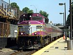
Wachusett is a commuter rail station on the MBTA Commuter Rail Fitchburg Line. It is northwest of the intersection of Massachusetts Route 2 and Route 31 in Fitchburg, Massachusetts. It serves as the northwestern terminus for Fitchburg Line trains. The opening of Wachusett extended service 4.5 miles (7.2 km) west from Fitchburg on the Pan Am Southern main line, lengthening the Fitchburg Line to 54 miles (87 km). The station is expected to draw 400 daily riders. After years of planning and discussion, work on the station began with site preparation in December 2012. Construction began in mid-2013. The station opened for limited weekday service on September 30, 2016, to satisfy the terms of the federal grant that funded it; full service began on November 21, 2016. At 54 miles (87 km) from North Station, Wachusett is the outermost MBTA station in Massachusetts; only Wickford Junction in Rhode Island is further from Boston.
Recently selected: Tukwila International Boulevard station - North Shore Branch - Jamaica–179th Street (IND Queens Boulevard Line)
- Week 22
- May 29 - June 4
Under the Whyte notation for the classification of steam locomotives by wheel arrangement, 4-6-0 represents the configuration of four leading wheels on two axles in a leading bogie, six powered and coupled driving wheels on three axles and no trailing wheels. In the mid 19th century, this wheel arrangement became the second most popular configuration for new steam locomotives in the United States of America, where this type is commonly referred to as a Ten-wheeler.
Recently selected: Wachusett (MBTA station) - Tukwila International Boulevard station - North Shore Branch
- Week 23
- June 5 - June 11
Arlanda Express is an airport rail link connecting Stockholm Central Station with the Stockholm-Arlanda Airport outside Stockholm, Sweden. Operated by A-Train AB, the trip takes 20 minutes and runs four to six times per hour using seven X3 electric multiple units. The services operate over the East Coast Line and the Arlanda Line and call at Stockholm Central Station, Arlanda North Station and Arlanda South Station. Planning of the airport link started in the 1980s. In 1993 the Government of Sweden issued a tender for a public–private partnership (PPP) to build the Arlanda Line. The construction of the line was subsidized with a combination of some state grants and large state loans. The successful tenderer would receive a monopoly on traffic between the airport and Stockholm until 2040. The line and the services were inaugurated on 25 November 1999. The PPP contract has since been criticized for being unclear, uneconomical for the state and leading to a low utilization of the service. The service was used by 2.7 million passengers in 2007 and by 3.3 million passengers in 2012.
Recently selected: 4-6-0 - Wachusett (MBTA station) - Tukwila International Boulevard station
- Week 24
- June 13 - June 18
In the timeline of electrification of the Norwegian railway network, the first electric industrial railway in Norway opened in 1892 at Skotfos Bruk near Skien. The first mainline systems to be electrified were private ore-hauling lines. The Thamshavn Line opened in 1909, and remained in revenue use until 1973, after which it was converted to a heritage railway. It is the world's oldest remaining alternating-current railway and the only narrow gauge railway in the country to have been electrified. It was followed by Norsk Transport's Rjukan and Tinnoset Lines in 1911, and Sydvaranger's Kirkenes–Bjørnevatn Line in 1922. The Norwegian State Railways' (NSB) first electrification began in 1922. In 1935, the Hardanger Line became the first section of new NSB track to be electrified. The 1950s saw the electrification of several regional and commuter lines around Oslo, including the Kongsvinger Line, the Trunk Line and the Dovre Line from Lillestrøm to Hamar, the Vestfold Line and the Eastern Østfold Line. This was largely due to NSB's program to remove all steam locomotives, either by electrification or by dieselization. The 1960s saw the remaining two steam lines in Southern Norway, the Bergen and Dovre Lines, electrified along with the Gjøvik Line. During the 1990s, a new program was attempted, this time to electrify the entire network, but only the Arendal Line was converted before the program was canceled. However, new lines around Oslo were electrified at the time they opened. Further plans have been launched, in particular the section of the Nordland Line from Trondheim to Steinkjer, which is part of the Trøndelag Commuter Rail, and the Meråker Line, which connects to the electrified Central Line in Sweden. In 2008, electric traction accounted for 90% of the passenger kilometers, 93% of the tonne kilometers and 74% of the energy consumption of all trains running in Norway, with the rest being accounted for by diesel traction.
Recently selected: Arlanda Express - 4-6-0 - Wachusett (MBTA station)
- Week 25
- June 19 - June 25
The Wootton Bassett SPAD incident refers to an incident on 7 March 2015 where a steam-hauled charter train passed a signal at danger (SPAD) near Wootton Bassett Junction, in Wiltshire, United Kingdom, and subsequently came to a stand across a high speed mainline junction. Another train, that had right of way, had passed through the junction 44 seconds earlier and no collision occurred nor was any damage done. As a direct result of the incident Network Rail banned the train's operator, West Coast Railway Company (WCRC), from operating trains anywhere on the British railway network. The Rail Accident Investigation Branch (RAIB) opened an investigation into the incident, which it called a "dangerous occurrence". The incident was rated the most serious SPAD in the United Kingdom since December 2010. Following improvements made by WCRC, the ban was lifted. In December 2015, the Office of Rail and Road initiated a prosecution against the driver of the train and WCRC for offences under the Health and Safety at Work Act 1974. The case was heard in June 2016. Both WCRC and the driver of the train pleaded guilty. WCRC was fined £200,000 plus costs. The driver received a sentence of four months imprisonment, suspended for eighteen months. In May 2016, the RAIB published a report on the incident, which largely blamed the incident on the train crew tampering with a safety system that would otherwise have safely brought the train to a halt.
Recently selected: Timeline of railway electrification in Norway - Arlanda Express - 4-6-0
- Week 26
- June 26 - July 2
The timeline of the transport system now known as the London Underground began in 1863 with the Metropolitan Railway, the world's first underground railway. Over the next forty years, the early sub-surface lines reached out from the urban centre of the capital into the surrounding rural margins, leading to the development of new commuter suburbs. At the end of the 19th and beginning of the 20th century, new technology—including electric locomotives and improvements to the tunnelling shield—enabled new companies to construct a series of "tube" lines deeper underground. Initially rivals, the tube railway companies began to co-operate in advertising and through shared branding, eventually consolidating under the single ownership of the Underground Electric Railways Company of London (UERL), with lines stretching across London. In 1933, the government brought the UERL and the Metropolitan Railway together as a single organisation, the London Passenger Transport Board. The London Underground has since passed through a series of administrations, expanding further by the construction of new extensions and through the acquisition of existing main line routes, culminating in its current form as part of Transport for London, the capital's current transport administration, controlled by the Greater London Authority.
Recently selected: 2015 Wootton Bassett SPAD incident - Timeline of railway electrification in Norway - Arlanda Express
- Week 27
- July 3 - July 9
The IND Culver Line (formerly BMT Culver Line) is a rapid transit line of the B Division of the New York City Subway, extending from Downtown Brooklyn south to Coney Island, Brooklyn, New York City, United States. The line is named after Andrew Culver, who built the original Culver Line that preceded the current subway line. The line starts at an interlocking north of Jay Street–MetroTech, where Culver Line trains can access the IND Sixth Avenue Line or IND Eighth Avenue Line, south to Church Avenue in Kensington, the line is mostly a four-track subway, though it rises to cross over the Gowanus Canal on the only above-ground structure on the original Independent Subway System. In Kensington, a ramp allows the line to rise onto a three-track elevated structure built by the City for operation by the Brooklyn Rapid Transit Company as part of the Dual Contracts. When this ramp was opened in 1954, the older route from Kensington northwest to Sunset Park remained as the Culver Shuttle until it was closed in 1975. The final portion of the line in Coney Island is on the lower level of a double-decked elevated structure, with the BMT Brighton Line above.
Recently selected: timeline of the London Underground - 2015 Wootton Bassett SPAD incident - Timeline of railway electrification in Norway
- Week 28
- July 10 - July 16
Aqueduct Racetrack is a station on the IND Rockaway Line of the New York City Subway. Located on the west side of Aqueduct Racetrack near Pitkin Avenue in South Ozone Park, Queens, it is served by northbound A trains at all times. The station was built in 1959 to serve the racetrack and on racing days the station would be open with "Aqueduct Special" trains running nonstop from 42nd Street. The specials were replaced by JFK Express service, before service at the station was altogether discontinued in 1992. The station reopened in 1997, but was closed again in 2011. It reopened in 2013 after being rebuilt in order to provide better access to the Resorts World Casino. Aqueduct Racetrack is one of the least-used stations in the system; it was ranked 392nd out of 422 by ridership as of 2016[update].
Recently selected: IND Culver Line - timeline of the London Underground - 2015 Wootton Bassett SPAD incident
- Week 29
- July 17 - July 23
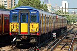
The British Rail Class 455 is a type of electric multiple-unit passenger train drawing power from a 750 V DC third rail. Built by BREL York works in the early and mid-1980s, they were initially categorised as Class 510 as the successor to the Class 508. They are used on suburban services in South London, by South West Trains and Govia Thameslink Railway (GTR) for Southern services.
Recently selected: Aqueduct Racetrack (IND Rockaway Line) - IND Culver Line - timeline of the London Underground
- Week 30
- July 24 - July 30
The Hastings line is a secondary railway line in Kent and East Sussex, England, linking Hastings with the main town of Tunbridge Wells, and from there into London via Tonbridge and Sevenoaks. Although primarily carrying passengers, the railway serves a gypsum mine which is a source of freight traffic. Southeastern operates passenger trains on the line. The railway was constructed by the South Eastern Railway in the early 1850s across the difficult terrain of the High Weald. Supervision of the building of the line was lax, enabling contractors to skimp on the lining of the tunnels. These deficiencies showed up after the railway had opened. Rectifications led to a restricted loading gauge along the line, requiring the use of dedicated rolling stock. Served by steam locomotives from opening until the late 1950s, passenger services were then taken over by a fleet of diesel-electric multiple units built to the line's loading gauge. Diesel locomotives handled freight, also built to fit the loading gauge. The diesel-electric multiple units served on the line until 1986, when the line was electrified and the most severely affected tunnels were reduced from double track to single.
Recently selected: British Rail Class 455 - Aqueduct Racetrack (IND Rockaway Line) - IND Culver Line
- Week 31
- July 31 - August 6
The IRT Broadway–Seventh Avenue Line (also known as the Seventh Avenue Line or the West Side Line) is a New York City Subway line. It is one of several lines that serves the A Division (IRT), stretching from South Ferry in Lower Manhattan north to Van Cortlandt Park–242nd Street in Riverdale, Bronx. The Brooklyn Branch is also part of the Broadway–Seventh Avenue Line. The line was constructed in two main portions by the Interborough Rapid Transit Company. The first portion, north of 42nd Street, was opened between 1904 and 1908, and is part of the first subway line in the city. The line ran from City Hall, up the Lexington Avenue Line, across 42nd Street, and up Seventh Avenue and Broadway, before splitting into the Broadway Branch and the Lenox Avenue Line. The second portion of the line, that south of 42nd Street, was constructed as part of the Dual Contracts, which were signed between the IRT, the New York Municipal Railway (a subsidiary of the Brooklyn Rapid Transit Company), and the City of New York. Among the various subway lines that were to be constructed as part of the contracts, the West Side Line was to be extended south along Seventh Avenue to serve Manhattan's West Side. This extension extended service to the end of Lower Manhattan and into Brooklyn, relieving crowding on the East Side Line, while opening up service to new areas. The Pennsylvania Railroad's new hub in Manhattan, Penn Station, could now be accessed by the subway. Two major projects are being undertaken on the southern portion of the line: the rebuilding of the Cortlandt Street station, and the rebuilding of the new South Ferry terminal. Following the September 11 attacks, the Cortlandt Street station was destroyed, and as a result, is being completely rebuilt with a new connection to the World Trade Center PATH station. In 2009, a new station at South Ferry opened to replace the old South Ferry loop station. The new station, a two-terminal, was intended to increase capacity and to save travel times. However, just three years later it closed as a result of Hurricane Sandy, which completely flooded the station. The loop station was temporarily open to serve the area, but it closed in June 2017 when the newer station reopened.
Recently selected: Hastings line - British Rail Class 455 - Aqueduct Racetrack (IND Rockaway Line)
- Week 32
- August 7 - August 13
Rainier Beach is a light rail station located in Seattle, Washington, in the Rainier Beach neighborhood. It is situated between the Tukwila International Boulevard and Othello stations on the Central Link line of the Link light rail system. The station consists of an at-grade island platform south of South Henderson Street in the median of Martin Luther King Jr. Way. The Rainier Beach area was first proposed for light rail service in 1995, and included in the final plan for Central Link approved in 1999. Construction on Rainier Beach station began in 2006, and regular train service began on July 18, 2009. Trains serve the station 20 hours a day on most days; the headway between trains is 6 minutes during peak periods, with less frequent service at other times. Rainier Beach station is also served by three King County Metro bus routes that connect it to Beacon Hill, Downtown Seattle, Georgetown, Mount Baker and Renton. The station also has six art installations that were funded by a systemwide art program.
Recently selected: IRT Broadway–Seventh Avenue Line - Hastings line - British Rail Class 455
- Week 33
- August 14 - August 20
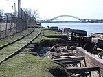
The Severn Railway Bridge was a bridge carrying the railway across the River Severn between Sharpness and Lydney, Gloucestershire. It was built in the 1870s by the Severn Bridge Railway Company, primarily to carry coal from the Forest of Dean to the docks at Sharpness; at that time it was the furthest downstream bridge over the Severn. The company was taken over in 1893 by the Great Western Railway and the Midland Railway Companies when it got into financial difficulties. The bridge continued to be used for freight and passenger services until 1960, and saw temporary extra traffic on the occasions that the Severn Tunnel was closed for engineering work. The bridge was approached from the north via a masonry viaduct and had twenty-two spans. The pier columns were formed of circular sections, bolted together and filled with concrete. The twenty-one regular wrought iron spans were then put in place, as well as the southernmost span, the swinging bridge over the Gloucester and Sharpness Canal. The bridge was 4,162 ft (1,269 m) long and 70 ft (21 m) above high water, a total of 6,800 tons of iron being used in its construction. After a series of collisions between river traffic and the bridge piers, the bridge was demolished between 1967 and 1970, with few traces remaining.
Recently selected: Rainier Beach station - IRT Broadway–Seventh Avenue Line - Hastings line
- Week 34
- August 21 - August 27
University Street is a light rail and bus station that is part of the Downtown Seattle Transit Tunnel in Seattle, Washington. The station is located under 3rd Avenue at University Street, between Westlake and Pioneer Square stations. It is served by the Central Link, part of Sound Transit's Link light rail system, as well as buses from King County Metro and Sound Transit Express. The station was designed in the style of high-tech architecture and includes several pieces of public art added during construction and later additions. The transit tunnel opened on September 15, 1990, and was used exclusively by buses until 2009. Along with all other stations in the transit tunnel, University Street station was closed from 2005 to 2007 for a major renovation to accommodate light rail. Link light rail service to the station began on July 18, 2009. Trains and buses serve the station 20 hours a day on most days; the headway between light rail trains is 6 minutes during peak periods, with less frequent service at other times.
Recently selected: Severn Railway Bridge - Rainier Beach station - IRT Broadway–Seventh Avenue Line
- Week 35
- August 28 - September 3
Wedgemere is a commuter rail station on the MBTA Commuter Rail Lowell Line located in the southeast portion of Winchester, Massachusetts. Wedgemere is served by most Lowell Line trains except for several expresses, as well as a small number of Haverhill Line trains which run via the Wildcat Branch. The station consists of two platforms serving the line's two tracks on an elevated grade. The 1957-built station building, largely unused, is adjacent to the inbound platform. After several years of work, the station was made fully handicapped accessible in February 2013.
Recently selected: University Street station - Severn Railway Bridge - Rainier Beach station
- Week 36
- September 4 - September 10
The West Somerset Mineral Railway was a 11+1⁄2-mile long (18.5 km) standard gauge line in Somerset, England, with a 310-yard (280 m) branch to Raleigh's Cross Mine. The line's core purpose was to carry iron ore northwards from mines on the Brendon Hills to Watchet harbour on the Bristol Channel. The line opened in 1861, and passenger services commenced in 1865. The mines' and line's "period of prosperity" ended in 1875 and by 1883 all mining had ceased. The line lingered on for passengers and small goods until 1898, when it closed. A new mineral venture was attempted in 1907, for which much of the line was re-opened and a 2 ft (610 mm)-gauge extension was added, but this failed and the line closed again in 1910. A section of the track was used to test and demonstrate an automatic signal warning device in 1911 and occasionally used in that connection up to 1914. The tracks were lifted for scrap in 1917, after which a light railway was laid on part of the trackbed in 1918 to carry timber. This ended in 1920 and the company was wound up in 1925. The line included a massive rope-worked inclined plane 3,272 feet (997 m) long to bring the ore down a 770 feet (230 m) vertical interval on a 1 in 4 (25%) gradient. A section of the inclined plane has been scheduled as an ancient monument. It can still be seen, along with the remains of some of the buildings and other structures.
Recently selected: Wedgemere (MBTA station) - University Street station - Severn Railway Bridge
- Week 37
- September 11 - September 17
72nd Street is a station on the first phase of the Second Avenue Line of the New York City Subway. Located at the intersection of Second Avenue and 72nd Street on the Upper East Side, it opened on January 1, 2017, with the Q train providing full-time service, as well as some N service during rush hours. This is the southernmost station on the first phase of the Second Avenue Line; south of this station, the BMT 63rd Street Line diverges to the west, towards the Lexington Avenue–63rd Street station, and bellmouths exist for a future extension to Second Avenue–Houston Street and Hanover Square.
Recently selected: West Somerset Mineral Railway - Wedgemere (MBTA station) - University Street station
- Week 38
- September 18 - September 24
The Downtown Seattle Transit Tunnel (DSTT), also referred to as the Metro Bus Tunnel, is a 1.3-mile-long (2.1 km) pair of public transit tunnels in Seattle, Washington, United States. It was used only by buses from its opening in 1990 until 2005, and since 2009 it has been shared by buses and light rail. The double-track tunnel and its stations, except Convention Place, constitute parts of the Central Link light rail line, which continues north to the University of Washington station and south through the Rainier Valley to Seattle–Tacoma International Airport as part of Sound Transit's Link light rail network. Its five stations are also served by King County Metro and Sound Transit Express buses that leave the tunnel north via Interstate 5, south via the SODO Busway, or east via Interstate 90. The DSTT is the busiest section of the Link light rail network, with an average of over 10,000 weekday boardings. It is one of two tunnels in the United States shared by buses and trains, the other being the Mount Washington Transit Tunnel in Pittsburgh, Pennsylvania, and is the only one in the United States with shared stations. Light rail service through the tunnel began on July 18, 2009. A stub tunnel, branching from the main tunnel, was constructed under Pine Street to allow light rail trains to stop and reverse direction; it was later used as the first segment of a light rail extension to Capitol Hill and the University of Washington that opened in 2016. Plans call for the downtown transit tunnel to lose its bus service during the permanent closure of Convention Place station in 2019; from that point on, the tunnel will be used only by light rail trains.
Recently selected: 72nd Street (Second Avenue Subway) - West Somerset Mineral Railway - Wedgemere (MBTA station)
- Week 39
- September 25 - October 1
Amfleet is a fleet of single-level intercity railroad passenger cars built by the Budd Company for American company Amtrak in the late 1970s and early 1980s. Budd based the Amfleet design on its earlier Metroliner electric multiple unit. An initial order for 57 cars in 1973 to supplement the Metroliners on the Northeast Corridor grew to two orders totaling 642 cars, sufficient to reequip all the services on the Northeast Corridor and many other routes around the United States. The first 492 cars, known as Amfleet I and completed between 1975–1977, were designed for short-distance service. A second order of 150 cars, known as Amfleet II and completed between 1980–1983, were designed for long-distance service. They were the last intercity passenger cars built by Budd. The Amfleets were the first new locomotive-hauled intercity cars ordered by Amtrak and the first such cars built in the United States since 1965. Their introduction in the mid-1970s led to improved reliability for Amtrak's trains and ridership gains. As of 2015, Amfleet cars are used extensively in the eastern and mid-western United States, forming the backbone of Amtrak's single-level fleet.
Recently selected: Downtown Seattle Transit Tunnel - 72nd Street (Second Avenue Subway) - West Somerset Mineral Railway
- Week 40
- October 2 - October 8
Ayer is a commuter rail station on the MBTA Commuter Rail Fitchburg Line, located off Main Street (Route 2A/111) in the Ayer Main Street Historic District in downtown Ayer, Massachusetts. There are three tracks through the station, two of which are served by a pair of low-level side platforms, which are not handicapped accessible. There is a shelter on the inbound platform. Ayer has been a major railroad interchange since the Fitchburg Railroad opened through South Groton in 1845, followed by the Stony Brook Railroad, Worcester and Nashua Railroad, and Peterborough and Shirley Railroad in 1848. The original depot was replaced with a union station with a large trainshed in 1848. A new station was constructed in 1896. By 1900, the town was served by five lines all controlled by the Boston and Maine Railroad, with service to Boston, Worcester, and Lowell plus New York, New Hampshire, and Maine. Passenger service ended on all of the lines except the Fitchburg Line between 1931 and 1961. After a brief disruption in early 1965, the Massachusetts Bay Transportation Authority began subsidizing commuter rail service to Ayer. The station and part of the line was closed in 1975, but reopened in 1980. Pan Am Railways also runs freight trains through the town to various destinations.
Recently selected: Amfleet - Downtown Seattle Transit Tunnel - 72nd Street (Second Avenue Subway)
- Week 41
- October 9 - October 15
Gandy dancer is a slang term used for early railroad workers, more formally referred to as "section hands", who laid and maintained railroad tracks in the years before the work was done by machines. The British equivalents of the term gandy dancer are "navvy" (from "navigator"), originally builders of canals or "inland navigations", for builders of railway lines, and "platelayer" for workers employed to inspect and maintain the track. In the Southwestern United States and Mexico, Mexican and Mexican-American track workers were colloquially "traqueros". In the United States, early section crews were often made up of recent immigrants and ethnic minorities who vied for steady work despite poor wages and working conditions, and hard physical labor. The Chinese, Mexican Americans, and Native Americans in the Western United States, the Irish in the Midwestern United States, and East Europeans and Italians in the Northeastern United States all worked as gandy dancers. Though all gandy dancers sang railroad songs, it may be that African American gandy dancers from the Southern United States, with a long tradition of using song to coordinate work, were unique in their use of task-related work chants. There are various theories about the derivation of the term, but most refer to the "dancing" movements of the workers using a specially manufactured 5-foot (1.52 m) "lining" bar, which came to be called a "gandy", as a lever to keep the tracks in alignment.
Recently selected: Ayer (MBTA station) - Amfleet - Downtown Seattle Transit Tunnel
- Week 42
- October 16 - October 22
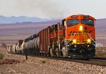
The BNSF Railway Company (reporting mark BNSF) is one of the largest freight railroad networks in North America, second to the Union Pacific Railroad (UP) (its primary competitor for Western U.S. freight), and is one of seven North American Class I railroads. It has 44,000 employees, 32,500 miles (52,300 km) of track in 28 states, and operates more than 8,000 locomotives. It has three transcontinental routes that provide rail connections between the western and eastern United States. BNSF trains traveled over 169 million miles (272 million km) in 2010, more than any other North American railroad. The BNSF and UP have a duopoly on all transcontinental freight rail lines in the Western U.S. and share trackage rights over thousands of miles of track. The creation of BNSF started with the formation of a holding company on September 22, 1995. This new holding company purchased the Atchison, Topeka and Santa Fe Railway (often called the "Santa Fe") and Burlington Northern Railroad, and formally merged the railways into the Burlington Northern and Santa Fe Railway on December 31, 1996. On January 24, 2005, the railroad's name was officially changed to "BNSF Railway," using the initials of its original name. On November 3, 2009, Warren Buffett's Berkshire Hathaway announced it would acquire the remaining 77.4 percent of BNSF it did not already own for $100 per share in cash and stock - a deal valued at $44 billion. The company is investing an estimated $34 billion in BNSF and acquiring $10 billion in debt. On February 12, 2010, shareholders of Burlington Northern Santa Fe Corporation voted in favor of the acquisition.
Recently selected: gandy dancer - Ayer (MBTA station) - Amfleet
- Week 43
- October 23 - October 29
Broad Street was a major terminal station in the City of London, adjacent to Liverpool Street station. It served as the main terminus of the North London Railway (NLR) network, running from 1865 to 1986. During its lifetime, it catered for mainly local suburban services around London, and over time struggled to compete with other modes of transport, leading to its closure. The station was built as a joint venture by the NLR and the London and North Western Railway (LNWR) in order to have a station serving freight closer to the City. It was immediately successful for both goods and passenger services and saw a significant increase in NLR traffic. Usage peaked in the early 20th century, after which it suffered from competition of London trams, buses, and particularly the London Underground network. Patronage gradually fell and services decreased, while the station building became increasingly dilapidated. By the 1980s, all freight services had been cancelled, and the station closed in 1986. The station building was replaced by Broadgate, an office and retail space, while part of the connecting line to the station was re-used as part of the London Overground.
Recently selected: BNSF Railway - gandy dancer - Ayer (MBTA station)
- Week 44
- October 30 - November 5
The Budd Metroliner was a class of American electric multiple unit (EMU) railcar designed for first-class, high-speed service between New York City and Washington, D.C., on the Northeast Corridor. They were designed for operation up to 150 mph (240 km/h) - what would have been the first high speed rail service in the Western Hemisphere. The Pennsylvania Railroad (PRR) ordered 61 Metroliner cars from the Budd Company in 1966 as part of a collaboration with the federal government to improve railroad service between New York, Philadelphia, and Washington. After difficulties testing the cars, PRR successor Penn Central began their eponymous Metroliner service on January 16, 1969. Amtrak took over the service in 1971. The Metroliner cars proved to have poor reliability, with less than two-thirds of the fleet in service at many times. Four cars were successfully overhauled for improved operation in 1974, but the rebuilding cost more than the original purchase price of the cars. Thirty-three more cars were overhauled. but by this time, new AEM-7 locomotives pulling Amfleet cars could match Metroliner schedules with higher reliability. Metroliners were withdrawn from Metroliner service entirely in 1981; they served until 1988 on Keystone Service trains. Despite their electrical flaws, the Metroliners proved mechanically sound. Beginning in 1987, Amtrak converted 23 former Metroliners for use as cab control cars on corridor trains. Fourteen more cars were used with minimal modifications - six as cab cars and 8 as trailer coaches. Most former Metroliners were scrapped between 2003 and 2011. However, some cab cars remain in use on Keystone Service and Shuttle trains. Three former Metroliners have also been converted to technology testing or track measurement cars, and one more is used by Amtrak as a special-purpose business car. One original Metroliner is preserved at the Railroad Museum of Pennsylvania.
Recently selected: Broad Street railway station (London) - BNSF Railway - gandy dancer
- Week 45
- November 6 - November 12
The Superliner is a type of bilevel intercity railroad passenger car used by Amtrak, the national rail passenger carrier in the United States. Amtrak ordered the cars to replace older single-level cars on its long-distance trains in the Western United States. The design was based on the Budd Hi-Level vehicles, employed by the Santa Fe Railway on its El Capitan trains. Car types include coaches, dining cars, lounges, and sleeping cars. Most passenger spaces are on the upper level, which features a row of windows on both sides. The Sightseer Lounge observation cars have distinctive floor-to-ceiling windows on the upper level. Boarding is on the lower level; passengers climb up a center stairwell to access the upper level. Pullman-Standard built 284 cars, known as Superliner I, in 1975–1981; Bombardier Transportation built 195, known as Superliner II, in 1991–1996. The Superliner I cars were the last passenger cars built by Pullman. The first Superliner I cars entered service in February 1979, with deliveries continuing through 1981. Amtrak assigned the cars to both long-distance and short-distance trains in the Western United States. The first permanent assignment, in October 1979, was to the Chicago–Seattle Empire Builder. Superliner II deliveries began in 1993; the additional cars enabled the retirement of the aging Hi-Level cars and the assignment of Superliners to trains in the Eastern United States. Tunnel clearances prevent their use on the Northeast Corridor.
Recently selected: Budd Metroliner - Broad Street railway station (London) - BNSF Railway
- Week 46
- November 13 - November 19
Broad Channel is a station on the IND Rockaway Line of the New York City Subway, located in the neighborhood of the same name at Noel and West Roads in the borough of Queens. It is served by the A train and the Rockaway Park Shuttle at all times, the latter of which originates/terminates here. Broad Channel originally opened in 1880 as a Long Island Railroad station. The LIRR discontinued service in 1950 after a fire on the trestle across Jamaica Bay, to the station's north. The station reopened June 28, 1956, as a subway station. Although is the least-used station in the subway system, this is the transfer point between the Rockaway Park Shuttle, which runs to Rockaway Park–Beach 116th Street, and the A train, which runs through Brooklyn and Manhattan. North of this station, two additional tracks are located within the right-of-way. One of the tracks is used to allow for Rockaway Park Shuttle trains to relay and to go back into service to the Rockaways, while the other track is called the Far Rockaway Test Track. The latter of the two tracks is used to test new subway cars to make sure that they are ready for acceptance into New York City Transit's fleet of subway cars.
Recently selected: Superliner (railcar) - Budd Metroliner - Broad Street railway station (London)
- Week 47
- November 20 - November 26
Capitol Hill is a light rail station in the Capitol Hill neighborhood of Seattle, Washington, United States. The station is served by Sound Transit's Link light rail system and is located near the intersection of Broadway and East John Street. The station consists of an island platform approximately 65-foot (20 m) under street level, connected to three surface entrances via two mezzanines. Capitol Hill had been proposed as the site of a subway stop in unimplemented plans from 1911 and 1968, but voter approval did not come until 1996. It was built as part of the University Link Extension, which began construction in 2009 and opened on March 19, 2016. Construction of the station required the demolition of two city blocks along Broadway, which will be redeveloped into a transit-oriented, mixed-use complex in 2019. Light rail trains serve the station 20 hours a day on most days; the headway between trains is 6 minutes during peak periods, with less frequent service at other times. The station is also served by the First Hill Streetcar and several King County Metro bus routes at nearby stops.
Recently selected: Broad Channel (IND Rockaway Line) - Superliner (railcar) - Budd Metroliner
- Week 48
- November 27 - December 3
The City of Denver was a streamlined passenger train operated by the Union Pacific Railroad between Chicago, Illinois, and Denver, Colorado. It operated between 1936 and 1971. From 1936–1955 the Chicago and North Western Railway handled the train east of Omaha, Nebraska; the Chicago, Milwaukee, St. Paul and Pacific Railroad (the "Milwaukee Road") handled it thereafter. The train was the fastest long-distance train in the United States when it debuted in 1936, covering 1,048 miles (1,687 km) in 16 hours. On its launch in 1936 the City of Denver used a pair of articulated trainsets built by Pullman-Standard. They were the fastest of the streamliners employed by the Union Pacific at the time and maintained the fastest long-distance schedule in the United States. The streamliners would remain in service until 1953, when conventional locomotive-hauled rolling stock replaced them. The City of Denver always carried both sleeping cars and coaches. For almost its entire career its principal competitor was the Chicago, Burlington and Quincy Railroad's Denver Zephyr. When Amtrak assumed operation of most intercity trains in the United States in 1971 it discontinued the City of Denver, preferring to use the Burlington's route between Chicago and Denver.
Recently selected: Capitol Hill station - Broad Channel (IND Rockaway Line) - Superliner (railcar)
- Week 49
- December 4 - December 10
Columbia City is a light rail station located in Seattle, Washington. It is situated between the Othello and Mount Baker stations on the Central Link line, which runs from Seattle–Tacoma International Airport to Downtown Seattle and the University of Washington as part of the Link light rail system. The station consists of two at-grade side platforms between South Alaska Street and South Edmunds Street in the median of Martin Luther King Jr. Way South in the Columbia City neighborhood, part of Seattle's Rainier Valley. The station opened on July 18, 2009. Trains serve the station 20 hours a day on most days; the headway between trains is 6 minutes during peak periods, with less frequent service at other times. Columbia City station is also served by two King County Metro bus routes that connect it to Mount Baker, Renton and West Seattle.
Recently selected: City of Denver - Capitol Hill station - Broad Channel (IND Rockaway Line)
- Week 50
- December 11 - December 17
Coney Island–Stillwell Avenue (also known as Coney Island Terminal and signed on some trains as either Coney Island or Stillwell Avenue) is a New York City Subway terminal in Coney Island, Brooklyn, acting as the railroad-south terminus for the D, F, N, and Q trains. The large facility, originally built in 1919, was designed at a time when Coney Island was the primary summer resort area for the New York metropolitan area, with all of the rail lines in southern Brooklyn funneling service to the area. It is one of the largest elevated transportation terminals in the world. Coney Island–Stillwell Avenue has eight tracks and four island platforms, with trains entering from both compass north and south. It is located at the corner of Stillwell and Surf Avenues in Coney Island, the site of the former West End Terminal. Geographically, the station is the southernmost terminal in the New York City Subway system.
Recently selected: Columbia City station - City of Denver - Capitol Hill station
- Week 51
- December 18 - December 24
The Caltrain Modernization Program (CalMod) is a $1.9 billion project that will add a positive train control (PTC) system and electrify the main line of the U.S. commuter railroad Caltrain, which serves cities in the San Francisco Peninsula and Silicon Valley, as well as transition from its current diesel-electric locomotive powered trains to electric multiple units (EMU). According to Caltrain, electrification of the tracks will allow it to improve service times via faster acceleration and shorter headways, reduce air pollution and noise, and facilitate a future railway tunnel (the Downtown Rail Extension) into downtown San Francisco's Transbay Transit Center (as diesel trains cannot serve underground stations). Proposals for electrifying the line began as early as 1992, when the California Department of Transportation conducted an early feasibility study. When completed, CalMod will electrify 51 miles (82 km) of tracks between 4th and King station and Tamien Station and install a PTC management system along the tracks. PTC is designed to fulfill federal safety mandates for passenger rail and is part of the Federal Railroad Administration (FRA) waiver to use EMUs on tracks shared with freight traffic. Funding for the project comes from various federal, state, and local sources, including from the California High-Speed Rail Authority. Caltrain plans to complete the project by 2021, after which it plans to use double-decker EMU Stadler Rail trainsets on the electrified route. Some of the diesel locomotives will be retained for service south of Tamien.
Recently selected: Coney Island–Stillwell Avenue (New York City Subway) - Columbia City station - City of Denver
- Week 52
- December 25 - December 31
The EMD SDP40F was a six-axle 3,000 hp (2.2 MW) C-C diesel–electric locomotive built by General Motors Electro-Motive Division (EMD) from 1973–1974. EMD built 150 for Amtrak, the operator of most intercity passenger trains in the United States. Amtrak had begun operation in 1971 with a fleet of aging diesel locomotives inherited from various private railroads. The SDP40F was the first diesel locomotive built new for Amtrak and for a brief time they formed the backbone of the company's long-distance fleet. A series of derailments in the mid-1970s shattered Amtrak's confidence in the locomotive, and many railroads banned it from their tracks. Multiple investigations pointed to issues with the locomotive's trucks, the weight of the water and steam generators used for train heating, or the vibration of baggage cars behind the locomotive. In 1977 Amtrak decided to move on from the SDP40F in favor of the EMD F40PH, which was already in use on short-distance routes. Amtrak traded most of its fleet into EMD; the components were incorporated into new F40PHs. The remainder were traded to the Atchison, Topeka and Santa Fe Railway (ATSF) for use in freight service. The Santa Fe rebuilt the locomotives and designated them SDF40-2. The Burlington Northern Santa Fe Railway (BNSF), successor to the Santa Fe, retired them in 2002.
Recently selected: Electrification of Caltrain - Coney Island–Stillwell Avenue (New York City Subway) - Columbia City station


