This is an archive of article summaries that have appeared in the Selected article section of Portal:Trains in 2013. For past archives, see the complete archive page.
- Week 1
- December 30, 2012 - January 5
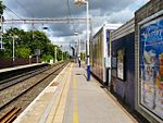
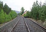
Watsessing Avenue (also known as Watsesssing) is a New Jersey Transit station in Bloomfield, New Jersey, along the Montclair-Boonton Line. It is located beneath the Bloomfield Police Benevolent Association meeting hall (which formerly served as the station building) near the corner of Watsessing Avenue and Orange Street in Bloomfield. It is one of two stations on the line where the boarding platform is below ground level (the Glen Ridge Station, two stops away from it, is the other). The Watsessing station and the Kingsland station in Lyndhurst on the Main Line shared similar designs (both station platforms are located below street level) and were built about the same time. The current Glen Ridge, Bloomfield and Watsessing stations along the Montclair branch were all built in 1912 during a grade separation program by the Delaware, Lackawanna and Western Railroad. During New Jersey Transit's running of the line, two stations between Watsessing and Newark Broad Street were closed due to low ridership—the Roseville Avenue station in Newark, at the junction with the Morristown Line on September 16, 1984, and Ampere Station in East Orange on April 7, 1991. The word "Watsessing" is a Native American term that translates to "mouth of the creek". The station has been on the New Jersey State Historic Preservation Office listings since March 25, 1998, the last of the four stations from East Orange to Glen Ridge to receive the listing. On September 14, 2005, the entire Montclair Branch was added to the same listings, although Ampere, Bloomfield and Glen Ridge stations have been on the listings since March 17, 1984.
Recently selected: Roa–Hønefoss Line - Redland railway station - Furuset Line
- Week 2
- January 6 - January 12
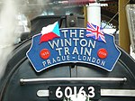
The Winton Train was a private passenger train which traveled from the Czech Republic to England in September 2009, in tribute to the wartime efforts of Sir Nicholas Winton, described as the 'British Schindler' for his part in saving refugee children from Czechoslovakia. In 1939 Winton arranged a number of trains to transport Czechoslovak children refugees to London. In total eight locomotives transported 669 children of mainly Jewish heritage. Sir Nicholas' efforts remained largely unrecognised until 1988 when he came to public attention. As the majority of 'Winton's Children' (as they came to be known) were Jewish, it is believed this saved them from certain death had they stayed in Czechoslovakia. As of 2009, the direct descendants of Winton's Children numbered over 5,000 people. The tribute train carried some of those original children and their families on the 70th anniversary of the original Winton trains retracing their original route. The 2009 train departed on 1 September from Prague Main railway station, and travelled through Germany and the Netherlands. After a transfer by ferry to Harwich, the journey resumed by train again to arrive in London's Liverpool Street station on 4 September, where it was met by the 100 year old Sir Nicholas himself. For the journey across mainland Europe the train was formed of period carriages and was hauled by historically authentic steam locomotives, while the British leg was hauled by 60163 Tornado, a brand new main line British steam locomotive completed in 2008, along with carriages that were constructed in the 1950s. The tribute train was the centrepiece of a wider cultural awareness project known as 'Inspiration by Goodness', organised by the Czech government.
Recently selected: Watsessing Avenue (NJT station) - Roa–Hønefoss Line - Redland railway station
- Week 3
- January 13 - January 19
Yatton railway station, on the Bristol to Exeter Line, is in the village of Yatton in North Somerset, England. It is 12 miles (19 km) west of Bristol Temple Meads railway station, and 130 miles (209 km) from London Paddington. Its three-letter station code is YAT. It was opened in 1841 by the Bristol and Exeter Railway, and served as a junction station for trains to Clevedon and Cheddar, but these lines closed in the 1960s. The station, which has two platforms, is managed by First Great Western, the seventh company to be responsible for the station, and the third franchise since privatisation in 1997. They provide all train services at the station, mainly hourly services between Bristol Parkway and Weston-super-Mare, and between Cardiff Central and Taunton. The line is not currently electrified, and there is local support for electrification as an extension of the Great Western Main Line upgrade programme. A community centre and café was opened at the station in 2011.
Recently selected: Winton Train - Watsessing Avenue (NJT station) - Roa–Hønefoss Line
- Week 4
- January 20 - January 26
Cheadle Hulme railway station is an open triangular railway station serving Cheadle Hulme in Greater Manchester, England. It is located on the West Coast Main Line and is included in Network Rail Route 20 (North West Urban). The station is in Cheadle Hulme's District Centre and is operated by Northern Rail. Cheadle Hulme's first railway station opened in 1842, when the Manchester and Birmingham Railway to Crewe was completed. With the extension of the line to Macclesfield (and later Stoke-on-Trent), a new station opened in 1845 which has served the area since. The railway had a major impact on the area, transforming it from a collection of small hamlets into a suburb of over 29,000 people. The station remains an important part of the community, and is regularly discussed in local community meetings (known as the Cheadle Hulme Partnership). It is staffed part-time; there are no facilities other than waiting rooms and the ticket office; the closest station with more facilities is Stockport. In 2011 a major building programme was carried out, with the construction of pedestrian bridges linking all four platforms, and lifts enabling some disabled access.
Recently selected: Yatton railway station - Winton Train - Watsessing Avenue (NJT station)
- Week 5
- January 27 - February 2
Clifton Down railway station is on the Severn Beach Line and serves the district of Clifton in Bristol, England. It is 3.9 miles (6.3 km) from Bristol Temple Meads. Its three letter station code is CFN. It was opened in 1874 by the Great Western and Midland Railways as part of the Clifton Extension Railway. By 1995 there was talk of the line being closed completely, but services were improved following action by the campaign group Friends of Suburban Bristol Railways, and in the nine years 2002–11, the station saw a 130% increase in passenger numbers. As of 2012, it is managed by First Great Western, which is the third franchise to be responsible for the station since privatisation in 1997. They provide all train services at the station, mainly a train every forty minutes in each direction between Bristol Temple Meads and Avonmouth.
Recently selected: Cheadle Hulme railway station - Yatton railway station - Winton Train
- Week 6
- February 3 - February 9
Cumberland is a station on the Chicago Transit Authority's 'L' system. It is situated between the Rosemont and Harlem stations on the Blue Line, which runs from O'Hare Airport to Forest Park. The station is located in the median of the Kennedy Expressway at Cumberland Avenue in the O'Hare neighborhood on Chicago's Northwest Side, and it is in close proximity to both the Norwood Park neighborhood and the city of Park Ridge. The area surrounding the station consists of mixed commercial and residential development. Nearly 1.4 million passengers boarded trains at Cumberland in 2010. The Cumberland station was first proposed in 1972 as part of an extension of the 'L' to O'Hare Airport. The station opened on February 27, 1983, along with the Harlem and Rosemont stations. The three new stations brought 6,000 new riders to the northwest CTA line in the following month, and Cumberland became especially attractive to suburban commuters. The station at Cumberland consists of a single island platform; a pedestrian overpass connects the platform to a station building to the south and an exit stairway to the north. Trains serve Cumberland 24 hours a day every day; the headway between trains is 10 minutes during peak periods, with less frequent service at other times.
Recently selected: Clifton Down railway station - Cheadle Hulme railway station - Yatton railway station
- Week 7
- February 10 - February 16
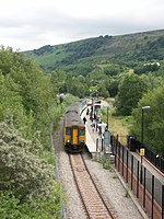
The Ebbw Valley Railway (Welsh: Rheilffordd Cwm Ebwy) is a branch line of the Great Western Main Line in South Wales. Arriva Trains Wales provides an hourly passenger service each way, between Ebbw Vale Parkway and Cardiff Central. The Great Western Railway (GWR) operated a passenger service on the line from the 1850s between Newport and Ebbw Vale. The line became part of British Railways' Western Region in 1948, following the nationalisation of the railways. Passenger services ceased on the line in 1962 – part of the Beeching Axe. However, the route continued to be used to carry freight to and from the Corus steelworks in Ebbw Vale, until its closure in 2002. Proposals to re-open the existing freight railway line to passenger services were first mooted in 1998. The Welsh Assembly Government announced their commitment to the project in 2002, as part of a package of measures to help the steel communities. Passenger services were restored to the line in February 2008 using Class 150 diesel multiple units. Predominantly single track north of Newport, the Ebbw Valley Railway runs 18 miles (29 km) along the Ebbw River valley from Ebbw Vale, before joining the South Wales Main Line at a triangular set of junctions in Newport – the line splitting at Park Junction with the eastbound section joining at Gaer Junction and the westbound section joining at Ebbw Junction. The line's stations and services are managed by Arriva Trains Wales.
Recently selected: Cumberland (CTA station) - Clifton Down railway station - Cheadle Hulme railway station
- Week 8
- February 17 - February 23
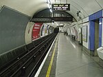
Embankment is a London Underground station in the City of Westminster, known by various names during its history. It is served by the Circle, District, Northern and Bakerloo lines. On the Northern and Bakerloo lines, the station is between Waterloo and Charing Cross stations; on the Circle and District lines, it is between Westminster and Temple and is in Travelcard Zone 1. The station has two entrances, one on Victoria Embankment and the other on Villiers Street. The station is adjacent to Victoria Embankment Gardens and is close to Charing Cross station, Embankment Pier, Hungerford Bridge, Cleopatra's Needle, the Royal Air Force Memorial, the Savoy Chapel and Savoy Hotel and the Playhouse and New Players Theatres. The station is in two parts: sub-surface platforms opened in 1870 by the Metropolitan District Railway (MDR) as part of the company's extension of the Inner Circle eastwards from Westminster to Blackfriars and deep-level platforms opened in 1906 by the Baker Street and Waterloo Railway (BS&WR) and 1914 by the Charing Cross, Euston and Hampstead Railway (CCE&HR). A variety of underground and mainline services have operated over the sub-surface tracks and the CCE&HR part of the station was reconstructed in the 1920s.
Recently selected: Ebbw Valley Railway - Cumberland (CTA station) - Clifton Down railway station
- Week 9
- February 24 - March 2
Sir John Fowler, 1st Baronet KCMG LLD (15 July 1817 – 20 November 1898) was an English civil engineer specialising in the construction of railways and railway infrastructure. In the 1850s and 1860s, he was engineer for the world's first underground railway, London's Metropolitan Railway, built by the "cut-and-cover" method under city streets. In the 1880s, he was chief engineer for the Forth Railway Bridge, which opened in 1890. Fowler's was a long and eminent career, spanning most of the 19th century's railway expansion, and he was engineer, adviser or consultant to many British and foreign railway companies and governments. He was the youngest president of the Institution of Civil Engineers, between 1865 and 1867, and his major works represent a lasting legacy of Victorian engineering.
Recently selected: Embankment tube station - Ebbw Valley Railway - Cumberland (CTA station)
- Week 10
- March 3 - March 9
The Numedal Line (Norwegian: Numedalsbanen) is a 92.8-kilometer (57.7 mi) long railway line that runs up the Numedal valley between Kongsberg and Rødberg in Buskerud, Norway. Built and operated by the Norwegian State Railways, the non-electrified, standard gauge line passes through the municipalities of Kongsberg, Flesberg, Rollag and Nore og Uvdal. It is now owned by the Norwegian National Rail Administration. The first plans for a line through Numedal were launched after the Sørland Line reached in Kongsberg in 1871. After it was decided that the Bergen Line would instead follow Hallingdal, the Numedal plans lay dead until it was decided that a railway was necessary to build two hydroelectric power stations near Rødberg. The plans were passed in 1918, the first trains started running in 1924 and the line was officially opened in 1927. At first all services were provided with steam locomotives, but from the 1930s diesel multiple units were used for passenger trains. The line was frequented with classes Cmd 16, 86, 87 and 91. The last regular train ran in 1988; since, there has been sporadic freight service and some heritage trains running from Kongsberg to Rollag. Draisine rental is available on the section from Veggli to Rødberg. The line is proposed to be preserved as a cultural heritage.
Recently selected: Sir John Fowler, 1st Baronet - Embankment tube station - Ebbw Valley Railway
- Week 11
- March 10 - March 16
Oslo Commuter Rail (Norwegian: NSB Lokaltog Østlandet) is a commuter rail centered in Oslo, Norway, connecting the capital to six counties in Eastern Norway. The system is operated by the Norwegian State Railways (NSB) and its subsidiary NSB Gjøvikbanen, using Class 69 and Class 72 electric multiple units (EMU). The network spans eight routes and 128 stations, with Oslo Central Station (Oslo S) as the central hub. The trains run on 553 kilometers (344 mi) of electrified mainline railway owned by the Norwegian National Rail Administration. The commuter rail operates mainly within Greater Oslo. The system is also an airport rail link to Oslo Airport, Gardermoen. West of Oslo, the system uses the Drammen, Asker, Spikkestad and Sørland lines, north of Oslo it uses the Gjøvik Line, east of Oslo it uses the Trunk, Gardermoen and Kongsvinger lines and south of Oslo it follows the Østfold and Eastern Østfold lines. The system's predecessors date back to the opening of the Trunk Line in 1854. By 1902, all the routes used by the commuter rail had been taken into service. Electrification started in 1922, and was completed in 1963. In 1980, the Drammen Line was connected to the rest of the system and all trains started operating to the new Oslo S. The high-speed Gardermoen Line opened in 1998. By 2012, NSB will have taken delivery of new Stadler FLIRT units and the Asker Line will have been completed. By 2018, the Follo Line is scheduled to open.
Recently selected: Numedal Line - Sir John Fowler, 1st Baronet - Embankment tube station
- Week 12
- March 17 - March 23
Parson Street railway station serves the western end of Bedminster in Bristol, England. It also serves other surrounding suburbs including Bishopsworth and Ashton Gate, along with Bristol City FC. It is 2 miles (3.2 km) from Bristol Temple Meads, and 120 miles (193 km) from London Paddington. Its three letter station code is PSN. It was opened in 1927 by the Great Western Railway, and was rebuilt in 1933. The station, which has two through-lines and two platforms, plus one freight line for traffic on the Portishead Branch Line, has minimal facilities. As of 2012, it is managed by First Great Western, which is the sixth company to be responsible for the station, and the third franchise since privatisation in 1997. They provide all train services at the station, mainly an hourly service between Bristol Parkway and Weston-super-Mare. There is local support for the line to be electrified, as an extension of the planned electrification of the London to Bristol route, and the level of service would be improved if proposals for the re-instatement of passenger services on the nearby Portishead Branch Line, which was re-opened for freight in 2001, are successful.
Recently selected: Oslo Commuter Rail - Numedal Line - Sir John Fowler, 1st Baronet
- Week 13
- March 24 - March 30
The Virginia Central Railroad was an early railroad in the U.S. state of Virginia that operated between 1850 and 1868 from Richmond westward for nearly 200 miles (320 km) to Covington. Chartered in 1836 as the Louisa Railroad by the Virginia General Assembly, the railroad began near the Richmond, Fredericksburg and Potomac Railroad's line and expanded westward to Orange County, reaching Gordonsville by 1840. In 1849, the Blue Ridge Railroad was chartered to construct a line over the Blue Ridge Mountains for the Louisa Railroad which reached the base of the Blue Ridge in 1852. After a decision from the U.S. Supreme Court, the Louisa Railroad was allowed to expand eastward from a point near Doswell to Richmond. Renamed as the Virginia Central Railroad in 1850, the railroad bypassed the under-construction Blue Ridge Railroad via a temporary track built over Rockfish Gap. This connected the railroad's eastern division with its expanding line across the Blue Ridge in the Shenandoah Valley. Having reached Clifton Forge by 1857, the railroad began operating the completed Blue Ridge Railroad in 1858 and continued preparing for further expansion until the beginning of the American Civil War in 1861. As a prime target for Federal raids by Union Cavalry, the railroad faced significant action against it during the war. Although the war left the railroad with only a fraction of its line left operable, the railroad was running over its entire pre-war length by July 1865. After the war, both longtime president Edmund Fontaine and former Confederate General Williams Carter Wickham served as president of the Virginia Central and oversaw its expansion towards Covington. The Chesapeake and Ohio Railroad was formed in 1868 from the merger of the Virginia Central Railroad and the Covington and Ohio Railroad, and had expanded westward to the Ohio River by 1873 after new financing from Collis P. Huntington was recruited. CSX, Amtrak, and the Buckingham Branch Railroad still use portions of the old Virginia Central line for freight and passenger rail service.
Recently selected: Parson Street railway station - Oslo Commuter Rail - Numedal Line
- Week 14
- March 31 - April 6
The Washington Metropolitan Area Transit Authority (often abbreviated as WMATA and commonly referred to as Metro) is a tri-jurisdictional government agency that operates transit service in the Washington Metropolitan Area. WMATA was created by the United States Congress as an interstate compact between the District of Columbia, the State of Maryland, and the Commonwealth of Virginia. WMATA provides rapid transit service under the Metrorail brand, fixed-route bus service under the Metrobus brand, and paratransit service under the MetroAccess brand. The authority is also part of a public-private partnership that operates the DC Circulator bus system. WMATA has its own police force, the Metro Transit Police Department. The authority's Board of Directors consists of two voting representatives each from the District of Columbia, Maryland, Virginia, and the federal government. Each jurisdiction also appoints two alternate representatives. WMATA has no independent taxation authority and depends on its member jurisdictions for capital investments and operating subsidies. In addition to ongoing operations, WMATA participates in regional transportation planning and is developing future expansions of its system. These projects include an extension of Metrorail to Dulles Airport, street car lines in the District and northern Virginia, and light rail in suburban Maryland.
Recently selected: Virginia Central Railroad - Parson Street railway station - Oslo Commuter Rail
- Week 15
- April 7 - April 13
The Ålgård Line (Norwegian: Ålgårdbanen) is a closed, but not abandoned, railway line between Ganddal and Ålgård in Rogaland, Norway. The 12.24-kilometer (7.61 mi) line was built as a narrow gauge branch line of the Jæren Line by the Norwegian State Railways (NSB) and opened in 1924. It runs through the villages of Foss-Eikeland and Figgjo in Sandnes to Ålgård in Gjesdal. Several proposals were made for the Ålgård Line to become the first part of the main line from Stavanger to Oslo, but instead the Sørlandet Line was connected to the Jæren Line in 1944. At the same time, the Ålgård Line was upgraded to standard gauge. The line had up to ten daily round trips with diesel multiple units, until passenger traffic was terminated in 1955. Freight traffic remained until 1988, when most of the line was abandoned in 1988, although 3 kilometers (2 mi) was used until 2001. The line is owned by the Norwegian National Rail Administration. The station at Figgjo has been converted to a museum, and the 3-kilometer (2 mi) section from there to Ålgård is used for recreational draisines. There have been proposals to reopen the line either as part of the Jæren Commuter Rail or the planned light rail for Greater Stavanger.
Recently selected: Washington Metropolitan Area Transit Authority - Virginia Central Railroad - Parson Street railway station
- Week 16
- April 14 - April 20
The Astoria Riverfront Trolley is a 3-mile (4.8 km) heritage streetcar line that operates in Astoria, Oregon, United States, using former freight railroad tracks along or near the south bank of the Columbia River, with no overhead line. The service began operating in 1999, using a 1913-built streetcar from San Antonio, Texas. As of 2012, the service was reported as carrying 35,000 to 40,000 passengers per year and has been called a "symbol" of Astoria. The line's operation is seasonal, normally during spring break and from May through September. Volunteers from the non-profit Astoria Riverfront Trolley Association (ARTA) operate the service and maintain the streetcar and tracks, but the city of Astoria has provided some funds for certain purchases, including a new carbarn in 2001 and a contribution to the cost of purchasing the streetcar. The car was on loan from San Antonio for the first seven years, but was purchased by ARTA in August 2005. By 2004, the Trolley had become "one of Astoria's most popular features" and "a main attraction in the city of Astoria".
Recently selected: Ålgård Line - Washington Metropolitan Area Transit Authority - Virginia Central Railroad
- Week 17
- April 21 - April 27
The Axholme Joint Railway was a committee created as a joint enterprise between the Lancashire and Yorkshire Railway (L&Y) and the North Eastern Railway (NER) and was established by the North Eastern Railway Act of 31 July 1902. It took over the Goole and Marshland Railway, running from Marshland Junction near Goole to Reedness Junction and Fockerby, and the Isle of Axholme Light Railway, running from Reedness Junction to Haxey Junction. Construction of the Goole and Marshland Railway had begun in 1898, and by the time of the takeover in early 1903, was virtually complete. The Isle of Axholme Light Railway was started in 1899, but only the section from Reedness Junction to Crowle was complete at the takeover. The northern section opened in November 1903, and the line from Crowle to Haxey Junction opened for passengers on 2 January 1905. A branch to Hatfield Moor was opened in 1909, but traffic from the peat works at Hatfield did not start to use the railway until 1913, when the company extended their line into the works. Traffic was mainly agricultural produce, together with peat from Hatfield Moor and from Swinefleet Peat Works which processed peat from Thorne Moors. Passenger services ceased in 1933, although occasional excursion trains continued to be run. The Haxey Junction to Epworth section closed in 1956, the Hatfield Moor Branch closed in 1964, and the remainder closed in 1965. However, most of the tracks were retained and operated as a long siding, to allow it to be used to carry heavy parts from Keadby Power Station across the Stainforth and Keadby Canal, as the bridge on the A161 road could not support the weight. The road bridge was replaced in 1970, and the rails were finally removed in 1972.
Recently selected: Astoria Riverfront Trolley - Ålgård Line - Washington Metropolitan Area Transit Authority
- Week 18
- April 28 - May 4
The Axholme Joint Railway was a committee created as a joint enterprise between the Lancashire and Yorkshire Railway (L&Y) and the North Eastern Railway (NER) and was established by the North Eastern Railway Act of 31 July 1902. It took over the Goole and Marshland Railway, running from Marshland Junction near Goole to Reedness Junction and Fockerby, and the Isle of Axholme Light Railway, running from Reedness Junction to Haxey Junction. Construction of the Goole and Marshland Railway had begun in 1898, and by the time of the takeover in early 1903, was virtually complete. The Isle of Axholme Light Railway was started in 1899, but only the section from Reedness Junction to Crowle was complete at the takeover. The northern section opened in November 1903, and the line from Crowle to Haxey Junction opened for passengers on 2 January 1905. A branch to Hatfield Moor was opened in 1909, but traffic from the peat works at Hatfield did not start to use the railway until 1913, when the company extended their line into the works. Traffic was mainly agricultural produce, together with peat from Hatfield Moor and from Swinefleet Peat Works which processed peat from Thorne Moors. Passenger services ceased in 1933, although occasional excursion trains continued to be run. The Haxey Junction to Epworth section closed in 1956, the Hatfield Moor Branch closed in 1964, and the remainder closed in 1965. However, most of the tracks were retained and operated as a long siding, to allow it to be used to carry heavy parts from Keadby Power Station across the Stainforth and Keadby Canal, as the bridge on the A161 road could not support the weight. The road bridge was replaced in 1970, and the rails were finally removed in 1972.
Recently selected: Astoria Riverfront Trolley - Ålgård Line - Washington Metropolitan Area Transit Authority
- Week 19
- May 5 - May 11
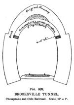
The Brookville Tunnel (also Brooksville Tunnel) was a historic railroad tunnel engineered by Claudius Crozet during the construction of the Blue Ridge Railroad in the 1850s. The tunnel was part of a series of four tunnels used to cross the Blue Ridge Mountains of Virginia for the Virginia Central Railroad of the United States. The Brookville Tunnel was the second tunnel used to cross the mountains from the east (the easternmost being the Greenwood Tunnel), and was located approximately 1.5 miles (2.4 km) west of the village of Greenwood, Virginia. During the tunnel's construction, numerous cave-ins and landslides occurred because of the fragile and weak rock the tunnel passed through, and at one point, an outbreak of cholera forced work to stop. By October 1856 the tunnel was completed at a cost of $114,600, having been lined with a thick elliptical brick arch to hold back the earth. The Brookville Tunnel was used by the Virginia Central Railroad, and after 1868, the line's successor, the Chesapeake and Ohio Railroad. After the reorganization of the line in 1878 as the Chesapeake and Ohio Railway, the tunnel continued to be used until it was demolished and replaced by a cut during the construction of Interstate 64 in the 1960s and 1970s, at which point it was one of only two of Crozet's original four tunnels still in use.
Recently selected: - Axholme Joint Railway - Astoria Riverfront Trolley
- Week 20
- May 12 - May 18
Chester is a subway station on the Bloor–Danforth line located in Toronto, Canada. It is served by subway trains that are operated by the Toronto Transit Commission. The station is located at 370 Danforth Avenue, at Chester Avenue. It was opened in 1966 as one of the original stations of this subway line. The Toronto Parking Authority operates a public parking lot on the opposite side of the across from the subway entrance.
Recently selected: Brookville Tunnel - - Axholme Joint Railway
- Week 21
- May 19 - May 25
Captain William P. Halliday (July 21, 1827 – September 22, 1899) was an American steamboat captain, banker, printer, hotel owner, and businessman. Halliday began his professional career working on steamboats on the Mississippi and Ohio rivers and eventually became a captain of a steamboat based out of Louisville, Kentucky. A pioneer in the river and railroad transportation businesses, Halliday was responsible for the expansion of Cairo, Illinois, following the American Civil War. Before the war, Halliday predicted that it would greatly impact river and railroad transportation and moved to Cairo, Illinois, a town at a critical position, at the confluence of the Ohio and Mississippi rivers. Soon after relocating, Halliday established many businesses that focused on river transportation and general merchandise. During the war, Halliday became good friends with General Ulysses S. Grant, and this relationship increased his personal fortune considerably through favorable military contracts. After the Civil War, Halliday, his four brothers, and other family members rapidly expanded their business interests in the region. Halliday purchased real estate, businesses, hotels, mines, railroads (including the Cairo and Vincennes Railway), lumber yards, steamboats, and furniture companies, and took advantage of many other business opportunities. He served on the transportation committee of the Illinois Central Railroad, and was closely associated with the Mobile and Ohio Railroad through the railroad's use of his wharfboats. His business success led to the advancement of the region and specifically contributed to the development of Cairo and Hallidayboro, Illinois.
Recently selected: Chester (TTC) - Brookville Tunnel -
- Week 22
- May 26 - June 1
The Hammersmith & City line is a London Underground service that runs between Hammersmith and Barking. Coloured salmon pink on the tube map, the line serves 29 stations in 15.8 miles (25.5 km). The railway is underground in the central section between Paddington and Bow Road; between Farringdon and Aldgate East this section skirts the City of London, the capital's financial heart. Unlike London's deep level tube railways, the railway tunnels are just below the surface and are a similar size to those on British main lines. Most of the track and all the stations are shared with the District, Circle or Metropolitan lines, the other parts of London Underground's sub-surface railway, and over 114 million passenger journeys are made each year on this line and the Circle line. In 1863 the Metropolitan Railway began the world's first underground railway service between Paddington and Farringdon with wooden carriages and steam locomotives. The following year a railway west from Paddington to Hammersmith opened and this soon became operated and owned jointly by the Metropolitan and Great Western railways. The line was extended to the east in stages, reaching the East London Railway in 1884. The line was electrified in 1906, and in 1936, after the Metropolitan Railway had been absorbed by London Passenger Transport Board, some Hammersmith & City trains were extended over the former District Railway line to Barking. The Hammersmith & City route was shown on the tube map as part of the Metropolitan line until 1990 when it appeared as a separate line. The track and signalling systems are being upgraded and the 6-car C Stock trains are being replaced by new 7-car S Stock trains in a programme to increase capacity by 65 per cent by 2019.
Recently selected: William P. Halliday - Chester (TTC) - Brookville Tunnel
- Week 23
- June 2 - June 8
The Lier Line (Norwegian: Lierbanen) or LB is an abandoned railway line that ran through Lier in Norway. The private, narrow gauge railway branched from the Drammen Line at the old Lier Station, and ran 21.15 kilometers (13.14 mi) to Svangstrand on the lake Tyrifjorden, where it connected with a steam ship operated by the railway company. Among the villages the line served were Egge, Sjåstad and Sylling, in addition to two branch lines, from Iledalen to Tronstad Bruk, and from Egge to Egge Gravel Pit. Discussions regarding the building of a line through Lier started in 1895, and construction commenced in 1901. The line opened on 12 July 1904 and was initially profitable, in part because of tourist traffic. In 1920, the Drammen Line was converted to standard gauge, resulting in expensive transshipment between the two lines. This and falling traffic caused the line to become unprofitable. The Lier line was closed for ordinary traffic on 23 October 1932. All traffic ceased on 1 January 1937 and the track was demolished shortly afterwards.
Recently selected: Hammersmith & City line - William P. Halliday - Chester (TTC)
- Week 24
- June 9 - June 15
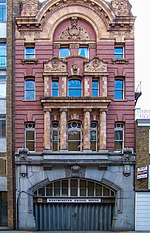
London Necropolis railway station refers to two stations in Waterloo, London, England, which served successively as the London terminus of the London Necropolis Railway. The London Necropolis Railway was opened in 1854 as a reaction to severe overcrowding in London's existing graveyards and cemeteries. It aimed to use the recently-developed technology of the railway to move as many burials as possible to the newly-built Brookwood Cemetery in Brookwood, Surrey. This location was within easy traveling distance of London, but distant enough that the dead could not pose any risk to public hygiene. Although it had its own branch line into Brookwood Cemetery, most of the route of the London Necropolis Railway ran on the existing London and South Western Railway (LSWR). Consequently, a site was selected in Waterloo, near the LSWR's recently-opened London terminus at Waterloo Bridge station (now London Waterloo). The building was specifically designed for the use of mourners. It had many private waiting rooms, which could also be used to hold funeral services, and a hydraulic lift to raise coffins to platform level. In 1899 the location of the terminus was blocking the expansion of Waterloo station. After much negotiation, the LSWR reached agreement with the London Necropolis Company, the owners of the cemetery and the railway: in return for the existing site, the LSWR re-equipped the London Necropolis Railway and supplied it with a new station on Westminster Bridge Road. This new building was designed to contrast with other funeral directors' premises by being as attractive as possible. In 1902 the railway moved into the new building, and the earlier station was demolished. On 16 April 1941 the station was heavily damaged in an air raid. Much of the building was destroyed and the tracks to the station were rendered unusable. Although some funeral trains continued to run from nearby Waterloo station, the London terminus was never used again. Following the end of the war the London Necropolis Company decided that reopening the London Necropolis Railway was not financially worthwhile, and the surviving part of the station building was sold as office space. This remnant remains intact, and relatively unaltered since its opening.
Recently selected: Lier Line - Hammersmith & City line - William P. Halliday
- Week 25
- June 16 - June 22
Departmental locomotives on the London Underground consist of vehicles of a number of types which are used for engineering purposes. These include battery locomotives, diesel locomotives, electric locomotives, sleet locomotives, pilot motor cars and ballast motor cars. Pilot motor cars and ballast motor cars are generally vehicles which have been withdrawn from passenger service, but continue to be used by the engineering department. Pilot motor cars are used to move other vehicles around the system, while ballast motor cars are used to haul ballast trains and engineering trains. The first ballast motor cars were former trailer cars built for the Central London Railway in 1900, which were converted to motor cars for trials of the first multiple system to be used in Britain, and were retained for departmental use after 1903. These were followed by French and Hungarian Gate stock cars, built in 1906, which were converted in the 1920s and 1930s. The next batch consisted of 14 standard stock cars converted in 1953. Rolling stock reorganisation and replacement in the 1970s on the District and Metropolitan lines resulted in a number of surface stock cars being used for pilot motor duties. Subsequently motor cars of 1938 stock and 1960 stock were used for this purpose, and complete 4-car units of 1962 stock. The London Underground has also owned several departmental self-powered vehicles designed for other duties. These include a tunnel cleaning train, consisting of two 1938 stock motor cars and three purpose-built cars, which act like a giant vacuum cleaner, and can hold 6 tons of dust before the filter tanks need to be emptied. Three Plasser & Theurer track tamping machines were purchased in 1980, and two Unimog road-rail vehicles were obtained in 1983 and 1986, for use as depot shunters.
Recently selected: London Necropolis railway station - Lier Line - Hammersmith & City line
- Week 26
- June 23 - June 29
Lynx Rapid Transit Services (styled corporately as LYNX Rapid Transit Services) comprises a 9.6-mile (15.45 km) light rail line serviced by the Charlotte Area Transit System (CATS) in Charlotte, North Carolina, United States. It commenced service on November 24, 2007, and runs through Uptown and South End, before paralleling South Boulevard to its southern terminus just north of Interstate 485 at the Pineville city limits. There are 15 stations in the system, which carries an average of over 15,900 passenger trips every day. Despite the name, Lynx is a light rail, not a rapid transit service. A Charlotte light rail system was proposed in the mid-1980s, with Mecklenburg voters approving a one-half cent sales tax to finance its construction in 1998. The construction of Lynx resulted in controversy regarding its costs and benefits with an unsuccessful 2007 referendum to repeal the transit tax. Future expansion includes plans for light rail, commuter rail, streetcars and bus rapid transit along the five corridors in the 2030 Transit Corridor System Plan adopted in 2006 by Metropolitan Transit Commission (MTC). Build-out of the entire system is estimated for completion by 2034.
Recently selected: London Underground departmental stock - London Necropolis railway station - Lier Line
- Week 27
- June 30 - July 6
The Manchester and Bolton Railway was a railway in the historic county of Lancashire, England, connecting Salford to Bolton. It was built by the proprietors of the Manchester, Bolton and Bury Canal Navigation and Railway Company who had in 1831 converted from a canal company. The 10-mile long (16 km) railway was originally to have built upon most of the line of the canal, but it was eventually built alongside the Salford and Bolton arms of the canal. The Act of Parliament also allowed the construction of a connection to Bury, but technical constraints meant that it was never built. The railway required significant earthworks, including a 295-yard (270 m) tunnel. The railway termini were at Salford Central railway station and Trinity Street station in Bolton. The railway was opened in 1838 to passenger and freight services. In 1841 it was extended to Preston, and in 1844 to Victoria Station in Manchester. It amalgamated with the Manchester and Leeds Railway in 1846. The railway is in use today as part of the Manchester to Preston Line, although some of the original stations are no longer in use.
Recently selected: Lynx Rapid Transit Services - London Underground departmental stock - London Necropolis railway station
- Week 28
- July 7 - July 13
Metrolink is a light rail system in Greater Manchester, England. The network consists of six lines which radiate from Manchester city centre and terminate at Altrincham, Bury, Didsbury, Droylsden, Eccles, and Rochdale. The system is owned by Transport for Greater Manchester (TfGM) and operated and maintained under contract by RATP Group. Also referred to as Manchester Metrolink, over 21 million passenger journeys were made on the system in 2011. A light rail system for Greater Manchester was born of Greater Manchester County Council's obligations to provide "an integrated and efficient system of public transport" under its structure plan and the Transport Act 1968. Greater Manchester's public transport network suffered from poor north – south connections, exacerbated by the location of Manchester's main railway stations, Piccadilly and Victoria, which were unconnected and lay at opposing edges of central Manchester. Light rail was proposed in 1982 as the best and most economical public transport solution for Manchester city centre and the surrounding Greater Manchester metropolitan area, and gathered support throughout the 1980s as an appropriate integrated commuter service. Government approval was granted in 1988 and the network began operating services between Bury Interchange and Victoria on 6 April 1992. Serving 69 stops located within seven of the ten boroughs of Greater Manchester, Metrolink uses a fleet of light rail vehicles — popularly known as trams — composed of Ansaldo Firema T-68/T-68As and Bombardier Flexity Swift M5000s. The system's 45.6 miles (73.4 km) of standard gauge track spans a mix of designated light railway (segregated from other traffic) and on-street tramway. Expansion of Metrolink has been a key strategy of transport planners in Greater Manchester, who have overseen its development in successive projects which, upon completion of Phase 3b in 2016, will make Metrolink the largest light rail network in the United Kingdom, with 59 miles (95 km) of track and 92 stops, handling an estimated 45 million passenger journeys a year. TfGM have endorsed further expansion with proposals for two new lines to Stockport and Port Salford, and an additional line across Manchester city centre.
Recently selected: Manchester and Bolton Railway - Lynx Rapid Transit Services - London Underground departmental stock
- Week 29
- July 14 - July 20
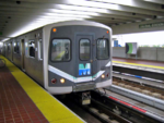
Metrorail, colloquially called the Metro, is the heavy rail rapid transit system of Miami, Florida, United States, serving the Greater Miami area. Metrorail is operated by Miami-Dade Transit (MDT), a departmental agency of Miami-Dade County. Opened in 1984, it is Florida's only rapid transit metro system, and is currently composed of two lines of 23 stations on 24.4 miles (39.3 km) of standard gauge track. Metrorail serves the urban core of Miami, connecting the urban centers of Miami International Airport, the Civic Center, Downtown Miami, and Brickell with the northern developed neighborhoods of Hialeah and Medley to the northwest, and to suburban The Roads, Coconut Grove, Coral Gables, and South Miami, ending at urban Dadeland in Kendall. Metrorail connects to the Metromover in Downtown, which provides metro service to the entirety of Downtown and Brickell. Additionally, it connects to South Florida's commuter rail system at Tri-Rail Station. Metrorail has seen increased ridership growth over the years, with an average daily ridership of 74,100 passengers, as of February 2013[update] or 106,800 daily passengers including Metromover. In 2012, Metrorail opened its 23rd station, Miami Central Station, at Miami International Airport (MIA), opening a 16-station newly-created Orange Line between the MIA and Dadeland South stations. The new line is expected to increase ridership significantly, adding millions of riders per year, and allowing residents and visitors alike direct access from the MIA to Downtown Miami, and greater connectivity between various modes of transit throughout Miami-Dade County. Central Station provides direct service to Amtrak inter-city rail services, Tri-Rail commuter rail, Greyhound Lines intercity bus, and the Rental Car Center. Miami Central Station is expected to attract 150,000 daily commuters and travelers.
Recently selected: Manchester Metrolink - Manchester and Bolton Railway - Lynx Rapid Transit Services
- Week 30
- July 21 - July 27
Nailsea and Backwell railway station, on the Bristol to Exeter Line, is in the village of Backwell, close to the town of Nailsea in North Somerset, England. It is 8 miles (13 km) west of Bristol Temple Meads railway station, and 126 miles (203 km) from London Paddington. Its three-letter station code is NLS. The station, opened in 1841 by the Bristol and Exeter Railway, has two platforms but little in the way of facilities. It is managed by First Great Western, the seventh company to be responsible for the station, and the third franchise since privatisation in 1997. They provide all train services at the station, mainly hourly services between Bristol Parkway and Weston-super-Mare, and between Cardiff Central and Taunton. The line is not electrified, but there is local support for electrification as an extension of the Great Western Main Line upgrade programme.
Recently selected: Metrorail (Miami) - Manchester Metrolink - Manchester and Bolton Railway
- Week 31
- July 28 - August 3
Nationaltheatret Station (Norwegian: Nationaltheatret stasjon) is an underground railway station on the Drammen Line serving Vika and the central business district of Oslo, Norway. It is the second-busiest railway station in Norway, behind Oslo Central Station (Oslo S), from which Nationaltheatret is 1.4 kilometers (0.9 mi) away. Owned and operated by the Norwegian National Rail Administration, Nationaltheatret serves regional services to the Vestfold Line and intercity services on the Sørland Line operated by the Norwegian State Railways (NSB), the Oslo Commuter Rail operated by NSB and NSB Gjøvikbanen, and the Airport Express Train. The station is located below an Oslo Metro station with the same name. At ground level there is transfer to the Oslo Tramway and Ruter buses. Nationaltheatret is the only underground mainline railway station in Norway, and named for the adjacent National Theatre. The station opened as the terminus of Holmenkolbanen's light rail services in 1928. The railway station opened on 1 June 1980 and was upgraded to four tracks in 1999. The older section received a full renovation in 2008.
Recently selected: Nailsea and Backwell railway station - Metrorail (Miami) - Manchester Metrolink
- Week 32
- August 4 - August 10
The Pennsylvanian is a 444-mile (715 km) daytime Amtrak train running between New York and Pittsburgh via Philadelphia. The trains travel through Pennsylvania's capital, the Pennsylvania Dutch Country, suburban and central Philadelphia, and New Jersey en route to New York. Trains run once daily in each direction. The entire train ride takes about 9 hours total, with 1.5 hours between New York and Philadelphia, 2 hours between Philadelphia and Harrisburg, and 5.5 hours between Harrisburg and Pittsburgh. The Pennsylvanian is the replacement of the former Keystone service between New York and Pittsburgh. Prior to Amtrak, the route was known as the Duquesne, named after Fort Duquesne in Pittsburgh, and operated by the Pennsylvania Railroad. The Pennsylvanian began on April 27, 1980, as a state-supported daylight train between Philadelphia and Pittsburgh, with connecting service to New York. Amtrak would later extend the train to serve New York directly. Between 1998–2005 Amtrak shifted the endpoints west to Chicago and Philadelphia, providing daylight service to Cleveland, Ohio. In 2005 the Pennsylvanian reverted to a Pittsburgh–New York schedule. On its inauguration the Pennsylvanian used Amfleet equipment and continues to be so equipped.
Recently selected: Nationaltheatret Station - Nailsea and Backwell railway station - Metrorail (Miami)
- Week 33
- August 11 - August 17
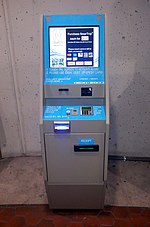
SmarTrip is a contact-less stored-value smart card payment system managed by the Washington Metropolitan Area Transit Authority (WMATA). Unlike traditional paper farecards or bus passes, SmarTrip is designed to be permanent and reloadable. The Maryland Transit Administration (MTA) uses a compatible payment system called CharmCard. A reciprocity agreement between the MTA and WMATA allows either card to be used for travel on any of the participating transit systems in the Baltimore-Washington Metropolitan Area. WMATA began using SmarTrip for payment on Metrorail in 1999 followed shortly by Metrobus and Metro parking lots. It was later extended to other public transit systems throughout the region. SmarTrip users receive discounts on Metrorail and Metrobus fares. Although WMATA initially drew criticism due to the limited number of SmarTrip sales locations, distribution has expanded to local convenience stores and supermarkets. In October 2010, WMATA announced that it was working on a replacement system because the company that makes SmarTrip cards has since gone out of business. However, the transit agency found an alternate manufacturer to produce additional cards until a new payment system is introduced. In late 2012 all Metrorail stations were equipped with SmartTrip vending machines.
Recently selected: Pennsylvanian (train) - Nationaltheatret Station - Nailsea and Backwell railway station
- Week 34
- August 18 - August 24
Westminster is a London Underground station in the City of Westminster. It is served by the Circle, District and Jubilee lines. On the Circle and District lines, the station is between St. James's Park and Embankment and, on the Jubilee line it is between Green Park and Waterloo. It is in Travelcard Zone 1. The station is located at the corner of Bridge Street and Victoria Embankment and is close to the Houses of Parliament, Westminster Abbey, Parliament Square, Whitehall, Westminster Bridge and the London Eye. Also close by are Downing Street, the Cenotaph, Westminster Millennium Pier, the Treasury, the Foreign and Commonwealth Office and the Supreme Court. The station is in two parts: sub-surface platforms opened in 1868 by the Metropolitan District Railway (MDR) as part of the company's first section of the Inner Circle route and deep level platforms opened in 1999 as part of the Jubilee line extension from Green Park to Stratford. A variety of underground and mainline services have operated over the sub-surface tracks, but the original station was completely rebuilt in conjunction with the construction of the deep level platforms and Portcullis House which sits above the station.
Recently selected: SmarTrip - Pennsylvanian (train) - Nationaltheatret Station
- Week 35
- August 25 - August 31
Åndalsnes Station (Norwegian: Åndalsnes stasjon) is a railway station in the town of Åndalsnes, the administrative centre of Rauma Municipality in Møre og Romsdal county, Norway. It has been the terminal station of the Raumabanen railway line since the line was extended to Åndalsnes on 30 November 1924. The station was designed by Gudmund Hoel and is located on reclaimed land along the Isfjorden. To get the line to the station, a cutting had to be built. In addition to a station building, the station has an engine shed and a bus station; the station building is next to a cruise ship port. It serves four passenger trains per day, and has correspondence by bus onwards to the nearby towns of Molde and Ålesund. The station is manned and features a chapel within a retired train carriage.
Recently selected: Westminster tube station - SmarTrip - Pennsylvanian (train)
- Week 36
- September 1 - September 7
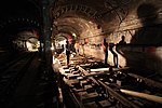
The 7 Subway Extension — Hudson Yards Rezoning and Development Program is the plan to extend the IRT Flushing Line of the New York City Subway, which carries the 7 local and <7> express services, westward from its current terminus at Times Square, and adding a new station at 34th Street and Eleventh Avenue. A second station at 10th Avenue – 41st Street was dropped from the plans in October 2007, but could be restored if funding can be found. The extension's opening has been shortly delayed to June 2014, while the rest of the 34th Street station will be opened at the end of 2015. The extension is a key part of the Hudson Yards Redevelopment Project, and is expected to bring business and entertainment into the area; the project is intended to aid redevelopment of the west side of Midtown Manhattan around the West Side Yard of the Long Island Rail Road. It was originally proposed as part of the failed attempt to build the West Side Stadium for the New York Jets and the city's bid for the 2012 Summer Olympics. Although the stadium plan was rejected by city and state planning agencies, the 7 subway extension plan received approval to move ahead, as New York political leaders wanted to see the warehouse district west of Eighth Avenue and north of 34th Street redeveloped, and a subway service would be an essential part of that effort. The extension would also serve the Jacob K. Javits Convention Center, renovated in 2006. The New York State Society of Professional Engineers awarded the first construction phase, "Running Tunnels and Underground Structures," its 2013 Construction Project of the Year. According to the society, the project team won the award "for outstanding professional engineering efforts in developing creative solutions and innovative technologies in construction of an infrastructure project. The No. 7 project used the first double-shielded tunnel boring machines (TBMs) to tunnel under New York City while placing precast concrete segments to form the tunnels’ walls. For the first time in the world, a ground freezing method was used to harden soil to act as rock to allow TBMs to maintain proper course while boring and placing the tunnel liners."
Recently selected: Åndalsnes Station - Westminster tube station - SmarTrip
- Week 37
- September 8 - September 14
Bedminster railway station is on the Bristol to Exeter Line and serves the districts of Bedminster and Windmill Hill in Bristol, England. It is 0.9 miles (1.4 km) to the west of Bristol Temple Meads, and 119 miles (192 km) from London Paddington. Its three letter station code is BMT. It was opened in 1871 by the Bristol and Exeter Railway, was resited slightly further to the west in 1884 and was rebuilt in 1932. The station, which has three through-lines and two island platforms, but minimal facilities, was managed by First Great Western in 2012, the seventh company to be responsible for the station, and the third franchise since privatisation in 1997. They provide all train services at the station, mainly an hourly service between Bristol Parkway and Weston-super-Mare. There is local support for the line to be electrified, as an extension of the planned electrification of the London to Bristol route, and the level of service would be improved if proposals for the reinstatement of a passenger service on the nearby Portishead Branch Line, which was reopened for freight in 2001, are successful.
Recently selected: 7 Subway Extension - Åndalsnes Station - Westminster tube station
- Week 38
- September 15 - September 21
The Charlottesville and Albemarle Railway (C&A) was a short electric street railroad operating within the city of Charlottesville, Virginia, United States, during the early 20th century. The line was preceded by several streetcar lines operating both horse-drawn and electric powered cars dating back to 1887. After facing financial difficulties, the predecessor lines were reorganized into the C&A in 1903. The C&A's electric streetcars operated off of an overhead line system that was powered by the railroad's own power plant. The C&A also offered electric power generated by its plant to the city of Charlottesville. During the mid-1910s, the line received numerous upgrades, including the construction of a new power plant on the Rivanna River, a new company headquarters building, expansion of track, and the purchase of new streetcars. Increased expenses and decreasing ridership, coupled with the Great Depression, caused the railway to cease streetcar operations in 1935. The railway was reorganized as the Charlottesville and Albemarle Bus Company in 1936 with a transition to bus service. Today, Charlottesville Area Transit provides bus service to the city of Charlottesville; however, the city has recently investigated the feasibility of a streetcar line following much of the same route as the Charlottesville and Albemarle Railway.
Recently selected: Bedminster railway station - 7 Subway Extension - Åndalsnes Station
- Week 39
- September 22 - September 28
The Cleveland Railway was a railway line in north-east England running from Normanby Jetty on the River Tees, near Middlesbrough, via Normanby and then via Guisborough through the Eston Hills, to Loftus in East Cleveland. It carried minerals from numerous iron ore mines along its route to the River Tees for shipment to Tyneside and elsewhere. The line was jointly proposed by the West Hartlepool Harbour and Railway (WHH&R), who provided half its capital, together with various landowners. The WHH&R lay on the north bank of the Tees, to which it had a cross-river connection via a jetty at Normanby. The Cleveland Railway was built as a freight railway and provided no passenger services during its brief existence as an independently owned railway. It was built in a number of stages, bypassing the centre of Guisborough, and opened in November 1861. Its construction was repeatedly held up by disputes with its main rival, the Stockton and Darlington Railway, which attempted unsuccessfully to use all means at its disposal to maintain its rail monopoly south of the Tees. However, the Cleveland Railway remained independent only until 1865, when the company and its rivals were bought out by the North Eastern Railway (NER). The new management linked the line with an existing coastal railway via Saltburn, running north of the Eston Hills, and closed the line west of Guisborough in 1873 after only twelve years of service, though part of the line continued in service until 1966 as a freight route for a brickworks and carried passengers to Eston between 1902 and 1929. The NER constructed four passenger stations at the eastern end of the line in the 1870s. These were closed between 1958–1964 along with the section of the line from Guisborough to Brotton, but the easternmost part of the line is still in use today as a mineral railway.
Recently selected: Charlottesville and Albemarle Railway - Bedminster railway station - 7 Subway Extension
- Week 40
- September 29 - October 5
Edinburgh Trams is a tram system under construction in Edinburgh, Scotland. The first phase of the project consists of a sixteen-station, 14-kilometre (8.7 mi) link between York Place in New Town and Edinburgh Airport. Construction has been ongoing since 2008, but has been met with many delays and contractual disputes. Only half of the line proposed at the start of construction is being built. Originally, it was meant to stretch from the airport to Newhaven, but this was truncated due to a funding crisis. Another line serving the Southside has been postponed indefinitely. The system will be operated by Edinburgh Trams Limited, a company owned by the City of Edinburgh Council. The first part of the tram system was originally scheduled to open in February 2011. By March 2010, project delays had resulted in the prime contractor revising their estimated completion date to 2014, and by the end of 2010 only 28% of the infrastructure had been completed. The whole scheme was originally costed in 2003 at £375 million. A report issued in August 2011 estimated that the final cost of the truncated network would be over £1 billion, including £228 million of interest payments on a 30-year loan to cover the funding shortfall. As of September 2013[update], work continues on the tram scheme. The system is scheduled to open by May 2014.
Recently selected: Cleveland Railway (England) - Charlottesville and Albemarle Railway - Bedminster railway station
- Week 41
- October 6 - October 12
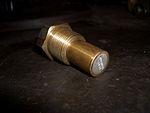
A fusible plug is a threaded metal cylinder usually of bronze, brass or gunmetal, with a tapered hole drilled completely through its length. This hole is sealed with a metal of low melting point that flows away if a pre-determined, high temperature is reached. The device was invented in 1803 by Richard Trevithick, the proponent of high-pressure (as opposed to atmospheric) steam engines, in consequence of an explosion in one of his new boilers. Experiments in the 19th century proved its value as a safety precaution against low water levels in steam engine boilers, but later applications extended its use to other closed vessels, such as air conditioning systems and tanks for transporting corrosive or liquefied petroleum gasses.
Recently selected: Edinburgh Trams - Cleveland Railway (England) - Charlottesville and Albemarle Railway
- Week 42
- October 13 - October 19
Charles Melville Hays (May 16, 1856 – April 15, 1912) was the president of the Grand Trunk Railway. He began working in the railroad business as a clerk at the age of 17 and quickly rose through the ranks of management to become the General Manager of the Wabash, St. Louis and Pacific Railway. He became Vice-President of that company in 1889 and remained as such until 1896 when he became General Manager of the Grand Trunk Railway (GTR) of Canada. Hays left GTR for a short time to serve as the President of the Southern Pacific Railway Company but returned to GTR after one year. As Vice-President and General Manager of GTR he is credited with keeping the company from bankruptcy. In 1909, he became the president of GTR and all its consolidated lines, subsidiary railroads, and steamship companies. He was known for his philanthropy and received the Order of the Rising Sun, third class, from the Emperor of Japan in 1907. Hays is credited with the formation of the Grand Trunk Pacific Railway (GTP), a dream he had to create a second transcontinental railroad within the borders of Canada. He is also blamed for the insolvency of both the GTR and the GTP. He died before his dream was complete as he perished at sea in the sinking of the RMS Titanic. His body was recovered and he was buried in Montreal. He was survived by his wife and four daughters.
Recently selected: Fusible plug - Edinburgh Trams - Cleveland Railway (England)
- Week 43
- October 20 - October 26
The Chicago and North Western Railway's Kinzie Street railroad bridge (also known as the Carroll Avenue bridge) is a single leaf bascule bridge across the north branch of the Chicago River in downtown Chicago, Illinois. At the time of its opening in 1908 it was the world's longest and heaviest bascule bridge. Previous bridges on the same site included the first bridge to cross the Chicago River, Chicago's first railroad bridge, and one of first all-steel bridges in the United States. The Chicago Sun-Times, the last railroad customer to the east of the bridge, moved their printing plant out of downtown Chicago in 2000, and the bridge has been unused since. It was designated a Chicago Landmark in 2007.
Recently selected: Charles Melville Hays - Fusible plug - Edinburgh Trams
- Week 44
- October 27 - November 2
The Wallkill Valley Rail Trail is a 23.7-mile (38.1 km) rail trail and linear park that runs along the former Wallkill Valley Railroad rail corridor in Ulster County, New York. As of 2011[update], it stretches from Gardiner through New Paltz, crossing the Wallkill River as it reaches Rosendale. Plans to create the rail trail began as early as 1983, when New Paltz considered uses for the then-defunct Wallkill Valley corridor; the railroad had ceased regular traffic in 1977, and by 1983 had begun to remove its tracks. In 1991, a local land trust purchased the 12-mile (19 km) section of the former rail corridor between New Paltz and Gardiner, and conveyed the New Paltz section to the town and village of New Paltz. The trail was formally opened between New Paltz and Gardiner in 1993, though Gardiner did not purchase its section from the trust until 2007. The length of the trail was effectively doubled by a county land seizure in 2009, extending the walkway north from Rosendale through Ulster to Kingston. The extension included the Rosendale trestle, a 940-foot (290 m) bridge across the Rondout Creek. There are several other bridges that carry the trail, though none are as long. The trail passes through several historic districts, such as Huguenot Street in New Paltz, and the Binnewater Historic District and Snyder Estate in Rosendale.
Recently selected: Kinzie Street railroad bridge - Charles Melville Hays - Fusible plug
- Week 45
- November 3 - November 9
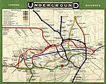
The Underground Electric Railways Company of London Limited (UERL), known operationally as The Underground for much of its existence, was established in 1902. It was the holding company for the three deep-level "tube" underground railway lines opened in London during 1906 and 1907: the Baker Street and Waterloo Railway, the Charing Cross, Euston and Hampstead Railway and the Great Northern, Piccadilly and Brompton Railway. It was also the parent company from 1902 of the Metropolitan District Railway, which it electrified between 1903 and 1905. The UERL is the main precursor of today's London Underground; its three tube lines form the central sections of today's Bakerloo, Piccadilly and Northern lines. The UERL struggled financially in the first years after the opening of its lines and narrowly avoided bankruptcy in 1908 by restructuring its debt. A policy of expansion by acquisition was followed before World War I, so that the company came to operate the majority of the underground railway lines in and around London. It also controlled large bus and tram fleets, the profits from which subsidised the financially weaker railways. By the early 1930s, the company's lines stretched beyond the County of London and served destinations in Middlesex, Essex, Hertfordshire and Surrey. In the 1920s, competition from small unregulated bus operators reduced the profitability of the road transport operations, leading the UERL's directors to seek government regulation. This led to the establishment of the London Passenger Transport Board in 1933, which absorbed the UERL and all of the independent and municipally operated railway, bus and tram services in the London area.
Recently selected: Wallkill Valley Rail Trail - Kinzie Street railroad bridge - Charles Melville Hays
- Week 46
- November 10 - November 16
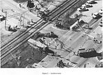
The 1995 Fox River Grove bus–train collision was a grade crossing accident that killed seven students riding aboard a school bus in Fox River Grove, Illinois, on the morning of October 25, 1995. The school bus, driven by a substitute driver, was stopped at a traffic light with the rearmost portion extending onto a section of the railroad tracks when it was struck by a Metra commuter train en route to Chicago. The National Transportation Safety Board (NTSB) investigation found that, while the bus driver was not aware that a portion of the bus was on the tracks as she should have been, the timing of signals was so insufficient that, even if she had identified the hazard as the train approached, she would have had to proceed against a red traffic signal into the highway intersection to have moved out of the train's path. Legislation and re-engineering of interconnected crossings across the state of Illinois combined with greater awareness elsewhere resulted in efforts to help to prevent similar accidents from occurring. Informational decals were also added to Illinois school buses advising drivers of the length of each bus, since the substitute school bus driver was apparently unaware of the exact length of the bus she was driving. Other states have also embraced that and related aspects and incorporated them into their school bus driver training curriculum. The Fox River Grove accident stands as the worst accident involving a Metra train in its history, and one of the worst grade crossing accidents in U.S. history. At the accident site, the improved signaling system installed after the accident now protects the passing trains and motor vehicle traffic. Nearby, a small memorial to the seven high school students killed stands in remembrance.
Recently selected: Underground Electric Railways Company of London - Wallkill Valley Rail Trail - Kinzie Street railroad bridge
- Week 47
- November 17 - November 23
Under the Whyte notation for the classification of steam locomotives, 2-8-2 represents the wheel arrangement of two leading wheels on one axle, usually in a leading truck, eight powered and coupled driving wheels on four axles, and two trailing wheels on one axle, also usually in a trailing truck. This configuration of steam locomotive is most often referred to as a Mikado, frequently shortened to Mike, but at times it was also referred to on some railroads in the United States of America as the McAdoo Mikado and, during World War II, the MacArthur. Other equivalent classifications are: 1D1 in UIC classification (also known as German and Italian classifications), 141 in French classification (also known as Spanish classification), 46 in Turkish classification and 4/6 in Swiss classification. The notation 2-8-2T indicates a tank locomotive of this wheel arrangement on which the water is carried in tanks mounted on the locomotive, rather than in an attached tender.
Recently selected: 1995 Fox River Grove bus–train collision - Underground Electric Railways Company of London - Wallkill Valley Rail Trail
- Week 48
- November 24 - November 30
The A Eighth Avenue Express is a rapid transit service in the B Division of the New York City Subway. Its route bullet is colored blue on route signs, station signs, and the official subway map since it runs on the IND Eighth Avenue Line in Manhattan. The A service operates at all times. The usual service pattern is between 207th Street in Inwood, Manhattan and Mott Avenue in Far Rockaway, Queens or Ozone Park–Lefferts Boulevard in Richmond Hill, Queens via Central Park West / Eighth Avenue Express in Manhattan, Fulton Street Express in Brooklyn and Liberty Avenue / Rockaway Local in Queens. The A provides the longest one-seat ride in the system, at over 31 miles from Inwood to Far Rockaway. Five rush hour trips (designated ![]() in the schedule) run from Beach 116th Street in Rockaway Park, Queens to Manhattan during the peak weekday morning commute hours and five trips run to Rockaway Park from Manhattan during the peak weekday late-afternoon commute hours. At all times, a shuttle train (S – Rockaway Park Shuttle) operates between Rockaway Park and Broad Channel. Take the A Train, a jazz standard by Billy Strayhorn, referred to the A service which at that time from eastern Brooklyn up into Harlem and northern Manhattan, using the express tracks in Manhattan.
in the schedule) run from Beach 116th Street in Rockaway Park, Queens to Manhattan during the peak weekday morning commute hours and five trips run to Rockaway Park from Manhattan during the peak weekday late-afternoon commute hours. At all times, a shuttle train (S – Rockaway Park Shuttle) operates between Rockaway Park and Broad Channel. Take the A Train, a jazz standard by Billy Strayhorn, referred to the A service which at that time from eastern Brooklyn up into Harlem and northern Manhattan, using the express tracks in Manhattan.
Recently selected: 2-8-2 - 1995 Fox River Grove bus–train collision - Underground Electric Railways Company of London
- Week 49
- December 1 - December 7
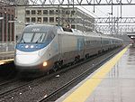
The Acela Express (/əˈsɛlə/ ə-SEL-ə; colloquially abbreviated to Acela) is Amtrak's high-speed rail service along the Northeast Corridor (NEC) in the Northeast United States between Washington, D.C., and Boston via 14 intermediate stops including Baltimore, Philadelphia, and New York City. Acela Express trains are the only true high-speed trainsets in the Americas; the highest speed they attain is 150 mph (240 km/h). Acela trains use tilting technology which allows the train to travel at higher speeds on the sharply curved NEC without disturbing passengers, by lowering lateral centrifugal forces. Compared to other high-speed rail systems, Acela is unusual in that it shares tracks with other types of trains, as well as the advanced age of infrastructure in many segments of the system. As of 2013 the fastest Acela run between Boston and Washington covers the 454 miles (731 km) in six and a half hours, an average speed of slightly under 70 mph (110 km/h). Acela has helped Amtrak capture a 75% share of air/train commuters between New York and Washington in 2011, up from 37% in 2000. Due to this competition, some airlines have even canceled service between Washington and New York. The Acela carried just under 3.4 million passengers in fiscal year 2012, and the Acela Express accounted for approximately 25% of all total revenue generated by Amtrak services.
Recently selected: A (New York City Subway service) - 2-8-2 - 1995 Fox River Grove bus–train collision
- Week 50
- December 8 - December 14
The Alaska Railroad (reporting mark ARR) is a Class II railroad which extends from Seward and Whittier, in the south of the state of Alaska, in the United States, to Fairbanks (passing through Anchorage), and beyond to Eielson Air Force Base and Fort Wainwright in the interior of that state. Uniquely, it carries both freight and passengers throughout its system, including Denali National Park. The railroad has a mainline over 470 miles (760 km) long and is well over 500 miles (800 km) including secondary branch lines and siding tracks. It is currently owned by the state of Alaska. The railroad is connected to the lower 48 via three rail barges that sail between the Port of Whittier and Harbor Island in Seattle (the Alaska Railroad-owned Alaska Rail Marine, from Whittier to Seattle, and the CN Rail-owned Aqua Train, from Whittier to Prince Rupert, British Columbia) but does not currently have a direct, land-based connection with any other railroad lines on the North American network. In 2011, the company earned a profit of $4.9 million (down 11%) on revenues of $161.5 million (up 8.5%), $121.5 million of which was operating revenue (up 11.9%).
Recently selected: Acela Express - A (New York City Subway service) - 2-8-2
- Week 51
- December 15 - December 21
The Albula Railway is a single track metre gauge railway line forming part of the so-called core network of the Rhaetian Railway (RhB), in the Canton of Graubünden, Switzerland. It links Thusis on the Hinterrhein (697 m (2,287 ft)* above sea level) with the spa resort of St. Moritz in Engadine (1,774 m (5,820 ft)* above sea level). Construction of the Albula Railway began in September 1898, the opening took place on 1 July 1903, and the extension to St. Moritz commenced operations on 10 July 1904. With its 55 bridges and 39 tunnels, the 61.67-kilometre long (38.32 mi) line is one of the most spectacular narrow gauge railways in the world. On 7 July 2008, the Albula Railway and the Bernina Railway, which also forms part of the RhB, were jointly recorded in the list of UNESCO World Heritage Sites, under the name Rhaetian Railway in the Albula / Bernina Landscapes. The best known trains operating on the Albula Railway are the Glacier Express and the Bernina Express.
Recently selected: Alaska Railroad - Acela Express - A (New York City Subway service)
- Week 52
- December 22 - December 28
The Indian Pacific is a weekly passenger rail service running between Sydney and Perth in Australia. It is one of the few truly transcontinental trains in the world. The train first ran in February 1970 after the completion of gauge conversion projects in South and Western Australia. The route includes the world's longest straight stretch of railway track, a 478-kilometre (297 mi) stretch over the Nullarbor Plain. In 1983 the service was extended to serve Adelaide. A one-way trip originally took 75 hours, but with line and efficiency improvements it now takes 65 hours. The train currently has four classes, branded as Platinum, Gold Service and Red Service Sleeper and Red Service Daynighter and also a Motorail service to convey passengers' motor vehicles. In February 1993 the train became part of Australian National and in October 1997 was sold to Great Southern Rail.
Recently selected: Albula Railway - Alaska Railroad - Acela Express
- Week 53
- December 29, 2013 - January 4, 2014
Holborn is a London Underground station in Holborn central London. It is served by the Central and Piccadilly lines. On the Central line the station is between Tottenham Court Road and Chancery Lane stations; on the Piccadilly line it is between Covent Garden and Russell Square and is in Travelcard Zone 1. The station is located at the junction of High Holborn and Kingsway. Close by are the British Museum, Lincoln's Inn Fields, Red Lion Square, Bloomsbury Square and Sir John Soane's Museum. Located at the junction of two earlier tube railway schemes, the station was opened in 1906 by the Great Northern, Piccadilly and Brompton Railway (GNP&BR). The station entrances and below ground circulation were largely reconstructed for the introduction of escalators and the opening of Central line platforms in 1933, making the station the only interchange between the lines. Before 1994, Holborn was the northern terminus of the short and little-frequented Piccadilly line branch to Aldwych and two platforms originally used for this service are disused. One of the disused platforms has been used for location filming when a London Underground station platform is needed.
Recently selected: Indian Pacific - Albula Railway - Alaska Railroad

