Wikipedia talk:WikiProject New York City Public Transportation/Archive 16
| This is an archive of past discussions. Do not edit the contents of this page. If you wish to start a new discussion or revive an old one, please do so on the current talk page. |
| Archive 10 | ← | Archive 14 | Archive 15 | Archive 16 | Archive 17 | Archive 18 | → | Archive 20 |
Question about copyright
Ladies & gentlemen,
I've found some images of the NYCS that are identical to images of http://nycsubway.org.


All of them here were originally uploaded by User:Error46146. All of them on nycsubway are copyrighted by Bill E.
I don't see any license confirming the right of the uploader to use these images, but I think that User:Error46146 is the same Bill E.
How can I check it, and how can I mark the images so they don't raise questions about their copyright? Vcohen (talk) 14:58, 23 June 2012 (UTC)
- The discussion over a formerly proposed deletion of some of his pics mentions the fact that he is the same person. ----DanTD (talk) 00:34, 24 June 2012 (UTC)
Entrances on Broad Street
I've found some entrances on Google Street View: two here and one here. I'm trying to associate them with the description of Broad Street (BMT Nassau Street Line)#Entrances/Exits, but it doesn't work. It's a crossing, but the point shown on the map is not near any crossing.
Both views are shot from the door of Bobby Van's Steakhouse that is supposed to be near this entrance, but it isn't one of those three entrances.
Thanks in advance. Vcohen (talk) 16:17, 13 July 2012 (UTC)
P.S. I guess that this point is the crossing of Broad St and Exchange Pl. The green globe lamp on the left in the first view is the red globe lamp in the picture of nycsubway (perhaps the lamps of this entrance have been replaced, but I don't know which photo is newer).
I still cannot identify the "three street stairs, one to the northeast corner of Broad Street and Exchange Place and two along Broad Street between Exchange Place and Beaver Street" from the article. "The northeast corner of Broad Street and Exchange Place" is the far left corner in the first view, i.e. the only corner without entrance. Even if there is an entrance at that corner that I don't see, I don't understand why the rest that I do see are not mentioned. Vcohen (talk) 19:48, 13 July 2012 (UTC)
P.P.S. Not only the location is wrong on this map, but the direction is too. We are looking from the southeast corner. The northeast corner is in the second view. The left entrance in the first view is indeed "along Broad Street between Exchange Place and Beaver Street". The right one is not. It doesn't fit again. Vcohen (talk) 13:14, 14 July 2012 (UTC)
P.P.P.S. I've added it with an approximate wording. Vcohen (talk) 19:53, 14 July 2012 (UTC)
- Do you know you're talking to yourself? This should probably be on the article talkpage? 69.158.95.135 (talk) 21:04, 14 July 2012 (UTC)
http://www.mta.info/nyct/maps/lowermanhattan.pdf, I believe the exit/entrance at Chase Manhattan Plaza is closed due to some construction. Should be open by the spring, I think. Hmanck (talk) 17:30, 7 August 2012 (UTC)
I need the correct English pronunciation
Our colleagues from the Russian wikipedia asked me to help them spell all the names of NYCS stations in Russian. I did it for most of the stations, but there are some that I am not sure about. Help me please: I need the correct English pronunciation for the following list:
Bleecker, Bryant, Buhre, Burke, DeKalb, Delancey, Dyckman, Dyre, Fordham, Halsey, Hewes, Intervale, Kew, Lehman, Nevins, Rego, Sutphin, Tremont, Zerega.
Thanks in advance. Vcohen (talk) 15:07, 17 July 2012 (UTC)
The list has been reduced. Vcohen (talk) 07:46, 24 July 2012 (UTC)
Can someone please tell me why we even need those two articles? There were many new lines planned during the proposed expansions of the 1930s (including the Utica Avenue Line, Van Wyck Boulevard Line, Bayside Line, etc.) and we do not have articles on any of them, so what makes the IND Worth Street Line so significant? The last section of the article is a duplicate of what already exists in the "Provisions" section of the main expansion article while the "Route" section can easily be incorporated into the main article's chart, so I am considering merging them.
I have the same problem with the 60th Street Tunnel Connection article. We have scores of other connections in the subway system (e.g. between the IRT White Plains Road Line and IRT Lenox Avenue Line, between the IND Fulton Street Line and former BMT Fulton Street Line and the IND Rockaway Line, between the IRT Eastern Parkway Line and IRT New Lots Line, and recently, between the IND 63rd Street Line and IND Queens Boulevard Line) and we do not have articles on any of them either, so what makes this connection any different? I do not see anything special about it being that it has no stations (so I do not think any average commuter really cares about it), is not even considered a "line," and is only used by the R train to travel between Manhattan and Brooklyn. The "service history" section seems a little redundant to me since this is not a subway history website. I am considering merging that with the 60th Street Tunnel article if no one can find anything notable about this connection. The Legendary Ranger (talk) 22:31, 23 July 2012 (UTC)
- What makes the 60th Street Tunnel Connection different is that this connection, like the Chrystie Street Connection, is between IND and BMT and is considered an important milestone in the after-1940 integration. Vcohen (talk) 04:05, 24 July 2012 (UTC)
- By the way, I support all you say about the IND Worth Street Line article. Vcohen (talk) 05:16, 25 July 2012 (UTC)
- So would you support redirecting the IND Worth Street Line article to Proposed New York City Subway expansion (1929–1940)? Not much is lost if that is done and hopefully, other members of this project support it too. The Legendary Ranger (talk) 13:49, 25 July 2012 (UTC)
- Do you mean I have to vote for it? I'll be glad to do it, tell me where. Vcohen (talk) 14:08, 25 July 2012 (UTC)
- Just vote here on this discussion, Support or Oppose. I am not starting a discussion on the IND Worth Street Line article because few people watch it, so it would be a waste of time. Hopefully, other members of this project will weigh in on this, but if no one says Oppose without providing a good reason in the next 1-2 weeks, I will perform the redirect. The Legendary Ranger (talk) 15:37, 25 July 2012 (UTC)
So, Support for merging IND Worth Street Line into Proposed New York City Subway expansion (1929–1940). Vcohen (talk) 15:43, 25 July 2012 (UTC)- And Oppose to changing the current status of 60th Street Tunnel Connection. Vcohen (talk) 15:45, 25 July 2012 (UTC)
- Eh, most of the lines in the Proposed New York City Subway expansion (1929–1940) article seem like they might be extensions of existing line articles. The only two that aren't seem to be the IND Worth Street Line and the Second Avenue Subway. I'd have to vote Weak Oppose on this one, although a redirect would still be better than a total deletion. ----DanTD (talk) 16:13, 25 July 2012 (UTC)
- Excuse me, the first phrase of the IND Worth Street Line article declares that "The IND Worth Street Line was envisioned as part of the IND Eighth Avenue Line." Vcohen (talk) 20:04, 29 July 2012 (UTC)
- Okay, so if you're going to redirect it to anything, why not redirect it to that? You could have a whole section on the formerly proposed IND Worth Street Line within the IND Eighth Avenue Line article. ----DanTD (talk) 20:19, 29 July 2012 (UTC)
- Yes, Support for merging IND Worth Street Line into IND Eighth Avenue Line. Vcohen (talk) 20:10, 5 August 2012 (UTC)
- Okay, so if you're going to redirect it to anything, why not redirect it to that? You could have a whole section on the formerly proposed IND Worth Street Line within the IND Eighth Avenue Line article. ----DanTD (talk) 20:19, 29 July 2012 (UTC)
- Excuse me, the first phrase of the IND Worth Street Line article declares that "The IND Worth Street Line was envisioned as part of the IND Eighth Avenue Line." Vcohen (talk) 20:04, 29 July 2012 (UTC)
- Eh, most of the lines in the Proposed New York City Subway expansion (1929–1940) article seem like they might be extensions of existing line articles. The only two that aren't seem to be the IND Worth Street Line and the Second Avenue Subway. I'd have to vote Weak Oppose on this one, although a redirect would still be better than a total deletion. ----DanTD (talk) 16:13, 25 July 2012 (UTC)
- Just vote here on this discussion, Support or Oppose. I am not starting a discussion on the IND Worth Street Line article because few people watch it, so it would be a waste of time. Hopefully, other members of this project will weigh in on this, but if no one says Oppose without providing a good reason in the next 1-2 weeks, I will perform the redirect. The Legendary Ranger (talk) 15:37, 25 July 2012 (UTC)
- Do you mean I have to vote for it? I'll be glad to do it, tell me where. Vcohen (talk) 14:08, 25 July 2012 (UTC)
- So would you support redirecting the IND Worth Street Line article to Proposed New York City Subway expansion (1929–1940)? Not much is lost if that is done and hopefully, other members of this project support it too. The Legendary Ranger (talk) 13:49, 25 July 2012 (UTC)
While the IND Worth Street Line was seen to be an extension of the IND Eighth Avenue Line, but it is substantially different by nature to merge them. It would make more sense to merge it into the Proposed New York City Subway expansion (1929-1940). — Preceding unsigned comment added by Hmanck (talk • contribs) 17:10, 7 August 2012 (UTC)
Dey Street Headhouse

What is "Dey Street Headhouse"? Is it part of the Fulton Center or of the Dey Street Passageway? How crazy is the idea to merge these two articles? Vcohen (talk) 20:05, 5 August 2012 (UTC)
The answer is at the end of Dey Street Passageway article: "The headhouse will serve as an entrance to both the passageway and the southbound platform of the 4/5 at Fulton Street (New York City Subway) station." I've added this image to that article (although the original MTA's comment of the image says that it's "the Dey Street Headhouse portion of the Fulton Street Transit Center"). Vcohen (talk) 08:33, 6 August 2012 (UTC)
Station Renovated Dates?
Should we include in the station information templates a year date for when the station was renovated? For stations that we don't have sufficient information, we can always put N/A. Hmanck (talk) 17:22, 7 August 2012 (UTC)
- Support, but I think we need a bot to update hundreds of articles. I tried to talk about it some sections above... Vcohen (talk) 18:50, 7 August 2012 (UTC)
- Oppose, station renovations happen on a frequent basis. One station does not get renovated just once in a lifetime. It would be impossible to find evidence of every time each station was renovated since their building. The recent renovations of the West End Line, Culver Viaduct, and Brighton Line stations were not the first times they were renovated. The Legendary Ranger (talk) 00:33, 8 August 2012 (UTC)
We can probably just use the most recent renovation, I'd say. We can't go back in time and figure out every single date when a station was renovated, if it even was.Never gonna give you up, never gonna let you down 00:46, 8 August 2012 (UTC)
Proposed Sunnyside (LIRR station)
Two weeks ago, User:Nellymen created an article for the proposed Sunnyside (LIRR station), which I just found out about tonight. I was actually working on the sandbox for the article as far back as May 2012, and I saw his version, which had no references, external links, or infobox until I swiped my text from my sandbox in order to replace his([1]). Needless to say it went live a little sooner than I originally planned. So who wants to do some work on it, if any? ----DanTD (talk) 22:50, 20 July 2012 (UTC)
- I live in the area, and have followed the EAS project for some time. Quite honestly, I never even heard of such a project. Perhaps, it should be put on a list of stations until there is more information ready. For all it matters, the MTA could axe the plan anytime between 2012 and the 2019, the proposed opening date. Hmanck (talk) 17:24, 7 August 2012 (UTC)
- I didn't actually write the article, but I was planning my own version of it, which I was willing to keep in my sandbox until it was a little closer to being opened. When I saw the original version and how it had nothing but a couple of sentences, I had to replace it with mine. ----DanTD 00:01, 19 August 2012 (UTC)
Fulton Center - New section for criticism?
A project of such a scale does not go without controversy. I do have a list of problems that the public had, but I would like to collaborate, so that we can create a section that is properly styled.
- Cost overruns, budget
- Not on time
- Necessity of the Fulton Building?
- Demolishing buildings, relocating businesses
- Disruption of road traffic (Dey Street)
- The Dey St. tunnel has drew criticism for not allowing a free transfer
Add to the list if possible? Never gonna give you up, never gonna let you down 05:05, 8 August 2012 (UTC)
Bleecker vs. Broadway – Lafayette
There are two articles about two stations, and the transfer between these two stations is being reconstructed:
The station that's actually being reconstructed is the former. The article that has a detailed description of the process is the latter. I think something is not OK here. Until some minutes ago the first article had no even separate section for this topic. Could anybody fix it? Vcohen (talk) 15:44, 13 August 2012 (UTC)
- I made the edits last night for the Broadway – Lafayette Street (IND Sixth Avenue Line) page, and I will justify my actions here, to clarify about this particular problem. My edit was to make the article more consistent and to organise the facts around. Previously, the information was all over the place. I have reduced the part with the entrances to a paragraph. Moreover, I added a little more to the information that was present for extra clarification. For example, the distinction between the lower mezzanine at the IND station, and the passageway above it. I had to really think about what the previous editor wrote, before I clarified it. It was very vague, and as a frequent user myself, I was confused. This part: "to renovate this station, which includes installation of ADA-accessible elevators and a free transfer to the northbound platform of Bleecker Street" was pre-existing when I edited the article. I found the information here to be problematic, but I can neither support nor dispute the "renovation" part. It really depends on how one analyses it. While the wall tiling in the IND station is largely intact and untouched, the floors have been retiled (due to the heavy construction work during 2008-2009), and staircases were rebuilt to a certain degree. Moreover, new features are being added to upgrade the station - namely the elevators. To think that ADA accessibility is not an upgrade is quite disputable. Come to think of it, the BMT Chambers Street station was "rehabilitated" in 2009, and it still has a very deplorable condition to it. I've taken photos last Wednesday, if you desire proof that it is still in a sad state despite the "renovation work" that the MTA had billed previously. Also, until the 300 feet shift of the uptown platform, Bleecker Street users did not exactly see the big effects of the rehabilitation process, until 2010. That was when the station underwent a major re-tiling process. Much of the construction work was either visible from street-level, or from the IND platforms, where the construction of new escalators and elevators was visible to public. Also, from 2011 onwards, one can visibly see the transfer mezzanine be built from the eastern end of the IND platforms. I think it is best to wait and see whether or not the MTA will treat the complex as one large station complex, as it did with Jay Street-Metrotech, Court Square and South Ferry. If this happens, we could just merge the articles into one, like how other station complexes have their articles done. Then we could discuss the transfer in elaboration within a single article. Judging from what I saw yesterday from the IND platforms, I have confidence that the complex will open in September or earlier, but I cannot confirm anything at this point. H-Man (talk) 22:32, 13 August 2012 (UTC)
- Thank you for your reply.
- I'd like to say that the MTA doesn't treat complexes as large stations. They publish the number of 468 as the total number of stations (here for example), and 468 is the result of counting each separate station alone. However, you are right that wikipedia usually merges articles about stations that belong to a complex, and the discussed two articles are one of several exceptions that have not been merged yet. Vcohen (talk) 08:02, 14 August 2012 (UTC)
Struggle for titles
There is one article that has been renamed several times there and back because of changes in the rules about spaces near endash in article titles. Some users deleted the spaces according to the new rule, User:Acps110 put them back worrying about the whole project rather than one article. The last action was locking the article by an administrator for one month. The locking is over (it expired about a month and a half ago).
I am going to put the spaces back, referring to WP:TITLECHANGES that says, "Changing one controversial title to another is strongly discouraged." Who supports me? What have I to do in addition, for example write any magic word in my edit summary or on the article's talk page? Vcohen (talk) 12:35, 16 August 2012 (UTC)
High Street – Brooklyn Bridge
I've discovered that the High Street – Brooklyn Bridge (IND Eighth Avenue Line) station is shown on the map as High Street, without Brooklyn Bridge. I am going to perform the full procedure of renaming the article and updating all links pointing to it. Vcohen (talk) 21:36, 10 September 2012 (UTC)
 Done Vcohen (talk) 22:08, 10 September 2012 (UTC)
- FYI, the page move was done incorrectly, and I'm in the process of fixing it. When renaming articles, you should not cut and paste it, because it disrupts the page history. The article could not be simply moved because the redirect had been edited a few times. I'll add {{db-move}}, which notifies an administrator to perform the necessary page deletion so the article can be moved. It may take a day to be done. --Scott Alter (talk) 00:30, 12 September 2012 (UTC)
We have the same problem with another station: the Fifth Avenue – Bryant Park (IRT Flushing Line) is shown as Fifth Avenue, without Bryant Park. This time it's a section of a larger article and a redirect to this section. Vcohen (talk) 08:37, 11 September 2012 (UTC)
Trolley history of bus routes
I just found Wikipedia:WikiProject New York City Public Transportation/bus redirects, and decided to add a few former trolley lines in Queens. Has anybody else thought of continuing to fill the blanks in that list? ---------User:DanTD (talk) 02:05, 8 October 2012 (UTC)
Some info
For information only: somebody has finished uploading a series of 445 videos of NYCS stations taken in 1997-1998. Each video contains the pedestrian path from one platform to one exit. Among the stations are Cortlandt St (IRT) and South Ferry loops. Vcohen (talk) 07:07, 29 September 2012 (UTC)
UPD. I've used it for both Cortlandt St (IRT) and South Ferry loops, plus the closed exit of 96th Street (IRT Broadway–Seventh Avenue Line). Vcohen (talk) 19:09, 27 October 2012 (UTC)
Subway car experts needed
Let me guess; R62? -------User:DanTD (talk) 16:46, 9 October 2012 (UTC)

- No answers, hmm? Oh, well. I guess the only thing to do is create this huge space in this thread so the image doesn't spill over into the next one. -------User:DanTD (talk) 11:46, 9 November 2012 (UTC)
- This is definitely an R62. No other car type currently runs on the 3. The Legendary Ranger (talk) 01:17, 17 November 2012 (UTC)
Several questions about photos
Hello all,
- Which image/images in this category belongs/belong to the R station?
- Which image/images in this category belongs/belong to the A/C station?
- There are some images that have not been moved to Commons. Are all of them OK to be moved there?

.jpg)

Thanks in advance. Vcohen (talk) 13:03, 17 November 2012 (UTC)
- All images really should have descriptions before they're loaded into the commons, if they don't have them already. In any case, yes they should be loaded into the commons. That first pic looks like the old New York, Westchester and Boston Railway depot and former administration building. ---------User:DanTD (talk) 19:01, 17 November 2012 (UTC)

Vcohen (talk) 15:18, 25 November 2012 (UTC)
- Yes, far as I remember I snapped this two years ago under Broadway in the Canal Street (BMT Broadway Line) station as shown in the Commons Camera Location and Commons Category. And yes, far as I know this station only hosts trains of the N and R services. If any of the photos are of another station, someone (could be me but mine look good in a hasty review) miscategorized. Jim.henderson (talk) 15:31, 25 November 2012 (UTC)
- Thanks a lot a lot. My problem is that under the Canal Street (BMT Broadway Line) title two stations are described, one for the R train (N late nights) and one for the Q and N. The image used in the infobox is of the Q station. I need another image for the second station. Vcohen (talk) 16:33, 25 November 2012 (UTC)
- Yeah, I frequently take the Q express over the Manhattan Bridge, and the N a couple weeks ago, but rarely get out at Canal. Maybe I'll at least remember to do a shot out the door next time. Which won't be soon, my main hope for now being to get out to Breezy Point, probably on the 2 and bike over Marine Parkway Bridge while there's still some messy storm damage to photograph. Jim.henderson (talk) 19:11, 25 November 2012 (UTC)
- Anyway, we have to wait till the tunnel branch reopens... Vcohen (talk) 18:39, 26 November 2012 (UTC)
- I just added one of these to the commons, along with one you didn't show here. Maybe I'll add others this winter, because my PC isn't really in the best shape, and I'll soon have to get a new one. ---------User:DanTD (talk) 17:06, 2 December 2012 (UTC)
- Thank you and sorry, I had to do it myself. I will complete the task, if you explain me the procedure. Vcohen (talk) 18:04, 2 December 2012 (UTC)
- That's okay. I'm actually considering renaming one of these before I submit it to the commons. ---------User:DanTD (talk) 17:00, 7 December 2012 (UTC)
- Thank you and sorry, I had to do it myself. I will complete the task, if you explain me the procedure. Vcohen (talk) 18:04, 2 December 2012 (UTC)
- I just added one of these to the commons, along with one you didn't show here. Maybe I'll add others this winter, because my PC isn't really in the best shape, and I'll soon have to get a new one. ---------User:DanTD (talk) 17:06, 2 December 2012 (UTC)
- Anyway, we have to wait till the tunnel branch reopens... Vcohen (talk) 18:39, 26 November 2012 (UTC)
- Yeah, I frequently take the Q express over the Manhattan Bridge, and the N a couple weeks ago, but rarely get out at Canal. Maybe I'll at least remember to do a shot out the door next time. Which won't be soon, my main hope for now being to get out to Breezy Point, probably on the 2 and bike over Marine Parkway Bridge while there's still some messy storm damage to photograph. Jim.henderson (talk) 19:11, 25 November 2012 (UTC)
- Thanks a lot a lot. My problem is that under the Canal Street (BMT Broadway Line) title two stations are described, one for the R train (N late nights) and one for the Q and N. The image used in the infobox is of the Q station. I need another image for the second station. Vcohen (talk) 16:33, 25 November 2012 (UTC)
Watchlist broken, again
The Wikiproject Watchlist - WikiProject New York City Public Transportation is broken, once again. Does anybody want to inform tim1357 about this, or should I do it myself? ---------User:DanTD (talk) 18:44, 26 November 2012 (UTC)
Could anybody find an image of this entrance?

Vcohen (talk) 09:43, 13 November 2012 (UTC)

[2] Vcohen (talk) 06:37, 3 October 2012 (UTC)
UPD. flickr.com seems to have not such an image that is free enough. Is there anybody in NYC that can make it himself? Vcohen (talk) 19:12, 27 October 2012 (UTC)
- I wish I were still back up there, so I could. It looks like a good one. ---------User:DanTD (talk) 20:29, 10 November 2012 (UTC)
- Do you have a chance to get there? Vcohen (talk) 21:30, 10 November 2012 (UTC)
- Not even close. In my last two trips to New York I couldn't even get into the city. ----------User:DanTD (talk) 14:35, 11 November 2012 (UTC)
- So, the shop on E85th opens so late that after picking up my repaired bike (broken on solo photoexpedition to South Beach) I only arrived at Overlook Terrace after the Sun moved too far west. Better picture next time, maybe, but next trip is gang ride to Gravesend. Jim.henderson (talk) 02:38, 13 November 2012 (UTC)
- This looks nice. But the Street VIew shows that gigantic building dramatically perched above it. A photo that includes that might be cool, if you get back by there. Dicklyon (talk) 00:03, 14 November 2012 (UTC)
- Busy week for me, but after Bettina Johae's tour of condemnation sites in Brooklyn tomorrow, not so busy until a friend's party overlooking the Macy's mighty balloon inflation Wednesday. Among other darkroom work I hope to sort through my other half dozen pictures at this location, and crop and upload versions approximating the various wishes discussed above. This one was merely the one that looked best without any crops or other adjustments. Or after Thanksgiving Day. I don't expect to have any great preference as to how much or little the article should show. And I certainly don't intend to return to this street this year or think about the trashcans. I hope you're all having as much fun with whatever you're doing! Jim.henderson (talk) 20:46, 16 November 2012 (UTC)
- So, this is what I got. Next time, I'll be thinking about this building and be here in the morning. Funny thing, this past Thursday morning when the sun must have been right I took this line to 175 St and couldn't go one more stop lest I miss my buddies for a biker gang ride to Northvale, NJ where I dined with them, quit them on the return leg, got lost, had fun, and maybe got a few okay suburban pix. Much to do; my photo processing backlog is now a month long. Jim.henderson (talk) 02:10, 16 December 2012 (UTC)
- Do you have a chance to get there? Vcohen (talk) 21:30, 10 November 2012 (UTC)
- I wish I were still back up there, so I could. It looks like a good one. ---------User:DanTD (talk) 20:29, 10 November 2012 (UTC)
Image for IRT Cortlandt Street

I've found and uploaded a free image related to the IRT Cortlandt Street station. I need a correct wording to integrate the image into the article. What can I put instead of the three dots? The station is not exactly there, it only used to be there. It is under construction somewhere around the point in the photo. The tunnel is supposed to widen where the station is, but I cannot see any widening. Vcohen (talk) 18:01, 9 December 2012 (UTC)
In general, am I right that this photo is related to that station? Is it correct to use this photo in the article? Vcohen (talk) 10:48, 13 December 2012 (UTC)
So, the image is there. Vcohen (talk) 09:16, 15 December 2012 (UTC)
Deletion?
Wikipedia:Articles for deletion/New York City Subway in popular culture. I've already voted to oppose. Vcohen (talk) 08:26, 14 December 2012 (UTC)
NJ Transit ridership data
I realize this is only tangentally connected to NYCPT, but User:Oknazevad suggested asking here. This document of detailed station-by-station ridership numbers was noted on the railfan forums the other day. I'm not terribly involved with NJT articles so I'm not sure if I'll have the motivation to go through station-by-station updating the numbers, nor do I have anything like AWB to make the task easier. Is anyone willing to update the numbers? Pi.1415926535 (talk) 04:31, 22 December 2012 (UTC)
- Yes, we cover New Jersey Transit here. Just like we cover Metro-North, the Long Island Rail Road, the Port Authority of New York and New Jersey, and various local bus services. ---------User:DanTD (talk) 14:00, 22 December 2012 (UTC)
Fashion Race Course vs. West Flushing Stations
Does anybody have any evidence of a relationship between the Flushing and North Side Railroad's acquisition of New York and Flushing Railroad, and the abandonment of the nearby West Flushing (LIRR station) and subsequent name change of Corona (LIRR station) to "West Flushing?" Neither the Vincent Seyfreid notes nor the Bob Emery notes have any info on this. ---------User:DanTD (talk) 01:11, 30 December 2012 (UTC)
Reference crusade; NYC Subway in Popular Culture
Last December, there was a proposal to delete New York City Subway in popular culture, because the person who nominated it for deletion thought the whole thing was too trivial. Despite being saved, it was gutted by another administrator. I restored most of the material that was gutted and have been adding references whenever I can find them. Now, I'd like to urge the rest of you to do the same, and I still say it should be list class in all Wiki Projects. ---------User:DanTD (talk) 15:13, 10 February 2013 (UTC)
Hurricane Sandy
As we recover from the effects of the storm, it's becoming clear that there are going to be long-term effects to our transportation network. With that in mind, I think we need to figure out a way to include this in relevant articles without going too far into undue weight territory. The current mention of it (that barely registers as a complete sentence) in the subway article is inadequate. Our flagship page should at least have a small paragraph covering it. As far as content, I figure something along the following summary:
- Storm hits, shutdown
- Reduced service, damages, losses, recovery
- Long term plans and changes (if any)
Of course if people have another idea, throw it out there. Pacific Coast Highway {gobble • gobble} 02:56, 9 November 2012 (UTC)
- After 9/11 there were many changes, and none of them is mentioned here. Instead, there is a separate article with a section dedicated to the NYC Subway. Now too, there is a separate article. Maybe we have to organize a section for the NYC Subway there. Vcohen (talk) 13:09, 9 November 2012 (UTC)
- That could also work. Again, some info is better than none. Also, it seems that service to the Rockaways is out indefinitely based on the MTA's estimates. I think it warrants a mention since we also updated the South Ferry article to note it's perpetual closing. Pacific Coast Highway {gobble • gobble} 22:36, 9 November 2012 (UTC)
- You are right. 1 2 Vcohen (talk) 22:45, 9 November 2012 (UTC)
- It seems that revisions are being removed under the reasoning that there was no consensus (completely ignoring this discussion). This same issue cropped up during the Brighton Line rehab project where no one wanted to acknowledge that the B was running local even in the face of multiple press and MTA citations. Sticking your head in the sand, colluding with other users, exchanging weasel words about other editors and unilateral decisions is not how this works, and isn't going to get anyone anywhere. Can we try to be mature about this? Pacific Coast Highway {talk • contribs} 02:58, 22 November 2012 (UTC)
- You are right. 1 2 Vcohen (talk) 22:45, 9 November 2012 (UTC)
- That could also work. Again, some info is better than none. Also, it seems that service to the Rockaways is out indefinitely based on the MTA's estimates. I think it warrants a mention since we also updated the South Ferry article to note it's perpetual closing. Pacific Coast Highway {gobble • gobble} 22:36, 9 November 2012 (UTC)
Below is a brief summary of articles, edited and not edited after Hurricane Sandy. Let's try to keep it consistent.
Edited:
- Rockaway Park Shuttle - service suspended, H opened
- Unused New York City Subway service labels - H in use
- S (New York City Subway service) - H shuttle
- A (New York City Subway service) - shortened to Howard Beach, H serves Far Rockaway
- IND Rockaway Line - same as above
- Broad Channel (IND Rockaway Line) - closed
- South Ferry – Whitehall Street (New York City Subway) - partial edit, regarding the 1 station only
South Ferry loops (New York City Subway) - temporarily used for turnarounds- Howard Beach – JFK Airport (IND Rockaway Line) - platform layout
- Aqueduct-North Conduit Avenue (IND Rockaway Line) - platform layout
- Aqueduct Racetrack (IND Rockaway Line) - platform layout
- Rector Street (IRT Broadway–Seventh Avenue Line) - platform layout
Not edited (or edited and reverted):
- R (New York City Subway service) - split into two parts
- N (New York City Subway service) - runs over the bridge including late nights
- J/Z (New York City Subway service) - Broad St and Fulton St closed
- 1 (New York City Subway service) - South Ferry closed
- BMT Broadway Line
- BMT Nassau Street Line
- IRT Broadway–Seventh Avenue Line
- Beach 98th Street (IND Rockaway Line)
- Beach 105th Street (IND Rockaway Line)
- Rockaway Park – Beach 116th Street (IND Rockaway Line)
- Canal Street (New York City Subway) - the tunnel station closed
- City Hall (BMT Broadway Line)
- Cortlandt Street (BMT Broadway Line)
- Rector Street (BMT Broadway Line)
- Broad Street (BMT Nassau Street Line)
- Fulton Street (New York City Subway)
My opinion is:
- to write something in the text, so it could be easily changed from present to past after the service returns
- not to change infoboxes and tables (and revert where already changed) Vcohen (talk) 18:43, 26 November 2012 (UTC)
- I agree with Vcohen. For the services affected, we can just put a brief summary in the article's History section (e.g. for the J/Z trains, put something like "Due to damage to the BMT Nassau Street Line by Hurricane Sandy, J and Z trains terminate at Chambers Street at all times until further notice.") For the lines, put something like "Due to damage by Hurricane Sandy, all stations between Canal Street and Jay Street-Metrotech are closed until further notice." For the stations affected, put "Due to damage by Hurricane Sandy, this station is closed until further notice" or "this station is the terminal for the A train until further notice." I have reverted edits people made because they contained so much detail about the changes, they violated Wikipedia's policy of not being a travel guide (i.e. they were basically telling people, though not directly, how to get around the service changes). That is why we only include normal service in the articles. If someone wants to know alternatives to closed stations and lines, they should consult the MTA website or customer service center, not Wikipedia. As a note, we should not edit the article Unused New York City Subway service labels or S (New York City Subway service) to reflect the H train because it is only temporary. I highly doubt the MTA plans to keep the label when service is restored to the Rockaways. I also do not think we should edit the South Ferry loops article because it is pure WP:FANCRUFT (i.e. no one cares that the 1 train is using the loop because it is closed to the public), so I reverted that too. The Legendary Ranger (talk) 01:01, 1 December 2012 (UTC)
- I would personally agree too with Vcohen and Legendary Ranger. Although this didn't stop users from having articles reflecting the 7 service as only going to Queensboro Plaza, as if it was a regular occurance, although this was only during the winter and fall months, and NOT the spring and summer months. Here's an example from the last pre-April 2nd edit of the List of New York City Subway services article. Point I'm trying to bring out is, while the 7 suspension has been very controversial even making news reports, the official schedules, maps and timetables on the MTA have never recognized it. And I don't expect to change the 7 and related articles as such come January.Roadrunner3000 (talk) 02:02, 1 December 2012 (UTC)
- Support as above. I was one of those editors who "wrote something in the text" as suggested above and those too were reverted. My point is: Wikipedia policy of what is encyclopedic and/or notable supersedes whatever we come up with as a project. Period. If the MTA, the press and politicians are pushing out information that's reasonably notable, and it's being dismissed, then there's a serious problem. Pacific Coast Highway {'tis • the season} 04:11, 1 December 2012 (UTC)
- Addendum - Now that I think about it, a greater conversation needs to be had on how we note things like this since things like this will keep coming back up until we speak on it. Pacific Coast Highway {'tis • the season} 04:18, 1 December 2012 (UTC)
So, we have a consensus. Thank you. I will wait a little more and begin the edits. (I would prefer, however, not to do it, because after my edits there is a need to fix my English.) Vcohen (talk) 05:16, 2 December 2012 (UTC)
- I haven't done it yet, but meanwhile we've got a new Service Guide, with the 1 till Rector St, the A till Howard Beach, and the H. These changes seem to be the only relatively long-term ones, while the rest are already in the past. However, I keep thinking that it would be too much work to update all tables and infoboxes and we still have to see these changes as temporary. Vcohen (talk) 16:17, 21 December 2012 (UTC)
- There are also a new late night map and a new Lower Manhattan map. They take it seriously. Vcohen (talk) 20:19, 21 December 2012 (UTC)
- The last time the maps, timetables and schedules were updated to reflect changes, we followed suit. There is no good reason not to, doing anything else is nothing short of original research. Pacific Coast Highway {'tis • the season} 22:10, 22 December 2012 (UTC)
- BTW, the original map is still on the mta.info website, and the changes at South Ferry and the Rockaways are shown there as temporary changes compared to the original pattern. Vcohen (talk) 13:46, 28 December 2012 (UTC)
- The last time the maps, timetables and schedules were updated to reflect changes, we followed suit. There is no good reason not to, doing anything else is nothing short of original research. Pacific Coast Highway {'tis • the season} 22:10, 22 December 2012 (UTC)
Update: The MTA has put up a new regular PDF map dated January 2013 with the above changes. Pacific Coast Highway {talk • contribs} 00:50, 7 February 2013 (UTC)
- With South Ferry already edited to reflect the closure, should we go ahead for the Rockaways? — Train2104 (talk • contribs) 03:24, 23 February 2013 (UTC)
- South Ferry is estimated to be closed for about 3 years. The Rockaway Line is supposed to reopen in some months. Vcohen (talk) 11:49, 23 February 2013 (UTC)
- Exactly why I was hesitant to make the edits. That doesn't mean I'd be fiercely opposed if they were altered. Pacific Coast Highway {talk • contribs} 04:14, 3 March 2013 (UTC)
- South Ferry is estimated to be closed for about 3 years. The Rockaway Line is supposed to reopen in some months. Vcohen (talk) 11:49, 23 February 2013 (UTC)
Proposing merging all Port Authority Trans-Hudson service articles to PATH article
I boldly merged all service articles of PATH to the Port Authority Trans-Hudson article, but they were all reverted by User:Oknazevad, who opposed it citing that all New York City Subway services have individual articles. This is not a fair comparison because unlike the subway, there is no significant history behind the PATH services. Everything we need to know is in the main PATH article. We don't have individual articles for every MTA Regional Bus Operations route or the services on Hudson Bergen Light Rail and Newark Light Rail. This is how the the merged article looks like, which did not expand much nor looks bad in any way. The service articles are all extremely short in text (it also contains some information that violates WP:NOTTRAVEL like how long it takes for each service to complete its run or what passengers must do when their service is not running and thus should be removed), the Station Listing and infoboxes are completely pointless since their contents already exist in the PATH article, and the template listing what colors each service is template can be added to the article without trouble. If no one else other than User:Oknazevad opposes combining all the PATH services together within a month, I'm just going to revert all his edits. The Legendary Ranger (talk) 01:10, 7 February 2013 (UTC)
- Well, I largely objected because I thought this should be discussed first, especially whn some other parts of the Wikipedia infrastructure related to the PATH (like the PATH navbox) are reliant on separate articles. As for the history, there actually is quite a bit about why the service patterns are what they are (esp. the lack of a NWK-33RD service under normal conditions) and the various changes they have undergone. It is true though that they don't have the differing line histories like the subway services and I'm ultimately not wedded to the need for separate articles, but I did want to prompt more discussion of it. oknazevad (talk) 03:01, 7 February 2013 (UTC)
- I have to share some of oknazevad's objections, partially there is a bit more history to these lines. I may be able to consider a split of the Hudson-Bergen Light Rail lines, but the Newark Light Rail line can stay in tact, although I'd love to add some chapter on the former Heller Parkway and Franklin Avenue stations to Branch Brook Park (NLR station). ---------User:DanTD (talk) 03:17, 7 February 2013 (UTC)
- You two do know that when we merge articles, the links remain intact, thus allowing the articles to be separated again quickly if needed (like User:Oknazevad did), so even if all the PATH service articles are merged, if someone finds something significant about one or all of them in the future, the merge can be undone with a click of a button. For now, though, we cannot have short articles that have content that either violate a WP:NOT policy or exist in other articles sitting around for an extended period of time. The Legendary Ranger (talk) 22:25, 9 February 2013 (UTC)
- The way I see it, if you merge all the lines of PATH, you might as well merge all the ones of Metro-North, New Jersey Transit, and the Long Island Rail Road. Admittedly though, I did consider merging Journal Square – 33rd Street with Journal Square – 33rd Street (via Hoboken). -------User:DanTD (talk) 23:03, 9 February 2013 (UTC)
- UPDATE - I think I found a merger we can all agree on; Park Place – Hudson Terminal --> Newark – World Trade Center. We could make Park Place-Hudson Terminal part of the history section. ---------User:DanTD (talk) 23:10, 9 February 2013 (UTC)
- I agree with the two merge considerations you have suggested User:DanTD. Other than serving one extra station and operating at different times, there is no difference between Journal Square – 33rd Street and Journal Square – 33rd Street (via Hoboken). I am pretty sure you can find a way to merge the infoboxes and station listing boxes without a hitch. Park Place – Hudson Terminal and Newark – World Trade Center should also be merged being that technically, they are the same service, just different names and under different operation (like EE and N of the New York City Subway). I recently found two NJ Transit-related articles that are just useless, List of New Jersey Transit stations because each individual branch already has a list of the stations they serve, and Light rail in New Jersey since the information there already exists in the three Light Rail articles, but I am hesitant to nominate them for AfD for the reasons why you opposed merging the PATH services. In fact, I have come to realize that Wikipedia will never be perfect no matter what I do and there are more important things in life, so I am considering taking a long wikibreak or just downright retiring. If you want to merge the PATH service articles to look like this, go right ahead. If not, just leave them and it is fine by me. PATH is not as big or historical of a rapid-transit system as LIRR, Metro-North, and NJ Transit. Honestly, it is like a shuttle connecting Manhattan and New Jersey, so it is not fair to compare it with the big commuter rails and subway systems. The Legendary Ranger (talk) 01:22, 11 February 2013 (UTC)
- I don't really think the complete List of New Jersey Transit stations is useless. Sure, it should be reformatted, but it's not useless. Also, while PATH may not be big, it's certainly historical enough, as you can see with NWK–WTC's evolving from Park Place – Hudson Terminal. -------User:DanTD (talk) 12:29, 11 February 2013 (UTC)
- UPDATE: The Park Place – Hudson Terminal merge discussion is now on. ---------User:DanTD (talk) 16:53, 11 February 2013 (UTC)
- Allow me to interject, but you're gonna get burnt out (if not already) if you keep look at editing that way. It's great that you take contributing seriously, and that you're passionate about it, but trying to make Wikipedia perfect is a wasted effort and will probably drive you mad. Pacific Coast Highway {talk • contribs} 03:18, 12 February 2013 (UTC)
- I don't really think the complete List of New Jersey Transit stations is useless. Sure, it should be reformatted, but it's not useless. Also, while PATH may not be big, it's certainly historical enough, as you can see with NWK–WTC's evolving from Park Place – Hudson Terminal. -------User:DanTD (talk) 12:29, 11 February 2013 (UTC)
- I agree with the two merge considerations you have suggested User:DanTD. Other than serving one extra station and operating at different times, there is no difference between Journal Square – 33rd Street and Journal Square – 33rd Street (via Hoboken). I am pretty sure you can find a way to merge the infoboxes and station listing boxes without a hitch. Park Place – Hudson Terminal and Newark – World Trade Center should also be merged being that technically, they are the same service, just different names and under different operation (like EE and N of the New York City Subway). I recently found two NJ Transit-related articles that are just useless, List of New Jersey Transit stations because each individual branch already has a list of the stations they serve, and Light rail in New Jersey since the information there already exists in the three Light Rail articles, but I am hesitant to nominate them for AfD for the reasons why you opposed merging the PATH services. In fact, I have come to realize that Wikipedia will never be perfect no matter what I do and there are more important things in life, so I am considering taking a long wikibreak or just downright retiring. If you want to merge the PATH service articles to look like this, go right ahead. If not, just leave them and it is fine by me. PATH is not as big or historical of a rapid-transit system as LIRR, Metro-North, and NJ Transit. Honestly, it is like a shuttle connecting Manhattan and New Jersey, so it is not fair to compare it with the big commuter rails and subway systems. The Legendary Ranger (talk) 01:22, 11 February 2013 (UTC)
- UPDATE - I think I found a merger we can all agree on; Park Place – Hudson Terminal --> Newark – World Trade Center. We could make Park Place-Hudson Terminal part of the history section. ---------User:DanTD (talk) 23:10, 9 February 2013 (UTC)
- The way I see it, if you merge all the lines of PATH, you might as well merge all the ones of Metro-North, New Jersey Transit, and the Long Island Rail Road. Admittedly though, I did consider merging Journal Square – 33rd Street with Journal Square – 33rd Street (via Hoboken). -------User:DanTD (talk) 23:03, 9 February 2013 (UTC)
- You two do know that when we merge articles, the links remain intact, thus allowing the articles to be separated again quickly if needed (like User:Oknazevad did), so even if all the PATH service articles are merged, if someone finds something significant about one or all of them in the future, the merge can be undone with a click of a button. For now, though, we cannot have short articles that have content that either violate a WP:NOT policy or exist in other articles sitting around for an extended period of time. The Legendary Ranger (talk) 22:25, 9 February 2013 (UTC)
Bus lists and links
Other Side One (talk · contribs) has been going through all the NYC bus route lists, removing neighborhood and street links, citing WP:OVERLINK. He also reverted my use of spans on the express bus route tables. Can we come to a consensus on what should be done? I feel that removing the links detracts from the usability of the table. (and wasn't there a guideline somewhere that said that rows of a table should stand alone?) — Train2104 (talk • contribs) 22:49, 5 March 2013 (UTC)
Sources for car assignments
Hello,
User:EdJohnston asked me to explain him what happens with edit warring in articles about cars. Now he is asking one more question that I cannot answer myself. Could anybody help me? Vcohen (talk) 15:37, 6 March 2013 (UTC)
More subway car experts needed
I need another type of subway car to identify, because I almost considered giving them the wrong ones.---------User:DanTD (talk) 17:14, 17 February 2013 (UTC)

- That is an R46, and all current subway cars which look like that (Flush front door) are R46s. However, The R44 fleet looked very similar and was the fleet which made up the majority of the A until 2009-2010 74.64.111.51 (talk) 22:26, 7 March 2013 (UTC)
- Thanks. Now can somebody fix this image? ---------User:DanTD (talk) 23:03, 7 March 2013 (UTC)
- I can't access it. It seems to have been deleted. Epic Genius 23:37, 16 March 2013 (UTC)
Merging closed stations on demolished line articles
With a few exceptions like Anderson - Jerome Avenue and Park Row, almost every article we have on closed stations on now-demolished lines are barely one paragraph long and have not expanded at all since their creation more than four years ago. While sources providing information about them probably exist, they are almost impossible to find because they are not publicly available for free (i.e. old newspaper articles and books). This is why I believe for those very short station articles, we should merge them to the lines they were part of (e.g. Ninth Street and 25th Street to BMT Fifth Avenue Line, 28th Street and 23rd Street to IRT Sixth Avenue Line, etc.). This can easily be done by changing the station listing section from an infobox to a list (we did the same for New York City Subway yards after merging all the articles together) and since the link for the station articles will remain intact, if substantially more information about any of them is found, the merge can be undone with a click of a button. We really should not have hundreds of stub articles sitting around forever with little to no hope of improving them and the infoboxes many of them have merely duplicate what is already stated in the articles. The Legendary Ranger (talk) 13:56, 20 March 2013 (UTC)
- We had a discussion on this quite a while back, in fact as many of them were being written. I was one of the people who preferred merging most of them to specific lines, but the consensus was against the mergers. As it stands, I've tried to improve and expand many of the old El station articles as best as I can, and even created two of them myself. ---------User:DanTD (talk) 16:10, 20 March 2013 (UTC)
- There's a bunch of info on the "abandoned stations" section of nycsubway.org. We should see if we could cite it as a partial source. Epicgenius (talk) 01:53, 24 March 2013 (UTC)
- The more unique information that can be applied to the stubs, the more worthy they are to keep. Getting pictures is very helpful for that. I've been going through the MBTA system (which has a lot of similar stubs) and adding historical information. Pi.1415926535 (talk) 02:08, 24 March 2013 (UTC)
- Epicgenius, sometimes NYCSubway.org is a good source, but not always. Pi, is there any chance you can get the exact date of the closing date for Eastern Parkway (BMT Fulton Street Line), and the opening date for it's replacement Hinsdale Street (BMT Fulton Street Line)? While you're at it, what can you find on Troy Avenue (BMT Fulton Street Line) and Clark-Tillary Street (BMT Fulton Street Line) stations? ---------User:DanTD (talk) 04:30, 24 March 2013 (UTC)
- Unfortunately, I doubt it. With the exception of one general history book on the NYC Subway system, my personal reference collection is geared towards the Boston system. Pi.1415926535 (talk) 04:49, 24 March 2013 (UTC)
- Epicgenius, sometimes NYCSubway.org is a good source, but not always. Pi, is there any chance you can get the exact date of the closing date for Eastern Parkway (BMT Fulton Street Line), and the opening date for it's replacement Hinsdale Street (BMT Fulton Street Line)? While you're at it, what can you find on Troy Avenue (BMT Fulton Street Line) and Clark-Tillary Street (BMT Fulton Street Line) stations? ---------User:DanTD (talk) 04:30, 24 March 2013 (UTC)
- The more unique information that can be applied to the stubs, the more worthy they are to keep. Getting pictures is very helpful for that. I've been going through the MBTA system (which has a lot of similar stubs) and adding historical information. Pi.1415926535 (talk) 02:08, 24 March 2013 (UTC)
- There's a bunch of info on the "abandoned stations" section of nycsubway.org. We should see if we could cite it as a partial source. Epicgenius (talk) 01:53, 24 March 2013 (UTC)
Next-stop links for station layouts
Hello. I am trying to do station layouts like this and this. However, I feel that it is incomplete without the links in small text that show the next stop for the trains served by the platforms. I'm trying to do something like this. If someone could help, it would be much appreciated. Thanks. — Preceding unsigned comment added by Epicgenius (talk • contribs)
- These links will create difficulties for subsequent updates. Note that the infoboxes use the {{NYCS next}} template for this need. I would suggest using this template this time as well. Vcohen (talk) 22:09, 1 April 2013 (UTC)
- It should be noted that if you decide to do these, that the directions for the platforms Smithtown (LIRR station) are reversed. Don't just assume that if the tracks are on the north side, they automatically go to New York City. -------User:DanTD (talk) 13:34, 6 April 2013 (UTC)
- BTW, see this diff. Our naming convention says, "The link to a station that is part of a complex should be constructed as if the station were in its own article." Vcohen (talk) 14:18, 8 April 2013 (UTC)
76 Street Station
[3] — Preceding unsigned comment added by 87.123.134.139 (talk) 08:48, 2 April 2013 (UTC)
Merging BMT 63rd Street Line and IND 63rd Street Line
- The following discussion is closed. Please do not modify it. Subsequent comments should be made in a new section.
User:Epicgenius has stated that the two articles should be merged a new article simply called 63rd Street Line and I agree with him. The BMT 63rd Street Line is an extremely short line with no significant history behind it. The article only contains info about past, present, and future services for the line, which can easily be added to the new 63rd Street Line article. The station listing section is totally, utterly pointless since it only contains one stop with no regular service right now and even though it will be connected to the Second Avenue Subway, I don't see this as a way of creating a significant expansion. All the yard articles have been merged into one (New York City Subway yards) and most tunnel articles have been merged into their respective line articles, so I see no harm in combining both 63rd Street Line articles. The Legendary Ranger (talk) 13:56, 20 March 2013 (UTC)
- Support. It will be more consistent with the Archer Avenue Line article that describes two lines. Vcohen (talk) 14:10, 20 March 2013 (UTC)
- Support - I've always wondered why the Archer Avenue Line is merged as one but the 63rd Street Line is split in two, although I just discovered as I was writing this message that "63rd Street Line" is an incomplete dab that was redirected to 63rd. ---------User:DanTD (talk) 15:56, 20 March 2013 (UTC)
- Here is the page in question. If there's anything that I missed, please edit the page. Thanks. Epicgenius (talk) 15:07, 21 March 2013 (UTC)
- There was quite a bit of whitespace in the article. I tried to get rid of it by moving around some images and moving the map template into the infobox, although the latter of these two solutions seems to create problems of it's own. ---------User:DanTD (talk) 02:11, 26 March 2013 (UTC)
- Well, the merge was completed, and I recently tagged the BMT & IND versions to redirect class. So can we close this now? -------User:DanTD (talk) 22:29, 10 April 2013 (UTC)
- There was quite a bit of whitespace in the article. I tried to get rid of it by moving around some images and moving the map template into the infobox, although the latter of these two solutions seems to create problems of it's own. ---------User:DanTD (talk) 02:11, 26 March 2013 (UTC)
Template needs updating
As already noted at the Montauk Branch and City Terminal Zone articles (including the latter's chart), the Lower Montauk is no longer in use by any LIRR trains. Actually, it's not technically even part of the LIRR anymore, as control has been transferred to the New York and Atlantic Railway fully, and it has been downgraded to secondary track. (To be clear, the LIRR still owns the tracks, and they're fully connected, but they're now part of the areas under full NYAR control as part of their lease that also includes trackage rights over the still-LIRR controlled tracks used by passenger trains.) As such, it can, even should, be removed from the Template:City Terminal Zone LIRR diagram so readers don't think that the Lower Montauk route is still used by the LIRR and considered part of the City Terminal Zone services. I suck at these diagrams, so I ask for assistance.oknazevad (talk) 17:19, 23 April 2013 (UTC)
- I just changed the template from having a solid line (STR) to a dotted line (LUECKE). LUECKE is used when there is a "gap," but I think it could fit here, too. Another option might be to keep it a solid line, but use light red, indicating that the line is not in use. --Scott Alter (talk) 16:46, 24 April 2013 (UTC)
- Looks pretty good, but if te legend says that it's a gap, and its not that, that may not be the best solution. Actually, as the template is really a service one (it doesn't contain the Bay Ridge Branch, for example), then outright removal is probably best. oknazevad (talk) 18:45, 24 April 2013 (UTC)
Category:Defunct New York City Subway stations
Hello all,
I've discovered that there are many articles that are members in both the Category:Defunct New York City Subway stations category and its subcategories, in violation of the WP:SUBCAT rule. I am going to fix it by removing them from the parent category. Vcohen (talk) 11:02, 26 April 2013 (UTC)
Saving 145th Street (IRT Lenox Avenue Line)
One sentence in the article on the 145th Street (IRT Lenox Avenue Line) mentions a failed proposal to close the station after expansion to Harlem – 148th Street (IRT Lenox Avenue Line). I still can't find any reference to the alleged community rally to keep the station open, but the only possible nearby apartment complex that could've been involved seems to be the Espalande Gardens apartments. can anybody else find any other related info about this? -------User:DanTD (talk) 15:28, 2 May 2013 (UTC)
Next-stop links for the BMT Jamaica Line and BMT Myrtle Avenue Line
Since Broad Street on the J/Z is further north than Jamaica Center, and Forest Hills on the M is further north than Metropolitan Avenue, can we change the s-templates to the standard NYCS templates? "West" could be changed to north and vice-versa for "east". Epicgenius(talk to me • see my contributions) 12:11, 2 May 2013 (UTC)
- I am sorry, where are west and east in the s-templates? Anyway, the concepts of north and south are not as monosemantic as we could wish on the BMT Jamaica Line. The fact that something is geographically further north does not matter. Vcohen (talk) 18:33, 4 May 2013 (UTC)
- "West" is "previous", and "east" is "next" on the s-template. Epicgenius(talk to me • see my contributions) 23:28, 5 May 2013 (UTC)
Colored link text
Interested parties, please see Wikipedia talk:WikiProject Trains#Template:Rail text color, where a discussion has been going on about the practice of changing colors on links (which is discouraged by a Manual of Style guideline) in running text and in "Station layout" tables. I don't know how many articles under this project contain such links/tables, but folks here might have opinions or additional information they want to offer. dcljr (talk) 18:19, 4 May 2013 (UTC)
Macombs Dam Park grate

On the off chance that it might have to do with a Bronx transit line, I offer this mysterious item for identification. Jim.henderson (talk) 12:09, 6 May 2013 (UTC)
- It's a vent for the IND Concourse Line. Epicgenius(talk to me • see my contributions) 12:41, 7 May 2013 (UTC)
- Ah. I had rejected that possibility on grounds the vent is north of the map line from 155 St Manh to 161 St Bx, but that's because I had forgotten that the Manhattan station lies N/S while the Bronx station lies E/W (depite having photographed both myself) thus putting the tunnel north of my drawn straight line. Thanks; I'll correctly categorize it in Commons. Jim.henderson (talk) 23:40, 9 May 2013 (UTC)
The Map is on wikipedia

Hello all,
The MTA has uploaded The Map to flickr with license allowing transfer to wikipedia. Is it true that we may use it? Vcohen (talk) 18:30, 11 June 2013 (UTC)
- It appears so. How times have changed - wondering why we couldn't use the map was my introduction to copyright law several years ago - and now the MTA has decided that they're willing for others to use their map. Very cool. Pi.1415926535 (talk) 22:44, 11 June 2013 (UTC)
More trains to identify
I've got yet more questions about some of the makes and models of trains on the subways;
-
 R68 or something else?
 -
 R160?
R160? -
 And what about...
 -
 .. these two D Trains?

.jpg)


BTW, check the galleries. I've removed three of them from the one-image list this month. -------User:DanTD (talk) 21:41, 18 June 2013 (UTC)
- All of the trains are R68s, except the second image, which is an R160A. Epicgenius(talk to me • see my contributions) 17:17, 20 June 2013 (UTC)
Image Progress Update; June 2013
I'm sorry to say that after my previous trip to the New York Tri-State area, I didn't get all the photos I wanted, let along all the railroad and subway-related photos I wanted. What I did get (besides a cold that I still haven't recovered from yet), is another image for the Sayville (LIRR station) gallery, an additional image that could be used for the Hillside Facility, a decent image and an actual gallery for Hollis (LIRR station), a chance to not only fill the single image galleries of Seventh Avenue (IND Queens Boulevard Line) station, Long Island City - Court Square (IND Crosstown Line) platforms, Times Square (IRT Flushing Line) platforms, and Grand Central (IRT Flushing Line) platforms, but an image of the storefront that used to be the 168th Street (BMT Jamaica Line) station, and a new gallery for Jamaica - 179th Street (IND Queens Boulevard Line) station. Unlike in my message from 2011, now I can pat myself on the back and say the IND Queens Boulevard Line is fully illustrated. You can all decide which one of the new images in the latter gallery you want to replace the trash train with, or just go to that station and take new pictures.
What I didn't get, and really wanted were Bellerose (LIRR station), East Williston (LIRR station), Seaford (LIRR station), the pedestrian tunnels at Stewart Manor (LIRR station), and every station between Patchogue (LIRR station) and Speonk (LIRR station) including those in the southeastern Town of Brookhaven that haven't operated in decades. The long dead Calverton (LIRR station) and Water Mill (LIRR station) would've been nice to capture too, as would a few Metro-North station images I had in mind. And once again the replacement for Woodmere (LIRR station)'s image is still a task yet to be accomplished. ---------User:DanTD (talk) 22:16, 21 June 2013 (UTC)
A, C and J
As RollOverMyHead at New York Transit Forunms, I've heard that the official confirmation about the summer swap on the A and C not happening this year. Plus, the R160A-1s are undergoing CBTC work so a few R32s from 207th Street will be transferred to East New York for the J/Z to avoid car shortage there. The M will still stay 100% R160s while the L stays with most R143s and some R160A-1s. But the J/Z are confirmed to get some R32s this summer.
I think its fair to re-word the sentence in the R32 article that "The cars are maintained at 207th Street Yard in Manhattan and run on the C train." But a user reverted my edit days back saying that NYCT Forums is not a reliable source. So what are we suppose to do? Wait for the Joe Korner sheet to be updated after the Rockaways restoration? I mean its already said by two transit workers at NYCT Forums that the A and C will stay the way they are while some R32s go for the J/Z..... JoesphBarbaro (talk) 21:08, 26 May 2013 (UTC)
- Yes, exactly, we wait until the Joe Korner sheet is updated as Wikipedia is not a crystal ball, plus transit workers posting on NYCTF are not always reliable. There are so many of them and they always get conflicting information, like while most believe R62As will go to the 6 when the R188s enter the 7, some transit workers are saying they will go to the 2 because the MTA wants to make 7th Avenue 100% R62/62As and Lexington Avenue 100% NTTs. Some transit workers say R179s will go on the A and C while others say they will go on the B or D or even the R. NYCT never announces car assignments beforehand, which is why we can't assume or predict future assignment changes. — Preceding unsigned comment added by 24.146.211.116 (talk) 00:15, 27 May 2013 (UTC)
- No, the 6 will most probably get the R62As since it has a local/express peak service already anyway, and the 7 service' R62As have LEDs denoting local and express peak services. Besides, the placement of the NTTs don't really matter because the MTA won't be installing platform screen doors anytime soon.
Additionally, the R179s will definitely be gong to the J/Z and the Q for CBTC installation on the Eastern Division/Second Avenue Subway. The C isn't really the MTA's top priority right now.Epicgenius(talk to me • see my contributions) 23:54, 12 June 2013 (UTC)
- No, the 6 will most probably get the R62As since it has a local/express peak service already anyway, and the 7 service' R62As have LEDs denoting local and express peak services. Besides, the placement of the NTTs don't really matter because the MTA won't be installing platform screen doors anytime soon.
Most of the R179s will be in eight-cars in sets of four and very few of them will be in ten-cars in sets of five. The R179s are to replace the remaining R32s and R42s. It IS much more clear that the C will get them like the J/Z. I highly doubt these will run on the Q. JoesphBarbaro (talk) 11:25, 23 June 2013 (UTC)
- But by the time the R179s are delivered, the Second Avenue Subway Phase 1 will be open, and the Q will need more rolling stock, so the R179 5-car sets will most likely go to the Q. Epicgenius(talk to me • see my contributions) 13:04, 23 June 2013 (UTC)
Whose maps are these?
Could anybody help me identify the designers of these maps and the years they were in use?


Thanks in advance. Vcohen (talk) 12:03, 22 June 2013 (UTC)
- Those look like Official MTA Maps between 1965 and 1969. Here are two links from 1968. ---------User:DanTD (talk) 15:22, 22 June 2013 (UTC)
- No, they're both the same map by George Salomon. This is just split in half between two links. This is the Michael Calcagno map. ---------User:DanTD (talk) 15:56, 22 June 2013 (UTC)
- No. The first two lead to George Salomon, and the third one leads to Michael Calcagno. ---------User:DanTD (talk) 16:17, 22 June 2013 (UTC)
Hanging over 181 St IND entrance

Vaguely I remember promising a better pic and I think this is it. Jim.henderson (talk) 23:55, 1 July 2013 (UTC)
- Perfettissimo! Vcohen (talk) 04:23, 2 July 2013 (UTC)
- What's up with the building's stilts? Otherwise, great shot! Epicgenius(talk to me • see my contributions) 19:34, 2 July 2013 (UTC)
Thanks; I am pleased with the photo, but have no idea who put the building there or why. Jim.henderson (talk) 21:07, 4 July 2013 (UTC)
NYCPT Watchlist
The Wikiproject Watchlist - WikiProject New York City Public Transportation is broken once again. It has been making me wonder if we should even have it here in the first place. -------User:DanTD (talk) 17:14, 14 July 2013 (UTC)
Car width
Hello all,
I am looking at the cars in the Transit Museum. According to the article, the car on the left, No. 1407, is a BRT car (that is, BMT), and the car on the right, No. 9306, is an IRT car. The left one is expected to be wider, but they seem to be the same width (at least the same distance from the platform). How can it be? Vcohen (talk) 17:49, 19 July 2013 (UTC)
- Two words: gap fillers. The track dedicated to IRT-width equipment has hinged wooden platform extenders to fill the space, allowing for safe boarding of the cars in the museum, while still allowing the cars to move out freely if they're being used for a museum train run. Source: been there. oknazevad (talk) 18:32, 19 July 2013 (UTC)
- Sorry, where are the gap fillers in this panorama? I see a straight and smooth platform edge. Vcohen (talk) 18:57, 19 July 2013 (UTC)
- The whole straight and smooth yellow portion is gap filler. It's is the full length of the platform, unlike the retractable ones at South Ferry, the Times Square shuttle or Union Square. If you look carefully, you can see that the yellow on the IRT track is wider than the plain painted-on-concrete yellow on the Div B side. oknazevad (talk) 20:53, 19 July 2013 (UTC)
- I am speaking about two specific cars, one of them being BMT and the other IRT. They are on the same track. Vcohen (talk) 21:11, 19 July 2013 (UTC)
- Oh, my bad. You mean the car on the left in your original shot. That is a BRT elevated car. Originally, the BRT (from before the BMT days) used the same size elevated cars as the IRT. It was when they expanded into subways during the dual contract era that they converted everything to the larger car sizes that the IND later also picked up on and Division B still uses; the larger, roomier cars was a selling point when the BRT/BMT and IRT were competitors. That's why the older car fits alongside the IRT/Division A cars on that track. oknazevad (talk) 21:32, 19 July 2013 (UTC)
- I am speaking about two specific cars, one of them being BMT and the other IRT. They are on the same track. Vcohen (talk) 21:11, 19 July 2013 (UTC)
- You were able to get a Google Street View from inside the museum? Nice. :-) ---------User:DanTD (talk) 04:53, 20 July 2013 (UTC)
Montague template updates
I did the template updates to reflect the Montague closure, could someone please check my work? Also, note that there is no icon for weekends only (R via Bridge) so I used nightsweekends. — Train2104 (talk • contribs) 15:00, 3 August 2013 (UTC)
- I added the R to {{NYCS DeKalb bypass}}. Am I right? I suppose on weekends the R takes the same route as the N. Vcohen (talk) 16:16, 3 August 2013 (UTC)
- All R's stop at DeKalb, bridge or Court. — Train2104 (talk • contribs) 16:32, 3 August 2013 (UTC)
- Thank you. Anyway, in the table in the DeKalb Avenue (BMT Fourth Avenue Line) article the weekend R is missing. Which track does it use? Vcohen (talk) 16:43, 3 August 2013 (UTC)
- Looking at a trackmap it has to use the outermost tracks or there's no way for it to reach the bridge (and make the station stop). — Train2104 (talk • contribs) 18:31, 3 August 2013 (UTC)
- OK, thank you once more. Vcohen (talk) 18:44, 3 August 2013 (UTC)
- Unrelated to Montague, but I notice quite a few "terminal" templates ({{NYCS Broadway Junction Canarsie terminal}},{{NYCS 238th}}). Why do they exist? (they are unused) — Train2104 (talk • contribs) 19:27, 3 August 2013 (UTC)
- I have no idea. Try to ask their creator. Vcohen (talk) 19:36, 3 August 2013 (UTC)
- Unrelated to Montague, but I notice quite a few "terminal" templates ({{NYCS Broadway Junction Canarsie terminal}},{{NYCS 238th}}). Why do they exist? (they are unused) — Train2104 (talk • contribs) 19:27, 3 August 2013 (UTC)
- OK, thank you once more. Vcohen (talk) 18:44, 3 August 2013 (UTC)
- Looking at a trackmap it has to use the outermost tracks or there's no way for it to reach the bridge (and make the station stop). — Train2104 (talk • contribs) 18:31, 3 August 2013 (UTC)
- Thank you. Anyway, in the table in the DeKalb Avenue (BMT Fourth Avenue Line) article the weekend R is missing. Which track does it use? Vcohen (talk) 16:43, 3 August 2013 (UTC)
- All R's stop at DeKalb, bridge or Court. — Train2104 (talk • contribs) 16:32, 3 August 2013 (UTC)
Aqueduct Racetrack
I see that edits already have been done to reflect the fact that the Aqueduct Racetrack station is open 24/7. However, the only source for these edits is a message on twitter. Are there other sources for it? Vcohen (talk) 12:57, 4 August 2013 (UTC)
- I don't think there are yet, but since its the official MTA twitter I don't see any problems for now. — Train2104 (talk • contribs) 14:07, 4 August 2013 (UTC)
- Thanks. I am looking for a source to use as a link in articles. Vcohen (talk) 14:31, 4 August 2013 (UTC)
- The official August 2013 map] on the MTA website shows Aqueduct Racetrack being served at all times. — Preceding unsigned comment added by 74.88.115.231 (talk) 12:28, 8 August 2013 (UTC)
- Thanks. I am looking for a source to use as a link in articles. Vcohen (talk) 14:31, 4 August 2013 (UTC)
More NJT line template questions
I never thought I was going to ask another question about the templates on New Jersey Transit; Why does the {{NJTransit-Raritan-infobox}} end at Pennsylvania Station (Newark) if the actual eastern terminus of the line is at Hoboken Terminal? And how the hell do you get the template links to show up? ---------User:DanTD (talk) 23:47, 7 August 2013 (UTC)
- For historical reasons I don't entirely understand, most Raritan Valley trains (save for one morning inbound) turn at Newark rather than Hoboken. It's actually in the Newark Division rather than the Hoboken division. Pi.1415926535 (talk) 01:14, 8 August 2013 (UTC)
- The Raritan Valley Line was built by CNJ and originally ran to Communipaw Terminal in Jersey City. When the Aldene Connection was created in 1967, the Raritan Valley Line was re-routed to Newark Penn Station. Because the line was never electrified, it could not continue to New York Penn Station. It was only able to continue to Hoboken after creation of the Waterfront Connection in 1991. --Scott Alter (talk) 03:52, 8 August 2013 (UTC)
Reformatting station lists
I mentioned this on their respected talk pages, but before I head for my vacation to the New York Tri-State area next week, I'd like to remind everybody that the List of Metro-North Railroad stations and List of New Jersey Transit stations should both be reformatted, Both should be listed in alphabetical order much like the List of Long Island Rail Road stations and List of SEPTA Regional Rail stations, rather than being listed according to each line and the geographical order those stations are in. We can get those from the existing articles. I started a sandbox for the new version of the NJT list, but I'm keeping one for the MNRR list on reserve. ---------User:DanTD (talk) 02:28, 31 May 2013 (UTC)
- Excuse me, I really don't understand. What is the reason to sort railway stations in alphabetical order, rather than in their natural order on the line? Vcohen (talk) 11:28, 31 May 2013 (UTC)
- Because they're kind of redundant if they're in the natural order of the lines. The articles on the Northeast Corridor Line and the Hudson Line already have that. ---------User:DanTD (talk) 12:21, 31 May 2013 (UTC)
Update
Looks like I ended up reformatting the Metro-North station list sooner than I expected to. So I'm going to have to go back to working on the New Jersey Transit list at some point. ---------User:DanTD (talk) 20:33, 5 July 2013 (UTC)
- UPDATE #2: I just found out that User:Mitchazenia has his own version of a reformatted List of New Jersey Transit stations that he started working on four years ago. His list has details that mine doesn't, and he also has lines and stations that I never intended to use, but I have former railroads on my version. I just started working on mine at the end of May 2013. -------User:DanTD (talk) 14:42, 22 July 2013 (UTC)
- The problem with separate alphabetical tables, like you have, is that you can't truly sort since the station lists have been divided. One large table would still allow you to sort from A to Z but also by every other sortable heading. You would not have included those categories if you did not think they were important. Secondarywaltz (talk) 15:01, 22 July 2013 (UTC)
- Yes, but the articles on the lines themselves already have the stations in geographical order. They make the general lists seem pointless. ---------User:DanTD (talk) 15:32, 22 July 2013 (UTC)
- It's not just geographic. The Metro-North, Long Island and SEPTA lists that you mention above are all in one table. When you go to the trouble of entering all that information the entries can be sorted and explored in many ways. Why make them sortable if they are locked in alphabetical tables? Might as well be a text list. Secondarywaltz (talk) 16:28, 22 July 2013 (UTC)
- Yes, but the articles on the lines themselves already have the stations in geographical order. They make the general lists seem pointless. ---------User:DanTD (talk) 15:32, 22 July 2013 (UTC)
- The problem with separate alphabetical tables, like you have, is that you can't truly sort since the station lists have been divided. One large table would still allow you to sort from A to Z but also by every other sortable heading. You would not have included those categories if you did not think they were important. Secondarywaltz (talk) 15:01, 22 July 2013 (UTC)
- Definitely agree with SW here. Sorting systemwide by fare zone, ridership, and open/close dates are potentially very useful, and these lists are the only way to do so - they are not replaced by the individual line articles. Pi.1415926535 (talk) 17:10, 22 July 2013 (UTC)
- I fully intend to put every station in one table -- Actually, two; One for current stations and one for former stations. Adding fare zones are also a good idea, but there's a problem with adding them to the Metro-North list; They don't exist in Connecticut. I might not have a problem adding them to New Jersey. The alphabetical chapters that you see now in my sandbox are only intended to be temporary. ---------User:DanTD (talk) 15:22, 24 July 2013 (UTC)
- They do actually exist in Connecticut, but finding Metro-North documents listing them is difficult. Archive.org might have a fare chart from a few years back which I believe listed them. Pi.1415926535 (talk) 15:51, 24 July 2013 (UTC)
- Do you know the old website that had them? -------User:DanTD (talk) 10:36, 31 July 2013 (UTC)
After a quick look through archive.org I can't find one, but I'll keep looking. It may not be worth including if they're not generally available. I can't for the life of me figure out why Metro-North doesn't use numbered fare zones in CT. Pi.1415926535 (talk) 12:30, 31 July 2013 (UTC)
- MNR does have numbered fare zones in CT, they're printed on the tickets. I'll try to find a source. — Train2104 (talk • contribs) 15:40, 31 July 2013 (UTC)
- Everything that I thought had them didn't have them...— Train2104 (talk • contribs) 20:35, 31 July 2013 (UTC)
- I sent an email to Emily of iridetheharlemline. If anyone can find something, it's her. Pi.1415926535 (talk) 03:05, 1 August 2013 (UTC)
- And here we go. Diversion in stations table, dated 2009. May have been what I was thinking of in the first place. It doesn't have Fairfield Metro or West Haven, but those should be easy to establish. Pi.1415926535 (talk) 13:24, 1 August 2013 (UTC)
- That certainly helped me with adding them to existing station articles. They'd be good for the Metro-North station list too, once I get the chance to reformat it. -------User:DanTD (talk) 16:50, 1 August 2013 (UTC)
- And here we go. Diversion in stations table, dated 2009. May have been what I was thinking of in the first place. It doesn't have Fairfield Metro or West Haven, but those should be easy to establish. Pi.1415926535 (talk) 13:24, 1 August 2013 (UTC)
- I sent an email to Emily of iridetheharlemline. If anyone can find something, it's her. Pi.1415926535 (talk) 03:05, 1 August 2013 (UTC)
- Everything that I thought had them didn't have them...— Train2104 (talk • contribs) 20:35, 31 July 2013 (UTC)
NJT Query
Okay, getting back to the New Jersey Transit list; Should I list Newark Broad Street Station under "B" for Broad Street, or "N" for Newark? Additionally, I've also got a hidden chart for each line like in the SEPTA list, and I'm not sure how I should arrange the inbound vs. outbound termini. -------User:DanTD (talk) 21:41, 2 August 2013 (UTC)
- It should be N. People usually more often use that then just "Broad Street", and all the pull down menus at njtransit.com list it under N as well. oknazevad (talk) 13:32, 3 August 2013 (UTC)
- "N" it is then. I'll get on it. -------User:DanTD (talk) 14:06, 3 August 2013 (UTC)
Done, without fare zones
Well, I didn't include the fare zones, and I don't have the ridership numbers for all the lines, but the New Jersey Transit List is finally reformatted. Maybe someday I'll add fare zones to both lists, but so far I like what I've done. -------User:DanTD (talk) 01:28, 5 August 2013 (UTC)
Note on reformatting
Before this whole thread is archived, I feel obligated to inform you all that when I was working on the reformatting of the MNRR list, I put them all in alphabetical order at first, then merged each section as one table, which was the same thing I had planned to do with the NJT list. In both cases the alphabetical tables were meant to be temporary. ---------User:DanTD (talk) 20:45, 29 August 2013 (UTC)
14th Street / Sixth Avenue
I'd like to bless the efforts of User:Epicgenius in merging two articles into the new 14th Street / Sixth Avenue (New York City Subway). However, there is a third station included in the same complex. Is there a reason not to add it to the new article? Vcohen (talk) 12:03, 22 June 2013 (UTC)
- If this is a genuine complex, perhaps a new commons tag should be added that serves as a base for the existing
 Media related to 6th Avenue (BMT Canarsie Line) at Wikimedia Commons, Media related to 14th Street (IND Sixth Avenue Line) at Wikimedia Commons tags, and even the Media related to 14th Street (IRT Broadway–Seventh Avenue Line) at Wikimedia Commons as well. Also until I fixed it, the infoboxes from each section blended into one another, and a single image is needed for the main infobox. ---------User:DanTD (talk) 12:32, 22 June 2013 (UTC)
- Oops! My mistake, I'll add 14th Street-7th Avenue soon. I thought that 14th Street-6th Avenue and 14th Street-7th Avenue were two separate stations. Epicgenius(talk to me • see my contributions) 12:08, 23 June 2013 (UTC)
- There are 5 "14th Street" stations in Manhattan (not including the L service's stops) so I added the "7th Avenue" to disambiguate. Epicgenius(talk to me • see my contributions) 13:06, 23 June 2013 (UTC)
- I just combined the commons tags, but I no longer believe that the 14th Street Station along the IRT Broadway - Seventh Avenue Line should be combined. It's more or less for the same reason 42nd Street – Port Authority Bus Terminal (IND Eighth Avenue Line) isn't combined with Times Square – 42nd Street (New York City Subway). In the meantime, I think I'll tag the Media related to 6th Avenue (BMT Canarsie Line) at Wikimedia Commons portion of the gallery for renaming as "Sixth Avenue (BMT Canarsie Line)." ---------User:DanTD (talk) 15:36, 23 June 2013 (UTC)
- I just combined the commons tags, but I no longer believe that the 14th Street Station along the IRT Broadway - Seventh Avenue Line should be combined. It's more or less for the same reason 42nd Street – Port Authority Bus Terminal (IND Eighth Avenue Line) isn't combined with Times Square – 42nd Street (New York City Subway). In the meantime, I think I'll tag the
- Why do you think these stations should not be combined? Is it because the passageway leading to them is longer than an average passageway in the system? Now each group of stations connected inside fare control is described in one article, and only a few exceptions break the consistency. Vcohen (talk) 15:45, 23 June 2013 (UTC)
- Basically, it's because the only connection between the stations is the passageway. If they weren't, or if there were only a short one, I might be more open to the idea. ---------User:DanTD (talk) 15:57, 23 June 2013 (UTC)
- Sorry, what does it mean the only connection? This is the case every time we have an article describing several stations, such as 161st Street – Yankee Stadium (New York City Subway), Roosevelt Avenue / 74th Street (New York City Subway) and so on. What is the difference? Vcohen (talk) 16:09, 23 June 2013 (UTC)
- I believe the answer can be found on The Map, which you recently uploaded in another thread. ---------User:DanTD (talk) 16:30, 23 June 2013 (UTC)
- No, I mean the same thing. Those long passageways are the only connections. -------User:DanTD (talk) 17:00, 23 June 2013 (UTC)
- Think about it; The Sixth Avenue (BMT Canarsie Line) station and 14th Street (IND Sixth Avenue Line) are both at the exact same location and they're connected to one another, therefore making them a single complex. 14th Street (IRT Broadway - Seventh Avenue Line) is a block away and has no connection other than the transfer. Compare this to 161st Street – Yankee Stadium (New York City Subway), Roosevelt Avenue / 74th Street (New York City Subway) which you mentioned earlier, both of which are directly connected to one another, although in the case of the latter, the connection between 74th Street – Broadway (IRT Flushing Line) and Jackson Heights - Roosevelt Avenue (IND Queens Boulevard Line) clearly appears to be a connection made during the late-20th Century. ---------User:DanTD (talk) 18:49, 23 June 2013 (UTC)
- Those are connected directly to one another, and as far as I know, the address of both platforms is "East 161st Street & River Avenue." That makes them the same complex. 14th Street on the Broadway - 7th Avenue Line is at West 14th Street & Seventh Avenue, while 6th Avenue on the Canarsie Line and 14th Street on the Sixth Avenue line are both at Avenue of the Americas & West 14th Street. I wish I could make you understand why I'm skeptical about the 7th Avenue station being part of the same complex as 14th and Sixth. A tunnel between the two isn't enough for me. As the article says, "There is also a now-closed passageway with directional mosaics that leads from the B'Way - 7th Ave. station to 14th Street – Eighth Avenue (New York City Subway)." ---------User:DanTD (talk) 00:35, 24 June 2013 (UTC)
- No chance. I don't understand. Let's take another example: 42nd Street / Fifth Avenue – Bryant Park (New York City Subway). What do you say about these two? Vcohen (talk) 07:38, 24 June 2013 (UTC)
- I was always skeptical about it, despite having created a single commons tag for both galleries. I still remember from previous discussions about combining station articles that we could put ourselves at risk of completely making up station names. -------User:DanTD (talk) 12:05, 24 June 2013 (UTC)
- Don't take this so hard, Vcohen. If I didn't have any doubts about that third station, I not only wouldn't complain, I'd contribute to the merge. Which leads me to other users here; Does anybody else on this project have anything to add to this discussion? ---------User:DanTD (talk) 20:30, 24 June 2013 (UTC)
I'd say that this argument is like that of the PABT-TS stations. Even though they are physically connected within fare control by a passageway, they are not the same station, just as 14th/7th on the 1, 2, and 3 is not the same station as 14th/6th on the 1, 2, 3, F and <F>, L, and M. Epicgenius(talk to me • see my contributions) 18:57, 27 June 2013 (UTC)By the way, the {{NYCS 14th Sixth}} template has to be fixed somehow. ![]() Done Epicgenius(talk to me • see my contributions) 18:57, 27 June 2013 (UTC)
Done Epicgenius(talk to me • see my contributions) 18:57, 27 June 2013 (UTC)
Additionally, the Roosevelt Avenue / 74th Street (New York City Subway), which was mentioned earlier, consists of the Fushing Line platforms almost directly over the Queens Blvd Line platforms. I see no reason to split the article. Epicgenius(talk to me • see my contributions) 18:54, 27 June 2013 (UTC)
- Excuse me in advance, but there are only two methods of counting stations, supported by sources: 468 stations considered separate stations by the MTA, and 421 stations/complexes when each group interconnected within fare control is counted together. Any other method is WP:OR.
- The stations at TS+PABT are 5 separate stations by the first method and one complex by the second. The stations at 14+6+7 are 3 stations and one complex. There is no method that takes into account distances, postal addresses, years of construction etc. Vcohen (talk) 05:31, 2 July 2013 (UTC)
- In that case, the Fulton Center construction will make the Fulton Street, Chambers Street – World Trade Center / Park Place, and Cortlandt Street stations one complex (counting by complexes) and seven stations (counting sets of platforms separately) (considering that Chambers Street – World Trade Center is one station). Why not combine the articles now? Epicgenius(talk to me • see my contributions) 19:32, 2 July 2013 (UTC)
- As far as I know, only Cortlandt St will be added to the complex of Chambers St - WTC / Park Place. The passageway leading to the Fulton St complex will be out of system and out of fare control. So, when Cortlandt St is added to the complex, we will have to merge the two articles. But certainly not now, because WP:CHRYSTAL. Vcohen (talk) 06:57, 3 July 2013 (UTC)
- I think I should remind you people that I've always been open to the possibility of the Broadway-Seventh Avenue Line station being part of the complex. The Map is what left me with my doubts. I'd say the image below makes Vcohen's argument valid. ---------User:DanTD (talk) 13:33, 10 August 2013 (UTC)
- As far as I know, only Cortlandt St will be added to the complex of Chambers St - WTC / Park Place. The passageway leading to the Fulton St complex will be out of system and out of fare control. So, when Cortlandt St is added to the complex, we will have to merge the two articles. But certainly not now, because WP:CHRYSTAL. Vcohen (talk) 06:57, 3 July 2013 (UTC)
- In that case, the Fulton Center construction will make the Fulton Street, Chambers Street – World Trade Center / Park Place, and Cortlandt Street stations one complex (counting by complexes) and seven stations (counting sets of platforms separately) (considering that Chambers Street – World Trade Center is one station). Why not combine the articles now? Epicgenius(talk to me • see my contributions) 19:32, 2 July 2013 (UTC)

- Entrances similar to this one exist for every station complex. Once entered, you are inside fare control and can get to each station the complex includes. Vcohen (talk) 13:41, 10 August 2013 (UTC)
- The Court Square station has different entrances for the G/7 and the E/M routes. I guess this situation is opposite the Court Square one. Epicgenius(talk to me • see my contributions) 23:20, 12 September 2013 (UTC)
- Entrances similar to this one exist for every station complex. Once entered, you are inside fare control and can get to each station the complex includes. Vcohen (talk) 13:41, 10 August 2013 (UTC)
Train ID's again
I'm continuing my effort to sort out all the subway cars in the commons;
-
 R160, or R143?
 -
 Same for this one.
 -
 And what about this graffiti covered one from the 1970's?
 -
 Along with this one from the 1970's?
 -
 Back to the old graffiti covered ones...
 -
 .. including this oldie...
 -
 .. and this...
 -
 .. and the last one.


It should be pretty obvious all the graffiti covered trains are retired, but I still want the exact model names for them. ---------User:DanTD (talk) 00:02, 25 August 2013 (UTC)
- The first picture is an R143 and the second is an R160. Placement of the flag in relation to the MTA logo indicates the train type (if the flag is above the decal, it's a 160; if it's below, it's a 143). The third picture from the end is a consist of R22s. Car numbers are a clear giveaway. The picture second from the end is a painting of an R21. Once again, this is based on the car numbers. Hope that helps.Lance22 (talk) 22:59, 26 August 2013 (UTC)
Station layouts
I've raised a question regarding the use of the HTML-coded platform layouts at Wikipedia talk:WikiProject Trains#Platform layouts on less complex systems. While the system at hand is mostly the MBTA, it weighs on NYC stations as well, and I'd appreciate further input. Pi.1415926535 (talk) 02:13, 2 September 2013 (UTC)
Wikimapia
Hello all,
I have found some images on wikimapia:
- http://wikimapia.org/showphoto/?obj=5217274&type=1&lng=0&id=1501539
- http://wikimapia.org/showphoto/?obj=5217274&type=1&lng=0&id=1501549
Is there a chance to copy them to commons and not to see them deleted? Vcohen (talk) 21:35, 4 September 2013 (UTC)
- Why wouldn't you ask at Commons? This is WikiProject New York City Public Transportation and it seems a stange place to look for that kind of advice. 174.88.135.122 (talk) —Preceding undated comment added 23:44, 4 September 2013 (UTC)
- I agree with the anonymous IP. There are no subway related images there, so if anything you should bring this to Wikipedia talk:WikiProject New York City. ---------User:DanTD (talk) 00:14, 5 September 2013 (UTC)
- The question is for Commons - not about New York! 174.88.135.122 (talk) —Preceding undated comment added 00:28, 5 September 2013 (UTC)
OK, thank you. Vcohen (talk) 07:35, 5 September 2013 (UTC)
P.S. These two are subway related, this is the destroyed entrance to the Cortlandt Street (IRT Broadway–Seventh Avenue Line) station. Vcohen (talk) 07:37, 5 September 2013 (UTC)
- It is hard for someone to see that without being told first. Those pictures primarily focus on the destruction in the streets. Mysteryman557 (talk) 18:05, 5 September 2013 (UTC)
- I am also confused by this. What has the subject matter got to do with uploading files commons? They could be elephants! Martin Morin (talk) 21:13, 5 September 2013 (UTC)
- They're 9/11 pictures. Epicgenius(talk to me • see my contributions) 23:16, 12 September 2013 (UTC)
Names of station complexes
Hello all,
As far as I know, the names of station complexes are made of the names of the stations they consist of. The 14th Street / Sixth – Seventh Avenues (New York City Subway) complex consists of stations whose names are 14th Street and Sixth Avenue only. There is no station named Seventh Avenue in this complex. Why was the article renamed this way? Vcohen (talk) 10:25, 13 September 2013 (UTC)
- Isn't the IRT Broadway–Seventh Avenue Line station under Seventh Avenue and 14th Street? Epicgenius(give him tirade • check out damage) 15:02, 14 September 2013 (UTC)
- It is, but it is just called 14th Street. They don't use the cross street name in most NYC Subway Stations. On the (L) platform, the station is Sixth Avenue and on the (F) and (M) platforms it is 14th Street. Mysteryman557 (talk) 15:17, 14 September 2013 (UTC)
- Agree Mysteryman557 (talk) 04:05, 15 September 2013 (UTC)
- I have changed the name of the article back to 14th Street / Sixth Avenue (New York City Subway) Mysteryman557 (talk) 03:27, 23 September 2013 (UTC)
Platform Layout Template
If you click here, you will see that I have replaced the platform layout with a template for the platform layout. This dramatically reduces the size of the article and removes the coding from the article, making it more friendly for Screen readers. I think it would be a good idea to do this for all of the stations. We do not need to create 421 templates, as several stations have the same layout and could all use the same template. However, before I continue, please comment on the suggestion. Mysteryman557 (talk) 20:49, 21 September 2013 (UTC)
- I support templating, but single-use templates are really discouraged. It's a confusing and complicated to write, but a multi-template system works best here, in my opinion. This basically means templates for standard setups as well as some utilities (start, end, text level, 2 track local, 3 track local, 3 track express, 4 track local, 4 track express, 2 track island) Anything strange and non-standard (Penn Station/Atlantic Av) will need to be made its own template or hardcoded, but there shouldn't be too many. If you want, I can start on this... — Train2104 (talk • contribs) 23:55, 21 September 2013 (UTC)
- Exactly. Standard local and express stations along a line can all use the same template (I have also created one for the IRT Broadway-Seventh Avenue line local stations). As for single templates, although they are discouraged, they should still be made, as the layouts code in the article almost doubles the size of the article and makes it hard for screen readers to read (as I noted above). The only stations I can think of that would need there own template are the 3 six track stations, Times Square (N Q R S 1 2 3 7), Grand Central ( S 4 5 6 7), Chambers Street (J/Z), Delancey Street/Essex Street (F J M Z) and Coney Island (D F N Q), although there may be others. Mysteryman557 (talk) 00:33, 22 September 2013 (UTC)
- I'm going a step further and saying that all standard local stations should use the same template (parameterization of the text!), regardless of what line or line segment they're on. If full interchangeability is desired, you can use switch statements to pull the proper route/destination for each segment from a sub-template or from a list connecting terminals with the current route template series, but that's a bit complex. — Train2104 (talk • contribs) 01:42, 22 September 2013 (UTC)
- Indeed that is a bit complex and would limit the number of editors who would know how to edit them properly. Even though changes would most likely not be made, they would be needed occasionally, like when South Ferry re-opens, the 1 will need to be relinked back to South Ferry-Whitehall Street article. I personally do not like to make things very complicated, as it turns away editors and Wikipedia is trying to get more editors. However, I will keep the idea in mind. Mysteryman557 (talk) 02:21, 22 September 2013 (UTC)
- You have a point. I think that having each platform layout be one, while all the station-specific text is fed by parameter, should reduce the template complexity enough. After all, {{NYCS time 2}} and the whole network of templates using it is by no means easy. — Train2104 (talk • contribs) 03:23, 22 September 2013 (UTC)
- I believe that the templates should be removed for some stations which have features exclusive to the station (e.g. Chambers Street has an elevator, but it is not mentioned in the station's template). Also, it is really annoying having to redo all the station layout links again; for an article on four-track station, for example, the station layout section would feature no less than five templates. If all else fails we can ask User:Vcohen for the use of his platform layouts. Epicgenius(give him tirade • check out damage) 01:19, 26 September 2013 (UTC)
- You have a point. I think that having each platform layout be one, while all the station-specific text is fed by parameter, should reduce the template complexity enough. After all, {{NYCS time 2}} and the whole network of templates using it is by no means easy. — Train2104 (talk • contribs) 03:23, 22 September 2013 (UTC)
- Indeed that is a bit complex and would limit the number of editors who would know how to edit them properly. Even though changes would most likely not be made, they would be needed occasionally, like when South Ferry re-opens, the 1 will need to be relinked back to South Ferry-Whitehall Street article. I personally do not like to make things very complicated, as it turns away editors and Wikipedia is trying to get more editors. However, I will keep the idea in mind. Mysteryman557 (talk) 02:21, 22 September 2013 (UTC)
- I'm going a step further and saying that all standard local stations should use the same template (parameterization of the text!), regardless of what line or line segment they're on. If full interchangeability is desired, you can use switch statements to pull the proper route/destination for each segment from a sub-template or from a list connecting terminals with the current route template series, but that's a bit complex. — Train2104 (talk • contribs) 01:42, 22 September 2013 (UTC)
- Exactly. Standard local and express stations along a line can all use the same template (I have also created one for the IRT Broadway-Seventh Avenue line local stations). As for single templates, although they are discouraged, they should still be made, as the layouts code in the article almost doubles the size of the article and makes it hard for screen readers to read (as I noted above). The only stations I can think of that would need there own template are the 3 six track stations, Times Square (N Q R S 1 2 3 7), Grand Central ( S 4 5 6 7), Chambers Street (J/Z), Delancey Street/Essex Street (F J M Z) and Coney Island (D F N Q), although there may be others. Mysteryman557 (talk) 00:33, 22 September 2013 (UTC)
New York City Subway rolling stock
I need help editing the New York City Subway rolling stock articles. I have been having trouble trying to remove several bullets on each car type box because of the now updated Joe Korner assignment sheet. I also have trouble trying to post a link source of the September 29, 2013 updated sheet in the "editing" thing. Thanks. JoesphBarbaro (talk) 23:30, 26 September 2013 (UTC)
J/Z
The MTA doesn't treat the Z as its own line. Many of the New York City Subway articles have the terms "J and Z trains". Just because the Z has its own official individual map, that doesn't necessarily mean the MTA views it as its own line. The J/Z is one line. It has two letters so riders can tell the two skip-stop variants apart, but its one line. That's a plain fact. I suggest we change the term from "J and Z trains" to "J/Z". The Z is and will always be a clone of the J. Anybody agrees? JoesphBarbaro (talk) 20:43, 29 September 2013 (UTC)
- As for the J/Z issue, I understand what you are saying. However, I believe it should be left the way it is for a few reasons. 1) They are two separate services, station signs read

 , not (J/Z) at stations they both serve. 2) When conductors announce transfers, they will say, "Transfer is available to the J and Z trains." 3) Wikipedia is an encyclopedia. We need to write in proper English. Therefore, saying J/Z is not proper. J and Z is preferred. Mysteryman557 (talk) 22:56, 29 September 2013 (UTC)
 - and the article giving the details is J/Z (New York City Subway service). No need to change the phrase because the trains are different "services" on the same line. Secondarywaltz (talk) 23:30, 29 September 2013 (UTC)
- They are treated as two separate services even with the exact same routing. Not exactly helping the J/Z case. 67.220.154.178 (talk) 18:08, 30 September 2013 (UTC)
Message
Why is this message appearing in the Infoboxes of the NYCS station articles "Expression error: Unrecognized word "march". Expression error: Unrecognized word "march". Mysteryman557 (talk) 00:36, 30 September 2013 (UTC)
- This is happening with a lot of stations. I hope it's not taking place on other types of stations. ---------User:DanTD (talk) 03:05, 30 September 2013 (UTC)
- UPDATE - Check out Dearborn Station; It has the same problem. ---------User:DanTD (talk) 03:12, 30 September 2013 (UTC)
- SOLUTION: The "Start Date and Age" template has changed its format. Dates must now be typed in this way:
{{Start date and age|yyyy|mm|dd}}to display formatted as: March 25, 2010 Mysteryman557 (talk) 03:27, 30 September 2013 (UTC)
- SOLUTION: The "Start Date and Age" template has changed its format. Dates must now be typed in this way:
- Okay, now the next question; Who else have been fixing them besides me? ---------User:DanTD (talk) 14:16, 30 September 2013 (UTC)
- I noticed it today (and independently figured out why it was broken) before I checked here; glad I wasn't the only one. I'll try to fix some of them. I looked through the template history, and I can't see that it ever accepted the old format with the names of the months spelled out (at least not in the last year), so this may have been broken for a while (maybe someone changed the dates to the text at some point for some reason?) Andrew Maiman (talk) 23:21, 30 September 2013 (UTC)
- Bah, just spent an hour setting up regular expressions to fix the rest of these through AWB and it looks like someone went and fixed the template since the "Expression error" isn't appearing anymore, even with the old date format. Oh well; fixing the template is probably the better way, anyway. I'll hold onto the regexps in case they're needed later. Andrew Maiman (talk) 22:37, 1 October 2013 (UTC)
Station Exits in Articles for Individual Stations
I'm often frustrated by the lack of information on the location of entrances and exits to subway stations in their articles on Wikipedia. When there is such information, as in the article about W 4th St, the information is often vague and confused. While I concede that, given the complexity of the system, making this information available might be a difficult undertaking, but still, this is useful, relevant information, and I would argue that it is just these sorts of difficulties (elucidating esoteric information from esoteric sources) that Wikipedia's crowdsourced model was designed to accomplish, and accomplishes most successfully. I would like us to vote on whether we'd be in favor of attempting to make exact information available in articles on all subway stations. I've already stated what I view as the arguments for and against. Obviously I'm in favor, so count my vote as a yes. Quodfui (talk) 00:20, 27 September 2013 (UTC)
- It probably goes agains WP:NOTTRAVEL, but would be a handy addition nonetheless—they are already in use on Seoul Subway and Taiwanese railway layouts. 67.220.154.178 (talk) 18:05, 30 September 2013 (UTC)
- Seems nobody's against, so yes, I say get started. If you are confident in your methods and abilities, do it for some complicated stations and others will surely follow the example. Otherwise, I'm not so sure. Maybe start with intermediate cases and hope others will join and tackle the tough ones. Jim.henderson (talk) 13:41, 3 October 2013 (UTC)
Help!
Talk:Parkside Avenue (BMT Brighton Line). Vcohen (talk) 20:27, 10 October 2013 (UTC)
Change to WP:TWP template
I've proposed a change to {{WikiProject Trains}} which will affect how image requests pertaining to this project are categorized. Please see Template talk:WikiProject Trains#name of image request categories for discussion. Thanks, Mackensen (talk) 02:13, 13 October 2013 (UTC)
New York and Putnam Railroad; New station list coming
Earlier this year, User:Jim.henderson made an edit on the New York and Putnam Railroad article that was reverted by User:Oknazevad, who commented that the list should be upgraded to a chart, so we can include them in a column for coordinates. I'm happy to announce that I have a new version of the station list in my sandbox, and a coordinates parameter is included. There are some lingering issues, though; I wasn't 100% certain of whether the former Mosholu (NYC station) on the Getty Square Branch was in the Bronx or Yonkers, until I looked on an old map. Thankfully that was settled. Currently there's the issue of the fare zones that would exist if the line still did. All the fare zones appear to be exclusively for Metro-North, and not of New York Central Railroad, and since there are still former Old Put stations used by Metro-North on the Hudson and Harlem Lines, I decided to add them to the list. The official MTA site seems to indicate that the stations in Northern Westchester would be in Fare Zone #7. However, according to the Harlem Line template, all the stations around the horn except for Brewster would've been in Fare Zone #6, even those in Putnam County. So which is it?
Another thing; this map seems to indicate that the former segment that served Tarrytown Heights, Tower Hill, and Pocantico Hills stations was on a separate loop branch. What was the real name of it? Because as far as I'm concerned the name "Tarrytown Heights Branch" only exists in my head at this point. ---------User:DanTD (talk) 18:00, 14 October 2013 (UTC)
- It wasn't a separate branch, but a total realignment of the main track. The two never coexisted, and it wasn't a loop branch, so it never had a separate name. It was just the formr alignment of the Put itself. As for the fare zones, I'd just leave them off. As you note, they're a modern Metro-North thing, so adding any reference to them would be an anachronistic bit of origna research. Other than that, the chart looks very good. oknazevad (talk) 19:58, 14 October 2013 (UTC)
- As a stylistic thing, I'd suggest forcing column widths so that the separate tables stay the same widths. Otherwise, looks very nice! Pi.1415926535 (talk) 20:07, 14 October 2013 (UTC)
- Okay, I can get rid of the fare zones. But if that one portion wasn't a loop, what was the segment between East View and north of Pocantico Hills station? I see at least three alignments there. As for the width of the tables, I suspect there's some markup I'm overlooking. ---------User:DanTD (talk) 21:05, 14 October 2013 (UTC)
- UPDATE - The fare zones are gone, and so are all references to them. ---------User:DanTD (talk) 21:17, 14 October 2013 (UTC)
- UPDATE #2 - I can't force the separate tables to stay the same widths. All the tips I've seen on how to do it aren't working for me. ---------User:DanTD (talk) 14:10, 15 October 2013 (UTC)
- UPDATE - The fare zones are gone, and so are all references to them. ---------User:DanTD (talk) 21:17, 14 October 2013 (UTC)
- Okay, I can get rid of the fare zones. But if that one portion wasn't a loop, what was the segment between East View and north of Pocantico Hills station? I see at least three alignments there. As for the width of the tables, I suspect there's some markup I'm overlooking. ---------User:DanTD (talk) 21:05, 14 October 2013 (UTC)
- As a stylistic thing, I'd suggest forcing column widths so that the separate tables stay the same widths. Otherwise, looks very nice! Pi.1415926535 (talk) 20:07, 14 October 2013 (UTC)
Please comment on naming conventions
Please see Wikipedia talk:Article titles#Train stations & subway stations and precision. Thanks! --Epicgenius (talk) 14:32, 23 October 2013 (UTC)
Unsourced source
Google Maps have added two phantom stations to the NYC Subway.
I tried to report the problem, but they did not fix it. They seem to be waiting for somebody else to report the problem once more. Vcohen (talk) 15:53, 24 October 2013 (UTC)
- What did they do? Make them up? And is the so-called "11th Street Cut" supposed to be a portal for the 60th Street Tunnel? Because they've located it several blocks east of 11th Street... ten if you go by street names. ---------User:DanTD (talk) 16:04, 24 October 2013 (UTC)
- Maybe they accidentally assigned a subway station to a geographical feature. Epicgenius (talk) 16:19, 28 October 2013 (UTC)
- Seems reasonable. But we should still tell them they're not real stations. I did, but they only seemed to reply about the "11th Street Cut." ---------User:DanTD (talk) 20:03, 28 October 2013 (UTC)
- Maybe they accidentally assigned a subway station to a geographical feature. Epicgenius (talk) 16:19, 28 October 2013 (UTC)
For nearly two years I've been working on and off on a navbox for New York Metropolitan Area Streetcars of the past and present, due to the misuse of bus navboxes on trolley-related articles. Since I don't want to keep this in my sandbox forever, can somebody tell me what I'm missing, and what I should get rid of if anything? ---------User:DanTD (talk) 03:15, 31 October 2013 (UTC)
- BE BOLD. We all trust you and I'm sure the community will fix any shortcomings. Secondarywaltz (talk) 03:25, 31 October 2013 (UTC)
- Wow. Okay, it's there. -------User:DanTD (talk) 04:07, 31 October 2013 (UTC)
- One link leads to an external website, it looks a little odd. Vcohen (talk) 07:03, 31 October 2013 (UTC)
- Yeah, I was hoping it would lead to the making of an existing page. I saw a passing reference on one page, but I can't remember which one it was. ---------User:DanTD (talk) 13:13, 31 October 2013 (UTC)
- One link leads to an external website, it looks a little odd. Vcohen (talk) 07:03, 31 October 2013 (UTC)
- Wow. Okay, it's there. -------User:DanTD (talk) 04:07, 31 October 2013 (UTC)
Good work Dan! I made a few tweaks (mostly removing the Philadelphia stuff, as that's pretty much by definition not New York area).
I also strongly suggest splitting the current and proposed lines, as there's a big difference between, say, Newark Light Rail, which I could take today if I had the time, and the proposed Staten Island light rail, which is at least a decade away, if ever it does exist. (Indeed, WP:CRYSTAL may apply in relation to some of those redlinks; certainly the 42nd street line is exceedingly unlikely to ever be anything more than a half-baked idea.) But overall, I like it. oknazevad (talk) 15:39, 31 October 2013 (UTC)
- Aw, dammit! I just tried splitting them up. It's not letting me do that! ---------User:DanTD (talk) 15:58, 31 October 2013 (UTC)
- Got it. oknazevad (talk) 16:16, 31 October 2013 (UTC)
- I see that, and I was almost getting it myself. I was bummed that you removed New York and Boston Rapid Transit Company, but the fact that it was an interurban system and not a streetcar system made me realize you were right to do so. ---------User:DanTD (talk) 16:21, 31 October 2013 (UTC)
- Got it. oknazevad (talk) 16:16, 31 October 2013 (UTC)
Need help
173.81.105.226 (talk · contribs) is tampering with and removing station layouts from articles (see [4] and [5]). Also, there is an ongoing discussion on their talk page about the layout colors. Any help is appreciated. Thanks! Epicgenius (talk) 00:29, 5 November 2013 (UTC)
- In both of the cases given the colored text may not be clearly visible. See Wikipedia:Manual of Style/Accessibility#Color. That may not be the kind of help you wanted, but why does that text have to be in color when there are already so many icons and symbols? Secondarywaltz (talk) 05:00, 5 November 2013 (UTC)
- Okay, so I will remove some of the colors. -Epicgenius (talk) 13:05, 5 November 2013 (UTC)
Talk Archive tags for Grand Central Terminal & Penn Station; Yay or Nay?
Because the talk pages of Grand Central Terminal are so packed, and much to my surprise, Pennsylvania Station (New York City)'s talk page is pretty stuffed as well, I've considered adding talk archive tags for both of them, but the only thing that concerns me is when and how to set the bot to automatically archive the messages at a specific time. ---------User:DanTD (talk) 20:23, 4 November 2013 (UTC)
- UPDATE - I added them anyway. Feel free to arrange the old messages as you wish. ---------User:DanTD (talk) 13:14, 6 November 2013 (UTC)
IRT Sixth Avenue Line station images
I have to ask about this, because this image of the old IRT Sixth Avenue Line clearly contains a station.

And don't be surprised if I ask about more of them. ---------User:DanTD (talk) 01:17, 1 November 2013 (UTC)
- Well, that sign to the right of the Griddle sign says "362 Fifth Ave", which is probably even less than helpful. Pi.1415926535 (talk) 14:36, 1 November 2013 (UTC)
- Less than you can imagine, because that's a real estate sign, and is more than likely the address of the company selling or renting the building. I was hoping the sign for "The Griddle" would be the biggest clue, but I can't find anything on a building with that name. And that Chinese restaurant sign is pretty vague as well. ---------User:DanTD (talk) 16:52, 1 November 2013 (UTC)
- And a Nedick's behind the Chow Mein though I have no idea where to look for a list of branches. My candidate is Park Place. The shadows make this a midday, midsummer view south. This suggests the vantage is an eastbound train or near the eastbound track, which means from a curve. N/S streets on the route, wide enough to match the photo, were Church St and 6th Ave, and I see no record of such curves on 6th. That leaves the Murray Street curve. This evidence does not seem strong enough for article space but perhaps my suspicion belongs in the image description. Jim.henderson (talk) 01:46, 3 November 2013 (UTC)
- Your analysis seems a little faulty. Shadows would be short when the sun is high at midday in summer. Some men are wearing overcoats and one lady has a fur collar, which don't really indicate a hot summer's day. Sorry that I can't be more productive. Secondarywaltz (talk) 02:08, 3 November 2013 (UTC)
- You know Jim, I remember when I first started on Wikipedia, they used to allow lists of store locations for retail stores, supermarkets, and fast food chains in various articles. I was hoping there might be an older version of the Nedick's article that had one of those. No such luck. ---------User:DanTD (talk) 04:20, 3 November 2013 (UTC)
- Anybody got a midcentury phonebook?Jim.henderson (talk) 10:19, 8 November 2013 (UTC)
- You know Jim, I remember when I first started on Wikipedia, they used to allow lists of store locations for retail stores, supermarkets, and fast food chains in various articles. I was hoping there might be an older version of the Nedick's article that had one of those. No such luck. ---------User:DanTD (talk) 04:20, 3 November 2013 (UTC)
SAS map

I have found an extremely outdated map of the Second Avenue Subway. I will find somebody to update it, but prior to that I'd like to verify my list of corrections.
- The 107 St station should be 106 St.
- The periods marked as 2015 and 2022 should be changed to:
- from 106 St and up - Phase 2,
- from 96 St till 72 St - Phase 1,
- down till Houston St - Phase 3,
- from Grand Street and down - Phase 4.
- The transfer at 125 St should not be one station serving two lines, but two connected stations, one on the green line and one on the yellow-turquoise line;
- bring the 125 St label closer to the stations.
- The Lexington avenue label should be Lexington Avenue (an uppercase 'A');
- bring the label closer to the station.
- Remove three W bullets.
- Change one V bullet to M of the same color.
- Add a green north-south line at 42 St and 55 St to the west of the turquoise line (like the one at 125 St),
- draw two stations on it, one being just below the blue-orange line, and one being just above the purple line,
- connect them to the already existing station complexes at 55 St and 42 St accordingly,
- label the existing station on the west-east blue-orange line as 53 St,
- label the station on the green line connected to it as 51 St,
- add green 4 and 6 bullets near the 51 St station and green 4, 5, and 6 bullets near the 42 St station.
- Add a gray west-east line just below the purple line at 42 St,
- add an S bullet near it and a station on it connected to the existing station complex;
- the line should have an arrow pointing to the west only and not continue to the east past the station;
- the gray color of the line and the S bullet should be darker than the color of the L bullet and the line near 14 St;
- replace the existing Grand Central Station and 42 St labels with one label: Grand Central - 42 St.
- The transfer at Houston Street should not be one station serving two lines, but two connected stations, one on the orange line and one on the turquoise line;
- label the station on the orange line as 2 Av,
- add an orange M bullet to the B, D, and F bullets on the left,
- where the orange line splits into two, one of them having an F bullet and the second having B and D bullets, add a thin orange line branching from the same point between the two existing ones and pointing to the east, like the yellow line below it, and add an M bullet,
- add a thin brown west-east line just below the thin orange line (but still above the Grand Street station), add brown J and Z bullets next to it.
- The Chatam Square station should be Chatham Square (the 'h' is missing).
- West of the Hannover Square station, remove all the lines, bullets, labels, and connections, leave the station alone with the Hannover Square label and the T bullet.
Thanks in advance and sorry for my English. Vcohen (talk) 14:54, 8 November 2013 (UTC)
- Being that the map isn't actually used on the article, where a far better map is in place, I don't see the need to worry about it. If anything it a should just be deleted because of the inaccuracies. oknazevad (talk) 15:09, 8 November 2013 (UTC)
- The map is used on wikipedias in other languages. I am asking here only because here are people that know the subject. Vcohen (talk) 15:13, 8 November 2013 (UTC)
- It was in French wikipedia (fr:Métro de New York#Création de la ligne T (Second Avenue Line)). It was uploaded in French. I considered adding this to the SAS article to prepare it for its second GA nomination, but the image was so full of mistakes, that it shouldn't be on any wikipedia. Also, "Hannover Square" is wrong, and it has no planned transfers to any lines.Epicgenius (talk) 23:48, 8 November 2013 (UTC)
- The map is used on wikipedias in other languages. I am asking here only because here are people that know the subject. Vcohen (talk) 15:13, 8 November 2013 (UTC)
The R188
.png)
While riding the 7 train, I caught a photo of the line strip map on an R188 trainset in service today. Can someone get a better picture to upload on the R188 page? [[Epicgenius (talk) 02:09, 12 November 2013 (UTC)
- It is still unsourced and cannot be included in articles. This map may mean the train is only going to be assigned to the service. Vcohen (talk) 08:25, 12 November 2013 (UTC)
- I found the map on a R188 at Times Square, which was in service and heading towards Flushing – Main Street. I know that it can't be included in articles because of the picture's poor quality; that is why I am requesting that someone take a better picture of the R188 strip map. By the way, I am 100% certain that it is a R188—the conductor confirmed this when I asked him. Epicgenius (talk) 13:27, 12 November 2013 (UTC)
- All you have seen is one train. You don't know if it is assigned to that service or ran only once on it. Even if its conductor said you something, you cannot attach his words to the article. You need a source, otherwise it's WP:OR. Vcohen (talk) 14:55, 12 November 2013 (UTC)
- The picture at far bottom was in revenue service earlier yesterday. Therefore, it's not just once—it might be a test, but tests usually don't involve a crowd at rush hour. Epicgenius (talk) 15:11, 12 November 2013 (UTC)
- All you have seen is one train. You don't know if it is assigned to that service or ran only once on it. Even if its conductor said you something, you cannot attach his words to the article. You need a source, otherwise it's WP:OR. Vcohen (talk) 14:55, 12 November 2013 (UTC)
- I found the map on a R188 at Times Square, which was in service and heading towards Flushing – Main Street. I know that it can't be included in articles because of the picture's poor quality; that is why I am requesting that someone take a better picture of the R188 strip map. By the way, I am 100% certain that it is a R188—the conductor confirmed this when I asked him. Epicgenius (talk) 13:27, 12 November 2013 (UTC)

- What you are doing is your research. Your original research. Vcohen (talk) 15:17, 12 November 2013 (UTC)
- Yeah, so NYCS fans would know.Epicgenius (talk) 16:04, 12 November 2013 (UTC)
- They are not a reliable source either. The rules of wikipedia don't permit unsourced information. Vcohen (talk) 16:29, 12 November 2013 (UTC)
- They don't recommend it but that does not mean that they don't allow it. Wikipedia will allow unsourced information on non-BLPs for short period of time. Epicgenius (talk) 16:49, 12 November 2013 (UTC)
- Vcohen, are you arguing that identifying any kind of rolling stock whatsoever is original research? Pi.1415926535 (talk) 16:55, 12 November 2013 (UTC)
- No, I am not. If somebody measures time intervals between trains with a stopwatch, he shouldn't claim that his measurements are the official schedule. Similarly, if somebody sees a certain type of train on a certain line, he shouldn't claim that this train is assigned to the line. Vcohen (talk) 17:06, 12 November 2013 (UTC)
- Epicgenius, would you be so kind to provide a link to such a strange rule? Vcohen (talk) 17:10, 12 November 2013 (UTC)
- See WP:REF. Epicgenius (talk) 20:40, 12 November 2013 (UTC)
- Vcohen, are you arguing that identifying any kind of rolling stock whatsoever is original research? Pi.1415926535 (talk) 16:55, 12 November 2013 (UTC)
- They don't recommend it but that does not mean that they don't allow it. Wikipedia will allow unsourced information on non-BLPs for short period of time. Epicgenius (talk) 16:49, 12 November 2013 (UTC)
- They are not a reliable source either. The rules of wikipedia don't permit unsourced information. Vcohen (talk) 16:29, 12 November 2013 (UTC)
- Yeah, so NYCS fans would know.Epicgenius (talk) 16:04, 12 November 2013 (UTC)
- What you are doing is your research. Your original research. Vcohen (talk) 15:17, 12 November 2013 (UTC)
Attempt to destroy the existing system of article names by moving them one by one
Talk:Parkside Avenue (BMT Brighton Line)#Requested move. Vcohen (talk) 18:34, 21 November 2013 (UTC)
- Please also see WP:CANVASS. I'll point out again that no attempt to destroy has been made. Unless you want to call the current local consensus on the naming an attempt to destroy the article naming conventions. -- JHunterJ (talk) 20:07, 21 November 2013 (UTC)
Note that I've proposed a general convention at User:Mackensen/Naming conventions (US stations) and would welcome discussion there. As an aside, it's hardly canvassing to notify an involved WikiProject of an article move. Mackensen (talk) 01:26, 25 November 2013 (UTC)
- WP:CANVASS: "Notifications must be polite, neutrally worded with a neutral title, ..." The title here is hardly neutrally worded. Instead, it's an attempt to influence the outcome of a discussion towards one side of a debate. Or canvassing, in Wikipedia terms. -- JHunterJ (talk) 12:56, 28 November 2013 (UTC)
Manhattan Valley
The 125th Street (IRT Broadway–Seventh Avenue Line) article says, "This is the only station on the short elevated Manhattan Valley Viaduct, which bridges the Manhattan Valley from 122nd to 135th Streets." However, the Manhattan Valley article says, "Manhattan Valley is an area of the Upper West Side of Manhattan in New York City, bounded by West 110th Street to the north." How can it be Manhattan Valley north of 122nd Street? Vcohen (talk) 15:28, 25 November 2013 (UTC)
- The reason that station is elevated is because the area is a valley and by doing this, the subway remains relatively level. 125th Street is part of the Manhattan Valley. Perhaps the wording on the Manhattan Valley should be reworded.[1] Mysteryman557 (talk) 01:50, 26 November 2013 (UTC)
- I should've mentioned that, and I considered the possibility some adjustments for the Manhattan Valley article would be a good idea. ---------User:DanTD (talk) 02:18, 26 November 2013 (UTC)
- These are two valleys. The Manhattan Valley,
northsouth of 110th Street, where the IRT Broadway–Seventh Avenue Line is suddenly forced to slope downward; and the 125th Street rift, where there is a fault line in the earth's crust at 125th Street. Epicgenius (talk) 02:07, 27 November 2013 (UTC)
- These are two valleys. The Manhattan Valley,
Major vandalism simply because of the B44 Select Bus Service
We have had major vandalism to the 2, 3, 4, 5, A, C, G, J/Z and M articles done by many IPs. See the contributions on each of these 9 articles for the answer. They didn't even have a source confirming all of this. I had repeatedly reverted all of those edits. I need help from other members here to protect the articles that I mention. JoesphBarbaro (talk) 13:18, 29 November 2013 (UTC)
- Don't SBS Buses usually count as valid connections for these service articles? From what I've seen of the IP's edits, they need to be linked (B44 SBS), but there doesn't seem to be anything indicating that this bus doesn't go to the stations(http://www.mta.info/nyct/bus/schedule/bkln/b044scur.pdf). ---------User:DanTD (talk) 14:39, 29 November 2013 (UTC)
I'm terribly sorry for not looking at the Select Bus Service article and falsely reverting the IP's edits. They were all correct but they just haven't linked/edited it properly. I will fix the manner and I I promise there will be no more edit warring on these 9 articles I mention above. JoesphBarbaro (talk) 20:43, 29 November 2013 (UTC)
It's not really vandalism in the traditional per se. It is actually a type of sneaky adding of hoax information. I will rollback any instances of the B44 appearing in any other NYC subway articles. Epicgenius (talk) 14:16, 30 November 2013 (UTC) Why do we have to add SBS bus routes to the station listings, anyway? Epicgenius (talk) 14:19, 30 November 2013 (UTC)
- User:Acps110 might have the answer to this. I added some bus links to the 7 train nearly two years ago, and he reverted them because they're not airport connections or SBS connections. ---------User:DanTD (talk) 15:22, 30 November 2013 (UTC)
- That user is retired and unlikely to come back… Epicgenius (talk) 16:05, 30 November 2013 (UTC)
Another rerouted C-Train?
I just discovered another case of a C train at a station that normally serves the F train;---------User:DanTD (talk) 22:57, 1 December 2013 (UTC)
-
 A C train at Delancey Street?
 -
 I know I've brought this discussion up before.
_train_at_Delancey_Street.jpg)

Typical station layouts
{{SL top|V|2|size=G}}
{{SL head|V|U|size=G}}
{{SL row|V|T|S|A||{{rint|newyork|C|size=10}}|{{rint|newyork|E|size=10}}|size=G}}
{{SL row|V|P1|S|S|size=G}}
{{SL row|V|P2|S|S|size=G}}
{{SL row|V|T|S|A||{{rint|newyork|A|size=10}}|size=G}}
{{SL row|V|T|A|S||{{rint|newyork|A|size=10}}|size=G}}
{{SL row|V|P1|S|S|size=G}}
{{SL row|V|P2|S|S|size=G}}
{{SL row|V|T|A|A||{{rint|newyork|C|size=10}}|{{rint|newyork|E|size=10}}|size=G}}
{{SL sep|V|size=G}}
{{SL head|V|L|size=G}}
{{SL row|V|T|S|A||{{rint|newyork|F|size=10}}|{{rint|newyork|M|size=10}}|size=G}}
{{SL row|V|P1|S|S|size=G}}
{{SL row|V|P2|S|S|size=G}}
{{SL row|V|T|S|A||{{rint|newyork|B|size=10}}|{{rint|newyork|D|size=10}}|size=G}}
{{SL row|V|T|A|S||{{rint|newyork|B|size=10}}|{{rint|newyork|D|size=10}}|size=G}}
{{SL row|V|P1|S|S|size=G}}
{{SL row|V|P2|S|S|size=G}}
{{SL row|V|T|A|A||{{rint|newyork|F|size=10}}|{{rint|newyork|M|size=10}}|size=G}}
{{SL bottom|V|2}}
This discussion has started on the talk page of Epicgenius and is about the typical station layouts presented at List of New York City Subway stations#Station configurations. That section has a description by Acps110, a series of layouts by me, and an addition about two-level stations. This addition, including layouts, was originally created by me (by the way, could anybody fix my English there?) and recently extended by Epicgenius. I support the fourth case, but I think the last layout is too much. I am going to leave only four of them, while the fifth one will be removed and the second one will be replaced by West Fourth Street – Washington Square (New York City Subway), because it is more complex. Vcohen (talk) 20:27, 2 December 2013 (UTC)
- The correct way to say it is "I originally created this addition, including layouts", but I am not the best at English, either. Anyway, the 145th Street station is set up like the West Fourth Street station, except that the lower level is missing one track. Epicgenius (talk) 20:51, 2 December 2013 (UTC)
Hudson Line accident
I don't have much time at the moment, but the crash on the Hudson Line could use some attention. It looks like this may be photographable from the Spuyten Duyvil station overpass or this overlook. Dan or Jim, might either or you (or any other editor in the area) have a chance? Pi.1415926535 (talk) 23:14, 1 December 2013 (UTC)
- I was in a hurry this morning, skipped the news, learned about the crash in conversation over pancakes with my biker gang in Bayonne, and only returned to NYC, tired, after dark. The station will surely be off limits until the mess is straightened out. The Spuyten duyvil bluff, probably also. Other possible viewpoints on 1 train stations, Broadway Bridge, Henry Hudson Bridge and Inwood Park may offer a distance view. After sleep and morning news I'll figure the odds of a good view with my camera's limited long shot capability, against a blown half day. Jim.henderson (talk) 00:11, 2 December 2013 (UTC)
- You've probably got a better chance of Jim taking those pictures than me, because I've been back in Florida since the night of November 19. Right now, the only photo available are those that already being used elsewhere which replaced one from User:AEMoreira042281, that needs to have categories added and replaced. ---------User:DanTD (talk) 01:14, 2 December 2013 (UTC)
- Looks like this NTSB aerial doesn't match any of the news agency photos, and thus should be PD-USGov. Pi.1415926535 (talk) 04:55, 2 December 2013 (UTC)
- This article has two photos: one photo of the actual crash plus a picture of the wye from 2007. Epicgenius (talk) 18:58, 2 December 2013 (UTC)
- What I got from Inwood Park was very poor, due to lack of adequate hardware or access to the one good location, Henry Hudson Bridge. Were any of them good, I wouldn't be too tired tonight to identify the best, but picking the best of a bad lot is more daunting. Jim.henderson (talk) 22:12, 2 December 2013 (UTC)
- This article has two photos: one photo of the actual crash plus a picture of the wye from 2007. Epicgenius (talk) 18:58, 2 December 2013 (UTC)
- Looks like this NTSB aerial doesn't match any of the news agency photos, and thus should be PD-USGov. Pi.1415926535 (talk) 04:55, 2 December 2013 (UTC)
- You've probably got a better chance of Jim taking those pictures than me, because I've been back in Florida since the night of November 19. Right now, the only photo available are those that already being used elsewhere which replaced one from User:AEMoreira042281, that needs to have categories added and replaced. ---------User:DanTD (talk) 01:14, 2 December 2013 (UTC)
- Set on flickr on repair work, all CC-BY. I don't really have time to edit much for a few days but I hope someone else finds these useful. Pi.1415926535 (talk) 02:27, 5 December 2013 (UTC)
Corona LIRR station and West Flushing NY&F station
Okay, I've been trying to find out the answer to this for years, but I've had a theory about the renaming of Corona (LIRR station) from "Fashion Race Course" station to "West Flushing" station. I've been hiding this edit for years, and I've asked about the origins of the changing of the name being related to the closing of the National Racetrack, and construction of the Flushing and Woodside Railroad, but nobody has ever given me any answers. ---------User:DanTD (talk) 02:24, 7 December 2013 (UTC)
Anderson – Jerome Avenue (IRT Ninth Avenue Line)
There is an article named Anderson – Jerome Avenue (IRT Ninth Avenue Line). I am going to rename it Anderson–Jerome Avenues (IRT Ninth Avenue Line), like Hoyt–Schermerhorn Streets or Myrtle–Wyckoff Avenues, changing Avenue to plural and removing two spaces near the dash. Vcohen (talk) 16:00, 6 December 2013 (UTC)
P.S. My list is a little longer than I thought it to be.
- Anderson – Jerome Avenue (IRT Ninth Avenue Line) -> Anderson–Jerome Avenues (IRT Ninth Avenue Line)
- Albany-Sumner Avenue (BMT Fulton Street Line) -> Albany–Sumner Avenues (BMT Fulton Street Line)
- Brooklyn-Tompkins Avenue (BMT Fulton Street Line) -> Brooklyn–Tompkins Avenues (BMT Fulton Street Line)
And also (correction of dashes only):
- Court Street-Myrtle Avenue (BMT Fulton Street Line) -> Court Street – Myrtle Avenue (BMT Fulton Street Line)
- Elm Place-Duffield Street (BMT Fulton Street Line) -> Elm Place – Duffield Street (BMT Fulton Street Line)
Vcohen (talk) 12:10, 7 December 2013 (UTC)
- In principle, I like the idea. But I also wonder if we should be certain that these are the actual names. The use of end-dashes may be okay, though. ---------User:DanTD (talk) 14:25, 7 December 2013 (UTC)
New York Transit Museum Flickr Pics
Has anybody looked at the New York Transit Museum's Flickr account? Are they worth anything to anybody? ---------User:DanTD (talk) 21:06, 8 December 2013 (UTC)
Image Progress Update; November 2013
I'm sure some of you know that back in mid-November 2013, I took another short road trip to the New York Tri-State area. Just as in 2013 the previous trip I didn't get all the photos I wanted, let along all the railroad and subway-related photos I wanted. But I did fill a few galleries up, and snagged some images of stations and other sites up and down the east coast. For starters in Brooklyn, I added eight to the Pennsylvania Avenue (IRT New Lots Line) station, one at the Nostrand Avenue (IRT Eastern Parkway Line) station, and eight at the Grand Army Plaza (IRT Eastern Parkway Line) station. I tried to get a mosaic of the Kingston Avenue (IRT Eastern Parkway Line) station, but it turned out like crap. On the bright side though, I started a small Junius Street (IRT New Lots Line) station gallery that some of you can fill up. And thanks to me, the Eastchester – Dyre Avenue (IRT Dyre Avenue Line) station gallery has more than one image, meaning that no station article on the IRT Dyre Avenue Line has a single gallery image.
I finally got images of Bellerose (LIRR station) and East Williston (LIRR station), and even a couple of the former Clinton Road (LIRR station), although I probably should've taken one from the expanded bay along the firehouse where the truck comes out. I still wasn't able to get Seaford (LIRR station), the pedestrian tunnels at Stewart Manor (LIRR station), every station and former station between Patchogue (LIRR station) and Speonk (LIRR station), every station and former station between Shinnecock Hills (LIRR station) and Amagansett (LIRR station). Calverton (LIRR station) still eludes me, as does the produce storage facility at Mattituck (LIRR station), and unfortunately the replacement for Woodmere (LIRR station). I still would've liked to get some more Metro-North station images, mostly along the Harlem Line, but I can think of a few Hudson Line and Old Put images that would be worth getting. Mount Kisco (Metro-North station) and Brewster (Metro-North station) were two along the Harlem Line I was looking forward to the most, and in the case of the latter, I've even considered walking around town and keeping an eye out for contemporary girls with flip hairdos. ;-) To this day, I still think an image of 167th Street (IRT Jerome Avenue Line) from Gerard Avenue would be a decent shot, and I desperately want to add an image of IRT Substation #18 at Simpson Street (IRT White Plains Road Line). ---------User:DanTD (talk) 18:19, 7 December 2013 (UTC)
- Are you able to stay longer to get more pictures, or do you have to go back to Florida soon? Epicgenius (talk) 20:27, 8 December 2013 (UTC)
- I've been in Florida since November 19th sadly. You'll have to wait until I return sometime in the Spring or Summer. ---------User:DanTD (talk) 21:09, 8 December 2013 (UTC)
Harlem Line: Abandoned stations
I just reformatted the list of abandoned stations along the Harlem Line. Feel free to comment on it, or even revert the edit if necessary. ---------User:DanTD (talk) 03:31, 17 December 2013 (UTC)
Move request is taking place at this moment; comment there while it lasts. --George Ho (talk) 03:16, 19 December 2013 (UTC)
Art in the New York City Subway
I created a new, long-missing category on commons, commons:Category:Art in the New York City Subway. Everyone is welcome to populate it and to use its contents. Vcohen (talk) 13:38, 20 December 2013 (UTC)
- I hate to be the downer here, but many of those images should not be on Commons. The United States lacks freedom of panorama, so public artwork is not free. The MTA flickr shots are fine because the agency (which , and the station mosaics can probably be called PD based on simplicity, but files like File:Happy City vc.jpg are very likely not free. Pi.1415926535 (talk) 16:07, 20 December 2013 (UTC)
- No problem. The good news is that a lot of these are covered under the MTA flickr and should be okay. I'll go through and deletion nominate the nonfree ones sometime; some can probably be copied low-res to enwiki as fair use. Pi.1415926535 (talk) 16:52, 20 December 2013 (UTC)
- Only those transferred from the official MTA flickr are free. The MTA owns the artwork and appear to have the ability to release the rights to images of it (a rare case where the author doesn't necessarily hold the copyright). Images from other flickr users and from Wikimedia users are non-free because the MTA have not released rights to them. Pi.1415926535 (talk) 17:14, 20 December 2013 (UTC)
What about photos that a member of this project takes themselves? Are they allowed? Epicgenius (talk) 01:54, 21 December 2013 (UTC)
- Nope. The issue is not the permissions of the photograph (that's handled perfectly well by the CC releases on flickr and Commons), but the permissions of the artwork itself. It's the same deal as taking a photograph of a copyrighted painting - the copyright holder of the artwork must release permission. In this case, the MTA appears to have acquired copyright to the artworks and is thus able to release the permissions on the flickr account. Those permissions are only good for those individual images, not for the whole artworks. Pi.1415926535 (talk) 02:58, 21 December 2013 (UTC)
- @Pi.1415926535: So, even if I took a picture of the artwork and licensed the picture as free use under the CC BY license, it would still be copyrighted? I thought that the photographers were the ones who released the licenses, not the artists. Epicgenius (talk) 17:22, 21 December 2013 (UTC)
- In this case, both are required. Think of it as a collaboration. The artist must release the rights to the creation of a 2D depiction of their 2D or 3D work, and the photographer must release the rights to the photograph they have taken. The MTA can do both at once, as they own the artwork (not merely the physical artwork, but also the rights) and the photograph. Pi.1415926535 (talk) 21:19, 21 December 2013 (UTC)
Hudson Yards?

On this photo I see that the new station is called "... - Hudson Yards". Is there a source to rename the article? Vcohen (talk) 15:35, 21 December 2013 (UTC)
- It probably doesn't need to be renamed. Many existing stations have alternative names that are not in Wikipedia article titles. In any case, let's wait until the official NYC Subway map comes out, with the new station on it. Epicgenius (talk) 16:29, 21 December 2013 (UTC)
- Okay, now there's a source http://www.nydailynews.com/news/politics/bloomberg-sneak-ride-7-line-extension-article-1.1554643. I have renamed the article 34th Street – Hudson Yards (IRT Flushing Line). Epicgenius (talk) 23:25, 22 December 2013 (UTC)
- Forget it, I moved it back. The station name isn't even finalized yet. The station sign is a fake. Epicgenius (talk) 23:55, 22 December 2013 (UTC)
- The MTA is the source of that pic. Why would they fake this? 34th Street – Hudson Yards (IRT Flushing Line) may not be the official name, but that doesn't make the sign fake. ---------User:DanTD (talk) 00:12, 23 December 2013 (UTC)
- Forget it, I moved it back. The station name isn't even finalized yet. The station sign is a fake. Epicgenius (talk) 23:55, 22 December 2013 (UTC)
- Okay, now there's a source http://www.nydailynews.com/news/politics/bloomberg-sneak-ride-7-line-extension-article-1.1554643. I have renamed the article 34th Street – Hudson Yards (IRT Flushing Line). Epicgenius (talk) 23:25, 22 December 2013 (UTC)
- Epic is right. There's no reason for the sign to be in that position in regular service - only for this photo op. Pi.1415926535 (talk) 00:19, 23 December 2013 (UTC)
- So, it's just a photo op. So just leave it at that. It'd be a cool name, though. ---------User:DanTD (talk) 00:30, 23 December 2013 (UTC)
- Yeah, it would be a cool name, but that would also mean that the name would take up more space on NYC Subway map. Epicgenius (talk) 23:18, 23 December 2013 (UTC)
- Yes, but still… with all these transfer bubbles… Epicgenius (talk) 17:17, 26 December 2013 (UTC)
Service names

I have noticed that the signs on trains display the service names in a more detailed form than sources on the web do. For example, this sign (on the right) says that the 4 is "Lexington Avenue express, Eastern Parkway express," while both the schedule and the official station list call it just "Lexington Avenue express." I am looking for a source that uses the full form for all the services. Vcohen (talk) 17:27, 27 December 2013 (UTC)
- "Eastern Parkway Express" usually refers to the primary cross street or former IRT/IND/BMT line the service operates outside of Manhattan, informing passengers if the train is local or express on outside of manhattan. The MTA, maps, shedules, group the services by the primary trunk line they use in Manhattan. Also, only the side signs on the new subway cars use those displays, the signs on the older subway cars only display the terminals. Mysteryman557 (talk) 17:41, 27 December 2013 (UTC)
- It's OK, but if at least some of the side signs show these service names, there is expected to be a source that lists them. Am I wrong? Vcohen (talk) 18:55, 27 December 2013 (UTC)
- Well, if you're looking for a source that gives names like "IRT New Lots Line", "IND Rockaway Line", etc. then Wikipedia is probably the only place where these particular names are found. Epicgenius (talk) 19:01, 27 December 2013 (UTC)
- Really? Here we go again with Wikipedia created names! Secondarywaltz (talk) 19:24, 27 December 2013 (UTC)
- This time we have the side signs, already mentioned here. Vcohen (talk) 19:27, 27 December 2013 (UTC)
- Plus every single underground station has at one end of the platform a small sign hanging above it showing the evacuation route along the tracks if the regular exists were ever to be impassable. These signs, which are red-orange in color with white text and a simple diagram of the station include the formal line name right on them. So, no, Secondarywaltz, though obscure to the average traveller, none of these names are made up for Wikipedia, and the lack of good faith in your comment is in poor form. oknazevad (talk) 00:04, 30 December 2013 (UTC)
- This time we have the side signs, already mentioned here. Vcohen (talk) 19:27, 27 December 2013 (UTC)
- Epicgenius, don't say so, you may attract evil spirits.
 Vcohen (talk) 19:27, 27 December 2013 (UTC)
- I've noticed that, everywhere, new LED destination signs have led (?) to additional information for travellers. This is supplemental and is never meant to be interpreted as the route name. Secondarywaltz (talk) 19:51, 27 December 2013 (UTC)
- Vcohen, on the subway map, if you scroll down to the bottom in Brooklyn, they still publish the names of the former BMT lines. On the Service Guide, it indicates which services operate express in Brooklyn. By using both sources, they technically say that a service like the
 could be considered "Sixth Avenue Express/Brighton Express" but there are no sources that directly say that. Mysteryman557 (talk) 20:30, 27 December 2013 (UTC)
- The MTA only includes the line names because four different lines end at Coney Island. In order to not confuse riders, the line names (e.g. "via Sea Beach Line") are displayed, so riders know which route to take. Note that the text "Fourth Avenue Line" is not displayed on the map. Epicgenius (talk) 21:09, 27 December 2013 (UTC)
- Vcohen, on the subway map, if you scroll down to the bottom in Brooklyn, they still publish the names of the former BMT lines. On the Service Guide, it indicates which services operate express in Brooklyn. By using both sources, they technically say that a service like the
- I've noticed that, everywhere, new LED destination signs have led (?) to additional information for travellers. This is supplemental and is never meant to be interpreted as the route name. Secondarywaltz (talk) 19:51, 27 December 2013 (UTC)
- Really? Here we go again with Wikipedia created names! Secondarywaltz (talk) 19:24, 27 December 2013 (UTC)
- Well, if you're looking for a source that gives names like "IRT New Lots Line", "IND Rockaway Line", etc. then Wikipedia is probably the only place where these particular names are found. Epicgenius (talk) 19:01, 27 December 2013 (UTC)
- It's OK, but if at least some of the side signs show these service names, there is expected to be a source that lists them. Am I wrong? Vcohen (talk) 18:55, 27 December 2013 (UTC)
Ronkonkoma Branch tag
I recently found this tag on the article about the Ronkonkoma Branch added by an anonymous IP;
"Electrified service, which was extended from Hicksville to Ronkonkoma in 1987,[1] ends at the enormous[peacock prose] Ronkonkoma station."
I'm going to assume for the moment, that everybody who is involved in this project has at least a vague how big of a station Ronkonkoma (LIRR station) truly is, and I understand that IP's reason for tagging the word "enormous" as a peacock word, assuming that the editor isn't from Long Island. But what can we do to make sure this description is taken legitimately? ---------User:DanTD (talk) 03:34, 28 December 2013 (UTC)
- To people that aren't familiar with the area, a station with just two tracks and a Spanish solution doesn't exactly seem enormous. A quick geolocation [6] shows that the IP geolocates to Hazleton, Pennsylvania—a little distant from Long Island. Epicgenius (talk) 20:13, 29 December 2013 (UTC)
- Perhaps, but it does have more than that, like a massive parking lot, the gigantic parking garage and clock tower, and of course the nearby storage yard. ---------User:DanTD (talk) 23:46, 29 December 2013 (UTC)
Transfer to SAS at Grand Street
I have found two articles contradicting each other.
- Grand Street (IND Sixth Avenue Line) says, "Current plans, however, have the Second Avenue station to be built below the current one."
- Second Avenue Subway says, "the station will have four tracks: two for the existing upper level (B D trains), and two for the Second Avenue Subway."
Which of these two statements is sourced? Vcohen (talk) 20:21, 15 January 2014 (UTC)
- I don't think they disagree. The original plans for SAS called for Grand's two side platforms to be converted into two islands; instead, the SAS station will now be built as a two-track level of its own. Part of the Grand Street complex, but no cross-platform transfers. The Grand Street station will have four tracks - two for BD on the upper level, and two for T on the lower. Pi.1415926535 (talk) 22:18, 15 January 2014 (UTC)
- So, the only difference between the statements is that Grand Street (IND Sixth Avenue Line) calls the complex two stations, and Second Avenue Subway calls it one station. Right? Vcohen (talk) 22:30, 15 January 2014 (UTC)
- The usage of "station" in the Grand Street article is correct, if we are to count 468 stations in the subway system. The Second Avenue Subway statement is correct if there are 421 stations counted. It's just a different usage of "station". Epicgenius (talk) 01:24, 16 January 2014 (UTC)
- Speaking of the Second Avenue Subway, somebody should add information about proposed SAS platforms at 14th Street - Third Avenue (BMT Canarsie Line). ---------User:DanTD (talk) 02:55, 16 January 2014 (UTC)
MTA Flickr Image cats
Who else has been moving images from ![]() Media related to Flickr images taken by the Metropolitan Transportation Authority (New York) to check at Wikimedia Commons besides me? I know User:Beyond My Ken was doing it a couple of days ago, but I'm not sure whether or not anyone else is doing it, let alone how many other people are doing it. ---------User:DanTD (talk) 04:11, 21 January 2014 (UTC)
Media related to Flickr images taken by the Metropolitan Transportation Authority (New York) to check at Wikimedia Commons besides me? I know User:Beyond My Ken was doing it a couple of days ago, but I'm not sure whether or not anyone else is doing it, let alone how many other people are doing it. ---------User:DanTD (talk) 04:11, 21 January 2014 (UTC)
- Is there a problem? I don't believe I moved anything out of that cat, just re-organized those in the GCT cat. BMK: Grouchy Realist (talk) 09:48, 21 January 2014 (UTC)
- Really? Because I though you replaced most of them with existing cats and new ones. For the record, no I have no problem. I just wanted to be sure we aren't the only ones doing this. ---------User:DanTD (talk) 15:02, 21 January 2014 (UTC)
- I wasn't even aware of the Flickr/MTA cat until you brought it up. I just went to the Grand Central Terminal cat looking for a good exterior picture for the 42nd Street (Manhattan) article, and found so many images there that it was hard to find what I wanted, so I started to clean it up. I created an "exterior" category, a "centennial" category and a "special events" category and moved images out of the GCT category into the new ones. Most of what (I assume) were Flckr/MTA images went into those latter two, although some also went into the existing "interior" cat. BMK: Grouchy Realist (talk) 15:53, 21 January 2014 (UTC)
- Really? Because I though you replaced most of them with existing cats and new ones. For the record, no I have no problem. I just wanted to be sure we aren't the only ones doing this. ---------User:DanTD (talk) 15:02, 21 January 2014 (UTC)
R188: How Many Cars Are Officially In Service
According to the the latest JoeKorner, which was updated on December 15, a little more than a month ago, it says only 11 R188s are officially assigned for service. Over the last few weeks, several unregistered Ip's and a few other users are claiming that there are more cars in service, but the only sources that support this are photographed trains and YouTube videos. Mysteryman557 (talk) 03:35, 22 January 2014 (UTC)
- Oh no, more fancruft. Maybe the article needs to be tagged with an {{unreliable sources}} tag. By the way, what the IP editors are saying may be true, as the JoeKorner sheets are sometimes not updated for several days. Epicgenius (talk) 19:51, 22 January 2014 (UTC)
Unofficial LIRR History website moving
There's a note on the homepage of the Unofficial Long Island Rail Road History Website's homepage that says the following;
"NOTE: This website may be down for a day or two around January 26, 2014 since it's being transferred to a new ISP."
So any articles with links to that site will be down unless they're changed soon. ---------User:DanTD (talk) 00:36, 26 January 2014 (UTC)
Ballpark Wye
Where can I see a map of the Ballpark Wye? Vcohen (talk) 13:35, 26 January 2014 (UTC)
- Here is an old subway map that shows it. Mysteryman557 (talk) 15:30, 26 January 2014 (UTC)
- Thank you, but it is not exactly what I mean. I want to see the tracks. As far as I know, the station had (or still has) only one track, but there were trains arriving from both St.George and Tompkinsville, where the main line has two tracks. How many tracks had each side of the wye? Vcohen (talk) 16:19, 26 January 2014 (UTC)
- This is the only known track map of the Staten Island Railway. Its a 1949 map, so it does not show the Ballpark station or the wye. However, using Google Earth, it appears that the three westernmost tracks at St George merged into one track heading towards the Ballpark station and one track that would bypass the station and connect to the mainline. Mysteryman557 (talk) 17:32, 26 January 2014 (UTC)
- Thank you, but it is not exactly what I mean. I want to see the tracks. As far as I know, the station had (or still has) only one track, but there were trains arriving from both St.George and Tompkinsville, where the main line has two tracks. How many tracks had each side of the wye? Vcohen (talk) 16:19, 26 January 2014 (UTC)
I have some more questions about the Ballpark station.
- In these photos (1, 2) I see a kind of ceiling above the platform. Was this station underground?
- In the second photo I see a diesel pulling a train. Did they use diesels because the station was not electrified, or was it just a fan trip? Here is some text, but I did not find the answer. Vcohen (talk) 18:58, 29 January 2014 (UTC)
- This station has a similar layout to the Harlem – 148th Street. It is build at ground level but it appears underground. There is a road adjacent to the station that is at a higher elevation. The entrance is build directly on top of the station and connects to that road. As for the second photo, it is a fan trip. If you look closely at the photos, you will notice that the tracks do have third rails. Here is a link to some more photos of the station, including SIR trains at the station and the entrance. Mysteryman557 (talk) 20:33, 29 January 2014 (UTC)
Identification needed
I have found a very expressive shot, but I cannot identify the station. What station is it? Vcohen (talk) 15:02, 31 January 2014 (UTC)
- 14th Street – Union Square (IRT Lexington Avenue Line). It seems to have been taken from the mezzanine above the southbound platform. --Epicgenius (talk) 15:27, 31 January 2014 (UTC)
Streetcar franchise fiasco
It has been a good 4 1/2 months since I posted that Metro NYC Streetcar navbox, and even when I was working on it in my sandbox, I found lines and railroads that have primarily been merely franchises. I had considered a new navbox for the BMT that included the acquired trolley lines, but now I see that I may have to not only do that, but also make navboxes and categories for affilates with NYR, TARS, IRT, and possibly others, and have even considered subdividing the existing navbox by franchise owners. UGH!! ---------User:DanTD (talk) 18:44, 14 February 2014 (UTC)
PANYNJ Buses
Clearly this is what I get for not living in the Tri-State area for 15 years, because I forgot that the Port Authority of New York and New Jersey still has it's own bus fleet. Why hasn't this been covered in any of the related articles? ---------User:DanTD (talk) 06:54, 4 March 2014 (UTC)
- Because, as far as I know, the Port Authority-owned bus fleet are only used as airport circulators, and not as general buses. Therefore it should be mentioned at the three airport articles, if anywhere. I'm not sure that they are even notable enough to get more than a passing mention, honestly. (Funny story: once my father and I went to a display of WWII-era aircraft at Teterboro Airport, and the PA was using some of those buses to shuttle people over from parking, as it was on the other side of route 46. That is literally the only time I've ever seen them outside of the commercial airports, and it was still a Port Authority airport!) oknazevad (talk) 02:51, 14 March 2014 (UTC)
Bushwick Branch station list
Yesterday, I added a station list to the Bushwick Branch, but I'm convinced I have a lot missing from this. Make whatever additions and adjustments are necessary, so I can deleted the copy from my sandbox. ---------User:DanTD (talk) 22:51, 13 March 2014 (UTC)
Express bus fare history
I have listed some fare history dates in the express bus section of the transit fare article, does anyone know the fares before 1998? - BWCNY (talk) 21:47, 29 March 2014 (UTC)
A discussion is going on at Talk:R (New York City Subway service), and can use some input. Epicgenius (talk) 14:46, 31 March 2014 (UTC)
Invitation to User Study
Would you be interested in participating in a user study? We are a team at University of Washington studying methods for finding collaborators within a Wikipedia community. We are looking for volunteers to evaluate a new visualization tool. All you need to do is to prepare for your laptop/desktop, web camera, and speaker for video communication with Google Hangout. We will provide you with a Amazon gift card in appreciation of your time and participation. For more information about this study, please visit our wiki page (http://meta.wikimedia.org/wiki/Research:Finding_a_Collaborator). If you would like to participate in our user study, please send me a message at Wkmaster (talk) 07:53, 16 April 2014 (UTC).
Images needed; New Jersey Transit and affiliates
After hiding the original link in a different form on the main WP:NYPT page for many years, I finally decided to add a list of images needed for New Jersey Transit stations and affiliated railroads. If anyone seeks to add some NJT, HBLR, River Line, or other stations in New Jersey that need images, the list is now available. ---------User:DanTD (talk) 00:09, 18 April 2014 (UTC)
MTA dead links
There are a lot of dead links on MTA-related pages because MTA recently moved all its pages to new URLs.
For example, The URL http://www.mta.info/nyct/facts/ridership/ridership_sub_annual.htm was moved to http://web.mta.info/nyct/facts/ridership/ridership_sub_annual.htm.
The URLs all have to be changed from http://www.mta.info/... to http://web.mta.info/... Can someone with AWB do this? --Epicgenius (talk) 13:29, 6 April 2014 (UTC)
- You probably had to go through all MTA related pages and do the edits. I have done some changes as well. Its a workout BWCNY (talk) 21:59, 10 April 2014 (UTC)
- Yes, though I think that the link fixes would be done much faster if done by a bot. I've added a request at WP:BOTREQ. Epicgenius (talk) 13:35, 11 April 2014 (UTC)
- Thanks for looking into this. Blue Rasberry (talk) 15:31, 14 April 2014 (UTC)
- No problem. BTW, there's still quite a lot of dead links out there. Epicgenius (talk) 19:22, 5 May 2014 (UTC)
- Thanks for looking into this. Blue Rasberry (talk) 15:31, 14 April 2014 (UTC)
- Yes, though I think that the link fixes would be done much faster if done by a bot. I've added a request at WP:BOTREQ. Epicgenius (talk) 13:35, 11 April 2014 (UTC)


I have a mediocre picture of the station entrance: File:7 subway extension 34th Street main entrance 1.JPG. If anyone has a better picture of the station entrance, it would be appreciated. Epicgenius (talk) 15:04, 8 May 2014 (UTC)
- Standing further west on a sunny day I can't claim to have got a better shot even after cropping the foreground and brightening the shadows to show the plywood. Jim.henderson (talk) 12:08, 10 May 2014 (UTC)
- @Jim.henderson: Thanks. It looks better than the other picture, which I took during the rain with an iPad (not really a good-quality camera to work with). Much appreciated. --Epicgenius (talk) 15:52, 12 May 2014 (UTC)
- I only wish my fancier hardware and partial sunlight would automatically bring a good result. Next time, I'll try applying more thought. Jim.henderson (talk) 13:39, 14 May 2014 (UTC)
- @Jim.henderson: Thanks. It looks better than the other picture, which I took during the rain with an iPad (not really a good-quality camera to work with). Much appreciated. --Epicgenius (talk) 15:52, 12 May 2014 (UTC)
Which modification of R160A is used by the C?
Hello all,
A new BMT-IND car assignment datasheet has been published. The change is that "R-160A assigned to C for the summer". Saying R-160A, do they mean R160A-1 (4-car sets) or R160A-2 (5-car sets)? The new assignments are in effect beginning this Sunday. Vcohen (talk) 10:43, 16 May 2014 (UTC)
New Jersey Transit expansion colors
Does anybody have a clue, or even a guess about what the official colors being proposed by New Jersey Transit for the West Trenton Line, Lackawanna Cut-Off, Monmouth-Ocean-Middlesex Branch and any others might be? Or am I getting ahead of myself? ---------User:DanTD (talk) 12:36, 16 May 2014 (UTC)
- You are so far ahead of yourself that you've lapped yourself 12 times already. Seriously, none of these are anywhere near service, only one of them has had any work done, and one of them doesn't even have a route decided on. Good chance they never even happen, let alone anywhere near having a color assigned. Even if any do get built, there's no guarantee that NJT will still be using the line color scheme by then; remember it's only 10 years old and even then it's been tweaked since. oknazevad (talk) 13:52, 16 May 2014 (UTC)
- I think what DanTD is talking about is what colors to use int he line articles. I suggest white, as the colors are undecided, though it will probably not be the same color if and when they open. Epicgenius (talk) 19:02, 16 May 2014 (UTC)
- If there's no official color, I won't bother. I was somehow under the impression that the West Trenton Line might be the same color as the Raritan Valley Line or a variation of that shade of orange. If anything I was leaning towards a decision on what to use for the station list for the time being. But with nothing official, I'd rather just leave it hanging. ---------User:DanTD (talk) 19:30, 16 May 2014 (UTC)
- I think what DanTD is talking about is what colors to use int he line articles. I suggest white, as the colors are undecided, though it will probably not be the same color if and when they open. Epicgenius (talk) 19:02, 16 May 2014 (UTC)
A merge discussion is currently going on there about whether South Ferry loops (New York City Subway) and South Ferry – Whitehall Street (New York City Subway) should be merged. Epicgenius (talk) 01:12, 30 May 2014 (UTC)
File:NYCS_map_M.svg, File:NYC_subway-4D.svg, and other maps


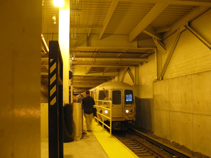
Someone needs to update these maps, and other maps as well, quickly. The M train's new weekend terminus is Essex Street. --Epicgenius (talk) 18:32, 5 June 2014 (UTC)
- Not really; the left map shows the M train's longest extent at leak service. It already doesn't cover the short turn overnight shuttle, so the weekend short turns at Essex Street, a station already served by the M train at all times, doesn't need to be noted either. The map is a quick glance overview of the fullest extent of the service, not a detailed one. oknazevad (talk) 11:59, 6 June 2014 (UTC)
- Actually, it does note the short turn at Myrtle Avenue. (And also note File:NYCS map R.svg; the 36th Street overnight short-turn terminal is noted.) Epicgenius (talk) 00:47, 7 June 2014 (UTC)
Naomi Campbell
Help me, please. Is Naomi Campbell mentioned in the West Farms Square – East Tremont Avenue (IRT White Plains Road Line) article the famous Naomi Campbell? Vcohen (talk) 19:25, 9 June 2014 (UTC)
- I doubt it! Why would the supermodel make an artwork to be installed in the subway? — Preceding unsigned comment added by 67.87.211.36 (talk) 00:11, 10 June 2014 (UTC)
Trolley list tidbits
Who has tidbits for my proposed List of streetcar lines in Westchester County, New York? I've been trying to start that list for several months, and I'm certainly not going to post it as is at this point. ---------User:DanTD (talk) 01:08, 11 June 2014 (UTC)
Naming convention for SAS stations
Is there a reason that stations on the Second Avenue Subway like 96th Street (IND Second Avenue Line) use "(IND Second Avenue Line)" instead of "(Second Avenue Subway)"? It seems like changing the name of the line so it will fit the naming convention. The SAS was obviously begun long after IND ceased to exist. Listroiderbobtalkeditsmore 17:02, 1 June 2014 (UTC)
- It's technically considered an IND line, hence "Foo Street (IND Second Avenue Line)." ---------User:DanTD (talk) 21:56, 1 June 2014 (UTC)
- But there's no good reason its should be. The problem is the naming convention can't handle anything constructed post-1940. Listroiderbobtalkeditsmore 23:03, 1 June 2014 (UTC)
- We have an IND Archer Avenue Line station (Jamaica – Van Wyck (IND Archer Avenue Line)), and two IND 63rd Street Line stations. We also have stations on the extension of the IRT Flushing Line west of Times Square - 42nd Street (New York City Subway) that are still listed as IRT Flushing Line stations, all of which are built after 1940. If the BMT Canarsie Line were reextended south of Canarsie – Rockaway Parkway (BMT Canarsie Line), the stations would still be listed as BMT stations, even if they were new. ---------User:DanTD (talk) 02:25, 2 June 2014 (UTC)
- I would not argue with the extension stations. But the SAS is not really an extension of a preexisting line, at least IMO. Can anyone provide a source outside Wikipedia that refers to the SAS or Archer lines as IND lines? Listroiderbobtalkeditsmore 03:43, 2 June 2014 (UTC)
- This was already discussed on the talk page. Do you want to step in on this, User:Epicgenius? ---------User:DanTD (talk) 04:30, 2 June 2014 (UTC)
- Chaining is not something most readers will know or care about. If anything, BMT makes more sense from a system persective because the Q (New York City Subway) runs on BMT lines in Manhattan, and the Q is the only service that will run on both existing track and the SAS. Listroiderbobtalkeditsmore 23:55, 2 June 2014 (UTC)
- There are other issues besides chaining, and besides that, we've had the stations misnamed as merely " Foo Street (Second Avenue Subway)" before. ---------User:DanTD (talk) 01:10, 3 June 2014 (UTC)
- I'm not sure specifically what other issues you are referring to. I haven't even seen a source which says anything about SAS being chained in IND. Even if there is one, it's still really a technical distinction...per WP:RF and WP:NOTJARGON it should be most understandable for readers, and the average reader will know the name "Second Avenue Subway" better than IND or BMT anything, regardless of chaining. Listroiderbobtalkeditsmore 22:23, 4 June 2014 (UTC)
- You've got two different Second Avenue Lines; You've got the IRT, which is the original el, and you've got the IND, which is the subway that was supposed to replace it decades ago, but is only being built now. Stop trying to undo the naming conventions. ---------User:DanTD (talk) 16:19, 5 June 2014 (UTC)
- We can't suffix our SAS articles "(Second Avenue Subway)", because the MTA's official name for the line is the IND Second Avenue Line. @User:Listroiderbob, the MTA still refers to the lines by division (A-IRT, B1-BMT, B2-IND), even if they did not exist after 1940. Otherwise, we'd have Roosevelt Island (63rd Street Line), Jamaica – Van Wyck (Archer Avenue Line), and 34th Street (Flushing Line). However, since the post-1940 stations are still divided into divisions based on their former companies, we have Roosevelt Island (IND 63rd Street Line), Jamaica – Van Wyck (IND Archer Avenue Line), and 34th Street (IRT Flushing Line), respectively. See New York City Subway chaining and this; it says which lines are IND, BMT, or IRT based on their chaining. Epicgenius (talk) 18:38, 5 June 2014 (UTC)
- You've got two different Second Avenue Lines; You've got the IRT, which is the original el, and you've got the IND, which is the subway that was supposed to replace it decades ago, but is only being built now. Stop trying to undo the naming conventions. ---------User:DanTD (talk) 16:19, 5 June 2014 (UTC)
- I'm not sure specifically what other issues you are referring to. I haven't even seen a source which says anything about SAS being chained in IND. Even if there is one, it's still really a technical distinction...per WP:RF and WP:NOTJARGON it should be most understandable for readers, and the average reader will know the name "Second Avenue Subway" better than IND or BMT anything, regardless of chaining. Listroiderbobtalkeditsmore 22:23, 4 June 2014 (UTC)
- There are other issues besides chaining, and besides that, we've had the stations misnamed as merely " Foo Street (Second Avenue Subway)" before. ---------User:DanTD (talk) 01:10, 3 June 2014 (UTC)
- I would not argue with the extension stations. But the SAS is not really an extension of a preexisting line, at least IMO. Can anyone provide a source outside Wikipedia that refers to the SAS or Archer lines as IND lines? Listroiderbobtalkeditsmore 03:43, 2 June 2014 (UTC)
- We have an IND Archer Avenue Line station (Jamaica – Van Wyck (IND Archer Avenue Line)), and two IND 63rd Street Line stations. We also have stations on the extension of the IRT Flushing Line west of Times Square - 42nd Street (New York City Subway) that are still listed as IRT Flushing Line stations, all of which are built after 1940. If the BMT Canarsie Line were reextended south of Canarsie – Rockaway Parkway (BMT Canarsie Line), the stations would still be listed as BMT stations, even if they were new. ---------User:DanTD (talk) 02:25, 2 June 2014 (UTC)
- But there's no good reason its should be. The problem is the naming convention can't handle anything constructed post-1940. Listroiderbobtalkeditsmore 23:03, 1 June 2014 (UTC)
- Also refer to the following past naming discussions (not all are related to NYC public transport):
- Wikipedia talk:WikiProject New York City Public Transportation/Archive 15#Using qualifiers when no ambiguity exists
- Wikipedia talk:WikiProject New York City Public Transportation/Archive 15#Somebody is moving our pages
- Talk:Durham–UNH station#WP:PRECISION
- Wikipedia talk:Naming conventions (stations)#WP:PRECISION
- Wikipedia talk:Naming conventions (stations)#Parentheticals again
- Wikipedia talk:Naming conventions (stations)#Station naming convention
- Wikipedia talk:Naming conventions (stations)#Station names being messed up again
- Wikipedia talk:Naming conventions (stations)#Station naming (again)
- Talk:San Marco Station#Title
- Talk:Jefferson Station#Title
- Talk:Kings Avenue Station#Title
- Wikipedia talk:Article titles/Archive 42#Parenthesis in title
- Talk:Jacksonville Skyway#Individual station articles
- Talk:Parkside Avenue (BMT Brighton Line)#Incremental improvements
- Wikipedia talk:Article titles/Archive 44#Train stations & subway stations and precision
- Wikipedia talk:Article titles/Archive 45#Train stations article naming proposal
- (By the way, anyone up against moving Lexington Avenue – 63rd Street (New York City Subway), Sutphin Boulevard – Archer Avenue – JFK Airport (New York City Subway), and Jamaica Center – Parsons/Archer (New York City Subway), to Lexington Avenue – 63rd Street (63rd Street Lines), Sutphin Boulevard – Archer Avenue – JFK Airport (Archer Avenue Lines), and Jamaica Center – Parsons/Archer (Archer Avenue Lines), respectively?) Epicgenius (talk) 18:44, 5 June 2014 (UTC)
- Firstly, I still have seen no source of any kind (outside WP) call the SAS an IND line (or say that it is chained IND, not that it matters) let alone an official MTA one. The one external source you gave doesn't list SAS at all. And to be clear, I think the IRT former line should stay as is, because that's its correct, historical, most easily recognizable name. I also can't follow your reasoning of "the MTA doesn't do it, so we can't do it." The MTA doesn't write out abbreviations either, but WP does and should. In fact, when the MTA needs to disambiguate station names for maps, etc., they use services, not lines, e.g. "86 St (4)(5)(6)". That would be unwieldy for WP in many cases, however, so we don't do it.
- And why the list of nearly all unrelated naming discussions? This is clearly a NYCS specific problem. Listroiderbobtalkeditsmore 21:41, 5 June 2014 (UTC)
- Because these discussions were brought up in past New York City Subway Station renaming discussions. Epicgenius (talk) 01:46, 6 June 2014 (UTC)
- By the way, since the IRT Second Avenue El was once considered part of the subway (according to maps, albeit an elevated line), the IND disambiguator is necessary. This refers to "IND Second Avenue Line", and so does [7]. Epicgenius (talk) 01:50, 6 June 2014 (UTC)
- Also, read WP:NC. (Second Avenue Subway) is better in all the criteria, save maybe consistency. Listroiderbobtalkeditsmore 21:49, 5 June 2014 (UTC)
- @Listroiderbob: I believe that it should remain at "(IND Second Avenue Line)" in conformity with all the other articles (that, and the Second Avenue Subway is known internally as the IND Second Avenue Line – it's the exception, not the rule, in NYCS line naming, forbidding WP:COMMONNAME (which is another matter)). Epicgenius (talk) 01:47, 6 June 2014 (UTC)
- So why exactly is this an exception to WP:COMMONNAME? Not to mention WP:NOTJARGON. I understand that it conforms with other names, but just because a majority of the subway system follows a certain naming (and systematic) pattern, doesn't mean that names in the part that doesn't should be modified to fit the rest. (I think there is a reason that consistency is listed last in WP:NC, and in this case names are basically being contrived for consistency alone.) IND Second Avenue Line isn't just an uncommon name, it's extremely uncommon except in a historical context (referring to the actual IND plans for the line) or when referring to the sections of the line built earlier (your two sources respectively). My point with the IRT is that if "Subway" is used instead of "Line" on the SAS stations, that would take care of the disambig because the IRT line was elevated, not a subway, per se, and "Line" was its more correct name. Also, it seemed to me that none of the discussions above pertained to this specific issue. Please point me to ones that do. Listroiderbobtalkeditsmore 02:04, 6 June 2014 (UTC)
- But the BMT Jamaica Line, IND Fulton Street Line, IRT White Plains Road Line, BMT Myrtle Avenue Line, etc. are subway lines that use former elevated-railway structures. Should they be renamed "Jamaica El", "Fulton Street El", "White Plains Road El", "Myrtle Avenue El", etc.? Besides, referring to your "extremely uncommon" name argument, there are 31 more lines with "extremely uncommon names" (like IRT Dyre Avenue Line, which is always referred to as the "5 line" outside of the railfanning and Wikipedia world), but yet we keep these stations at these names.
- In fact, even though the IND has not existed for over 73 years, this is still an IND line, being chained and signaled as part of the subway's "B2" or IND division (even I didn't know what that was, it's so obscure). The Archer Avenue Line is still referred to as IND (upper level) and BMT (lower level) because of its signalling. But again, the Second Avenue Line is internally referred to as an IND line, not just in historical fashion.
- Going back to the topic: I don't think "xxx (Second Avenue Subway)" is a suitable qualifier for the stations. Maybe "xxx (IND Second Avenue Line station)" would do. (We can't use "xxx (Second Avenue Line_" because it would be confused with the elevated, and we can't use "xxx (Second Avenue Subway)" because then all the other 422 articles would have to be renamed "xxx (yyy Line subway station)" and "xxx (New York City Subway station)" – it probably won't just be one, since a whole bunch of advocates for renaming will probably come into the discussion. The names of the articles are not very important, compared to the actual articles' contents, which do need expansion even though the average SAS article is about 20KB.) --Epicgenius (talk) 02:26, 6 June 2014 (UTC)
- Pinging Listroiderbob. Epicgenius (talk) 12:05, 6 June 2014 (UTC)
- I think in almost all if not all cases, the name the MTA uses for a line is the one in common use. However, the vast majority of lines, perhaps all except the SAS and some tunnel connectors, do not have a common name or one used by the MTA, hence the semi-historical IND/BMT/IRT constructions: they are the closest practical thing to a common name. The difference between those and the SAS is that it has a name that is common, recognizable, and used exclusively (externally) by the MTA. On the other hand, there would be no reason to use "Jamaica El" etc. because it is neither common nor used by the MTA or any external source (except possibly in a historical context). Besides WP:RF and WP:NC, there are other reasons not to use chaining or signalling as a naming framework: it appears there are few if any reliable sources with complete chaining lists. Also, there's a reason the MTA refers to it as IND internally only and not externally.
- As for disambig for the whole system, I don't see how adding "station" would solve anything. You are right that (Second Avenue Line) would be confused with the elevated, which is why I am not proposing that. Listroiderbobtalkeditsmore 19:25, 6 June 2014 (UTC)
- @Listroiderbob: That's not exactly true, as the MTA often refers to the lines by the names given on Wikipedia, minus the IRT/IND/BMT prefixes; for example, the MTA uses "Queens Blvd Line" for the IND Queens Boulevard Line. (Of course, that would mean that the real name of the articles of stations on the line would need to be "xxx (Queens Boulevard Line)", if we are to use the naming system that you propose for the Second Avenue Subway stations.) According to the current naming convention, the division should be kept in the station articles' title, even though it is not normally used in public usage, and in spite of the fact that the elimination of the division from the SAS stations' names is the crux of the discussion. The MTA, in fact, uses the same (or similar) names as Wikipedia does to refer to individual lines. This is a good thing to think about, and I will post more on this later. Epicgenius (talk) 00:46, 7 June 2014 (UTC)
- @Epicgenius: I see that MTA does use line names (though it would be a stretch to call these common names), but the argument stands. The reason we add the IND/BMT/IRT prefixes on WP despite their absence in common usage (or the MTA) is for disambiguation (and where no disambiguation is needed, for consistency), which is fine because they are still accurate names. However, for SAS, adding IND makes it an inaccurate name for WP purposes as I have explained previously. If for some reason we wanted to eliminate the division prefix for all articles at once (which is not necessary at all), we could use the "(defunct)" or "(former station)" qualifiers such as those used in some other areas of WP for the former stations. However there are places in the system where this naming might get very complicated. Also I should note that there are two elements of my proposal which are equally important: removing IND but also changing "Line" to "Subway". One without the other will screw everything up. Listroiderbobtalkeditsmore 01:36, 7 June 2014 (UTC)
- @Listroiderbob: There are some that prefer to do "either all or nothing" when it comes to moving articles. Personally, I believe that the IND prefix clarifies the fact that this is chained, signaled and (historically, at least) branded as an IND line. If you really feel that the page should be moved, you should check with Railroads WikiProject to get more opinions first. (I believe that it would be quite pointless to move the article, however, as it's quite unnecessary; the two titles of each article – the ones suffixed "(IND Second Avenue Line)" and "(Second Avenue Subway)" – will refer to the same thing.) Epicgenius (talk) 02:04, 7 June 2014 (UTC)
- Point of order; the IRT/BMT/IND are part of the lines' full names. They're often omitted, but they are part of the names. And they're easily seen by any person looking at a station's emergency exit diagram, posted over one end of each platform. So we did not make up the names of the articles and their use as disambiguators. oknazevad (talk) 08:16, 7 June 2014 (UTC)
- I know...that's why I said in most cases the names are accurate with the prefixes, and I didn't mean to assert that they were made up. Do you know if the emergency exit diagrams in SAS stations will use the IND prefix? If they don't, there will literally be no published source outside of Wikipedia using that name for the modern line. We already know that this is not a common name, but the existence of a source would clarify whether it has any significant use at all in the modern context. I feel like there's really nothing to discuss without an external source using "IND Second Avenue Line" in a modern context. Listroiderbobtalkeditsmore 00:11, 8 June 2014 (UTC)
- Point of order; the IRT/BMT/IND are part of the lines' full names. They're often omitted, but they are part of the names. And they're easily seen by any person looking at a station's emergency exit diagram, posted over one end of each platform. So we did not make up the names of the articles and their use as disambiguators. oknazevad (talk) 08:16, 7 June 2014 (UTC)
- @Listroiderbob: There are some that prefer to do "either all or nothing" when it comes to moving articles. Personally, I believe that the IND prefix clarifies the fact that this is chained, signaled and (historically, at least) branded as an IND line. If you really feel that the page should be moved, you should check with Railroads WikiProject to get more opinions first. (I believe that it would be quite pointless to move the article, however, as it's quite unnecessary; the two titles of each article – the ones suffixed "(IND Second Avenue Line)" and "(Second Avenue Subway)" – will refer to the same thing.) Epicgenius (talk) 02:04, 7 June 2014 (UTC)
- @Epicgenius: I see that MTA does use line names (though it would be a stretch to call these common names), but the argument stands. The reason we add the IND/BMT/IRT prefixes on WP despite their absence in common usage (or the MTA) is for disambiguation (and where no disambiguation is needed, for consistency), which is fine because they are still accurate names. However, for SAS, adding IND makes it an inaccurate name for WP purposes as I have explained previously. If for some reason we wanted to eliminate the division prefix for all articles at once (which is not necessary at all), we could use the "(defunct)" or "(former station)" qualifiers such as those used in some other areas of WP for the former stations. However there are places in the system where this naming might get very complicated. Also I should note that there are two elements of my proposal which are equally important: removing IND but also changing "Line" to "Subway". One without the other will screw everything up. Listroiderbobtalkeditsmore 01:36, 7 June 2014 (UTC)
- @Listroiderbob: That's not exactly true, as the MTA often refers to the lines by the names given on Wikipedia, minus the IRT/IND/BMT prefixes; for example, the MTA uses "Queens Blvd Line" for the IND Queens Boulevard Line. (Of course, that would mean that the real name of the articles of stations on the line would need to be "xxx (Queens Boulevard Line)", if we are to use the naming system that you propose for the Second Avenue Subway stations.) According to the current naming convention, the division should be kept in the station articles' title, even though it is not normally used in public usage, and in spite of the fact that the elimination of the division from the SAS stations' names is the crux of the discussion. The MTA, in fact, uses the same (or similar) names as Wikipedia does to refer to individual lines. This is a good thing to think about, and I will post more on this later. Epicgenius (talk) 00:46, 7 June 2014 (UTC)
- Pinging Listroiderbob. Epicgenius (talk) 12:05, 6 June 2014 (UTC)
- So why exactly is this an exception to WP:COMMONNAME? Not to mention WP:NOTJARGON. I understand that it conforms with other names, but just because a majority of the subway system follows a certain naming (and systematic) pattern, doesn't mean that names in the part that doesn't should be modified to fit the rest. (I think there is a reason that consistency is listed last in WP:NC, and in this case names are basically being contrived for consistency alone.) IND Second Avenue Line isn't just an uncommon name, it's extremely uncommon except in a historical context (referring to the actual IND plans for the line) or when referring to the sections of the line built earlier (your two sources respectively). My point with the IRT is that if "Subway" is used instead of "Line" on the SAS stations, that would take care of the disambig because the IRT line was elevated, not a subway, per se, and "Line" was its more correct name. Also, it seemed to me that none of the discussions above pertained to this specific issue. Please point me to ones that do. Listroiderbobtalkeditsmore 02:04, 6 June 2014 (UTC)
- @Listroiderbob: I believe that it should remain at "(IND Second Avenue Line)" in conformity with all the other articles (that, and the Second Avenue Subway is known internally as the IND Second Avenue Line – it's the exception, not the rule, in NYCS line naming, forbidding WP:COMMONNAME (which is another matter)). Epicgenius (talk) 01:47, 6 June 2014 (UTC)
I don't think there's a source that says that the SAS is a BMT line, either (in fact, there are none because it doesn't exist). We can't argue that it's BMT, and it's definitely not in both divisions. But "IND Second Avenue Line" seems to exist in many places outside of Wikipedia, so that's why it's used. Epicgenius (talk) 12:09, 9 June 2014 (UTC)
- @Listroiderbob: Would you like to move the articles/continue discussion? Epicgenius (talk) 17:39, 10 June 2014 (UTC)
- Many places? Try [8]. (Not citing numbers per WP:GYNOT.) The first few are either not relevant or used in a historical context. Then try [9] and tell me that IND is a more common name. I'm sure they are both used in "many" places outside Wikipedia, but there is still a great difference in both the amount and context of their usage. So yes, I still want the moves. Should we start an RFC? Listroiderbobtalkeditsmore 02:03, 11 June 2014 (UTC)
- @Listroiderbob: As I said above, most lines have the division abbreviation first, then the line name. I don't think a RfC is necessary yet (it would cause many problems at this point, including move-warring and month-long arguments like the ones at Talk:Parkside Avenue (BMT Brighton Line)). In fact, I believe that you can be bold and move the articles. After all, our naming convention specifically says that the articles should be titled by the station name, then the name of the Wikipedia article on the line (which applies to 425 out of 428 stations, but will apply to 422 stations should you move the article). After you move the articles, you could have an RfC if you wish. Of course, you can have an RfC now; I am just saying that I personally think that it isn't a good idea. Epicgenius (talk) 15:46, 11 June 2014 (UTC)
- Ok, I moved them to 72nd Street (Second Avenue Subway), 86th Street (Second Avenue Subway), 96th Street (Second Avenue Subway). Anyone please feel free to make any necessary changes to match that I missed. Listroiderbobtalkeditsmore 20:49, 11 June 2014 (UTC)
- Now that we have an infobox with values like the first one on the right, I personally think that we should keep the "IND Second Avenue Line in the "services" parameter. Otherwise we'll have "B (IND) Second Avenue Subway", which doesn't look like the value in any of the other NYCS station articles. Since we have the Second Avenue Subway link in the lede already, I've changed back the infobox links. My edit summary ("Maybe moving wasn't such a good idea...") is inaccurate, so please ignore.
- Alternatively, I can propose other values for the "line" parameter, much like those in the second infobox.
- Finally, when revenue service starts (or perhaps earlier), the IND Second Avenue Line might either become a separate article or be moved from Second Avenue Subway, and maybe the station articles can be moved again, since this is still pretty much a IND line. I'd like to make a compromise in which the article's title still adheres to NYCPT naming conventions by then. --Epicgenius (talk) 21:18, 11 June 2014 (UTC)
- It's entirely possible that MTA might start using a different name once service starts or that some other name might develop. A move should be considered in either case. The division could just be "B," but I'm fine with it (and the line name) as is. Listroiderbobtalkeditsmore 01:13, 12 June 2014 (UTC)
- Ok, I moved them to 72nd Street (Second Avenue Subway), 86th Street (Second Avenue Subway), 96th Street (Second Avenue Subway). Anyone please feel free to make any necessary changes to match that I missed. Listroiderbobtalkeditsmore 20:49, 11 June 2014 (UTC)
- @Listroiderbob: As I said above, most lines have the division abbreviation first, then the line name. I don't think a RfC is necessary yet (it would cause many problems at this point, including move-warring and month-long arguments like the ones at Talk:Parkside Avenue (BMT Brighton Line)). In fact, I believe that you can be bold and move the articles. After all, our naming convention specifically says that the articles should be titled by the station name, then the name of the Wikipedia article on the line (which applies to 425 out of 428 stations, but will apply to 422 stations should you move the article). After you move the articles, you could have an RfC if you wish. Of course, you can have an RfC now; I am just saying that I personally think that it isn't a good idea. Epicgenius (talk) 15:46, 11 June 2014 (UTC)
- Many places? Try [8]. (Not citing numbers per WP:GYNOT.) The first few are either not relevant or used in a historical context. Then try [9] and tell me that IND is a more common name. I'm sure they are both used in "many" places outside Wikipedia, but there is still a great difference in both the amount and context of their usage. So yes, I still want the moves. Should we start an RFC? Listroiderbobtalkeditsmore 02:03, 11 June 2014 (UTC)
xxx | |||||||||||||||||||||||||||||||
|---|---|---|---|---|---|---|---|---|---|---|---|---|---|---|---|---|---|---|---|---|---|---|---|---|---|---|---|---|---|---|---|
| Station statistics | |||||||||||||||||||||||||||||||
| Division | B (IND)[2] | ||||||||||||||||||||||||||||||
| Line | IND Second Avenue Line | ||||||||||||||||||||||||||||||
| Services | N Q R | ||||||||||||||||||||||||||||||
| Opposite- direction transfer | Yes | ||||||||||||||||||||||||||||||
| Traffic | |||||||||||||||||||||||||||||||
| 2023 | [3] | ||||||||||||||||||||||||||||||
| Rank | out of 423[3] | ||||||||||||||||||||||||||||||
| |||||||||||||||||||||||||||||||
xxx | |||||||||||||||||||||||||||||||
|---|---|---|---|---|---|---|---|---|---|---|---|---|---|---|---|---|---|---|---|---|---|---|---|---|---|---|---|---|---|---|---|
| Station statistics | |||||||||||||||||||||||||||||||
| Division | B (IND)[2] | ||||||||||||||||||||||||||||||
| Line | Second Avenue Subway (IND Second Avenue Line) | ||||||||||||||||||||||||||||||
| Services | N Q R | ||||||||||||||||||||||||||||||
| Opposite- direction transfer | Yes | ||||||||||||||||||||||||||||||
| Traffic | |||||||||||||||||||||||||||||||
| 2023 | [3] | ||||||||||||||||||||||||||||||
| Rank | out of 423[3] | ||||||||||||||||||||||||||||||
| |||||||||||||||||||||||||||||||
- Excuse me if I find it a little hard to believe the MTA is going to give it a different name. I look at this line and I can't believe it would be anything else but the IND Second Avenue Line. Something else bothers me about this renaming of the IND 2nd Ave stations; Epicgenius recently renamed three stations on two different lines, and for those it's easy to see why he would; Jamaica Center – Parsons/Archer (Archer Avenue Lines) and Sutphin Boulevard – Archer Avenue – JFK Airport (Archer Avenue Lines) carry both IND and BMT lines. The same goes for Lexington Avenue – 63rd Street (63rd Street Lines). The stations along the Second Avenue Subway are exclusively IND stations. ---------User:DanTD (talk) 02:14, 12 June 2014 (UTC)
By different name I meant a name other than "Second Avenue Subway." "IND Second Avenue Line" (maybe without the IND) is certainly one of those possibilities. As for your other complaint, this issue was addressed multiple times in the discussion. Listroiderbobtalkeditsmore 03:48, 12 June 2014 (UTC)
We have a category problem
Category:Future IND Second Avenue Line stations still needs to be renamed to comply to the new naming style. Epicgenius (talk) 00:55, 12 June 2014 (UTC)
- Done. Listroiderbobtalkeditsmore 01:13, 12 June 2014 (UTC)
Leaflet For Wikiproject New York City Public Transportation At Wikimania 2014
Hi all,
My name is Adi Khajuria and I am helping out with Wikimania 2014 in London.
One of our initiatives is to create leaflets to increase the discoverability of various wikimedia projects, and showcase the breadth of activity within wikimedia. Any kind of project can have a physical paper leaflet designed - for free - as a tool to help recruit new contributors. These leaflets will be printed at Wikimania 2014, and the designs can be re-used in the future at other events and locations.
This is particularly aimed at highlighting less discoverable but successful projects, e.g:
• Active Wikiprojects: Wikiproject Medicine, WikiProject Video Games, Wikiproject Film
• Tech projects/Tools, which may be looking for either users or developers.
• Less known major projects: Wikinews, Wikidata, Wikivoyage, etc.
• Wiki Loves Parliaments, Wiki Loves Monuments, Wiki Loves ____
• Wikimedia thematic organisations, Wikiwomen’s Collaborative, The Signpost
For more information or to sign up for one for your project, go to:
Project leaflets
Adikhajuria (talk) 10:51, 13 June 2014 (UTC)
Metro-North train 1567?
As you people know I've been struggling to sort out numerous New York City Subway, Long Island Rail Road and Metro-North related images. One that has eluded me are the Metro-North M2/M4/M6 railcars. I read all the fleet numbers, but one is listed that I can't seem to find.

- 1567, mentioned in the file name, is a train number, not a fleet number. That's why you can't find it in the car roster. It's the 1:46 p.m. Departure from New Haven to Grand Central, running local to Stamford and express from there to Grand Central. The actual car number of the MU in the image is too difficult to read. oknazevad (talk) 19:49, 17 June 2014 (UTC)
- Okay, that just bites testicles endlessly. It's a shame that there will never be any way of determining whether any of these trains are either M2's, M4's or M6's, including the one I took at Mount Vernon East (Metro-North station) three years ago. ---------User:DanTD (talk) 22:56, 17 June 2014 (UTC)
- That one's an M2; the ends of the M2s have just the red stripe on the font, instead of a full red face. Looking at the the one of train 1567 more closely, it's a five car train consisting of an M4 pair leading an M6 triplet; though both feature the full red face, and are fully compatible with each other, M4s came in married pairs and M6s in three car sets. Looking carefully at the spaces between the cars in the train 1567 pic, there's a little bit more of a gap between the second car and the third, indicating where the pair meets the triplet. oknazevad (talk) 01:17, 18 June 2014 (UTC)
- Really? Because this one has the "full red face" too, and it's categorized as an M2, although the GermanWiki article on Metro-North lists it as an M3. Of course if that were true, it would be an M3A, but obviously not the case. ---------User:DanTD (talk) 02:23, 18 June 2014 (UTC)
- That one's an M2; the ends of the M2s have just the red stripe on the font, instead of a full red face. Looking at the the one of train 1567 more closely, it's a five car train consisting of an M4 pair leading an M6 triplet; though both feature the full red face, and are fully compatible with each other, M4s came in married pairs and M6s in three car sets. Looking carefully at the spaces between the cars in the train 1567 pic, there's a little bit more of a gap between the second car and the third, indicating where the pair meets the triplet. oknazevad (talk) 01:17, 18 June 2014 (UTC)
- Okay, that just bites testicles endlessly. It's a shame that there will never be any way of determining whether any of these trains are either M2's, M4's or M6's, including the one I took at Mount Vernon East (Metro-North station) three years ago. ---------User:DanTD (talk) 22:56, 17 June 2014 (UTC)
There is a large blotch of irrelevant information on that article that is repeatedly removed and restored, which is the following:
- Nostrand Avenue station opened on April 9, 1936, as part of an extension of the Independent Subway System (IND) from its previous Brooklyn terminus at Jay Street – Borough Hall, which opened three years earlier, to Rockaway Avenue. Although an express station, it was served solely by the A, which ran local on the line at the time with express portions in Manhattan on its way to Inwood – 207th Street. In 1944, the CC began running along the line, making local stops in the peak rush hour direction only, allowing the A to act as an express during those hours.[4]
- Five years later, the CC and the E switched terminals (the CC now ran to the Hudson Terminal and the E to Euclid Avenue), a pattern that would last throughout the 1950s and 1960s, only for the CC and the E to once again switch terminals (the A had now run express full-time on the line apart from late nights).[5] By this time the E had been extended all the way to Rockaway Park – Beach 116th Street and the CC similarly ran there. In 1985, the MTA eliminated double-lettered trains, leaving only the A and C to serve Nostrand Avenue and seven years after that, the C was reduced to Euclid Avenue, where it terminates today.
Except for the first sentence, what does anything have to do with the station's history? This section talks about the history of the services that stopped here, not the station itself. If we leave this on this article, shouldn't every other IND Fulton Street Line station article have this information too? Should every single NYC Subway station article include history of services that stopped there since they opened? — Preceding unsigned comment added by 173.3.76.96 (talk) 20:16, 25 June 2014 (UTC)
- Only if every station served the same trains at the same time. ---------User:DanTD (talk) 21:15, 25 June 2014 (UTC)
- ^ Schmitt, Eric (December 31, 1987). "Electric Service Extended by L.I.R.R." The New York Times. p. B3. Retrieved 2009-07-05.
- ^ a b "Glossary". Second Avenue Subway Supplemental Draft Environmental Impact Statement (SDEIS) (PDF). Vol. 1. Metropolitan Transportation Authority. March 4, 2003. pp. 1–2. Archived from the original (PDF) on February 26, 2021. Retrieved January 1, 2021.
- ^ a b c d "Annual Subway Ridership (2018–2023)". Metropolitan Transportation Authority. 2023. Retrieved April 20, 2024.
- ^ 1948 route information NYCSubway Retrieved 2009-07-17
- ^ 1959 system map (route information) NYCSubway Retroeved 2009-07-17