This article needs additional citations for verification. (February 2021) |
The Tōhoku region (東北地方, Tōhoku-chihō, IPA: [toːhokɯ̥ tɕiꜜhoː]), Northeast region, Ōu region (奥羽地方, Ōu-chihō), or Northeast Japan (東北日本, Tōhoku Nihon) consists of the northeastern portion of Honshu, the largest island of Japan. This traditional region consists of six prefectures (ken): Akita, Aomori, Fukushima, Iwate, Miyagi, and Yamagata.[2]
Tōhoku region
東北地方 | |
|---|---|
 Tōhoku region in Japan | |
 | |
 Prefectures and major cities in Tōhoku | |
| Coordinates: 38°54′N 140°40′E / 38.90°N 140.67°E | |
| Country | Japan |
| Area | |
| • Total | 66,951.97 km2 (25,850.30 sq mi) |
| Population (August 1, 2023) | |
| • Total | 8,331,385 |
| • Density | 120/km2 (320/sq mi) |
| Gross Regional Product | |
| • Total | JP¥35.159 trillion US$323 billion |
| Time zone | UTC+09:00 (JST) |
Tōhoku retains a reputation as a remote, scenic region with a harsh climate. In the 20th century, tourism became a major industry in the Tōhoku region.
History
editAncient & Classical period
edit
In mythological times, the area was known as Azuma (吾妻, あづま) and corresponded to the area of Honshu occupied by the native Emishi and Ainu. The area was historically the Dewa and the Michinoku regions,[3] a term first recorded in Hitachi-no-kuni Fudoki (常陸国風土記) (654). There is some variation in modern usage of the term "Michinoku".[4]
Tōhoku's initial historical settlement occurred between the seventh and ninth centuries, well after Japanese civilization and culture had become firmly established in central and southwestern Japan. The last stronghold of the indigenous Emishi on Honshu and the site of many battles, the region has maintained a degree of autonomy from Kyoto at various times throughout history.
The Northern Fujiwara (奥州藤原氏 Ōshū Fujiwara-shi) were a Japanese noble family that ruled the Tōhoku region during the 12th century as their own realm. They kept their independence vis-a-vis the Imperial Court in Kyoto by the strength of their warrior bands until they were overwhelmed by Minamoto no Yoritomo in 1189.[5]
Feudal period
editChristianity in Tōhoku
editThis section possibly contains original research. (October 2021) |

Date Masamune (1567–1636), feudal lord of Date clan, expanded trade in the Tōhoku region. Although initially faced with attacks by hostile clans, he managed to overcome them after a few defeats and eventually ruled one of the largest fiefdoms of the later Tokugawa shogunate. He built many palaces and worked on many projects to beautify the region. He is also known to have encouraged foreigners to come to his land. Even though he funded and promoted an envoy to establish relations with the Pope in Rome, he was likely motivated at least in part by a desire for foreign technology, similar to that of other lords, such as Oda Nobunaga. He showed sympathy for Christian missionaries and traders in Japan. In addition to allowing them to come and preach in his province, he also released the prisoner and missionary Padre Sotelo from the hands of Tokugawa Ieyasu. Date Masamune allowed Sotelo as well as other missionaries to practice their religion and win converts in Tōhoku.
Further, once Tokugawa Ieyasu (1543–1616) outlawed Christianity, Masamune reversed his position, and though disliking it, let Ieyasu persecute Christians in his domain. For 270 years, Tōhoku remained a place of tourism, trade and prosperity. Matsushima, for instance, a series of tiny islands, was praised for its beauty and serenity by the wandering haiku poet Matsuo Bashō.
Early modern period
edit
The haiku poet Matsuo Bashō (1644–1694) wrote Oku no Hosomichi (The Narrow Road to the Deep North) during his travels through Tōhoku.
Contemporary period
editIn the 1960s, ironworks, steelmaking, cement, chemical industry, pulp, and petroleum refining industries began developing. The region is traditionally known as a less developed area of Japan.[6]
The catastrophic 9.0-magnitude earthquake and tsunami on March 11, 2011, inflicted massive damage along the east coast of this region, causing 19,759 deaths,[7] and was the costliest natural disaster ever which left 500,000 people homeless along with radioactive emissions from the Fukushima Daiichi nuclear disaster.
Geography
edit

Tōhoku, like most of Japan, is hilly or mountainous, with the Ōu Mountains running north–south. The inland location of many of the region's lowlands has led to a concentration of much of the population there. Coupled with coastlines that do not favor seaport development, this settlement pattern resulted in a much greater than usual dependence on land and rail transportation. Low points in the central mountain range make communications between lowlands on either side of the range moderately easy.
Tōhoku was traditionally considered the granary of Japan because it supplied Sendai and the Tokyo-Yokohama market with rice and other farming commodities. Tōhoku provided 20 percent of the nation's rice crop.
- Gallery
-
 Mount Iwate dominates the city of Morioka
 -
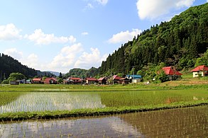 Rice paddies in Aizu in early summer
 -
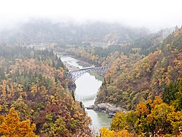 Tadami River and Tadami Line in autumn
 -
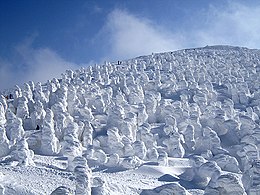 Snow monsters on Mount Zaō
 -
 Satellite image of Tōhoku region


_at_Zao)_08_Feb,_2011_-_panoramio.jpg)

Subdivision
editThe most often used subdivision of the region is dividing it to "North Tōhoku" (北東北, Kita-Tōhoku) consisting of Aomori, Akita, and Iwate Prefectures and "South Tōhoku" (南東北, Minami-Tōhoku) consisting of Yamagata, Miyagi, and Fukushima Prefectures.
Climate
editThe climate is colder than in other parts of Honshū due to the stronger effect of the Siberian High, and permits only one crop a year on paddy fields. The Pacific coast of Tohoku, however, is generally much less snowy than the region's popular image and has among the smallest seasonal temperature variation in Japan. The city of Iwaki, for instance, has daily mean temperatures ranging from 3.0 °C (37.4 °F) in January to 23.9 °C (75.0 °F) in August.
Cities and populated areas
editCore cities
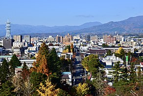
edit- Sendai (population: 1,098,000)
- Iwaki (population: 322,000)
- Kōriyama (population: 322,000)
- Akita (population: 300,000)
- Morioka (population: 284,000)
- Aomori (population: 265,000)
- Yamagata (population: 242,000)
- Hachinohe (population: 216,000)
- Gallery
-

-

-

-


Other cities
edit- Aizuwakamatsu
- Daisen
- Date
- Fukushima
- Goshogawara
- Hachimantai
- Hanamaki
- Hachinohe
- Higashimatsushima
- Higashine
- Hirakawa
- Hirosaki
- Ichinoseki
- Ishinomaki
- Iwanuma
- Kakuda
- Kamaishi
- Kaminoyama
- Katagami
- Kazuno
- Kesennuma
- Kitaakita
- Kitakami
- Kitakata
- Kuji
- Kurihara
- Kuroishi
- Minamisōma
- Misawa
- Miyako
- Motomiya
- Murayama
- Mutsu
- Nagai
- Nan'yō
- Natori
- Nihonmatsu
- Nikaho
- Ninohe
- Noshiro
- Obanazawa
- Oga
- Ōdate
- Ōfunato
- Ōsaki
- Ōshū
- Rikuzentakata
- Sagae
- Sakata
- Semboku
- Shinjō
- Shiogama
- Shirakawa
- Shiroishi
- Sōma
- Sukagawa
- Tagajō
- Takizawa
- Tamura
- Tendō
- Tome
- Tomiya
- Tōno
- Towada
- Tsugaru
- Tsuruoka
- Yamagata
- Yokote
- Yonezawa
- Yurihonjō
- Yuzawa
Demographics
edit| Year | Pop. | ±% |
|---|---|---|
| 1884 | 3,957,085 | — |
| 1898 | 4,893,747 | +23.7% |
| 1920 | 5,793,974 | +18.4% |
| 1940 | 7,164,674 | +23.7% |
| 1950 | 9,021,809 | +25.9% |
| 1955 | 9,334,442 | +3.5% |
| 1970 | 9,031,197 | −3.2% |
| 1975 | 9,232,875 | +2.2% |
| 1980 | 9,572,088 | +3.7% |
| 1985 | 9,730,352 | +1.7% |
| 1990 | 9,738,284 | +0.1% |
| 1995 | 9,834,124 | +1.0% |
| 2000 | 9,817,589 | −0.2% |
| 2010 | 9,335,636 | −4.9% |
| 2023 | 8,400,960 | −10.0% |
| Note: All figures since 1920 are October, except 2023 which is 1/1. Source: Japan Census figures except latest which from ja:東北地方 | ||
The population decline of Tōhoku, which began before the year 2000, has accelerated, now including previously dynamic Miyagi. Despite this, Sendai City has grown, in part due to relocations of people affected by the 2011 disaster. The population decline of Aomori, Iwate and Akita Prefectures, Honshu's three northernmost, began in the early 1980s after an initial loss of population in the late 1950s. Fukushima Prefecture, prior to 1980, had traditionally been the most populated, but today Miyagi is the most populated and urban by far.
Points of interest
editNatural features
edit- Mount Bandai
- Hakkōda Mountains
- Mount Hayachine
- Mount Iwaki
- Lake Tazawa
- Lake Towada
- Kitakami River
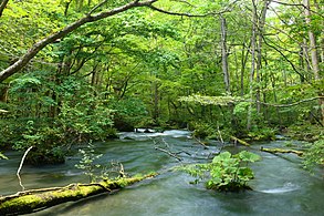
- Oirase River Valley
- The islands of Matsushima Bay
- Mount Osore
- Sanriku Coast
Parks
edit- Bandai-Asahi National Park
- Miss Veedol Beach
- Sanriku Fukkō National Park
- Towada-Hachimantai National Park
Historical features
edit- Aizuwakamatsu Castle
- Hirosaki Castle
- Chūson-ji
- Mōtsū-ji
- Mount Osore
- Three Mountains of Dewa
- Yama-dera
- Ōuchi-juku
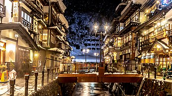
Onsen
editFestivals
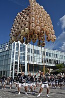
edit- Aomori Nebuta Matsuri
- Hachinohe Sansha Taisai
- Akita Kantō
- Yamagata Hanagasa Festival
- Goshogawara Tachineputa Festival
- Gallery
-
-
 Aizuwakamatsu Castle in spring
 -

-
-
 Akita Kantō Festival


See also
editNotes
edit- ^ "県民経済計算(平成23年度 - 令和2年度)(2008SNA、平成27年基準計数)<47都道府県、4政令指定都市分>".
- ^ Nussbaum, Louis-Frédéric. (2005). "Tōhoku" in Japan Encyclopedia, p. 970, p. 970, at Google Books
- ^ Hanihara, Kazuro. "Emishi, Ezo and Ainu: An Anthropological Perspective," Archived 2011-10-02 at the Wayback Machine Japan Review, 1990, 1:37 (PDF p. 3).
- ^ McCullough, Helen Craig. (1988). The Tale of the Heike, p. 81, p. 81, at Google Books; excerpt, "Furthermore, in the old days, the two famous eastern provinces, Dewa and Michinoku, were a single province made up of sixty-six districts, of which twelve were split off to create Dewa."
- ^ LOUIS FREDERIC (2008). "O Japão". Dicionário e Civilização. Rio de Janeiro: Globo Livros. pp. 223–224. ISBN 9788525046161. Archived from the original on 7 October 2022. Retrieved 3 November 2020.
- ^ Dentsu. (1970). Industrial Japan, Issues 18–26, p. 58 Archived 2022-10-07 at the Wayback Machine; retrieved 2013-4-17.
- ^ "平成23年(2011年)東北地方太平洋沖地震(東日本大震災)について(第162報)(令和4年3月8日)" [Press release no. 162 of the 2011 Tohuku earthquake] (PDF). 総務省消防庁災害対策本部 [Fire and Disaster Management Agency]. Archived from the original (PDF) on 27 August 2022. Retrieved 23 September 2022. Page 31 of the PDF file.
References
edit- Nussbaum, Louis-Frédéric and Käthe Roth (2005). Japan Encyclopedia. Cambridge, Mass.: Harvard University Press. ISBN 978-0-674-01753-5. OCLC 58053128.
 This article incorporates text from this source, which is in the public domain. Country Studies. Federal Research Division. Japan.
External links
edit- Akita Prefecture Official website (in English)
- Aomori Prefecture Official website
- Fukushima Prefecture Official website (in English)
- Miyagi Prefecture Official website (in English)
- Yamagata Prefecture Official website (in English)
- Iwate Prefecture Living Guide for Foreign Nationals (in English)
- Tohoku Region Facts and detailed information on Tohoku (in English)