User talk:Lemongirl942/Guidelines and naming conventions (Singapore)
Regarding planning areas
editPlanning areas don't usually change over time, their boundaries remain fixed. Subzones usually have more flexible boundaries. MageLam (talk) 15:35, 13 March 2016 (UTC)
Similar WikiProject
editHey @Lemongirl942. It appears there is a similar convention list on a long dead Singaporean WikiProject. Probably we could revive it and re-define the conventions that other fellow Wikipedians laid down a decade ago? MageLam (talk) 15:58, 13 March 2016 (UTC)
Centering Article on Subzones
edit@MageLam: I was just thinking if we should centre articles on subzones. Considering that subzones change frequently/get dissolved, I feel it would be better not to centre articles on subzones. There are also conflicting subzone names. For example the subzone named Joo Seng was previously called Paya Lebar and it used to lie within the planning area of Toa Payoh.
Some thoughts: For example, if the article is about a housing estate/HDB neighbourhood and there is a subzone with the same name (and the housing estate physically lies in the same subzone), then the article could mention about the subzone was well in the second line.
If there is an existing article about a road, then preferably let it be. However, the second line of the article should mention about the subzone (particularly if the subzone has the a name derived from the name of the road). My reasoning is that since roads are usually permanent, it would be easier to keep the article as it is. --Lemongirl942 (talk) 04:23, 24 March 2016 (UTC)
@Lemongirl942: The best thing to do is to basically not create subzone articles which have little notability (look at Shipyard, Boon Lay for example). It isn't necessary to create articles for every subzone that currently exists. There are some articles which should be converted into subzone articles (Bras Basah Road should merge with Bras Basah for instance), as the subzone is a historical precinct which makes for good content. Even if the boundaries of notable subzones change, their names would more or less remain the same.
In the case of a housing estate which is conterminous with a subzone, the heading line should read, "______ is a subzone and a housing estate" (like with Bidadari for instance). Thus even if the subzone is dissolved, the article can still be used to describe the housing estate (like with Buona Vista).
I'll be writing my draft for the new Bedok article introduction in the meantime. Do contact me if need be. -- MageLam (talk) 04:39, 24 March 2016 (UTC)
- One reason I prefer having the current roads articles is because the roads are also historical roads and they existed before the subzones were created. Another is that the roads do not always lie within the subzones. For example the majority of Anson road lies within Tanjong Pagar [1] --Lemongirl942 (talk) 07:35, 24 March 2016 (UTC)
Some subzones do define an important general area. Look at Chinatown for instance, it is a subzone located within Outram that has some kind of notability internationally. Some subzone articles are important in order to help establish locations within a planning area. If the subzone isn't notable, and its name is better associated with another geographical entity (like with Anson (subzone)/Anson Road for instance). The article can be rewritten in the context of that geographical entity. (rewritting Anson as Anson Road basically) -- MageLam (talk) 08:45, 24 March 2016 (UTC)
Also, speaking about subzones. I would also like to bring up articles that discuss places that are often considered a single area, although in the master plan, said area is divided up into numerous subzones. For example, Tiong Bahru. In the current master plan, Tiong Bahru is split into three subzones, Tiong Bahru (subzone), Tiong Bahru Station and Kampong Tiong Bahru. However, they are all still discussed in the same article, Tiong Bahru. So like I said, it isn't really necessary to create articles of every single subzone, just the general subzone region or a notable subzone will do. -- MageLam (talk) 08:45, 24 March 2016 (UTC)
- Ah yes, I agree that historically significant subzones should be kept. The Chinatown is a bit of a problem though because the area referred commonly referred to as Chinatown actually included parts of nearby subzones as well. Let me find the map. --Lemongirl942 (talk) 09:08, 24 March 2016 (UTC)
@MageLam: While researching about Changi Point today and looking at how Urban Planning is done in other cities, I realised that subzones in Singapore are actually fluid Urban Planning subdivisions (used for statistical purposes) and not really geographically static entities. I mean, I have always heard of "People's Park Complex" inside Chinatown, but the 2014 plan shows it is not in Chinatown. URA seems to be using names of one place and then using it for the whole subzone. Another interesting thing is Boon Lay. A previous masterplan showed Boon Lay as part of Jurong East (occupying the rough area of current Yuhua West). But now we have Boon Lay in Jurong West (leaving aside the Boon Lay planning area). Similarly, Joo Seng subzone (of 2014) was previously a subzone called "Paya Lebar" and it was adjacent to the Paya Lebar planning area. The problem with changing boundaries/names means that it is harder to define. On the other hand, roads and housing estates are smaller entities but more permanent and easier to geolocate. To me, subzones are simply administrative divisions (like wards). For a neighbourhood to disappear, it would require physically demolishing the buildings and people would need to move out. But wards and subzones can be easily changed without the need for that happening. I also looked at how New York City handles these problems and got a few insights.
- NYC is broadly divided into 5 Boroughs and these boundaries are fixed.
- Each borough is divided into Community boards which look after land use/zoning/community needs etc. (This seems to me similar to town councils/wards/RC zones).
- The NYC Department of City Planning divides the city into 55 Public Use Microdata Areas (PUMAs). These are in turn sub-divided into Neighborhood Tabulation Areas (NTAs). These are used for Census purposes. This seems similar to Planning Areas/Subzones which are used for census as well.
- Apart from the 3 official divisions, NYC contains numerous neighbourhoods whose boundaries are not officially defined and can change with respect to real estate developments. From what I can see, articles are mostly centred around neighbourhoods.
If you look at the neighbourhood articles, they do not mention the PUMAs/NTAs they are part of. They's only a brief mention about the Community boards they are part of. The rough location of a neighbourhood is mentioned in the article and it seems to be inferred from previously published maps/other cited sources. Another interesting aspect I found was that both NTAs of New York and Subzones of Singapore may not coincide with existing developments.
Maps of Neighborhood Tabulation Areas (NTAs). Neighborhood Tabulation Areas, or NTAs, are aggregations of census tracts that are subsets of New York City's 55 Public Use Microdata Areas (PUMAs). Primarily due to these constraints, NTA boundaries and their associated names may not definitively represent neighborhoods.
The Master Plan 20014 is a forward looking guiding plan for Singapore's development in the medium term over the next 10 to 15 years and the planning boundaries may not coincide with existing developments for some areas.
— About Subzones, https://data.gov.sg/dataset/master-plan-2014-subzone-boundary
Taking into account that article about NYC neighbourhoods do not seem to reference the NTAs, I would suggest the same for the Singapore neighbourhood articles. NYC neighbourhood articles mention approximate locations based on previous sources. (A well written article example here Riverdale, Bronx). This can be applied to Singapore as well and it would make it easier to handle articles (particularly estate articles) considering that in Singapore, estates are actually neighbourhoods which containing a market/residential flats/hawker centre/schools etc. --Lemongirl942 (talk) 06:23, 30 March 2016 (UTC)
- @Lemongirl942: Well, I can agree on your points. But you still cannot deny that notable subzones (such as Chinatown and Little India) do have boundaries of some sort. I'm not saying that all articles have to respect the boundaries of subzones (such as neighborhoods and estates for example). But if the place exists and there is a subzone for it, its boundaries should be observed. Now there is no denying that there are badly written subzone articles (such as Shipyard, Boon Lay for example), but there is really nothing we can do about them as these articles are already there and they correlate with existing locations. -- MageLam (talk) 07:58, 30 March 2016 (UTC)
- @MageLam: The problem here is that the Chinatown subzone boundaries are not the same as the boundaries of the "Chinatown" as we know (People's Park Complex for example). There are many cases where a place name and a subzone name may be same, but the boundaries are usually not same. I don't mind a reference to subzones/planning areas but I guess we can mention it (perhaps along with CDC divisions) in a separate section on administrative divisions, as is done in the New York articles. --Lemongirl942 (talk) 08:07, 30 March 2016 (UTC)
@Lemongirl942: You can probably mention that kind of information in an infobox. Use a dividing line for the URA divisions and the main administrative divisions, like I do with most of the infoboxes in the new town articles (look at the infobox for Hougang for example). -- MageLam (talk) 08:12, 30 March 2016 (UTC)
- @MageLam: I understand. But what I meant was that articles should be centred on neighbourhoods rather than subzones, because subzones are just administrative divisions. I just checked People's Park Complex and according to the 2014 masterplan it is not in Chinatown (see [2]). But I personally know it is in Chinatown and sources say the same as well [3], [4], [5]. --Lemongirl942 (talk) 09:20, 30 March 2016 (UTC)
@Lemongirl942: I do agree that the building has some kind of historical association with Chinatown, but due to its technical location within People's Park, I believe it would be appropriate to say that the building is located in the People's Park subzone. However, we could also say that the building is well associated with the subzone of Chinatown. The reason why I'm saying this is because we can't just assume that a building is located in said place when it is actually located somewhere else. It is like saying the Empire State Building is located in Vancouver when it is actually located in NYC. -- MageLam (talk) 09:36, 30 March 2016 (UTC)
Basically saying, don't look outside of clearly defined boundaries. -- MageLam (talk) 09:37, 30 March 2016 (UTC)
- @MageLam: I'll disagree with this though. URA boundaries are not geographical boundaries and Subzones names may not really reflect location. CDC/Town Council/Ward/Subzones are all competing administrative divisions (and clearly defined boundaries). The question then arises, which one do we follow and why prioritise one over the other. For me Chinatown is a neighbourhood/place and a neighbourhood/place doesn't need to have clear boundaries (as shown for NYC). In the case of People's Park Complex, my proposal would be to have the lead sentence as "People's Park Complex is a mixed use building in Chinatown, Singapore".--Lemongirl942 (talk) 10:03, 30 March 2016 (UTC)
@Lemongirl942: If URA boundaries are not geographical boundaries, then why do people use terms such as Bukit Merah or Changi to refer to planning areas which have clearly defined boundaries but yet do not have a corresponding constituency which also has the planning area's name? -- MageLam (talk) 10:11, 30 March 2016 (UTC)
Look, I think we can all agree on this. Planning area boundaries should be respected, subzone boundaries do not necessarily describe the general location of a neighborhood/estate. -- MageLam (talk) 10:14, 30 March 2016 (UTC)
Besides, you should have a look at this booklet about the Bukit Timah Community Trail, page 2 describes Bukit Timah as such:
Although the boundaries have been withdrawn and new roads added, to many older Singaporeans and Bukit Timah residents, Bukit Timah is not only defined by the road but also by the other areas that surround it.
-- MageLam (talk) 10:23, 30 March 2016 (UTC)
- @MageLam: Bukit Merah and Changi actually used to be constituencies before the GRCs were introduced. I'm personally OK with planning area boundaries. From what I saw, Planning Area boundaries usually contain one HDB town (except for Kallang/Whampoa). But I guess a distinction still needs to be made between the planning area and the town itself. For example, no one says Pasir Panjang is in Queenstown. The thing is, when people refer to a name they usually mean the town(if the name is the same as the HDB town). Thus an article about Queenstown would need to make this distinction clear. I'm personally in favour of removing references to subzones from articles (unless it is in a dedicated section "administrative divisions"). I find subzones to be no better than wards/constituencies. --Lemongirl942 (talk) 10:41, 30 March 2016 (UTC)
- @MageLam: Yup, but the planning areas are weird. Bukit Timah Hill and Bukit Timah nature reserve are part of Bukit Panjang planning area. --Lemongirl942 (talk) 10:47, 30 March 2016 (UTC)
Differentiating Planning Areas from the New Town itself
edit@MageLam: I found this map which actually shows the borders of the HDB towns. Check page 12 over here [6]. --Lemongirl942 (talk) 03:26, 31 March 2016 (UTC)
- @Lemongirl942: Yes, I've seen this page before, the thing is, the map isn't interactive so there really isn't anyway to see where the development boundaries are. Boundaries in Singapore are often defined by roads and existing rivers or canals. -- MageLam (talk) 04:30, 31 March 2016 (UTC)
- I would also say that a HDB town is a subset of a planning area. Although some HDB towns are indeed conterminous with a planning area (like Choa Chu Kang and Sengkang for instance). -- MageLam (talk) 04:30, 31 March 2016 (UTC)
- Also didn't noticed the HDB boundaries in Changi, it strangely appears that this HDB exclave is a part of Pasir Ris Town. -- MageLam (talk) 04:32, 31 March 2016 (UTC)
- @MageLam: That looks like Changi Village to me though. Damn, this map isn't interactive.
- I was actually thinking if an article should mention the difference between the planning area and town (and how should it mention the difference). Because Yio Chu Kang, although a part of Ang Mo Kio planning area, is not considered within Ang Mo Kio new town itself. Same with Bukit Timah nature reserve and Bukit Panjang new town. And Pasir Panjang and Queenstown. --Lemongirl942 (talk) 06:14, 31 March 2016 (UTC)
- Well, there isn't necessarily a way to tell if a precinct is part of a town. I myself study at ITE College Central so I do know the general area of Yio Chu Kang, whenever I take a walk around the area I would always see signs that are labelled "Ang Mo Kio Town" in the vicinity, so saying that Yio Chu Kang isn't a part of Ang Mo Kio would be a rather questionable statement. However, it is kind of true that some places aren't often associated with each other, like with Bukit Timah Hill in Bukit Panjang. There are some facilities though that are named after other towns but are located in a different location. Take Punggol Park for instance which is technically located in Hougang. -- MageLam (talk) 07:07, 31 March 2016 (UTC)
- @MageLam: No, I don't mean the area around the Yio Chu Kang MRT station. That is surely Ang Mo Kio town. I mean the area to the north of Yio Chu Kang road (north of Ang Mo Kio) which contains private property --Lemongirl942 (talk) 07:43, 31 March 2016 (UTC)
- @Lemongirl942: So, what do you propose for this issue? -- MageLam (talk) 08:06, 31 March 2016 (UTC)
@MageLam: I'm personally in a dilemma as well. On one hand, the planning area needs to be differentiated from the town it contains (Queenstown/Pasir Panjang). But on the other hand, having separate articles may lead to duplication of content. I'll need to have a look at how this is done for other cities. --Lemongirl942 (talk) 08:24, 31 March 2016 (UTC)
@Lemongirl942: Like you said previously, I think it would better to treat HDB towns as subsets of a planning area. Basically in the introduction we could mention the HDB entity's rough location within the planning area, something like that I guess? -- MageLam (talk) 09:01, 31 March 2016 (UTC)
@MageLam: NYC handles it differently though. They have "Community Districts" with well defined borders (similar to planning areas) and they deal with stuff like land use and zoning. See Community boards of New York City. The mapping of Community Boards to neighbourhoods is done here Neighborhoods in New York City and also for each borough like here Community Boards of Manhattan. I realised each Community Board also has their own individual article, for example Manhattan Community Board 1.
In Singapore, "Bukit Panjang" generally refers to the Town (based on media reports) as opposed to the Planning Area. Thus, we wouldn't say "Bukit Timah Hill" is in Bukit Panjang. This differentiation is hard to do with a single article. HDB towns are not always subsets either (Kallang/Whampoa).
A solution, similar to the NYC version would be to have a separate article for the planning area. Like "Bukit Panjang (planning area)". If you notice the NYC articles, the articles for community boards usually only talk about their extent and urban planning/demographics. The rest is left for individual neighbourhood articles. This can be followed for Singapore as well. I find this more organised and helps people to differentiate between a geographical neighbourhood/town vs the extent of the urban planning area. --Lemongirl942 (talk) 09:57, 31 March 2016 (UTC)
London seems to have informal "areas" and formal "Boroughs". They have separate articles as well Harrow, London and London Borough of Harrow with possible duplication of content. --Lemongirl942 (talk) 10:22, 31 March 2016 (UTC)
- @Lemongirl942: You know, I don't think creating a separating article would be useful, that is basically returning every SG geo article back to their original state in 2006. Your example of how Harrow is an informal area in London is kinda wrong. Harrow is a district located in a borough called London Borough of Harrow, which contains other districts with different names as well. Both of them are entirely different entities at this point you could say. Personally, I think of planning areas as boroughs in NYC, they have fixed boundaries. Within that planning area are the numerous neighborhoods of said planning area. HDB towns are more or less special entities you could say, think of them as incorporated areas of a U.S. state, which are sometimes spread out across several counties. -- MageLam (talk) 12:03, 31 March 2016 (UTC)
@MageLam: The term district (inside a borough) is similar to an estate/place/area. There is no formal definition of districts inside a borough. --Lemongirl942 (talk) 12:30, 31 March 2016 (UTC)
@Lemongirl942: My best solution would be to discuss a bit about the HDB entity in the article, mentioning the rough boundaries and location of the HDB town within the planning area. We can also discuss about the neighborhoods of the HDB town within that article itself. -- MageLam (talk) 12:33, 31 March 2016 (UTC)
The term "town" has also been used to refer to areas outside the HDB town itself, look at Bedok for example. -- MageLam (talk) 12:35, 31 March 2016 (UTC)
- @MageLam: I thought "new town" and "town" are usually references to the HDB town (except for certain cases where it means town council). Where is this example of Bedok? --Lemongirl942 (talk) 13:15, 31 March 2016 (UTC)
@Lemongirl942: Look at Siglap, although it is historically associated with Bedok, the precinct is actually located outside of Bedok New Town. -- MageLam (talk) 13:23, 31 March 2016 (UTC)
Well, it is kind of an irrelevant statement but its true nonetheless. -- MageLam (talk) 13:34, 31 March 2016 (UTC)
But hey, I found this on the HDB website regarding Bukit Merah:
Bukit Merah New Town comprises five estates; Tiong Bahru, Telok Blangah, Redhill, Bukit Purmei and the HarbourFront district.
Interestingly enough, the HDB entity of Bukit Merah New Town does not cover HarbourFront as seen here on page 12 regarding HDB development boundaries. -- MageLam (talk) 13:44, 31 March 2016 (UTC)
- @MageLam: Siglap was always outside Bedok New Town if I am not wrong. I found this recent article. It mentiones Siglap separately from Bedok [7] --Lemongirl942 (talk) 14:22, 31 March 2016 (UTC)
- Yup, and historically as well [8] --Lemongirl942 (talk) 14:35, 31 March 2016 (UTC)
- I also had a look at the population tables. The population for Towns and Planning Areas are different. --Lemongirl942 (talk) 14:40, 31 March 2016 (UTC)
@Lemongirl942: I believe information for that could be placed in the main infobox. -- MageLam (talk) 14:57, 31 March 2016 (UTC)
@Lemongirl942: Any other suggestions other than creating a separate article? -- MageLam (talk) 14:58, 31 March 2016 (UTC)
- @MageLam: The HarbourFront thing is interesting. From what I know, Bukit Merah town was actually formed by HDB as an amalgamation of existing estates. Telok Blangah was the new town and it was amalgamated into Bukit Merah town. Bukit Merah town included other existing estates like Tiong Bahru as well. The town boundaries of Bukit Merah however, almost touch the coast. I'm willing to bet that HDB wants to promote HarbourFront and called it so. Pulau Brani for example is part of Bukit Merah Planning Area but it surely cannot be part of Bukit Merah Town. --Lemongirl942 (talk) 15:20, 31 March 2016 (UTC)
- @MageLam: Lol, while looking at the previous 2010 Bukit Merah map, I just found that Bukit Merah had a subzone called Tanjong Pagar! They renamed it to "City Terminals" in 2014. Like seriously, URA just spouts names at random sometimes. --Lemongirl942 (talk) 15:25, 31 March 2016 (UTC)
@Lemongirl942: This is just getting rediculous at this point. Tanjong Pagar in Bukit Merah?! LMAO [9] -- MageLam (talk) 15:57, 31 March 2016 (UTC)
@Lemongirl942: But yeah it's true, Pulau Brani isn't a part of Bukit Merah New Town. I think we do need a small seperate section for each new town article discussing about the two entities. -- MageLam (talk) 16:01, 31 March 2016 (UTC)
- @MageLam: I thought a lot about it, but it is hard to have a single article for both entities. Separate articles will solve multiple problems such as HDB towns lying across 2 planning areas. Kallang Planning Area thus, can be differentiated from Kallang/Whampoa. This also helps to make it clear in the case of Bukit Timah hill, as it lies in the Bukit Panjang Planning Area but not the Town itself. Lower Seletar reservoir becomes part of Yishun Planning Area (but not Yishun Town). And having separate articles for Planning Areas and Towns makes it sustainable for the future -
- If HDB creates a new town lying in 2 planning areas and uses the name of an existing planning area.
- The new town article can be created separately and a reference can be included in the respective planning area articles.
- If HDB extends the boundaries of a current town beyond the planning area boundary (assuming same name of town and planning area)
- Just update town article accordingly and also put references in respective planning area articles.
- If Planning area is renamed but HDB town is not.
- Mention change in planning area article. Renaming of planning area article after consensus. Article on HDB town remains as it is, with a small added detail about the new planning area name (ensure that the historical planning area name is also mentioned).
- If Planing area boundaries are changed but HDB town remains static.
- Make changes as required in planning area article and list new boundaries. (Mention date of change/nature of change and keep old boundary information as well). Update HDB town article accordingly as well.
- If Planning Area is dissolved and absorbed into another Planning Area/split into two planning areas with separate names.
- Do similar to above. Mention changes and new planning area on town article. If planning area is dissolved, mention on Planning Area article that it is a former planning area (mention master plan when it is dissolved). If split into two with different names (Example, A split into B,C), do similarly and mention A is a former planning area. Create new articles about new planning areas B and C. Update changes on article about town.
- If HDB creates a new town lying in 2 planning areas and uses the name of an existing planning area.
- Basically having separate articles decouples these two entities and makes it more systematic for the future. The focus of an article doesn't need to change regardless of what happens. We can then have two templates - Planning Areas and Official HDB Towns/Estates.
- Planning Area articles can mention Urban Planning Related information - Constituent Towns/Estates/Neighbourhoods (or parts of such), Demographics (easily available from Singstat), Educational institutions, Parks/Nature Reserve, Transportation. (A section on History may not be needed in my opinion. It can go into the town/estate/neighbourhood articles). Each planning area article can be named X Planning Area. This would help to standardise for example, the Museum Planning Area. Town/Estate/Neighbourhood/Place articles can mention the history as well as relevant info like Educational institutions, Parks/Nature Reserve, Transportation. Some info might be duplicated (like educational institutions), but this is OK because it is a matter of providing information at different levels. --Lemongirl942 (talk) 18:52, 31 March 2016 (UTC)
- @Lemongirl942: So after some careful thinking and consideration, I think you may be right at this point. However, I do wanna point out some things:
- Planning area articles should simply use the common name of the area as per WP:COMMONNAME.
- Town articles should use the most appropriate name associated with them (Tampines Town for Tampines, Clementi New Town for Clementi and Kallang/Whampoa for Kallang and Whampoa).
- More care should be taken to help differentiate the two entities (just don't repeat the mistakes that WikiProject Singaporean Places did). Disambiguation links to the two articles should be included on such pages. Infoboxes in both articles should mention the existence of both entities.
- Planning area articles should be more robust in terms of content, discussing about the areas within its boundaries (think of the contents that all U.S state articles have).
- Town articles should have lesser content, dropping on the important points regarding the HDB entity, with only minor duplication in parts where necessary (have a look at Johannesburg and the City of Johannesburg Metropolitan Municipality for instance).
Let's talk more about this, hopefully we can settle on a permanent and solid solution. -- MageLam (talk) 21:30, 31 March 2016 (UTC)
@Lemongirl942: So what's the plan? Oh and any comments? -- MageLam (talk) 06:12, 1 April 2016 (UTC)
- @MageLam: I am going to look up more about this. But I had a look at some examples and it seems Planning Area articles (articles about administrative divisions) are the ones which need specification and not the town articles. Like for example, Museum Planning Area or Ang Mo Kio Planning Area (instead of just Museum or Ang Mo Kio). Queenstown Planning Area Vs Queenstown. (For HDB towns, we don't have a clear source which names the town). The City of Johannesburg Metropolitan Municipality for example is the article about the administrative division while Johannesburg is the article about the city itself. The City of Johannesburg Metropolitan Municipality focuses on concepts related to planning including Planning history, population and politics. Looking at London articles, I realised that certain things like parks/schools/transport will have to be be replicated. But this cannot be helped because the articles provide information at different levels. Other stats like population are tied to planning area, so this could stay in the Planning Area article but is not required in the town/neighbourhood article. History for example could probably stay in the town/neighbourhood. (A history in the planning area could talk about development plans though, if at all). However, I will need to study this a bit more.--Lemongirl942 (talk) 06:24, 1 April 2016 (UTC)
- @Lemongirl942: My personal opinion would be to leave the planning area articles in the current state, unless it needs necessary distinction (like the Museum Planning Area for instance). The town articles should be the ones that require further distinguishing. Look at Kallang, the general planning area we all know of as Kallang dosen't necessarily reflect the HDB entity of Kallang/Whampoa. I would suggest that HDB town articles be distinguished from their planning area counterparts via their HDB long conventional name (Bukit Merah New Town for example). For Queenstown and Geylang we could probably go with "Queenstown (HDB town) and Geylang (HDB town)". As for planning areas that are conterminous with the HDB town (like with Sengkang), what do you suggest? -- MageLam (talk) 06:55, 1 April 2016 (UTC)
- Ok, think of it like this, let's use the political geography of the United States as an example. Planning areas are basically states, subzones are like the counties in the state, the new town itself is an incorporated area that can be in one or numerous other counties, or in this case, subzones. -- MageLam (talk) 07:13, 1 April 2016 (UTC)
- @MageLam: I refrained from looking at them because Singapore is ultimately a city and I wanted to compare the system with other cities (and using urban planning divisions). State boundaries are fixed and they have usually existed for a long time (100 years at least). In Singapore, planning area boundaries are fairly recently drawn (1998 onwards and I suspect there have been amendments in 2003). And subzones are arbitrarily named, some of which changed names/boundaries last year. The London example is relevant because the boroughs were introduced in 1965 (much later, compared to the history of the individual areas).
- Having planning area as part of the name ensures a systematic way of referring to, for example - Pulau Brani is in the Bukit Merah Planning Area as opposed to saying Pulau Brani is in Bukit Merah. The conventional usage of "Bukit Merah" is for the town.
- Sengkang Planning Area is mainly composed of the Sengkang New Town but also includes the Seletar West Farmway (which I expect is going to be demolished, because the place was built in 1980s before the town was built, and is currently used as a dormitory). The town will probably take over in the future. But even in that case, Sengkang would still mean the town. Separate articles are OK, a bit of redundancy will be there but not much. (Population for example is different for towns vs planning areas).
- The problem here is that most people/media have conventionally used the names to mean the town. The URA planning area is a recent addition. Having dedicated planning area articles offers a systematic hierarchy. Tomorrow if the Planning area is dissolved, the main town article can still remain there. And I also noticed that the URA always uses Planning Area at the end. [10]. Basically, it reduces any chance of confusion, and future changes can still be handled. --Lemongirl942 (talk) 08:27, 1 April 2016 (UTC)
- @Lemongirl942: I think my stance on this will remain ultimately clear and the same. You cannot simply deny the existence of URA regions, planning areas and subzones. Whilst you can easily ignore the internal boundaries of a planning area, ala constantly changing subzones, planning areas have the most rigid and fixed boundaries over time when compared to electoral or other development boundaries. The reason why people prefer using them over HDB town boundaries is because of how clear and defined they are. When you use Google Maps and look at each individual area in Singapore, you will see that Google preferably uses the planning area boundaries over the HDB town boundaries. Hell, even NLB uses planning areas as a way to define the exact location of a planning area (look at the Bedok infopedia article for instance). Saying that an area is defined by the HDB boundary is like saying that Greater London's are defined by that of the City of London, which is ultimately not true. Look at Kallang for instance, before the HDB consolidated Whampoa estate with Kallang, were they ever historically associated? No. Is there a bit of Kallang in Novena? No. Another example, Changi Bay is a planning area that was carved out of the historical region of Changi. To say that they are one and the same is the exact same example as with the City of London and Greater London. My stance in other words, would be to let the current planning areas articles be. Create HDB town articles as a way to distinguish the town entity from the planning area. Let's not make this too confusing for other people who want to read information shall we? -- MageLam (talk) 10:20, 1 April 2016 (UTC)
- Also your statement about the entire Singapore being a city isn't entirely correct. Look at the Central Area, it is often dubbed "The City" and is usually differentiated from the rest of Singapore by its dense developments. It was even at one point an actual city, with an actual governmental body before it was dissolved in 1959. Singapore was never designed in mind to be entirely a city, it was its mere size and the fact that it has a single governmental body that made it got described as a city-state. -- MageLam (talk) 10:30, 1 April 2016 (UTC)
- Look, I'm gonna start on my draft for the new Bukit Batok introduction now. I think I found some important information that you might need. [11] [April Fools!] -- MageLam (talk) 11:52, 1 April 2016 (UTC)
![[11]](http://i3.kym-cdn.com/photos/images/original/000/581/168/9f1.jpg)
@MageLam: I like that Doge haha! But I guess my stance is based on how London functions.
City of London is the centre of Greater London similar to how the Central Area is the centre of Singapore. Both grew outside the borders of the city. (This analogy is valid only for the centre of a city).
Greater London was subsequently divided into boroughs with fixed boundaries. Singapore was divided into Planning Areas.
Each London borough can have one or more constituent areas (or districts as they are called sometimes) which are loosely defined.
- Some areas like Cricklewood are split across multiple boroughs
- Some boroughs have same name as their main constituent towns/areas such as London Borough of Hounslow and Hounslow.
The two level system makes it easier to distinguish and organise articles. --Lemongirl942 (talk) 14:05, 1 April 2016 (UTC)
@MageLam: Personally I think this should be asked to the Wikipedia community because it involves Singapore. --Lemongirl942 (talk) 14:14, 1 April 2016 (UTC)
- @Lemongirl942: I guess its that time of the year again! XD -- MageLam (talk) 14:24, 1 April 2016 (UTC)
- But yeah I do think the two level system for such articles work. We should probably pitch this to the SGPedians' Notice board somehow... - MageLam (talk) 14:29, 1 April 2016 (UTC)
@MageLam: Wait what? --Lemongirl942 (talk) 14:30, 1 April 2016 (UTC)
@MageLam: See this Wikipedia:Articles for deletion/Wikipedia (8th nomination) lol. --Lemongirl942 (talk) 14:34, 1 April 2016 (UTC)
- @Lemongirl942: I think you just came to your senses. HAHAHAHAHA XD -- MageLam (talk) 14:42, 1 April 2016 (UTC)
@MageLam: Wah, my whole day was tiring already. Then add Wikipedia on top. --Lemongirl942 (talk) 14:45, 1 April 2016 (UTC)
Oh btw, today I also realised that NTU is actually in the Western Water Catchment Planning Area :D No wonder it is called Pulau NTU. :D [April Fools!] --Lemongirl942 (talk) 14:52, 1 April 2016 (UTC)
- @Lemongirl942: MURAI RESERVOIR OFFICIALLY RENAMED TO NTU RESERVOIR. [April Fools!] -- MageLam (talk) 14:57, 1 April 2016 (UTC)
@MageLam: There should be an SG only April Fools --Lemongirl942 (talk) 15:10, 1 April 2016 (UTC)
@Lemongirl942: I also found an official source for this. [12] [April Fools!] -- MageLam (talk) 15:26, 1 April 2016 (UTC)
- @MageLam: I recognised that youtube address itself :D (Familiar since I spammed it to some friends last year) --Lemongirl942 (talk) 15:43, 1 April 2016 (UTC)
@Lemongirl942: Ok, back to serious talk right now. Should we bring this topic up on the SGPedians Notice board? -- MageLam (talk) 17:48, 1 April 2016 (UTC)
- @MageLam: Yup, this will need to be discussed there. But I would like to spend a bit more time first looking at the structure again and try to find out any shortcomings (like being a devil's advocate).
- I had a look at the page history of certain pages and it looks like some pages were moved unilaterally without discussion by Allkayloh way back in 2013. "Boon Lay" was moved to "Boon Lay (Jurong West)" and another page called "Boon Lay" was created in its place. The "Boon Lay (Jurong West)" was converted to a subzone article (at that time the subzone was named Boon Lay) although the original was about the housing estate. This will need to be fixed while taking care not to lose any editing history of either article. (Maybe Boon Lay can be moved to planning area and then Boon Lay Place moved to Boon Lay). But it needs to be done very carefully without disturbing the edit history.
- Another issue is the geolocation of places. Most wikipedia articles about a place mention a rough geolocation in the first line. This should ideally be simple enough such that a first time reader who knows nothing about the place can still get an idea where it is located. Usually this is done by saying (for example), X is a place in the south west of Singapore. But in Singapore's case this is not standarised. Like which parts are considered the north/south/east/west (or other directions) of Singapore. NTU for example - is it in the south-west of Singapore or west of Singapore? From what I saw, Wikiprojects usually discuss this first, gain some sort of rough consensus about it and then apply it. In Singapore's case it seems most people have arbitrarily chose directions. This will need to be discussed as well. Lemongirl942 (talk) 06:29, 2 April 2016 (UTC)
- @Lemongirl942: I think the Boon Lay and Boon Lay Place articles in their current state are fine, Boon Lay Place (although more commonly known as Boon Lay) is the proper name of the subzone and housing estate. Boon Lay however, is the name of the planning area located south of Jurong West which is a part of the larger Jurong Industrial Estate. It's really kinda like differentiating the state called New York from the city called New York City or the city called London from the county called the City of London. -- MageLam (talk) 11:45, 2 April 2016 (UTC)
- @Lemongirl942: Do help me out with the favor of bringing this topic up to the SGPedian Notice board, I'm currently busy drafting the new introduction for the Bukit Batok article. -- MageLam (talk) 11:51, 2 April 2016 (UTC)
@MageLam: No worries, I'll think a bit more about it first though, before posting on the noticeboard. The Boon Lay case is interesting because, prior to 2014, the subzone (according to previous masterplans) was also named "Boon Lay". And if we ignore the subzones (considering the inconsistent naming scheme), it was still known as Boon Lay before that, and is still referred to as Boon Lay even today [13], [14]. I looked up the history of Boon Lay and it was originally called "Boon Lay Gardens" but has been referred to Boon Lay ever since. The reason I am interested in this example is because it helps us to understand if we should change place names immediately or leave the most common existing English name as it is. --Lemongirl942 (talk) 14:02, 2 April 2016 (UTC)
@MageLam: Thanks for this map here [15]. Assuming this is a 1998 master plan map (or 2001), this is interesting.
- Sengkang used to be actually called Jalan Kayu/Kangkar (although I remember I had read it as Sengkang in a 1996 publication).
- Pulau Brani used to belong to the Southern Islands planning area.
- The planning boundary between Paya Lebar and Hougang PAs has been modified and some parts of Hougang PA has been amalgamated into the Paya Lebar PA.
- Pioneer, Jurong West and Boon Lay PAs boundaries have changed
- Choa Chu Kang, Sungei Kadut and Western Water Catchment PAs boundaries have been modified
- Queenstown and Clementi PAs have some modifications near the Western Coast.
I'm going to see if I can get some of the previous maps from somewhere. --Lemongirl942 (talk) 08:43, 3 April 2016 (UTC)
- @Lemongirl942: Those were the proposed planning areas of the URA 1991 Concept Plan, the boundaries of those planning areas were never legitimately recognized by the government up until 1999, when it was gazetted as the revised and modified URA 1998 Concept Plan. After the 1991 Concept Plan was introduced, the URA created 55 Development Guide Plans which nailed down the present-day boundaries of each of the 55 planning areas. The last time I remembered planning area boundaries being modified was 2003 I believe, not to sure though. -- MageLam (talk) 08:57, 3 April 2016 (UTC)
@MageLam: I think the first official plan with fixed boundaries was the 1998 Master Plan (which used the individual DGPs). I guess modifications might have been done either in 2003 or 2008. Because at least since 2008, there seems to have been no change in planning area boundaries (except for some minor ones such as [16]). I found the 2003 map here but it is not interactive so it is hard to conclude anything [17]. Also, in the 2014 plan, Marina East is another similar situation like Boon Lay. It is planning area but also a subzone of Marine Parade. --Lemongirl942 (talk) 09:31, 3 April 2016 (UTC)
@Lemongirl942: Anything we can do about this so far? -- MageLam (talk) 09:05, 5 April 2016 (UTC)
- @MageLam: I posted on the SGpedians noticeboard. Let us wait for some of their responses and see what they think. --Lemongirl942 (talk) 09:14, 5 April 2016 (UTC)
I'm sorry. I wish to highlight that Jurong West is a planning area, and Boon Lay is a sub-zone of Jurong West.
There is another planning area that is also called "Boon Lay".
Please keep the article of the sub-zone "Boon Lay", and also keep the article of the planning area "Boon Lay".
For more information, look at the URA map of planning areas and sub-zones.
Existing convention - problems/changes required if any
editLet's have a look at these 2 existing guidelines. --Lemongirl942 (talk) 12:56, 22 April 2016 (UTC)
Discussion
edit@MageLam: We can discuss here. --Lemongirl942 (talk) 13:06, 22 April 2016 (UTC)
@Lemongirl942: I don't think the current guidelines are suitable for Wikipedia. The way the WikiProject handled it ended up rather confusing for everyone. Can the casual reader even tell the difference between Ang Mo Kio (the "general area"), Ang Mo Kio Planning Area and Ang Mo Kio New Town? I don't think so. My suggestion would be to stick to the boundaries of planning areas and regard them as the so-called "general area". A new town article can be written about them if necessary. -- MageLam (talk) 13:21, 22 April 2016 (UTC)
As for the maps, they are not good in their current state. The ones made by Vsion show all the outdated planning area boundaries. Most of them don't even show the borders of other planning areas in certain locator maps. What I meant for the latter statement is this, have a look at this map highlighting the U.S. state of Massachusetts in red with the borders of other non-highlighted states shown. In the case of maps done for PAs (such as this for Changi Bay), this isn't visible, making it rather confusing as to where the highlighted planning area is in respect to the other planning areas bordering it. -- MageLam (talk) 13:21, 22 April 2016 (UTC)
.svg)
Oh and also, a lot of maps depict Changi Bay incorrectly. It is a thin narrow strip that stretches north to south at the easternmost point of Pulau Ujong. However due to limited space, most maps opt to show just the artificial peninsulas at the northern and southernmost tips of the PA instead of depicting it as a whole. -- MageLam (talk) 13:26, 22 April 2016 (UTC)
- @MageLam: Interesting. So the maps could do with some zooming in. That would need someone specialised though. --Lemongirl942 (talk) 13:48, 22 April 2016 (UTC)
@Lemongirl942: Look for ---------> TUBS -- MageLam (talk) 14:11, 22 April 2016 (UTC)
Or you could go for this. -- MageLam (talk) 14:13, 22 April 2016 (UTC)
@Lemongirl942:@MageLam: Indeed generally I have to agree that Singapore's country subdivision is really ambiguous. It really depends on the context of GRC, economy/business, tourism, etc. Even once I went to Wang Dae Bak restaurant, most of my Singaporean friends think that the restaurant is located in Tanjong Pagar, while actually (based on Wikipedia) it is located in Telok Ayer, Chinatown. So again, we need to bear in mind that there will be so many misconception regarding this topic, in which for sure we need to clear things up one by one to make exact boundary. Besides, due to Singapore's small size & huge reclamation project, its country subdivision border will change a lot in the future. So yeah, "general area" is by general people/tourist's perception and "planning area" is by government's decision (land and district office/department?). This way of thinking will lead us into which sources we need to find (either more towards gov/official sources or general/public/tourist sources). Chongkian (talk) 15:37, 23 April 2016 (UTC)
@Lemongirl942: I totally agree on Chongkian's point here. Should we be following the public's perception of areas in Singapore or should we be following the government's perception of areas in Singapore? And even if we are following the government's perception, should we be following the statements of the official urban planning department, the URA, or should we follow other verified governmental sources as well? -- MageLam (talk) 16:09, 23 April 2016 (UTC)
@Lemongirl942 and Chongkian: Ok, mind me, just a little personal ramble and opinion here, alright? Usually when I ask my friends about where they live or where they wanna go, they would just generally refer to the MRT stations map for locations. Clever way to grasp locales of Singapore ain't it? Well, the truth is, that's how the public would just perceive the PAs and subzones of Singapore, through a vague map made solely for a transport system. Well, that can easily explain why everyone would think that Lim Chu Kang is its own seperate entity from Ang Mo Kio, just because a station with the former's name exist.-- MageLam (talk) 16:09, 23 April 2016 (UTC)
@MageLam: I went through the previous discussions as well. The discussion about Planning Area/New Town/General Area offer some interesting perspectives and I understand why consensus seems to have been to create separate articles. A planning area is distinct from a new town (as shown in the Pulau Brani/Bukit Merah). This can be simply seen by superimposing the HDB map on the planning area map. A general area is also distinct from a planning area. A planning area is designated by the URA and has fixed boundaries; it is used mainly for urban planning purposes. A general area on the other hand may have loosely defined boundaries. It is defined not only in geographical terms, but also has significant cultural aspects. A good example is Bukit Timah (see [18],[19] and [20]). The Old Ford Factory is in Bukit Timah, although it is in the Bukit Batok Planning Area. People's Park Complex for example is at the site of a park named "People's Park" and both have been mentioned multiple times in sources to be in Chinatown (although the URA subzone doesn't show it). An interesting part of a general area is that it depends on facts/incidents/cultures/memories which have been passed down through generations. Even if the memory of a general area fades away, it still exists in history. Radin Mas for example is now simply a constituency. But it used to be an area (a kampong) and was widely referred to in those days. Geylang for example is infamous for being a red light district as present. It is possible that 50 years later the URA dissolves/renames/splits/merges the planning area and removes all references to it. Yet, the historical fact that Geylang was a red light area still remains.
I personally agree with the existing convention which in my opinion had correctly distinguished between a general area, a new town and a planning area. However a practical problem which can occur is that 3 articles may not have enough content. I can propose at the moment having 2 articles - one for a planning area and one for a general area/town (combined). The link "X New Town" can redirect to "X". The planning area can discuss urban planning issues - population, major master-plan, future developments, relevant statistical data etc and should have a map. The "general area" article can discuss about the town planning, history etc. --Lemongirl942 (talk) 14:42, 22 April 2016 (UTC)
- @Lemongirl942: I would personally go for the 2 article proposal if you ask me. I do think however, that the planning area articles should be the one discussing about the so-called "general area" and its current boundaries. The HDB town articles should discuss about the area's history after the town was built and other relevant statistics if need be. -- MageLam (talk) 14:47, 22 April 2016 (UTC)
- @Lemongirl942: The reason why I prefer a "general area/planning area" article over a "new town/general area" article is because not all planning areas have HDB towns or estates contained within them. And besides, the HDB can also change existing boundaries if they so please. Planning Area boundaries are rigid and don't really change over time. They also largely cover the so-called "general areas" in question, even if they don't include locations associated with the area (like with Bukit Timah) for instance. I mean, if you do a Google search for general areas in Singapore (like if I searched for Jurong East for instance), the planning area boundaries are often depicted on the map shown.-- MageLam (talk) 15:00, 22 April 2016 (UTC)
- Also, would you say that Whampoa of the HDB town of Kallang/Whampoa, is a part of the "general area" and planning area of Kallang, when it is actually in Novena? -- MageLam (talk) 15:15, 22 April 2016 (UTC)
@MageLam: I kind of think of a "general area" as distinct from a "planning area". Contemporary Seletar for example, is a general area. It spans the Seletar PA, the Lower Seletar subzone of Yishun PA and the western part of Sengkang PA (the Seletar West farmway/Jalan Kayu). Having a single article for this is problematic since we wouldn't know what "Seletar" refers to (eg. if we say "a monument X is in Seletar"). Of course, this same problem can be with new towns, because new towns can be a subset or superset of a general area. (Bukit Merah "general area", for example is specifically the estate, which is a subset of Bukit Merah (town) which is in turn a subset of "Bukit Merah" PA. Telok Blangah, although part of Bukit Merah town, is usually referred to as a separate entity and not inside "Bukit Merah". Which is why the original proposal specifies that there should be 3 articles, area/PA/town (or 2 area/PA if new town doesn't exist) - basically there should be different articles for entities with fixed and fluid boundaries. The existing proposal is quite well thought out and does a great job at reducing ambiguity. Towns for example, may lie across Planning Areas "Kallang/Whampoa", and this wouldn't affect the articles. And there are also cases where a general area Boon Lay[21] shares the name with a planning area. (If you check previous newspaper archives for Boon Lay references, the vast majority reference the HDB estate in Jurong West). Having a single article introduces way too much ambiguity. Do go through some of the discussions the original project planners went through. --Lemongirl942 (talk) 16:23, 22 April 2016 (UTC)
@Lemongirl942: I just said I agree with the 2 article solution. But I rather discuss the general area of a place in the planning area article rather than in the HDB town article. Probably the general area of said place should be discussed in detail in the geography section of each article. -- MageLam (talk) 16:26, 22 April 2016 (UTC)
Should the planning area have no HDB town or estate contained within it, the general area can still be discussed in the geography section (like with Seletar). -- MageLam (talk) 16:29, 22 April 2016 (UTC)
The 3 article system set out by the project planners, although helpful at differentiating the three entities, is seriously messy and confusing in my opinion. -- MageLam (talk) 16:37, 22 April 2016 (UTC)
- @MageLam: Discussing the general place in a planning area is problematic. Seletar is distinct from "Seletar Planning Area". Think of it this way. For example, suppose you had a single article titled "Seletar" for Seletar (planning area) which discussed the planning area and the general area. Now, what happens if the planning area is (1)renamed to "XYX" and it's boundaries extended all the way to Changi. How would you handle this? And where would Seletar go now? --Lemongirl942 (talk) 16:39, 22 April 2016 (UTC)
- I fully understand with MageLam that this will be a very problematic & dilemmatic situation if we were to go for too many version of Seletar article (3 articles for general, planning & other things). I think I've come across similar articles before from other country's subdivision & i eventually figured out the best solution for this. I can't really recall at this moment, but I'll get back to this asap. Now I'm on a business trip far north in Ipoh, so a bit tired now. Gonna go to zzz first. Nitez everyone! Chongkian (talk) 14:59, 24 April 2016 (UTC)
@Lemongirl942: Given that something like this would most likely not occur in the foreseeable future and that the DGPs are pretty strict regarding planning areas and their boundaries, I would say that a seperate-general area article wouldn't be needed. -- MageLam (talk) 16:44, 22 April 2016 (UTC)
I seriously wouldn't want a messy system of articles. -- MageLam (talk) 16:45, 22 April 2016 (UTC)
- @MageLam: The DGPs are not infallible. They had labelled Jalan Kayu separately from Sengkang, if I remember correctly. I also remember the flip-flops regarding the subzone names. Given the rate of urban planning in Singapore, it is not implausible that something like that could occur. When we create an encyclopaedia, we are creating something which will also be consulted a couple of hundred years later. Stuff like this needs to be thought out. --Lemongirl942 (talk) 16:50, 22 April 2016 (UTC)
@Lemongirl942: Well this does tend to happen to boundaries after all, look at the old province of Champagne in France, it was reorganized into the region of Alsace-Champagne-Ardenne-Lorraine but yet the general area is slightly discussed in the region article as well (although an article about the wine region is found here). Italy also had some provinces which recently had their boundaries changed, remember the maps I showed you that were made by TUBS? -- MageLam (talk) 17:01, 22 April 2016 (UTC)
- @MageLam: I'm not sure if you have worked with GIS tools. It provides layering over an existing map. The urban planning subdivisions, political subdivisions, CDC subdivisions, towns are all layers over the base map. The base map consists of general areas. --Lemongirl942 (talk) 17:04, 22 April 2016 (UTC)
@Lemongirl942: Not really, and given the fact that I've been editing over mobile since late 2015, I haven't fiddled around with a computer program since. -- MageLam (talk) 17:08, 22 April 2016 (UTC)
@Lemongirl942: (*Sigh*) Let's just try to keep the articles simplified for the eyes of a casual reader all right? -- MageLam (talk) 17:14, 22 April 2016 (UTC)
- @MageLam: OK, let's look at the Champagne case. There was a historical place known as Champagne (province). Later it was absorbed into Champagne-Ardenne and again into Alsace-Champagne-Ardenne-Lorraine. The last 2 are both administrative divisions and as such the articles only deals related stuff. You noticed that even though Champagne-Ardenne was absorbed into Alsace-Champagne-Ardenne-Lorraine, the article was still kept. --Lemongirl942 (talk) 17:19, 22 April 2016 (UTC)
@Lemongirl942: Well I mean Alsace-Lorraine did exist as an entity at one point so it should be covered. -- MageLam (talk) 17:24, 22 April 2016 (UTC)
@Lemongirl942: Anyways, I think the 3 article system only works in the case of Jurong as the region is more well defined compared to other places in Singapore. The geographical region of Jurong stretches from Jurong East all the way to Tuas and because each planning area in Jurong is distinct from each other, they do deserve their own articles. The HDB entities of Jurong, both East and West, can be discussed a little in their own seperate articles. -- MageLam (talk) 17:33, 22 April 2016 (UTC)
- @MageLam: Explanation about article structure
- Ideal case:
- Ang Mo Kio PA - Discuss boundaries (geography), DGP, year of formation, population, other stats, planned developments, constituent towns.
- Ang Mo Kio New Town - Boundaries (geography), etymology, history of town, residential units, schools, religious buildings, transport, political boundaries, parks
- Ang Mo Kio -(general area) Geography (then and now), History, etymology, developments, cultural significance
- Current Solution
- Ang Mo Kio PA - keep separate (as above)
- Ang Mo Kio new town - redirect to "Ang Mo Kio
- Ang Mo Kio - include information about both town and general area
- (If town and GA have a lot of difference and more content is found for each, then have separate articles)
- For PA/area with no HDB town
- Current solution
- Lim Chu Kang PA -Discuss boundaries (geography), DGP, year of formation, population, other stats, planned developments
- Lim Chu Kang - (general area) Geography (then and now), History, etymology, developments, cultural significance
Here's my proposed structure --Lemongirl942 (talk) 17:36, 22 April 2016 (UTC)
@Lemongirl942: Mine would be the complete opposite of your proposed solution.
- Current Solution
- Ang Mo Kio PA - Discusses geography (then and now), History, etymology, developments, cultural significance, DGP, year of formation, population, other stats.
- Ang Mo Kio new town - discusses same topics but in the context of the HDB town itself not the PA.
- For PA/area with no HDB town
- Current solution
- Lim Chu Kang PA - Discusses geography (then and now), History, etymology, developments, cultural significance, DGP, year of formation, population, other stats.
-- MageLam (talk) 17:41, 22 April 2016 (UTC)
- @MageLam: The problem with your approach is that it assumes the Planning Area (an administrative subdivision) is equivalent to the geographical area. In this vein, I could also say that the Ang Mo Kio polling district is the Ang Mo Kio general area. Polling districts have been there much longer than the PAs. --Lemongirl942 (talk) 17:48, 22 April 2016 (UTC)
@Lemongirl942: Well, I don't see how Lim Chu Kang has a general area of sorts. Might as well assume the boundaries of the PA. And of course, we obviously know that the polling districts are never conterminous with a certain area. -- MageLam (talk) 17:53, 22 April 2016 (UTC)
- @MageLam: "Might as well assume the boundaries of the PA" Yes that is the problem. We don't do that in Wikipedia. Sources say that Lim Chu kang started out as a village, it had a rural centre (estate) and the area around it was known as Lim Chu Kang. The thing is that neither the PA nor the Polling districts are conterminous with the general area. --Lemongirl942 (talk) 17:59, 22 April 2016 (UTC)
@Lemongirl942: Remember this quote?
Although the boundaries have been withdrawn and new roads added, to many older Singaporeans and Bukit Timah residents, Bukit Timah is not only defined by the road but also by the other areas that surround it.
— [22]
Basically, even though Bukit Timah is characterized by the region surrounding it, it still has proper boundaries. So shouldn't we be following the PA boundaries then? -- MageLam (talk) 18:02, 22 April 2016 (UTC)
And where is the general area in the first place? Isn't it loosely defined after all? -- MageLam (talk) 18:06, 22 April 2016 (UTC)
- @MageLam: OK, firstly it means "even though Bukit Timah's boundaries have been changed multiple times, many citizens associate Bukit Timah not only with the road, but also with the areas around it". You turned the quote around lol. Secondly, the quote doesn't specify that the PA boundaries are the only true boundaries. Holland-Bukit Timah town council boundaries could be valid as well. This is the problem - there are multiple competing fixed boundaries.
- Exactly, general areas are always loosely defined. Why? Because there are competing descriptions. The area around Bukit Timah road is Bukit Timah. The area around the Hill is also referred to as Bukit Timah. NUS, although technically in Tanglin PA, is also in Bukit Timah. General areas are always fluid. --Lemongirl942 (talk) 18:13, 22 April 2016 (UTC)
@Lemongirl942: I wouldn't exactly consider constituency boundaries valid, given how flexible they are. Look, can we try to define all of this in a simplified way, my head is literally spinning from all this debating. And jeez, its the wee hours here already. -- MageLam (talk) 18:18, 22 April 2016 (UTC)
- @MageLam: There is a reason why the previous guideline had consensus. It was systematic and was future oriented. Anyway, think of this - where is Marina East? --Lemongirl942 (talk) 18:22, 22 April 2016 (UTC)
@Lemongirl942: I would say that Marina East proper is the PA itself. The subzone of the same name is a part of Marine Parade. -- MageLam (talk) 18:25, 22 April 2016 (UTC)
@Lemongirl942: I would like you to have a look at this NLB Infopedia article discussing about the planning area and the HDB town of Bishan. They are clearly defining the place down there. Also, this Infopedia article about Bukit Merah which makes no direct mention of the planning area itself also includes the subzones of Bukit Merah. The Kim Seng Road article from Infopedia also says that the road is the easternmost portion of Bukit Merah. -- MageLam (talk) 18:27, 22 April 2016 (UTC)
- @MageLam: Here is why it is important to be specific. Marina Parade can refer to the estate or the planning area. I would say Marina east is an area which spans the PAs of Marina East and Marina Parade. Marine Parade is the name of an estate in the Marine Parade PA. --Lemongirl942 (talk) 18:30, 22 April 2016 (UTC)
- "Bishan commonly refers to Bishan New Town, a self-contained Housing and Development Board (HDB) estate built during the mid-1980s to 1990s. " Interesting, so the general area named Bishan is actually Bishan new town. --Lemongirl942 (talk) 18:31, 22 April 2016 (UTC)
- There will always be competing definitions of areas. See [23]. library serves residents in central areas of Bukit Ho Swee, Bukit Merah, Henderson, Leng Kee, Radin Mas, Tanjong Pagar, Telok Blangah and Tiong Bahru. --Lemongirl942 (talk) 18:38, 22 April 2016 (UTC)
@Lemongirl942: Well, the defenition of a general area is usually very broad and at times, making assumptions about where it begins and ends would be unsourced material nonetheless. -- MageLam (talk) 18:41, 22 April 2016 (UTC)
Took me long enough to reply after all those edit conflicts I had trying to post this message. Look, I need you to understand that this is not an automated machine replying to you. I'm getting pretty tired right now, and probably in a few hours or even minutes time, my body might not be able to take the stamina to stay awake any longer. Let's discuss more about this in the morning shall we? :/ -- MageLam (talk) 18:41, 22 April 2016 (UTC)
- @MageLam: I understand that you are having a bit of trouble grasping the concept of a general area. For an entity X, the general area includes any place which is said to lie in X (and sources can definitely be found for them, this is not unsourced). Of course, this definition is fluid, which is fine! A general area doesn't have fixed boundaries. Let me ask you something. Suppose you have a single article about Bukit Timah (titled "Bukit Timah"). Is the NUS campus in Bukit Timah or not? --Lemongirl942 (talk) 03:00, 23 April 2016 (UTC)
- I would say the NUS campus is in Bukit Timah [24],[25],[26]. --Lemongirl942 (talk) 03:02, 23 April 2016 (UTC)
@Lemongirl942: Ok, before we continue our discussion, can we get Chongkian here to see what he agrees on? -- MageLam (talk) 03:33, 23 April 2016 (UTC)
- @MageLam: No worries, but try answering the question about Bukit Timah and NUS. --Lemongirl942 (talk) 03:36, 23 April 2016 (UTC)
@Lemongirl942: Well if you ask the average person, they would tell you that the Botanic Gardens stretches from Tanglin in the south to Bukit Timah in the north. The NUS campus at Bukit Timah (which is located within the gardens), sits in the general area defined as Bukit Timah although it should technically by right, be located entirely in the Tanglin PA. After all, the Botanic Gardens has several gates, two of which are pretty notable by name, the Tanglin Gate and the Bukit Timah Gate. -- MageLam (talk) 03:44, 23 April 2016 (UTC)
Problem is, where do we draw the line between the two areas? -- MageLam (talk) 03:45, 23 April 2016 (UTC)
- @MageLam: A small correction: The NUS Bukit Timah campus is not inside botanic gardens, but near Botanic Gardens [27],[28]. Where does it say it is located "inside the gardens"? --Lemongirl942 (talk) 04:16, 23 April 2016 (UTC)
@Lemongirl942: Sorry, my bad. I think I must have typed something wrong there. So yeah, any other comments? -- MageLam (talk) 04:24, 23 April 2016 (UTC)
- @MageLam: Alright. So at least it can be agreed that the NUS campus, for example, lies in Bukit Timah. This is of course inconsistent with the Bukit Timah PA and Tanglin PA. To make it clear,
- NUS Campus is in Bukit Timah not Tanglin
- NUS Campus lies in the Tanglin PA not Bukit Timah PA
- This is an example that PAs are not really reflective of the existing perceptions of an area. Which is what I have been implying. --Lemongirl942 (talk) 04:29, 23 April 2016 (UTC)
@Lemongirl942: Although I do agree with the fact that Bukit Timah is defined by its general surrounding region, there is no denying the official boundaries of Bukit Timah that the URA laid out back in 1991. -- MageLam (talk) 04:46, 23 April 2016 (UTC)
- @MageLam: The official boundaries you are talking about is the (Bukit Timah) Planning Area which is an administrative subdivision used by the URA, (similar to an electoral subdivision, a postal district etc). Can you find me a source where URA states that the planning areas are indeed the only and exclusively true boundaries of "Bukit Timah"? --Lemongirl942 (talk) 04:51, 23 April 2016 (UTC)
@Lemongirl942: Well I didn't said that they are the "only" and "exclusive" boundaries. There are many various interpretations of where Bukit Timah begins and ends. Now, search for Bukit Merah on Google, what do you get? The Bukit Merah PA boundaries of course. I would say that these are the official boundaries of Bukit Merah as they are drawn up by the main urban planning department of the Republic of Singapore, the Urban Redevelopment Authority. But like I said, anyone can interpret what Bukit Merah is to them. Whether it is the contemporary estate, the town or the PA itself. -- MageLam (talk) 05:08, 23 April 2016 (UTC)
@Lemongirl942: Ok mate, I know this topic is starting get a little heated up, but let's cool down a bit for a while. WP:CIVIL basically. Let's discuss this again in half-an-hour shall we? :) -- MageLam (talk) 05:17, 23 April 2016 (UTC)
@Lemongirl942: Would you like to start off first? :) -- MageLam (talk) 05:58, 23 April 2016 (UTC)
- @MageLam: I'm perfectly civil. When did I get heated up? (if you feel any of my statements has violated WP:CIVIL please point it out and I will retract immediately). In Wiki-debates, we always examine claims.
- Anyway, so you do agree that the "PA" boundaries are not the "only" and "exclusive" boundaries for an area. Which means Bukit Timah is not solely defined by the planning area. (correct me if I am wrong).
- You however claim that the "PA"boundaries are the official boundaries of a (general?) area, since it has been drawn up by URA. Again I would like a secondary source to backup the claim that the "URA boundaries are the official boundaries of a general area". Notice that URA/SingStat say that
The Master Plan 2008 is a forward looking guiding plan for Singapore's development in the medium term over the next 10 to 15 years and the planning boundaries may not coincide with existing developments for some areas.
[29]. Also remember that your previous article about Bishan specified "The name Bishan generally refers to the new town" (and not the planning area). - There are also multiple competing official boundaries. Postal districts for example.
- Google maps can be edited by anyone and I have done it myself many times. It is similar to Wikipedia and hence not a reliable source.
- The existing convention on Singaporean places had consensus. If you want to overturn this existing consensus, the burden of proof lies on you to pin point exactly what is wrong with the current guideline. Come up with the specific shortcomings of this guideline and give examples. I suggest you list them down as points in the section below. Remember there needs to be compelling reasons if the existing guideline has to be changed. --Lemongirl942 (talk) 06:07, 23 April 2016 (UTC)
@Lemongirl942: Sorry if I interpreted your statements in a bad way. I really didn't wanted this debate to escalate into a full on drama at any point. Ok, I should be able to point out the flaws of the current consensus shortly. Gimme a moment to think through. -- MageLam (talk) 06:16, 23 April 2016 (UTC)
@MageLam: You can take your time, do your research and then write down what you feel are the flaws in the correct guideline. You can organise your writing in the section below. You don't need to tag me until you are done. --Lemongirl942 (talk) 06:33, 23 April 2016 (UTC)
@Lemongirl942: So I found something interesting while looking up on counties in Hawaii. Apparently most counties don't have incorporated places with a proper local authority governing them. Instead, the U.S. Census Bureau classifies these areas as "Census-designated places". The boundaries of these areas aren't exactly official in the eyes of the law, yet they are often used de-facto for administrative, statistical and planning purposes. Look at the city of Hilo in Hawaii County for instance. It has the official status of a CDP, yet people regard it as somewhat of a city with loose boundaries. Kinda brings us back to the PA/general area situation here. -- MageLam (talk) 06:45, 23 April 2016 (UTC)
@Lemongirl942: Well, we just kinda created the reasoning section for no real purpose. By saying you have relatively no problems with the current system, we are in other words, still standing at polar opposite ends (given that the title of the topic is called, "Problems with current guideline"). Look, we can't simply go on vetoing each other, I prefer someone else's say in this. -- MageLam (talk) 09:40, 23 April 2016 (UTC)
- @MageLam: I do have some proposed amendments, but overall I am satisfied with the existing guideline. Remember that the existing guideline is based on consensus and overturning it will require compelling reasons to show why it doesn't work. --Lemongirl942 (talk) 09:50, 23 April 2016 (UTC)
@Lemongirl942: So what exactly do you propose then? And how are you going to manage the issues that I just addressed? -- MageLam (talk) 09:53, 23 April 2016 (UTC)
@MageLam: Let me answer your concerns
- Confusing to have three articles explaining the same thing at once.
- Firstly confusion is subjective. Secondly, the current guideline clearly explains that a general area is often different from a planning subdivision and a town, which explains the needs for separate articles. You assertion assumed that they are all the same, which is not the case.
- Duplication of information in such a scenario.
- Duplication to a certain extent is fine (as already established by Wikiproject London).
- The general interpretation of the locale's region and planning area of said locale (example Bukit Timah), can be easily explained in the geography section of a single article. So even if the planning area is dissolved, it can still be mentioned in a section of said article. A seperate article wouldn't exactly be needed in such a scenario unless there is some sort of significant difference. Look at how the articles of CDPs in Hawaii are handled for instance.
- I see this - a single article named Bukit Timah which also contains a section about the planning area of the same name. Well, having a same article for 2 different entities leads to inconsistencies in other articles. Consider an article about NUS and we have a single article about Bukit Timah (general area + PA). Then both the following statements become logically correct "NUS is in Bukit Timah" and "NUS is not in Bukit Timah".
- Certain planning areas do not have an associated "general area". Take certain PAs within the Central Area (such as the Marina East, Marina South and Straits View) for instance. Creating separate articles for such PAs would be inappropriate.
- Why would it be inappropriate? Administrative subdivisions usually have separate articles. (See Community boards of New York City which are used for population purposes) Also, Marina East and Marina South have been known long before the 1991 masterplan. Straits View is named after Straits View road in Marina Bay. Having an article "Straits View Planning Area" is not a problem. Every planning area gets its own article.
- The "general area" of some PAs are sometimes even associated with larger geographical regions. Take the PAs within Jurong for example or even those within Tanah Merah.
- Which is taken care of by the current guideline - have separate articles for Jurong and the the PAs. --Lemongirl942 (talk) 10:22, 23 April 2016 (UTC)
@Lemongirl942: So let me ask you, where is the "general area" of Straits View? -- MageLam (talk) 10:29, 23 April 2016 (UTC)
- @MageLam: There is no general area called "Straits View", it lies in the general area of Marina South (if you consult maps). What I meant is that regardless of the "general area" of the same name, the planning area article should still be created as "Straits View Planning Area". --Lemongirl942 (talk) 10:36, 23 April 2016 (UTC)
@Lemongirl942: Precisely that's what I meant, general areas are left up to interpretation and do not conform to any sort of rule whatsoever. -- MageLam (talk) 10:41, 23 April 2016 (UTC)
- @MageLam: Oh my, the guideline doesn't state we need to "compulsorily" create a general area article for each planning area. It states that separate articles should be created if a general area also exists. For general areas we look in to cited sources: previous maps, old newspapers, books etc. I personally don't know any area called "Straits View" (although I know the nearby road). It hasn't appeared in the old maps I have access to. But others places are shown on maps. Lim Chu Kang, Tengah (and it is not the present Tengah Planning Area), Jurong, Ulu Pandan, Telok Blanga etc. We determine general places based on their existence in sources. The situation here is that almost all planning areas are named after a general place which doesn't coincide with the URA boundary. Thus the general area named Marina South actually includes the Straits View Planning area. --Lemongirl942 (talk) 10:48, 23 April 2016 (UTC)
@Lemongirl942: I would like you to create a test article for me. I want you to do some modifications to the Bukit Timah article in its current state in your sandbox and redo it to your liking. I want to see how you interpret articles if the system is put into place. -- MageLam (talk) 11:19, 23 April 2016 (UTC)
- @MageLam: I would create a new article called "Bukit Timah Planning Area" and include any urban planning stuff into it. The other article about "Bukit Timah" can be modified just a bit to just say "an area" in Singapore. --Lemongirl942 (talk) 11:29, 23 April 2016 (UTC)
- @MageLam: A rough draft here [30]. --Lemongirl942 (talk) 11:43, 23 April 2016 (UTC)
@Lemongirl942: By the way, just wondering, do you have any opinions on the CDPs in Hawaii? -- MageLam (talk) 11:48, 23 April 2016 (UTC)
- @MageLam: I didn't get the analogy in Hawaii. I would be glad if you could clarify. --Lemongirl942 (talk) 11:53, 23 April 2016 (UTC)
@Lemongirl942: Census-designated places, these are areas within a county that have boundaries created only for the pure purpose of statistics. Although they act like legitimate settlements, the boundaries they are given are not officially recognized as no municipal governmental entity is controlling the area (a city council for example). However, the boundaries they are given are used for de facto administration and urban planning. The city of Hilo for example, is a CDP. CDPs also usually have broad interpretations of their locations as well. You may want to look into this further. -- MageLam (talk) 12:08, 23 April 2016 (UTC)
- @MageLam: Ah, I see what you mean. But this is only applicable to Hawaii as it has no incorporated places (lower than a county); everything is a census designated place over there. --Lemongirl942 (talk) 12:14, 23 April 2016 (UTC)
@Lemongirl942: See any similarities with our situation here? -- MageLam (talk) 12:16, 23 April 2016 (UTC)
- @MageLam: Singapore does have equivalents of incorporated places (Town Councils), unlike Hawaii. --Lemongirl942 (talk) 12:18, 23 April 2016 (UTC)
@Lemongirl942: Anyways, I'm still not entirely confident and convenienced if your move is correct. I rather get community input and see what they think. -- MageLam (talk) 12:33, 23 April 2016 (UTC)
- @MageLam: You are welcome to get community input if you want to change the current guidelines. But remember that 10 years back this was the consensus and there must have been a reason for it. NYC, London and Hong Kong (Tuen Mun District,Tuen Mun New Town,Tuen Mun) also follow similar guidelines. --Lemongirl942 (talk) 12:38, 23 April 2016 (UTC)
- @Lemongirl942:@MageLam: Wow, I've missed so many things in just one day. Sorry, went out almost the whole day today. I need to read it one by one from the very beginning. Chongkian (talk) 15:28, 23 April 2016 (UTC)
@Lemongirl942: Sorry mate, I'm going to have a busy time handling family affairs today. Mind if we continue our discussion on Monday? Also, please leave any article regarding Singaporean places as WP:STATUSQUO for the time being until we return back to discussion, I don't wish to waste any time edit warring on a day I'm supposed to be out with my relatives. ;) -- MageLam (talk) 18:43, 23 April 2016 (UTC)
@Lemongirl942: Please only contact me today if the matter at hand is seriously urgent. Thanks for understanding. -- MageLam (talk) 18:47, 23 April 2016 (UTC)
- @MageLam: Take your time. But you also need to understand that according to Wikipedia WP:BRD, reverting a contested bold edit/move to a long term statusquo is always OK and does not constitute edit warring. Articles generally stay at the long term statusquo during the discussion and not the bold edit version. If you have noticed, any changes I do, I always note it down on the discussion page. This is not edit warring. Edit warring happens when the bold edit is done again, after the first revert. I understand that you have done many of the changes in good faith and I am not blaming you for it. But many of your moves simply assume the fact that the URA subzone names are the correct name for the location, which is incorrect most of the time. I am going to have a look at place articles today. I will try to avoid reverting your moves of course, but if some moves are downright unreasonable, I will move them back and open a discussion. --Lemongirl942 (talk) 03:29, 24 April 2016 (UTC)
@Lemongirl942: While I still have time to kill, let me reiterate my reasons more clearly on why I stand against the current consensus laid out 10 years ago and why PA a boundaries are appropriate. I'm going to go through this point by point. I won't promise you I will reply to you directly today, as I'm going to be pretty busy handling other matters more important at hand.
- Ambiguity and duplication of information
Sure, it is ok to duplicate a bit of it. But when three articles mention roughly the same topic at the same time, all three articles may more or less be explaining the same exact thing. In the case of the London boroughs, their style of writing and they way they are presented are way different from our situation here. The name of the London boroughs are just essentially, given names. Each borough has numerous districts located within them, even the district that the borough is named after. In the case of certain Singaporean PAs, this not true, Ang Mo Kio for instance has no subzone named "Ang Mo Kio". While the HDB entity of "Ang Mo Kio Town" is contained within it, its boundaries aren't entirely clear (even with the HDB development boundaries map). Leaving one to interpret where is Ang Mo Kio proper and what is located outside the HDB town's fringe area. Which brings me to my next reason.
- General areas are often left up to personal interpretation and are usually unsourced
This is what I personally experience and is my opinion of locations in Singapore, so I can't necessarily cite everything here. First off, Bukit Timah, a complete mess of interpretations. Let's examine this case alright? Tell me, where do you think is the greatest extent of Bukit Timah on a map. Can you draw a fine line between its greatest extent and the other areas in Singapore? No. Sure, the region known as Bukit Timah may have a historical reach up to areas within present-day Bukit Batok and Bukit Panjang, but where do we draw the line? Some will tell you that the private residences of Hillview in Bukit Batok are a part of Bukit Timah due to its proximity to the actual Bukit Timah PA itself. Others will also tell you that Holland Village is completely in Bukit Timah or even worse, some may not even know where exactly Holland Village is located at.
Let's examine another case, Sengkang and specifically Jalan Kayu. Let's discuss Jalan Kayu first, according to the URA, Jalan Kayu is located on the border between Sengkang and Seletar. However if you ask people residing near the proximity of the road, they will most likely tell you, they live in Sengkang even if that means they are living on the Seletar side of the road. Some may even just say they simply live along Jalan Kayu to avoid the hassle of explaining. Why? Because of historical interpretation. Jalan Kayu is well associated with Sengkang and because of that, people perceive the road is in Sengkang. The same can be said for Buangkok. By every right and defenition, Buangkok is located entirely within Hougang (based on the boundaries of the subzone of Trafalgar). But because of its close proximity to the Hougang–Sengkang border, some people believe they are actually living in Sengkang.
Now, the Central Area is probably the mother of all general interpretations. Where is Straits View, Marina South, Marina East and the Downtown Core at? They are all feel distinctively different, but the average person would just say, the CBD or Marina Bay. No one knows where exactly the Central Area is, nobody even knows about it by name. So are you suggesting we should create an article called "Central Business District, Singapore" and assume everything around the Downtown Core is a general area or remodify the Marina Bay article and assume which places are a part of it? My answer to that would be that general interpretations of areas are entirely inappropriate and have very vague and loose definitions.
- The planning area boundaries although used in official census and statistical figures, are also the de-facto boundaries of each area in Singapore
Remember the CDPs of Hawaii? CDP boundaries have no legal status in the U.S as they are not incorporated and have no municipal governmental entity maintaining the area. But yet, these boundaries are still used in terms of statistical analysis, urban planning and de-facto administration. Same can be said about our PAs. They have no 100% legal status but are still used for such purposes stated above. In the States, CDPs can be dissolved anytime the U.S. Census Bureau so wishes to do it. Same can be said about the URA, they too can dissolve any PAs or annex new areas into PAs if they so wish. Should a PA be dissolved (which is most likely a very rare occurrence), we can modify the current article as it is and create a new article regarding the new PA. Look at Serbia and Montenegro for instance. The two countries were once a political union before the state of Montenegro effectively seceded via referendum in 2006, effectively dissolving the union. Look at how the Wikipedia community handled that. They rectified the two seperate articles for Serbia and Montenegro each and subsequently modified the Serbia and Montenegro article accordingly to the situation. Things like this tend to happen every now and then and can never be avoided, you just have to simply adjust to the situation as it dictates.
-- MageLam (talk) 06:01, 24 April 2016 (UTC)
- Citations needed for the following statement
- "The planning area boundaries although used in official census and statistical figures, are also the de-facto boundaries of each area in Singapore"
- The above statement is a summary of the entire problem. Assuming that PA boundaries are the de-facto boundaries of each area. This is refuted by SingStat
The Master Plan 2008 is a forward looking guiding plan for Singapore's development in the medium term over the next 10 to 15 years and the planning boundaries may not coincide with existing developments for some areas.
[31]. Unless a citation can be found, it cannot be assumed that planning area boundaries are the de-facto boundaries of each area. --Lemongirl942 (talk) 08:02, 24 April 2016 (UTC)
- The above statement is a summary of the entire problem. Assuming that PA boundaries are the de-facto boundaries of each area. This is refuted by SingStat
- "The planning area boundaries although used in official census and statistical figures, are also the de-facto boundaries of each area in Singapore"
De facto (/dᵻ ˈfæktoʊ/, /deɪ-/, Latin: [deː ˈfaktoː]) is a Latin expression that means "in fact, in reality, in actual existence, force, or possession, as a matter of fact" (literally "of fact"). In law, it often means "in practice but not necessarily ordained by law" or "in practice or actuality, but not officially established".
The boundaries of the CDPs in Hawaii are not legal by law but are still recognized de-facto. Same here in the case of Singapore's planning areas. No sane governmental source would directly tell you that they are using it de-facto, but it is already in practice. Let me make this clear, no one said it was ordained by the law, but the practice is already taking in effect. Look at MOE for instance, they have a full list of schools by planning area. Singstat, as we all know, uses them for their statistics and census. NEA uses them in this report regarding developmental control issues. -- MageLam (talk) 09:56, 24 April 2016 (UTC)
I would look at governmental sources and their interpretation of areas in Singapore rather than relying on public sources in this case. -- MageLam (talk) 09:59, 24 April 2016 (UTC)
- @MageLam: Sorry, but it doesn't address the matter. Show me a source which says that "planning areas boundaries coincide with existing settlement boundaries of the same name". --Lemongirl942 (talk) 10:18, 24 April 2016 (UTC)
- And let me know what you think of this. Is People's Park Complex a part of Chinatown? --Lemongirl942 (talk) 10:23, 24 April 2016 (UTC)
@Lemongirl942: I wouldn't necessarily say that all subzone boundaries coincide with existing developments as they rapidly change over time. Planning Area boundaries are usually fixed and don't usually change at all and even if they do, the change is relatively minor. Let me quote a line from your question, "existing settlement boundaries of the same name", let's look back at Hilo in Hawaii. If you disregard the non legal boundaries of Hilo given by the U.S. Census Bureau, where are the boundaries of the existing settlement then? Can you answer that? -- MageLam (talk) 10:32, 24 April 2016 (UTC)
@MageLam: You are looking at a situation where there have been no competing boundaries. This doesn't apply to Singapore with multiple competing official boundaries. Tell me what you think about People's Park Complex. Is it in Chinatown? --Lemongirl942 (talk) 10:38, 24 April 2016 (UTC)
@Lemongirl942: Well who says Hilo dosen't have competing boundaries? Hilo lies within the ZIP Code area of 96720 as you can see here, covering a rather sizable portion of Hawaii island outside of Hilo's CDP borders. Hilo also currently lies in the Hawaii's 2nd congressional district, which covers almost the whole of the State of Hawaii. Looking back at Singapore's PAs, the same can be said with our vague postal district boundaries (ZIP code areas) and other governmental constituencies and town council boundaries (congressional districts). As for PPC I would personally say that it is associated with and a part of Chinatown. Although, to the best of my knowledge, some people would also tell you that the area around the building is also known as People's Park, just like the subzone named after it. Look, don't question me like that, people would definitely tell you that almost the whole of the Outram PA is in Chinatown, excluding the area surrounding the MRT station of a similar name. Everyone has various interpretations of what is where and I don't think we should be conforming to the public's perception, given that it is WP:ORIGINALRESEARCH. -- MageLam (talk) 11:15, 24 April 2016 (UTC)
Also, there is a nature reserve outside the non-legal boundaries of Hilo called Hilo Forest Reserve. But is there an article called "Hilo Census-designated place" that is separate from the article called "Hilo, Hawaii"? No, there isn't. -- MageLam (talk) 11:29, 24 April 2016 (UTC)
- @MageLam: If people have different interpretations of where a place is, and these interpretations are reported in reliable sources, the article should report them as well. Wikipedia is not supposed to follow solely the interpretations of a single government agency.
- Postal districts in Singapore are not vague. They have been around much longer than PAs and have been fixed for a longer while. Real estate agents still prefer to use the postal districts.
- If people's perceptions are reported in reliable sources, it is not original research. Original research has no citations. This is an example of original research.: Along with Geylang, Queenstown is one of the only two new towns in Singapore that lacks a long conventional name.
- People's Park Complex is a part of Chinatown. This has been reported multiple times. Reliable sources exist to prove this.
- What you are still unable to understand is that an actual settlement/area/town is different from a statistical subdivision. (In some case like Hawaii, it may be considered the same. But in Singapore this is clearly not the case).
- Most reliable sources, when they refer to Queenstown, refer to simply the town and not the planning area (which is a statistical subdivision). Having a single article creates ambiguity - "The population of Queenstown is X". Here we don't know if it is the town or the planning area.
- This is present in other cases as well (where there is only a planning area and a general area). Lim Chu Kang, for example, is not only the planning area. It includes parts of the Western water catchment as well. See this live firing area [33]. Ama Keng Road is also considered part of Lim Chu Kang [34],[35]. So is the cemetery [36].
- Tengah is another example. I went through the newspaper archives and found that Tengah has been used to refer to the area around the place where RAF Tengah came up [37],[38]. Thus, Tengah Airbase is actually in Tengah (but not in the Tengah Planning Area). I also found a map which labels the area around the airbase as Tengah.
- Pulau Brani is in Bukit Merah Planning Area, but not in the Bukit Merah town or the Bukit Merah estate proper. If you assume that the planning area is the sole correct boundary of Bukit Merah, then Pulau Brani should lie in Bukit Merah.
- Again, I still maintain the fact that the PA boundaries are simply statistical subdivisions, similar to electoral subdivisions (GRC), municipal subdivisions (Town council) and Postal subdivisions (postal districts).
- I am willing to change my view if you show me a source which says that "URA planning boundaries accurately represent and coincide with the existing boundaries of the settlements of the same name". --Lemongirl942 (talk) 14:38, 24 April 2016 (UTC)
- @Lemongirl942: @MageLam: Based on my experience from seeing all of the country subdivision in Taiwan, Malaysia, Indonesia, I come to a conclusion that official political/government division of a country comes as the "highest rank" for any area naming. So in this case, Planning Area shall prevail over the others. Articles about Planning Area are the ones should be linked to any other articles regarding a country divisions (e.g. province, state, districts etc), e.g. Malacca has 3 districts (Jasin, Alor Gajah and Central Malacca (in which Malacca Town is located)), but 99% of the people will just simply refer Malacca Town as the "Malacca" only, indeed this is technically wrong, but the use of district is rarely used in Malaysia. People know Johor Bahru as a town in Johor, although it can also be a district in Johor. Even Kuala Lumpur's subdivision is really confusing. I can hardly fully define the exact area of Bukit Bintang, Imbi, Bukit Nanas and KLCC. Even several times I saw different area naming for the address for one particular building in Kuala Lumpur by its official website & by Google Map. A really different case in Taiwan, in which Taipei's subdivisions (district), such as Zhongshan, Shilin, Beitou etc, are really heavily used to refer to any areas within Taipei, so there are less misunderstanding for Taiwan's case. And it is in line with their divisions by the government (by their Ministry of Interior), and also by their election constituency (although some districts are combined to make one constituent or one representative in their council). General Area is indeed important also, but try to keep it within tourism related context (e.g. tourist objects (East Coast Park, famous road (Orchard Road) etc) without linking to any other subdivision. Because as East Coast Park changes its shape (due to the future land reclamation), so will its tourist-based "subdivision" of definition ... Let's make it this way. Can we have the official data from the gov on Singapore's current administrative division (not the GRC one). We need to start to work from that. Chongkian (talk) 14:50, 24 April 2016 (UTC)
@Lemongirl942 and Chongkian: I absolutely agree with Chongkian here. The government's perception of an area should prevail over the public's perspective on said areas. General areas can be discussed within articles, but only in the appropriate context. -- MageLam (talk) 14:59, 24 April 2016 (UTC)
- The problem here is that there is no single government's perception of an area. Most countries I have seen use municipal limits to differentiate between settlements/areas. In Singapore's case, this would actually be "Town Council limits" and not planning areas. The Singapore government doesn't declare that the Planning Areas are to be followed above all other subdivisions. Which is exactly why I oppose defining places by planning areas. --Lemongirl942 (talk) 15:08, 24 April 2016 (UTC)
@Lemongirl942: Remember the situation with Hilo? How there's a nature reserve called "Hilo Forest Reserve" outside of the CDP itself. Also remember how I explained earlier that if we remove the CDP boundaries you still have the ZIP code area and the congressional district? -- MageLam (talk) 15:29, 24 April 2016 (UTC)
- @MageLam: You still don't get it. Show me reliable source which says that "Hilo Forest Reserve is inside Hilo". --Lemongirl942 (talk) 15:38, 24 April 2016 (UTC)
@Lemongirl942 and Chongkian: Look, there is literally no point if this debate is going to continue with just two people vetoing each other. We can either continue with this wall of text over who is right or wrong or reach a proper consensus with the community. We should try to do some sort of referendum, discussion or something and see whose idea is more appropriate. We are literally reaching no where with this tug-o-war of words. -- MageLam (talk) 16:18, 24 April 2016 (UTC)
- @MageLam: Sorry, but you are deflecting questions now. I had asked you a set of question previously as well to try to make you understand the situation. If you can answer them, you will understand the nuances involved. --Lemongirl942 (talk) 16:24, 24 April 2016 (UTC)
@Lemongirl942: Look mate, I don't wish to give in to you neither do I wish to continue on with this debate. I want to get community input on this now and hear a final say. No party here is correct. -- MageLam (talk) 16:30, 24 April 2016 (UTC)
- @MageLam: Have a look at this which may be something which can help you understand. WP:UKGUIDE. If you don't wish to continue this debate, I have nothing to say. We fall back on the existing consensus till then. --Lemongirl942 (talk) 16:33, 24 April 2016 (UTC)
@Lemongirl942: I would draw up some kind of new consensus or modify the old one right now if I were you. I don't see how the old consensus provided by Wikiproject Singaporean places, fits into the current times. I prefer we get proper community input and see what they think. In the mean time, I prefer we leave every article as WP:STATUSQUO unless it is some kind of subzone article that needs appropriate renaming. -- MageLam (talk) 16:42, 24 April 2016 (UTC)
@MageLam: WP:STATUSQUO would mean edits before you touched the articles. Are we clear on that? --Lemongirl942 (talk) 16:46, 24 April 2016 (UTC)
@Lemongirl942: I don't literally mean reverting all my edits. (WP:ROWN) We leave them as they currently are (without the old consensus from the WikiProject) until we reach some kind of community consensus. I'm not going to do any further edits for such articles for the time being. -- MageLam (talk) 16:50, 24 April 2016 (UTC)
- @MageLam: This [39] was the Queenstown, Singapore article before you changed it. It was only about the town. Here is what you did : You converted an article about a town to an article about both the town and the planning area, even though they have clearly different boundaries and population. While Queenstown is a settlement, the planning area is not. This is the thing which I want you to understand. Entities with differing boundaries and populations can never be the same and should not have the same article. An article deals with only a single entity - you need to understand this fact. I'm sorry, but if you want to seek community consensus, we have to be clear that you do not object to returning any article you edited to the way it was prior to your editing. --Lemongirl942 (talk) 16:56, 24 April 2016 (UTC)
@Lemongirl942: There were certain articles that were talking about planning areas before I edited them. Look I rather we not touch the articles for now. Let them remain stagnant. A lot of information has been put into these articles already. We need to only do reversion if absolutely necessary. I suggest that we leave them as they currently are. -- MageLam (talk) 17:00, 24 April 2016 (UTC)
- @MageLam: I can't promise it, although I will try not to. I won't remove any relevant cited information of course. But any unsourced information you have inserted may be removed. --Lemongirl942 (talk) 17:07, 24 April 2016 (UTC)
@Lemongirl942 and Chongkian: Isn't it about time we bring this urgent matter up to the SGpedians' notice board? -- MageLam (talk) 18:27, 24 April 2016 (UTC)
- @MageLam: I suggest you prepare your points first. What you are saying is that a planning area is exactly similar to an HDB town which is exactly similar to a general area of the same name - and we have all of them in 1 article. First, you will need to show citations for your assumptions. Second, you will need to show practices from other wiki-projects where 3 entities with differing boundaries (but same name) share the same article. --Lemongirl942 (talk) 18:46, 24 April 2016 (UTC)
@Lemongirl942: You missed my point here, I didn't exactly meant for there to be a single article. Just two articles, one discussing the planning area/"general area" and the other, if need be, discussing the new town. But anyways, I will be listing them down, I just need to get a message up there on the notice board. -- 00:02, 25 April 2016 (UTC)
@Lemongirl942: Hey there! Is there a possibility we could engage the community to notice this issue? All of us need to arrive at a consensus. -- MageLam (talk) 02:40, 26 April 2016 (UTC)
@Chongkian and Gzyeah: Any other remarks on our points? -- MageLam (talk) 03:39, 26 April 2016 (UTC)
- I don't think so. At least u've put a public notice calling on Wikipedians interested in Singapore-related article. And it ended up having us as the interested parties. No point making public announcement/polling then getting inputs from those who are not interested in the topics which might be not relevant. The three of us can make the decision regarding the Singapore divisions related articles and always include this discussion as the agreed consensus on why we came up to such result/conclusion. Those who object are most welcomed in this discussion for any further improvement or any suggestion. But if we wait for everyone in Wikipedia to give a voice, it will just take forever. Chongkian (talk) 15:25, 26 April 2016 (UTC)
@Lemongirl942 and Chongkian: Well, if its the just the three of us (Gzyeah may or may not provide an opinion), when exactly can we arrive on an consensus? Although both me and Lemongirl942 are still listing our individual points, we still have yet to come on to proper terms or establish any sort of guideline. Also, we can't exactly vote or poll given WP:POLL and WP:DEMOCRACY, so I believe this is gonna be harder to manage. -- MageLam (talk) 16:06, 26 April 2016 (UTC)
A final decision
edit@Lemongirl942 and Chongkian: In recent days, both me and Lemongirl942 had several spats regarding the locations of several places in Singapore. From what I can understand, this is my view of the current situation, correct me if I'm wrong. On one side we have Lemongirl942, who wishes to disregard all the boundaries of the URA Master Plan (Regions, Planning Areas, Subzones) in favor of maintaining articles about "general areas" in Singapore. On the other we have me, who wishes to respect the interpretations made by the URA and observe said boundaries.
In light of this, I would like to politely request that all three parties involved in this project (yes including myself) to now stop contributing to all articles related to places in Singapore for the time being until we reach a final and agreeable consensus regarding the Planning Area/General Area debate. This would be required so we can help prevent further COI cases between us editors until we can all agree that a place is located in a particular locale. I would require the full civil cooperation of all parties in order to create a new guideline that we can all agree on to replace the old one which was rather flawed. I am going to place Chongkian in the position of a mediator for this discussion. Let's stop arguing, state our points and come up with a plan now. -- MageLam (talk) 06:26, 27 April 2016 (UTC)
- Firstly, I don't understand where is the COI case, but if there is one, please report it at WP:COIN. Secondly, an existing consensus already holds. Any changes in the meantime must follow the existing consensus, (till any further decision is taken). I am personally satisfied with the current guideline, except for minor aspects.
- I understand the situation is that MageLam wants to overturn the existing guideline. In the current guideline, an article titled "X" talks about the area commonly referred to as "X". (that is, if an article is titled "X", the main topic of the article will be the area referred to as "X", and not the "X Planning Area").
- MageLam's point is that an article titled "X" should be about the "X Planning Area" (except in cases of HDB towns), and that there should only be one article whose primary topic is "X Planning Area". (such an article would thus begin, "X is a planning area in Singapore"). [Note, that a primary topic needs to be identifiedv - either the "area referred to by X" or the "X Planning Area"]
- My view is that the basis of the above argument is flawed. MageLam's argument assumes that the URA Masterplan boundaries are the actually the "sole" / "overwhelmingly accepted" boundaries of an area over a major period of time in Singapore's history. This is not true for the following reasons
- The URA/Singstat states very clearly that planning area boundaries do not match existing developments.
- There are multiple competing boundaries in Singapore - electoral, municipal and postal, all defined by the government.
- Postal districts have been in use for a much longer time. It is still used by property developers today to indicate where a property lies. These boundaries differ from the URA Masterplan Planning Boundaries.
- The URA (which came up with the Planning area boundaries) itself has not totally switched over to using the Planning Area Boundaries. It still continues to use the postal districts, particularly in cases of property [40]. The fact that URA itself is not using it leads me to doubt the fact that Planning Area boundaries are more important than other boundaries.
- In continuation of the above point, I would actually say Postal Districts are more notable than planning areas considering long term significance. Till 2000, population statistics were shown using postal districts. Even now, census register works using postal districts but the data is later shown in terms of Planning Areas. Postal districts have been in use since a much longer time (60+ years) than planning area (15 years), and still continues to be used to refer to districts.
- There might be an argument that the Planning Area boundaries (in future) will remain permanent and in the future, it will be used over other competing boundaries. This is WP:CRYSTALBALL.
- The second assumption made in MageLam's argument is that "X" refers to "X Planning Area" in the vast majority of cases, considering long term significance.
- This assumption is very easy to disprove and I have done it before. Simply use newspaper reports to show that "places lying on X" do not lie in the "X Planning Area".
- MageLam's point is that an article titled "X" should be about the "X Planning Area" (except in cases of HDB towns), and that there should only be one article whose primary topic is "X Planning Area". (such an article would thus begin, "X is a planning area in Singapore"). [Note, that a primary topic needs to be identifiedv - either the "area referred to by X" or the "X Planning Area"]
- If the current guideline would have to be overturned, the 2 assumptions I listed above (and proved false) will have to be proven true. Otherwise it would be absurd to have an article on 'X' talking about the 'X Planning Area' when X in common usage actually refers to just the general area named X. --Lemongirl942 (talk) 08:27, 27 April 2016 (UTC)
- @Lemongirl942: I know you wish to continue pointing out the flaws and loopholes in my system, but you gotta understand that the same can be said with yours. Look, if we keep on arguing who's system is better over the other, we are never gonna reach a final agreement between the two of us at the end of the day. Let's settle down and list some points about either of our systems that we can agree on, its better to solve the dispute this way. If you do wish to continue stating your points about your system in order to clarify things, please do so in your own section regarding the current stance on the guideline. -- MageLam (talk) 19:38, 27 April 2016 (UTC)
- @Lemongirl942 and Chongkian: May I suggest you guys read this and this as well? -- MageLam (talk) 22:39, 27 April 2016 (UTC)
- @MageLam: What I wrote is actually quite basic. In Wikipedia, an article about 'X', is about the entity most commonly known as 'X' considering long term significance. This is something which has to be satisfied everywhere (and not only in Singapore place articles). So you will have to prove the points I stated above. Try going through these 2 assumptions I listed and it will help you to think deeper about this. --Lemongirl942 (talk) 22:54, 27 April 2016 (UTC)
- @Lemongirl942: And before I reply to that question, would you kindly state what you agree on about my points below? -- MageLam (talk) 23:00, 27 April 2016 (UTC)
- @MageLam: I'm sorry but I really cannot see the problem in the existing proposal. The confusion that you are talking about (about X and X Planning Area) can be fixed by a simple hatnote on top. Also a small factual correction: postal districts are not vague. URA defines the postal districts and it is URA which publishes the map even today. And URA continues to use postal districts even now, particularly for property. So you point that planning areas is the primary boundary is not correct because URA itself is not following it. The existing proposal is better because it takes into account multiple boundaries and perception while defining an area. --Lemongirl942 (talk) 23:25, 27 April 2016 (UTC)
- @Lemongirl942: I want to be clear with you on this, the world doesn't always conform to your own ideas, the same of which can be said about me and with everyone else. Instead of meeting ends, you have decided to isolate yourself with your own concepts, which you believe is absolutely fine and dandy. I just want to let you know that here on Wikipedia, no editor is right and no editor can win, a policy which not only applies to you and me but the whole of this entire site. I seriously rather have Chongkian assess this situation for us than have the Arbitration Committee do it. Can you at least agree to be civil and cooperate on this so that the both of us as well as the whole of this community would benefit from the outcome? My final stand on this would be to wait for Chongkian's thoughts and then settle this discussion before we continue with anything else on this project. I do not wish to hear anymore rebutting from you on this section for the time being until we get our third opinion. Until then, if you really still wish to vent your opinions out, do it in your own "Stance on current guideline" section. -- MageLam (talk) 04:58, 28 April 2016 (UTC)
- @MageLam: You first implied that I had a COI. Next you are saying "Can you at least agree to be civil". I have no idea where I have violated WP:CIVIL or WP:COI. Accusations need to be backed up by diffs, otherwise they constitute personal attacks. I have asked some valid questions, but you refuse to answer (while I have always answered your queries). Since you are the one who wants to overturn the current consensus, the burden of proof lies on you to prove that the convention you are proposing doesn't have any flaws. The correct way forward is for you to address the flaws I pointed out. This will happen anywhere on Wikipedia. Answering questions is the way people understand each other and often extensive discussions take place before consensus is formed. --Lemongirl942 (talk) 05:38, 28 April 2016 (UTC)
- @Lemongirl942: I do personally apologize if you may have interpreted my words for accusations or personal attacks, which I clearly did not intend in mind. But in the meantime, I'll continue listing down my points in my section. Until then, avoid this section entirely until we get a say from Chongkian. -- MageLam (talk) 05:46, 28 April 2016 (UTC)
- @Lemongirl942: I would like you to refer to Chongkian's talk page for my conversation between me and him. Also of note, he's organizing a meetup in Johor Baru. Seems pretty interesting, although I doubt I would be coming given the schedule I have as a student and my fuss with cross-border checkpoints (wish the world could just work on Schengen if everyone liked it that way). Once again, if you do feel offended by what I'm saying, take it with a pinch of salt. I do not literally mean what I say and I myself dislike the idea of personal attacks (*cough**clears throat* Oh, Ronggy *cough**cough*). -- MageLam (talk) 18:31, 28 April 2016 (UTC)
- @Lemongirl942: Also, I'm going on a 2-day vacation over the weekend across the causeway (ironic statement I just made above). So while the both of us are away (leaving on Saturday in my case), just make sure you don't do anything, (*clears throat*) funny. Me and Chongkian will come back on Monday most likely, and we will continue our three party talks from there. -- MageLam (talk) 18:53, 28 April 2016 (UTC)
- @MageLam: Actually, I'm gonna be busy too this weekend. Relax! Enjoy your trip. --Lemongirl942 (talk) 18:58, 28 April 2016 (UTC)
@Lemongirl942: Let's talk peace for awhile. What should we discuss? -- MageLam (talk) 07:08, 13 May 2016 (UTC)
- I was always at peace lol! --Lemongirl942 (talk) 07:11, 13 May 2016 (UTC)
@Lemongirl942: I kinda feel like I'm always blowing things up when the situation is rather stable. Anyways, let's see what we can do while Chongkian is still busy. -- MageLam (talk) 07:14, 13 May 2016 (UTC)
@Lemongirl942: Anything on your mind you wanna bring up? By the way, I'm currently trying to look into the sizes of planning areas. It apparently seems that the statistics we currently have for the sizes of the planning areas are incorrect. -- MageLam (talk) 07:50, 13 May 2016 (UTC)
- I already told my stuff above. Basically, I was looking for policy/guideline based reasons for replacing the current guidelines but at the moment, I don't see a strong reason for the change. My other main point is that if the Planning Area system is not widely used for geographic references in reliable sources, it should not be used on Wikipedia either.
- For the planning area sizes, does Singstat have them? --Lemongirl942 (talk) 08:03, 13 May 2016 (UTC)
@Lemongirl942: *clears throat* The notice above. -- MageLam (talk) 08:19, 13 May 2016 (UTC)
@Lemongirl942: Anyways, the guidelines provided by Huaiwei weren't clear and comprehensive enough in my honest opinion. I can't even call them guidelines because they aren't even approved (there would be a template displayed indicating that if it were a guideline). If they were, everyone in the community would be following them right now. If you don't want change, another person does. In fact, two people do. That's all I'm going to say, I don't wish to reply again. This whole situation will never end if you keep the constant cycle of disagreement going on like this. Let's hear from the meetup and see what we can renew from there. -- MageLam (talk) 08:30, 13 May 2016 (UTC)
@Lemongirl942: I can't even call it "peace" if we remain like this. In fact, the community is dead, its just the two of us adrift on the same boat. It is up to us to revive it and we can do so by taking the first step. -- MageLam (talk) 08:34, 13 May 2016 (UTC)
- Debates are part of Wikipedia. And in Wikipedia everything is done according to guidelines/policies. It is not about reaching a "mid point". So a new guideline would have to prove that it solves more problems than it causes. I'm willing to listen to policy/guideline based reasons for the new proposal. --Lemongirl942 (talk) 10:40, 13 May 2016 (UTC)
@Lemongirl942: You know what, probably I should talk. I want you to read this statement from WP:PROPOSAL:
The long-time existence of a wikiproject advice page or some other essay on a topical matter does not automatically make it guideline material. Many such proposals are found to conflict with more broadly established consensus.
— Wikipedia
Stating that Huaiwei's structure is a guideline is ultimately a statement that doesn't hold water. Huaiwei created this structure entirely on his or her own. Whether there was a consensus or not is ultimately not known. If we are creating a guideline now, we must start from the bottom. Let's not refer to someone else's statements as our basis. Rather than simply dismissing my statements at the end of the day, think about it carefully and consider it as my legitimate concern as well. A consensus isn't simply reached by tossing words at each other on a talk page for nearly three weeks, it also requires mutual understanding as well. -- MageLam (talk) 11:28, 13 May 2016 (UTC)
@Lemongirl942: I knew you as a nice person the first time we came across. Here we are now arguing over whose opinion is better. Rather than continue this, shouldn't we wait for opinions from the Wikipedia Meetup on the 22nd? If not, we can take this to MedCom. -- MageLam (talk) 11:36, 13 May 2016 (UTC)
- From what I have seen, there was some amount of consensus. Quite a bit of the stuff in the guideline is based on existing policies/guidelines and much of it follows from WP:UKGUIDE. If we have to reinvent the wheel, there has to be a good reason for it - if for instance, any particular policies are being violated. I don't presently see a need to TNT the entire existing guideline, that's all. Of course, specific issues can be discussed.
- Dispute resolution is useful, but since you are the proposer of the new guideline, you will have to draft the new guideline first and point out the policy based improvements over the existing guideline. --Lemongirl942 (talk) 11:47, 13 May 2016 (UTC)
@Lemongirl942: Once again, I do not wish to cite Huaiwei's statements as a guideline, but rather as a form of advice as this has not been approved by the overall community. How about this, I know you may not agree with my statements now, but can you at least give me some advice on what to write for the time being. Rather than argue like we did for the past three weeks, let's sit and discuss this like gentleman (if you are a gentleman that is...). -- MageLam (talk) 11:56, 13 May 2016 (UTC)
Alright, then. Sorry about that. So just "it" then... Can we just get back to out discussion now. -- MageLam (talk) 12:02, 13 May 2016 (UTC)
If you got any advice, just say it. There is no need to toss around "points". -- MageLam (talk) 12:05, 13 May 2016 (UTC)
- I would suggest you to create a draft guideline. You can do a literature survey on geographical concepts as well. Creating the draft will help you to understand some of the nuances about places better. When you create the draft, try showing how it is better than the existing guideline. You can look up similar existing guidelines, see if your version agrees with it and if it doesn't then why not. --Lemongirl942 (talk) 12:15, 13 May 2016 (UTC)
@Lemongirl942: Settle this one main issue first, then we talk editing everything else. This is the main issue plaguing everything that we have been doing. You need to acknowledge this problem, its been getting worse. -- MageLam (talk) 08:56, 26 May 2016 (UTC)
Stance on current guideline (by MageLam)
edit | This section should only be used to state points on the current guidelines set out by WikiProject Singaporean places. For general discussion, use this section. |
What I do currently accept about the consensus set by the old WikiProject is the fact that planning areas and new towns are two entirely different entities in many ways and that the two entities should differentiated by using seperate articles. However, I do not see why there is a need to have a seperate article discussing about a "general area". From what I can understand, the term "general area" refers to the historical reach and interpretation of an area or region (for example, Bukit Timah to the average person is not only the PA, but also Bukit Timah Hill and the areas around Hillview as well). This historical interpretation can be easily presented in the "Geography" section of each PA article. The "Geography" section can explain the historical extent of said area and explain about its boundaries today.
Proposal
editFor those who don't want the TL;DR explanation below, here is my summary:
- Follow URA Master Plan's planning areas (describe planning area/general interpretation in a single article) - This way, there will be a more systematic organization of locations within Singapore. PAs will also have a more natural approach towards the casual reader unlike the 2005 guidelines where information was loosely spread out throughout 2 or 3 articles. The guidelines I propose would also help discourage and prevent WP:WEASEL, as an article made solely to describe the general interpretation of an area can result in editors flower picking which areas they consider to be a part of the larger settlement (for example: "Yio Chu Kang is not a part of Ang Mo Kio" or "some people consider Simei to be seperate from Tampines"). In these articles, the general interpretation of the area, history, locations and subset areas (or subzones) within the PA will be discussed. Organizing articles regarding Singapore areas this way would also make it easier to tabulate statistics, specifically census data from SingStat. Should the 2005 guidelines be used, what should the largest settlement on the infobox of the Singapore article say? Think about that.
- HDB towns and estates get seperate articles - Such articles will specifically detail about the history of the HDB town/estate, the administrative divisions within the town (neighbourhoods) and the current developments within the town. These articles should only strictly focus on the history and areas within the town and not detail on the general overall history of the area on any other places outside its boundaries (not even areas within its associated planning area(s)). The article should define which PA(s) the town/estate is located in to help clarify its location. HDB towns (or estates should it need be) that are entirely conterminous with a planning area wouldn't necessarily need a seperate article. These PAs/towns are Choa Chu Kang, Sengkang and Punggol.
Salient features
edit- Unambiguity and less confusion - Planning Area/general historical interpretation articles can be written in a single page (similar to the format used for Las Vegas). A seperate HDB town article helps to distinguish the HDB entities from the PAs (this is not needed in the case when a HDB town/estate is entirely conterminous with a PA; like with Choa Chu Kang for example).
- Preserves naturalness and recognizability - A point which Lemongirl942 had failed to promise. Using the PA/GA and New Town/Estate system, readers are able to more easily search for locations without too much ambiguity.
Explainations
edit- Confusing to have three articles explaining the same thing at once.
- Duplication of information in such a scenario.
- The general interpretation of the locale's region and planning area of said locale (example Bukit Timah), can be easily explained in the geography section of a single article.
- Certain planning areas do not have an associated "general area".
- For example, the North-Eastern Islands. Anyone can just simply nitpick and say which island belongs to this area. I could just say both Pulau Ubin and Tekong and disregard the other smaller islands, or I could list down what actually forms a part of this planning area. In fact, the article right now in its current state as of the writing of this post, contains an incorrect and unverified list of islands within the vicinty.[41] Also, Kallang. What does the "general area" of Kallang constitute? Could we say it also includes Whampoa just because the HDB entity includes a housing estate located in Novena? Or could we say that we can exclude Geylang Bahru just because "Geylang" is in its name. Creating separate articles for said "general areas" would be inappropriate, as anyone can have their own interpretation of a "general area" and the article can be modified to one's liking and perspective on said "general area". Such articles are in other words, committing WP:WEASEL.
- Postal districts are NOT statistical boundaries
Lemongirl942 approached me with this statement
...I would actually say Postal Districts are more notable than planning areas considering long term significance. Till 2000, population statistics were shown using postal districts. Even now, census register works using postal districts but the data is later shown in terms of Planning Areas.
— Lemongirl942
- This statement is completely and utterly, false. This is what you effectively call, WP:ORIGINALRESEARCH. I've recently went on two consecutive trips to the National Library at Victoria Street. After hours searching through every nook and cranny, no geospatial data that I've analyzed contained a single mention about said postal districts. Before 1990, the system that was used was the Census Division system, which was roughly based on the electoral divisions of Singapore at the time the census was taken.
- Let me a grab a quote from a record to reiterate this better:
The electoral boundaries of Singapore, with its 58 electoral divisions and 197 polling districts, have been used as the basis for delineating the census boundaries. Thus, the census divisions and census districts correspond fully to the electoral divisions and polling districts respectively.
For the purpose of tabulation and analysis, the 58 electoral divisions were regrouped into twelve census areas according to population density, socio-economic homogeneity and contiguity of census divisions...— P. Arumainathan (Superintendent of Census), REPORT ON THE CENSUS OF POPULATION 1970 SINGAPORE - Volume II
- Beginning from 1990, the census started to shift towards using URA boundaries. The print publication for the 1990 Census was released in 1994. At that time, the only existing boundaries was the then new basic DGP that was formed from the 1991 Concept Plan. In the year 2000, this was completely replaced by the 1998 Master Plan boundaries and ever since then, SingStat has continued to use the URA Master Plan boundaries.
- In other words, a similar statement that is still up on the article for Planning Areas of Singapore as of the time of this post, has also been proven untrue. [42]
Arguments in favor of having a separate article for each new town and/or estate (if applicable)
editI do agree with some of Lemongirl942's points however, specifically in the case of new towns and estates. These entities, created by the Housing and Development Board, are distinct, acting seperately and independently from planning areas. Articles regarding new towns should be differentiated from articles regarding the planning area of the same name. However, I would handle such articles in a slightly different way from Lemongirl942's proposal.
Arguments against having a separate article for each planning area
edit- Planning Areas are indeed addressed by their most commonn name.
Let me start of by quoting this line from Lemongirl942
There is no "common name" of a planning area
— Lemongirl942
- Who says so? PAs have been described numerous times without the "Planning Area" suffix. This map of the PAs by Singstat don't use the suffix. These brochures by the URA also don't use the suffix as well. Said suffix is usually used in official documents or when using it to disambiguate it from confusing terms. For instance the generic word "Museum" can be distinguished from the "Museum Planning Area" when the suffix is applied. Also, the "Central Water Catchment" (as it is known to the URA) is more commonly referred to as the "Central Catchment Nature Reserve". So as you can see, my point is proven. PAs DO indeed have common names.
- Mixing up a "general area" article with a HDB town/estate article?
- Isn't it going to be the same mess regardless even if we mix up PAs/GAs? First of all, the boundaries of HDB towns and estates are also used for statistics and urban planning. Secondly, these boundaries do not necessarily cover the often interpreted "general area" and are usually enclosed within a single planning area or spread out over two or more planning areas (like with Kallang/Whampoa for instance). Planning Areas generally cover a larger extent and even if they do not include historical areas associated with it (like with Bukit Timah), their extent are still the closest we can get to what the public perceives as the "general area".
- Historical interpretions of a region cover a contiguous land mass. However in some cases, this does not apply.
Lemongirl942 gave us this statement:
Seletar Hills housing estate is considered to be part of the Seletar area (district 28). This is possibly because of historical reasons and also because it is part of the postal district called "Seletar". Property agents still refer to Seletar Hills as part of Seletar. Yet, the URA excludes it from the "Seletar Planning Area" and includes it in the "Serangoon Planning Area".
— Lemongirl942
- Historical interpretations of a region are usually contiguous in terms of the land mass they cover (like in the case of Siberia and Tibet). However, Seletar Hills is seperated from Seletar proper by a large portion of Sengkang New Town. So does that justify that I can say Sembawang Hills is a part of Sembawang or that Tanglin Halt is in Tanglin or that Jalan Jurong Kechil is located in Jurong even if that means spreading the boundaries of the West Region all the way to Bukit Timah? Also, postal districts in Singapore have ultimately vague boundaries and they are usually drawn up based on the postal codes of several buildings and structures and are not bounded by physical existing features (unlike PA boundaries), leading to several interpretations such as this and this. Even this map of the postal districts has a disclaimer saying that they are "not intended to be a precise representation of the regional boundaries within Singapore".
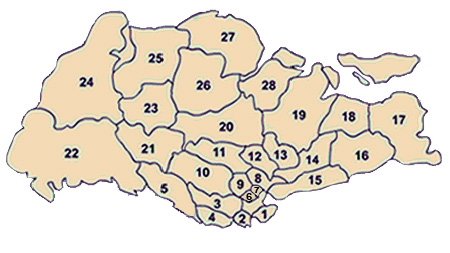
- The use of postal districts and electoral boundaries are no excuse for competeting boundaries
- As discussed earlier in the above point, the postal districts are completely incompatible with PAs or even with the average Joe's general interpretation in fact. So Lemongirl942 told me that Seletar Hills should be a part of Seletar because it is located in the postal district of the same name. Well ok then, a part of Sengkang is located within the same district. So based on that same analogy, does that mean that Sengkang is a part of Seletar too? Think about that.
Anyways, let me quote this from Lemongirl942
Also a small factual correction: postal districts are not vague. URA defines the postal districts and it is URA which publishes the map even today.
— Lemongirl942
Let me debunk this once again. First of all, the boundaries of postal districts ARE vaguely defined by several sources as explained in this point and in the above point. Secondly, the URA NEVER defined the boundaries of postal districts. The URA was formed in 1974, and that was way after the postal district system was implemented back in 1950. The postal districts were actually defined by the Singapore Post Office (present-day Singapore Post) while the two digit and four digit system was still used.[43] The postal districts were effectively dissolved when the six digit postal code came into force in 1995. No governmental body uses these districts for the purposes of administration, urban planning or statistics today. These districts are still used by real estate property agents to define several areas based on the location of the property's postal code. While the URA does have an online service referring to the postal districts on a map as well as several guidelines regarding them, they are once again, used in the context of the real estate industry (which I wouldn't call a form of administration but rather a form of commercial business) and nothing else more. The planning areas have also been used by the URA to define the rough location of the postal districts as well (as seen here). I also wish to clarify that the postal districts are well defined in terms of how they correspond with present-day postal codes but not their boundaries, which can be vaguely determined as they are not bounded by existing features.
As for electoral boundaries. My stance on this is clear. Electoral boundaries as well as municipal boundaries (although a form of administration) in Singapore DO NOT reflect PAs or even general interpretations of an area, and as such, can't be factored in as "competing boundaries". Its like saying the congressional districts in the United States do reflect the areas they cover (more of that analogy in the appropriate section). Municipal (CDC districts and town councils) undergo constant redistricting every four years and their boundaries change with regards to the situation of constituency boundaries.
- Re: Clarification about Postal Districts
Lemongirl942 recently stirred up an unintentional debate regarding the points I've stated about postal districts. Here I am once again to break down and debunk some of her points for the final time. I have no interest in reacting to any of her new points should she "reply" to this post in her own section as I rather discuss about other important points than just simply focusing on exposing each other for very minute loopholes and details.
- "WP:OR No evidence cited that they are incompatible with "average Joe's general interpretation"."
- Well then, let's try getting back into the analogy with postal district 28 shall we? Here in this article, it states that "The area east of Jalan Kayu has been renamed Fernvale and forms the western part of Sengkang.". So as you can see, there is no reference to the URA Master Plan here, it is effectively an average Joe's interpretation. Fernvale clearly sits in the same postal district as the rest of Seletar. Here is the postal code of Fernvale Primary School, 797701, as cited from their website. In accordance to the table provided by the URA,[44] we can see that Fernvale is located within District 28 (Seletar). I quoted you saying that "Seletar Hills housing estate is considered to be part of the Seletar area (district 28). This is possibly because of historical reasons and also because it is part of the URA postal district called "Seletar".". So using that same analogy of yours, am I right to say that Fernvale is a part of Seletar too? What I've just presented to you is not even WP:OR, these are all sources that are clearly stated in line and referenced. This also proves an article simply focusing on just the general interpretation of Seletar can be manipulated via WP:WEASEL. I could say in that article (should it exist) that Seletar consists of a portion of Sengkang because the postal codes within Fernvale correspond to postal district 28. When in fact, this area is not located within Seletar.[45]
- "No evidence to backup claim of dissolution. This says first two digits (of current 6 digit post code) represent the sector. This table by URA maps districts to sectors."
- The Singapore Post no longer uses these postal districts as I have previously said. What the URA is presenting in the table you mentioned are the first two digits of the present day six digit code and how they correspond with the aforementioned postal districts.
- "I'm not sure if I understand this correctly. I thought this map by URA defines the boundaries quite well."
- "I thought this map by the URA defines the boundaries quite well.", yeah sure you "thought". The map you have provided me is just one of the numerous interpretations of where the postal district boundaries begin and end. As such, I would once again, give you the same exact answer.
- Also, have a look at this. In this map, we are presented the 28 postal districts in a map from 1960. The description reads as such:
The 28 postal districts have now been replaced by a system that assigns each block of flat and each landed property a unique postal code, which made the sorting and delivery of mail much easier. Though no longer in official use, the 28 postal districts are still used by property agents to divide Singapore.
— Yee Weng Hong, [46]
- As we can see from this quote, these postal districts have been effectively dissolved. Although they are still used by property agents, the postal districts are no longer legally used at the official government level. Also, notice how different the boundaries are to the ones published by various other sources?
- MSF seems to use it.
- So does JTC for rental statistics
- URA uses them for statistics related to private properties
- The locations used here seem to correlate very well with postal districts. Notice that they don't use planning areas.
- Notice how all except one of these sources relate to property? In the table MSF provided however, we can see that they are using the postal districts based on the corresponding first-two digits of the present-day six digit postal code. Also of note is how MSF didn't used any boundaries to calculate the statistics but rather they calculated the statistics via the postal codes of the child care centres? This is unlike SingStat, where the boundaries are used to calculate specific data. In fact, let me quote this disclaimer from the MSF statistical table:
Based on first 2 digits of postal code
— Ministry of Social and Family Development, [47]
- So as you can see, the postal district boundaries are not used here, only the postal code. These postal codes are then grouped into the postal districts that are presented in the table.
- "Straw man fallacy. I never said who defined it (or defined it first). My claim is that URA has a definition for it- a list of the districts and a map of the boundaries."
- I'm afraid Lemongirl942 didn't took this quote into consideration:
I also wish to clarify that the postal districts are well defined in terms of how they correspond with present-day postal codes but not their boundaries, which can be vaguely determined as they are not bounded by existing features.
— MageLam
- The guidelines on WikiProject Singaporean places wasn't agreed via consensus or by the community
I've done my investigations on this and I am concluding my results here. These statements are not intended to be false accusations or personal attacks against any user involved in either project but rather, it is a conclusive report of what I have found after searching through the oldest records regarding WikiProject Singapore, the SGpedians' notice board and WikiProject Singaporean places.
It seems apparent that the guidelines were written by the co-founder of WikiProject Singapore and WikiProject Singaporean places, Huaiwei. Before the creation of the guidelines, Huaiwei was responsible for maintaining most of the articles regarding Singaporean places (specifically areas and settlements). The guidelines that he or she has written, were done impromptu and without proper input from the community whatsoever. Throughout Huaiwei's time maintaining the three articles regarding Ang Mo Kio, Ang Mo Kio New Town and Ang Mo Kio Planning Area (I'm using Ang Mo Kio to illustrate this case) after the guidelines were published, she has explained several times why the three article system worked better;[48] with some users agreeing with her concept [49] and others questioning the ambiguity, confusion and similarities in the content of the pages.[50][51][52]
When both WikiProjects died out after c.2008, editors started to realize that the need for three articles wasn't relevant. As the three articles were getting in the way of improvement, several editors assumed WP:FATRAT and decided that the three articles needed to be merged.
Analogous cases
editCensus-designated places of the United States
editIn the United States, Census-designated places are areas that act like municipal settlements. However, due to their status, the U.S. government do not recognize these CDPs as legal incorporated entities as they have no governing municipal body. The boundaries of each CDP are determined by the U.S. Census Bureau, created for the main purpose of collecting statistical data. The boundaries are also used in de-facto administration and urban planning. However, once again, due to the status of CDPs, these boundaries are still not recognized as legitimate. Comparing it back to the PAs in Singapore, we can see that planning areas aren't exactly the legitimate boundaries of each area, but are still used de-facto in terms of urban planning and for the collection of statistical data.
CDP case study #1 - Hilo, Hawaii
editIn this scenario, I will depict a CDP with several "competing boundaries". According to Lemongirl942, she defines that "A planning area is a statistical subdivision". Alright, so one good example of a CDP is the settlement of Hilo in the State of Hawaii. So, what is a CDP according the U.S. Census Bureau? A statistical subdivision. So while the de facto boundaries of Hilo are respected in its own article, why not the boundaries of PAs? Now this statement can be easily defended by saying, "Oh, there are still competeting boundaries!". Well, guess what? Hilo sits in a ZIP code area called 96720 according to the United States Postal Service,[53] which includes the settlement of Hilo itself along with a few other nature reserves, one of which is interestingly named "Hilo Forest Reserve". Apart from that, There are two districts in the County of Hawaii (which Hilo CDP is a part of), that are named "North Hilo" and "South Hilo", both of which have clearly defined legal borders (similar to our town council boundaries). Also, Hilo sits in Hawaii's 2nd congressional district, which consists of an overwhelming majority of the U.S. state itself. Aren't all of these "competing boundaries" as well if we do not recognize the de facto boundaries of Hilo CDP? My point here is to prove that these competing boundaries do not necessarily reflect the area known as Hilo and that these are entirely incompatible with the CDP boundaries provided by the U.S. Census Bureau. It is also noteworthy that U.S. settlement articles completely disregard any other boundaries (ZIP code areas and congressional districts) and stick to those provided by the U.S. Census Bureau.
CDP case study #2 - Bostonia, California
editIn this case, I present a CDP which has varying interpretations of its location, although the general area of the CDP is covered in a single article. Located outside of the city limits of El Cajon in the state of California, is the CDP of Bostonia. Here, we can see that the article clearly follows the statistical information and boundaries provided by the U.S. Census Bureau, ignoring all other public interpretations of Bostonia, although such interpretations are explicitly mentioned where appropriate. According to several maps, Bostonia is also the name of a neighborhood located in adjacent El Cajon. Several areas in the unincorporated territory nearby that are not covered by Bostonia CDP's boundaries also carry the same name.[54] Several facilities which carry the name "Bostonia" and are often considered a part of it are also located outside the CDP. Here is my question, is there an article called "Bostonia CDP" that was used to differentiate the average Joe's interpretation of "Bostonia, California"? No.
I also found this quote on the U.S. Census Bureau's website.
CDP boundaries may change from one decennial census to the next with changes in the settlement pattern; a CDP with the same name as in an earlier census does not necessarily have the same boundary.
Compare the previous statement from the U.S. Census Bureau to this statement from Singstat
The Master Plan 2014 is a forward looking guiding plan for Singapore's development in the medium term over the next 10 to 15 years and the planning boundaries may not coincide with the existing developments for some areas.
— Singapore Department of Statistics, [56]
Once again, if US articles regarding CDPs respect their boundaries, even if it means they change and do not necessarily coincide with the public's interpretation of a settlement, why does Lemongirl942 insist that a seperate article be created for a "general area" when U.S. articles do not do the same?
The Wikipedia article for "Census-designated place" cites this
However, criteria established for the 2010 Census require that a CDP name "be one that is recognized and used in daily communication by the residents of the community" (not "a name developed solely for planning or other purposes") and recommend that a CDP's boundaries be mapped based on the geographic extent associated with residents' use of the place name.
— Wikipedia, [57]
However it also mentions this
The boundaries of a CDP have no legal status. Thus, they may not always correspond with the local understanding of the area or community with the same name.
— Wikipedia, [58]
In the case of Bostonia, the latter quote would apply. Not all CDPs necessarily comply with the census bureau's criteria and the public's interpretation of an area. But yet, a Wikipedia article about both the CDP and the general area can coexist in a single article. So why can't a "general area" be described in a PA article?
CDP case study #3 - Las Vegas vs. Paradise
editOne VERY infamous example of area misinterpretation is the City of Las Vegas and the nearby CDP/unincorporated town of Paradise. The area often associated with the famous Las Vegas Strip, casinos, hotels and even the iconic sign are all actually located in Paradise. Paradise itself also adopts the same mailing addresses that the City of Las Vegas uses. In the Las Vegas article, the general region often associated with the name "Las Vegas", is explained thoroughly throughout the article. But is there a separate article called "Las Vegas (general area)"?. No. Sure, there is an article describing the metropolitan area, however, this area has well defined borders unlike general areas and also includes other areas that are not often associated with the general worldwide perception of Las Vegas (such as Sunrise Manor and Enterprise). Tourist areas often associated with Las Vegas, such as Red Rock, are excluded from this metropolitan area.
Common misinterpretations about Las Vegas are pointed out in the article about the city proper, such as for example:
The center of the gambling and entertainment industry, however, is located on the Las Vegas Strip, outside the city limits in the surrounding unincorporated communities of Paradise and Winchester in Clark County. The largest and most notable casinos and buildings are located there.
— Wikipedia
The article for the "Welcome to Fabulous Las Vegas sign" also shows that the government's interpretation of the area comes first before the public's perception of the place.
The sign, like most of the Strip, sits in the town of Paradise and is located roughly 4 miles (6.4 km) south of the actual city limits of Las Vegas. (Such distinctions are usually ignored by both locals and tourists, who refer to the entire metro area as "Las Vegas".)
— Wikipedia
Notice how the ZIP code area and congressional districts are ignored in favor of the census bureau's boundaries?
I quoted Lemongirl942 saying this:
"General area" or "place" is not only general people's perception. An article about place is supposed to represent the various perceptions neutrally, including people's perception, electoral, postal, new town, town council, planning area etc.
— Lemongirl942
But have the articles regarding "Las Vegas" and the "Welcome to Fabulous Las Vegas sign" done this? No. Instead, there was a primary interpretation (the U.S. Census Bureau boundaries) followed by the public's interpretation.
Also, the history of the city, the metropolitan area and the general region are discussed in a single article titled, "History of Las Vegas".
This analogous case is probably the best evidence I can provide to prove that a planning area/general area (city/general region in the case of Vegas) can coexist in a single article. It is also a good example of how an article handles places that are often associated with a specific locale that are actually in fact, located in another area (like with the case regarding the Bukit Timah campus of NUS that is actually located in Tanglin).
Batam
editIn this case I'm presenting, I wouldn't be discussing about boundaries unlike what Lemongirl942 is doing with her analogous cases. In this analogy, I will be exploring the guidelines of WP:SCOPE as well as WP:PRIMARYTOPIC. This is what the Batam article looks like as of this post. [59]
In the introduction of the article, we have this quote:
Batam refers to both an island, municipality (an Indonesian kotamadya), the largest city in the Riau Islands Province of Indonesia
— Wikipedia, [60]
When the article first began in 2004, this was its heading line:
Batam is one of the island in the Riau Island province
— Wikipedia, [61]
As you can see, the scope of the article expanded throughout its development. As more facts and knowledge are uncovered, articles expand in content and defenition. Lemongirl942's idea is that an article should start of with its primary defenition and that defenition should stay stuck even up till the present-day. So should the article regarding Batam be reverted all the way back to its scope regarding just the island and not the municipality? Well, no one has done this yet but Lemongirl942 has done that with Orchard, Singapore vs Orchard Road.
Stance on current guideline (by Lemongirl942)
edit | This section should only be used to state points on the current guidelines set out by WikiProject Singaporean places. For general discussion, use this section. |
I personally find no problems. The existing guideline is well defined and follows from existing conventions in major cities like London, New York City and Hong Kong. Hong Kong in particular follows a similar guideline. For example, Yuen Long District,Yuen Long New Town,Yuen Long Town, Hong Kong,Yuen Long.
Salient features (of existing guideline)
editPlease note that in some cases I have used the words area and place interchangeably. Terms "Area" and "general area" are supposed to be read as "place"
- Satisfies Policy: WP:NAMINGCRITERIA (Keeps precision, conciseness,consistency while preserving naturalness, recognizability)
- Satisfies consistency. - consistent naming system. Example 'X Planning Area'
- Satisfies precision. - unambiguously identifies the entity using the title - Planning Area/New Town/GRC
- Satisfies conciseness - shortest possible title while also satisfying precision
- Preserves recognizability - Separate articles for planning areas/towns instantly allows people (familiar with the subject area) to recognise the specific entities. Place articles are consistent with various interpretations of the place and guide users to specific entities.
- Preserves naturalness - Place articles preserve naturalness. Having a broader scope, it accommodates (reliably sourced) statements like "NUS campus is in Bukit Timah" and "Seletar Hills in Seletar" and can be used to naturally link from other articles.
- If this place article is converted to a Planning Area article, these sentences wouldn't be true anymore. For example, converting Seletar to a planning area article will cause "Seletar Hills in Seletar" to mean "Seletar Hills in Seletar Planning Area", which is incorrect as Seletar Hills is not part of the planning area.
- Area(place) articles consistent with guideline WP:BROADCONCEPT.
- For an article about an area X, it neutrally describes the various perceptions of X (including different boundaries and entities) and links to the sub articles - X Planning Area, X New Town, X GRC etc.
- Area articles continue to have a broad WP:SCOPE. Corresponding Planning Area/New Town/GRC have separate articles, linked and briefly described in the broad article. Follows from WP:RELART
it is perfectly proper to have separate articles for each different definition of a term
- Area articles are not converted to Planning Area articles. This helps to avoid a WP:POVFUNNEL.
- Satisfies WP:NPOV The concept of a "place" is subject to a variety of nuances - natural, cultural and perhaps administrative. There may be multiple perceptions of boundaries (particularly when administrative boundaries are weaker). Places are not mutually exclusive as well and often overlap (particularly in cities with dense populations). In cases with multiple (and overlapping) boundaries, Wikipedia is supposed to NPOV describe the various perceptions giving due weight. The current guideline keeps up the spirit of NPOV and reports the various perceptions in the broad concept article.
- If a place article is converted to a Planning Area article, it is a violation of NPOV. Firstly, Wikipedia is not supposed to decide that one particular boundary is correct, unless the government has explicitly declared so and this has been accepted by a majority of sources (these boundaries are usually administrative boundaries). In Singapore's case, no such declaration has been done. In such a scenario, converting a place article to a planning area article would mean that undue weight is given to Planning Area boundaries and its influences in defining the area (when this very fact is contradicted by sources indicating that postal/electoral boundaries have influenced perceptions for a longer period and continue to do so even today).
- This is probably the most important issue which needs to be addressed. A new proposal, must keep this in mind as NPOV is non-negotiable.
- For relevant articles, satisfies WP:PRIMARYTOPIC. An article about "X" refers to the entity most commonly known as "X", over a long term significance.
- Geo Specific Guidlines
- Unambiguity - A clear difference between statistical subdivisions (planning area) and a general area. (follows from WP:UKSTAT)
- eg. Consider an article about NUS. Now NUS has a campus at Bukit Timah
- Single article case: NUS is in Bukit Timah (How to differentiate?)
- Using existing guideline. NUS is in Bukit Timah. NUS is not within the Bukit Timah Planning Area.
- Consistent naming system. WP:NCCS for each "Planning Area".
- Dedicated articles for administrative subdivisions - Ensures that even if the subdivision is dissolved, the Wikipedia article stays (WP:NTEMP). eg. Ang Mo Kio Single Member Constituency still has an article of its own, despite being officially dissolved .
- An article about an area X neutrally mentions the various perceptions of boundaries. Follows from WP:UKGUIDE.
- Resolves problem of competing "official" subdivision boundaries - PAs, postal districts, town-council limits. GRC/SMCs, CDCs, PAs can have separate parallel articles if required.
- Consensus
It is very clear that there was consensus for the guideline when it was adopted and also after that. Of course, some people disagreed [62], but overall there was consensus (Huaiwei,Vsion,Terence,Sengkang and others who later added their names). In any case, no opposition was registered on the talk page of the guideline, nor was any new guideline proposed. While some editors post 2008 did propose merging pages, there doesn't seem to be any evidence that they actually read the guideline. The merges was proposed based on the article content (which was possibly in a bad state due to drive by edits), rather than a principled opposition to the guideline. The consensus still holds.
- Clarification about WP:WEASEL
The current guideline doesn't "rely on" weasel wording. (OK, this is a bit funny but I have never before heard of anything "relying on" WP:WEASEL) Coming back, WP:WEASEL is a MOS and can apply to any article. Weasel wording happens due to unsourced attributions. As long as information is properly sourced, it shouldn't occur.
Explanations
edit- Each planning area article is titled as "X Planning Area".
- An article about an area X, decribes the various perceptions of X (including the planning area, neighbourhood, electoral subdivision, municipal subdivision etc).
- History is not dealt with in the planning area articles (Although the date of formation of the planning area can be mentioned. This is similar to articles about electoral divisions which don't mention history of the region)
Arguments in favour of having a separate article for each planning area (distinct from an area named "X")
editEg. An article about the "area/place" known as "Lim Chu Kang" should be titled "Lim Chu Kang". The article about the URA "planning area" subdivision should be titled "Lim Chu Kang Planning Area".
- A planning area is a statistical subdivision. For maintaining uniformity, it is easier to have articles named "X planning area" WP:NCCS.
- Naming an article about "X Planning Area" as "X" violates WP:PRIMARYUSAGE (as X has been used to refer to an entity other than the planning area). There is no "common name" of a planning area. A planning area is referred to as "X Planning Area" (sometimes as "X DGP" or "Planning Area of X"), and not simply "X". This can be seen on government websites like SCDF[63]. The term "planning area" is always explicitly specified to disambiguate it, instead of only using the name 'X'. (To be precise, it may not be a prefix/suffix, but is always present in the surrouding text to indicate that the planning area is being referred to).
- A counter example to this point would involve a case where (1) only the term "X" is used, (2) no mention of the term "planning area" is there in the text surrounding it or explaining it and (3) "X" is used to refer to the planning area. (It would also need to be shown that this happens in the vast majority of cases).
- Example 1. The common name of Planning Area "Central Water Catchment" is NOT "Central Catchment Nature Reserve". They are 2 different entities, defined separately and their borders are not coterminous. The "Central Catchment Nature Reserve" is defined under the URA's parks and waterbodies plan [64] while "Central Water Catchment" is under the URA's Masterplan. (Assuming that one is a common name of the other is WP:OR.
- Example 2. Per WP:PRIMARYTOPIC "Boon Lay" should refer to the neighbourhood in Jurong West New Town and not the "Boon Lay Planning Area". The Planning Area will need to have its own article.
- A planning area is NOT equivalent to the settlement of the same name. The settlement of the same name is actually a town/neighbourhood/locality/road. The planning area boundaries were drawn up in 1998 (after being first proposed in 1991) and each planning area represents an area with a certain amount of population.
- The HDB towns (settlements) are not equivalent to the planning areas of the same name. The HDB towns have clear boundaries which do not coincide with the boundaries of the planning areas. Secondly, the population of both are different (I did a comparison for the year 2010). There is no evidence that they are one and the same.
Articles about a "general area
editFollows from WP:UKGUIDE Singapore has multiple areas. These areas have been historically defined using multiple systems. Over the years, there is ambiguity over the extent of these areas. From what I understand, Wikipedia should report the different interpretations and not only a single one.
Singapore examples
editQueenstown vs. Queenstown Planning Area
editAn interesting problem with Singapore is the concept of New Towns and Planning Area. New Towns are built up settlements while Planning Areas are statistical/urban planning subdivisions. Let's consider Queenstown and Bishan. In general, a reference to Queenstown is a reference to the new town and not to the similarly named "Queenstown Planning Area". Similarly a reference to Bishan is a reference to Bishan New Town and not the Bishan Planning Area. This creates a problem if we use a single article named "Queenstown" or "Bishan".
Firstly, every Wikipedia article needs to have a primary topic. Either an area/town or a Planning Area. It cannot be both. Consider this situation if we include 2 entities (Planning Area and the HDB town) in a single article.
- The population of Queenstown (the town) is 5000
- The population of Queenstown Planning Area is 8000
Suppose a single article Queenstown exists for both. In this case
- a third article could state "the population of Queenstown is 5000" and it would be correct.
- a fourth article could state "the population of Queenstown is 8000" and it would still be correct.
Thus, there is no distinction between the town and planning area and it creates confusion in other articles.
The existing guideline which prescribes separate articles - "Queenstown" (for the town) and "Queenstown Planning Area" avoids this rabbit hole.
Seletar vs. Seletar Planning Area
editHere's another case. To the north of Singapore is an area known as Seletar. This area has a long history as it contained the Seletar Naval Base and the Seletar Airbase. Seletar is marked on multiple maps throughout the years.
Now URA has a planning area called "Seletar Planning Area". It's boundaries enclose only a subset of the area generally referred to as "Seletar".
- Seletar Hills housing estate is considered to be part of the Seletar area (district 28 [65],[66]). This is possibly because of historical reasons[67] and also because it is part of the URA postal district called "Seletar" [68],[69]. Property agents still refer to Seletar Hills as part of Seletar. Yet, the URA takes the conflicting steps.
- URA includes it in the "Seletar district"
- URA excludes it from the "Seletar Planning Area" and includes it in the "Serangoon Planning Area".
- Report mentions "Cabana condominium in Seletar"[70], although according to URA it is not part of Seletar Planning Area.
The above is sufficient to prove that the boundaries of "Seletar Planning Area", does not coincide with the boundaries of an area known as "Seletar". There are multiple competing definitions of Seletar.
The Seletar district is also contiguous. (See [71]). The map doesn't know any "bisection" of the district.
According to MageLam's new proposal there should be a single article about the Planning Area and the general area known as "Seletar". Let's assume we have a "single combined article" about Seletar. What would be the introduction which establishes the primary topic of the article.?
- "Seletar is an area in Singapore"?
- "Seletar is an area and also a Planning Area in Singapore"?
- "Seletar is an area, Planning Area and an island in Singapore"?
Let's also look at the infobox of such a "single combined article"
- Would the infobox report the population?
- This would be incorrect since the URA population figures are the "Population of the Seletar Planning Area" (statistical subdivision) and not the "Population for Seletar". (see WP:UKSTAT).
- An infobox about the area should report multiple administrative subdivisions it is part of. In the case of "Seletar" would it report both "Seletar Planning Area" and "Serangoon Planning Area (part)"?
Analogous cases
editLondon
editGreater London is a similar case like Singapore. It consists of administrative divisions called Boroughs and also place names. Each borough has its own article.
- Places can lie in 1 borough (Example Westcombe Park) or across 2 boroughs (Example Chadwell Heath, Blackheath, London).
- There are some boroughs with the same name as a place inside it - in this case, the place name has a separate article. (Example, Royal Borough of Greenwich and Greenwich.
- A constituency has a separate article Greenwich and Woolwich (UK Parliament constituency).
- Former administrative subdivisions still have their own article. Example Metropolitan Borough of Greenwich and a former constituency Greenwich (UK Parliament constituency).
New York City
editReasons for comparison: Major city like Singapore, similar land area (NYC:789 sq.km to SG:719.1 sq.km), comparable population density (NYC:10,756/sq.km to SG:7,697/sq.km), similar history of starting out a colonial outpost.
New York City is a major city like Singapore. It contains many neighbourhoods whose boundaries are not fixed. Quoting from a footnote at Hudson Heights, Manhattan,
Neighborhoods in New York City do not have official status, and their boundaries are not specifically set by the city. (There are a number of Community Boards, whose boundaries are officially set, but these are fairly large and generally contain a number of neighborhoods, and the neighborhood map issued by the Department of City Planning only shows the largest ones.) Because of this, the definition of where neighborhoods begin and end is subject to a variety of forces, including the efforts of real estate concerns to promote certain areas, the use of neighborhood names in media news reports, and the everyday usage of people.
I feel this is much better and holistic way of defining an area. It keeps up the spirit that Wikipedia is supposed to report multiple views/interpretations and not simply stick to one particular "official government version" of boundaries.
New York City and Statistical Subdivisions NYC does have statistical subdivisions called "Census tracts" and "Neighbourhood Tabulation Area" [72]. These boundaries are not used as neighbourhood boundaries.
NYC does not have any Census-designated places (CDPs) because CDPs are never used inside a city. This makes New York City a much better comparison to Singapore, as Singapore is also a city.
Hong Kong
editHong Kong uses a system very similar to the existing Singapore guideline. Articles about districts are separate from an area of the same name.
- Yuen Long District Article about the district (administrative subdivision)
- Yuen Long article about the "general area" called Yuen Long (this area is part of Yuen Long Plain)
- Yuen Long New Town article about the new town
- Yuen Long Town, Hong Kong article about the original township at the centre of Yuen Long
Las Vegas, Las Vegas Strip and Las Vegas Valley
editNot a very good example (as Singapore is a city), but nevertheless
The name "Las Vegas" is used for the City of Las Vegas, (follows from WP:PRIMARYTOPIC, since "Las Vegas" is used to refer to the 'city in Nevada' considering long term significance, and not the Las Vegas Strip)
- The metropolitan area (a former statistical subdivision, defined by the US Census Bureau from 1950 onwards) is Las Vegas Valley.
- The "Urban Planning Area" named "Las Vegas" doesn't get an article of its own. It is briefly discussed in the above.
- The administrative boundaries are Clark County, Nevada
- The metropolitan statistical area (statistical subdivison, defined by US census bureau) is Las Vegas–Paradise, NV MSA (this is coterminous with the above (Clark County boundaries).
Basically, statistical subdivisions get their own article. The WP:PRIMARYTOPIC of the entity referred to as "Las Vegas" is the City of Las Vegas.
Statistical Subdivisions in Canada
editIn Canada, certain states have statistical subdivisions which do not coincide with prevailing administrative/municipal boundaries. In these cases, a separate article is created for each statistical subdivision. See Alberta, Manitoba, Saskatchewan, Newfoundland and Labrador, Northwest Territories. This is done quite systematically. (The existing guideline recommends a similar concept in Singapore, with dedicated Planning Area articles).
Problems with MageLam's version
edit- I understand the situation is that MageLam wants to overturn the existing guideline. In the current guideline, an article titled "X" talks about the area commonly referred to as "X". (that is, if an article is titled "X", the main topic of the article will be the area referred to as "X", and not the "X Planning Area").
- MageLam's point is that an article titled "X" should be about the "X Planning Area" (except in cases of HDB towns), and that there should only be one article whose primary topic is "X Planning Area". (such an article would thus begin, "X is a planning area in Singapore").
- [Note, that a primary topic needs to be identified for articles - either the "area referred to by X" or the "X Planning Area"]
- My view is that the basis of the above argument is flawed. MageLam's argument assumes that the URA Masterplan boundaries are the actually the "sole" / "overwhelmingly accepted" boundaries of an area over a major period of time in Singapore's history. This is not true for the following reasons
- The URA/Singstat states very clearly that planning area boundaries do not match existing developments.
- There are multiple competing boundaries in Singapore - electoral, municipal and postal, all defined by the government.
- Postal districts have been in use for a much longer time. It is still used by URA and other property developers today to indicate where a property lies. These boundaries differ from the URA Masterplan Planning Boundaries.
- The URA (which came up with the Planning area boundaries) itself has not totally switched over to using the Planning Area Boundaries. It still continues to use the postal districts, particularly in cases of property [73]. The fact that URA itself is not using it leads me to doubt the fact that Planning Area boundaries are more important than other boundaries.
- In continuation of the above point, I would actually say Postal Districts are more notable than planning areas considering long term significance.
Till 2000, population statistics were shown using postal districts. Even now, census register works using postal districts but the data is later shown in terms of Planning Areas.Postal districts have been in use since a much longer time (60+ years) than planning area (15 years), and still continues to be used to refer to districts. The URA still continues to use the postal districts, particularly when dealing with private property. As a result, private housing is indicated by the district, rather than the planning area. - There might be an argument that the Planning Area boundaries (in future) will remain permanent and in the future, it will be used over other competing boundaries. This is WP:CRYSTALBALL.
- The second assumption made in MageLam's argument is that "X" refers to "X Planning Area" in the vast majority of cases, considering long term significance.
- This assumption is very easy to disprove and I have done it before. Simply use newspaper reports to show that "places lying on X" do not lie in the "X Planning Area".
- If the current guideline would have to be overturned, the 2 assumptions I listed above (and proved false) will have to be proven true. Otherwise it would be absurd to have an article on 'X' talking about the 'X Planning Area' when X in common usage actually refers to just the general area named X.
Clarification about Postal Districts
editQuite a bit of stuff in this edit is incorrect. I will clarify
- Postal districts are not vague. See URA published map of postal districts.
- Postal districts are still defined today. See URA list of postal districts
Incorrect statements from this edit:
- the postal districts are completely incompatible with PAs or even with the average Joe's general interpretation
- WP:OR No evidence cited that they are incompatible with "average Joe's general interpretation".
- Of course Postal districts are not compatible with PAs.
- First of all, the boundaries of postal districts ARE vaguely defined by several sources as explained in this point and in the above point.
- Incorrect. URA publishes a map of the boundaries
- Secondly, the URA NEVER defined the boundaries of postal districts. The URA was formed in 1974, and that was way after the postal district system was implemented back in 1950. The postal districts were actually defined by the Singapore Post Office (present-day Singapore Post) while the two digit and four digit system was still used.
- Straw man fallacy. I never said who defined it (or defined it first). My claim is that URA has a definition for it- a list of the districts and a map of the boundaries.
- The postal districts were effectively dissolved when the six digit postal code came into force in 1995.
- No evidence to backup claim of dissolution. This says first two digits (of current 6 digit post code) represent the sector. This table by URA maps districts to sectors.
- No governmental body uses these districts for the purposes of administration, urban planning or statistics today.
- MSF seems to use it.
- So does JTC for rental statistics
- URA uses them for statistics related to private properties
- The locations used here seem to correlate very well with postal districts. Notice that they don't use planning areas.
- While the URA does have an online service referring to the postal districts on a map as well as several guidelines regarding them, they are once again, used in the context of the real estate industry (which I wouldn't call a form of administration but rather a form of commercial business) and nothing else more.
- That's just an opinion. Real estate is related to urban planning as well (Can be verified from multiple university websites offering courses in urban planning).
- While postal districts are not administrative boundaries, neither are planning area boundaries. The Singaporean equivalent of administrative (geo-political) boundaries would be town council boundaries.
- The planning areas have also been used by the URA to define the rough location of the postal districts as well (as seen here).
- Wrong. It says "Core Central Region comprises of Postal Districts 9, 10, 11, Downtown Core Planning Area and Sentosa." Here, the postal district is being used to define the core central region.
- I also wish to clarify that the postal districts are well defined in terms of how they correspond with present-day postal codes but not their boundaries, which can be vaguely determined as they are not bounded by existing features.
- I'm not sure if I understand this correctly. I thought this map by URA defines the boundaries quite well.
- I also don't understand what is meant by they are not bounded by existing features. I cannot see any citations for such a claim. (On the other hand Singstat has admitted that Planning Area boundaries may not coincide with existing developments for some area [74])
- Well then, let's try getting back into the analogy with postal district 28 shall we? Here in this article, it states that "The area east of Jalan Kayu has been renamed Fernvale and forms the western part of Sengkang.". So as you can see, there is no reference to the URA Master Plan here, it is effectively an average Joe's interpretation. Fernvale clearly sits in the same postal district as the rest of Seletar. Here is the postal code of Fernvale Primary School, 797701, as cited from their website. In accordance to the table provided by the URA,[75] we can see that Fernvale is located within District 28 (Seletar). I quoted you saying that "Seletar Hills housing estate is considered to be part of the Seletar area (district 28). This is possibly because of historical reasons and also because it is part of the URA postal district called "Seletar".". So using that same analogy of yours, am I right to say that Fernvale is a part of Seletar too? What I've just presented to you is not even WP:OR, these are all sources that are clearly stated in line and referenced. This also proves an article simply focusing on just the general interpretation of Seletar can be manipulated via WP:WEASEL. I could say in that article (should it exist) that Seletar consists of a portion of Sengkang because the postal codes within Fernvale correspond to postal district 28. When in fact, this area is not located within Seletar.[76]
- This article is a good example. The area East of Jalan Kayu is the western part of Sengkang. (Which means the area West of Jalan Kayu is not part of Sengkang, although URA mentions it as part of the planning area). And yes, you are correct that Fernvale IS a part of Seletar. (as can be seen from the postcode mapping to general location). Also notice that Seletar Mall is opening in Fernvale. This is exactly what I am trying to make you understand. The concept of a place is fluid. And places often overlap. Which is why the original proposal provided for the distinctions between place/town/planning area. I'm saying this from my own experience of Geography modules that places have fluid boundaries and social as well as cultural characteristics. And I can see why I agree with Huaiwei, who was a Geography grad from NUS. The fluid and ambiguous concept of a place is a reason why location maps write out the area name and put it over a location (see here, for an example) rather than drawing fixed boundaries for places. (Boundaries in maps are usually used for administrative divisions).
The following discussion is closed. Please do not modify it. Subsequent comments should be made on the appropriate discussion page. No further edits should be made to this discussion.
FINAL CONSENSUS ON RENEWING THE CURRENT GUIDELINE FOR SINGAPORE AREAS, URBAN REDEVELOPMENT AUTHORITY REGIONS AND PLANNING AREAS AS PROVIDED BY WIKIPROJECT SINGAPORE AND WIKIPROJECT SINGAPOREAN PLACES
editACCOUNT OF EVENTS
editLemongirl942's account
In 2005 a guideline was established and there was consensus. This was at a time when the community was more active and there was much better collaboration. Explanations were provided on the talk page of the guideline. There's doesn't seem to have been any sustained disagreement with the guideline.
Post 2010, multiple drive by edits occurred, by editors not aware of the guideline.
In 2016, I noticed MageLam create a bunch of messy page moves and unilaterally merged some pages [77],[78].
MageLam disagreed with the consensus and wanted to propose a new guideline. I tried to explain the problems but we disagreed. Although, there was no draft of the new guideline, I didn't agree with the basic point that a "Planning Area" is equivalent to the place of the same name. So currently, we are trying to find this out. We are also trying to understand why the previous guideline is problematic.
Till a new guideline is worked out, we keep following the old guideline. --Lemongirl942 (talk) 12:25, 5 May 2016 (UTC)
MageLam's account
In 2005, Singaporean editor Huaiwei, co-founded WikiProject Singapore and WikiProject Singaporean places in an effort to improve Singapore-related articles. Following the formation of WikiProject Singaporean places, Huaiwei published a guideline for which all articles regarding Singaporean places, had to be modeled after (said guideline is cited below). It is not clear if the guideline was established via consensus as no discussion regarding to the guideline's creation exists on the site (an account which only Huaiwei can provide). Initially, several prominent community members (such as Sengkang and Vsion) agreed to the consensus, however as time went on, several editors voiced their disapproval of the complexity and ambiguity of the stated guidelines. Note that the guidelines were written at a period of time when the SGpedian community was still in its infancy.
Around 2008-2009, the SGpedian community started to become more loosely organized, as individual members parted ways to focus on other projects. It was also around this time that several new community members as well as editors from outside the SGpedian community, started to realize the amount of duplication in the contents of the articles that followed Huaiwei's system (Ang Mo Kio, Ang Mo Kio New Town and Ang Mo Kio Planning Area for example). Most articles had their content merged and redirected to their parent articles (as seen with Ang Mo Kio) in response to the ambiguity and confusing content of these articles.
I met Lemongirl942 on March 2016 and co-founded the SG geo articles improvement project in an effort to fix articles regarding Singaporean places. One of my key points I addressed to Lemongirl942, was to fix the current consensus provided by Huaiwei as I felt it was flawed in opinion. Lemongirl942 responded with fierce opposition and insisted on following the 2005 guidelines. The debate then turned into a standoff between both me and her as we constantly argued over who's opinion was better. Chongkian subsequently stepped in to tone down the tension between us. I then proposed that the three of us stopped editing articles relating to Singaporean-places in order to avoid anymore conflicts (unless the edit was a revert in regards to vandalism or unsourced claims). As of the writing of this account, the both of us have yet to meet ends with each other on the issue surrounding the 2005 guidelines.
-- MageLam (talk) 11:47, 5 May 2016 (UTC)
GUIDELINES IN QUESTION
editORIGINAL GUIDELINE SET BY WIKIPROJECT SINGAPOREAN PLACES (written on 29.05.2005 by Huaiwei)
Place name articles
Although not a perfect article, refer to Ang Mo Kio (article as of the time the guideline was published) for an example of what should and not should be in general placename articles. They should have:
- An info table showing the placename in all four official languages
- A brief description of the general locality of the said placename
- Origin of placename
- Description of the place's history of development (avoid going into too much details on the building of specific amenities which may be more relevant to the new town article)
- Where possible, a section on the placename's relevance to Singaporean social culture and spatial consciousness. For example, the red-light district image of Geylang, the laid-back, recreational feel of Pasir Ris, and so on
- Locator map
New Towns
Again, refer to Ang Mo Kio New Town (article as of the time the guideline was published) as a rough template. In general, the article should include:
- An infobox with basic information, including area, units, population, etc.
- An introduction mentioning the boundaries of the said new town
- History of the new town's development from conceptualisation to the present (including the rebuilding, upgrading of existing facilities)
- Sections describing the physical configuration of the new town, as well as its supporting facilities
Planning Areas
- Define the boundaries of the said planning area
- Detail planning objectives and considerations
- Elaborate on specific planning initiatives and results
ORIGINAL MANUAL OF STYLE REGARDING SINGAPOREAN PLACES BY WIKIPROJECT SINGAPORE (written between 01.11.08 - 20.11.08 by Jacklee)
The official English name for places should be used. For example, "Hougang", which is used officially in English, should be used in preference to "Aukang" even though the latter is often used locally. Also, "Punggol" should be spelt as indicated when referring to the town, but as "Ponggol" in the road name "Ponggol Seventeenth Avenue" as that is the official name of the road in English.
If a name refers to the Singapore place much more than to any other place (that is, the Singapore place is significantly more commonly searched for than other places), the article can be named after the Singapore place without any qualifications (see Wikipedia:Disambiguation#Is there a primary topic?), for example: "Orchard Road" and "Yishun". Where it is necessary to disambiguate place or structure names, place the disambiguating term after a comma instead of enclosing it in parentheses (see Wikipedia:Disambiguation#Naming the specific topic articles and Wikipedia:Naming conventions (settlements)), for example, "Chinatown, Singapore" and "Woodlands, Singapore".
CONDUCT
editFirst proposal
- From 4 May 2016 up till the midnight of 6 May 2016 (UTC+08:00), both me and Lemongirl942 would reserve the right to clarify anymore of our points. Both me and Lemongirl942 would also have the right to provide opinions on Chongkian's thoughts (as of 24 April 2016) as well as his current statements up till the stated time.
- After 00:00 on 6 May 2016 (UTC+08:00), all activity on this page MUST CEASE until Chongkian reads our stances and provides his proposed solution on the matter at hand. The "Stance on the current guideline" sections should also henceforth, stop getting updated from the aforementioned time. This will give Chongkian more time think about the opinions of both parties.
- Following his say, both me and Lemongirl942 can provide opinions and objections to Chongkian's 1st proposal in the appropriate sub-sections. Following this, Chongkian can refactor all of these opinions and create new amendments accordingly. This point would be repeated until we get to a midway agreement that respects all three parties as well as Wikipedia's policies and guidelines.
- Once we get a completely agreeable consensus, we will place this proposal in the penultimate sub-section of this discussion.
Guideline composition
- While the guideline is being written, it is best adviced that feedback be given in order to improve more points.
- An assessment will be done for each of the points mentioned in the feedback. Modifications may be done to the points if need be.
- If found suitable, the suggested feedback would be implemented.
NEUTRAL MEDIATOR - CHONGKIAN
edit | This section should only posses the thoughts and opinions of Chongkian. No one else should edit this section unless given the appropriate permission to. |
All of Chongkian's opinions on the debate (before 24 April 2016)
edit- Opinion #1
- Indeed generally I have to agree that Singapore's country subdivision is really ambiguous. It really depends on the context of GRC, economy/business, tourism, etc. Even once I went to Wang Dae Bak restaurant, most of my Singaporean friends think that the restaurant is located in Tanjong Pagar, while actually (based on Wikipedia) it is located in Telok Ayer, Chinatown. So again, we need to bear in mind that there will be so many misconception regarding this topic, in which for sure we need to clear things up one by one to make exact boundary. Besides, due to Singapore's small size & huge reclamation project, its country subdivision border will change a lot in the future. So yeah, "general area" is by general people/tourist's perception and "planning area" is by government's decision (land and district office/department?). This way of thinking will lead us into which sources we need to find (either more towards gov/official sources or general/public/tourist sources). Chongkian (talk) 15:37, 23 April 2016 (UTC)
- Opinion #2
- I fully understand with MageLam that this will be a very problematic & dilemmatic situation if we were to go for too many version of Seletar article (3 articles for general, planning & other things). I think I've come across similar articles before from other country's subdivision & i eventually figured out the best solution for this. I can't really recall at this moment, but I'll get back to this asap. Now I'm on a business trip far north in Ipoh, so a bit tired now. Gonna go to zzz first. Nitez everyone! Chongkian (talk) 14:59, 24 April 2016 (UTC)
- Opinion #3
- Based on my experience from seeing all of the country subdivision in Taiwan, Malaysia, Indonesia, I come to a conclusion that official political/government division of a country comes as the "highest rank" for any area naming. So in this case, Planning Area shall prevail over the others. Articles about Planning Area are the ones should be linked to any other articles regarding a country divisions (e.g. province, state, districts etc), e.g. Malacca has 3 districts (Jasin, Alor Gajah and Central Malacca (in which Malacca Town is located)), but 99% of the people will just simply refer Malacca Town as the "Malacca" only, indeed this is technically wrong, but the use of district is rarely used in Malaysia. People know Johor Bahru as a town in Johor, although it can also be a district in Johor. Even Kuala Lumpur's subdivision is really confusing. I can hardly fully define the exact area of Bukit Bintang, Imbi, Bukit Nanas and KLCC. Even several times I saw different area naming for the address for one particular building in Kuala Lumpur by its official website & by Google Map. A really different case in Taiwan, in which Taipei's subdivisions (district), such as Zhongshan, Shilin, Beitou etc, are really heavily used to refer to any areas within Taipei, so there are less misunderstanding for Taiwan's case. And it is in line with their divisions by the government (by their Ministry of Interior), and also by their election constituency (although some districts are combined to make one constituent or one representative in their council). General Area is indeed important also, but try to keep it within tourism related context (e.g. tourist objects (East Coast Park, famous road (Orchard Road) etc) without linking to any other subdivision. Because as East Coast Park changes its shape (due to the future land reclamation), so will its tourist-based "subdivision" of definition ... Let's make it this way. Can we have the official data from the gov on Singapore's current administrative division (not the GRC one). We need to start to work from that. Chongkian (talk) 14:50, 24 April 2016 (UTC)
Current thoughts
editRelated Articles
editOk, before any further discussion, let me list down articles related to any subdivision of Singapore, in which currently under dispute/debate, so I can easily refer to any of this during the discussion later:
- Administrative divisions of Singapore (the ultimate article for subdivisions of Singapore - although not complete (just general overview))
- Regions of Singapore (the most general "subdivision of Singapore" article, a good start for the introduction of planning areas)
- Planning Areas of Singapore (more detailed subdivision/local gov of Spore)
- Constituencies of Singapore (more towards political divisions)
- New towns of Singapore (good one also, although not the ultimate complete coverage for all areas)
- Community Development Council (too general, but just keep this in mind)
Frustrating Articles
editI'm listing down here any similar article with each other in which the difference is just way too small. People probably put this as a practical/tourism purpose, in which for administrative division purpose, it serves nothing much new. We might eventually merge these 2 articles (to make the whole Singapore Wikipedia articles become more Neat) or maintain the two distinctive articles, but one we make it more into the "official subdivision" articles (linked to any local gov office etc) and the other as "tourism" article (link to any tourist attractions, festivals etc) - if applicable of course. Again, as we try to solve all of this dispute, it has to be supported/shown/proved by our efforts in streamlining all of the disputed articles asap as well as we go through our whole discussion.
- Central Area, Singapore and Downtown Core (very similar, should we merge? of course each will be directly linked to each other)
- East Region, Singapore, this is probably the geographical divisions of Singapore, such as the Central Region, Singapore, North Region, Singapore, North-East Region, Singapore and West Region, Singapore. So to make these articles become neat, we should create a parent article to accommodate these articles. Maybe these articles should be put under Geography of Singapore article or something like Geographical Divisions of Singapore.
- Malaysia's states subdivisions were initially soo frustrating. But now things have become much much more well-organized after I had to work out editing so many articles with respect to Districts of Malaysia. Initially, most of the towns had no proper boundary or location, it was simply written, for example (not necessarily it was like this) "Johor Bahru is a major city in Southern Malaysia, located just across Singapore. Many Singaporeans spend weekends in Johor Bahru". Hello, we are talking about a Malaysian city, thus it was to be written from Malaysia point of view first, so it was changed to something like "Johor Bahru is a city in Johor State of Malaysia. It is located inside Johor Bahru District under the administration of Johor Bahru City Council. It is located in the southern point of Peninsular Malaysia with an area of 123 km2." So things had to be changed like that. The first sentence was a general description, second sentence was the political entity of it, third is the geographical info of it. Then only if we want to add more info, we can add its transportation (first link and second link), then that's the time we add Singapore in it.
Examples of Near-Perfect Solutions
editEventually, there is no right or wrong thing in this world. Even people can say the earth is flat of 1+1 is not equal to 2. So keep in mind, we also need to strike a balance between the ultimate truth, general accepted knowledge & try to correct misunderstanding.
- Holland has its own detail article, but there is an explanation at its introductory paragraph to link to the country Netherlands. This is example to correct misunderstanding. Besides, Netherlands is widely accepted/used in official terms, Holland is more towards general public or tourism use.
- Taiwan is the (so far) most accepted name for that country in East Asia, although its official name Republic of China is directly linked to Taiwan article. For historical purpose in terms of its official political entity when it was still in Mainland China, there is a special article Republic of China (1912–49). For a complete history story of Republic of China, there is History of the Republic of China and History of Taiwan. By right, for a continuing political entity, the Taiwan and Republic of China (1912–49) articles should just be written in one Republic of China article. Yet for practical purpose, those proposal seems not very practical & feasible at all at this moment of political time. Nevertheless, Taiwan/Republic of China is probably the most frustrating naming convention (not to mention the "Taiwan, China" or "Chinese Taipei"), even official government entity use "Republic of China (Taiwan)"
- I can understand that there can be another divisions based on geography (when geographical feature is way too distinct not to be made separate article - and it has nothing to do with any political/electoral divisions at all), such as:
- Peninsular Malaysia and East Malaysia (very good example here I have to say. very clear border, very clear definition, and very widely used & practical)
- Northern Taiwan, Southern Taiwan, Western Taiwan (very weak reason to make these articles, they even haven't made Central Taiwan and Eastern Taiwan aritcles). And there is no link to any official gov agency regarding this geographical divisions (e.g. Ministry of Interior, Ministry of Environment etc). The links written there is just to the Lonely Planet website. Very bad example here.
- Pulau Ujong and Singapore, this is a good example. Pulau Ujong is a 100% story about the island of Singapore's geographical feature, while Singapore itself (by default) is a political entity first, then probably an "island".
Proposed solution
edit- First proposal
I will write quickly & briefly all of the summary I can gather so that we can go forward fast. The very first amendment (or anything that we need to do) will be written directly as bullet point under Amendment #1 below. Once all of the naming convention have been agreed, it should also be followed with the Wikimedia Commons of the same name of those subdivision name for a particular area. I think it will be more efficient to work top-down (bigger area to smaller area), so that those small small things can easily follow up. (This might takes more time at the moment. I'm still in the office when writing this :P)
- Amendment #1
- Although there is no 100% perfect solution, but it looks like Planning Areas of Singapore is the best solution to improve all of subdivision-related articles to Singapore, giving better link to geographical distribution, HDB town, exact location, exact boundary & electoral district. Now it looks like writing the planning area is must in all inside infobox of any place/building/museum/malls-related in Singapore. You can always argue about this, but at this moment of time (year 2016), this is the best solution. One thing, we can always add Regions of Singapore (text only, no need map) as the intro paragraph of the planning area (like I said before, do top-down approach or bigger to smaller areas approach).
- From now onward, all of location/place/building-related articles in Singapore, must include the planning areas subdivision location (e.g. "Building ABC is a skyscraper in Punggol/Bishan/Bedok, Singapore." Not just "Building ABC is a skyscraper in Singapore." If there is more to that division, then we should write for example, "Siloso Beach is a beach in Sentosa Island, Bukit Merah, Singapore" cuz Sentosa Island is part of Bukit Merah planning area (correct me if i'm wrong here)). This is in order to "reinforce" the existence & usage of Singapore's subdivision area (this is our next big thing to do, cuz a lot to do wei). Less usage/reinforcement means people will find it less significant. Same now like more & more location-related articles of Malaysia, I try to add their district locations.
- We should write/add the planning areas info & its map (in article Planning Areas of Singapore) to the article Singapore under (let's say) "Administrative divisions" sub-heading, to reinforce the importance of that subdivision info to Singapore. Just like the section of "Administrative divisions" in article Taiwan or Indonesia
- Write description of Planning Areas of Singapore in Administrative divisions of Singapore because of its growing significance now. And also add the map of planning area.
- Oh wait, we need to do some re-work here. On the map of Planning Areas of Singapore, it is written Central Area as if it looks like just one planning area. In fact once we open the article of Central Area, Singapore, it says it has 11 planning area (e.g. Newtown, Orchard, Outram etc), and it is also listed inside the table in Planning Areas of Singapore article. If that's the case, we need do change the map of Planning Areas of Singapore article first before we go further with those smaller planning areas around city center of Spore. Again, this is important cuz we are going top-down method. I guess my initial edit at ArtScience Museum has to be changed again, although I've tried to write it more objectively, but the Central Area location has to be changed to a more specific of what planning area that that museum is located at.
- Multiple almost-similar articles are ok (in the case of Yuen Long above (Yuen Long District, Yuen Long, Yuen Long New Town, Yuen Long Town, Hong Kong)) if ONLY the exact boundary of each of those articles are different from each other (due to overlapping etc). If there are two articles whose boundary are exactly the same, then both of them need to be merge using a more basic/neutral name (e.g. "Yuen Long" only).
- We need to work out on fully creating/perfecting all of those planning areas articles later. E.g. now the article Seletar is still the "general" Seletar. If the area matches Seletar Planning Area, then we just keep that one article. If not, then we need to make Seletar Planning Area soon. (I haven't gone through this exact Seletar area boundary research. Maybe you two (Magelam & lemongirl) can do it.)
PARTY #1 - LEMONGIRL942
edit | This section should only posses the thoughts and opinions of Lemongirl942. No one else should edit this section unless given the appropriate permission to. |
Thoughts on Chongkian's statements (made prior to 24 April 2016)
edit | No further editing should be done to this section after 00:00 6 May 2016 (UTC+08:00). |
- I fully understand with MageLam that this will be a very problematic & dilemmatic situation if we were to go for too many version of Seletar article (3 articles for general, planning & other things).
- I'll clarify. Seletar will only have 2 articles, since there is no town called Seletar. So in this case, there would be 2 articles, "Seletar" and "Seletar" Planning Area.
- I come to a conclusion that official political/government division of a country comes as the "highest rank" for any area naming. So in this case, Planning Area shall prevail over the others.
- Yes, administrative/local government boundaries are the primary boundaries. In case of Singapore, these would be town council boundaries [79]. (Map of town council boundaries) Not Planning Area boundaries.
- So yeah, "general area" is by general people/tourist's perception
- "General area" or "place" is not only general people's perception. An article about place is supposed to represent the various perceptions neutrally, including people's perception, electoral, postal, new town, town council, planning area etc.
- Can we have the official data from the gov on Singapore's current administrative division (not the GRC one)
Thoughts on Chongkian's current statements
editReserving judgement for a while. I realised that URA had planning areas back in 1980 as well [80],[81],[82],[83]. Will look at this give my feedback later.
![[80]](https://www.ura.gov.sg/dc/mp80/mp80wsImage159.jpg)
![[81]](https://www.ura.gov.sg/dc/mp80/mp80wsImage160.jpg)
![[82]](https://www.ura.gov.sg/dc/mp80/mp80wsImage172.jpg)
![[83]](https://www.ura.gov.sg/dc/mp80/mp80wsImage171.jpg)
- For point 1, I look at a place/neighbourhood article different from a museum/mall/building.
- The infobox for a museum/mall/building usually only has 1 field for location. I'm personally not in favour of compulsorily mentioning the planning area here, but rather using the location most often used for it WP:WEIGHT. For many museums, this will usually come down to the road or precinct. I am currently doing an analysis for "Reflections at Bukit Chandu". I have access to Straits Times archives from 1992-present and when I searched through it, there was no mention of Queenstown (or Queenstown Planning Area) along with the museum name. I will list down the mentions here later when I have time.
- For place/neighbourhood article, yes the infobox should contain the planning area, but along with other subdivisions equally (town council, electoral subdivision,postal sector/district). Planing Areas should not be accorded primacy. Checkout the Template:Infobox UK place. It does quite a good job.
Agreeable points on the first proposal
edit- Point 6,7 - Planning area articles will ultimately have to be separated (per Point 6,7) as they do not match the exact boundaries of the place of the same name. Also more suitable per WP:NCCS
- This convention is followed in Hong Kong place articles
Points to veto on the first proposal
edit- Point 1 may be implemented with certain conditions
- For buildings/malls/museums and entities with a single location, use the most commonly mentioned location in reliable sources (WP:WEIGHT)
- Mention other boundaries (apart from Planning Areas) as well in infobox of a place
- Separate Planning Area articles from other entities (otherwise the linking will lead to loss of precision)
- I disagree with point 2, particularly with
This is in order to "reinforce" the existence & usage of Singapore's subdivision area (this is our next big thing to do, cuz a lot to do wei). Less usage/reinforcement means people will find it less significant.
You can think of this as my main point of disagreement. The way I understand Wikipedia, it is supposed to follow the world and not lead it in using a particular convention. If the usage of Planning Areas is less among the population/media, Wikipedia is not supposed to use it and "reinforce" the usage of these subdivisions. I have gone through the StraitsTimes archives multiple times and I have found that Planning Areas are used as geographic references only a limited number of times. Per WP:WEIGHT we need to be careful that we do not give undue weight to one particular type of sub-division. (PS - We can do a sampling from the archives and examine it if you want).
This doesn't mean that Planning Areas should not be mentioned at all. It should be be mentioned along with other subdivisions. (A side note - From what I have seen, if subdivisions are mentioned in the first line of the article, it is usually the 'local government' (administrative) subdivision - and these subdivisions are also commonly used in the media as well) - Clarification of Seletar Mall - My mistake, I should have clarified it better. The fact that Seletar Mall is in Seletar is proved by URA postal sector to general location mapping, which says that postal sector 79 maps to the general location called Seletar. (I'm not sure how zipcode works in the US, but at least in SG, we have an explicit mapping of postal sector to general location.) You are correct that the link about the Seletar mall doesn't prove that it is in Seletar. I included it in the next sentence to show the historical association of Fernvale with Seletar, but I forgot to clarify. The original point about overlapping was that areas overlap and "Fernvale is in Sengkang" but also "Fernvale is in Seletar" (The area now called Fernvale was actually called "Seletar East Farmways"). You can also have a look at this which says
Until the construction of four and five-storey HDB flats in the Sengkang West/Fernvale area in 2003, public housing flats in Seletar were found in two locations; one at Seletar Road, near the junction of Jalan Kayu and Yio Chu Kang Road, and the other at Seletar West Farmway.
The place called Seletar overlaps with other places, including parts of Yishun Planning Area [84].
- That said, on the page of Seletar Mall, we don't need to mention "Seletar" in the Infobox(location) and or in the first line. We simply go by WP:WEIGHT and say "Seletar Mall is a mall in Fernvale, Singapore". --Lemongirl942 (talk) 03:15, 9 May 2016 (UTC)
- Point 3: This may not be appropriate. I will check out the facts later, but to the best of my knowledge the Singapore constitution doesn't define any administrative subdivisions.
- Analogy with CDPs: There is one problem. CDPs are defined outside incorporated territory. This doesn't match with Singapore which is a city itself. Statistical divisions inside a city would be a better comparison.
- CDPs which are enclaves are considered outside city boundaries.
- CDP counter example: Chevy Chase, Maryland (the broad place) and Chevy Chase (CDP), Maryland, Chevy Chase (town), Maryland, Chevy Chase Village, Maryland, Chevy Chase Section Three, Maryland, Chevy Chase Section Five, Maryland, North Chevy Chase, Maryland
- These villages, the town, and the CDP share a common history and together form a larger community colloquially referred to as "Chevy Chase". This community is roughly centered on Connecticut Avenue north of the District of Columbia and also includes a neighborhood of Washington, D.C., called Chevy Chase.
- Chevy Chase, Maryland doesn't have definitive boundaries. Note that the scope of this article is the larger community referred to as "Chevy Chase" including the neighbourhood in DC. It is not defined by the US census bureau. (Please offer proof that it is defined)
- Chevy Chase (Washington, D.C.) is a neighbourhood with rough boundaries.
- Cities do have statistical subdivisions though. These are called Census Tracts.
- NYC for example, has these Census tracts which are clubbed into "Neighbourhood Tabulation Areas (NTA)". Each NTA has a name and is defined by the department of city planning.
- These boundaries however are not used as the boundaries of the neighbourhood of the same name.
Proposed amendments
editPARTY #2 - MAGELAM
edit | This section should only posses the thoughts and opinions of MageLam. No one else should edit this section unless given the appropriate permission to. |
Thoughts on Chongkian's statements (made prior to 24 April 2016)
edit | No further editing should be done to this section after 00:00 6 May 2016 (UTC+08:00). |
Thoughts on Chongkian's current statements
edit- The Central Area and the Downtown Core should remain seperated as they are two distinct entities. The Central Area is the epicenter and focal point of Singapore (commonly referred to as "The City") that contains PAs such as Outram, Rochor, River Valley etc. . The Downtown Core however, contains the CBD as well as areas such as City Hall and Bugis. Two seperate articles can explain the two different entities very well. I will be improving the article regarding the Downtown Core once this dispute is settled. At the moment it appears to be in bad shape.
- Also keep in mind that we are reviewing and revising a guideline, so merging of articles shouldn't be our main topic here.
- I recommend you scrutinize all of our statements and do a bit of research before coming up with the first proposal when it's ready.
Agreeable points on the first proposal
edit- First of all Chongkian, Sentosa is in the Southern Islands.
- Second of all, yes, the system you proposed is more systematic. Although there may be multiple competing interpretations and boundaries of a certain area, it would still be preferable to follow statistical boundaries as they are the closest interpretation of an area. Let me bring you back to the analogy regarding CDPs. In the article, Ramona, California, we can see that multiple interpretations of Romona, from public to municipal level are reported in a single article in the "Geography" section. There's even a separate CDP which some people consider it to be a part of the area known as Romona itself. There is no such article that is titled "Romana (populated place)", that is seperated from "Romona, California". Romona, despite being a single article, is giving due weight to every interpretation available. But yet to keep it systematic, the article primarily focuses on the CDP as the Census Bureau can easily provide statistics via the use of the CDP boundaries when needed.
- Also, Lemongirl942 has completely forgotten the fact that the Republic of Singapore is a sovereign nation and not just some city in a country. A minuscule incompatibility with a city-state is no excuse for denying the fact that a similar subdivision still exists in some other part of the world.
- I would like to quote a statement made earlier by Lemongirl942:
NYC does not have any Census-designated places (CDPs) because CDPs are never used inside a city. This makes New York City a much better comparison to Singapore, as Singapore is also a city.
— Lemongirl942
- While CDPs are technically not used inside cities (which is theoretically an obvious fact), there have been several examples of CDPs that are enclaved within an incorporated city. These include, Esperance in Washington, which is surrounded by the city of Edmonds; and Broadmoor in California, which is entirely surrounded by Daly City. As these are still statistical subdivisions surrounded by a city, they are still considered integral communities to their neighboring incorporated counterparts. The same can be applied to CDPs which surround or are located directly adjacent to the limits of a city, for instance, Bostonia and Granite Hills which are heavily associated with the city of El Cajon; and Thermalito, which almost completely surrounds an exclave of the city of Oroville, is considered integral to the latter.
- Since Lemongirl942 has challenged me to a reply, I will give her one.
- The example provided by Lemongirl942 shows an article regarding a collection of settlements with very well defined boundaries (Chevy Chase, Maryland). She has failed to illustrate an example of an article which discusses a loosely defined populated area that is seperated from the CDP of the same name (like Bostonia and Granite Hills for example). As such, the analogy still applies.
- Lemongirl942 has also failed to notice that each of the settlements have a well defined boundary designated by the U.S. Census Bureau, there aren't numerous loose interpretations as to where the locations of these settlements are. As such, the statement that she has used to defend herself with has been proven false. Lemongirl942 has also dismissed the fact that each of the settlements have clearly defined boundaries. All of the settlements listed on the page have boundaries that are determined by either the incorporated community or the U.S. Census Bureau. The article has the suffix ", Maryland" and is mainly discussing about the community located within the state of Maryland. It dosen't include "and Washington D.C." in its title unlike Freedom, Idaho and Wyoming. Although it does briefly mention the neighborhood in D.C., the community in Maryland proper has well defined boundaries. Here is a portion of the layout for the disambiguation page for Chevy Chase.
*Chevy Chase, Maryland, a suburb of Washington, D.C., comprising:
- Chevy Chase (town), Maryland, an incorporated town
- Chevy Chase (CDP), Maryland, a census-designated place
- Chevy Chase Village, Maryland
- Chevy Chase Section Three
- Chevy Chase Section Five
- Martin's Additions
- North Chevy Chase
- Chevy Chase (Washington, D.C.), a neighborhood of Washington, D.C., bordering Chevy Chase, Maryland
— Wikipedia
- Notice how the article regarding the neighborhood in D.C. is separated from the article regarding the settlements in Maryland proper? Also, notice that the list in the article does not include the neighborhood in Washington D.C.?
Points to veto on the first proposal
edit- Although I do agree with Point 6 and Point 7 to a degree. I believe it would be rather unnecessary to seperate the Seletar article in to two and the same can be applied with every other article (unless it is a HDB town/estate that is not conterminous with the PA or a geographical feature that is seperate from the PA of the same name). I would strongly discourage heavy duplication of content, unless it is used in the correct context (for example: explaining a bit of Bukit Merah's history that lead up to the creation of Bukit Merah New Town). The explanation and stance given by Lemongirl942 on the Seletar matter is rather hypocritical. She previously questioned me when I told her about the analogy of how Hilo Forest Reserve is located outside of Hilo's CDP boundaries (the Forest Reserve itself is located within the same ZIP code area as Hilo and is within a district of Hawaii County called "South Hilo").[85] Then she subsequently told me that "The concept of a place is fluid. And places often overlap.", presenting Seletar Mall as evidence in her case. Now, I wish to question her back and ask if she can find a source that says that "Seletar Mall is indeed in Seletar". I would like to use her favorite quote here. Isn't this a "straw man's fallacy" itself?
- Lemongirl942 has also been quoting saying "Planning area articles will ultimately have to be separated". Also, given the fact that most of the points she has vetoed so far happened to be biased towards the 2005 guidelines and the fact that she said "will", isn't she already implying that it is a must to follow the 2005 guidelines? Also side note here, WP:WIN is not going to be an acceptable ending to this consensus, because at the end of the day, no one is superior. And also by the term "imply", this is in no way as I quote in Lemongirl942's words, "a straw man's fallacy".
Proposed amendments
edit- I would also like to bring up the issues regarding planning areas that are named after specific geographical features. How do we handle those? For example Orchard Road vs. Orchard, Singapore or Singapore River vs. Singapore River PA. Try looking at how other articles handle this (Niagara Falls vs. Niagara Falls, Ontario and Niagara Falls, New York, Victoria Falls vs. Victoria Falls, Zimbabwe).
FEEDBACK
editChongkian's feedback
edit
Phantrix's feedback
editCurrently, I feel that using planning areas would be better if we want to better classify the regions in Singapore, partly due to the fact that the Planning Areas of Singapore were introduced more recently (1990s) and will probably be more important. On the other hand the town planning concept is older (introduced in 1950s to 1970s), so it may not be as important to the current system that the HDB may have in place for Singapore. I am of the opinion that we should use newer plans which, to emphasise, are currently being used by the Singapore Police Force. Postal districts are rather unclear and apparently aren't in use anymore. Subzones, if I am not wrong, have more or less been replaced with the terms "GRC (Group Representation Constituency)" (Correct me if I'm wrong here) and if that isn't so, I think using GRCs to classify areas would still effectively cover the places in Singapore, though of course the term is leaning towards politics.
To better manage these changes, I really like Chongkian's suggestions to "write the planning area in all infoboxes of any place/building/museum/malls-related in Singapore." There aren't really loopholes and I think they will really help older/vague articles change over to the new method of classifying places in Singapore.
(Honestly, I'm very new to all these and am reading up to better understand all this. Do correct me/ clarify anything that I may have made a mistake on. By the way, could someone summarise the entire discussion thus far? I gave my feedback based on what I thought I saw, but perhaps the debate has moved further/ is completely different from whatever I've been yammering about?)
@Phantrix: This discussion has closed, you might wanna refer to the new discussion below. Lemongirl942 is currently really busy, so as of now, talks are temporarily on hold. -- MageLam 00:00, 20 July 2016 (UTC)
@MageLam: Oh sorry, how embarrassing! I'll check on this regularly so I'll know when things start up again-- Phantrix (talk) 12:30, 20 July 2016 (UTC)
Lemongirl942's feedback
edit1.) For identifying the location of a place, the general policy in Wikipedia is to always use reliable cited sources by weight and use the location. For the Singapore University of Technology and Design example, reliable sources say it is in Changi [86],[87],[88],[89],[90]. Although it technically may be in the URA's Tampines Planning Area, if sources do not refer to it as such, neither should Wikipedia. The propertyguru source mentioned [91] is not a reliable source. For a similar reason, we do not mention the Mukim (SLA land divisions) in which a place is. Using Tampines here contravenes WP:WEIGHT.
2.) Another problem with the proposed guideline is the primary topic. It assumes that the planning area is the primary topic. But this is mostly not the case; primary topic is assumed from coverage in reliable secondary sources over time. You will need to think of a way to get around this.
Assessment - Point 1
edit@Lemongirl942: Before I begin this assessment, I would like you to take a clear look at the solution I provided, not the analysis. -- MageLam (talk) 13:19, 30 May 2016 (UTC)
- I had a look at both solution and analysis and my opinion is that the solution is not required. The one size fits all solution (to use mailing address/subzone) doesn't work all the time. The prevailing NPOV policy and weight clearly says to go by due weight in reliable secondary sources and this cannot be overruled. (In many cases, using subzones contravenes this. The URA map used as a citation is a primary source) (Eg. Reliable sources say Istana is located on Orchard Road, not Newton). Using mailing address is too specific sometimes and I have ordinarily not seen it being used. I don't see a real problem here which needs to be solved. --Lemongirl942 (talk) 13:44, 30 May 2016 (UTC)
@Lemongirl942: One Wikipedia article has defied this rule, Welcome to Fabulous Las Vegas sign. Thoughts? -- MageLam (talk) 14:12, 30 May 2016 (UTC)
- @MageLam: The NPOV rule? How? --Lemongirl942 (talk) 14:19, 30 May 2016 (UTC)
@Lemongirl942: Numerous reliable sources identify the Las Vegas sign to be in Las Vegas.[92][93][94][95][96] Yet despite this, the article gives undue weight and identifies the location of the sign within the unincorporated town of Paradise (a minority view). Also, note that Paradise has no official boundaries. With that said, shouldn't it be right to identify the location of the Las Vegas sign as Las Vegas? If so, why hasn't anyone changed it? -- MageLam (talk) 15:18, 30 May 2016 (UTC)
@Lemongirl942: Also, notice the use of the full mailing address in the infobox? -- MageLam (talk) 15:27, 30 May 2016 (UTC)
- @MageLam: Nopes, you didn't understand the concept of undue weight. In this case multiple reliable secondary sources specify that the sign is in Las Vegas Strip in Las Vegas Boulevard [97],[98], [99], [100], [101], [102], [103], [104]. The mailing address is used on a case by case basis, not always. --Lemongirl942 (talk) 15:32, 30 May 2016 (UTC)
@Lemongirl942: And if so, why do a good majority of these sources not mention Paradise? Also, if that is so, shouldn't the article just mention Las Vegas Boulevard and not Paradise? -- MageLam (talk) 15:48, 30 May 2016 (UTC)
- @MageLam: I still don't get what the problem it. The mailing address says it is in Paradise and it is used in the infobox. Reliable secondary sources also say it, though less in number. Which is why Las Vegas Boulevard South is mentioned first and more prominently. --Lemongirl942 (talk) 16:09, 30 May 2016 (UTC)
@Lemongirl942: Mailing addresses in Paradise use Las Vegas ZIP codes. So by right, Paradise is still identified as being located in Las Vegas. The infobox is merely stating the correct location. -- MageLam (talk) 16:12, 30 May 2016 (UTC)
- @MageLam: I still don't get it. What is the problem here in Welcome to Fabulous Las Vegas sign? And what is the solution? --Lemongirl942 (talk) 16:24, 30 May 2016 (UTC)
@Lemongirl942: It is simple, undue weight. -- MageLam (talk) 16:26, 30 May 2016 (UTC)
- @MageLam: Explain please. I don't see any undue weight here. --Lemongirl942 (talk) 16:27, 30 May 2016 (UTC)
@Lemongirl942: The majority's consensus is that the Las Vegas sign is in Las Vegas (as can be seen from numerous reliable sources). So theoretically speaking, if I'm following your teachings, I am right to assume that the information provided on the article (identifying the sign's location as "Paradise, Nevada") is undue weight. But yet, this information still remains on the article, as it is a fact despite being held by the view of the minority. -- MageLam (talk) 16:28, 30 May 2016 (UTC)
- @MageLam: If a significant minority holds a position, it is also given a mention with an accompanying explanation. Please also not that there have been multiple reliable sources which specifically discuss the sign's location. I don't see any undue weight. --Lemongirl942 (talk) 16:32, 30 May 2016 (UTC)
@Lemongirl942: Notice how the article significantly favors the minority view and not the majority view regarding the sign's location? Isn't this undue weight? -- MageLam (talk)
- @MageLam: No it doesn't. Show me where does it give undue weight? --Lemongirl942 (talk) 16:36, 30 May 2016 (UTC)
The sign, like most of the Strip, sits in the town of Paradise and is located roughly 4 miles (6.4 km) south of the actual city limits of Las Vegas. (Such distinctions are usually ignored by both locals and tourists, who refer to the entire metro area as "Las Vegas".)
— Wikipedia
Notice how the minority's view is used as the primary interpretation before the majority's view? -- MageLam (talk) 16:41, 30 May 2016 (UTC)
@Lemongirl942: In other words, the article doesn't fairly represent both views. -- MageLam (talk) 16:43, 30 May 2016 (UTC)
- @MageLam: And before that it says:
The sign is located in the median at 5100 Las Vegas Boulevard South, north of the historic stone pillars of the old McCarran Airport on the east side, and across from the Bali Hai Golf Club and the (closed) Klondike Hotel & Casino on the west side. Some consider the sign to be the official southern end of the Las Vegas Strip.
. --Lemongirl942 (talk) 16:44, 30 May 2016 (UTC) - Another thing you need to consider is that when specifying location, a city is usually named. Paradise here, acts as the city. I really don't see an undue weight problem. --Lemongirl942 (talk) 16:47, 30 May 2016 (UTC)
@Lemongirl942: I'm talking about the location of the sign within a settlement. That being either Las Vegas or Paradise. Yet, the article favors the minority's view (Paradise). -- MageLam (talk) 16:47, 30 May 2016 (UTC)
- @MageLam: I see. What you mean is, is the sign in Las Vegas or is it in the township of Paradise? To solve this, we look for secondary sources which specifically discuss this problem (and I have already shown one [105]). They conclude that the sign is technically in Paradise but most people refer to it as Las Vegas. The article does justice to it - it mentions that it is in paradise but that the area is also referred to as Las Vegas. --Lemongirl942 (talk) 16:54, 30 May 2016 (UTC)
@Lemongirl942: Las Vegas is a city for crying out loud. Paradise is a seperate entity with no official legal boundaries. Due and undue weight must favor the views of the majority and that is non-negotiable. Yet, here we have an article that tells us the perspective of the minority despite numerous sources citing Las Vegas (the perspective of the majority). -- MageLam (talk) 16:59, 30 May 2016 (UTC)
- @MageLam: And (in this contentious case) we have given due weight to reliable secondary sources which specifically discuss the conflict in location of the strip. --Lemongirl942 (talk) 17:03, 30 May 2016 (UTC)
@Lemongirl942: Yes, but at the end of the day, that is a minority view. Discussion about this case should be neutral but at the same time, giving due weight to the majority. But in this case, this is not accomplished. -- MageLam (talk) 17:07, 30 May 2016 (UTC)
- @MageLam: Truth is not simply the majority - this is an oversimplification of NPOV. For a specific dispute about Las Vegas or Paradise, we need to look into sources which analyse this specific dispute. These secondary sources clearly conclude that the sign is technically in Paradise but usually referred to by people in Las Vegas. What's wrong here? --Lemongirl942 (talk) 17:19, 30 May 2016 (UTC)
@Lemongirl942: I conducted an investigation on landmarks in Bethesda, Maryland recently and I found something peculiarly interesting. Congressional Country Club is often well associated with Bethesda and numerous sources identify its location as such.[106][107][108] Yet despite this, the club is actually in a CDP named Potomac, which is located west of Bethesda CDP. While you may be right in this stance, I still can't completely conclude the assessment just yet. There are still some more loopholes I have to discuss regarding Point 1, but I will do this when I have the time. -- MageLam (talk) 11:45, 1 June 2016 (UTC)
@Lemongirl942: *Sigh* Hadn't talked for almost four days now, feels as if this project just died off. Was busy doing other stuff in life as well as thinking about WP:NCCS and WP:UCRN (this has been bugging me for the whole week btw). Before I cover that, I just wish to finish this point. I've decided to come to the conclusion that we should all treat PAs like they have no boundaries. Just like how CDPs in the U.S. have no legal boundaries. I believe this clause can be a consensus that we can all agree on. This also respects the Singapore constitution's stance on permenant administrative subdivisions. However as I've said previously, there are still loopholes to this system. Not all places can be necessarily identified by reliable secondary sources. That is why several landmarks still have to be identified by the master plan boundaries as they are the only interpretation available to them. For instance, the article for Punggol Park, cites Hougang as its location, and the article for Jalan Besar, cites Kallang. Even a GA article like Middle Road, identifies its location using this system. Why? Because there are a lack of secondary sources identifying the locations of these landmarks. Completely replacing the system by identifying landmarks using secondary sources wouldn't exactly be the right thing in mind. Imagine identifying such locations. Would you say that "Punggol Park is a park in Singapore" and not specify the area it is located in? Anyways, once we finish this point, I will make considerations and rectify the guidelines accordingly. Afterwards, do bring up something regarding WP:NCCS or WP:UCRN. I think the latter two are an urgent matter. Bring them up as the second point and I will follow it up with another assessment. -- MageLam (talk) 17:03, 5 June 2016 (UTC)
- I had a look at Punggol Park and found reliable sources saying it is in Hougang (town). For Jalan Besar, it is a road and I will have to look more into it. The previous version for example specifies that the world "Kallang" refers to the Planning Area in terms of URA. This kind of differentiation (and specification of context) is something which I feel is necessary,
The street itself falls under the Kallang urban planning area in the context of the Urban Redevelopment Authority.
;particularly when reliable secondary source do not mention it is in the planning area. However, the primary definition of the road seems to be Central Area (which I am not sure if accurate either). I will have to check and find out how primary definitions of roads are done. Usually, a temporally permanent "rough location" is used from my previous experience. --Lemongirl942 (talk) 04:48, 10 June 2016 (UTC)
@Lemongirl942: I also forgot to bring up the issue about identifying places that are located on the boundary of two or more planning areas. Holland Village for instance, has sources identifying it as either part of Bukit Timah [109] or Queenstown[110]. This also brings up the question, is it really an absolute must to follow secondary sources in such cases? It should be noted that there is certain ambiguity in news sources identifying locations in Singapore. Also, a rough geographic location won't necessarily suffice, as that would be rather vague. Anyways, I'm going off on a vacation soon. I will be semi-active from Monday onwards for the next two weeks, but I'll see what I can do while I'm abroad. -- MageLam (talk) 05:36, 11 June 2016 (UTC)
@Lemongirl942: I think it is best if we try this solution:
- Standard practice would be to identify places via credible and reliable sources.
- For places where credible sources are unable to identify the locale in question (for example, Dokota Crescent), use the name of the planning area.
- For places located on the boundary between two or more planning areas. Identify the location via the planning areas in question.
Anyways, I went through the MOS for Singapore and it seems like our guideline is going to have to override some of the MOS's guidelines. Is there something we can do about this? -- MageLam (talk) 20:24, 11 June 2016 (UTC)
- @MageLam: Hey! I had a look at the Holland Village problem. Reliable secondary sources indicate that neither Bukit Timah nor Queenstown was ever used widely for describing location (Queenstown, hardly at all). Most articles describe Holland Village independently of both; as a village located at the intersection of Holland Road and North Buona Vista road (around Lorong Liput and Lorong Mambong). It should be noticed that Holland Village existed long before Queesntown.
- Using reliable secondary sources by weight is something fundamental to Wikipedia and it needs to be followed. It is also true that most places will usually have secondary sources. If there are no secondary sources, then the place may actually not be notable. (Dakota crescent has reliable secondary sources identifying it as part of Kallang, located off Old Airport Road. Believe me, there will always be secondary sources for a notable area.)
- A rough geographic location is usually used from my experience in certain cases. In addition, the rough location is also temporally consistent, which is important considering that this is an encyclopaedia and we are writing something for the future.
- I hadn't noticed the SG MOS before. And damn, this thing has discretionary sanctions on it, so there is no way I am going to modify it. But I want to know how the proposed the guidelines will fall afoul of it. --Lemongirl942 (talk) 08:04, 12 June 2016 (UTC)
@Lemongirl942: I have listed the other problem under Point 2. I will assess this once we are done with Point 1. In the meantime, is there a solution we can think about for the latter? -- MageLam (talk) 08:17, 12 June 2016 (UTC)
@Lemongirl942: Can you reiterate your points on identifying locations again. Do make sure it covers all aspects of the issue with identifying locales. -- MageLam (talk) 14:10, 12 June 2016 (UTC)
Assessment - Point 2
edit@Lemongirl942: The guideline that we are creating will be conflicting with the MOS's points. One point that I've changed, is the use of infoboxes. I have decided that we should shift over to Template:Infobox settlement and other appropriate infoboxes as Template:Infobox Singapore neighbourhood has a lot more features (as well as features already visible) than the former infobox. I also find Infobox Singapore neighbourhood relatively useless as it is used for all the wrong situations. For example Middle Road should use Template:Infobox road and not Infobox Singapore neighbourhood. I will elaborate on this further when I have the time. -- MageLam (talk) 08:27, 12 June 2016 (UTC)
- @MageLam: Ah, the infobox is a tricky problem. To be honest, there is nothing wrong with the Template:Infobox Singapore neighbourhood as such and I actually like the name transcriptions (others countries do it for themselves). However, it has less features. --Lemongirl942 (talk) 08:35, 12 June 2016 (UTC)
- That said, it is probably best not to change to infobox settlement at the moment. This MOS is a formal guideline and I will rather follow it. (Someone got indeffed recently when they started to go against guidelines, so I am wary of going against it). --Lemongirl942 (talk) 08:39, 12 June 2016 (UTC)
- Ah OK! There's a way around it. An additional infobox can always be placed. In fact this is better. A single infobox creates problems about NPOV and primary topic. Multiple infoboxes can solve it. Let me think more about it. --Lemongirl942 (talk) 08:42, 12 June 2016 (UTC)
@Lemongirl942: Sounds like a pretty good idea. Kind of follows a good example, like Hainan, which discusses about both the province and the island itself. In the article, there are two infoboxes, each for the two entities. Anyways, I would like you to take a look at the Bethesda, Maryland article. While the article begins with "Bethesda is a census-designated place" it doesn't necessarily mean that the primary topic is the CDP. The article also identifies the place (the term "area" is used in the context of Singapore) known as "Bethesda" and mentions areas outside of it (like Congressional Country Club). The introduction of the article should help identify the topic, it doesn't necessarily have to be the first leading sentence. -- MageLam (talk) 14:09, 12 June 2016 (UTC)
@Lemongirl942: You could really say that this depends on weight though. Columbia, Maryland for instance identifies itself as a "planned community" in the first line (as its strictest definition is the unincorporated community), the CDP is subsequently explained in the later paragraphs of the introduction. -- MageLam (talk) 14:54, 12 June 2016 (UTC)
- @MageLam: Actually, the CDP articles are not always a good model. Many of them were initially created/expanded by a guy who wrote an bot which took data from US Census bureau and created articles automatically. This was controversial as some of the articles were not really communities in true sense. Later around 2009-10, the use of the term CDP uniformly in infoboxes (as well as the intro) was proposed by a group of editors (who had been going around creating the first infoboxes) on many of these articles. However, this was not accepted. The prevailing consensus was to use "unincorporated community" or local place name. CDP was recommended to be used only when scant reliable data was available apart from US Census/USGS. There was no uniform guideline imposed, which is why we see such a lot of variance. --Lemongirl942 (talk) 15:21, 12 June 2016 (UTC)
@Lemongirl942: Well, they still do exist in Wiki space and some articles are decently good examples. The introduction of Columbia, Maryland, is a pretty good example to follow and respects WP:LEAD. -- MageLam (talk) 15:28, 12 June 2016 (UTC)
- @MageLam: True, but simply because they exist doesn't mean it is always correct. In general, a guideline/consensus has higher weight. --Lemongirl942 (talk) 15:33, 12 June 2016 (UTC)
@Lemongirl942: Anyways, about the infoboxes, how are they going to help? -- MageLam (talk) 15:36, 12 June 2016 (UTC)
@Lemongirl942: Also, any recommended solutions? -- MageLam (talk) 15:37, 12 June 2016 (UTC)
- @MageLam: At the moment, let the infobox SG neighbourhood be there. I will do a wider survey and see if we really need 2 infoboxes for every location. My guess is that we don't need it most of the time. In certain cases where a planning area has same name as the region/area, it might be needed. --Lemongirl942 (talk) 15:39, 12 June 2016 (UTC)
@Lemongirl942: I think it is best to use Infobox settlement for planning areas. For smaller neighborhoods, housing estates or subzones, Infobox Singapore neighbourhood can be utilized. -- MageLam (talk) 15:47, 12 June 2016 (UTC)
- @MageLam: Umm, this goes against the MOS guideline here. Using a single infobox creates the same problem of NPOV and weight. For example, Sungei Kadut is widely cited as an industrial estate. Which is why creating separate articles about Planning Areas was the initial solution I had favoured. It would follow a consistent naming system, have a dedicated infobox and can be linked from the main article. --Lemongirl942 (talk) 15:59, 12 June 2016 (UTC)
@Lemongirl942: I don't necessarily mean, one single infobox. Probably both infoboxes. Also, it isn't always a must to follow all the rules all the time. Do remember that. -- MageLam (talk) 16:08, 12 June 2016 (UTC)
- @MageLam: IAR is supposed to be used when it unambiguously improves the encyclopaedia (and it is usually very contentious; the editor who recently got indeffed, tried to use IAR against a guideline). That said, the bigger issue is how to separate the planning area from the general article. Ultimately, Queenstown primarily refers to the town itself. I am wondering how to include information about the planning area in it. I personally see 2 solutions.
- Separate area/town/PA articles (in some cases primary topic has to be determined. Thus Ang Mo Kio seems to refer to the town while "Ang Mo Kio Planning Area" refers to the planning area.
- Create a separate section for Planning Area in the parent article (like create a "Queenstown Planning Area" in "Queenstown") --Lemongirl942 (talk) 16:27, 12 June 2016 (UTC)
@Lemongirl942: I do prefer the second solution, it produces less clutter and is more natural for readers. Anyways, I do want you to examine the neighborhoods of St. Louis and several other North American cities, see how it is best to include several defenitions in one article. St. Louis is a city with multiple competing boundaries (Alderman wards, neighborhoods, ZIP code areas and census tracts). Neighborhood boundaries in the St. Louis census are often ignored for other interpretations, thus creating overlapping areas. The same can be said for Winnipeg, although neighborhoods in that city aren't necessarily overlapping. -- MageLam (talk) 16:34, 12 June 2016 (UTC)
- @MageLam: The general principle is to again use weight in reliable secondary sources. For multiple definition, I will have a closer look. One interesting example is the Southern Islands which actually referred to the south islands as well as the constituents of Jurong Island. The Planning area on the other hand excludes those as well as Pulau Brani. This requires extensive research to evaluate weight. --Lemongirl942 (talk) 16:52, 12 June 2016 (UTC)
@Lemongirl942: The primary topic really depends on context. Bedok for instance, doesn't always refer to the new town. It may also refer (although vaguely) to the planning area itself. Recently, a heritage trail for Bedok was unveiled, and it included areas outside of the new town boundaries, implying the historical reach of Bedok in these areas.[111] This also bring up the question of uniformity, when should we define the primary topic as either the HDB town/estate or the planning area? I believe that we should treat these articles as simply geographical areas and the urban planning entities (planning areas and HDB towns/estates) as interpretations. -- MageLam (talk) 17:05, 12 June 2016 (UTC)
@Lemongirl942: As I have said previously, I highly advise you to study the neighborhoods/census boundaries of North American cities and see how numerous interpretations are provided in a single article. Try providing a solution from there. -- MageLam (talk) 17:29, 12 June 2016 (UTC)
- @MageLam: I had shown you New York previously. I had also shown you WP:UKGUIDE which was decided after consensus. Personally, I do not really see a problem here. Using secondary sources by weight provides all the solutions. --Lemongirl942 (talk) 17:36, 12 June 2016 (UTC)
@Lemongirl942: I'm sorry, what do you mean by "I do not really see a problem here"? If we are creating a guideline, there is a problem with the current status quo of articles. -- MageLam (talk) 17:39, 12 June 2016 (UTC)
- @MageLam: I already told you that I do not really see an urgent problem. The MOSSG and the guidelines at Wikiproject Singaporean places seemed good enough if properly followed. That combined with NPOV and weight in reliable secondary sources are sufficient. (This is why I asked you to clearly write down the policy based problems which you want to solve with the guideline. Listing the specific policy based problems would help you to lead the way and determine what is really required. Otherwise, it is a solution looking for a problem.) Maybe you can write down the specific policy based problems in a separate section of the guideline. --Lemongirl942 (talk) 17:52, 12 June 2016 (UTC)
@Lemongirl942: What you see on the WikiProject page aren't guidelines. They have no formal approval beforehand and I don't see why it should be recognized as such. In fact, if they were formal guidelines with discretionary sanctions, I would be following and implementing them right now. Besides, that project is long dead. What was advised only covered a small area of place articles. That format is highly ambiguous and as you can see, editors have decided to merge articles due to highly similar content. This is the main problem with that format. In other words, there is no real formal guideline. A new guideline isn't always about policies, it is also about creating an environment where contributors can edit without confusion and where readers can understand the format naturally. Recently, Tin Shui Wai New Town was merged into Tin Shui Wai. That goes to show how the Hong Kong format can't work here, it is ultimately confusing and ambiguous. If your head is all about following the rules then you should realize that IAR still exists as its own policy. -- MageLam (talk) 18:01, 12 June 2016 (UTC)
@Lemongirl942: I would wish to continue with this assessment and see if there is a way to properly improve the articles. The solution you provided earlier regarding writing a planning area under the parent article, seems interesting. I would like to explore this more. If you can elaborate on this, I will see what I can do when I'm abroad. I will try listing the policies that the guideline is trying to solve, but you have to remember that writing a guideline isn't necessarily about policy-based issues. -- MageLam (talk) 18:25, 12 June 2016 (UTC)
- @MageLam: I'm giving you advice because I feel you can contribute well. However, at the moment I still feel your understanding of policies needs to improve. It will happen gradually, but at the moment it is exhausting me to demonstrate everything to you.
- The merging happened due to the similarities in content - why? Because the original guideline at Wikiproject SG Places was not followed properly. Editors duplicated content.
- SGPlaces had consensus when it started. There were discussions about it. It was something which editors followed. Consensus doesn't change simply because the editors become inactive. The statusquo is that the consensus still holds, unless it can be demonstrated to the contrary. The burden lies on you to demonstrate that consensus has changed.
- "If it ain't broke, don't fix it" I do not believe in reinventing the wheel. I learn from others' mistakes. I like standing on the shoulders on giants. Thus, unless it can be shown what are the particular policy based problems, I don't see a real need to create another guideline from scratch. It is also important to consider points from the UK guideline as it has been discussed previously.
- An analogy to the Hong Kong merge is merging articles for Bishan and Bishan New Town. They are both the same (primary topic).
- My suggestion for you is to maybe edit more outside your comfort zone, where you will become involved in disputes and learn how policies/guidelines are applied in practice. I will have a look at the stuff later because this is exhausting. --Lemongirl942 (talk) 19:01, 12 June 2016 (UTC)
@Lemongirl942: I need to reiterate this to you again, the content on the WikiProject page isn't an approved formal guideline (it isn't like the MOS). It also doesn't cover all aspects of solving issues with SG geo articles. It is because of this, that I'm formulating a formal guideline to fix these issues. It may seem to you as an individual that these may not require fixing, but if there are loopholes you cannot simply just blindly dismiss them. I need you to look through the problems that we are experiencing right now, both in terms of policies and general issues. Then see what you can do solve them. -- MageLam (talk) 19:16, 12 June 2016 (UTC)
@Lemongirl942: I also need you to realize that I'm not bulldozing the entire structure (I'm once again reiterating that this is not a guideline, I'm taking it as an advice) that was originally formulated by WikiProject Singaporean places. This guideline is still in development and what we are trying to solve will evolve in its scope over time. Several elements from the old structure will still exist (such as the need of a seperate new town article if absolutely necessary). -- MageLam (talk) 19:22, 12 June 2016 (UTC)
- @MageLam: What I meant was that it reflects consensus. In most cases, consensus is good enough. The Wikiproject Singaporean Places reflects consensus. And if you feel something is wrong, then you can always try to change the existing consensus. This is harder and you will understand how hard it is when you actually have to do it. --Lemongirl942 (talk) 19:28, 12 June 2016 (UTC)
@Lemongirl942: *Sigh* Let's just see what we can do in the meantime. -- MageLam (talk) 19:38, 12 June 2016 (UTC)
@Lemongirl942: I know this might seem like nothing to you at the moment, but don't be quick to draw conclusions. The structure that was provided by WikiProject Singaporean places didn't covered all aspects of geographic locations in Singapore, such as subzones, neighborhoods, housing estates, conservation areas and specifically road vs. place articles. These things have no proper format and you need to realize that the articles are in a big mess. You will also need to realize that even with consensus, that page is still not a formal and approved guideline. I'm approaching you because I know you have the experience to guide me on this, so I'm really counting on your cooperation. All I need is your help and that is good enough to improve this guideline overtime. Right now I'm looking at the policies that this guideline can help cover and I'll see if I can write an explanation on this. If you can help me draft out a few things on my behalf, that would be good enough. I don't want to just stop work here and call it a day, after the amount of tedious effort I've put into this and personally I don't wish to be let down as a contributor myself. -- MageLam (talk) 11:18, 13 June 2016 (UTC)
@Lemongirl942: I also wish to ask you where it is best to show the policies this guideline is addressing. Should I write it in a section or should I imply it through the various points in the guideline? I have noticed the format used in most guidelines and I don't see a need to include an explanation in a separate section. Most of the time, the policies are just implied throughout various points in the guideline. -- MageLam (talk) 12:15, 13 June 2016 (UTC)
A new solution
edit@Lemongirl942: Before I get to my point, I would like to apologize for not responding to you for most of the past three weeks, I had a long vacation out of the country and came back pretty jet-lagged. I've been reflecting and thinking hard these past few days on the existing state of this guideline and I realized my mistakes in certain areas (such as proposing the amalgamation of different topics into a single article). I was recently reading Lhasa and its sister article, Lhasa (prefecture-level city), noticing how the contents of the two articles were successfully disambiguated. And then it struck me, I looked up the old discussion thread and referred to a line you mentioned:
However a practical problem which can occur is that 3 articles may not have enough content. I can propose at the moment having 2 articles - one for a planning area and one for a general area/town (combined).
I found what you said suitable for disambiguating planning areas and towns/roughly defined areas. It still retains elements of the old template that was used by WikiProject Singaporean places, respecting WP:PRIMARYTOPIC and WP:COMMONNAME and is an existing format utilized by WikiProject London for the London boroughs. This solution can't be 100% uniform and universal though (Sengkang and Punggol with their conterminous planning areas and HDB towns; or Bedok, whose location mostly corresponds with the boundaries of its planning area) and is only best applied in certain areas (Ang Mo Kio and Ang Mo Kio Planning Area). Nontheless, it still works. I would like to start discussing this planning area ambiguity issue first and once we modify and agree on the solution stated, we can subsequently work on other issues for the new guideline from the top down. I'm hoping that these new talks don't go haywire from here on, there has been enough wall of text on this page already. -- MageLam (talk) 09:49, 1 July 2016 (UTC)
- Hey, sorry for replying late. I have been busy in real life and a current event on Wikipedia has taken up a lot of my time. I will come back to this guideline and have a look. In the meantime, I'm trying to edit in some other areas as well so as to gain experience. --Lemongirl942 (talk) 18:15, 9 July 2016 (UTC)
@Lemongirl942: Wow, took you about a week. Still, if you got reasons for your late response, that's fine by me. ;) Anyways, I legitimately thought this whole thing was dead. I almost expected to be turned down, but I try to keep that negative perception out of my head. I've largely changed my perception of Wikipedia in that span of time, exploring other parts of the site and getting to know other things a bit (still learning more though). I'm glad we're getting the engine started again, hopefully there's some sort of development soon. Also, this might be unnecessary to say, but hey... I got myself a new flashy signature. :D -- MageLam 19:20, 9 July 2016 (UTC)
@Lemongirl942: Hey there, it has been awhile (once again). I'm thinking of shifting my focus away from guideline writing for the meantime (although I still do want to continue drafting when I can) and take more ample time to improve content on Singapore-geo articles. As for now, I do feel like proposing some changes.
- I remembered how you mentioned quite awhile back that we can have some sort of a work around for the Singapore neighbourhood infobox. I'm thinking of converting it into a transcription box, something like Infobox Chinese, making it more practical. A second option would be to expand it, although I don't really see the point of doing so, given that it would basically replicate the features already existing in Infobox settlement.
- Regarding the splitting of planning area and HDB towns/estate articles. I do feel alright to do this for HDB towns that are distinctive from their surrounding planning area (like Ang Mo Kio and Queenstown for instance). I don't think it would be necessary to create an entirely separate article for HDB towns that are entirely conterminous with their planning areas (like Punggol and Sengkang) or HDB towns whose borders or interpretations mostly correspond to their planning areas (like Choa Chu Kang and Bedok respectively). I think we can examine this on a case by case basis and see what we can work out. I base this proposal on what is existing in the Lhasa article (regarding the urban area of Lhasa and the largely corresponding Chengguan District).
I will touch on planning areas/geographical regions, subzones/neighborhoods and other issues sometime later, but for now, I prefer to put my focus on these two points first. Also, I just wish to inform you that I don't always have all day to edit. It's kind of a busy time for me right now, so you'll notice lesser activity coming from me. -- MageLam 08:52, 23 July 2016 (UTC)