
Santa Catarina | |
|---|---|
| Estado de Santa Catarina State of Santa Catarina | |
 Flag  Coat of arms | |
| Anthem: Hino do Estado de Santa Catarina | |
 Location map of Santa Catarina within Brazil | |
| Coordinates: 27°15′S 50°20′W / 27.250°S 50.333°W | |
| Country | |
| Capital | Florianópolis |
| Largest city | Joinville |
| Government | |
| • Governor | Jorginho Mello (PL) |
| • Vice governor | Marilisa Boehm (PL) |
| • Senators | Esperidião Amin (PP) Ivete da Silveira (MDB) Jorge Seif (PL) |
| Area | |
| • Total | 95,730.684 km2 (36,961.824 sq mi) |
| • Rank | 20th |
| Population (2022 census)[1] | |
| • Total | 7,610,361 |
| • Rank | 10th |
| • Density | 79/km2 (210/sq mi) |
| • Rank | 9th |
| Demonym | Catarinense Barriga-Verde (Green-Belly) |
| GDP nominal | |
| • Year | 2021 |
| • Total | US$ 86.518 billion (6th) |
| • Per capita | US$ 11,789 (3th) |
| HDI | |
| • Year | 2021 |
| • Category | 0.792 – high (3rd) |
| Time zone | UTC-3 (BRT) |
| Postal Codes | 87000-000 to 89990-000 |
| ISO 3166 code | BR-SC |
| Website | sc.gov.br |
Santa Catarina (Brazilian Portuguese: [ˈsɐ̃tɐ kataˈɾinɐ] ⓘ) is one of the 27 federative units of Brazil. It is located in the centre of the country's Southern region. It is bordered to the north by the state of Paraná, to the south by the state of Rio Grande do Sul, to the east by the Atlantic Ocean, and to the west by the Argentine province of Misiones.[2]
The state covers an area of approximately 95,730.69 square kilometres (37,000 sq mi), comparable to Hungary, and ranking as the seventh smallest Brazilian state by area.[1][3][2] With a population of 7.6 million inhabitants in 2022, it is the tenth most populous state in Brazil.[1] Its capital is Florianópolis, the second most populous city in the state after Joinville. Alongside Espírito Santo, Santa Catarina is one of the two states whose capital is not the largest city.[4] Jorginho Mello, a member of the conservative Liberal Party, has been the governor of the state since 2023.[5]
It is one of the Brazilian states with the most mountainous terrain, where 52% of the territory is located above 600 metres.[6] According to the Köppen-Geiger climate classification system, Santa Catarina predominantly features a humid subtropical climate (Cfa) in the coastal lowlands and the lower altitude areas of the plateau, whilst the remainder of the plateau is characterised by an oceanic climate (Cfb).[7]
The state of Santa Catarina is one of the oldest states in Brazil. It separated from São Paulo in 1738, with José da Silva Pais serving as its first governor. The state was established to extend Portuguese dominions to southern Brazil, reaching as far as the Rio de la Plata region.[8] It is also the oldest state in the South Region of Brazil, predating Rio Grande do Sul (1807) and Paraná (1853). The state was populated by various peoples throughout its history, such as the indigenous Carijós people of the Tupi-Guarani group, and later became an important destination for Azorean Portuguese, Italian, German, and other European immigrants.[8] African slaves and their descendants also contributed to the formation of the state's population.[9]
The socioeconomic indicators of Santa Catarina rank among the best in Brazil. The state leads in life expectancy and public safety, and boasts the lowest rates of homicide, poverty and extreme poverty in the country.[10][11][12][13] It holds also the third-highest Human Development Index (HDI), the third-highest GDP per capita, and the third-lowest rates of infant mortality and illiteracy. Additionally, it is the federative unit with the least economic inequality in Brazil.[1][14]
Etymology edit
Francisco Dias Velho, who arrived on the island now known as Santa Catarina around 1675, is said to have given the place its name. There, he built a chapel dedicated to Catherine of Alexandria, whom, it is claimed, one of his daughters was named after.[15][16] Other authors attribute the origin of the name to Sebastian Cabot, who is said to have dedicated the island. At that time, the renowned Venetian explorer and cartographer passed through the area between 1526 and 1527. He is thought to have consecrated it to Saint Catherine, or rather, honoured his wife, Catarina Medrano.[16] The name of the state is derived from that of the island.[15]
The state's native inhabitants are called Catarinenses or Barrigas-Verdes (lit. Green-Belly).[17][18][19] The origin of the term comes from the waistcoat worn by the soldiers of the Portuguese military forces, under Joaquim Francisco do Livramento. These troops, in 1753, departed from Santa Catarina to fight in Rio Grande do Sul and secured for Brazil the conquest of the Captaincy of Santa Catarina.[18][19]
Originating from Catholicism, the name honours the state's patron saint.[15][16] The Romans worshipped an ancient deity, Sancus, who ensured promises and oaths were not violated, mandating their fulfilment. From his name comes the Latin verb sancire, "to consecrate". Sanctus, "holy, consecrated, which must, above all, be treated with respect", is the past participle of the verb itself. Etymologically, the name Catherine derives from the Greek term εκατερινα, meaning "pure" or "immaculate".[20][21]
History edit
Indigenous peoples, colonial and imperial era edit


.jpg)
At the outset of the 16th century, the area now known as the state of Santa Catarina was populated by the Carijós, a tribe belonging to the Tupi-Guarani group. These Indigenous peoples were catechised (educated and pacified in the Catholic faith) starting from 1549.[22]
Expeditions from Portugal and Spain commenced exploration of the Santa Catarina coast in the early years following Brazil's discovery by Europeans.[23] Sebastian Cabot, en route to the Rio de la Plata, navigated past the island then known as Dos Patos, bestowing upon it the name Santa Catarina in 1526. In 1534, John III of Portugal awarded the mainland territories to Pedro Lopes de Sousa. Nevertheless, these lands remained largely uninhabited, with Jesuits, Spanish, and Portuguese settlers exploring them but failing to establish any permanent settlements throughout the 16th century.[23]
From the outset of Brazil's colonisation, the lands of Brazil's southern region did not greatly interest the Portuguese colonisers. This was due to the absence of precious metals and its colder climate (as frosts hindered the cultivation of sugarcane). The Portuguese only began to take an interest in the region in the mid-17th century. The settlement of Nossa Senhora da Graça do Rio de São Francisco was established by Manuel Lourenço de Andrade and his friends in 1658. The present-day city was the first permanent settlement in the region.[23]
The settlement of Nossa Senhora do Desterro, on the island of Santa Catarina, was established by the Paulista bandeirante Francisco Dias Velho in 1675. At that time, the notable settler was accompanied by his heirs, slaves, and servants. In 1676, the settlement of Laguna was initiated by Domingos de Brito Peixoto. The Captaincy of Santa Catarina, initially linked to São Paulo, was founded in 1738. It was separated from São Paulo and incorporated into Rio de Janeiro's in 1739.[23]
From the 1740s onwards, initiated by Alexandre de Gusmão, minister of King John V, Portugal began a colonisation and settlement project in southern Brazil, aiming to secure possession of the territory disputed by the Spanish. With this objective, immigration from Madeira Island and the Azores was sought. An insular defensive system was implemented. From 1748 to 1756, around five thousand Azorean immigrants began to populate the island and the coastline of the captaincy. Disputes between Portugal and Spain led to the occupation and destruction of the island of Santa Catarina by Spanish troops in 1777. The First Treaty of San Ildefonso forced the Spanish to surrender the invaded region.[23]
The Captaincy of Our Lady of the Rosary of Paranaguá was founded by the Marquis of Cascais in 1656.[24] It replaced the Captaincy of Santana,[25][26] which began at the mouth of the Paranaguá Bay and ended in the current city of Laguna.[25][27][28][29] It is bounded by the Captaincy of Santo Amaro (part of the second section of São Vicente) to the north,[25] the salty waters of the Atlantic Ocean to the east, and the Governorate of New Andalusia to the west.[30][31] These extinct states were delimited by the Treaty of Tordesillas.[30][32]
The captaincy was elevated to the status of a province with the declaration of independence of Brazil. The province of Santa Catarina suffered profound consequences from the Ragamuffin War, which took place in Rio Grande do Sul in 1835. The revolutionaries, led by Giuseppe Garibaldi and David Canabarro, invaded Laguna and declared the Juliana Republic in July 1839. Defeated by the troops of the Empire of Brazil, the rebels left Laguna.[23] The new South American country had a short duration because, when its independence was proclaimed, it stopped paying the Riograndense Republic due to lack of resources.[33] The last Ragamuffin trenches were demolished in 1840. European colonisation, especially from Germany and Italy, was boosted in the second half of the 19th century. The colonies of Dona Francisca, later Joinville, were established in 1850; Blumenau in 1852; and Brusque in 1860.[23]
Republican period edit

The province adhered to the proclamation of the Republic. However, the appointed governor rebelled against the federal government of the time, supporting the Federalist Revolution in 1893. Desterro became the naval base of the revolutionary squadron led by Custódio José de Melo.[23]
The armed conflicts spread throughout the coast of Santa Catarina. Defeated in 1894, the revolutionaries were severely punished by the loyalist troops. Hercílio Luz was elected governor in 1894 and developed a policy for the pacification of the region and the repair of the infrastructural problems that the state had suffered. Desterro was renamed Florianópolis, in honour of Floriano Peixoto, following a turn of events that cost the lives of the defenders of the revolution.[23]
The Contestado War began in 1912. This conflict pitted the needy inhabitants of the region located between the Negro, Iguazu, Canoas, and Uruguay rivers against the official forces.[34][35][36][23] José Maria de Santo Agostinho, a healer considered sacred, led the backlanders. Moreover, Paraná and Santa Catarina were disputing the region where they lived, which is why the area was called Contestado.[23] The disagreement between the two federative units and the armed conflict of the caboclos only ended completely in 1916. Santa Catarina's territory was invaded by the rebellious forces, which came from Rio Grande do Sul, in 1930. However, Florianópolis resisted until the triumph of the revolution throughout the country.[23]
During the Second World War, it was necessary to address the issue of Nazi infiltration in the state. In this area, the Brazilian military effort was not compromised by groups of Germans, following a futile attempt. Up until 1945, intervenors governed the state throughout President Getúlio Vargas's administration. Since the 1950s, encouragement for the colonisation of the far west and the centre of the state by Italian-Brazilian settlers has contributed to the progress of Santa Catarina. These settlers came from Rio Grande do Sul. The Federal University of Santa Catarina (UFSC) was established in 1960, and the University for the Development of the State of Santa Catarina was founded in 1965. All of this provided significant stimulus to the state's education.[23]
After a prolonged period of indirect elections for governors in Brazil, Esperidião Amin was elected in 1982. He was succeeded by the elected governor Pedro Ivo Campos (1987–1991). Vilson Pedro Kleinübing assumed office in March 1991. He resigned in April 1994, and was followed by Konder Reis, who completed the term. Paulo Afonso Evangelista Vieira was elected in 1994. He assumed his position in 1995 and remained in post until 1999, when he was replaced by Esperidião Amin.[23] Luiz Henrique da Silveira won the 2002 elections, staying in post until 2006, at which point his deputy, Eduardo Pinho, took over to complete the term. In 2010, Luiz Henrique, elected in 2006, was replaced by Leonel Pavan, who completed the term. In 2010, Raimundo Colombo was elected governor, being re-elected in 2014. Raimundo Colombo stayed in post until 2018, when he was succeeded by his deputy Eduardo Pinho Moreira.[37][38] In 2018, Carlos Moisés was elected governor, assuming the state government in January 2019.[39][40] In 2022, Jorginho Mello was elected governor, taking up his position in January 2023.[5][41]
Geography edit

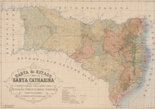
Santa Catarina is one of the three states in the Southern Region of Brazil. It is bordered to the north by the state of Paraná, to the south by the state of Rio Grande do Sul, to the east by the Atlantic Ocean, and to the west by the Argentine province of Misiones.[2] The state covers an area of approximately 95,730.69 square kilometres (37,000 sq mi), comparable to Hungary, and ranking as the seventh smallest Brazilian state by area.[3][2][1]
Its territory is entirely below the Tropic of Capricorn, in the southern temperate zone of the planet. It follows the UTC−03:00 time zone (Brasília time), three hours behind Greenwich Mean Time.[42] Its extreme points are: to the north, the Saí-Guaçu river in the municipality of Itapoá; to the south, the Mampituba river in Praia Grande; to the east, the Ponta dos Ingleses in Florianópolis; to the west, the confluence of the Uruguay and Pepiri-Guazu rivers in Itapiranga, on the border with Argentina.[43]
Relief edit
Santa Catarina has 77% of its territory above 300 metres and 52% above 600 metres, making it one of the Brazilian federative units with the highest relief. Four geomorphological units, ranging from the coast to the interior, form the state's relief: the coastal lowland, the Serra do Mar, the Palaeozoic plateau, and the Basaltic plateau.[6] The lowest altitudes are found in the coastal lowland, which encompasses lands located below 200 metres. In the northern part, it is quite wide, extending far inland through the valleys of the rivers that flow from the Serra do Mar. Meanwhile, towards the south, it gradually narrows.[6]
The Serra do Mar occupies the coastal lowland in the western part. In the north of the state, it forms the mountainous edge of a reasonably average plateau. It has a very different feature from what is found in other states such as Paraná and São Paulo. In Santa Catarina, it constitutes a range of mountains, with points above one thousand metres. This range is formed by a group of massifs isolated by the deep valleys of the rivers that descend to the Atlantic Ocean. Behind the Serra do Mar, the Palaeozoic plateau extends. Its flattened area is divided into spaces separated by rivers, which flow eastward. The Palaeozoic plateau decreases in altitude from north to south. In the southern portion of the state, it merges with the coastal plain, since the Serra do Mar does not extend to this region of Santa Catarina.[6]
The Basaltic plateau encompasses a significant portion of the state's territory. Comprising basaltic sediments (lava flows), interspersed with sandstone deposits, its eastern boundary is a mountainous edge known as the Serra Geral. In the north of the state, the edge of the basaltic plateau is situated inland. Moving southwards, it progressively approaches the coast until, at the border with Rio Grande do Sul, it starts to descend directly towards the sea. The plateau area is reasonably average and slopes gently westward. The rivers, flowing towards the neighbouring state of Paraná, have carved deep valleys into it.[6] The lands of the mixed ombrophilous forest are infertile, as are the soils of the grasslands, which are utilised for dairy and beef cattle farming. The soils of the humid subtropical forest are characterised by their fertility, despite their significant degradation due to improper use.[44]

.jpg)


Climate edit

According to the Köppen-Geiger climate classification system, Santa Catarina predominantly features a humid subtropical climate (Cfa) in the coastal lowlands and the lower altitude areas of the plateau, whilst the remainder of the plateau is characterised by a subtropical oceanic climate (Cfb).[7] Both have the four seasons well-defined and a rainfall regime evenly distributed throughout the year.[7]
The humid subtropical climate (Cfa) records average temperatures of 20 °C in the lowlands and the Uruguay Valley, and 18 °C in the western extremity of the state. Conversely, the temperate subtropical climate (Cfb) sees average temperatures ranging between 16 and 18 °C. There is a significant difference between summer and winter temperatures, leading to a considerable thermal amplitude throughout the year. Winters vary from cool to cold, with some regions experiencing about 25 days of frost annually.[7] During this period, the incursion of polar air masses is more common, some being stronger and more extensive, causing temperatures to fall below zero in various cities.[45][46] The majority of these cities are located in the Midwest, North Plateau, and South Plateau.[47] Notably, Bom Jardim da Serra, São Joaquim, Urubici, and Urupema, situated on the South Plateau, rank among the coldest municipalities in the country.[48]
A large part of Rio Grande do Sul is situated at latitudes lower than Santa Catarina. Despite this, it is in the higher areas of the Santa Catarina southern plateau where there is a higher occurrence of snowfall in Brazil during the winter months.[7][49] The state also holds the record for the lowest temperature recorded in Brazilian territory by official bodies. The temperature reached −14 °C in Caçador on 11 June 1952. On the other hand, the highest temperature reached 44.6 °C in Orleans on 6 January 1963. The hottest localities in the state are located in the regions of the southern coast, Itajaí Valley, and extreme west. This is because here lies the city considered the hottest in Santa Catarina, Itapiranga. In these regions, temperatures can exceed 40 °C in the summer or on other extreme occasions.[47]
Hydrography edit
The rivers that flow through the state's territory are part of both autonomous systems delineated by the Serra Geral and Serra do Mar mountain ranges. The South Atlantic basin is made up of inter-delimited basins, such as those of the Itajaí-Açu, Tubarão, Araranguá, Tijucas, and Itapocu rivers.[7] In the interior of the state, two basins come together to form the Plata basin: that of the Paraná, whose most important tributary is the Iguazu River, and that of the Uruguay River. The latter has as its main tributaries the Pelotas, Canoas, Chapecó, and Do Peixe rivers.[7]
Fauna and flora edit

Fully embedded within the Atlantic Forest biome, the original vegetation of Santa Catarina encompasses two formations: forests and grasslands. The forests, which harbour 65% of Santa Catarina's territory, have been extensively deforested. However, forestry has grown significantly due to government incentives and the progress of the timber industry.[7]
On the plateau, they occur in the form of mixed coniferous (Araucaria) forests with broadleaved trees and, in the lowland and foothills of the Serra do Mar, solely as broadleaved forest. The grasslands appear as scattered patches within the mixed forest. The main ones are those of São Joaquim, Lages, Curitibanos, and Campos Novos.[7]
In the fauna of Santa Catarina, about 600 species of birds,[50] 150 mammals,[51] and 140 systematic denominations of amphibians are catalogued.[52] There are 1,150 Lepidoptera (butterflies and moths), in addition to the registration of about 2,300 vascular plants.[53][54]
Demography edit

According to the 2022 Brazilian census conducted by the Brazilian Institute of Geography and Statistics (IBGE), Santa Catarina has a total population of 7.6 million and a population density of 79.5 inhabitants per square kilometre. This ranks it as the tenth most populous state in Brazil, accounting for 3.75% of the country's total population.[1] The state's largest city, Joinville, has a population of 616,317, making it the 34th most populous city in Brazil.[55] Meanwhile, its capital, Florianópolis, which is the state's second-largest city, has a population of 537,211, ranking it 39th among Brazilian municipalities by population.[56]
The population grew by approximately 1.3 million inhabitants since 2010, representing an increase of 21.79% between 2010 and 2022. In 2022, around 50.71% of the population (3,859,258 people) were female, whilst about 49.28% of the population (3,751,103 people) were male.[57]
The Human Development Index of Santa Catarina is considered high according to the UNDP. According to the latest Atlas of Human Development in Brazil, released in 2023 with data pertaining to 2021, the state has the 3rd highest HDI among the federal units in Brazil, with an overall index of 0.792. Breaking down the index into indicators of income, education, and life expectancy, the state ranks 4th in income (with an index of 0.759), 3rd in education (with an index of 0.790), and 3rd in life expectancy (with an index of 0.827).[58][1] The socioeconomic indicators of Santa Catarina rank among the best in Brazil. The state leads in public safety, and boasts the lowest rates of homicide, poverty and extreme poverty in the country.[10][11][12][13] It holds also the third-highest GDP per capita, and the third-lowest rates of infant mortality and illiteracy. Additionally, it is the federative unit with the least economic inequality in Brazil.[1][14]
.jpg)


|
| Rank | Municipality | Intermediate region | Population | Percentage of total
population |
|---|---|---|---|---|
| 1 | Joinville † | Joinville | 616,317 | 8.09% |
| 2 | Florianópolis †† | Florianópolis | 537,211 | 7.05% |
| 3 | Blumenau † | Blumenau | 361,261 | 4.74% |
| 4 | São José | Florianópolis | 270,299 | 3.55% |
| 5 | Itajaí | Blumenau | 264,054 | 3.46% |
| 6 | Chapecó † | Chapecó | 254,785 | 3.34% |
| 7 | Palhoça | Florianópolis | 222,598 | 2.92% |
| 8 | Criciúma † | Criciúma | 214,493 | 2.81% |
| 9 | Jaraguá do Sul | Joinville | 182,660 | 2.40% |
| 10 | Lages † | Lages | 164,981 | 2.16% |
| 11 | Brusque | Blumenau | 141,385 | 1.85% |
| 12 | Balneário Camboriú | Blumenau | 139,155 | 1.82% |
| 13 | Tubarão | Criciúma | 110,088 | 1.44% |
| 14 | Camboriú | Blumenau | 103,074 | 1.35% |
| 15 | Navegantes | Blumenau | 86,401 | 1.13% |
Ethnicity edit
According to the 2022 Brazilian census, the population of Santa Catarina was primarily composed of White Brazilians (76.28%), mixed race individuals (19.22%), Afro-Brazilians (4.07%), indigenous peoples (0.25%) and Asian Brazilians (0.18%).[60][61][33][62][63]
Historically, the region was primarily inhabited by the Kaingang, Xokleng, and Guarani peoples, whose populations were reduced since the beginning of colonisation but have survived to the present day. During colonial Brazil, Spanish colonisers were the first to initiate settlement in the territory of Santa Catarina.[33][62][63] However, the territory later came under Portuguese control, marked by Portuguese immigration and the arrival of African slaves.[9] Subsequently, the territory experienced further population growth with the arrival of more Portuguese (especially Azoreans) and other European immigrants (Italians, Germans, Poles, Ukrainians, Lithuanians, Jews, Dutch, Belgians, Swiss, Austrians, French, English, Irish, Norwegians, Swedes, Danes, Czechs, Slovaks, Greeks, and Russians), as well as by the Japanese.[33][62][63]
Languages edit
In Santa Catarina, two different groups of languages are spoken: indigenous languages and allochthonous languages, some of which are minority languages.[64][65][66][67][68][69][70] There are three indigenous or native languages: Kaingang, Mbyá-Guarani, and Xokleng.[64] With the European settlement of the state, allochthonous or immigrant languages emerged and persist today. These languages include Portuguese (by far the most widely spoken and used language in the state), Talian and other Italian dialects,[65] High German variants, and Low German variants such as the Pomeranian dialect near Blumenau and Pomerode.[66][67] Certain dialects were born in the region. Among them is Portuñol, a combination of Portuguese and Spanish spoken in the border regions with Argentina.[68] And Katarinensisch, part of the Hunsrik dialect, originating from the national language of Germany.[66] Other linguistic nuclei on a smaller scale include Spanish, Polish, Lithuanian, Japanese, Arabic, Yiddish and others.[69][70]
Religions edit
According to the 2010 population census, the population of Santa Catarina comprises Roman Catholics (73.07%); Protestants or Evangelicals (20.4%); Spiritists (1.58%); Jehovah's Witnesses (0.74%); Mormons (0.11%); the Brazilian Catholic Apostolic Church (0.17%); Buddhists (0.05%); new Eastern religions (0.04%), among which Messianics constitute 0.03%; Muslims (0.01%); Orthodox Christians (0.07%); followers of Umbanda (0.14%); Jewish (0.02%); Spiritualists (0.03%); adherents of esoteric traditions (0.17%); Indigenous religions (0.03%); practitioners of Candomblé (0.09%); and Hindus (0.01%). Another 3.27% had no religion, including atheists (0.29%) and agnostics (0.6%); 0.29% followed other Christian denominations; 0.21% had an undetermined faith; 0.04% were unsure, 0.04% followed other Eastern religions, and 0.03% did not declare.[71][72]
References edit
- ^ a b c d e f g h i j k "Santa Catarina | Cidades e Estados | IBGE". www.ibge.gov.br. Retrieved 13 February 2024.
- ^ a b c d "Geography of Santa Catarina". Government of of Santa Catarina (in Brazilian Portuguese). Retrieved 13 February 2024.
{{cite web}}: CS1 maint: url-status (link) - ^ a b "Áreas Territoriais | IBGE". www.ibge.gov.br. Retrieved 22 April 2021.
- ^ Frias Filho 1996, pp. 865–866
- ^ a b "Jorginho Mello é o governador eleito com a maior porcentagem do Brasil nas Eleições 2022". G1 (in Brazilian Portuguese). 31 October 2022. Retrieved 13 February 2024.
- ^ a b c d e Garschagen 2000, p. 82.
- ^ a b c d e f g h i Garschagen 2000, p. 83.
- ^ a b "History of Santa Catarina". Government of of Santa Catarina (in Brazilian Portuguese). Retrieved 13 February 2024.
- ^ a b "Da escravidão à liberdade na Ilha de Santa Catarina" (PDF). Moodle UFSC. 31 January 2016.
{{cite web}}: CS1 maint: url-status (link) - ^ a b "Estados mais seguros do Brasil: confira o ranking completo". MySide. Retrieved 15 February 2024.
{{cite web}}: CS1 maint: url-status (link) - ^ a b Redação 5 (14 August 2023). "Estados mais seguros do Brasil 2023; veja lista". Correio da Amazônia (in Brazilian Portuguese). Retrieved 15 February 2024.
{{cite web}}: CS1 maint: numeric names: authors list (link) - ^ a b IBGE, Síntese de Indicadores Sociais 2007 : Publicação completa Archived 2015-03-19 at the Wayback Machine. Tabela 1.4 - Taxa de fecundidade total, taxa bruta de natalidade, taxa bruta de mortalidade, taxa de mortalidade infantil e esperança de vida ao nascer, por sexo, segundo as Grandes Regiões e Unidades da Federação - 2022.
- ^ a b "Síntese de Indicadores Sociais | IBGE". www.ibge.gov.br. Retrieved 13 February 2024.
- ^ a b "Rendimentos de todas as fontes / Índice de Gini / Rendimento domiciliar per capita / A preços médios do ano". cidades.ibge.gov.br. Retrieved 13 February 2024.
- ^ a b c Houaiss et al. 1993, p. 10187.
- ^ a b c Girardi, Giovana. "Índios, santos e geografia". Revista Galileu. Archived from the original on 31 October 2013. Retrieved 28 September 2013.
- ^ "Adjetivos pátrios: Veja gentílicos dos Estados do Brasil". educacao.uol.com.br (in Brazilian Portuguese). Retrieved 13 February 2024.
- ^ a b "Por que os catarinenses são chamados de "barriga-verde"? – Estados e Capitais do Brasil". web.archive.org. 23 July 2017. Retrieved 13 February 2024.
- ^ a b Arruda 1988, p. 7129.
- ^ "santo | Palavras | Origem Da Palavra". origemdapalavra.com.br. Retrieved 13 February 2024.
- ^ "catarina | Palavras | Origem Da Palavra". origemdapalavra.com.br. Retrieved 13 February 2024.
- ^ Arruda 1988, p. 7135.
- ^ a b c d e f g h i j k l m n Mascarenhas et al. 1998, pp. 5224–5225.
- ^ Wachowicz 1995, p. 42.
- ^ a b c Wons 1994, p. 107.
- ^ Wachowicz 1995, p. 111.
- ^ Wachowicz 1995, p. 39.
- ^ Bueno 1999, p. 86.
- ^ Cintra 2013, p. 27.
- ^ a b "Sistema de Capitanias Hereditárias do Brasil". Archived from the original on 3 October 2016. Retrieved 12 February 2016.
- ^ Mingo, Milagros del Vas (1986). Las capitulaciones de Indias en el siglo XVI (in Spanish). Ediciones Cultura Hispánica, Instituto de Cooperación Iberoamericana. ISBN 978-84-7232-397-1.
- ^ "Tratado de Tordesilhas - História, mapa e Brasil". Estudo Prático. Archived from the original on 14 January 2016. Retrieved 12 February 2016.
- ^ a b c d Cabral, Oswaldo R. (1970). História de Santa Catarina (in Brazilian Portuguese). Editôra Laudes.
- ^ Dalfré, Liz Andréa (11 July 2018). "Outras Narrativas Da Nacionalidade: O Movimento Do Contestado" (PDF). Archived from the original (PDF) on 12 July 2018.
- ^ Wachowicz 1995, pp. 189–191.
- ^ Wachowicz 2010, pp. 231–232.
- ^ Governo de Santa Catarina. "Governadores de Santa Catarina". Archived from the original on 12 August 2017. Retrieved 25 November 2016.
- ^ "Raimundo Colombo 55 - Eleições 2014". web.archive.org. 19 December 2016. Retrieved 15 February 2024.
- ^ "Resultado da apuração do 2º turno das Eleições 2018 - Santa Catarina (SC) para governador, senador, deputado federal e deputado estadual". G1 (in Brazilian Portuguese). Retrieved 15 February 2024.
- ^ "Carlos Moisés (PSL) toma posse como governador de Santa Catarina". G1 (in Brazilian Portuguese). 1 January 2019. Retrieved 15 February 2024.
- ^ "Jorginho Mello toma posse como governador de Santa Catarina; FOTOS". G1 (in Brazilian Portuguese). 1 January 2023. Retrieved 15 February 2024.
- ^ "Fusos Brasil sem HV". web.archive.org. 22 July 2011. Retrieved 15 February 2024.
- ^ "SC - Caracterização do Território". www.angelfire.com. Retrieved 15 February 2024.
- ^ Arruda 1988, p. 7133.
- ^ "Sexta-feira amanheceu com temperatura negativa em várias regiões de Santa Catarina". www.diariodajaragua.com.br (in Brazilian Portuguese). Retrieved 15 February 2024.
- ^ "Frio em SC: Estado registra 40 cidades com temperaturas negativas". NSC Total (in Brazilian Portuguese). Retrieved 15 February 2024.
- ^ a b "Recordes de Frio – EPAGRI/CIRAM". web.archive.org. 24 November 2020. Retrieved 15 February 2024.
- ^ "Cidades mais frias do Brasil". Terra (in Brazilian Portuguese). Retrieved 15 February 2024.
- ^ "Onde já nevou no Brasil?". Super (in Brazilian Portuguese). Retrieved 15 February 2024.
- ^ "Aves de Santa Catarina". avesdesantacatarina.com.br (in Brazilian Portuguese). Retrieved 15 February 2024.
- ^ "Mastozoología neotropical - Lista dos mamíferos do Estado de Santa Catarina, Sul Do Brasil". web.archive.org. 21 June 2015. Retrieved 15 February 2024.
- ^ "Mastozoología neotropical - Lista dos mamíferos do Estado de Santa Catarina, Sul Do Brasil". web.archive.org. 21 June 2015. Retrieved 15 February 2024.
- ^ Piovesan, Monica; Orlandin, Elton; Favretto, Mario Arthur; Santos, Emili Bortolon (28 September 2014). "Contribuição para o conhecimento da lepidopterofauna de Santa Catarina". Scientia Plena (in Portuguese). 10 (9). ISSN 1808-2793.
- ^ Vibrans, Alexander Christian, ed. (2012). Inventário florístico florestal de Santa Catarina. Vol. 1: Diversidade e conservação dos remanescentes florestais / Alexander Christian Vibrans. Vol. 1. Blumenau: Universidade Regional de Blumenau, Brasil. pp. 99–111. ISBN 978-85-7114-330-2.
- ^ "Brasil | Santa Catarina | Joinville". cidades.ibge.gov.br. Retrieved 15 February 2024.
- ^ "Brasil | Santa Catarina | Florianópolis". cidades.ibge.gov.br. Retrieved 15 February 2024.
- ^ "Panorama do Censo 2022". Panorama do Censo 2022 (in Brazilian Portuguese). Retrieved 15 February 2024.
- ^ "Atlas Brasil". www.atlasbrasil.org.br. Retrieved 15 February 2024.
- ^ "Censo Demografico 2022. Populacao e domicilios". ftp.ibge.gov.br. Retrieved 15 February 2024.
- ^ a b "Censo 2022 - Panorama".
- ^ Lago 1971, pp. 54–67.
- ^ a b c MATOS, Jacinto Antônio de. Colonização do Estado de Santa Catarina, Tip. de "O Dia": Florianópolis, 1917. 241 p.
- ^ a b c EL-KHATIB, Faissal. História de Santa Catarina. Curitiba, PR: Grafipar, 1970. 4 v.
- ^ a b "Enciclópedia das Línguas do Brasil – Línguas indígenas". web.archive.org. 17 June 2017. Retrieved 24 February 2024.
- ^ a b "Enciclópedia das Línguas do Brasil – Italiano". Enciclópedia das Línguas do Brasil. 12 August 2017. Retrieved 24 February 2024.
- ^ a b c "Enciclópedia das Línguas do Brasil – Alemão". web.archive.org. 13 January 2017. Retrieved 24 February 2024.
- ^ a b "Enciclópedia das Línguas do Brasil – Pomerano". web.archive.org. 12 August 2017. Retrieved 24 February 2024.
- ^ a b "Enciclópedia das Línguas do Brasil – Espanhol". web.archive.org. 12 August 2017. Retrieved 24 February 2024.
- ^ a b "Enciclópedia das Línguas do Brasil – Línguas europeias". web.archive.org. 17 June 2017. Retrieved 24 February 2024.
- ^ a b "Enciclópedia das Línguas do Brasil – Línguas asiáticas". web.archive.org. 17 June 2017. Retrieved 24 February 2024.
- ^ «Censo 2010». IBGE
- ^ «Análise dos Resultados/IBGE Censo Demográfico 2010: Características gerais da população, religião e pessoas com deficiência» (PDF)