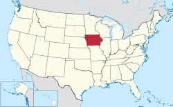
Iowa is a state located in the Midwestern United States. According to the 2020 census, Iowa is the 32nd most populous state with 3,190,369 inhabitants and the 26th largest by land area spanning 55,838.9 square miles (144,622 km2) of land and 418.8 square miles (1,085 km2) of water.[1] Iowa is divided into 99 counties with 942 incorporated cities. Iowa is also divided into 1,599 townships, which are considered by the United States Census Bureau to be minor civil divisions.[2].
The largest city by population and by total area is Des Moines with 214,133 residents and 88.178 square miles (228.38 km2) of land and 2.466 square miles (6.39 km2) of water[3]. The least populous city is Pioneer, with 4 residents[4]. The smallest city by area is Keomah Village, with a total area of 0.038 square miles (0.098 km2), all land[5].
According to the 2020 census, 1,950,256 of Iowa's 3,190,369 residents lived in urban areas, accounting for 64.0% of the population.[6] The first city to incorporate was Farmington on January 11, 1841, while the most recent was Maharishi Vedic City on July 25, 2001.[7]
Incorporation
editIowa is divided into 99 counties and has 947 cities. Every incorporated place in Iowa is called a "city," regardless of population. Incorporated cities can choose one of six forms of municipal government that differ primarily on how the legislative and administrative responsibilities are separated: mayor-council, mayor-council with an appointed manager, council-manager-at-large, commission, council-manager-ward, home rule charter or special charter. Most operate as mayor–council. 490 of Iowa's 947 cities—slightly more than half—have fewer than 500 residents.[8]
List of cities
edit| Name | Count(ies)[a] | Population (2020)[9] |
Population (2010)[6] |
Change | Land area (2020)[10] | Population density (2020) | Incorporation year[7] | |
|---|---|---|---|---|---|---|---|---|
| sq mi | km2 | |||||||
| Ackley | Hardin Franklin |
1,599 | 1,589 | +0.6% | 2.45 | 6.3 | 45.6/sq mi (17.6/km2) | August 28, 1869 |
Former city
edit| Name | County | Population (2010)[6] |
Area (2010)[6] | Unincorporation date |
Coordinates[6] | |
|---|---|---|---|---|---|---|
| sq mi | km2 | |||||
| Millville | Clayton | 30 | 0.067 | 0.2 | July 2014 | 42°42′13″N 91°04′35″W / 42.703640°N 91.076388°W |
See also
editNotes
edit- ^ For cities in more than one county, the primary county is listed first.
References
edit- ^ "Iowa Profile". 2020 United States Census. United States Census Bureau. Retrieved January 18, 2022.
- ^ "County Subdivisions: Iowa". 2020 United States Census. United States Census Bureau. Retrieved January 18, 2022.
- ^ "Des Moines city, Iowa". 2020 United States Census. United States Census Bureau. Retrieved January 18, 2022.
- ^ "Pioneer city, Iowa". 2020 United States Census. United States Census Bureau. Retrieved January 18, 2022.
- ^ "Places: Iowa". 2020 United States Census. United States Census Bureau. Retrieved January 18, 2022.
- ^ a b c d e "2010 U.S. Gazetteer Files". 2010 United States Census. United States Census Bureau. Retrieved January 11, 2022.
- ^ a b "List of Incorporated Cities" (PDF). Iowa Secretary of State. March 16, 2013. Retrieved August 4, 2013.
- ^ Iowa Official Register (PDF). Vol. 74 (2011–2012 ed.). Des Moines, Iowa: Iowa Legislative Assembly. 2011. p. 321. OCLC 7640453. Retrieved August 4, 2013.
- ^ "Explore Census Data". U.S. Census Bureau. Retrieved January 11, 2022.
- ^ "Places: Iowa". 2010 United States Census. United States Census Bureau. Retrieved January 11, 2022.