Cheshire West and Chester is a unitary authority area with borough status in Cheshire, England. It was established on 1 April 2009 as part of the 2009 local government changes, by virtue of an order under the Local Government and Public Involvement in Health Act 2007.[5] It superseded the boroughs of Ellesmere Port and Neston, Vale Royal and the City of Chester. The remainder of the ceremonial county of Cheshire is composed of Cheshire East, Halton and Warrington. Cheshire West and Chester has three key urban areas: Chester, Ellesmere Port and Northwich/Winsford.[according to whom?]
Cheshire West and Chester | |
|---|---|
 Chester, the county town of Cheshire and the largest settlement in Cheshire West and Chester | |
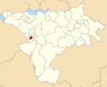
 Cheshire West and Chester shown within Cheshire | |
| Coordinates: 53°12′47″N 2°54′07″W / 53.213°N 2.902°W | |
| Sovereign state | United Kingdom |
| Country | England |
| Region | North West |
| Ceremonial county | Cheshire |
| Incorporated | 1 April 2009 |
| Administrative HQ | The Portal, Ellesmere Port |
| Government | |
| • Type | Unitary authority |
| • Body | Cheshire West and Chester Council |
| • Executive | Leader and cabinet |
| • Control | Labour |
| • Leader | Louise Gittins (Lab) |
| • Chairman | Robert Bisset (Lab) |
| • MPs | Six MPs |
| Area | |
| • Total | 363 sq mi (941 km2) |
| • Land | 360 sq mi (920 km2) |
| • Rank | 31st |
| Population (2022)[3] | |
| • Total | 361,694 |
| • Rank | 24th |
| • Density | 1,020/sq mi (393/km2) |
| Ethnicity (2021) | |
| • Ethnic groups | |
| Religion (2021) | |
| • Religion | List
|
| Time zone | UTC+0 (GMT) |
| • Summer (DST) | UTC+1 (BST) |
| Postcode areas | |
| Dialling codes |
|
| ISO 3166 code | GB-CHW |
| GSS code | E06000050 |
| Website | cheshirewestandchester |
The decision to create the Cheshire West and Chester unitary authority was announced on 25 July 2007 following a consultation period, in which a proposal to create a single Cheshire unitary authority was rejected.[6]
Governance
editThe council is a unitary authority, being a district council which also performs the functions of a county council. Full council meetings are held at Wyvern House in Winsford and the council has its main offices at The Portal in Ellesmere Port.[7][8]
Subdivisions
editThe borough is divided into forty-six wards,[9][10] listed below in alphabetical order.
There are ninety-seven parish councils in the borough,[11][12] despite there being a total of 166 civil parishes before a community governance review was undertaken by the borough council in 2014[13] under section 82 of the Local Government and Public Involvement in Health Act 2007.[14]
- Notes
- ^ 3: Civil parishes highlighted in bold have unilaterally declared town status under section 12A of the Local Government Act 1972.
This section needs expansion. You can help by adding to it. (February 2018) |
-

-

-
 Chester City
 -
 Chester Villages
 -

-
 Dodleston and Huntington
 -
 Willaston and Thornton
 -
 Winnington and Castle
 -
 Witton and Rudheath


Members of Parliament
edit.jpg)


Demography
editEthnicity
editIn line with nearly every local government district in England and Wales, the majority of the population describe themselves as 'white'. The exact figure – 95.3% – is comparable with metropolitan counties such as Merseyside, non-metropolitan counties such as Cumbria and principal areas throughout Wales. This would suggest that the figure is not a significant outlier nationwide.
The next largest ethnic group in the borough is Asian, who along with other ethnic minorities are supported by the Cheshire Asian & Minority Communities Council, a registered charity headquartered in Chester.
Religion
editThe main religion in Cheshire West and Chester is Christianity, with a percentage figure above the average for England (46.3%, 2021).[17] The single largest church is the Church of England, with the borough being served by the Chester Archdeaconry, with six deaneries and an average of twenty parish churches in each deanery. Roman Catholicism also has a significant presence across the borough, with all its churches located in the Diocese of Shrewsbury.
Methodist churches in the borough form groups averaging ten, known as 'circuits' (the four in Cheshire West and Chester are all part of the Chester and Stoke-on-Trent District). More marginal churches include Assemblies of God, Baptist Union, Elim Pentecostal, United Reformed and the English Presbyterian Church of Wales in Chester.
Aside from churches, there are two mosques in Cheshire West and Chester – one each in Chester and Ellesmere Port – which were subjected to property theft[18] and racially aggravated disorder[19] respectively in 2014.
Geography
edit| Local authority | In relation to the district |
|---|---|
| City of Liverpool | North (over the river) |
| Halton | North |
| Warrington | North east |
| Cheshire East | East |
| Newcastle-under-Lyme | South |
| Wrexham | South west |
| Flintshire | West |
| Wirral | North west |
Local nature reserves
editCheshire West and Chester Council maintains six Local Nature Reserves: Burton Mill Wood, Helsby Quarry, Marshall's Arm, Rivacre Valley, Stanney Wood, and Whitby Park.[20]
Transport
editAir
editThere are no passenger airports in the borough; only a grass airfield exists in Little Budworth, with the nearest being Liverpool John Lennon Airport and Manchester Airport.
Cycling
editNational routes which pass through the borough include NCR5, NCR45 (Mercian Way), NCR56, NCR562, NCR563, NCR568 and NCR573. Regional routes include 70 (Cheshire Cycleway) and 71.
Three disused railways in the borough have been converted to off-road cycleways, including:
- Birkenhead Railway: Contains sections of NCR56 and the Wirral Circular Trail and is now called Wirral Way.
- Chester & Connah's Quay Railway: Contains a section of NCR5 and is now called Chester Millennium Greenway.
- Winsford and Over Branch Line: Contains a section of regional route 71 and is now called Whitegate Way.
The Shropshire Union Canal towpath between Waverton and the National Waterways Museum is paved with asphalt; it is a shared-use route between cyclists and pedestrians for a distance of 12.5 miles (20.1 km).
In 2009, Chester was awarded the status of Cycling Town by Cycling England. To reflect this, a series of colour-coded signposted routes around the city were devised in 2012.[21] The total length of new signposted routes created by the project was 38 miles (61 km), bringing the overall total in the borough to 312.5 miles (502.9 km). The total funding received from the cycling town project, which ended in 2011 when Cycling England was disbanded, was £4.4 million.[22] A similar network of over 30 miles (48 km) of cycle routes branded the Ellesmere Port Grenway has been proposed by the town's development board.[23]
Park and Ride
editChester has four park and ride sites located adjacent to radial routes on the city's outskirts: Boughton Heath, Sealand Road, Upton and Wrexham Road; they run on two lines which intersect at Chester Bus Interchange. A fifth site is proposed near Hoole Village.
| Route | Terminus | Intermediate stop | Chester city centre | Intermediate stop | Terminus | |||
|---|---|---|---|---|---|---|---|---|
| Blue (PR1) | Upton (Zoo) | Countess of Chester Hospital | Delamere Street | Chester Bus Interchange | Foregate Street | Pepper Street | Grosvenor Road | Wrexham Road |
| Green (PR2) | Sealand Road | Sealand Road (Greyhound Park) | Canal Street | Boughton | Boughton Heath | |||
Hooton station is designated as a park and ride facility for railway services on the Wirral Line; it contains a 418-space car park.[24]
Railway
edit
Chester railway station is the hub of the railway network in the borough, with around 4.7 million passengers annually.[25] Passenger numbers doubled to this figure in the ten years to 2015, making the station the eighth-busiest in North West England.[26]
Railway lines, and their associated train operating companies in the borough, include:
- Borderlands line: Services between Bidston and Wrexham Central are provided by Transport for Wales Rail and call at Neston.
- Chester–Warrington line: Includes stops at Frodsham and Helsby, with services provided by Northern Trains and Transport for Wales Rail.
- Ellesmere Port to Warrington Line (Northern): includes stops at Stanlow & Thornton and Ince & Elton before meeting the Chester-Manchester Line near Helsby; it is operated by Northern Trains according to a Department for Transport-set minimum service pattern.
- Mid-Cheshire line: Leaves the Chester–Warrington line near Mickle Trafford and includes stops at Cuddington, Delamere, Greenbank, Lostock Gralam, Mouldsworth and Northwich, with services between Chester and Manchester Piccadilly provided by Northern Trains. A single-track railway exists between Northwich and Sandbach, but it is only used for freight.
- North Wales Main Line: Services between Crewe and Holyhead are provided by Avanti West Coast and Transport for Wales Rail, and call at Chester.
- Shrewsbury to Chester Line (InterCity West Coast and Wales & Borders): The section between Wrexham and Chester is currently in the process of being reinstated as a two-track railway under the direction of the Welsh Government. Services are provided by Transport for Wales and Avanti West Coast.
- West Coast Main Line (InterCity West Coast): aside from stops at Winsford, Hartford and Acton Bridge, the branch line to Liverpool Lime Street diverges at Weaver Junction – the oldest of its type in Great Britain. It is currently operated by Avanti West Coast, however High Speed 2 services to Liverpool using classic compatible trains are proposed to run along this section of the line.
- Wirral Line (Merseyrail): Chester is one of the terminus stations of the line which loops clockwise around Liverpool city centre in a tunnel. The line includes stops at Bache, Capenhurst and Hooton, with a branch line from the latter running to another terminus at Ellesmere Port, with stops at Little Sutton and Overpool. The line is operated by Merseyrail with this line and the WCML being the only two electrified railways in the borough.

Current and proposed improvements
editThe sections of railway between Chester–Stockport and Chester–Warrington Bank Quay are proposed for electrification during the period 2019–2024.[27]
Road
edit| Motorways | A roads | B roads |
|---|---|---|
|

Motorways and primary routes in the borough which are maintained by National Highways (trunk roads de jure) include the M6, M53, M56, A55, A483, A494, A550 and a short section of the A41 in Hooton. Other primary routes which are maintained by the council (principal roads de jure) include the A41, A49, A51, A54, A56, A483, A530, A533, A534, A556, A5115, A5116, A5117 and A5268.
Chester and Ellesmere Port – both primary route destinations – form the hub of the road network in Cheshire West and Chester, with routes of national importance carrying traffic in all directions to locations including Flintshire, Halton, Wirral and Wrexham.
European Route E05 is routed via the M6, carrying international traffic between Scotland, North West England, the West Midlands and France via Southampton. European route E22 is routed via the A494 and M56, carrying international traffic between Ireland (the route in fact begins at the Port of Holyhead), North Wales, North West England, Yorkshire and the Netherlands. Both routes meet at Lymm Interchange, which lies in neighbouring Cheshire East.
Three Roman roads exist in Cheshire West and Chester:
- Two originate in Chester. (Deva Victrix) and running to Northwich (Condate) and Whitchurch (Mediolanum) respectively.
- The Roman road of Kings Street in Northwich, which runs from Middlewich to Warrington.
The section of the A51 between its western terminus and the B5132 was named as one of the most congested roads in the United Kingdom by INRIX in August 2015.[28]
Three local MPs – Graham Evans, Justin Madders and Chris Matheson – raised safety concerns about the M56 between J12 and J14 in parliament after more than 160 incidents were recorded since 2011. In response, Andrew Jones, the Parliamentary Under Secretary of State for Transport, confirmed that an upgrade to smart motorway will only take place after 2020.[29][30]
Water
editNavigable waterways in the borough include the Manchester Ship Canal, Shropshire Union Canal, Trent and Mersey Canal and the Weaver Navigation. The latter two are connected together by the Anderton Boat Lift, near Northwich; this is the only caisson lift lock in the United Kingdom.
Places of interest
editTourist attractions
edit| Key | |
| Abbey/Priory/Cathedral | |
| Accessible open space | |
| Amusement/Theme Park | |
| Castle | |
| Country Park | |
| English Heritage | |
| Forestry Commission | |
| Heritage railway | |
| Historic House | |
| Places of Worship | |
| Museum (free/not free) | |
| National Trust | |
| Theatre | |
| Zoo | |
- Abbeywood estate
- Aldersey Green Golf Club
- Anderton Boat Lift
- Beeston Castle


- Bickerton Hill SSSI


- Blakemere Craft Centre
- Blue Planet Aquarium
- Bluebell Cottage Gardens
- Bolesworth Castle

- Burton Mere Wetlands (part of Dee Estuary RSPB reserve)
- Carden Park Hotel
- Cheshire Military Museum

- Cheshire Oaks Designer Outlet
- Cheshire Workshops
- Chester Castle
- Chester Cathedral

- Chester city walls
- Chester Racecourse
- Chester Roman Amphitheatre
- Chester History and Heritage

- Chester Rows
- Chester Zoo

- Craxton Wood Hotel
- The Crocky Trail
- Delamere Forest
- Deva Stadium
- Dewa Roman Experience
- Grosvenor Museum
- Grosvenor Park
- Grosvenor Park Open Air Theatre
- The Groves
- Harlequin Theatre
- Hoole Hall
- Ice Cream Farm
- JF Polo Academy
- Lion Salt Works
- Little Budworth Country Park

- Manley Mere
- Marbury Country Park
- Mersey View
- National Waterways Museum
- Ness Botanic Gardens
- Northgate Arena
- Oulton Park
- Parkgate salt marsh (part of Dee Estuary RSPB reserve and SSSI)
- Parkgate sea front
- Portal Hotel, Golf and Spa
- Pryors Hayes Golf Club
- Rowton Hall
- Rowton Moor battle site
- St John the Baptist's Church, Chester
- Stonyford Cottage Gardens
- Stretton Watermill
- Tirley Garth
- Vale Royal Falconry Centre
- Walk Mill
- Weaver Hall Museum and Workhouse
- Willington Hall
- Wincham Park
- Wirral Country Park
Media
editTelevision
editThe area is served by BBC North West and ITV Granada with television signals received from the Winter Hill TV transmitter.[31]
Radio
editRadio stations for the area are:[32]
- BBC Radio Merseyside
- Heart North West
- Smooth North West
- Capital North West & Wales
- Greatest Hits Radio Liverpool & The North West
- Hits Radio Liverpool
- Dee Radio, a community based station that broadcast from Chester.
Sport
editFootball
edit
Chester FC are the highest ranked club in the area and compete in the National League North (the sixth tier of English football. Northwich has four semi-professional teams – Barnton, Northwich Victoria, Witton Albion and 1874 Northwich – all of whom play in regional leagues. Winsford is also represented in the non-league pyramid by Winsford United, and Ellesmere Port by Vauxhall Motors FC – the former works team of the Vauxhall Ellesmere Port assembly plant.
Below level ten of the English pyramid are county-wide amateur leagues, with two covering the geographic area of the borough – the Cheshire Association Football League and West Cheshire Association Football League. Although several clubs are members of the former, many more compete in the latter. Below that is the Chester & Wirral Football League, and also the Mid-Cheshire district leagues who cater for the areas of knutsford, Northwich, Middlewich and Winsford where teams representing neighbourhoods/villages and/or pubs/social clubs ('pub teams') compete.
The largest football stadium in Cheshire West and Chester is the Deva Stadium, home to Chester FC, although the ground famously straddles the England-Wales border.
Twin towns
editWhilst the borough per se does not have any twinning agreements, several of its settlements have agreements predating its creation in 2009, listed below:
| Settlement(s) | Twin town(s) |
|---|---|
| Aubignan, France | |
| Chester |
|
| Ellesmere Port | Reutlingen, Germany |
| Malpas | Questembert, France |
| Northwich | |
| Tarporley | Bohars, France |
| Upton-by-Chester | Arradon, France |
| Winsford | Deuil-la-Barre, France |
See also
editReferences
edit- ^ "Councillors and committees". Cheshire West and Chester Council. Retrieved 15 December 2023.
- ^ "Mid-Year Population Estimates, UK, June 2022". Office for National Statistics. 26 March 2024. Retrieved 3 May 2024.
- ^ "Mid-Year Population Estimates, UK, June 2022". Office for National Statistics. 26 March 2024. Retrieved 3 May 2024.
- ^ a b c d UK Census (2021). "2021 Census Area Profile – Cheshire West and Chester Local Authority (E06000050)". Nomis. Office for National Statistics. Retrieved 15 December 2023.
- ^ "The Cheshire (Structural Changes) Order 2008 – Article 4". legislation.gov.uk. Archived from the original on 3 January 2011. Retrieved 15 January 2009.
- ^ "County split into two authorities". BBC News. 25 July 2007. Archived from the original on 7 January 2009. Retrieved 25 July 2007.
- ^ "Caldendar". Cheshire West and Chester Council. Retrieved 9 May 2024.
- ^ "Registered office address". Cheshire West and Chester Council. Retrieved 9 May 2024.
- ^ "Election 2011 Live Results". cheshirewestandchester.gov.uk. Cheshire West and Chester Council. 5 May 2011. Archived from the original on 11 May 2015. Retrieved 5 September 2015.
- ^ "Your Councillors by Ward". cheshirewestandchester.gov.uk. Cheshire West and Chester Council. Retrieved 5 September 2015.
- ^ "Town and parish councils". cheshirewestandchester.gov.uk. Cheshire West and Chester Council. Archived from the original on 22 May 2015. Retrieved 31 May 2015.
- ^ "Parish and Town Councils in Cheshire" (PDF). chalc.org.uk. Cheshire Association of Local Councils. Archived from the original (PDF) on 31 May 2015. Retrieved 30 May 2015.
- ^ "Community governance arrangements". cheshirewestandchester.gov.uk. Cheshire West and Chester Council. Archived from the original on 7 May 2015. Retrieved 6 June 2015.
- ^ "Local Government and Public Involvement in Health Act 2007 – Section 82". legislation.gov.uk. Retrieved 6 June 2015.
- ^ "Register of Geographic Codes (November 2020) for the United Kingdom". geoportal.statistics.gov.uk. Office for National Statistics. 26 November 2020. Retrieved 21 December 2020.
- ^ "Cheshire West and Chester unitary district". citypopulation.de. City Population. 27 June 2020. Retrieved 21 December 2020.
- ^ UK Census (2021). "2021 Census Area Profile – England Country (E92000001)". Nomis. Office for National Statistics. Retrieved 10 August 2023.
- ^ Flint, Rachel (28 July 2014). "Heartless thieves steal plants from mosque during Ramadan". Chester Chronicle. Archived from the original on 23 September 2015. Retrieved 28 July 2015.
- ^ Flint, Rachel (23 October 2014). "Ellesmere Port man arrested after pig's head placed outside Islamic centre". Chester Chronicle. Archived from the original on 23 September 2015. Retrieved 28 July 2015.
- ^ "Statutory Sites". Cheshire West and Chester council. Archived from the original on 3 January 2011. Retrieved 28 January 2011.
- ^ "Complete Library of Free Chester Cycle Route Maps". chestercyclecity.org. Chester Cycling Campaign. 10 January 2015. Archived from the original on 29 May 2015. Retrieved 29 May 2015.
- ^ "Cheshire West and Chester Council Cycling Strategy" (PDF). cheshirewestandchester.gov.uk. Cheshire West and Chester Council. Archived from the original (PDF) on 20 March 2017. Retrieved 19 March 2017.
- ^ "Ellesmere Port Greenway". ellesmereportdevelopment.co.uk. Invest in Ellesmere Port. Archived from the original on 19 August 2017. Retrieved 19 August 2017.
- ^ "Hooton". merseyrail.org. Merseyrail. Archived from the original on 25 August 2017. Retrieved 25 August 2017.
- ^ "Estimates of station usage | Office of Rail and Road". orr.gov.uk. Retrieved 17 May 2019.
- ^ "Chester Railway Station sees passenger numbers double in 10 years". chesterchronicle.co.uk. Chester Chronicle. 29 January 2016. Archived from the original on 30 January 2016. Retrieved 30 January 2016.
- ^ "Electrification Task Force Final Report Revealed". railnorth.org. Rail North. 5 March 2015. Archived from the original on 14 June 2017. Retrieved 29 May 2015.
- ^ "Chester Road one of most congested outside London". The Standard. 25 August 2015. Archived from the original on 23 September 2015. Retrieved 3 September 2015.
- ^ "Weaver Vale MP raises M56 issues in House of Commons". chesterchronicle.co.uk. Chester Chronicle. 18 November 2015. Archived from the original on 24 November 2015. Retrieved 5 December 2015.
- ^ "M56 Smart Motorway won't happen". chesterchronicle.co.uk. Chester Chronicle. 21 November 2015. Archived from the original on 8 December 2015. Retrieved 5 December 2015.
- ^ "Full Freeview on the Winter Hill (Bolton, England) transmitter". UK Free TV. May 2004. Retrieved 20 May 2024.
- ^ "Radio Stations". Cheshire West and Chester Council. Retrieved 20 May 2024.