| This article is rated Start-class on Wikipedia's content assessment scale. It is of interest to the following WikiProjects: | |||||||||||||||||||||||||||||||||||||||||
| |||||||||||||||||||||||||||||||||||||||||


| The contentious topics procedure applies to this page. This page is related to the Balkans or Eastern Europe, which has been designated as a contentious topic. Editors who repeatedly or seriously fail to adhere to the purpose of Wikipedia, any expected standards of behaviour, or any normal editorial process may be blocked or restricted by an administrator. Editors are advised to familiarise themselves with the contentious topics procedures before editing this page. |
Notability edit
Scored only 100 hits on google. Dengero (talk) 09:13, 10 March 2008 (UTC)
- But, You should try "Pančićev vrh"! Vanjagenije (talk) 22:57, 7 January 2009 (UTC)
Military Base on top edit
![[1]](http://i98.photobucket.com/albums/l242/n1dza/Nature/landscape3.jpg)
What do you see on these pictures? CrniBombarder!!! ![]() (†) 04:17, 23 September 2008 (UTC)
(†) 04:17, 23 September 2008 (UTC)
Central Serbia or Kosovo edit
Pančić's Peak is obviously located in Central Serbia, and not in Kosovo as anyone can see at google maps or google earth (see [4]). So, please, stop writing that it is in Kosovo.Vanjagenije (talk) 22:25, 7 January 2009 (UTC)
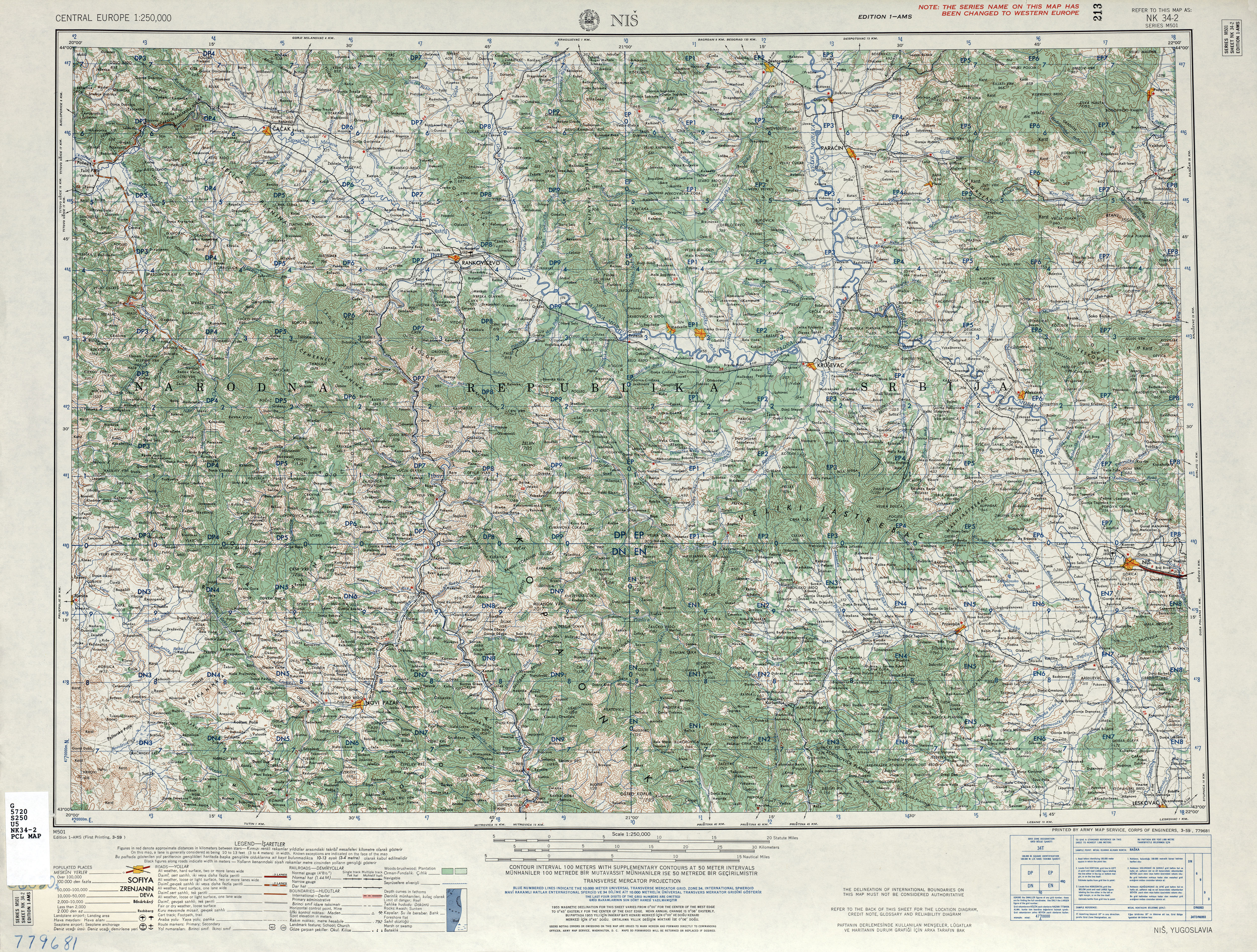
- Actually, it appears to be on the border. The coordinates given in the Pančić's Peak article, 43°16′9″N 20°49′21″E / 43.26917°N 20.82250°E, seem to be in Kosovo, rather than Central Serbia, but that point was not at the height of land. I looked at the map at footnote one (suggested above), and that point was not at the height of land. It appears that the height of land is 6548 ft. (on Google Earth), said to be 6617 ft/2017 m at "Nis, Sheet NK 34-2" U.S. Army Map Service, Corps of Engineers 1959, and the height of land is at 43°16′08.27″N 20°49′28.37″E / 43.2689639°N 20.8245472°E, which is right on the border, which makes sense if the border was set at the height of land. Lonely Planet Eastern Europe Chapter on Serbia indicates that the ski resort is in Serbia, and that the peak overlooks Kosovo. I've looked at several maps and Pančić's Peak (Milanov Vrh) appears to be the tripoint where the municipalities of Raška, Brus, and Leposavić meet. --Bejnar (talk) 20:50, 22 September 2010 (UTC)
- The exact peak is the point where Pančić's mausoleum is located. It was intentionally built exactly on the peak. The mausoleum is clearly visible on Google Maps at [5]. Vanjagenije 11:33, 23 September 2010 (UTC)
- Yes, it is mausoleum that is marker. It seams that cord is wrong, but i will fix it... :) --WhiteWriter speaks 15:24, 23 September 2010 (UTC)
- It is true that there are two small buildings at [6]; however, the top of the hill (mountain) is here where, when you zoom in, you can clearly see not only the mausoleum, but also the radio tower and that it is above the road and the rocks and grass match the picture in the article. Also, you haven't addressed the issue of the height-of-land as the defining characteristic of the border. The mausoleum here is on the height-of-land and the border. You can also see these features at Google Earth at 43°16′09.26″N 20°49′21.02″E / 43.2692389°N 20.8225056°E. --Bejnar (talk) 19:10, 23 September 2010 (UTC)
- Now, I have to say that I'm confused. We should determinate which of these buildings is the mausoleum. By the way, how do you check the altitude on google maps? Vanjagenije 18:28, 24 September 2010 (UTC)
- Check altitude with Google Earth, requires download and install. Altitude is displayed in the lower right. Google Earth's altitudes are relative, not absolute. Take a look at the mausoleum next time you are there, the location of the road and how the rocks outcrop there at the top. Or you can compare with the picture now on display in the article. People have placed several markers for Pančić's Peak on both Google Earth and Google Maps which are all in the general area, but which are all off just a bit from the actual point. --Bejnar (talk) 05:48, 26 September 2010 (UTC)
I`m little mixed up,about what are we talking here exactly.
Highest point (not peak) is 2017 metters above sea level and on that spot is mausoleum.Highest peak,is Pančićs peak,which is adjecent to Suvo Rudište peak (1976),on which most of the ski lifts ends (As you can see on this picture).
According to my recolection,mausoleum is this object on GoogleEarth 43°16′9″N 20°49′21″E / 43.26917°N 20.82250°E (which can be easily confirmed,by looking at this picture (you can see army bus on the road which goes around the highest point)).Also,according to GoogleEarth,height of that point is 1986,so we`re back at the beginning.(I faced a similar problem in other part of Kopaonik,where Google Earth shows very different height then real.)
You (Bejnar) said you look at several maps and the highest point represents tripoint of those municipalities (which is logical,if those municipal borders meet there).Which maps are those,since on Yugoslav military maps those thing aren`t marked.
Anyway,I`m still missing the point of this talking. CrniBombarder!!! ![]() (†) 13:05, 29 September 2010 (UTC)
(†) 13:05, 29 September 2010 (UTC)
- The point of this talking is whether the Pancic peak is located in Central Serbia or Kosovo, or on the border between two. Vanjagenije (talk) 20:10, 2 December 2010 (UTC)
I am not sure what you are saying. Are you saying that the highest point is not Pančić's Peak? --Bejnar (talk) 22:23, 15 October 2010 (UTC)
- No,no,Pančić's Peak is the highest peak on Kopaonik mountain.Maybe I made some badly understandable statements above. CrniBombarder!!!
 (†) 12:08, 29 October 2010 (UTC)
- I am including this in the Kosovo project and we need to add the albanian names for reference. thanks James Michael DuPont (talk) 06:06, 19 November 2010 (UTC)
Merge? edit
Not directly relevant to the section topic, but why don't we simply merge this into Kopaonik article, which isn't particularly long anyway? OK, it's a relatively well known peak, but it's just a peak with a few buildings on top. The article cannot grow significantly beyond the current point, because there isn't too much to be written about it, no? It isn't really Mount Blanc or K2. Why having an eternal stub? No such user (talk) 06:43, 23 September 2010 (UTC)
- Actually, article can grow, as none of its history is written, and none of its problems during 1999 war. Also, there is impšortant memorial on the top of this peak. I reject the merge. --WhiteWriter speaks 15:33, 23 September 2010 (UTC)
Yes,article can grove.It could be expanded in history section,but also it could be written about late roman and early byzantine church,just beneath it (article on sr.wiki) and natural rarites,since part of the peak is protected as part of Kopaonik national park ([7]).It could be written about Krčmar (Tavern waiter) spring,beneath it,which is a glacial relict and represent one of the most (naturaly) radioactive spring in Serbia and also is origin of the Toplica river. CrniBombarder!!! ![]() (†) 13:05, 29 September 2010 (UTC)
(†) 13:05, 29 September 2010 (UTC)
- Fair enough. Withdrawing. No such user (talk) 13:52, 29 September 2010 (UTC)
Maja Pançiq edit
Is "Maja Pançiq" the correct name for Pančić's Peak in Albanian? If so, and the peak is relevant enough to Albanian speakers that it is considered notable by them, https://secure.wikimedia.org/wikipedia/sq/wiki/Maja_Pan%C3%A7iq it belongs in the article. Whether Albanian is an official language in Central Serbia, or whether the peak is in Kosovo or not is irrelevant. The question is whether our article serves the reader, who is looking for "Maja Pançiq". Fred Talk 15:23, 20 November 2010 (UTC)
- But it doesn't matter, if you insist, you may enter it, but this peak have absolutely "zero" notability for Albanian speakers! It is located in Serbia, on its top is memorial of Serbian botanist Josif Pančić, and earlier it was named after Serbian king Milan Obrenović. It is only relevant for Serbia, and Serbs, in international meaning. By that logic, we should add multiple multilingual names to tons of articles, as they may be related to some other speakers. Also, as redirect exist, dont worry about readers who search for Maja Pançiq. They will find it, even without that other names. Also, that is the reason we have redirects here! :) Thanks anyway, but just imagine how it would be that we add all related names? That would be mess! All best! --WhiteWriter speaks 15:45, 20 November 2010 (UTC)
- We do insist. We are not involved in the Serbian-Kosovo dispute. If there is an English term in common use that should be the title with references in the introduction to the name as expressed in all local languages. If there is no English term in common use either Serbian or Albanian may be used, which will depend on more subtle matters. In this case the physical location and the memorial seem to make Serbian an appropriate choice. Fred Talk 19:01, 20 November 2010 (UTC)
- All related names? Albanian is a relevant language in southern Serbia if I may point out. If we look at south Serbia according to the Serbian claim to Kosovo, then you would also have to admit that there are very many Albanian speakers running around inside of Serbia. It does not matter if Albanian is a official language at all for the WP, WP is not a soapbox for the Serbian or any other government. We are trying to collect facts for scholars, to compile information that is relevant. The Albanian names of places in Serbia where Albanian people live are relevant if you like it or not. This peak is a relevant border point for Kosovo, and the mountain is half in Kosovo, it does not matter what status Kosovo has, if it is a province, a state or whatever, the border is still there, even if a local border according to some viewpoints. I think that it is relevant and according to a NPOV we should add it. I really don't care about this matter, but it seems that the discussion is not neutral. I have seen many examples of Albanian names being removed, and I wish it would stop. Thanks, Mike James Michael DuPont (talk) 16:53, 20 November 2010 (UTC)
- "Maja Pançiq" is documented in "Nazewnictwo Geograficzne Świata" (PDF) (in Polish). Warsaw: Komisja Standaryzacji Nazw Geograficznych poza Granicami Rzeczypospolitej Polskiej. 2009. p. 116. as editor Ktrimi991 has pointed out. --Bejnar (talk) 20:41, 30 January 2017 (UTC)
Sources are not Neutral|Primary Sources edit
Sorry but http://www.slobodan-milosevic.org [non-primary source needed] does not seem to me to be a secondary source, please use english language secondary sources and please include translations of the serbian sources here in talk for review. WP:RSUE thanks, mike James Michael DuPont (talk) 08:59, 21 November 2010 (UTC)
- We already have other sourced the primary ones. Also in WP:RSUE, translation is needed ONLY WHEN QUOTING A SOURCE. And not in regular reference usage. So please, stop asking for translation everywhere. Please, understand guideline first, before cite it in discussions. --WhiteWriter speaks 09:44, 21 November 2010 (UTC)
- We already have three sources for the simple statement that the peak was bombed. Including a link to website slobodan-milosevic.org, containing a transcript of trial in absentia to NATO leaders in a Belgrade court is... embarrassing, to put it mildly. No such user (talk) 08:03, 3 December 2010 (UTC)
NPOV edit
Why the desperation to link to Central Serbia rather than Serbia? Central Serbia is an administrative decision which ceased to exist years ago. "border between Serbia and Kosovo" is more neutral wording. WP:NPOV is not optional. bobrayner (talk) 18:08, 30 December 2012 (UTC)
- Incorrect. Central Serbia is not only administrative unit but also a term used to describe territory of Serbia without two its provinces. Please respect WP:NPA and comment on content, not on contributors. Don't attribute desperation to me.--Antidiskriminator (talk) 18:17, 30 December 2012 (UTC)
- If sources consider it the border between Serbia and Kosovo, changing the content per your POV isn't prudent.--— ZjarriRrethues — talk 23:42, 30 December 2012 (UTC)
- It's quite simple. There is a border between Kosovo and Serbia. This peak is on the border. Some articles have had their wording twisted in a desperate attempt to pretend that there is no border, but sources are quite clear that a border exists. bobrayner (talk) 03:56, 3 January 2013 (UTC)
- This is pure WP:IDHT and WP:TAGTEAM.--Antidiskriminator (talk) 10:10, 3 January 2013 (UTC)
- No; this is sourced and neutral content. Just because people - and reliable sources - disagree with you does not mean that they're breaking the rules. bobrayner (talk) 10:51, 3 January 2013 (UTC)
- Bob, you are pushing your POV in ARBMAC area. Step back. Kosovo is disputed, and you will act like that, if you want to edit this wikipedia. --WhiteWriterspeaks 18:48, 3 January 2013 (UTC)
- No; this is sourced and neutral content. Just because people - and reliable sources - disagree with you does not mean that they're breaking the rules. bobrayner (talk) 10:51, 3 January 2013 (UTC)
- This is pure WP:IDHT and WP:TAGTEAM.--Antidiskriminator (talk) 10:10, 3 January 2013 (UTC)
- It's quite simple. There is a border between Kosovo and Serbia. This peak is on the border. Some articles have had their wording twisted in a desperate attempt to pretend that there is no border, but sources are quite clear that a border exists. bobrayner (talk) 03:56, 3 January 2013 (UTC)
- If sources consider it the border between Serbia and Kosovo, changing the content per your POV isn't prudent.--— ZjarriRrethues — talk 23:42, 30 December 2012 (UTC)
Location edit
The location labelled Pančić's Peak is located 76 m. from the demarcation line, according to Google Maps. Pančić's mausoleum is located 51 m. from the demarcation line, again inside undisputed Serbian territory. 23 editor (talk) 19:43, 29 January 2017 (UTC)
- The peak is indeed within Serbia (outside of Kosovo). It is included as part of the Kopaonik ski tourist resort (in Serbia). The demarcation line goes in a northwest-southeast line down from the southern slopes if I understand the geography right.--Zoupan 23:47, 29 January 2017 (UTC)
- No, the peak itself is not at the municipal tripoint; as 23 editor said, the demarcation line runs somewhat south from it. You can check it out for yourself on official Serbian cadastral map and geoportal: http://geosrbija.rs/rga/default.aspx?gui=1&lang=1 It is rather slow and painful to use, but if you locate and zoom it, and turn on "Administrative units/Municipality", "Administrative units/Province", "Cadastral parcels/Cadastral Parcel", and maybe even some of "Orthophoto" layers, you can clearly see it, and they display the same as Google maps. I'm not sure why the Polish reference brought by Ktrimi99 would be more relevant than that.
I also searched for JNA topological maps (they are copyrighted so I won't link it, but google "580 Novi Pazar" for yourself to get the 1:100,000 one), but I don't see any administrative borders drawn on them.
That being said, as the peak is located almost at the border, and is relevant for Kosovo, I don't have a quibble with Albanian name being included in the lead and the article being tagged with Wikiproject Kosovo. No such user (talk) 12:19, 31 January 2017 (UTC)
- No, the peak itself is not at the municipal tripoint; as 23 editor said, the demarcation line runs somewhat south from it. You can check it out for yourself on official Serbian cadastral map and geoportal: http://geosrbija.rs/rga/default.aspx?gui=1&lang=1 It is rather slow and painful to use, but if you locate and zoom it, and turn on "Administrative units/Municipality", "Administrative units/Province", "Cadastral parcels/Cadastral Parcel", and maybe even some of "Orthophoto" layers, you can clearly see it, and they display the same as Google maps. I'm not sure why the Polish reference brought by Ktrimi99 would be more relevant than that.
- I went ahead and rewrote the article to address neutrality issues.
For what it's worth, a topographical map is available on the said portal, under "Thematic maps/Kopaonik national park" (1:40000). However, the green line drawn there is not the administrative border, but probably the national park border – the two clearly diverge around the peak and in the wider area when you also select the "Administrative units/Province" layer. No such user (talk) 15:23, 31 January 2017 (UTC)
- I went ahead and rewrote the article to address neutrality issues.
- I agree that the municipal map at Serbian cadastral map and geoportal: http://geosrbija.rs/rga/default.aspx?gui=1&lang=1 shows the peak on the border between Raška municipality (Рашка) and Brus municipality (Брус) and that the northern border of Leposavić municipality (Лепосавић), which from the west follows the height of land, just before the peak makes a straight line east-southeastly to meet Brus municipality just south of the peak. I do not find this completely dispositive, for example, the map of the boundaries of Raška municipality here, Правци регионалног развоја општине Рашка [Directions for the Regional Development of Raška Municipality], doi: 10.2298/IJGI1202033P, does not show the dip into the valley; neither does the map at MapNall The maps at http://www.kartografija.ba/ do not show regional/municipal boundaries, neither the 100k nor the 50k (580_2_novi_pazar). --Bejnar (talk) 16:07, 31 January 2017 (UTC)
- Personally, I can't say I'm too convinced with the map sources either, and would prefer some harder sources, but they don't seem to be available at the moment. From a practical standpoint (and I'm just speculating here), it makes sense to draw the administrative borders off this particular peak – it has a road access and built facilities, so it would be more practical to assign them to a specific administrative/cadastral unit in order to have someone in charge of them. Remember, those borders were drawn back in 1940s or 1950s, so nobody could foresee that one day they might pose a border dispute. No such user (talk) 16:44, 31 January 2017 (UTC)
- Presumably no, particularly for fine details such as this one, but GIS-based cadastral maps should qualify. However, both come close to being WP:PRIMARY sources. However, the Polish one is certainly not detailed enough to answer the question at hand: for most broad geographical intents and purposes, the peak is on the border. We need a RS that explicitly discusses the border issue around the very summit.
However, I've just dug a respectable Serbian source that states the following:
- Vladan Radosavljević (18 December 1999). "Kopaonik". Vreme.
Is a translation needed? However, that would make it to be located on Kosovo indeed. No such user (talk) 16:00, 1 February 2017 (UTC)Uprkos nekim drugačijim mišljenjima baziranim pre svega na principu "što je babi milo", katastarske knjige precizno i neumoljivo odagnavaju svaku sumnju: Pančićev vrh sve sa vojnom bazom pripada katastarskoj opštini Guvnište, SO Leposavić, a graniči se sa katastarskom opštinom Šibačina, SO Raška.
- Presumably no, particularly for fine details such as this one, but GIS-based cadastral maps should qualify. However, both come close to being WP:PRIMARY sources. However, the Polish one is certainly not detailed enough to answer the question at hand: for most broad geographical intents and purposes, the peak is on the border. We need a RS that explicitly discusses the border issue around the very summit.
- However, that finding seems to be disputed:
- D. Cale (30 December 2015). "Priština nišani i Pančićev vrh". Vesti.
No such user (talk) 16:11, 1 February 2017 (UTC)Granica je prolazila vrhom planine, tik pored baze Vojske Srbije, ali je nakon korekcije, koju Priština ne priznaje, pomerena za skoro kilometar i prolazi jarugom podno Pančićevog vrha. Cilj Prištine je da zagospodari i vrhom Kopaonika, a kako nas Beograd brani, ništa me ne bi iznenadilo - kaže bivši oficir Vojske Srbije koji je godinama radio na Kopaoniku.
From what I can conclude:
- Suvo Rudište height/plateau belongs to Kopaonik, Raška and Brzeće, Brus (Serbia).
- Pančić's Peak belongs to Brzeće (Serbia).
- Parts of slopes southwest of Pančić's Peak, between Suvo Rudište and Nebeska Stolica, belongs to Guvnište, Leposavić (Kosovo).
- Nebeska Stolica mountain belongs to Belo Brdo, Leposavić and Guvnište (Kosovo).
The 03.03.2010 cadastral parcel plan, which does not include Kosovo territory, indeed includes Pančić's Peak. See GeoSrbija, use 'Basemap (Vmap) + cadastral parcel ± cadastral municipal'. Pančić's Peak belongs to the Brus municipality according to the municipality itself.[3][4] The Kopaonik tourist center operates cable cars to Pančić's Peak and Suvo Rudište Peak.[5][6]--Zoupan 17:27, 1 February 2017 (UTC)
- Again, not very convincing. Yes access, including electricity are through Brus, and thus maintenance of the tower, etc. But so what does that have to do with whether the peak is on the border? --Bejnar (talk) 23:21, 15 February 2017 (UTC)
- Actually, its very convincing. You are welcomed to present some other source that dispute this finding, but per Zoupan's sources, its quite clear. --Ąnαșταη (ταlκ) 00:32, 16 February 2017 (UTC)
- Three editors agreed for the version changed by Zoupan. The sources are there. We turned a blind eye and agreed to include Google Maps which is a primary source and WP:OR because of good will. Google Maps is the only part one can delete. Bejnar I agree Zoupan's sources are not convincing. We have academic sources against Vreme and Novosti. Ktrimi991 (talk) 12:39, 16 February 2017 (UTC)
- Agreed? Where? I see only comments and proper questions by several editors, and consensus version that is NOT the version you are trying to push here. Edit warring is not a way to gain consensus when majority of users dont agree with your propositions. So learn more about other ways to dispute resolution, and DO NOT edit war anymore on this, or any other page before agreement, or you may be blocked again for disruptive editing. --Ąnαșταη (ταlκ) 16:38, 20 February 2017 (UTC)
- Three editors agreed for the version changed by Zoupan. The sources are there. We turned a blind eye and agreed to include Google Maps which is a primary source and WP:OR because of good will. Google Maps is the only part one can delete. Bejnar I agree Zoupan's sources are not convincing. We have academic sources against Vreme and Novosti. Ktrimi991 (talk) 12:39, 16 February 2017 (UTC)
- Actually, its very convincing. You are welcomed to present some other source that dispute this finding, but per Zoupan's sources, its quite clear. --Ąnαșταη (ταlκ) 00:32, 16 February 2017 (UTC)
- Again, not very convincing. Yes access, including electricity are through Brus, and thus maintenance of the tower, etc. But so what does that have to do with whether the peak is on the border? --Bejnar (talk) 23:21, 15 February 2017 (UTC)
- The stable version was that before 2017. See page history. The stable version said that the peak is on the border Serbia and Kosovo. I am not edit warring since I am undoing disruptive changes. Three editors agreed to keep the stable version and to add Google Maps which says the peak is wholly in Serbia. If you do not thing the previous version was OK, discuss here. Ktrimi991 (talk) 16:48, 20 February 2017 (UTC)
- How is page history determining stable version? Judging by what we have come across, the previous revisions are unstable. Ktrimi991, where are these "academic sources"?--Zoupan 06:59, 28 February 2017 (UTC)
- The stable version was that before 2017. See page history. The stable version said that the peak is on the border Serbia and Kosovo. I am not edit warring since I am undoing disruptive changes. Three editors agreed to keep the stable version and to add Google Maps which says the peak is wholly in Serbia. If you do not thing the previous version was OK, discuss here. Ktrimi991 (talk) 16:48, 20 February 2017 (UTC)
References
- ^ "NAZEWNICTWO GEOGRAFICZNE ŚWIATA" (PDF). p. 116.
Maja Pançiq [alb.]; Pančićev vrh [serb.]
- ^ Anton Berisha (1973). Kosovo nekad i danas: Kosova dikur e sot. Borba,"-Radna jedinica "Ekonomska politika,". p. 11.
- ^ "Kultura". Opština Brus.
- ^ "O Brusu". Turizam Opštine Brus.
- ^ "Plan naselja Suvo Rudište". Turistički centar Kopaonik.
- ^ "Kopaonik". Ski resorts of Serbia.
Language edit
@No such user: The peak is located entirely in Serbia. Albanian is not an official language of Serbia. This shouldn't be controversial. 23 editor (talk) 15:28, 31 January 2018 (UTC)
- I'm not so sure that we positively established that the peak is located entirely in Serbia, in a few lengthy discussions above (the evidence is contradictory, and the cadastral border seems to have moved at one point in time). Whatever the answer, it lies within a few hundred meters from the Kosovo border and represents a (currently minor) border dispute, so Albanian name seems relevant. I don't think that foreign language names in our articles should be treated as "trophies" – when in doubt, err on the side of NPOV. No such user (talk) 15:43, 31 January 2018 (UTC)
- The so-called evidence to the contrary is flimsy at best. Moreover, the pro-Albanian scholar Robert Elsie lists it as undisputed Serbian territory . 23 editor (talk) 18:31, 31 January 2018 (UTC)