NordNordWest
Welcome!
Hello, NordNordWest, and welcome to Wikipedia! Thank you for your contributions. I hope you like the place and decide to stay. Here are some pages that you might find helpful:
- The five pillars of Wikipedia
- Tutorial
- How to edit a page
- How to write a great article
- Manual of Style
I hope you enjoy editing here and being a Wikipedian! Please sign your messages on discussion pages using four tildes (~~~~); this will automatically insert your username and the date. If you need help, check out Wikipedia:Questions, ask me on my talk page, or ask your question on this page and then place {{helpme}} before the question. Again, welcome! - Darwinek (talk) 17:35, 22 July 2008 (UTC)
... and thank you very much for your new svg locator maps, much appreciated! - Darwinek (talk) 17:35, 22 July 2008 (UTC)
Svg maps edit

Hi your maps look great especially Greenland, However could you try to use a different colour for the neighboring countries, the grey scale looks quite bland. Could you use similar colors as in this image here? Your map would be perfect if it combined the color in the above. Oh I have a request, can you create one for Argentina, we are stuck with the awful Image:Argentina-locator.png? Blofeld of SPECTRE (talk) 22:21, 22 October 2008 (UTC)
- Hello! The map of Croatia is part of a trans-wiki project of the French and the German map labs to create all location maps as SVG in a consistent style unique for Wikipedia i.e. no CIA or UN style. It was discussed at Commons which colours should be used and as there is no English map lab (unfortunately!) only few other users beyond fr: and de: took part in it. So in the end it has not been my decision about the used colours.
- The maps have to meet quite a lot demands: they are used in info boxes where their colours should not be to dominant as they don't have to be an eye-catcher. Everything else is more important. On the other hand they are used with multi-colour map pointers so it is important to use as few colours as possible to allow even a complex thematic demonstration. In the end (but one of the most important items) we decided that these maps have to be easily used even by colour blinds, about every tenth male user, so that red and green should not be used. This of course led to a style which isn't quite nice but useful and this is the only purpose of location maps. For this and that there is no accounting for tastes [1] it becomes difficult for me to discuss the colours. Btw they are not my favourite colours, either.
- Unfortunately English Wikipedia is one of the most colourful ones so the difference between old and new maps is quite noticeable but about 30 projects are using these new map style without problems. I know that en: is used to a different style but be sure I had this discussion in quite a lot projects and in the end everyone understood why we came to this decision about the colours although it always started with "ugly" and "unusual". They all agreed that it is necessary to make a compromise for a consistent appearance. Perhaps you should start a discussion about it in en: as you seem to be quite known to a lot of users and you are interested in location maps. If en: decides to use a different way we can discuss again. I must underline "discuss" because I am not interested in reverts like this without any comment. It would have been easy to keep at least the interwiki links even if you don't like the colours. This is definitely not the way I deal in Wikipedia. Neither you nor me are pubescent trolling teenagers so it should be possible to find an acceptable handling for both of us.
- In the end as I said above this is a project to create maps of all countries and all important subdivisions. So also Argentina will get a new map (in the "greyish" style of course ;-) ). The status of already made maps can be seen here at de: or at Commons.
- Greetings, --NNW (talk) 12:26, 23 October 2008 (UTC)
| Tea green | |
|---|---|
| Hex triplet | #d0f0c0 |
| sRGBB (r, g, b) | (208, 240, 192) |
| HSV (h, s, v) | (100°, 20%, 94%) |
| CIELChuv (L, C, h) | (91, 36, 116°) |
| Source | [Unsourced] |
| B: Normalized to [0–255] (byte) | |
Yes the thing is I think the maps are of a very good quality its more the grey that I was concerned with which is not very reflective of land and after being used to the CIA maps seems very different. I'd rather see a pale green used and don't think it would make too much extra effort to produce two types of your svg maps one with the grey and one with a pale green colour to give wikipedias the choice. Given that the maps will affect hundreds of thousands of articles across all the wikipedias I think it should be a decision made by more than just a few on German and French wikipedia. I don't think a very pale green grey such as #d0f0c0 which is used as an example on the right would be problematic for color blinds and would take away the graphite looking appearance they have at present. It just looks unusual to see the land mass against the sea in grey thats all. Blofeld of SPECTRE (talk) 18:23, 23 October 2008 (UTC)
- Well, I think I can be glad that I didn't upload a version in orange. Now you want it green. ;-)
- a decision made by more than just a few on German and French WP: You will agree that it is impossible to have a cross-wiki poll. So my French collegues invited everybody who is interested in this topic – and only few came. In the end there was only one possibility to come to an end: that few had to decide. On the other hand it's kind of fair, too, cos they have the knowledge about mapmaking and they are the users who have all the work (and the discussions). Again Wikipedia isn't a democracy, either. Unfortunately you didn't seem to find the link to the former discussion but I cannot help it now, I'm sorry.
- With you suggesting green instead of grey the decision will even be made be less users. It's just you in contrast to the dozen some months ago.
- If I made another version just for you I will have a problem with the doubtlessly coming next user who wants his special version e.g. in orange, purple, brown... It's about creating all countries (ca. 200) and subdivisions (don't know how much it will be). So 200 plus x is the multiplier I have to have in mind while discussing. And every correction and updating will multiply with this, too. So it will be definitely quite an extra effort for us. If there is a consensus in a big Wikipedia about a different style we can discuss this but as long as is just a wish/opinion of a single user I really fear discussions without an end before we are able to finish the original series.
- Right now the new style is appreciated in lots of projects (although they used the CIA maps, too!). It's not only the French and German Wikipedia. Although they all weren't taking part in the style discussions before the maps are strongly supported by a bureaucrat in the Russian project and there is the first map in this style made by a Polish user. The graphite style fits perfectly to the grey infoboxes in Dutch Wikipedia so there are no complaints from there. Since I have stopped to insert these maps in English Wikipedia other users have adopted it here. Because of this I am not convinced that this style isn't wanted here at all. But again: if there is a wish for another colouring supported by more than just one user it may be made. Until then I prefer to spend my time on other work. I ask for your understanding for this.
- Btw this green is a problem for people with Tritanopia. For them it's too similar to the blue of the waterbodies. --NNW (talk) 09:38, 24 October 2008 (UTC)
- Some further points to notice:
- a decision made by more than just a few on German and French WP and English: it is also to notice that the users who talked about this issue were, without doubt, THE BEST (active) MAP MAKERS available which I contacted myself, the most famous being Sting, NNW, Sémhur, MapMaster, but also myself. Most come from successful Maps labs, the sole place were users already had such talks, and the according experience in the several need field such as : need of international compromise style, need of clear display, need of standardized conventions. need of conventional projections, need of svg (share and edit friendly), need to be color blind friendly.
- CIA style, catch eyes colors, and please avoid chartjunk issues : the current orange style is : 1. based on the CIA style and have been attacked for this, the CIA have an highly controversial history, and their map need are not necessary our. 2. this style was extended in 2005 by User:Planemad, leader of the Indian map project. In short : this CIA-extended style is a proposal by one man alone, never openly discussed. When contacted [by myself] to join the open talk for new inter-wiki map conventions, Planemad noticed his wikibreak and encouraged to set up new and global conventions, noticing his work as unaccomplish, and encouraging talks and compromise. However, his CIA-extended style [who was forgave from 2005 to 2007], was then validaded (but not critiqued) by 3 good english map makers and then encouraged localy, on the en-wiki, and mainly use in the historical field, despite his father [unknow (!)] advice to discusse again all the set.
- For me, despite some local reactions on wiki-en, it stay clear that these 'experts' massively agreed that we needed new wiki-web conventions, independant from the CIA style. Further talks have supported the grey-blue style to be set a the new interwiki standard for location maps.
- Yug (talk) 14:20, 30 December 2008 (UTC) (ancient leader of the French Graphic lab)
Kalmar map edit
Hello. I'm sorry if you didn't like the version I uploaded; just revert it. But in general, aren't separate map captions sufficient? - SSJ ☎ 12:11, 17 November 2008 (UTC)
- I'm sorry for answering this late, I just didn't recognize your posting somehow. You are right that there are maps in which a desciption isn't needed but this map is the result of a request in German map lab and description as a part of the map has been wanted by that guy. So in this case it's better to keep the text. That's why another user just reverted your upload. Regards, --NNW (talk) 11:17, 9 December 2008 (UTC)
 |
An image created by you has been promoted to featured picture status Your image, File:Germany general map.png, was nominated on Wikipedia:Featured picture candidates, gained a consensus of support, and has been promoted. If you would like to nominate an image, please do so at Wikipedia:Featured picture candidates. Thank you for your contribution! MER-C 02:33, 15 February 2009 (UTC)
|
That map would be good. I see though that none of us seem to know how to get the coordinates. And the discussion seems to be spread out over several talk pages. Enter CambridgeBayWeather, waits for audience applause, not a sausage 16:45, 10 March 2009 (UTC)
Deletion of German map templates edit
Hi, I see these have been very speedily deleted! I have no issue with that provided the articles that used them now point to the alternative template. Has anyone checked that or will they now just show a missing template? --Bermicourt (talk) 17:27, 7 May 2009 (UTC)
No it was early days and I remember thinking "I'll just copy this template over and the map will appear" and then it needed another template... and another... and I seem to remember it was a bit of a nightmare! But you live and learn! Gruß. --Bermicourt (talk) 19:02, 7 May 2009 (UTC)
El Salvador edit
Looks great! I especially like the Chile one! Dr. Blofeld White cat 08:08, 21 June 2009 (UTC)
Re: Poskarte Nordirland edit
Muchas gracias! --Soccer-holicI hear voices in my head... 20:28, 4 July 2009 (UTC)
Barnstar edit
You're quite welcome, the barnstar has been a long time coming. I know just how much work you also do on district/municipal maps of Germany and your workload so.. The Brazil map was the one map I've been anticipating for a while, I've added it to the top 10 cities in Brazil already. Thanks! Dr. Blofeld White cat 16:56, 6 August 2009 (UTC)
Armenia map edit
Dear NordNordWest, The map is simply beautiful... Many many thanks for a great work. Best, Serouj (talk) 17:20, 11 August 2009 (UTC)
Armenia too as well as Yeme? You are one frickinnnnng awesome cartographer. I've replied on my talk page!! Dr. Blofeld White cat 20:30, 17 August 2009 (UTC)
New BC location map edit
Re Template:Location map Canada British Columbia/doc, I haven't looked yet to see if the projection is right, but it does look different from the previous version's projection.....so I'll try it out on various locations and see if the push-pin comes out right (as they didn't on some maps that people had tried to use). My main objection is the use of regional district boundaries, which is WP:Undue weight on only one of several ways of subdividing British Columbia; if anything RDs are only relevant to incorporated communities, and not to anything else (parks, mountains, ghost towns, IRs etc). If you could upload a new version of this map without the RD boundaries shown, that would be great; it's high time Wikipedia stopped creating classification systems instead of observing existing ones; as noted there are many in BC, the primary one being Land Districts but they're largely useless and nobody thinks in terms of them except the sources (BCGNIS and CGNDB). IMO there should be two versions of this map, one terrain-based, for use with mountain, river, island, lae articles etc, and the other one showing the main highway grid, which is the usual way British Columbians think in terms of the provincial map; the RD boundaries are useless and obscure and only applicable to the limited powers of the RDs, which do not include such items as Indian Reserves, provincial parks etc. Note e.g. List of Forest Regions and Forest Districts of British Columbia for yet other boundaries that are equally and actually more important than RD boundaries.....Skookum1 (talk) 13:53, 27 August 2009 (UTC)
Canadian maps edit
I know that I and a number of the Canadian project members have been desperate to get hold of decent svgs for the Canadian provinces since day 1. Especially Nunavaut!!! Look forward to seeing the new maps! Ah, actually I know Dr. Blofeld had problems with Skookum before with British Columbia. Go ahead NNW and create the others, shouldn't be any problems, these maps are greatly needed, the ones we have at present are just awful. Himalayan 14:53, 27 August 2009 (UTC)
Just checked, the maps as can be expected are awesome! Most of the Canadian project will be grateful I'm certain. We need one for Nunavut though more than anything!!! Himalayan 14:57, 27 August 2009 (UTC)
- "Problems with Skookum1 before".....I am in the room, you know. What problems? My explaining t he particular needs of maps re BC to people unfamiliar with the subject matter is a problem? Mind your manners.Skookum1 (talk) 14:58, 27 August 2009 (UTC)
- PS I don't even recognize your name as a regular in the Canadian WikiProject, so speaking for the group seems a bit odd, also.....Skookum1 (talk) 14:58, 27 August 2009 (UTC)
- I just asked him because I often met him in discussions about location maps, not because Canada. Thank you both of you! NNW (talk) 15:02, 27 August 2009 (UTC)
- If "Baldy Blofeld" is the same as Dr. Blofeld, I can't have had too many problems with him; see this Smiley that Baldy Blofeld gave me.Skookum1 (talk) 15:04, 27 August 2009 (UTC)
- I just asked him because I often met him in discussions about location maps, not because Canada. Thank you both of you! NNW (talk) 15:02, 27 August 2009 (UTC)
- PS I don't even recognize your name as a regular in the Canadian WikiProject, so speaking for the group seems a bit odd, also.....Skookum1 (talk) 14:58, 27 August 2009 (UTC)
I vaguely recall you yelling at him after this, even though he didn't change the coordinates, only the map graphic.... Anyway you must be a cool guy as you have the same hairstyle as me! Plus he has the same awesome taste in classical music as I do! Best regards to all. Himalayan 15:06, 27 August 2009 (UTC)
- I don't know anything about the relationships of en-users (de:WP is complicated enough) but I hope you will come to a good end. :-) NNW (talk) 15:10, 27 August 2009 (UTC)
Nah, it was just a little misunderstanding over the bad old map. It was inaccurate and way offline. I think the new map is miles better. Himalayan 15:19, 27 August 2009 (UTC)
- That I used bold instead of italics for (strong) emphasis is not "yelling".Skookum1 (talk) 15:26, 27 August 2009 (UTC)
There are about 6686 pages in the BC Settlements hierarchy - many of them not settlements, but most with a location. They could all have maps if thier infoboxen supported them. Rich Farmbrough, 16:14, 27 August 2009 (UTC). 16:14, 27 August 2009 (UTC)
- Some of them are localities and other designations used by BCGNIS, and were given the unincorporated settlements category and the like for lack of anything more suitably named; and as noted elsewhere in this discussion, towns which existed and vanished/dwindled before regional districts were created should not have maps that show the regional district; if subdivisions are needed, then the Land Districts should be used, since they go back to the foundation of the colony and are permanent (which regional districts are not) and are also used by the primary sources (BCGNIS and CGNDB). Somewhere a while ago I proposed Category:Uninhabited localities in British Columbia, for instance (and others) but nobody "bit"....even "inhabited locality" is a different thing than a settlement; individual ranches have been given the unincorporated settlements for instnace, and should just maybe have "ranches in BC" as a category or at least "ranching settlements"...the inference being a household or two and an itinerant workforce, not a "settlement" in the usual sense of that word. Note also that BCGNIS has "abandoned village" and the like for native village sites (which again, have nothing to do with RDs, see below).Skookum1 (talk) 21:11, 27 August 2009 (UTC)
- Many many are people, because we habitually include eponymous categories - so metropolitan areas has Greater Vancouver as a subcategory. I have been thinking for some time we really need to distinguish between categories that are members and those that are real subcats. Rich Farmbrough, 03:04, 28 August 2009 (UTC).
Mmm, looks like a lot of cleanup will be needed on Canada. Slave Lake, Alberta for instance uses the dot maps. They will all need standardising. Nunavut uses the same system sigh... Himalayan 16:26, 27 August 2009 (UTC)
- But Slave Lake doesn't use the Template:Location map, either. It's your decision if you want to make it. The infoboxes at nl:WP e.g. completely work automatically with templates. NNW (talk) 18:00, 27 August 2009 (UTC)
- On a side note, the regional district boundaries need revision; there's been a major change in the northern boundary of Kitimat-Stikine, which now includes Dease Lake, which had previously beein in Stikine Region; I've been unable to find online documentation as to the shape of the new boundary, though the BCGNIS records for Dease Lake and I think the RDKS note the change.Skookum1 (talk) 21:05, 27 August 2009 (UTC)
- Done, as good as possible right now. NNW (talk) 08:17, 28 August 2009 (UTC)
- Just had a look. Is that your own conjecture or did you find a govt source for the shape of the boundary? If the latter, it's interesting to me they left the "Bear Lake Panhandle" in Stikine Region, and also the Skeena headwaters; what that means is that the RD is "cut out of the loop" on planing for the area, which is controlled by the Ministry of Energy, Mines adn Petroleum Resources (re mines planned in the area, also a coalbed methane project). Until I saw your update here I was going to write the Ministry of Municipal Affairs to see if they could provide a new boundary description; perhaps you've already found that.Skookum1 (talk) 14:31, 28 August 2009 (UTC)
- Done, as good as possible right now. NNW (talk) 08:17, 28 August 2009 (UTC)
- NNW do you know how to use Image:Canada British Columbia (no subdivisions) location map.svg in the mountain infobox like Image:Canada British Columbia location map.svg? I tried replacing the regional district map with the more proper non-regional district map on the Ash Mountain article but it did not seem to work. BT (talk) 05:05, 28 August 2009 (UTC)
- On a side note, the regional district boundaries need revision; there's been a major change in the northern boundary of Kitimat-Stikine, which now includes Dease Lake, which had previously beein in Stikine Region; I've been unable to find online documentation as to the shape of the new boundary, though the BCGNIS records for Dease Lake and I think the RDKS note the change.Skookum1 (talk) 21:05, 27 August 2009 (UTC)
Aleza_Lake,_British_Columbia is the first. I'm starting with those that have empty dot parameters and no pushpin. The danger is replacing a better, more local or more apropriate map with this one. Rich Farmbrough, 21:12, 27 August 2009 (UTC).
- The infobox uses the template. So there are two ways to use the map without districts:
- You can exchange the map in the template. Following Skookum1 districts are more or less meaningless in BC. This means that in no infobox district boundaries are shown. This is the easier way and there seems to be a consensus about not showing the districts at en:WP.
- You insert a line "alternative map=" in the infobox template (like in Template:Location map). This allows to choose a different map than the standard one in the Template:Location map. Both maps have to have the same extent otherwise it won't work but both Image:Canada British Columbia location map.svg and Image:Canada British Columbia (no subdivisions) location map.svg have the same so this is no problem. I'm not used in programming you have to ask someone who is. NNW (talk) 07:08, 28 August 2009 (UTC)
- Consider Tofino, British Columbia, the map is very different from the one we would replace with. Rich Farmbrough, 01:45, 29 August 2009 (UTC).
Egypt Map edit
Dear NNW, My name is Udi and I'm on the Hebrew wiki. I have troubles with the maps of the Governorates of Egypt. in april 2008 two new governorates were created in egypt. the maps that we have in wikipedia, to my opinion, are not showing the right new borders of some of the governorates. one of our users, hagay adler, wrote that your map is correct. it is not clear for me weather you took in account the new governorates in the map. can you clearify it please. here is a link to an article about the change.Tushyk (talk) 19:16, 2 September 2009 (UTC)
- Hello, I know about the changes in Egypt, another user told me this last November. Unfortunately I still haven't found a map where I can see the new boundaries. First laws concerning these new governorates were changed afterwards. As long as I cannot get such a map with correct boundaries it is impossible for me to correct the location map. NNW (talk) 08:25, 3 September 2009 (UTC)
I start to fill commons:Category:SVG maps of governorates of Egypt. NNW (talk) 11:43, 3 September 2009 (UTC)
- Thank you, You did a great work. Is there a general map of all the governorates? In the last few days i tried to invastigate this issue, and i find your maps fit to the conclussion that i have reached about the borders.Tushyk (talk) 20:04, 3 September 2009 (UTC)
- I found the general map.80.179.112.106 (talk) 20:38, 3 September 2009 (UTC)
- Thank you, You did a great work. Is there a general map of all the governorates? In the last few days i tried to invastigate this issue, and i find your maps fit to the conclussion that i have reached about the borders.Tushyk (talk) 20:04, 3 September 2009 (UTC)
Ethiopia map edit
Many thanks! Looks great! Llwyrch will be very pleased I'm sure. Thanks also for doing a new Georgian map and better Egyptian svg province locators, I added them yesterday! Thanks! Himalayan 19:52, 11 September 2009 (UTC)
Invitation edit

Thanks! Sebastian scha. (talk) 20:25, 14 October 2009 (UTC)
- Thanks for the invitation but I think drawing maps will take most of my WP-time. :-) NNW (talk) 08:57, 15 October 2009 (UTC)
- No problem, your great maps are truly awesome. Thanks and cheers. Sebastian scha. (talk) 09:21, 15 October 2009 (UTC)
Colombia map edit
The coordinates you added were way out. Trust me I was adding infoboxes yesterday and Cartago was in the middle of the Caribbean and a city in eastern Colombia was showing in the middle of Venezuela... Himalayan 18:04, 3 November 2009 (UTC)
It's still wrong because Cartagena, Colombia is supposed to be on the coast. I think there is a problem with the actual map... Himalayan 18:06, 3 November 2009 (UTC)
Tibet location map edit
Thankyou!! That's my Christmas present from the Nordster. Thanks mate! Aw if you are going to consider drawing a historical map of Tibet you'd likely spend several years arguing with people where the borders are. Not even I the Tibetologist know exactly what the frontiers were although I have a rough idea of the territory it included in Qinghai and Sichuan today. Cheers and Merry Christmas!! Dr. Blofeld White cat 20:58, 10 December 2009 (UTC)
i wish to know how do we create a city area locator map. I tried doing it with inkscape but it was quite difficult, especially drawing roads. i wish to create a Pune Area locator . thnx Nirvanareborn 05:06, 13 December 2009 (UTC)
- thnx a lot...Nirvanareborn 10:03, 14 December 2009 (UTC)
Spelling edit
I found your name on File:Mountain passes of Afghanistan2.png, used in an article currently linked from the Main Page, so perhaps you can easily correct the spelling. "Usbekistan" and "Tadschikistan" are German spellings, or at least that's how the German Wikipedia articles are spelled. But on English Wikipedia, they should ideally be "Uzbekistan" and "Tajikistan". Art LaPella (talk) 06:21, 22 May 2010 (UTC)
- Hello! It's a derivate work of File:Mountain passes of Afghanistan.png I made for German WP, so the names are German of course. It has not been planned for a use in en:WP. For this there has to be made a third version. NNW (talk) 12:53, 22 May 2010 (UTC)
Thanks for your reply. I suspected it must be something like that, because the WDBII data itself is really not very accurate in that respect. Cheers, htonl (talk) 12:30, 6 October 2010 (UTC)
Template:Location map Karachi edit
Hello, would it be possible to add the co-ordinates to Template:Location map Karachi?
bling edit

Thank you very much! But I just made the base map, the thematic part is by User:Jappalang. Best regards, NNW (talk) 19:53, 21 October 2010 (UTC)
NNW account edit
- Answer: User_talk:Yug#User:NNW
Hello NNW ! Yes, I created it. You want this account ? Yug (talk) 13:28, 13 January 2011 (UTC)
Location map: Kingdom of Hungary edit
"There's ane end of an old tune", was what was said signing the act Scots-English Act of Union 1707. It seems that there is no end to this tune about this map.
I have marked an image copyvio on WikiMedia Commons since an IP marked it as copyvio on EN:WP. I don't want to be overly pedantic with this but copyvios are taken quite seriously, so marked it as such. I should be glad of your help.
I have informed the original author, who I know uploaded it in good faith and I am not sure whether it is copyvio or not, so I undid the edit so that others could see and decide. I realise that is a bit of a copyvio myself, if it turns out it is (and the edit summmary was very clear to say where and when it was published, in 2002, under copyright). I did apologiuse a little to the uploader for taking BOLD and removing it, but also I know (as I said to him) that copyvios are taken very strictly, and seeing one, or rather the suggestion of one, I am no deletionist but I had to do it, though it pains me, because this editor has done a lot of good work making these articles better, with lots of research to make it so, so it pains me to have to mark it copyvio but I have to, if someone claims it to be so.
I should appreciate your views.
Si Trew (talk) 08:29, 25 July 2011 (UTC)
- The user talk is here: User_talk:Fz22#Copyvio. I should have said that, I was assuming that you would trace it back through the logs etc, but far easier just to say it. I really am AGF, more than that, know GF not have to A it, if it is a copyvio it has to go, but I also thanked this editore very much for improving very much the Hungarian articles, with no side or bias, so it kinda disdains me to have to mark it as copyvio if it is, since Fz has improved many good articles about Hungary on the Q.T. without any recognition, which I duly give now. Made many articles a lot better, so it kinda disdains me to have to mark it as copyvio, but I have to, dem!s de rules. Si Trew (talk) 08:36, 25 July 2011 (UTC)
iran location map edit
hello.
- tabas county of yazd province add to the south khorasan province.
- in this map the south khorasan shape is not true. three north county of south khorasan are shown in the razavi khorasan.
the true map is this: http://en.wikipedia.org/wiki/File:South_Khorasan_Colored.png http://fa.wikipedia.org/wiki/%D9%BE%D8%B1%D9%88%D9%86%D8%AF%D9%87:IranSouthKhorasan.png --Meysamwiki (talk) 07:27, 14 March 2013 (UTC)
Syria map edit
Hello Nord, as creator of multiple maps, your assistance is acquired due to discussion on Syrian geography. I had first approached user TUBS (see map), being redirected to your expert abilities.
Apparently there is a need for Syrian map with Golan Heights hatched version to be used in Syrian location map [2] (like here [3], but without governorate emphasis), in order to clearly represent the status of Golan area (part of Quneitra governorate officially, but occupied by Israel). If you could create such map, it would greatly help the dispute resolution.Greyshark09 (talk) 21:03, 6 July 2013 (UTC)
- Hello! Here it is: File:Syria location map3.svg. It shows exactly the same as File:Syria location map.svg but that might tell us something about the way these things are discussed. NNW (talk) 06:59, 8 July 2013 (UTC)
- Many thanks!Greyshark09 (talk) 21:39, 11 July 2013 (UTC)
Notify of noticeboard discussion edit
Hello! There is a DR/N request you may have interest in. edit
[[
File:Peacedove.svg|60px|left]]
This message is being sent to let you know of a discussion at the Wikipedia:Dispute resolution noticeboard regarding a content dispute discussion you may have participated in. Content disputes can hold up article development and make editing difficult for editors. You are not required to participate, but you are both invited and encouraged to help find a resolution. Please join us to help form a consensus. Thank you! --IRISZOOM (talk) 03:46, 12 January 2014 (UTC)
Since you reverted Sepsis II's edits to this image, he edited all of the templates on Wikipedia that use it to instead use his own version, File:Neutral Israel location map.svg. I'm trying to find a compromise solution so his change there can be undone. Do you have any suggestions for this? Jackmcbarn (talk) 02:56, 15 April 2014 (UTC)
- Your version of the Israel map won't please Sepsis II either because it shows Israel's occupation of Gaza, the West Bank and the Golan with a colour of its own. It doesn't matter if it is the usual light grey or your colour, Sepsis II will call it showing "extremist nationalist ideologies" as he did it before. He ignores the de facto situation deliberately. The location map template is protected – with his version. I don't know if he is interested in any discussion above it since he doesn't have to discuss right now. But with my experience at Commons any discussion with him is quite useless. NNW (talk) 07:17, 15 April 2014 (UTC)
- Can you take a look at Template talk:Location map Israel? Jackmcbarn (talk) 17:41, 15 April 2014 (UTC)
- Sorry, I didn't have the time to check my disc here. As far as I can see the talk at the template already died. NNW (talk) 08:49, 19 April 2014 (UTC)
- RfC's are always alive for a month, even if discussion stops for a while. Jackmcbarn (talk) 16:11, 19 April 2014 (UTC)
- Sorry, I didn't have the time to check my disc here. As far as I can see the talk at the template already died. NNW (talk) 08:49, 19 April 2014 (UTC)
- Can you take a look at Template talk:Location map Israel? Jackmcbarn (talk) 17:41, 15 April 2014 (UTC)
Ukrainian maps edit
Hi Nord, I noticed that you updated the Ukraine location map by making Crimea grey. Can you please also update the maps of Ukrainian oblasts such as File:Donetsk in Ukraine.svg by also depicting Crimea in grey.--WhyHellWhy (talk) 21:37, 29 April 2014 (UTC)
- Hello! As long as an uploader is still active you should ask him/her directly if he/she wants to change his/her maps. As far as I know TUBS regrets to change all his maps right now and prefers to wait a bit until the situation in Ukraine gets a bit clearer. With Ukraine it is not just updating but uploading at least a second version of every map because Ukrainian WP wants to keep the current version. For some maps there are even three versions now. NNW (talk) 08:21, 1 May 2014 (UTC)
Georgia map edit
I was just wondering why the Georgia location map doesn't depict Abkhazia and South Ossetia grey just like the Serbia location map which puts Kosovo in grey. --WhyHellWhy (talk) 02:44, 30 June 2014 (UTC)
- It's because the way how location maps were made changed in all the years it took to create the maps. Unfortunately it is really difficult to change an existing map. The map of Serbia is the best example for discussions and editwarring after some change. With all the trouble concerning Crimea I do not think that I am keen on having additional trouble in that area right now. Btw I am considering a whole new set of location maps with an improved graphic. Then all maps would follow consistent rules for such areas. NNW (talk) 08:18, 30 June 2014 (UTC)
Province of Saskatchewan Map used in infoboxes edit
I started a conversation on the help desk regarding the map of Saskatchewan under the title Error in maps and therefore in the GPS coordinates. The map titled File:Canada_Saskatchewan_location_map.svg does not look my province of Saskatchewan. There should be curvilinear lines north and south. The eastern and western borders albeit are parallel lines, however they are in no way parallel to each other. I see the map you used as a template File:Canada_Saskatchewan_relief_location_map.jpg, but it is not a good one at all. The boundaries for Saskatchewan have never changed, I think the cartograher who made File:Canada_Saskatchewan_relief_location_map.jpg took a short cut and made it rectangular with square corners in error. This one MapSK.JPG shows the not parallel east west boundaries and the curved north south borders the best, but it should be oriented more north and south and not off on a diagonal. This also shows the borders well. Saskatchewan Municipalities.png, or this one SK-Canada-province.png. Good job on your map making skills BTW I know they have to be rather particular to work with the GPS robot. Kind Regards SriMesh | talk 14:24, 6 March 2015 (UTC)
- Hello! It depends on the projection how Saskatchewan looks. File:Canada Saskatchewan location map.svg has got an equirectangular projection in which latitudes are horizontal parallel lines, not curved ones. Longitudes are parallel, too, although there are not parallel in reality. I chose the equirectangular projection because lots of Wikipedia projects were not able to handle location maps with a different projection (and are still not able to). NNW (talk) 15:05, 6 March 2015 (UTC)
Pushpin map of Varanasi district edit
Hello NNW, I had requested for a pushpin map of Varanasi district here. User Goran tek-en was kind enough to help but something does not work when I tried to use the map on Durga Mandir, Varanasi. Can you please give the map a look and help us out? Many thanks. Arun Kumar SINGH (Talk) 05:26, 15 May 2015 (UTC)
A barnstar for you! edit

|
The Technical Barnstar |
| Thanks for your help with Varanasi district map. Arun Kumar SINGH (Talk) 19:45, 15 May 2015 (UTC) |
Issue on the Syrian map edit
This is concerning an issue on the Syrian location map. A recent dispute has occurred regarding the location of certain villages along the Euphrates River. It affects the location of villages on the Syrian Civil War wiki map. Without going into too much detail, suffice it to say that there is an issue in the map svg itself that needs to be resolved: The Euphrates river appears too thick near the border with Turkey. It is no longer a thick lake, but rather a river, partly due to water shortages. The river's size and shape needs to be adjusted to the current status of the river, which can be interpreted from satellite images. Presumably, not only the Syria location map but also 2 other maps which use this map also need to be updated. The goal of this requested change is to improve the reliability and accuracy of this map, and along with it, Wikipedia. I and the rest of the community would greatly appreciate it if you would update the map. I would do it myself, but I like the necessary equipment and expertise to edit and save SVG files. Thank you. Pbfreespace3 (talk) 23:19, 27 September 2015 (UTC)
Hi,
You appear to be eligible to vote in the current Arbitration Committee election. The Arbitration Committee is the panel of editors responsible for conducting the Wikipedia arbitration process. It has the authority to enact binding solutions for disputes between editors, primarily related to serious behavioural issues that the community has been unable to resolve. This includes the ability to impose site bans, topic bans, editing restrictions, and other measures needed to maintain our editing environment. The arbitration policy describes the Committee's roles and responsibilities in greater detail. If you wish to participate, you are welcome to review the candidates' statements and submit your choices on the voting page. For the Election committee, MediaWiki message delivery (talk) 13:50, 24 November 2015 (UTC)
DR Congo maps edit
Hello, thank you for making this map ! If you have some time, could you please modify the maps in SVG format like this one for the 26 provinces ?
Thank you very much. Mightymights (talk) 19:02, 15 February 2016 (UTC)
- User:Profoss was faster than me: c:Category:SVG locator maps of provinces in the Democratic Republic of the Congo (26 provinces) (location map scheme). NNW (talk) 12:14, 18 February 2016 (UTC)
Question for you edit
Please correct borders of Eastern Bieh State in the locator map edit
Hello NordNordWest. Thank you for redrawing the location map of South Sudan. However, you have made a mistake in the boundaries of the Eastern Bieh State, the state on the eastern border of South Sudan. Your location map shows it too small, the state has a rectangular-like border with Jonglei State. Please redraw the boundary of the state in the location map. I'm linking all available maps showing correct borders Eastern Bieh for reference and also your original map with the wrong border. DinoBambinoNFS (talk) 16:37, 14 August 2016 (UTC)
-
 South Sudan map showing the Eastern Bieh State in the east with correct borders of the state
 -
South Sudan location map by User:Maproom showing the Eastern Bieh State in the east with correct borders of the state
-
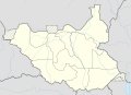 Your South Sudan location map showing the Eastern Bieh State in the east with wrong borders of the state


- Hello! How do you know that the border in the location map is wrong and in 28 States of South Sudan.png correct, not vice versa? NNW (talk) 16:43, 14 August 2016 (UTC)
- NordNordWest Oh sorry. Your map is correct, thank you for being vigilant. But that means the first map in the gallery being used to show all the new sates is incorrect. Can you please upload a new map showing new states with correct boundaries of Eastern Bieh state? Thank you. DinoBambinoNFS (talk) 17:21, 14 August 2016 (UTC)
- User:Aotearoa is still active. It is always easier for the original uploader to correct a file. NNW (talk) 17:24, 14 August 2016 (UTC)
- Thanks for that. But there is one more request that maybe you can solve. The region maps of Equatoria, Bahr el Ghazal and Greater Upper Nile cover the old states. Can you create maps with the regions covering the new states? DinoBambinoNFS (talk) 17:31, 14 August 2016 (UTC)
- User:Aotearoa is still active. It is always easier for the original uploader to correct a file. NNW (talk) 17:24, 14 August 2016 (UTC)
- NordNordWest Oh sorry. Your map is correct, thank you for being vigilant. But that means the first map in the gallery being used to show all the new sates is incorrect. Can you please upload a new map showing new states with correct boundaries of Eastern Bieh state? Thank you. DinoBambinoNFS (talk) 17:21, 14 August 2016 (UTC)
Please reply whether you will create the maps for the regions or not. I know you would have read my message. Whether you want to or don't want to make them it's ok. But at least please reply and don't leave me in a limbo of uncertainty. DinoBambinoNFS (talk) 18:53, 15 August 2016 (UTC)
- Limbo? Really? But yes: I can do it. NNW (talk) 08:10, 16 August 2016 (UTC)
- NNW (talk) 08:40, 16 August 2016 (UTC)
Thank you very much for your help. DinoBambinoNFS (talk) 20:22, 16 August 2016 (UTC)
Please create a map highlighting Greater Pibor Administrative Area in the old Jonglei State edit
-
 Locator map of the old Jonglei State before creation of new states

_location_map.svg)
![[3]](https://en.wikipedia.org/wiki/File:Rif_Dimashq_in_Syria_(%2BGolan_hatched).svg)
Hello again NNW. I would like to make one more request to you. The request is about making a new map highlighting the erstwhile Greater Pibor Administrative Area which existed before the creation of new states. The area existed in the old and larger Jonglei State in South Sudan but was dissolvd and replaced by Boma State after new states were created.
I submitted a request for this in Map Workshop but no one responded. So I came to you as it's your map that is to be used. Greater Pibor existed from 2014 - 2015 as a semi-autonomous area under the former lower eastern parts of Jonglei State before creation of new states and was replaced by Boma State after creation of the new states. Here's 2 sources I found whose image maps you can use as a reference to draw Greater Pibor region :
I hope you will create a map of the area. Please draw the map from the locator map I've given above highlighting the old Jonglei state and use a different color to highlight Greater Pibor. I will be highly obliged. Thank you. DinoBambinoNFS (talk) 21:53, 16 August 2016 (UTC)
- You requested this map at the Graphics Lab just three days ago. It is summer, lots of users have got their vacations, everything takes some time. NNW (talk) 08:34, 17 August 2016 (UTC)
- The last time I made a request, nobody even replied for more than 2 weeks and when they did, they did so only because I submitted to one user a personal request. Not just that, the graphists actually replied to other requests in the time frame of more than 2 weeks when my request was unanswered. I don't want that to happen again. So I've asked you. It gets really tiring being in uncertainty for so long. Please create the region map if you can. DinoBambinoNFS (talk) 12:48, 17 August 2016 (UTC)
It's now almost a week since I put the request on Workshop and nobody has even responded. I can't keep waiting forever. Therefore I'm asking you to create it. DinoBambinoNFS (talk) 06:24, 20 August 2016 (UTC)
Will you please reply already? DinoBambinoNFS (talk) 13:26, 20 August 2016 (UTC)
- I already answered your request from four days ago, no need to edit again and again here or at de:wp. It is senseless to demand that anyone has to react to your requests or questions immediately, Wikipedia is a hobby and in my hobby I decide when to do what. This is not my preferred way to communicate. I'd suggest you give my disc a wide berth from now on. NNW (talk) 17:07, 20 August 2016 (UTC)
- Wait, when did I demand immediate reaction from you or anyone? If you didn't notice already, my request at Map Workshop has been unanswered for a week and at your talk page for 4 days. And the last time it was unanswered on Workshop for more than 2 weeks. That is not immediate in any way. It's a very long time for a request. I can wait, but I can't wait for ages. You seem to be frustrated in your comment just because I asked you to reply. Can you imagine how I feel, the confusion etc because nobody cares to even say yes or no?
- Wikipedia is a place for sharing information and that's what I intended to do by making the request. I asked you because I thought nobody would reply on Map Workshop as usual. I thought you were a good editor who cared about helping others and making articles better. But if you are going to tell me off because I simply because I ask you to reply, then fine. I am not going to ask for any assistance from you again. Good day. DinoBambinoNFS (talk) 18:06, 20 August 2016 (UTC)
But I do ask you create this map since I've requested it. I have waited for too long. In actual I've been wanting to have a map for this region created for months, even before I started using a handle. I request you to please create the map quickly. DinoBambinoNFS (talk) 18:40, 22 August 2016 (UTC)
Lebanon edit
Hi, ....I´m still working on the Lebanese villages/towns.
In that connection; the map on Beqaa Governorate is not correct; if you look at this, you will see that the Beqaa Governorate only covers about half of the size (the bottom half) of that indicated on the map in Beqaa Governorate. The northern most part is now in its own Governorate, called Baalbek-Hermel Governorate, (So Lebanon has 8 Governorates, I believe List of municipalities of Lebanon is correct, while List of cities and towns in Lebanon is not.) I wonder if you could help me fixing those maps? (I have no idea as to how to do it!) Huldra (talk) 22:33, 14 September 2016 (UTC)
- Hello! In Governorates of Lebanon it says Two new governorates have been approved but not yet implemented. Before updating any map it has to be verified with a local source (official law or map, statistics of Lebanon etc.) that the governorates have been changed. Then it will be no problem for me to update the maps. NNW (talk) 07:22, 15 September 2016 (UTC)
ArbCom 2022 Elections voter message edit
Hello! Voting in the 2022 Arbitration Committee elections is now open until 23:59 (UTC) on Monday, 12 December 2022. All eligible users are allowed to vote. Users with alternate accounts may only vote once.
The Arbitration Committee is the panel of editors responsible for conducting the Wikipedia arbitration process. It has the authority to impose binding solutions to disputes between editors, primarily for serious conduct disputes the community has been unable to resolve. This includes the authority to impose site bans, topic bans, editing restrictions, and other measures needed to maintain our editing environment. The arbitration policy describes the Committee's roles and responsibilities in greater detail.
If you wish to participate in the 2022 election, please review the candidates and submit your choices on the voting page. If you no longer wish to receive these messages, you may add {{NoACEMM}} to your user talk page. MediaWiki message delivery (talk) 00:44, 29 November 2022 (UTC)
Seite "Buntbäuchiger Grashüpfer" edit
Hallo, da ich mich in der deutschen Wikipedia nicht an Sie wenden kann, hier der Versuch. Ich habe diese Seite nicht erstellt, ich habe lediglich einen SLA hinzugefügt, damit die Seite möglichst schnell gelöscht wird. Ich habe nicht die Absicht, die Wikipedia zu vandalisieren, ich revertiere viele unsinnige Bearbeitungen. Ich hoffe Sie lesen das hier, LG. 91.137.75.69 (talk) 12:05, 27 June 2023 (UTC)
Speedy deletion nomination of Category:Luxembourg geography templates edit

A tag has been placed on Category:Luxembourg geography templates indicating that it is currently empty, and is not a disambiguation category, a category redirect, a featured topics category, under discussion at Categories for discussion, or a project category that by its nature may become empty on occasion. If it remains empty for seven days or more, it may be deleted under section C1 of the criteria for speedy deletion.
If you think this page should not be deleted for this reason you may contest the nomination by visiting the page and removing the speedy deletion tag. Liz Read! Talk! 07:39, 4 July 2023 (UTC)
ArbCom 2023 Elections voter message edit
Hello! Voting in the 2023 Arbitration Committee elections is now open until 23:59 (UTC) on Monday, 11 December 2023. All eligible users are allowed to vote. Users with alternate accounts may only vote once.
The Arbitration Committee is the panel of editors responsible for conducting the Wikipedia arbitration process. It has the authority to impose binding solutions to disputes between editors, primarily for serious conduct disputes the community has been unable to resolve. This includes the authority to impose site bans, topic bans, editing restrictions, and other measures needed to maintain our editing environment. The arbitration policy describes the Committee's roles and responsibilities in greater detail.
If you wish to participate in the 2023 election, please review the candidates and submit your choices on the voting page. If you no longer wish to receive these messages, you may add {{NoACEMM}} to your user talk page. MediaWiki message delivery (talk) 00:33, 28 November 2023 (UTC)
Seasons Greetings! edit

.JPG)

Hello there, thanks for all of your contributions to Wikipedia! Wishing you a Very Merry Christmas and here's to a happy and productive 2024! ♦ Dr. Blofeld 20:22, 18 December 2023 (UTC)