| This article is rated Stub-class on Wikipedia's content assessment scale. It is of interest to the following WikiProjects: | |||||||||||||||||||||
| |||||||||||||||||||||


 | It is requested that an image or photograph of individual peaks in the Kaweah peaks be included in this article to improve its quality. Please replace this template with a more specific media request template where possible.
The Free Image Search Tool or Openverse Creative Commons Search may be able to locate suitable images on Flickr and other web sites. |
Photo edit
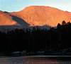
I am afraid that the picture does not depict the Kaweah Peaks Ridge, for the most part anyways. I am very certain about that. It is a view of a section of the Great Western Divide as seen from the High Sierra Trail about 1 mile east of the Mehrten Creek crossing. From this place, the Kaweah Peaks Ridge is located behind the Great Western Divide. Only on the far left the Black Kaweah (13765') is visible and just to the right, barely visible, is the Red Kaweah with its two peaks. The remaining peaks belong to the Great Western Divide. From the left: Eagle Scout Peak (12040') appearing just a tiny bit higher than the Black Kaweah. The next three peaks are unnamed. In the center of the picture is Lippincott Mountain (12265') and the prominent peak on the right side is Mt. Eisen (12160'). Theschenks 10:18, 12 February 2007 (UTC)
- Can anyone confirm if the current photo is of the peaks named in its caption, or does the note above still apply? --Justin (talk) 01:22, 28 January 2008 (UTC)
- I believe Theschenks is correct. These do not represent the Kaweah Peaks. This photo looks more like the southern most Great Western Divide.Naturespace (talk) 21:15, 9 April 2008 (UTC)
- Definitely not the Kaweahs. — Preceding unsigned comment added by 72.219.152.177 (talk) 20:43, 25 February 2012 (UTC)
Good question edit
Good question, as the Kaweah Ridge runs rough northwest -- southeast. I checked the map of Sequoia I picked up back when I lived there. Been a few, but where's the "orange lump" (copyrighted image here) of Mount Kaweah?
One copyrighted image lives here, another good one here, with the "broken up" Red Kaweah quite prominent.