Kolinec (German: Kolinetz) is a market town in Klatovy District in the Plzeň Region of the Czech Republic. It has about 1,500 inhabitants.
Kolinec | |
|---|---|
 Town square | |
 Flag  Coat of arms | |
 Kolinec Location in the Czech Republic | |
| Coordinates: 49°17′57″N 13°26′12″E / 49.29917°N 13.43667°E | |
| Country | |
| Region | Plzeň |
| District | Klatovy |
| First mentioned | 1290 |
| Area | |
| • Total | 48.72 km2 (18.81 sq mi) |
| Elevation | 545 m (1,788 ft) |
| Population (2023-01-01)[1] | |
| • Total | 1,474 |
| • Density | 30/km2 (78/sq mi) |
| Time zone | UTC+1 (CET) |
| • Summer (DST) | UTC+2 (CEST) |
| Postal code | 341 42 |
| Website | www |
Administrative parts edit
The villages of Bernartice, Boříkovy, Brod, Buršice, Hradiště, Javoří, Jindřichovice, Lukoviště, Malonice, Mlázovy, Podolí, Sluhov, Střítež, Tajanov, Tržek, Ujčín and Vlčkovice are administrative parts of Kolinec.
Geography edit
Kolinec is located about 15 kilometres (9 mi) southeast of Klatovy and 48 km (30 mi) south of Plzeň. It lies on the border between the Blatná Uplands and Bohemian Forest Foothills. The highest point is at 760 m (2,490 ft) above sea level. The Ostružná River flows through the market town. The Úslava River originates in the municipal territory, near the village of Lukoviště. There are several fishponds in the territory.
History edit
The first written mention of Kolinec is from 1290. It was probably founded as a settlement of gold panners. Until the mid-14th century, it was owned by Bohemian queens, then it was granted to the Lords of Velhartice. In 1506, Kolinec became property of Zdeněk Lev of Rožmitál, during whose reign great development occurred.[2]
Demographics edit
|
|
| ||||||||||||||||||||||||||||||||||||||||||||||||||||||
| Source: Censuses[3][4] | ||||||||||||||||||||||||||||||||||||||||||||||||||||||||
Transport edit
Kolinec lies on the regional railway line heading from Klatovy to Horažďovice.[5]
Sights edit
The Church of Saint James the Great was originally a fortified Romanesque church from the end of the 12th century. It was baroque rebuilt in 1727–1730 and in 1749–1755, but it retained its Romanesque core. The tower was added in 1854.[6]
The Church of Saint John the Baptist is Mlázovy is an early Gothic building from the first half of the 14th century.[7]
In the territory of Kolinec, there are several small castles that once served as aristrocratic residences and are now cultural monuments.
Notable people edit
- Johann Král (1823–1912), musician
Twin towns – sister cities edit
 Tápiószentmárton, Hungary
 Zemianska Olča, Slovakia
Gallery edit
-
 Mlázovy Castle
 -
 Jindřichovice Castle
 -
 Church of Saint James the Great
 -
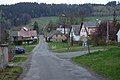 The village of Podolí
.jpg)
.jpg)


References edit
- ^ "Population of Municipalities – 1 January 2023". Czech Statistical Office. 2023-05-23.
- ^ "Podrobná historie Kolince" (in Czech). Městys Kolinec. Retrieved 2022-12-10.
- ^ "Historický lexikon obcí České republiky 1869–2011 – Okres Klatovy" (in Czech). Czech Statistical Office. 2015-12-21. pp. 15–16.
- ^ "Population Census 2021: Population by sex". Public Database. Czech Statistical Office. 2021-03-27.
- ^ "Detail stanice Kolinec" (in Czech). České dráhy. Retrieved 2023-07-05.
- ^ "Kostel sv. Jakuba Většího" (in Czech). National Heritage Institute. Retrieved 2022-12-10.
- ^ "Kostel sv. Jana Křtitele" (in Czech). National Heritage Institute. Retrieved 2022-12-10.
- ^ "Základní údaje" (in Czech). Městys Kolinec. Retrieved 2021-04-04.