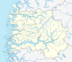
Borgund is a small village in Lærdal Municipality in Sogn og Fjordane county, Norway. It lies along the European route E16 highway, about 20 kilometres (12 mi) southeast of the village of Lærdalsøyri. It is the site of the Borgund Church and the historic Borgund Stave Church. Historically, the village was part of the old Borgund Municipality which existed from 1864 until its dissolution in 1964.[2]
Borgund | |
|---|---|
Village | |
 View of the village churches | |
| Coordinates: 61°02′55″N 7°48′49″E / 61.0487°N 7.8135°E | |
| Country | Norway |
| Region | Western Norway |
| County | Sogn og Fjordane |
| District | Sogn |
| Municipality | Lærdal Municipality |
| Elevation | 404 m (1,325 ft) |
| Time zone | UTC+01:00 (CET) |
| • Summer (DST) | UTC+02:00 (CEST) |
| Post Code | 6888 Borgund |
Name edit
The municipality (originally the parish) was named after the old Borgund farm (Old Norse: Borgyndr), where the historic Borgund Stave Church is located. The name is derived from the old word Borg meaning "fortress" or "stronghold".[3]
References edit
- ^ "Borgund, Lærdal (Sogn og Fjordane)". yr.no. Retrieved 2019-09-29.
- ^ Askheim, Svein, ed. (2019-05-24). "Borgund". Store norske leksikon (in Norwegian). Kunnskapsforlaget. Retrieved 2019-09-29.
- ^ Rygh, Oluf (1919). Norske gaardnavne: Nordre Bergenhus amt (in Norwegian) (12 ed.). Kristiania, Norge: W. C. Fabritius & sønners bogtrikkeri. p. 74.

