Talk:Alon (Israeli settlement)
| Warning: active arbitration remedies The contentious topics procedure applies to this article. This article is related to the Arab–Israeli conflict, which is a contentious topic. Furthermore, the following rules apply when editing this article:
Editors who repeatedly or seriously fail to adhere to the purpose of Wikipedia, any expected standards of behaviour, or any normal editorial process may be blocked or restricted by an administrator. Editors are advised to familiarise themselves with the contentious topics procedures before editing this page.
|


"Samaria"? edit
I wonder, is there really a reliable source for the claim that a part of the West Bank is called "Samaria"? To me, it appears to be Israel-specific (and thus POV) terminology. I suggest simply "The northern part of the West Bank". MeteorMaker (talk) 10:12, 17 February 2009 (UTC)
- yes - the article uses terminology which is used here. NoCal100 (talk) 15:03, 17 February 2009 (UTC)
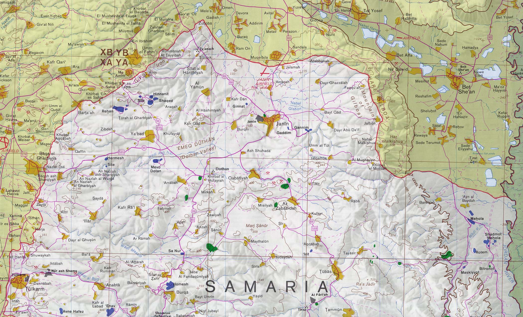
- That map is a bilingual map, showing what the areas are called locally (and it has never been in question that the area is called "Samaria"/"Shomron" by Israelis). The CIA, the organization that issued the map 15 years ago, never uses the term "Samaria" (see for yourself in their online archive, so it's clearly a misrepresentation of the purpose of the map to claim that the CIA uses this Israel-specific terminology. Here's another example of a bilingual map, you would not use that to claim that "Exhibition Center" is a Chinese word. MeteorMaker (talk) 15:58, 17 February 2009 (UTC)
Extended-confirmed-protected edit request on 2 November 2021 edit
This edit request to Alon, Mateh Binyamin has been answered. Set the |answered= or |ans= parameter to no to reactivate your request. |
This statement must be deleted because it is not true: According to ARIJ, Israel confiscated 328 dunams of land from the Palestinian town of 'Anata in order to construct Alon.[4]
The ARIJ organization is a political lobby that presents propaganda, not historical fact. The reference is not a reliable source of historical information and the statement in the wikipedia article is false. Israel did not "confiscate" land from Anata in order to construct Alon. Anata is (and was) a small city just east of Jerusalem and Alon is located ten kilometers away. Prior to the establishment of Alon, it was an empty desert area, zoned for Israeli housing.
Even prior to the Six Day War in 1967, when Jordan controlled the area, the site of Alon was an empty desert area. You can see these facts on this map: https://upload.wikimedia.org/wikipedia/commons/thumb/2/23/Jordan_%28including_West_Bank%29_1955.png/375px-Jordan_%28including_West_Bank%29_1955.png Just east of Jerusalem is the small city of Anata and the site where Alon is located is ten km to the east of that - an empty, uninhabited area - not a part of Anata at all.
Israel gained control of the area in 1967 and Alon was founded 23 years later in 1990. Nothing was confiscated "in order to construct" Alon.The statement is factually wrong and very misleading. Deb754 (talk) 17:44, 2 November 2021 (UTC)
- No to all parts of this. ARIJ is fine to use as an attributed source, and that there was nothing built on the land does not mean the land was not in the town. Israel "gained control" of the territory and holds it under belligerent occupation. nableezy - 17:59, 2 November 2021 (UTC)
Before 1967 Jordan expanded massively the municipal boundaries of Anata, but it was a future plan and was never implemented. And when Jordan lost control of the area and Israel gained control the plan for that area changed again. — Preceding unsigned comment added by Deb754 (talk • contribs) 15:17, 3 November 2021 (UTC)
- We dont edit these articles based on what we know but based on what we can source. ARIJ is perfectly fine to use as an attributed source. If you have some conflicting sources please bring them. nableezy - 19:08, 3 November 2021 (UTC)
Move discussion in progress edit
There is a move discussion in progress on Talk:Susya, Har Hevron which affects this page. Please participate on that page and not in this talk page section. Thank you. —RMCD bot 05:02, 7 April 2023 (UTC)
Move discussion in progress edit
There is a move discussion in progress on Talk:Susya, Har Hevron which affects this page. Please participate on that page and not in this talk page section. Thank you. nableezy - 05:11, 7 April 2023 (UTC)