Søm is a district in the city of Kristiansand in Agder county, Norway. With a population of about 9,500 (2022), it is the third largest district in Kristiansand. The district is a part of the borough of Oddernes. Søm has borders with the district of Hånes to the north, the district of Randesund to the east and south, and the Topdalsfjorden to the west. Søm is the second most wealthy district in Kristiansand after Lund.[2] Søm Church is located in the district.
District Søm | |
|---|---|
District of Kristiansand | |
View of the district | |
 Coat of arms | |
 | |
| Coordinates: 58°09′09″N 8°03′32″E / 58.1524°N 08.0590°E | |
| Country | Norway |
| Region | Southern Norway |
| County | Agder |
| Municipality | Kristiansand |
| Borough | Oddernes |
| Elevation | 80 m (260 ft) |
| Population (2014) | |
| • Total | 9,000 |
| Time zone | UTC+01:00 (CET) |
| • Summer (DST) | UTC+02:00 (CEST) |
| ISO 3166 code | NO-030112 |
| Website | kristiansand.kommune.no |
Neighbourhoods edit
- Bliksheia
- Elgstien
- Fuglevika
- Gudbranslia
- Haumyrheia
- Kjelleviktoppen
- Knarreviktoppen
- Knarrevikveien
- Korsvik vest
- Korsvik øst
- Liane
- Nordlia
- Rona
- Strømme
- Strømsdalen
- Søm
- Søm øst
- Sømslia
- Torsvik
- Vardåsen
Transportation edit
| Line | Destination [3] |
|---|---|
| M3 | Søm – Slettheia |
| A3 | Søm – Kvadraturen |
| N3 | Søm – Slettheia |
| 08 | Rona – Randesund |
| 17 | Tømmerstø – Hellemyr |
| 17 | Tømmerstø-Frikstad – Hellemyr |
| N17 | Tømmerstø – Kvadraturen |
| 18 | Tømmerstø Odderhei-Holte – Hellemyr |
| 18 | Dvergsnes – Hellemyr |
| A18 | Tømmerstø Odderhei-Holte – E.g.-Sykehuset |
| N17 | Tømmerstø – Kvadraturen |
| 139 | Høvåg-Lillesand – Kristiansand |
| 266 | Søm – Kristiansand Cathedral School |
Media gallery edit
-
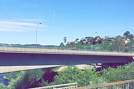 North of Søm seen from Varodd Bridge
 -
 Nordlia
 -
 Rona senter
 -
 Strømsdalen
 -
 Gudbrandslia
 -

-
 Østbyen Dagsenter, Strømme
 -
 Doctor clinic at Søm
 -
 Vardåsveien
 -
 Torsvikkleiva
 -
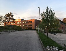 Haumyrheia Junior High
 -
 Rødhettes vei


References edit
- ^ "Søm, Kristiansand (Vest-Agder)". yr.no. Retrieved 22 February 2017.
- ^ "Befolkning i Kristiansand". ssb.no. Retrieved 1 January 2014.
- ^ "AKT".
This Agder location article is a stub. You can help Wikipedia by expanding it. |