Puerto Rico Highway 864 (PR-864) is an east–west road located in the municipality of Bayamón in Puerto Rico.[2] Located south of PR-2, the entire road is located in Hato Tejas barrio and is 2.1 km (1.3 mi) in length.[1] This route intersects with PR-2 at its eastern and western termini.
Highway 864 | ||||
|---|---|---|---|---|
| Ruta 864 | ||||
| Route information | ||||
| Maintained by Puerto Rico DTPW | ||||
| Length | 2.1 km[1] (1.3 mi) | |||
| Major junctions | ||||
| West end | ||||
| East end | ||||
| Location | ||||
| Country | United States | |||
| Territory | Puerto Rico | |||
| Municipalities | Bayamón | |||
| Highway system | ||||
| ||||

Route description edit
Puerto Rico Highway 864 has a single lane per direction in the entire length and provides access to several neighborhoods of the western area of Bayamón.[3] It begins at PR-2 in western Hato Tejas barrio and heads to the east, where meets with PR-862. After PR-862 intersection, PR-864 continues to the east, passing through few neighborhoods until its end at PR-2 in eastern Hato Tejas.[4]
-
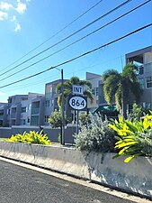
 Sign for PR-864 in Hato Tejas barrio, looking east
 -
 PR-2 west near PR-864 intersection in Hato Tejas barrio
 -
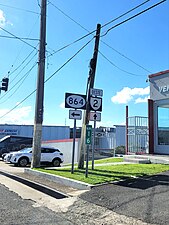 PR-2 west at PR-864 intersection in Hato Tejas barrio

.jpg)
.jpg)
History edit
Before its current numerical designation, the entire length of PR-864 belonged to an original segment of PR-2 prior to its current deviation and widening.[5] The current numerical designation corresponds to the 1953 Puerto Rico highway renumbering, a process implemented by the Puerto Rico Department of Transportation and Public Works (Spanish: Departamento de Transportación y Obras Públicas) that increased the insular highway network to connect existing routes with different locations around Puerto Rico.
Major intersections edit
The entire route is located in Hato Tejas, Bayamón.
| km[1] | mi | Destinations | Notes | ||
|---|---|---|---|---|---|
| 0.0 | 0.0 | Western terminus of PR-864; access to Toa Baja, Arecibo and San Juan | |||
| 0.4 | 0.25 | Northern terminus of PR-862 | |||
| 2.1 | 1.3 | Eastern terminus of PR-864; PR-2 east exit and entrance; access to Bayamón and San Juan | |||
| 1.000 mi = 1.609 km; 1.000 km = 0.621 mi | |||||
See also edit
References edit
- ^ a b c Google (29 February 2020). "PR-864" (Map). Google Maps. Google. Retrieved 29 February 2020.
- ^ National Geographic Maps (2011). Puerto Rico (Map). 1:125,000. Adventure Map (Book 3107). Evergreen, Colorado: National Geographic Maps. ISBN 978-1566955188. OCLC 756511572.
- ^ "Tránsito Promedio Diario (AADT)". Transit Data (Datos de Transito) (in Spanish). DTOP PR. p. 133. Archived from the original on 1 April 2019.
- ^ "Carretera 864, Bayamón, Puerto Rico". pr.geoview.info. Retrieved 7 February 2020.
- ^ "Bayamón, Memoria Núm. 24" (PDF). Puerto Rico Planning Board (in Spanish). 1952. Retrieved 14 August 2023.
External links edit
 Media related to Puerto Rico Highway 864 at Wikimedia Commons
This Puerto Rico road-related article is a stub. You can help Wikipedia by expanding it. |