Espino is a barrio in the municipality of Lares, Puerto Rico. Its population in 2010 was 1,695.[3][4][5]
Espino | |
|---|---|
Barrio | |
 Espino barrio, coming from Caballito Sector, Lares, PR-435 junction with PR-124 | |
 Location of Espino barrio within the municipality of Lares shown in red | |
 Espino | |
| Coordinates: 18°16′31″N 66°53′59″W / 18.275371°N 66.89971°W[1] | |
| Commonwealth | |
| Municipality | |
| Area | |
| • Total | 3.19 sq mi (8.3 km2) |
| • Land | 3.19 sq mi (8.3 km2) |
| • Water | 0 sq mi (0 km2) |
| Elevation | 1,460 ft (450 m) |
| Population (2010) | |
| • Total | 1,695 |
| • Density | 531.3/sq mi (205.1/km2) |
| Source: 2010 Census | |
| Time zone | UTC−4 (AST) |
History edit
Espino was in Spain's gazetteers[6] until Puerto Rico was ceded by Spain in the aftermath of the Spanish–American War under the terms of the Treaty of Paris of 1898 and became an unincorporated territory of the United States. In 1899, the United States Department of War conducted a census of Puerto Rico finding that the population of Espino barrio was 1,148.[7]
| Census | Pop. | Note | %± |
|---|---|---|---|
| 1900 | 1,148 | — | |
| 1910 | 1,199 | 4.4% | |
| 1920 | 1,117 | −6.8% | |
| 1930 | 1,298 | 16.2% | |
| 1940 | 1,210 | −6.8% | |
| 1950 | 1,454 | 20.2% | |
| 1960 | 1,481 | 1.9% | |
| 1970 | 1,407 | −5.0% | |
| 1980 | 1,638 | 16.4% | |
| 1990 | 1,591 | −2.9% | |
| 2000 | 1,932 | 21.4% | |
| 2010 | 1,695 | −12.3% | |
| U.S. Decennial Census 1899 (shown as 1900)[8] 1910-1930[9] 1930-1950[10] 1980-2000[11] 2010[12] | |||
Sectors edit
Barrios (which are, in contemporary times, roughly comparable to minor civil divisions)[13] and subbarrios,[14] in turn, are further subdivided into smaller local populated place areas/units called sectores (sectors in English). The types of sectores may vary, from normally sector to urbanización to reparto to barriada to residencial, among others.[15][16][17]
The following sectors are in Espino barrio:[18]
Arco Iris, Berrocal, Camino Caballito, Camino David González, Camino Emau, Camino Herminio Hernández, Camino Julito Nieves, Carmelo Mercado, Copa de Oro, Demetrio Otaño, El Maná, Las Lajas, Los Adames, Los Chayotes, Los Luciano, Los Otaño, Parcelas Tabonuco, Sector Ceiba, Sector Cheíto Vega, Sector Justo Malo, Sector La Cabaña, Sector Mameyes, Sector Milito Méndez, Sector Oliver, Sector Raty Guivas, Sector Tellado, Sector Toño Vega, Sector Trofy Lares, Tramo Carretera 124 (Lado este desde la Ferretería Los Muchachos hasta la residencia del señor Juanma Collazo), Tramo Carretera 124 (Parte oeste desde el negocio Rincón de los Trovadores hasta el Garage de Pepito Collazo), Tramo Carretera 436, and Urbanización Brisas de Lares.
Gallery edit
-
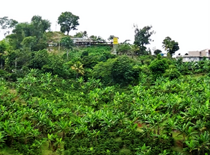
 Vegetation in Espino barrio, Lares; view from PR-435 near PR-124 junction.
 -
 Homes in Espino barrio, Lares; view from PR-435 near PR-124 junction.


See also edit
References edit
- ^ a b "US Gazetteer 2019". US Census. US Government.
- ^ U.S. Geological Survey Geographic Names Information System: Espino barrio
- ^ Picó, Rafael; Buitrago de Santiago, Zayda; Berrios, Hector H. Nueva geografía de Puerto Rico: física, económica, y social, por Rafael Picó. Con la colaboración de Zayda Buitrago de Santiago y Héctor H. Berrios. San Juan Editorial Universitaria, Universidad de Puerto Rico,1969.
- ^ Gwillim Law (20 May 2015). Administrative Subdivisions of Countries: A Comprehensive World Reference, 1900 through 1998. McFarland. p. 300. ISBN 978-1-4766-0447-3. Retrieved 25 December 2018.
- ^ Puerto Rico: 2010 Population and Housing Unit Counts.pdf (PDF). U.S. Dept. of Commerce, Economics and Statistics Administration, U.S. Census Bureau. 2010.
- ^ "Anuario del comercio, de la industria, de la magistratura y de la administración. 1881". Biblioteca Nacional de España (in Spanish). p. 1614. Retrieved 4 April 2023.
- ^ Joseph Prentiss Sanger; Henry Gannett; Walter Francis Willcox (1900). Informe sobre el censo de Puerto Rico, 1899, United States. War Dept. Porto Rico Census Office (in Spanish). Imprenta del gobierno. p. 160.
- ^ "Report of the Census of Porto Rico 1899". War Department Office Director Census of Porto Rico. Archived from the original on July 16, 2017. Retrieved September 21, 2017.
- ^ "Table 3-Population of Municipalities: 1930 1920 and 1910" (PDF). United States Census Bureau. Archived (PDF) from the original on August 17, 2017. Retrieved September 21, 2017.
- ^ "Table 4-Area and Population of Municipalities Urban and Rural: 1930 to 1950" (PDF). United States Census Bureau. Archived (PDF) from the original on August 30, 2015. Retrieved September 21, 2014.
- ^ "Table 2 Population and Housing Units: 1960 to 2000" (PDF). United States Census Bureau. Archived (PDF) from the original on July 24, 2017. Retrieved September 21, 2017.
- ^ Puerto Rico: 2010 Population and Housing Unit Counts.pdf (PDF). U.S. Dept. of Commerce Economics and Statistics Administration U.S. Census Bureau. 2010. Archived (PDF) from the original on 2017-02-20. Retrieved 2019-08-02.
- ^ "US Census Barrio-Pueblo definition". factfinder.com. US Census. Archived from the original on 13 May 2017. Retrieved 5 January 2019.
- ^ "P.L. 94-171 VTD/SLD Reference Map (2010 Census): Lares Municipio, PR" (PDF). www2.census.gov. U.S. DEPARTMENT OF COMMERCE Economics and Statistics Administration U.S. Census Bureau. Archived (PDF) from the original on 22 August 2020. Retrieved 22 August 2020.
- ^ "Agencia: Oficina del Coordinador General para el Financiamiento Socioeconómico y la Autogestión (Proposed 2016 Budget)". Puerto Rico Budgets (in Spanish). Retrieved 28 June 2019.
- ^ Rivera Quintero, Marcia (2014), El vuelo de la esperanza: Proyecto de las Comunidades Especiales Puerto Rico, 1997-2004 (first ed.), San Juan, Puerto Rico Fundación Sila M. Calderón, ISBN 978-0-9820806-1-0
- ^ "Leyes del 2001". Lex Juris Puerto Rico (in Spanish). Retrieved 24 June 2020.
- ^ "PRECINTO ELECTORAL LARES 053" (PDF). Comisión Estatal de Elecciones (in Spanish). PR Government. 14 June 2019. Archived from the original (PDF) on 22 June 2020. Retrieved 19 June 2019.
This Lares, Puerto Rico location article is a stub. You can help Wikipedia by expanding it. |