Saathain | |
|---|---|
 Saathain's Coat of Arms | |
 Saathain Approximate location of Saathain in Germany | |
| Coordinates: 51°27′50″N 13°27′53″E / 51.46389°N 13.46472°E | |
| Country | |
| Bundesland | |
| District or Landkreis | |
| Municipality | |
| Elevation | 90 m (300 ft) |
| Population (2018) | |
| • Total | 486 |
| Time zone | UTC+1 (CET) |
| Area code | 03533 |
Saathain, with a population of 516, is a Village (Ortsteil) of the municipality of Röderland in the Elbe-Elster district of southern Brandenburg. It is located next to the mouth of the Große Röder into the Black Elster, on the southern border of the Lower Lusatian Heath Nature Park.[Note 1][1]
The first documented mention of the village dates back to 1140 in a contract between Udo I. of Thuringia and Conrad, Margrave of Meissen. Due to the settlement of several puppeteer families in the 19th century, Saathain is considered the cradle of the Saxon traveling marionette theater. On October 26, 2003, Saathain and the surrounding villages of Haida, Reichenhain, Stolzenhain, Wainsdorf, Würdenhain and the municipality's future seat of government, Prösen, formed the municipality of Röderland.[2] The former Saathain Castle is one of the cultural centers of the municipality and the district of Elbe-Elster, hosting numerous concerts and exhibitions. Today, the grounds include a rose garden with around 5,000 rose bushes, a 17th century church (see: Gutskirche Saathain) and a summer café built on the foundations of Saathain Castle, which was destroyed in 1945.
Geography
editSaathain is located in the north of Röderland, about five kilometers southeast of Prösen, the municipality's seat of government. The Große Röder flows into the Black Elster about 1 Kilometer northwards of the center of Saathain. Overall, it is located at the southern border of the Lower Lusatian Heath Nature Park, which covers an area of 484 square kilometres (187 sq mi) 484 square kilometres in the districts of Elbe-Elster and Oberspreewald-Lausitz.[3][4] The village is surrounded by Elsteraue II, one of the three subdivisions of the Elsteraue landscape conservation area (officially a Landschaftsschutzgebiet), which covers a total of around 6011 hectares. One of the conservation purposes of the landscape conservation area is "the preservation of the area due to its particular importance for natural recreation in the area of the spa town of Bad Liebenwerda."[5]

Geology
editSaathain is located in the Breslau-Magdeburg glacial valley (see also: Urstromtal), which reaches its narrowest point a few kilometers to the east in the lowlands of the Schraden region between Elsterwerda and Merzdorf at a width of seven kilometers before it swings to the northwest. Today's landscape is largely shaped by the penultimate ice age. A layer of sand and gravel several hundred meters thick covers the crystalline bedrock, which was created by the Variscan orogeny that took place in the Saxothuringian region.[6][7]
Climate
editWith its humid climate, Saathain lies in the cool-temperate climate zone, although there is a noticeable transition to a continental climate. The nearest weather stations are located to the north-east in Doberlug-Kirchhain. Other relevant stations are in Torgau (30 kilometers to the west) and Oschatz (to the south-west).
-Deutschland.png)
History
editEtymology and the first documented mention
editThe first documented mention of Saathain is found on a contract signed between Udo I. of Thuringia and Conrad, Margrave of Meissen in 1140, mentioning a castle[1] (the Saathain Castle) named castrum Sathim. Later versions of the name were:
- 1197 (Uuernherus de) Satem
- 1199, 1210, 1221/22 (Wernerus de) Satem, Satim
- 1261 (Thymo de) Sathem
- 1285 Sathim
- 1289 Saten
- 1244, 1328 Satyn
- 1353 zcu dem Saten
- 1384 Sathan
- 1397 Sathen
- 1419 Sathan
- 1542 uffm Sattan
- 1555 Sathaynn, Sathan, Sahann
- 1575 Sathayn
- The current form of the name is only official since 1843.
It is possible that the castrum Sathim was built on a Slavic settlement or fortifiation and the name comes from the slavic word Zatyme, meaning "Place behind the swamp" or the Upper Sorbian tymjo or tymjenja for Swamp or River Source. Another theory suggests that the name derived from the root of the word "Seed" in the Eastphalian Language, possibly referring to seeds, the sowing, the harvested grain, or also the land overgrown with grain, the seed field or a piece of seed land. It should be noted that other fortifications in the region, such as in Wahrenbrück, Würdenhain, Liebenwerda and Elsterwerda, have german names, hence suggesting a Middle Low German (from Sāt, sate) or Middle High German (from sāze) Etymology, in both cases meaning (quiet, peaceful) place of settlement/residence.[8]
From the late Middle Ages to the Electoral Saxon Peasants' Revolt
editSaathain had one of the oldest weir systems on the Black Elster. The castle served to secure the river crossing at the nearby confluence of the Große Röder (which also defined the border to the neighboring Gau Nizizi), and also to protect and control the military and trade routes running parallel to the Black Elster. Only about one kilometer downstream, on the opposite side of the river mouth, was the Castle of Würdenhain, which was destroyed in 1442.
In addition to the Saathain village, the lordship of Saathain also included the villages of Stolzenhain (is today another part of Röderland), Mühldorf (which was, in 1935, incorporated into Kröbeln, which itself was incorporated into Bad Liebenwerda in 1996) and the original villages of Gröditz, Reppis, Schweinfurth, with their original territory, before they were incorporated into the now bigger municipality of Gröditz that exists today. The castle belonged to the Bishopric of Naumburg-Zeitz as an imperial fief until the middle of the 14th century. In 1274, Bishop Meinher von Neuenburg granted Saathain Castle to Henry the Illustrious for life. Two years later, the enfeoffment was extended to Henry's son Friedrich der Kleine (lit. 'Friedrich the Small') and his descendants.[9][10]
The noble family of Köckritz settled in Saathain from 1348. They remained in Saathain until 1475 and were followed by the Schleinitz family. At this time, the Meissen also owned the manor of Mückenberg (today incorporated into Lauchhammer as Lauchhammer-West), about twenty kilometers to the east, which was connected to Saathain via the so-called Schleinitzweg. The Meissen remained resident there until 1716 and later became extinct with the death of Hermann Otto von Schleinitz in 1891. In 1716, the Electoral Saxon Hofmarschall Woldemar von Löwendal, who had once come to Saxony under the influence of Countess Anna Constantia von Brockdorff and who had already acquired the neighboring manor of Elsterwerda to the east in 1708, acquired the manors of Saathain and Mückenberg.[11] In 1777, Saathain came into the sole possession of the Saxon cabinet minister Detlev Carl von Einsiedel. His father Johann George von Einsiedel had acquired it from the widow Löwendal in 1748.
-
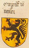
 The Köckritz' coat of arms
 -
 The Schleinitz' coat of arms
 -
 A depiction of the Meißen family's coat of arms, found in the Ingeram Codex
 -
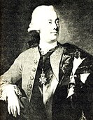 Detlev Carl von Einsiedel, by Anton Graff


At the end of August 1790, Count Einsiedel's Saathain was also affected by the Saxon Peasants' Revolt, which had begun a month earlier near Waldheim and Wechselburg and soon violently broke out in the Lommatzsch region. The rebellious peasants, who were mostly armed with scythes, pitchforks and axes, demanded, among other things, the abolition of compulsory service and interest. Some of the peasants of Saathain also rose up and wanted to summon Count von Einsiedel, who was in Bautzen at the time in his capacity as minister and exercised jurisdiction over them. However, the unrest was quelled a short time later by a detachment of dragoons who arrested four Saathain peasants and brought them to Dresden in chains. The Großenhain bailiff, who had initially come to Saathain himself to calm the rebellious peasants, reported calm in the Großenhain District on September 4, 1790, where the unrest had flared up in the dominions of Frauenhain and Zabeltitz with their associated communities as well as in Saathain itself.[12][13][14]
From the Congress of Vienna to the Second World War
editAfter the German campaign of 1813 ended the Napoleonic domination of the First French Empire over big parts of Europe, the following Congress of Vienna one year later, decided, among other things, that a German Confederation shall be created in near future, succeeding the former Holy Roman Empire (see also: Congress of Vienna#Final agreement and States of the German Confederation). The Kingdom of Saxony, where Saathain was located, became the Saxon Province of the Prussian Kingdom. With that, Saathain, lost its territories of Schweinfurth, Reppis und Gröditz. Thanks to its convenient location and the steel factory founded by Count von Einsiedel in 1779, the now-independent Gröditz quickly developed from a village counting just 150 people in 1834, to a middle-sized city peaking about 10 thousand inhabitants in the nineties.[15]
In 1852, construction work began in Zeischa (incorporated to Bad Liebenwerda, 1993), a few kilometers downstram, to regulate the Black Elster. The river, which until then had consisted of numerous small streams, was given its current bed and diked by 1861. The Röder, which previously flowed a few hundred meters behind Saathainer Castle, was diverted into the old Elster bed, known as the Alte Röder, and now flows into the new course of the Schwarze Elster.[16][17][18]
Around the same time, in the second half of the 19th century, industrialization of the region around Saathain began. The village itself, where agriculture remained the main source of income, was indirectly affected by this development. Fishing in the Röder and Schwarze Elster rivers was made largely impossible by the increasing pollution caused by the newly established industrial plants. Many inhabitants of the village found work outside Saathain, and tradesmen and politicians therefore endeavored to take this development into account. On 18 December 1908, on their initiative, the cooperative Elektrische Überlandzentrale Kreis Liebenwerda und Umgebung (lit. 'Interregional Electrical Center, District Liebenswerda and Vicinity') was founded in the Liebenwerda restaurant Weißes Roß (lit. 'White Horse'). The Saathainer landowner Otto Bormann was elected chairman of that project's board. A few years later, the first 110 kilowatt line (see: 110-kV-Leitung Lauchhammer–Riesa) in Europe was built to connect the Lauchhammer plant with the steelworks in Gröditz and Riesa. It went into operation on January 21, 1912. A 15 kilowatt line was branched off at the Gröditz switching station via Prösen to Stolzenhain, which was the first municipality in the Liebenwerda district to receive electricity on June 25, 1912. From there, cables were laid further into the surrounding villages, meaning that Saathain also received an electricity connection in the same year.[19][20][21]

Four years later, the Große Röder was regulated (straightened) by the Röderregulierungsgenossenschaft Saathain (lit. 'Saathain Röder regulation cooperative'). Most of the construction work was carried out by prisoners of war. Since then, the course of the river has not changed.[22][23] During the Second World War, the village was spared direct combat operations. Nevertheless, the Nazi era and the war did not leave Saathain unscathed. The Saathain pastor Wolfgang Bastian, who was newly appointed in September 1934, took over a long-standing dispute with a cantor from his predecessor, who demanded additional pay, which the local church council rejected. The dispute ended with the pastor being denounced to the authorities and warned by the church authorities. After another denunciation, the pastor was arrested in March 1942 and died during interrogation by the Gestapo in Torgau.[24][25]
Towards the end of the Second World War, the Elster Bridge was destroyed on April 22, 1945 to prevent the advancing troops of the First Ukrainian Front of the Red Army from entering the town. During these days, the Saathain Castle was destroyed by a deliberate fire, which also destroyed the extensive archive with historical records and files, the art treasures stored in the castle and the old church registers of the neighboring villages of Würdenhain (with entries of baptisms, weddings and funerals from 1655 to 1812) and Stolzenhain.
From the post-war period to the present day
editThe 587 hectares of land owned by the manor belonging to the castle were divided up as part of the land reform in the Soviet occupation zone. A total of 489.91 hectares were split among 281 people in the neighbouring communities of Haida (72.83 ha), Reichenhain (124.80 ha), Saathain (181.33 ha), Stolzenhain (30.11 ha), Würdenhain (78.80 ha) and Kröbeln (2.04 ha). The destroyed Elster bridge was completely replaced after the war by a new bridge, which was rebuilt in 2003 and 2004 due to considerable damage.[26]

In the German Democratic Republic (East Germany), Saathain belonged to the state of Saxony-Anhalt until its dissolution in 1952, and after the establishment of the Bezirke until reunification in 1990 to the Bezirk Cottbus. During this time, the village was shaped by the work of mayor Heinz Dreißig, who took over the office in 1951 and held it until 1990. In 1955, work began on the expansion of Friedensstraße ('Peace Street'). Further improvements to the infrastructure followed later. A sports ground with a bowling alley and open-air theatre was built. The old schoolhouse, built in 1837, was converted into a community centre with a nurses' station and doctor's surgery. After the village school was closed in 1975, a consumers' co-operative was set up the following year in the second school building, built in 1922. The castle ruins were converted into a terrace and the old estate park into a rose garden. Extensive renovation work was undertaken on the church. In 1991, the German National Committee for Monument Protection awarded Heinz Dreißig the German Prize for Monument Protection for his services. This prize, which has been awarded since 1977 and is the highest award in this field in Germany, "is given to individuals and groups of people who dedicate themselves on a voluntary basis to the protection, care and long-term preservation of the architectural and archaeological heritage. As a rule, the achievements should be of a long-term nature and go far beyond the usual civic commitment."[27]
After the Peaceful Revolution, the Amt Röderland (see also: Amt#Germany) was formed on 15 January 1992, consisting of the municipalities of Saathain and the surrounding villages of Prösen, Reichenhain, Stolzenhain, Wainsdorf, Haida and Würdenhain (which was then a subdivision of Haida). On 26 October 2003, as part of the Municipal Area Reform in the State of Brandenburg, the villages belonging to the Amt were merged to form the independent municipality of Röderland. The villages of the municipality belonged to the district of Bad Liebenwerda until the district reform in Brandenburg in 1993, which merged with the districts of Herzberg and Finsterwalde to form the district of Elbe-Elster on 6 December 1993.[28][29]
In the 1990s, the village's infrastructure, such as roads, the kindergarten facilities and a club were largely modernised. In addition, the reconstruction of the Saathainer estate, which was used for agricultural purposes by the Landwirtschaftliche Produktionsgenossenschaft, was completed in July 2001.
Population Development
editIn 1486, 14 gardeners were counted in Saathain.[30] In 1575, there were 14 Hufners, a type of farmer, and 15 gardeners. There were 412 people residing in 63 houses, along with 27 horses, 237 cattle, 600 sheep, 12 goats and 109 pigs in 1835.[31] Following World War II and the expulsion of Germans, the population significantly grew, and reached its all-time-preak of 790 in 1946. Since then, the population number has steadily been decreasing.
| Year | Population | Year | Population | Year | Population | Year | Population | Year | Population | Year | Population | |||||
|---|---|---|---|---|---|---|---|---|---|---|---|---|---|---|---|---|
| 1835 | 412 | 1939 | 573 | 1985 | 588 | 1994 | 567 | 2000 | 605 | 2018 | 486[1] | |||||
| 1875 | 400 | 1946 | 790 | 1989 | 577 | 1995 | 569 | 2001 | 606 | 2024 | ||||||
| 1890 | 460 | 1950 | 784 | 1990 | 576 | 1996 | 575 | 2002 | 595 | |||||||
| 1910 | 500 | 1964 | 656 | 1991 | 570 | 1997 | 603 | 2009 | 535[1] | |||||||
| 1925 | 565 | 1971 | 622 | 1992 | 563 | 1998 | 615 | 2010 | 547[33] | |||||||
| 1933 | 532 | 1981 | 580 | 1993 | 561 | 1999 | 604 | 2013 | 516 |
Politics
editRepresentation on the Municipal Level
editSince the merger of Saathain with the surrounding villages of Haida, Prösen, Reichenhain, Stolzenhain, Wainsdorf and Würdenhain on October 26, 2003, the village has been a district of the municipality of Röderland. According to the municipality's main statutes, every village except for Prösen is represented by the mayor and two more elected representatives, who form a three-head village council. Prösen, the administrative center of Röderland, has a five-head council but otherwise follows the same system.[34]
2019 Election
editIn 2019, 311 (71 Percent) of the 438 eligible voters submitted 896 votes. 64 (7.14%) of the votes went towards the candidate(s) of the SPD and 832 (92.86%) chose the Free Voters Association Saathain. The votes for the Free Voters Association Saathain break down as follows:[35][36][37]
| Candidate | Votes | Notes |
|---|---|---|
| Carsten Pötzsch | 363 | Became Mayor |
| Peter Hoffmann | 196 | |
| Rene Herrmann | 142 | Was chosen |
All three seats were given to the Free Voters Association Saathain's candidates. Carsten Pötzsch became mayor and chose Rene Herrmann as his deputy.
2014 Election
editThe 2014 Election resulted in the same distribution of seats as in 2008 and Joachim Pfützner was re-elected. 306 of the 454 eligible voters (a turnout of 67,40%) submitted 899 valid votes that break down as follows:[38]
| Party | Votes |
|---|---|
| The Left | 195 (21,69%) |
| Free Voters Association Saathain | 595 (66,18%) |
| Gut Saathain Party | 109 (12,12%) |
Of the 595 votes for the Voters Association, 230 went towards Wieland Roselt and 205 went towards Carsten Pötzsch, who both got seats in the council. The only candidate of the Left Party got the third seat.
2008 Election
editOn 28 September 2008, 308 of the 462 eligible voters, submitted 889 valid and 7 invalid votes. The candidates and the number of votes they received were:[39][40][41]
| Party | Name | Birth date | Profession | Votes |
|---|---|---|---|---|
| The Left | Joachim Pfützner | 1948 | Teacher | 169 |
| Sigmar Albrecht | 1953 | Teacher | 48 | |
| Free Voters Association Saathain | Reiner Marteinsteig | 1971 | Customer Service Technician | 63 |
| Dietmar Gebel | 1951 | Graduate Mathematician | 374 | |
| Klaus-Peter Schulze | 1945 | Retired | 66 | |
| Detlef Scheibe | 1956 | Educator | 167 |
Gebel was elected mayor with Scheibe as deputy. Pfnützner was the third member of the council without an extra role.[42]
Other Elections
editWhile the statistics for bigger elections such as for the Bundestag or the European Parliament exist for the entirety of Röderland, only the listed elections are tracked village-wise.
Kultur und Sehenswürdigkeiten
edit
Kulturelle Veranstaltungen
editDas einstige Saathainer Gut ist mit den zahlreichen Konzerten und Ausstellungen eines der kulturellen Zentren der Gemeinde und des Landkreises Elbe-Elster. Seit Mai 2006 wird angeboten, sich in der historischen Fachwerkkirche standesamtlich trauen zu lassen.
Seit 1953 kommt am Ostersonntag auf dem Sportplatz des Ortes der Osterhase zu Besuch. Meist von weiteren Artgenossen begleitet, verteilt er Süßigkeiten und Ostereier an die zahlreich erscheinenden Kinder.
Ein weiterer Höhepunkt ist das Sportfest im Juli.
Vereinsleben
editSeit 1920 gibt es den Sportverein SG Röder 20. 1949 wurde der Klub in BSG Traktor Saathain umbenannt. Nach der Wiedervereinigung der beiden deutschen Staaten erfolgte 1992 die Rückbenennung. Neben der Sparte Fußball, deren erste Mannschaft gegenwärtig (2010) in der 1. Kreisklasse spielt, gibt es die Abteilungen Kegeln, Volleyball und Gymnastik.[43]
Ein weiterer aktiver Verein ist der 1996 gegründete Förderverein Gut Saathain e. V. Der zunächst als Kirche, Park und Rosengarten Saathain e. V. gegründete Verein erhielt seinen Namen im Jahre 2008. Die gegenwärtig (2010) etwa 30 Mitglieder bemühen sich um die komplexe Förderung, den Erhalt und die Entwicklung des einstigen Gutes Saathain als Kulturzentrum.[44]
Die Freiwillige Feuerwehr des Ortes wurde 1934 gegründet und sorgt seitdem für den Brandschutz und die allgemeine Hilfe. Das von 1957 bis 1959 errichtete Feuerwehrhaus befindet sich gegenüber der einstigen Dorfschule am Abzweig nach Neusaathain.[45] Ausgestattet ist die Feuerwehr gegenwärtig (2010) mit einem Löschgruppenfahrzeug 8 (kurz: LF 8).[46]
Sehenswürdigkeiten
editmini|Springbrunnen aus dem Jahr 1930 mini|Unter Denkmalschutz stehendes Wohnhaus an der Breiten Straße Der Ort hat einige Baudenkmäler, die in die Denkmalliste des Landes Brandenburg aufgenommen wurden.[47]
Der Park des einstigen Saathainer Schlosses wurde ab 1972 in einen Rosengarten mit etwa 5000 Rosenstöcken und mehr als 70 Rosenarten umgewandelt. Die Ruine des Schlosses wurde zu einer Terrasse umgestaltet, auf der sich ein Sommer-Café befindet und von der man das Areal des Gartens überblicken kann.[48]
Der aus dem Jahr 1629 stammende Fachwerkbau der ehemaligen Gutskirche des Dorfes war auf dem Standort einer urkundlich 1575 erwähnten Schlosskapelle errichtet worden. Ihre heutige Gestalt erhielt sie durch Umbauarbeiten im Jahr 1816. Seit 1968 steht die Kirche unter Denkmalschutz. Nach umfangreichen Sanierungsmaßnahmen ist sie seit 1990 wieder für die Öffentlichkeit zugänglich. Unmittelbar hinter dem Bauwerk wurde auf einer Wiese im Mai 2004 ein Skulpturenpark eröffnet. Vor der Kirche befindet sich ein Gedenkstein für den Pastor Wolfgang Bastian, der 1942 in Torgau bei Verhören durch die Gestapo ums Leben kam.[24][49]
Im einstigen Schlosspark befindet sich vor den Resten des Schlosses ein am 6. Juli 1958 eingeweihtes Denkmal in Form eines unbehauenen Granitfindlings. Ein Schild im oberen Teil trägt den Ortsnamen sowie einen Eichenbaum und eine Seerose, die an den gewässerreichen Röderwald erinnern soll. Darunter befinden sich einige chronologische Daten über die Entwicklung des Dorfes Saathain.
Auf dem Dorfplatz befindet sich ein denkmalgeschützter Springbrunnen aus dem Jahr 1930, dessen Standort sich ursprünglich vor dem Saathainer Schloss befand. 1953 erfolgte die Umsetzung auf seinem heutigen Standort auf dem Dorfplatz.[50]
In der Breiten Straße ist ein Wohnhaus mit Auszugshaus, Scheune und Wirtschaftsgebäude unter Denkmalschutz.[47]
Unter Denkmalschutz stand auch die alte Rödermühle im Süden des Ortes. Das historische Bauwerk, das 1974 den Betrieb einstellte, fiel im September 1997 einem Brand zum Opfer. Die Ruine der erstmals im 16. Jahrhundert erwähnten Wassermühle befindet sich am einstigen Flusslauf der Großen Röder in der Siedlung Neusaathain. Auf dem Gelände der Rödermühle befinden sich neben einer Baumschule eine 1998 eröffnete Galerie, ein kleiner Streichelzoo und ein Sommer-Café.[51][52][53][54]
Saathain als Wiege des sächsischen Wandermarionettentheaters
editmini|Marionettentheatersammlung Bad Liebenwerda Saathain gilt wie das Elbe-Elster-Land als eine Wiege des sächsischen Wandermarionettentheaters. Seit Anfang des 19. Jahrhunderts sind in Saathain ansässige Vertreter dieser Kunst nachgewiesen. Der erste bekannte Marionettenspieler, der sich in der Siedlung Neu-Saathain niederließ, war Johann Georg Bille († 1832). Er erwarb dort 1803 vom Saathainer Rittergutsbesitzer, dem Reichsgrafen von Solms und Tecklenburg, für 200 Taler ein Wohnhaus mit Scheune und Stallung. Bille folgten weitere Puppenspieler; die bekanntesten Saathainer Namen von Puppenspielerfamilien sind Richter (seit 1832), Gassmann, Hähnel und Gierhold. Durch Eheschließungen zwischen den einzelnen Familien erwuchsen Familienbande zwischen fast allen sächsischen Puppenspielerfamilien. Diese waren den größten Teil des Jahres auf Wanderschaft und kamen nur nach Saathain, um dort den Winter bei ihren Verwandten zu verbringen.
Mit dem Aufkommen von Kino und Fernsehen im 20. Jahrhundert kam es weitgehend zur Aufgabe der einzelnen Spielbetriebe. Jedoch haben bis in die Gegenwart einzelne Familien diese Tradition bewahrt, wie die Familie Bille, die im 18. und 19. Jahrhundert allein etwa 12 eigenständige Bühnen besaß und damit eine der wichtigsten Marionettenspielerdynastien Europas war. Eine Dauerausstellung im Bad Liebenwerdaer Kreismuseum unter dem Titel Von der Schusterahle zum Marionettenzwirn beschäftigt sich seit Dezember 1998 mit der Geschichte des Marionettentheaters im Elbe-Elster-Gebiet. Kern der Ausstellung ist eine Marionettentheatersammlung des Dobraer Puppenspielers Karl Gierhold. Einer der vier Abschnitte dieser Ausstellung im Museum ist den Saathainer Marionettenspielern gewidmet.[55][56][57][58][59][60]
Wirtschaft und Infrastruktur
editWirtschaft und Verkehr
editAm 18. April 1958 wurde die Landwirtschaftliche Produktionsgenossenschaft Neue Saat vom Typ I in Saathain gegründet. Zunächst bestand sie aus zwei landwirtschaftlichen Betrieben, die mit vier Mitgliedern 20,66 Hektar bewirtschaftete. Bereits am 9. Juni 1959 gehörten der Saathainer LPG fünf Betriebe mit neun Mitgliedern an, und die bewirtschaftete Fläche war auf 47,09 Hektar angewachsen. 1974/75 schloss sie sich mit der LPG Friedrich Engels in Stolzenhain zusammen. Der Sitz der 1991 aufgelösten Genossenschaft befand sich in Stolzenhain.[61][45]
Die Landwirtschaft hat in Saathain ihre einstige Bedeutung weitgehend verloren. Einen großen Teil der landwirtschaftlichen Flächen in der Gemeinde Röderland bewirtschaftet die 1991 aus der LPG Friedrich Engels hervorgegangene Lawi GmbH mit Sitz in Stolzenhain.[62] Im Ort sind einige mittelständische Unternehmen ansässig, wie die Baumschule Saathainer Mühle und die Bäckerei Pförtner. An der Alten Dorfstraße befindet sich das Gasthaus Zur Linde. Die dem Dorf am nächsten gelegenen Gewerbegebiete befinden sich in Elsterwerda, Haida und im ebenfalls zur Gemeinde Röderland gehörenden Prösen.[28]
Saathain ist durch Verbindungsstraßen mit der Landesstraße 59 bei Stolzenhain und an die Elsterwerda tangierenden Bundesstraßen B 101 und B 169 angebunden. Die nächstgelegenen Bahnhöfe sind Bahnhof Elsterwerda (Bahnstrecken Berlin–Dresden und Riesa–Elsterwerda) sowie Elsterwerda-Biehla (Bahnstrecke Węgliniec–Falkenberg/Elster).
Mehrere befestigte Radwege entlang der Schwarzen Elster verbinden Saathain mit den Sehenswürdigkeiten des Umlandes, dem Naturpark Niederlausitzer Heidelandschaft und der wenige Kilometer östlich gelegenen Niederung des Schradens. Mit der Tour Brandenburg führt der mit 1111 Kilometern längste Radfernweg Deutschlands am Dorf vorbei. Weitere Radrouten sind der Fürst-Pückler-Radweg, der unter dem Motto 500 Kilometer durch die Zeit in die Projektliste der Internationalen Bauausstellung Fürst-Pückler-Land aufgenommen wurde, und der 108 Kilometer lange Schwarze-Elster-Radweg.[63]
Bildung
editNach der Auflösung der Dorfschule im Jahr 1975 wurden die Kinder des Ortes zunächst in die Polytechnische Oberschule in Elsterwerda-Biehla eingeschult, aus der nach der Wende ein inzwischen wieder aufgelöstes Gymnasium und eine Grundschule hervorgingen. Gegenwärtig werden die Schüler des Ortsteils in die Grundschule Prösen eingeschult, die den Status einer Verlässlichen Halbtagesschule besitzt; Träger ist die Gemeinde Röderland.[64] In Prösen befindet sich außerdem eine private Oberschule.[65] Im unweit gelegenen Elsterwerda besteht eine Oberschule, ein Gymnasium sowie weitere Bildungseinrichtungen. Die nächstgelegenen Bibliotheken sind in Elsterwerda und Prösen.[66]
Medien
editMonatlich erscheinen in Saathain der Gemeindeanzeiger sowie das Amtsblatt für die Gemeinde Röderland. Der Kreisanzeiger des Landkreises Elbe-Elster erscheint nach Bedarf.[67]
Die regionale Tageszeitung im Elbe-Elster-Kreis ist die zur Lausitzer Rundschau gehörende Elbe-Elster-Rundschau mit einer Auflage von etwa 99.000 Exemplaren. Die kostenlosen Anzeigenblätter Wochenkurier und SonntagsWochenBlatt kommen wöchentlich heraus.
Notable People
editThe lives of the following people are associated with Saathain:
- Walther von Köckritz (* in Saathain; † 1411), Domherr von Magdeburg, Merseburg und Meißen, Bischof von Merseburg
- Samuel August Wagner (* 1734 in Saathain; † 1788 in Dresden), Doctor and Educator
- Karl Benedikt Suttinger (* 1746 in Saathain; † 1830 in Lübben), Poet and Educator
- Hans Wolfgang Bastian (* 21. Mai 1906 in Elsterwerda; † 18. März 1942 in Torgau), evangelischer Pfarrer, umgekommen bei Verhören durch die Gestapo
- Heinz Dreißig (1925–2022)[68], Mayor from 1951 to 1990, bekam 1991 vom Deutschen Nationalkomitee für Denkmalschutz für seine Verdienste den „Deutschen Preis für Denkmalschutz“ verliehen. Seit dem Jahre 2015 war Dreißig Ehrenbürger von Saathain.[69]
Literature
edit- Felix Hoffmann (1957), Arbeitsgemeinschaften der Natur- und Heimatfreunde des Deutschen Kulturbundes Kreis Bad Liebenwerda (ed.), "Über 800 Jahre liegt Saathain an der Röder", Heimatkalender für den Kreis Bad Liebenwerda, Bad Liebenwerda, pp. 63–66
- Felix Hoffmann (1960), Arbeitsgemeinschaften der Natur- und Heimatfreunde des Deutschen Kulturbundes Kreis Bad Liebenwerda (ed.), "Die steinerne Chronik von Saathain", Heimatkalender für den Kreis Bad Liebenwerda, Bad Liebenwerda, pp. 198–201
External Links
editReferences
edit- ^ a b c d "Saathain". Röderland's Website. Retrieved 2018-11-12.
- ^ ""Gebietsänderungen vom 01.01. - 31.12.2003 (Jahr)": "Territorial changes from 01.01 - 31.12.2003 (Entire Year)". [xlsx format, 123KB]". Destatis. 1 July 2007.
- ^ "Internetauftritt des Naturparks Niederlausitzer Heidelandschaft". Naturpark Niederlausitzer Heidelandschaft. Retrieved 2009-08-21.
- ^ "Schutzgebietsinformationen des Naturschutzgebietes "Forsthaus Prösa"" (PDF). Naturpark Niederlausitzer Heidelandschaft. Archived from the original (PDF-Datei; 12 kB) on 2018-11-12. Retrieved 2009-08-21.
- ^ "Verordnung über das Landschaftsschutzgebiet „Elsteraue"". Brandenburgisches Vorschriftensystem (BRAVORS). 29 April 1996. Archived from the original on 3 December 2013.
- ^ Dietmar Winkler: Zur Entstehung unserer Landschaft. In: Arbeitsgemeinschaft für Heimatkunde e. V. (Hrsg.): Heimatkalender für den Altkreis Bad Liebenwerda, das Mückenberger Ländchen, Ortrand am Schraden und Uebigau-Falkenberg – 1998. Starke und Sachse GmbH, Großenhain 1998, ISBN 3-932913-01-9, S. 207–214.
- ^ Luise Grundmann, Dietrich Hanspach (2005), Institut für Länderkunde Leipzig und der Sächsischen Akad. der Wissenschaften zu Leipzig (ed.), Der Schraden. Eine landeskundliche Bestandsaufnahme im Raum Elsterwerda, Lauchhammer, Hirschfeld und Ortrand, Köln/Weimar/Wien: Böhlau Verlag, ISBN 3-412-10900-2
- ^ Chrome, Emilia (1968). Die Ortsnamen des Kreises Bad Liebenwerda. Berlin: Akademie-Verlag, today part of De Gruyter.
- ^ Saathain auf der Homepage des Hauptstaatsarchivs Dresden[dead link]
- ^ "Gut Saathain". Amt Schradenland. Archived from the original on 8 Feb 2007.
- ^ Grundmann, Luise; Hanspach, Dietrich (2005). Written at Köln/Weimar/Wien. Der Schraden. Eine landeskundliche Bestandsaufnahme im Raum Elsterwerda, Lauchhammer, Hirschfeld und Ortrand. Leibniz-Institut für Länderkunde and Sächsische Akademie der Wissenschaften zu Leipzig: Böhlau Verlag. pp. 151–155. ISBN 3-412-10900-2.
{{cite book}}: CS1 maint: location (link) - ^ Rudolf, Matthies (1957), "Gebt Freiheit!", Heimatkalender für den Kreis Bad Liebenwerda, Bad Liebenwerda, pp. 87–92
- ^ Czok, Karl (1989), Geschichte Sachsens, Weimar: Hermann Böhlaus Nachfolger, pp. 305 ff
- ^ Matthäus Karl Fitzkow (1961), Kreismuseum Bad Liebenwerda (ed.), Zur älteren Geschichte der Stadt Liebenwerda und ihres Kreisgebietes, Bad Liebenwerda, pp. 105–107
{{citation}}: CS1 maint: location missing publisher (link) - ^ Gröditz in the Digital historical gazetteer of Saxony
- ^ Rudolf Matthies (1964), Arbeitsgemeinschaften der Natur- und Heimatfreunde des Deutschen Kulturbundes Kreis Bad Liebenwerda (ed.), "Die Elsterbrücke zwischen Haida und Würdenhain", Heimatkalender für den Kreis Bad Liebenwerda, Bad Liebenwerda, pp. 108–110
- ^ Luise Grundmann, Dietrich Hanspach (2005), Institut für Länderkunde Leipzig und der Sächsischen Akad. der Wissenschaften zu Leipzig (ed.), Der Schraden. Eine landeskundliche Bestandsaufnahme im Raum Elsterwerda, Lauchhammer, Hirschfeld und Ortrand, Köln/Weimar/Wien: Böhlau Verlag, ISBN 3-412-10900-2
- ^ Rudolf Matthies, Arbeitsgemeinschaften der Natur- und Heimatfreunde des Deutschen Kulturbundes Kreis Bad Liebenwerda (ed.), ""Wo die Röder mündet"", Heimatkalender für den Kreis Bad Liebenwerda, vol. 1965/66, Bad Liebenwerda, pp. 223–225
- ^ Chronik der Stadt Falkenberg, S. 71. (PDF; 3,9 MB)
- ^ Autorengemeinschaft (2001), Kulturamt des Landkreises Elbe-Elster (ed.), Kohle, Wind und Wasser. Ein energiehistorischer Streifzug durch das Elbe-Elsterland., Herzberg/Elster, pp. 119–126, ISBN 3-00-008956-X
{{citation}}: CS1 maint: location missing publisher (link) - ^ Jürgen Bartholomäus (1997), Heimatverein Elsterwerda und Umgebung e. V. / Heimatverein zur Erforschung der sächsischen Stahlwerke-Gröditzer Stahlwerke GmbH (ed.), "Die Masten der ersten 110-kV-Leitung Europas standen am Floßkanal", 250 Jahre Floßkanal Grödel–Elsterwerda 1748–1998, Lampertswalde
- ^ Rudolf Matthies (1964), Arbeitsgemeinschaften der Natur- und Heimatfreunde des Deutschen Kulturbundes Kreis Bad Liebenwerda (ed.), "Die Elsterbrücke zwischen Haida und Würdenhain.", Heimatkalender für den Kreis Bad Liebenwerda, Bad Liebenwerda, pp. 108–110
- ^ Wilfried Höntzsch (1997), Heimatverein Elsterwerda und Umgebung e. V. / Heimatverein zur Erforschung der sächsischen Stahlwerke-Gröditzer Stahlwerke GmbH (ed.), "Die Große Röder – eine Lebensader unserer Region", 250 Jahre Floßkanal Grödel–Elsterwerda 1748–1998, Lampertswalde
- ^ a b Erhard Galle (2010), Arbeitsgemeinschaft für Heimatkunde e. V. Bad Liebenwerda (ed.), "Wolfgang Bastian – Pfarrer, Historiker, Autor, NS-Verfolgter, von der Gestapo erledigt und von der Nachwelt vergessen?", Heimatkalender für den Altkreis Bad Liebenwerda, das Mückenberger Ländchen, Ortrand am Schraden und Uebigau-Falkenberg, no. 58, pp. 297–306, ISBN 978-3-932913-08-2
- ^ Erhard Galle (2006), "100 Jahre alt wäre Pfarrer Wolfgang Bastian am 21. Mai!", Amtsblatt für die Stadt Elsterwerda, no. 5/2006, Elsterwerda, pp. 8–9
- ^ Felix Hoffmann (1960), Arbeitsgemeinschaften der Natur- und Heimatfreunde des Deutschen Kulturbundes Kreis Bad Liebenwerda (ed.), "Die steinerne Chronik von Saathain.", Heimatkalender für den Kreis Bad Liebenwerda, Bad Liebenwerda, pp. 198–201
- ^ Internetauftritt des Deutschen Nationalkomitees für Denkmalschutz
- ^ a b "Das Extra zur Wende: Wie sich das Elbe-Elster-Land verändert hat 1989-2009". Lausitzer Rundschau. 7 November 2009. p. 19.
- ^ a b Historical Gazetteer of Brandenburg (2005) (Archived)
- ^ M. K. Fitzkow (1964), "Zwischen Röder und Neugraben", Heimatkalender für den Kreis Bad Liebenwerda, pp. 146–158
- ^ "Übersicht der Bevölkerung und des Viehstandes im Jahre 1835", Die Schwarze Elster – Unsere Heimat in Wort und Bild, no. 596, Bad Liebenwerda, pp. 8–10, 1985
- ^ "1995 Teil 2: Bevölkerung der Gemeinden 1964, 1981 und 1995 nach ausgewählten Altersgruppen zum Gebietsstand 31.12.1995". Historisches Gemeindeverzeichnis des Landes Brandenburg (in German). 1997.
- ^ "Ortsteilseite von Saathain auf der Gemeinde-Homepage von Röderland". Gemeinde Röderland. Archived from the original on 2009-03-08. Retrieved 2011-03-12.
- ^ "Hauptsatzung der Gemeinde Röderland (The main statutes of Röderland)" (PDF). 27 November 2008. p. 2.
- ^ "Kommunalwahl 2019 Ortsbeirat Saathain". ssl.ratsinfo-online.net. Retrieved 2024-07-08.
- ^ "Röderland - Gemeindevertretung und Ortsbeiräte haben sich konstituiert". www.gemeinde-roederland.de (in German). Retrieved 2024-07-08.
- ^ "Gemeinde Röderland hat neue Ortsvorsteher". www.lr-online.de (in German). Retrieved 2024-07-08.
- ^ "Kommunalwahl 2014 Ortsbeirat Saathain". ssl.ratsinfo-online.net. Retrieved 2024-07-08.
- ^ "Bekanntmachung der zugelassenen Wahlvorschläge" (PDF). Amtsblatt für die Gemeinde Röderland (9): 3. 3 September 2008.
- ^ "Wahlergebnis zur Wahl des Ortbeirates im Ortsteil Saathain" (PDF). Amtsblatt für die Gemeinde Röderland (10): 3.
- ^ "Auflistung der Ortsvorsteher der Gemeinde Röderland auf der Gemeindehomepage". Gemeinde Röderland. Archived from the original on 2013-03-11. Retrieved 2009-11-08.
- ^ "Wahl der Ortsvorsteher und ihrer Stellvertreter in den Ortsteilen der Gemeinde Röderland" (PDF). Amtsblatt für die Gemeinde Röderland (11): 1.
- ^ [dead link]
- ^ Internetauftritt des Fördervereins Gut Saathain e. V.
- ^ a b Saathain auf der Homepage des Amtes Schradenland at the Wayback Machine (archived 2007-02-08)
- ^ Die Freiwilligen Feuerwehren auf der Website der Gemeinde Röderland.
- ^ a b Denkmalliste des Landes Brandenburg: Landkreis Elbe-Elster (PDF)
- ^ Heinz Kettmann (2002), Arbeitsgemeinschaft für Heimatkunde e. V. Bad Liebenwerda (ed.), "39 Jahre Bürgermeister in Saathain", Heimatkalender für den Altkreis Bad Liebenwerda, das Mückenberger Ländchen, Ortrand am Schraden und Uebigau-Falkenberg, no. 54, pp. 129–132, ISBN 3-932913-22-1
- ^ Erhard Galle (2006), "100 Jahre alt wäre Pfarrer Wolfgang Bastian am 21. Mai!", Amtsblatt für die Stadt Elsterwerda, no. 5/2006, Elsterwerda, pp. 8–9
- ^ Georg A. Kuhlins (1980), Kreismuseum Bad Liebenwerda (ed.), Denkmale und Denkmalpflege im Kreis Bad Liebenwerda, Bad Liebenwerda, p. 40
{{citation}}: CS1 maint: location missing publisher (link) - ^ Wolfgang Bastian: Die Rödermühle. Auszug aus einer vermutlich nicht mehr vorhandenen Chronik zur Geschichte des Ortes Saathain aus dem Jahr 1941, veröffentlicht in: Die Schwarze Elster, Nr. 17 (594), 1984.
- ^ Wilfried Höntzsch (1998), Arbeitsgemeinschaft für Heimatkunde e. V. Bad Liebenwerda (ed.), "Die Rödermühle zu Saathain.", Heimatkalender für den Altkreis Bad Liebenwerda, das Mückenberger Ländchen, Ortrand am Schraden und Uebigau-Falkenberg, Bad Liebenwerda, pp. 224–234, ISBN 3-932913-01-9
- ^ Manfred Woitzik, Kulturamt des Landkreises Elbe-Elster (ed.), "Wer zuerst kommt – mahlt zuerst." Eine Kulturgeschichte der Mühlen im Landkreis Elbe-Elster, Herzberg, pp. 133–134
- ^ Homepage der Saathainer Rödermühle
- ^ Internetauftritt des Marionettentheaters Bille in Markkleeberg
- ^ Biografie von Max Curt Bille (1884–1961) in der Sächsischen Biografie
- ^ Michael Freismuth: 7. Internationales Puppentheaterfestival Landkreis Elbe-Elster, 15.–23.9. In: Unima – Mitteilungsblatt Zentrum Österreich, mit Nachrichten des Kultur- und Museumsvereins, Dezember 2005, S. 6 (Online als PDF-Datei).
- ^ Rudolf Matthies, "Puppenspieler", Heimatkalender für den Kreis Bad Liebenwerda, vol. 1965/66, Bad Liebenwerda, pp. 168–173
- ^ Kurt Bille (1996), Arbeitsgemeinschaft für Heimatkunde e. V. Bad Liebenwerda (ed.), "Saathain – Heimat der Puppenspieler", Heimatkalender für den Altkreis Bad Liebenwerda, das Mückenberger Ländchen, Ortrand am Schraden und Uebigau-Falkenberg, Bad Liebenwerda, pp. 95–104
- ^ Ralf Uschner (2003), Arbeitsgemeinschaft für Heimatkunde e. V. Bad Liebenwerda (ed.), "Von der Schusterahle zum Marionettenzwirn", Heimatkalender für den Altkreis Bad Liebenwerda, das Mückenberger Ländchen, Ortrand am Schraden und Uebigau-Falkenberg, Bad Liebenwerda, pp. 99–103
- ^ Stolzenhain auf der Gemeindehomepage von Röderland at the Wayback Machine (archived 2010-10-12)
- ^ Ortsteilseite von Stolzenhain auf der Gemeinde-Homepage von Röderland at the Wayback Machine (archived 2010-10-12)
- ^ Der Schwarze-Elster-Radweg auf magicmaps at the Wayback Machine (archived 2010-07-27)
- ^ "Schuleinzugsbereich der Gemeinde Röderland" (PDF-Datei). Gemeinde Röderland. Retrieved 2009-09-02.
{{cite web}}: Unknown parameter|archiv-bot=ignored (help) - ^ "Internetauftritt der Oberschule Prösen". Retrieved 2009-06-17.
- ^ Bildungseinrichtungen der Gemeinde Röderland at the Wayback Machine (archived 2013-06-02)
- ^ "Unterseite zum Amtsblatt und dem Gemeindeanzeiger auf der Homepage der Gemeinde Röderland". Gemeinde Röderland. Archived from the original on 2013-07-28. Retrieved 2009-09-25.
- ^ Lebensdaten: Heinz Dreißig (* 19. September 1925; † 5. Juni 2022). Danksagung. In: Wochenkurier, 13. Juli 2013, S. 6
- ^ Jürgen Weser: Die Mutigsten zeigten klasse Theater. In: Lausitzer Rundschau vom 28. Juli 2015
Cite error: There are <ref group=Note> tags on this page, but the references will not show without a {{reflist|group=Note}} template (see the help page).