 | Draft article not currently submitted for review.
This is a draft Articles for creation (AfC) submission. It is not currently pending review. While there are no deadlines, abandoned drafts may be deleted after six months. To edit the draft click on the "Edit" tab at the top of the window. To be accepted, a draft should:
It is strongly discouraged to write about yourself, your business or employer. If you do so, you must declare it. Where to get help
How to improve a draft
You can also browse Wikipedia:Featured articles and Wikipedia:Good articles to find examples of Wikipedia's best writing on topics similar to your proposed article. Improving your odds of a speedy review To improve your odds of a faster review, tag your draft with relevant WikiProject tags using the button below. This will let reviewers know a new draft has been submitted in their area of interest. For instance, if you wrote about a female astronomer, you would want to add the Biography, Astronomy, and Women scientists tags. Editor resources
Last edited by 208.59.242.53 (talk | contribs) 1 second ago. (Update) |
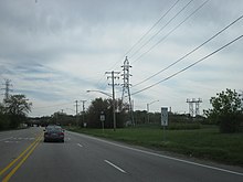
 Independence Boulevard southbound | |
| Part of | |
|---|---|
| Maintained by | the Illinois Department of Transportation |
| Length | 8.4 mi (13.5 km) |
| Location | Romeoville, Crest Hill |
| North end | |
| South end | |
Independence Boulevard is a north-south road in Romeoville and Crest Hill, Illinois. It serves as part of Illinois Route 53 and Illinois Route 7, as well as the former U.S. Route 66.
Major Intersections
editThe entire route is in Will County.
| Location | mi | km | Destinations | Notes | |
|---|---|---|---|---|---|
| Joliet–Crest Hill city line | 0.0 | 0.0 | IL 7 west (Theodore Street) / Historic US 66 south / IL 53 south (Broadway) | Southern terminus; Southern end of IL 7 concurrency; IL 53 and Historic US 66 continue south as Broadway | |
| Crest Hill | 3.0 | 4.8 | IL 7 east (9th Street) / CR 36 east (Renwick Road) | Northern end of IL 7 concurrency | |
| Romeoville | 4.2 | 6.8 | Lewis University Airport (Airport Road) | ||
| 8.4 | 13.5 | Historic US 66 north (Joliet Road) / IL 53 north (Bolingbrook Drive) to I-55 Toll | Northern terminus; Historic US 66 continues northeast as Joliet Road, IL 53 continues north as Bolingbrook Drive | ||
1.000 mi = 1.609 km; 1.000 km = 0.621 mi
| |||||