Crown Heights–Utica Avenue station
The Crown Heights–Utica Avenue station (signed as Utica Avenue) is an express station on the IRT Eastern Parkway Line of the New York City Subway. Located under Eastern Parkway near Utica Avenue in Crown Heights, Brooklyn, it is served by the 4 train at all times and the 3 train at all times except late nights. There is also limited rush hour 2 and 5 services here.
Crown Heights–Utica Avenue | ||||||||||||||||||||||||||||||||||||||||||||||||||||||||||||||||||||||||||||||||||||||||||||||||||||||||||||||||||||||||||||||||||||||||||||||||||||||||||||||||||||||||||||||||||||||||||||||||||||||||||||||||||||||||||||||||||||||||||||||||||||||||||||||||||||||||||||||||||||||||||||||||
|---|---|---|---|---|---|---|---|---|---|---|---|---|---|---|---|---|---|---|---|---|---|---|---|---|---|---|---|---|---|---|---|---|---|---|---|---|---|---|---|---|---|---|---|---|---|---|---|---|---|---|---|---|---|---|---|---|---|---|---|---|---|---|---|---|---|---|---|---|---|---|---|---|---|---|---|---|---|---|---|---|---|---|---|---|---|---|---|---|---|---|---|---|---|---|---|---|---|---|---|---|---|---|---|---|---|---|---|---|---|---|---|---|---|---|---|---|---|---|---|---|---|---|---|---|---|---|---|---|---|---|---|---|---|---|---|---|---|---|---|---|---|---|---|---|---|---|---|---|---|---|---|---|---|---|---|---|---|---|---|---|---|---|---|---|---|---|---|---|---|---|---|---|---|---|---|---|---|---|---|---|---|---|---|---|---|---|---|---|---|---|---|---|---|---|---|---|---|---|---|---|---|---|---|---|---|---|---|---|---|---|---|---|---|---|---|---|---|---|---|---|---|---|---|---|---|---|---|---|---|---|---|---|---|---|---|---|---|---|---|---|---|---|---|---|---|---|---|---|---|---|---|---|---|---|---|---|---|---|---|---|---|---|---|---|---|---|---|---|---|---|---|---|---|---|---|---|---|---|---|---|---|---|---|---|---|---|---|---|
 Southbound platform | ||||||||||||||||||||||||||||||||||||||||||||||||||||||||||||||||||||||||||||||||||||||||||||||||||||||||||||||||||||||||||||||||||||||||||||||||||||||||||||||||||||||||||||||||||||||||||||||||||||||||||||||||||||||||||||||||||||||||||||||||||||||||||||||||||||||||||||||||||||||||||||||||
| Station statistics | ||||||||||||||||||||||||||||||||||||||||||||||||||||||||||||||||||||||||||||||||||||||||||||||||||||||||||||||||||||||||||||||||||||||||||||||||||||||||||||||||||||||||||||||||||||||||||||||||||||||||||||||||||||||||||||||||||||||||||||||||||||||||||||||||||||||||||||||||||||||||||||||||
| Address | Utica Avenue & Eastern Parkway Brooklyn, New York | |||||||||||||||||||||||||||||||||||||||||||||||||||||||||||||||||||||||||||||||||||||||||||||||||||||||||||||||||||||||||||||||||||||||||||||||||||||||||||||||||||||||||||||||||||||||||||||||||||||||||||||||||||||||||||||||||||||||||||||||||||||||||||||||||||||||||||||||||||||||||||||||
| Borough | Brooklyn | |||||||||||||||||||||||||||||||||||||||||||||||||||||||||||||||||||||||||||||||||||||||||||||||||||||||||||||||||||||||||||||||||||||||||||||||||||||||||||||||||||||||||||||||||||||||||||||||||||||||||||||||||||||||||||||||||||||||||||||||||||||||||||||||||||||||||||||||||||||||||||||||
| Locale | Crown Heights | |||||||||||||||||||||||||||||||||||||||||||||||||||||||||||||||||||||||||||||||||||||||||||||||||||||||||||||||||||||||||||||||||||||||||||||||||||||||||||||||||||||||||||||||||||||||||||||||||||||||||||||||||||||||||||||||||||||||||||||||||||||||||||||||||||||||||||||||||||||||||||||||
| Coordinates | 40°40′08″N 73°55′52″W / 40.668758°N 73.931208°W | |||||||||||||||||||||||||||||||||||||||||||||||||||||||||||||||||||||||||||||||||||||||||||||||||||||||||||||||||||||||||||||||||||||||||||||||||||||||||||||||||||||||||||||||||||||||||||||||||||||||||||||||||||||||||||||||||||||||||||||||||||||||||||||||||||||||||||||||||||||||||||||||
| Division | A (IRT)[1] | |||||||||||||||||||||||||||||||||||||||||||||||||||||||||||||||||||||||||||||||||||||||||||||||||||||||||||||||||||||||||||||||||||||||||||||||||||||||||||||||||||||||||||||||||||||||||||||||||||||||||||||||||||||||||||||||||||||||||||||||||||||||||||||||||||||||||||||||||||||||||||||||
| Line | IRT Eastern Parkway Line | |||||||||||||||||||||||||||||||||||||||||||||||||||||||||||||||||||||||||||||||||||||||||||||||||||||||||||||||||||||||||||||||||||||||||||||||||||||||||||||||||||||||||||||||||||||||||||||||||||||||||||||||||||||||||||||||||||||||||||||||||||||||||||||||||||||||||||||||||||||||||||||||
| Services | 2 3 4 5 | |||||||||||||||||||||||||||||||||||||||||||||||||||||||||||||||||||||||||||||||||||||||||||||||||||||||||||||||||||||||||||||||||||||||||||||||||||||||||||||||||||||||||||||||||||||||||||||||||||||||||||||||||||||||||||||||||||||||||||||||||||||||||||||||||||||||||||||||||||||||||||||||
| Transit | ||||||||||||||||||||||||||||||||||||||||||||||||||||||||||||||||||||||||||||||||||||||||||||||||||||||||||||||||||||||||||||||||||||||||||||||||||||||||||||||||||||||||||||||||||||||||||||||||||||||||||||||||||||||||||||||||||||||||||||||||||||||||||||||||||||||||||||||||||||||||||||||||
| Structure | Underground | |||||||||||||||||||||||||||||||||||||||||||||||||||||||||||||||||||||||||||||||||||||||||||||||||||||||||||||||||||||||||||||||||||||||||||||||||||||||||||||||||||||||||||||||||||||||||||||||||||||||||||||||||||||||||||||||||||||||||||||||||||||||||||||||||||||||||||||||||||||||||||||||
| Levels | 2 | |||||||||||||||||||||||||||||||||||||||||||||||||||||||||||||||||||||||||||||||||||||||||||||||||||||||||||||||||||||||||||||||||||||||||||||||||||||||||||||||||||||||||||||||||||||||||||||||||||||||||||||||||||||||||||||||||||||||||||||||||||||||||||||||||||||||||||||||||||||||||||||||
| Platforms | 2 island platforms (1 on each level) cross-platform interchange | |||||||||||||||||||||||||||||||||||||||||||||||||||||||||||||||||||||||||||||||||||||||||||||||||||||||||||||||||||||||||||||||||||||||||||||||||||||||||||||||||||||||||||||||||||||||||||||||||||||||||||||||||||||||||||||||||||||||||||||||||||||||||||||||||||||||||||||||||||||||||||||||
| Tracks | 4 (2 on each level) | |||||||||||||||||||||||||||||||||||||||||||||||||||||||||||||||||||||||||||||||||||||||||||||||||||||||||||||||||||||||||||||||||||||||||||||||||||||||||||||||||||||||||||||||||||||||||||||||||||||||||||||||||||||||||||||||||||||||||||||||||||||||||||||||||||||||||||||||||||||||||||||||
| Other information | ||||||||||||||||||||||||||||||||||||||||||||||||||||||||||||||||||||||||||||||||||||||||||||||||||||||||||||||||||||||||||||||||||||||||||||||||||||||||||||||||||||||||||||||||||||||||||||||||||||||||||||||||||||||||||||||||||||||||||||||||||||||||||||||||||||||||||||||||||||||||||||||||
| Opened | August 23, 1920 | |||||||||||||||||||||||||||||||||||||||||||||||||||||||||||||||||||||||||||||||||||||||||||||||||||||||||||||||||||||||||||||||||||||||||||||||||||||||||||||||||||||||||||||||||||||||||||||||||||||||||||||||||||||||||||||||||||||||||||||||||||||||||||||||||||||||||||||||||||||||||||||||
| Accessible | ||||||||||||||||||||||||||||||||||||||||||||||||||||||||||||||||||||||||||||||||||||||||||||||||||||||||||||||||||||||||||||||||||||||||||||||||||||||||||||||||||||||||||||||||||||||||||||||||||||||||||||||||||||||||||||||||||||||||||||||||||||||||||||||||||||||||||||||||||||||||||||||||
| Opposite- direction transfer | Yes | |||||||||||||||||||||||||||||||||||||||||||||||||||||||||||||||||||||||||||||||||||||||||||||||||||||||||||||||||||||||||||||||||||||||||||||||||||||||||||||||||||||||||||||||||||||||||||||||||||||||||||||||||||||||||||||||||||||||||||||||||||||||||||||||||||||||||||||||||||||||||||||||
| Traffic | ||||||||||||||||||||||||||||||||||||||||||||||||||||||||||||||||||||||||||||||||||||||||||||||||||||||||||||||||||||||||||||||||||||||||||||||||||||||||||||||||||||||||||||||||||||||||||||||||||||||||||||||||||||||||||||||||||||||||||||||||||||||||||||||||||||||||||||||||||||||||||||||||
| 2023 | 5,071,387[3] | |||||||||||||||||||||||||||||||||||||||||||||||||||||||||||||||||||||||||||||||||||||||||||||||||||||||||||||||||||||||||||||||||||||||||||||||||||||||||||||||||||||||||||||||||||||||||||||||||||||||||||||||||||||||||||||||||||||||||||||||||||||||||||||||||||||||||||||||||||||||||||||||
| Rank | 52 out of 423[3] | |||||||||||||||||||||||||||||||||||||||||||||||||||||||||||||||||||||||||||||||||||||||||||||||||||||||||||||||||||||||||||||||||||||||||||||||||||||||||||||||||||||||||||||||||||||||||||||||||||||||||||||||||||||||||||||||||||||||||||||||||||||||||||||||||||||||||||||||||||||||||||||||
| ||||||||||||||||||||||||||||||||||||||||||||||||||||||||||||||||||||||||||||||||||||||||||||||||||||||||||||||||||||||||||||||||||||||||||||||||||||||||||||||||||||||||||||||||||||||||||||||||||||||||||||||||||||||||||||||||||||||||||||||||||||||||||||||||||||||||||||||||||||||||||||||||
| ||||||||||||||||||||||||||||||||||||||||||||||||||||||||||||||||||||||||||||||||||||||||||||||||||||||||||||||||||||||||||||||||||||||||||||||||||||||||||||||||||||||||||||||||||||||||||||||||||||||||||||||||||||||||||||||||||||||||||||||||||||||||||||||||||||||||||||||||||||||||||||||||
| ||||||||||||||||||||||||||||||||||||||||||||||||||||||||||||||||||||||||||||||||||||||||||||||||||||||||||||||||||||||||||||||||||||||||||||||||||||||||||||||||||||||||||||||||||||||||||||||||||||||||||||||||||||||||||||||||||||||||||||||||||||||||||||||||||||||||||||||||||||||||||||||||
| ||||||||||||||||||||||||||||||||||||||||||||||||||||||||||||||||||||||||||||||||||||||||||||||||||||||||||||||||||||||||||||||||||||||||||||||||||||||||||||||||||||||||||||||||||||||||||||||||||||||||||||||||||||||||||||||||||||||||||||||||||||||||||||||||||||||||||||||||||||||||||||||||
| ||||||||||||||||||||||||||||||||||||||||||||||||||||||||||||||||||||||||||||||||||||||||||||||||||||||||||||||||||||||||||||||||||||||||||||||||||||||||||||||||||||||||||||||||||||||||||||||||||||||||||||||||||||||||||||||||||||||||||||||||||||||||||||||||||||||||||||||||||||||||||||||||


Despite its name, this station has no exit to the corner of Utica Avenue and Eastern Parkway. It is actually located between Schenectady and Utica Avenues and the two exits lead to the middle of the block, several feet from the actual cross street.
The station opened on August 23, 1920, as part of an extension of the IRT Eastern Parkway Line by the Interborough Rapid Transit Company.
History
editBackground
editCrown Heights—Utica Avenue station was constructed as part of the Eastern Parkway Line. The line's section to Atlantic Avenue was part of Contract 2 of the Interborough Rapid Transit Company (IRT)'s plan to construct an extension of the original subway, Contract 1. Contract 2 extended the original line from City Hall in Manhattan to Atlantic Avenue in Brooklyn. The Board of Rapid Transit Commissioners approved the route on September 27, 1900,[4] and the contract was signed on September 11, 1902. Construction commenced on Contract 2 on March 4, 1903.[5] The first section opened on January 9, 1908, extending the subway from Bowling Green to Borough Hall.[6][7][8] On April 28, 1908, the IRT formally applied with the New York Public Service Commission for permission to open the final section of the Contract 2 line from Borough Hall to Atlantic Avenue near the Flatbush Avenue LIRR station. The application was approved, and the IRT extension opened on May 1, 1908.[9]: 194 [5]
On March 19, 1913, New York City, the Brooklyn Rapid Transit Company, and the IRT reached an agreement, known as the Dual Contracts, to drastically expand subway service across New York City. As part of Contract 3 of the agreement, between New York City and the IRT, the original subway opened by the IRT in 1904 to City Hall,[10] and extended to Atlantic Avenue in 1908,[11] was to be extended eastward into Brooklyn.[12] The line was to be extended along Flatbush Avenue and Eastern Parkway to Buffalo Street as a four-track subway line, and then along East 98th Street and Livonia Avenue to New Lots Avenue as an elevated two-track line, with provisions for the addition of a third track. In addition, a two-track branch line along Nostrand Avenue branching off east of the Franklin Avenue station was to be constructed.[13] The underground portion of the line became known as the Eastern Parkway Line, or Route 12, while the elevated portion became known as the New Lots Line.[14]
Construction and opening
editThe IRT Eastern Parkway Line was built as part of Route 12 from 1915 to 1918.[15] On August 23, 1920, the Eastern Parkway Line was extended from Atlantic Avenue to Crown Heights–Utica Avenue, with the Utica Avenue station opening at this time. The new trains would be served by trains from Seventh Avenue.[16]
On November 22, 1920, the first portion of the IRT New Lots Line opened between Utica Avenue and Junius Street opened on November 22, 1920, with shuttle trains operating over this route.[17][18]
Later years
editThe New York City Board of Transportation announced plans in November 1949 to extend platforms at several IRT stations, including Utica Avenue, to accommodate all doors on ten-car trains. Although ten-car trains already operated on the line, the rear car could not open its doors at the station because the platforms were so short.[19][20] Funding for the platform extensions was included in the city's 1950 capital budget.[21]
In 1981, the Metropolitan Transportation Authority listed the station among the 69 most deteriorated stations in the subway system.[22] A renovation of the Utica Avenue station was funded as part of the MTA's 1980–1984 capital plan.[23] The MTA received a $106 million grant from the Urban Mass Transit Administration in October 1983; most of the grant would fund the renovation of eleven stations,[24][25] including Utica Avenue.[24]
In April 1993, the New York State Legislature agreed to give the MTA $9.6 billion for capital improvements. Some of the funds would be used to renovate nearly one hundred New York City Subway stations,[26][27] including Utica Avenue.[28] The MTA announced in 2024 that it would replace the station's existing waist-high turnstiles with taller, wide-aisle turnstiles.[29]
Station layout
edit| Ground | Street level | Exit/entrance |
| Mezzanine | Fare control | |
| Upper platform | Southbound express | |
| Island platform | ||
| Southbound local | | |
| Lower platform | Northbound express | ← ← |
| Island platform | ||
| Northbound local | ← ← ← ← | |

The Crown Heights–Utica Avenue station, signed as Utica Avenue station, is an express station configured in a two level layout, with southbound trains on the upper level and northbound trains on the lower one, each consisting of an island platform with the local tracks to the west and the express tracks to the east.[30] The station is served by the 4 train at all times and by the 3 train at all times except late nights. During rush hours, limited 2 and 5 trains also serve the station. 2, 3 and nighttime 4 trains run on the local tracks along with two weekday a.m. northbound 5 trains, while most daytime 4 and limited rush hour 5 trains run on the express tracks. Southbound 4 and 5 express trains both discharge all passengers on the upper level before reversing direction and returning northbound on the lower level to recruit passengers.
The next stop to the west (railroad north) is Kingston Avenue for local trains and Franklin Avenue–Medgar Evers College for express trains. The next stop for all service to the east (railroad south), with the exception of the aforementioned most daytime 4 and limited rush hour 5 trains that originate and terminate here, is Sutter Avenue–Rutland Road.[31]
This is the easternmost underground and four-track subway station on the Eastern Parkway Line; to the east (railroad south) of here, the local tracks rises to an elevated structure and become the IRT New Lots Line, while the express tracks end at bumper blocks just under Ralph Avenue. Diamond crossover tracks exist west (railroad north) of the station for northbound trains and east for southbound trains. Another diamond crossover, east of here, connects the southbound express track to a ramp down to the lower level. Trains descending the ramp can access either the local or express track.[30]
There is an active tower at the south end of the platform while a closed one exists on the east of the lower level.
Exits
editThe station's two exits are located at either end. The one on the west (railroad north) is staffed weekdays only and accessed via a wide staircase in place of the end wall of the New Lots Avenue-bound platform. This staircase leads up to a small mezzanine where there is a token booth and turnstiles. When the booth and turnstile bank are closed, three HEET turnstiles and one exit-only turnstile provide access to/from the entrance. The two street staircases lead out to the two malls on either side of the main road of Eastern Parkway on the west side of Schenectady Avenue.[32]
The station's full-time exit is at the east end (railroad south) of the platforms. Two narrow staircases and one elevator connect both platforms to a small upper level mezzanine that has two public restrooms (one for men and the other for women) and leads to a bank of turnstiles. The two street stairs here lead to either mall of Eastern Parkway west of Utica Avenue. Another elevator from the south mall leads to fare control.[32]
Design
edit
On the New Lots Avenue-bound platform, the track walls have a section of yellow-orange tiles beneath the trim-line and another line of yellow tiles on the bottom of the tiled portions. The I-beams and other steel work along the track walls are painted in dark blue. The Manhattan-bound platform has its metalwork painted in golden yellow and the tiles beneath the trim line in dark blue. In the station, there are ornate doors in the tile walls which serve as vent chambers.
The 2004 artwork here is part of a series called Good Morning and Good Night.[33] It consists of ceramic tiles of the sun and moon on the platform walls.
Provisions for expansion
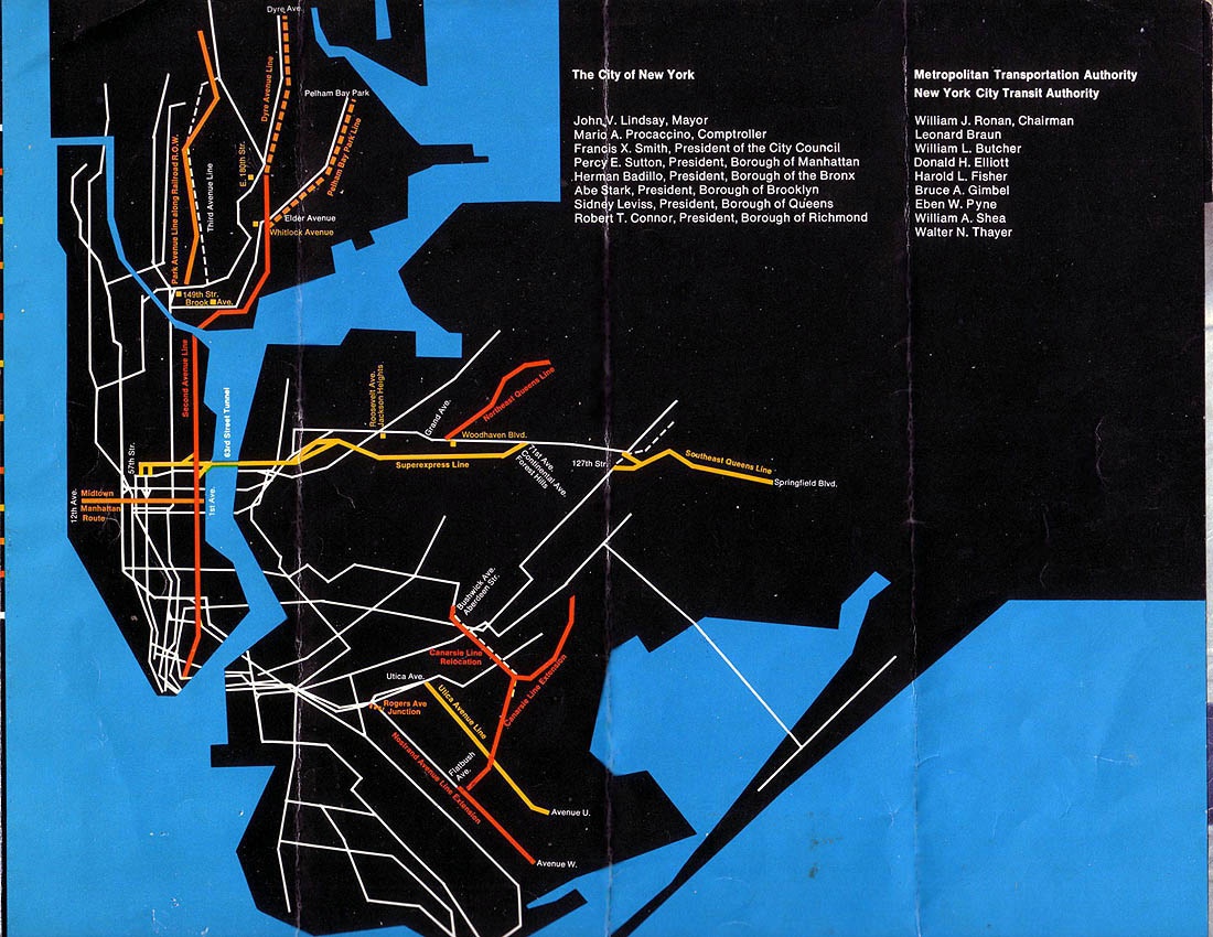
editExtensions of the IRT subway east or south of the station have been proposed since the line's planning in the 1910s, which included terminating the line at Buffalo Avenue just east of the station, or extending the line down Utica Avenue towards Flatbush Avenue and Avenue U near Kings Plaza. The Utica Avenue extension in particular has been proposed several times as part of the New York City Transit Authority's 1968 expansion proposals, in older pre-unification plans, and in the competing pre-unification expansion plans of the Independent Subway System (IND).[34][35][36][37][38] Just east of this station, a bellmouth splits away from the local track on both levels, and curves south. This was built into the station as a provision for the proposed Utica Avenue Line, which is why the station itself has no exits to Utica Avenue.[39] In 2015, New York City Mayor Bill de Blasio announced his proposal for an extension of the 3 and 4 trains down Utica Avenue.[40]
References
edit- ^ "Glossary". Second Avenue Subway Supplemental Draft Environmental Impact Statement (SDEIS) (PDF). Vol. 1. Metropolitan Transportation Authority. March 4, 2003. pp. 1–2. Archived from the original (PDF) on February 26, 2021. Retrieved January 1, 2021.
- ^ "Brooklyn Bus Map" (PDF). Metropolitan Transportation Authority. October 2020. Retrieved December 1, 2020.
- ^ a b "Annual Subway Ridership (2018–2023)". Metropolitan Transportation Authority. 2023. Retrieved April 20, 2024.
- ^ Report of the Public Service Commission for the First District of the State of New York for the Year Ending December 31, 1909 Vol. 1. New York State Public Service Commission. 1910. p. 195.
- ^ a b "Brooklyn Joyful Over New Subway". The New York Times. May 2, 1908. p. 1.
- ^ "Subway to Brooklyn Opened for Traffic; First Regular Passenger Train Went Under the East River Early This Morning. Not a Hitch in the Service. Gov. Hughes and Brooklyn Officials to Join in a Formal Celebration of Event To-day". the New York Times. January 9, 1908. Retrieved September 1, 2016.
- ^ "Brooklyn Joyful Over Its Tunnel". The New York Times. January 10, 1908. Retrieved March 6, 2010.
- ^ Gasparini, D. A. (February 2006). "Battery-Joralemon Street Tunnel". Journal of Performance of Constructed Facilities. 20 (1). American Society of Civil Engineers: 92–107. doi:10.1061/(ASCE)0887-3828(2006)20:1(92).[permanent dead link]
- ^ Report of the Public Service Commission For The First District of the State of New York For The Year Ending December 31, 1908. New York State Public Service Commission. 1908.
- ^ "Exercises In City Hall.; Mayor Declares Subway Open -- Ovations for Parsons and McDonald". The New York Times. October 28, 1904. Retrieved December 16, 2018.
- ^ "Brooklyn Joyful Over New Subway — Celebrates Opening of Extension with Big Parade and a Flow of Oratory — An Ode to August Belmont — Anonymous Poet Calls Him "the Brownie of the Caisson and Spade" — He Talks on Subways". The New York Times. May 2, 1908. p. 1. Retrieved November 6, 2016.
- ^ "618 Miles of Track In The Dual System; City Will Have Invested $226,000,000 When Rapid Transit Project Is Completed". The New York Times. August 3, 1913. Retrieved April 25, 2018.
- ^ Comptroller's Monthly Report For March 1916 And From January 1, 1916 To March 31, 1916. New York City Department of Finance. 1916. p. 121.
- ^ "Differ Over Assessment Plans in Transit Projects: Eastern Parkway Subway and Livonia Avenue Extension the Cause of Bitter Dissension Among Property Owners Uptown" (PDF). The Daily Standard Union. March 13, 1910. Retrieved August 14, 2016 – via Fulton History.
- ^ "More Interborough Service for Brooklyn 2 New Lines". pudl.princeton.edu. Interborough Rapid Transit Company. August 23, 1920. Retrieved September 19, 2016.
- ^ "Brooklyn Tube Extensions Open: I.R.T. Begins Service on Eastern Parkway and Nostrand Avenue Lines" (PDF). The New York Times. August 23, 1920. Retrieved December 20, 2015.
- ^ "Annual Report of the Interborough Rapid Transit Company For The Year Ended June 30, 1921". HathiTrust. Interborough Rapid Transit. Retrieved September 5, 2016.
- ^ Cunningham, Joseph; DeHart, Leonard O. (1993). A History of the New York City Subway System. J. Schmidt, R. Giglio, and K. Lang. p. 53.
- ^ Bennett, Charles G. (November 20, 1949). "Transit Platforms on Lines in Queens to Be Lengthened; $3,850,000 Program Outlined for Next Year to Care for Borough's Rapid Growth". The New York Times. ISSN 0362-4331. Retrieved May 23, 2023.
- ^ "37 Platforms On Subways To Be Lengthened: All Stations of B. M. T. and I.R.T.in Queens Included in $5,000,000 Program". New York Herald Tribune. November 20, 1949. p. 32. ISSN 1941-0646. ProQuest 1325174459.
- ^ Crowell, Paul (September 15, 1949). "Platforms Added at 32 IRT Stations; City Pays Out $13,327,000 in Lengthening Local Stops to Take 10-Car Trains". The New York Times. ISSN 0362-4331. Retrieved May 23, 2023.
- ^ Gargan, Edward A. (June 11, 1981). "Agency Lists Its 69 Most Deteriorated Subway Stations". The New York Times. Retrieved October 5, 2019.
- ^ Goldman, Ari L. (April 28, 1983). "M.T.A. Making Major Addition to Capital Plan". The New York Times. ISSN 0362-4331. Archived from the original on April 25, 2022. Retrieved May 4, 2023.
- ^ a b Moses, Charles T. (October 3, 1983). "TA Gets Funds to Fix Subways". Newsday. p. 3. ISSN 2574-5298. Retrieved May 5, 2023.
- ^ Gargan, Edward A. (October 3, 1983). "City Speeding Its Subway Repairs". The New York Times. ISSN 0362-4331. Archived from the original on April 28, 2022. Retrieved May 5, 2023.
- ^ Benenson, Joel (April 1, 1993). "Albany deal to save the $1.25 fare". New York Daily News. p. 1059. Archived from the original on April 28, 2023. Retrieved April 28, 2023.
- ^ Faison, Seth (April 3, 1993). "$9.6 Billion Package for M.T.A. Is Crucial to its Rebuilding Plans". The New York Times. ISSN 0362-4331. Archived from the original on April 28, 2023. Retrieved April 28, 2023.
- ^ "Stop the Fussing". Newsday. May 28, 1993. p. 56. Archived from the original on May 3, 2023. Retrieved April 28, 2023.
- ^ Brachfeld, Ben (May 22, 2024). "MTA will test middle-out turnstiles at 15 subway stops this year". amNewYork. Retrieved May 23, 2024.
- ^ a b "www.nycsubway.org: New York City Subway Track Maps". www.nycsubway.org. October 9, 2015. Retrieved October 9, 2015.
- ^ "Subway Map" (PDF). Metropolitan Transportation Authority. September 2021. Retrieved September 17, 2021.
- ^ a b "MTA Neighborhood Maps: Crown Heights" (PDF). mta.info. Metropolitan Transportation Authority. Retrieved October 5, 2019.
- ^ "Artwork: Good Morning, Good Night (Hugo Consuegra)". Retrieved October 5, 2019.
- ^ Raskin, Joseph B. (2013). The Routes Not Taken: A Trip Through New York City's Unbuilt Subway System. New York, New York: Fordham University Press. doi:10.5422/fordham/9780823253692.001.0001. ISBN 978-0-82325-369-2.
- ^ "1968 NYCTA Expansion Plans (Picture)". Second Avenue Sagas. Retrieved October 5, 2019.
- ^ "MTA Program for Action". thejoekorner.com. Retrieved October 5, 2019.
- ^ "Transit Outlook Bright in Brooklyn: First Branch Lines on Assessment Plan Likely to be Built in That Borough" (PDF). The New York Times. March 6, 1910. Retrieved October 5, 2019.
- ^ Prial, Frank J. (October 31, 1971). "Brooklyn Bemoans Its Ancient Subways". The New York Times. Retrieved October 5, 2019.
- ^ Taft, Lyman W. (October 13, 1954). "Finds Many Unused Subway Tunnels Under City Streets". Brooklyn Daily Eagle. p. 24. Retrieved October 5, 2019 – via Newspapers.com.
- ^ Fitzsimmons, Emma G. (April 22, 2015). "Mayor de Blasio Revives Plan for a Utica Avenue Subway Line". The New York Times. Retrieved October 5, 2019.
External links
edit- nycsubway.org – Brooklyn IRT : Utica Avenue
- MTA's Arts For Transit — Crown Heights–Utica Avenue (IRT Eastern Parkway Line)