[1] Name on the Register[2]
Image
Date listed[3]
Location
City or town
Description
16
C. A. Nothnagle Log House C. A. Nothnagle Log House April 23, 1976 (#76001153 ) Swedesboro-Paulsboro Rd. 39°49′05″N 75°15′59″W / 39.818056°N 75.266389°W / 39.818056; -75.266389 (C. A. Nothnagle Log House ) Gibbstown, New Jersey
23
Salisbury Farm Upload image March 7, 1979 (#79001489 ) Address Restricted Bridgeport, New Jersey just a farm field along a long road?
29
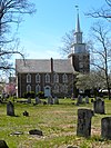
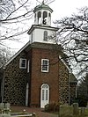
Trinity Church Trinity Church January 29, 1973 (#73001098 ) NW corner of Church St. and King's Hwy. 39°45′01″N 75°18′41″W / 39.750278°N 75.311389°W / 39.750278; -75.311389 (Trinity Church ) Swedesboro, New Jersey aka "Old Swedes"
31
Holy Trinity Church Holy Trinity Church October 15, 1966 (#66000261 ) 7th and Church Sts. 39°44′18″N 75°32′26″W / 39.738333°N 75.540556°W / 39.738333; -75.540556 (Holy Trinity Church ) Wilmington, Delaware The oldest of the Old Swedes, 1699?
16
Gloria Dei (Old Swedes') Church National Historic Site Gloria Dei (Old Swedes') Church National Historic Site October 15, 1966 (#66000682 ) Swanson Street, between Christian and Water Streets39°56′4″N 75°8′38″W / 39.93444°N 75.14389°W / 39.93444; -75.14389 (Gloria Dei (Old Swedes') Church National Historic Site ) Coordinates missing
Queen Village, Philadelphia, Pennsylvania the 2nd oldest of the "Old Swedes" 1701?
5
Brandywine Park Brandywine Park December 22, 1976 (#76000574 ) Roughly bounded by Augustine, 18th, and Market Sts. and Lovering Ave. 39°45′01″N 75°32′57″W / 39.750278°N 75.549167°W / 39.750278; -75.549167 (Brandywine Park ) Wilmington, Delaware A special place, especially if you like big gullies, mill races, small zoos or industrial history
21
Nathaniel Irish House Nathaniel Irish House March 16, 1972 (#72001160 ) 704 South Front Street39°56′23.7″N 75°8′40″W / 39.939917°N 75.14444°W / 39.939917; -75.14444 (Nathaniel Irish House ) Coordinates missing
Queen Village, Philadelphia, Pennsylvania
30
Capt. Thomas Moore House Capt. Thomas Moore House March 16, 1972 (#72001165 ) 702 South Front Street 39°56′24″N 75°8′40″W / 39.94000°N 75.14444°W / 39.94000; -75.14444 (Capt. Thomas Moore House ) Coordinates missing
Queen Village, Philadelphia, Pennsylvania
43
South Front Street Historic District South Front Street Historic District April 25, 1972 (#72001171 ) 700–712 South Front Street, western side of Bainbridge Street to Kenilworth Street39°56′24″N 75°8′40″W / 39.94000°N 75.14444°W / 39.94000; -75.14444 (South Front Street Historic District ) Coordinates missing
Queen Village, Philadelphia, Pennsylvania
57
Widow Maloby's Tavern Widow Maloby's Tavern March 16, 1972 (#72001175 ) 700 South Front Street39°56′24″N 75°8′40″W / 39.94000°N 75.14444°W / 39.94000; -75.14444 (Widow Maloby's Tavern ) Coordinates missing
Queen Village
58
Independence National Historical Park Independence National Historical Park October 15, 1966 (#66000683 ) Bounded by Walnut, 6th, Chestnut, and 2nd Streets39°56′52″N 75°8′53″W / 39.94778°N 75.14806°W / 39.94778; -75.14806 (Independence National Historical Park ) Coordinates missing
Independence Mall lots and lots to go with this
121
Society Hill Historic District Society Hill Historic District June 23, 1971 (#71000065 ) Bounded on the north by Walnut St., on the south by Lombard St., on the east by the pier line of the Delaware River, and on the west by 8th39°56′42″N 75°8′58″W / 39.94500°N 75.14944°W / 39.94500; -75.14944 (Society Hill Historic District ) Coordinates missing
Society Hill
17
Fairmount Park Fairmount Park February 7, 1972 (#72001151 ) Both banks of the Schuylkill River and the Wissahickon Creek , from Spring Garden Street to Northwestern Avenue39°59′33″N 75°12′19″W / 39.99250°N 75.20528°W / 39.99250; -75.20528 (Fairmount Park ) Coordinates missing
Fairmount Park Extends into North and Northwest Philadelphia. There's series of old mansions in the park
10
Colonial Germantown Historic District Colonial Germantown Historic District October 15, 1966 (#66000678 ) Germantown Avenue between Windrim Avenue and Upsal Street; also the 6500–7600 blocks of Germantown Avenue from the Fort Washington branch of the Pennsylvania Railroad to Sharpnack Street40°2′11″N 75°10′29″W / 40.03639°N 75.17472°W / 40.03639; -75.17472 (Colonial Germantown Historic District ) Coordinates missing
Germantown and Mount Airy, Philadelphia, Pennsylvania
1
1724 Chester Courthouse 1724 Chester Courthouse May 27, 1971 (#71000702 ) Market Street below 5th Street 39°50′57″N 75°21′36″W / 39.849167°N 75.36°W / 39.849167; -75.36 (1724 Chester Courthouse ) Chester
5
Booth Farm Booth Farm June 13, 2003 (#03000527 ) 3221 Foulk Road 39°51′15″N 75°29′24″W / 39.854167°N 75.49°W / 39.854167; -75.49 (Booth Farm ) Boothwyn
19
Chichester Friends Meetinghouse Chichester Friends Meetinghouse March 14, 1973 (#73001622 ) 611 Meetinghouse Road 39°50′11″N 75°25′53″W / 39.836389°N 75.431389°W / 39.836389; -75.431389 (Chichester Friends Meetinghouse ) Boothwyn
20
Collen Brook Farm Collen Brook Farm December 22, 1988 (#88003048 ) Off Mansion and Marvine Roads 39°57′05″N 75°19′16″W / 39.951389°N 75.321111°W / 39.951389; -75.321111 (Collen Brook Farm ) Upper Darby Township
21
Concord Friends Meetinghouse Concord Friends Meetinghouse June 17, 1977 (#77001164 ) Old Concord Road 39°53′07″N 75°31′13″W / 39.885278°N 75.520278°W / 39.885278; -75.520278 (Concord Friends Meetinghouse ) Concordville
22
Concordville Historic District Concordville Historic District April 3, 1973 (#73001624 ) Concord Road and Baltimore Pike 39°53′09″N 75°31′15″W / 39.885833°N 75.520833°W / 39.885833; -75.520833 (Concordville Historic District ) Concordville
26
Darby Meeting Darby Meeting September 13, 1978 (#78002392 ) 1017 Main Street 39°55′15″N 75°15′48″W / 39.920833°N 75.263333°W / 39.920833; -75.263333 (Darby Meeting ) Darby
30
Federal School Federal School November 5, 1971 (#71000704 ) Haverford-Darby Road 39°59′48″N 75°19′34″W / 39.996667°N 75.326111°W / 39.996667; -75.326111 (Federal School ) Haverford n=
}}
32
Gilpin Homestead Gilpin Homestead May 27, 1971 (#71000700 ) Harvey Road 39°53′02″N 75°33′50″W / 39.883889°N 75.563889°W / 39.883889; -75.563889 (Gilpin Homestead ) Chadds Ford Township
33
Glenays Glenays December 27, 1977 (#77001163 ) 926 Coopertown Road 40°00′41″N 75°19′49″W / 40.011389°N 75.330278°W / 40.011389; -75.330278 (Glenays ) Bryn Mawr
36
High Hill Farm High Hill Farm August 21, 1986 (#86001784 ) 180 Thornton Road 39°53′48″N 75°31′30″W / 39.896667°N 75.525°W / 39.896667; -75.525 (High Hill Farm ) Concordville
37
Hood Octagonal School Hood Octagonal School February 14, 2006 (#06000045 ) 3500 West Chester Pike, Newtown Square 39°59′10″N 75°23′22″W / 39.986111°N 75.389444°W / 39.986111; -75.389444 (Hood Octagonal School ) Newtown Township On grounds of Dunwoody Village
38
Idlewild Idlewild May 8, 2013 (#13000255 ) 110 Idlewild Circle 39°54′44″N 75°23′18″W / 39.912336°N 75.388465°W / 39.912336; -75.388465 (Idlewild ) Upper Providence Township Summer cottage owned and designed by Frank Furness
43
The Lazaretto The Lazaretto March 16, 1972 (#72001119 ) Wanamaker Avenue and 2nd Street 39°51′38″N 75°18′02″W / 39.860556°N 75.300556°W / 39.860556; -75.300556 (The Lazaretto ) Essington
44
Thomas Leiper Estate Thomas Leiper Estate December 29, 1970 (#70000547 ) Avondale Road 39°53′12″N 75°21′30″W / 39.886667°N 75.358333°W / 39.886667; -75.358333 (Thomas Leiper Estate ) Wallingford
45
Lower Swedish Cabin Lower Swedish Cabin June 9, 1980 (#80003484 ) Creek Road 39°56′05″N 75°17′43″W / 39.934722°N 75.295278°W / 39.934722; -75.295278 (Lower Swedish Cabin ) Drexel Hill
46
Thomas Massey House Thomas Massey House November 16, 1970 (#70000904 ) Lawrence and Springhouse Roads 39°57′57″N 75°21′07″W / 39.965778°N 75.351889°W / 39.965778; -75.351889 (Thomas Massey House ) Broomall
50
Morton Homestead Morton Homestead December 2, 1970 (#70000546 ) 100 Lincoln Avenue 39°52′37″N 75°18′21″W / 39.876944°N 75.305833°W / 39.876944; -75.305833 (Morton Homestead ) Prospect Park
51
Morton Morton House Morton Morton House February 4, 2000 (#00000055 ) Junction of Muckinipates and Darby Creeks 39°52′50″N 75°17′27″W / 39.880556°N 75.290833°W / 39.880556; -75.290833 (Morton Morton House ) Norwood
52
Newlin Mill Complex Newlin Mill Complex March 9, 1983 (#83002240 ) South Cheyney Road 39°53′25″N 75°30′22″W / 39.890278°N 75.506111°W / 39.890278; -75.506111 (Newlin Mill Complex ) Glen Mills
53
Nicholas Newlin House Nicholas Newlin House April 26, 1972 (#72001118 ) Concord Road 39°53′10″N 75°31′19″W / 39.886111°N 75.521944°W / 39.886111; -75.521944 (Nicholas Newlin House ) Concordville
56
Ogden House Ogden House November 20, 1979 (#79002223 ) 530 Cedar Lane 39°54′41″N 75°21′04″W / 39.911389°N 75.351111°W / 39.911389; -75.351111 (Ogden House ) Swarthmore
59
Old Rose Tree Tavern Old Rose Tree Tavern June 21, 1971 (#71000705 ) Northeast of junction of Rose Tree and Providence Roads 39°56′17″N 75°23′34″W / 39.938056°N 75.392778°W / 39.938056; -75.392778 (Old Rose Tree Tavern ) Media Inside Rose Tree Park
60
William Painter Farm William Painter Farm July 27, 1971 (#71000701 ) 2 miles (3.2 km) northeast of Chadds Ford on U.S. Route 1 39°52′42″N 75°33′10″W / 39.878333°N 75.552778°W / 39.878333; -75.552778 (William Painter Farm ) Chadds Ford Township
61
William Penn Landing Site William Penn Landing Site March 11, 1971 (#71000703 ) Penn and Front Streets 39°50′36″N 75°21′41″W / 39.843333°N 75.361389°W / 39.843333; -75.361389 (William Penn Landing Site ) Chester
63
Pont Reading Pont Reading October 26, 1972 (#72001116 ) 2713 Haverford Road 39°59′47″N 75°18′10″W / 39.996389°N 75.302778°W / 39.996389; -75.302778 (Pont Reading ) Ardmore
64
The Printzhof The Printzhof October 15, 1966 (#66000661 ) Taylor Avenue and 2nd Street 39°51′40″N 75°18′11″W / 39.861111°N 75.303056°W / 39.861111; -75.303056 (The Printzhof ) Essington
65
Caleb Pusey House Caleb Pusey House March 11, 1971 (#71000706 ) 15 Race Street 39°51′04″N 75°23′13″W / 39.851111°N 75.386944°W / 39.851111; -75.386944 (Caleb Pusey House ) Upland
66
Pusey-Crozier Mill Historic District Pusey-Crozier Mill Historic District September 27, 1976 (#76001638 ) Race Street 39°51′05″N 75°23′12″W / 39.851389°N 75.386667°W / 39.851389; -75.386667 (Pusey-Crozier Mill Historic District ) Upland
67
Radnor Friends Meetinghouse Radnor Friends Meetinghouse August 31, 1978 (#78002393 ) Sproul and Conestoga Roads 40°01′48″N 75°21′53″W / 40.03°N 75.364722°W / 40.03; -75.364722 (Radnor Friends Meetinghouse ) Ithan
68
Ridley Creek State Park Ridley Creek State Park October 8, 1976 (#76001637 ) Northwest of Media between Pennsylvania Routes 3 and 352 39°57′13″N 75°26′41″W / 39.953611°N 75.444722°W / 39.953611; -75.444722 (Ridley Creek State Park ) Media
70
Rose Valley Historic District Rose Valley Historic District July 19, 2010 (#10000470 ) Roughly bounded by Ridley Creek, Woodward Rd., Providence and Brookhaven Rds. and Todmorden Ln. within Rose Valley Borough 39°53′46″N 75°23′06″W / 39.896111°N 75.385°W / 39.896111; -75.385 (Rose Valley Historic District ) Rose Valley
71
St. David's Church and Graveyard St. David's Church and Graveyard September 20, 1978 (#78002394 ) 7 miles (11 km) north of Media 40°01′37″N 75°24′16″W / 40.026944°N 75.404583°W / 40.026944; -75.404583 (St. David's Church and Graveyard ) Newtown Township
73
Second Street Bridge Second Street Bridge June 22, 1988 (#88000752 ) Pennsylvania Route 291 /Second Street over Chester Creek39°50′41″N 75°21′39″W / 39.844722°N 75.360833°W / 39.844722; -75.360833 (Second Street Bridge ) Chester Destroyed[4]
74
Seventeen-hundred-and-four House Seventeen-hundred-and-four House December 24, 1967 (#67000018 ) Oakland Road, near junction of U.S. Route 202 and County Road 15199 39°53′47″N 75°33′40″W / 39.896389°N 75.561111°W / 39.896389; -75.561111 (Seventeen-hundred-and-four House ) Dilworthtown
79
Thornton Village Historic District Thornton Village Historic District November 14, 2006 (#06000745 ) Centered on Thornton and Glen Mills Roads 39°54′36″N 75°31′54″W / 39.91°N 75.531667°W / 39.91; -75.531667 (Thornton Village Historic District ) Thornbury Township
80
Thunderbird Lodge Thunderbird Lodge August 18, 1989 (#89001053 ) 45 Rose Valley Road 39°53′55″N 75°23′17″W / 39.898611°N 75.388056°W / 39.898611; -75.388056 (Thunderbird Lodge ) Rose Valley Will Price , architect.
85
Benjamin West Birthplace Benjamin West Birthplace October 15, 1966 (#66000662 ) Swarthmore College campus39°54′18″N 75°21′06″W / 39.905°N 75.351667°W / 39.905; -75.351667 (Benjamin West Birthplace ) Swarthmore
87
Wolley Stille Wolley Stille June 27, 1980 (#80003487 ) Harvey Road 39°52′28″N 75°21′58″W / 39.874444°N 75.366111°W / 39.874444; -75.366111 (Wolley Stille ) Wallingford


