

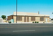
My uploaded pictures of Historic Structures, etc. Part I
I believe that it is a shame that so many of our historical structures are being demolished and destroyed in the name of progress. It is a pity that many of these structures will not be around for future generations to enjoy. By taking these photos and documenting them I am hoping that I will help them understand how our ancestors lived in the past when the United States was still young and defining itself as a nation.
I have been fortunate enough that Lisa DeForest, editor at The Arizona Republic, has published some of the photos which I have uploaded in a feature about local historic properties thereby, allowing me to share the images of places that I have seen with others who may never have the opportunity to do so. See: Glendales Historic Homes and Buildings, Phoenix Historic Buildings, Peoria Historic Buildings, Scottsdale Historic Buildings, Tempe Historic Buildings and Wickenburg Historic Buildings.
Contents: Top – Adamsville (Ghost town), Agua Caliente (Ghost town), Anthem, Apache Grove, Apache Junction, Arlington, Ash Fork, Avondale, Bellemont, Benson, Bisbee, Black Canyon City, Bouse, Brigham City, Buckeye, Bullhead City, Bylas, Cameron, Camp Verde, Carefree, Casa Grande, Cave Creek, Chandler, Chino Valley, Clarkdale, Claypool, Clifton, Cochise, Cocopah Indian Reservation, Cool Springs, Coolidge, Cornville, Cottonwood, Dateland, Dewey-Humboldt, Dos Cabezas (Ghost town), Douglas, Dragoon, Duncan, Eagar, Ehrenberg, El Mirage, Elfrida, Eloy, Fairbank, Flagstaff, Florence, Fort Apache, Fort Huachuca, Fort McDowell Yavapai Nation, Fort Thomas, Fort Tyson, Fountain Hills, Gadsden, Geronimo, Gila Bend, Gila County, Gila River Indian Reservation, Gilbert, Gillett (Ghost town), Glendale, Globe, Goldfield (Ghost town), Goodyear, Grand Canyon Village, Guadalupe, Hackberry, Hayden, Hereford, Holbrook, Hyder (Ghost town), Indian Gardens, Jerome, Joseph City, Kearny, Kingman, Lake Havasu City, Litchfield Park, Mammoth, Mayer, McNary, Mesa, Miami, Morristown, New River, Nogales.
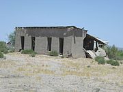
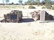
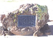
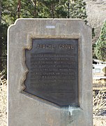
Adamsville was a farming town founded in 1870 by Fred Adams. The town had stores, homes, a post office and a flour mill and water tanks. In 1900 the Gila River overflowed and wiped out most of the town. Those who survived the flood moved to the town of Florence. The inscription on the marker reads as follows: “In the 1870's, a flour mill and a few stores formed the hub of life in Adamsville, where shootings and knifings were commonplace, and life was one of the cheapest commodities. Most of the adobe houses have been washed away by the flooding Gila River”. Listed in the National Register of Historic Places in 1970, reference #10000114.
(National Register of Historic Places)
-
 Adamsville Ghost Town Marker.
 -
 Adamsville Ghost Town Water Tower
 -
 Adamsville Ghost Town store.
 -
 Adamsville Ghost Town Water Tanks. Located on Adamsville Road. Listed in the National Register of Historic Places in 1970, reference #10000114.
 -
 Adamsville grain storage.
 -
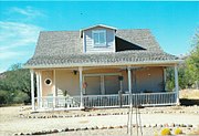
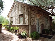 Windmill Farmhouse


-
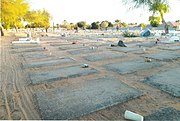
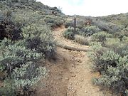
 Cemetery trail.
 -
 Entrance.
 -
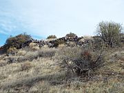
 Rock formation in the middle of the cemetery
 -
 Grave of Fred A. Adams (1844 - 1910).
 -
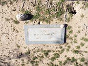 Grave of Judge H. B. Summers (1823-1895)
 -
 Grave of Capt. Granville Henderson Oury (1825 - 1891)
 -
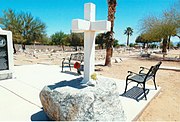
 Capt. Granville Henderson Oury monument
 -
 Graves of Felix Grunde Hardwick (1831 - 1908) and his wife Martha Angeline Hardwick (1831 - 1896).
 -
 The Stevens family: Olnorah Stevens (1858 - 1893); Carmen Sarah Stevens (1888 - 1889) and Taylor Stevens (1898 - 1898).
 -
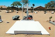
 Unknown grave.


-Agua_Caliente_Resort-1897.jpg)
-
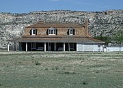
 The Agua Caliente Resort.
 -
 Agua Caliente Resort pump house.
 -
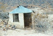 An Agua Caliente shack.
 -
 Inside the Agua Caliente a shack.
 -
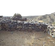
 Stone house ruins.
 -
 Stone house ruins.
 -
 Stone house ruins.
 -
 Stone house ruins.
 -
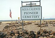 Agua Caliente Pioneer Cemetery.
 -
 Graves in the Agua Caliente Pioneer Cemetery.
 -
 Lone grave in Agua Caliente.
 -
 Equipment used in the Agua Caliente Resort.
-Agua_Caliente_Resort-1897.jpg)


-
 Anthem's Christmas Tree is the tallest in Arizona.
 -
 Traditional giant Christmas decoration in Anthem


-
 Apache Grove Marker.
 -
 Apache Grove Dance Hall-1880


-
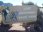 Entrance to the Lost Dutchman State Park located at 6109 N. Apache Junction, Az.
 -
 The Lost Dutchman Mine, located in the Superstition Mountains was made famous by Jacob Waltz, who also known as the “Dutchman”. Waltz never told anyone the location where he obtained his gold and took the secret of his “mine” to his grave in 1891. Even today, treasure hunters scout the mountains searching for the Lost Dutchman Mine.
 -
 The Superstition Mountain Museum is located at 2087 N. Apache Trail in Apache Junction, Az.
 -
 The Elvis Memorial Chapel on the grounds of Superstition Mountain Museum. It was moved there from the Apacheland Movie Ranch.
 -
 The Audie Murphy Barn on the grounds of Superstition Mountain Museum. It was moved there from the Apacheland Movie Ranch.
 -
 A 19th Century Blacksmith shop adjacent to the Audie Murphy Barn.
 -
 A replica of a 19th Century Wells Fargo Bank located on the grounds of Superstition Mountain Museum.
 -
 A 19th Century Gallows located on the grounds of Superstition Mountain Museum.
 -
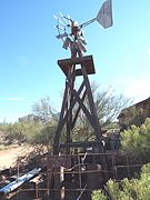 A 19th Century Windmill located on the grounds of Superstition Mountain Museum.
 -
 Historic Apache Trail sign on Highway 88.


(National Register of Historic Places)
-
 Old Highway 80
 -
 Historic Old Highway 80.
 -
 The Gillespie Dam was constructed in 1921. The dam is a concrete gravity dam located on the Gila River between the towns of Buckeye and Gila Bend, Arizona. On the morning of January 9, 1993, the dam failed when a segment approximately 120 feet (37 m) in length collapsed into the Gila River.
 -
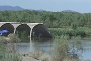 The Gila River flows freely through the breached dam.
 -
 Different view of the dam.
 -
 The Gillespie Dam
 -
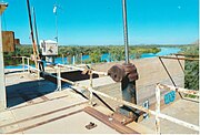 Rusted equipment on the dam.
 -
 More rusted equipment on the dam.
 -
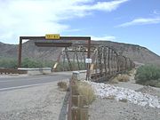
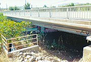
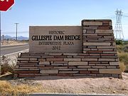 The marker of the historic Gillespie Dam Bridge. The historic Gillespie Dam Bridge was built in 1927 over the Gila River and is located on Old Highway 80 north of Gila Bend and south of Arlington between the Buckeye Hills and the Gila Bend Mountains in Maricopa County. The bridge was at the time the longest highway bridge in the state of Arizona. The bridge was listed on the National Register of Historic Places on May 5, 1981, reference #81000136.
 -
 The historic Gillespie Dam Bridge.
 -
 Front view of the historic Gillespie Dam Bridge.
 -
 Different view of the historic Gillespie Dam Bridge.
 -
 The historic Hassayampa Bridge. The bridge was built in 1929 and was modified and repaired in 1993. The bridge, which is described as a Concrete slab and girder, is located in the Old U.S. Highway Route 80 over the Hassayampa River between Salome Highway and 309 Ave. in the areas of Hassayampa and Arlington within the boundaries of the town of Buckeye, Az. The bridge was listed in the National Register of Historic Places in September 30, 1988, reference #88001658.
 -
 A different view of the historic Hassayampa Bridge.
 -
 This is what remains of some of the sections which were removed from the historic Hassayampa Bridge.


-
 1903 Bar and Brothel
 -
 1903 General Store
 -
 Remains of the 1907 Escalante Harvey House and Hotel
 -
 Route 66 Copper State Motel-1930
 -
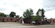 Different view of the Route 66 Copper State Motel-1930
 -
 Route 66 Stagecoach 66 Motel-1930
 -
 1958 Texaco Station (now De Soto's Salon) on Route 66
 -
 1933 Yavapai Trading Post on Route 66


-
 Historic Monument Hill. This is where the initial point of the Gila and Salt River Meridan is located.
 -
 The Gila River as viewed from the summit of historic Monument Hill.
 -
 Gila and Salt River Meridan.
 -
 National Register of Historic Places marker on Monument Hill where the initial point of the Gila and Salt River Meridan is located.
 -
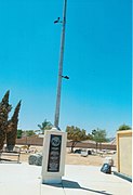
 The initial point of the Gila and Salt River Meridan. Period of significance: 1850-1874.The surveying marker of the Gila and Salt River Meridan is located on Monument Hill. Ever since 1851, this has been the center point used by the state to measure the land in Arizona. The federal government recognized this point for measuring the boundary between the United States and Mexico after the Mexican-American War ended. The first survey conducted in 1867, involved the first 36 miles of Arizona. Up until 1874, this was the epicenter of all surveying in Arizona for property deeds. It was listed in the National Register of Historic Places on October 15, 2002, reference #02001137. Monument Hill is located at 115th Ave. and Baseline Road.
 -
 Marker of the initial point of the Gila and Salt River Meridan on Monument Hill in Avondale. The following is engraved on the round marker: U.S. Department of the Interior Bureau of Land Management. Initial Point of Establishment in 1865. Gila and Salt River Meridian, Arizona. Cadastral Survey. The rectangular marker states the following: Dedicated to all land owners in Arizona by the Arizona Professional Land Surveyors originally set by A. B. Gray in 1851.
 -
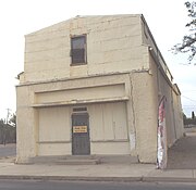
 Old Commercial Building built in 1925.
 -
 Union Pacific Railroad Bridge
 -
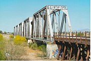 Union Pacific Railroad Bridge built in 1926.
 -
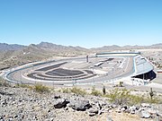 The Phoenix International Raceway as viewed from the summit of Monument Hill in Avondale.


-
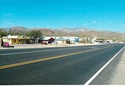
 Historic Avondale as viewed from Western Ave.
 -
 The White House built in 1938.
 -
 Different view of the White House.
 -
 The Avon Theater built in 1947 and located at 16 E. Western Ave.
 -
 Front of the Avon Theater.
 -
 Avondale Elementary School built in 1937 and located on 295 West Western Ave.
 -
 Burger building built in 1960 and located at 60 East Western Ave.
 -
 Church built in 1900 and located in 11 N. 3rd. Ave. It now houses the Salvation Army branch of Avondale.


-
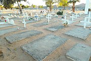 Unmarked graves.
 -
 More Unmarked graves.
 -
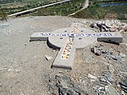
 Cross
Cross -
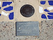
 Graves of Amado B. Sernas (1908-1994) and his wife Francisca T. Sernas (1907-1988).
 -
 Inscription on the Sernas tomb.
 -
 Goodyear Farms Historic Cemetery Cross
 -
 Cemetery Flag Pole.
 -
Cemetery mural.
-
 Cemetery Mural Dedication
 -
 The name of Jose M. Villela scratched from the dedication during an act of vandalism.


-2.jpg)
.jpg)


-
 Kartchner Cavern Mural in the historic Benson Railroad District
 -
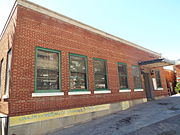
 Benson Railroad Station
 -
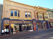
 Hi Wo Grocery Company
 -
 William D. Martinez General Merchandise Store
 -
 Max Treu Territorial Meat Company
 -
 Redfield-Romine House
 -
 Smith-Beck House
 -
 Oasis Court
 -
 Oasis Court
 -
 Oasis Court historical marker
 -
 Benson San Pedro River RR Bridge
 -
 Different view of the Benson San Pedro River RR Bridge


}}

-
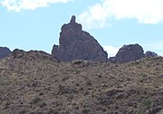
 Castle Rock in Tombstone Canyon is Bisbee’s original landmark. Jack Dunn was filling the canteens of soldiers’ on a summer day in 1877, on the twin granite monoliths, when he discovered copper ore and recorded the first mining claim in what in the near future was to be known as the town of Bisbee.
 -
 The Copper Queen Hospital was built 1880 and is located in 29 Howell Street.
 -
 The Letson Loft Hotel (Letson Loft Block) was built in 1883 and is located on 26 Main Street. It was where the Goldwater-Castaneda Mercantile Store was originally located. On December 8, 1883, Daniel “Big Dan” Dowd, Comer W. “Red” Sample, Daniel “York” Kelly, William “Billy” Delaney and James “Tex” Howard held up the Goldwater-Castaneda Store. A gunfight between the thieves and the citizens of Bisbee took place on Main Street in front of the store leaving four people dead in what is known as the infamous "Bisbee Massacre".
 -
 The Tombstone Canyon Inn was built in 1890 and is located in 102 Tombstone Canyon.
 -
 The Inn at Castle Rock was built in 1895 and is located in 105 Tombstone Canyon.
 -
 The Phelps Dodge Headquarters Building was built in 1896 and is located in 5 Copper Queen Plaza. The building was the headquarters of the Phelps Dodge Mining Co. from 1896 to 1961. It now houses the Bisbee Mining & Historical Museum. It was the first museum in the southwest to be distinguished as a Smithsonian Affiliate Museum. The building was listed in the National Register of Historic Places on June 3, 1971, reference #71000109.
 -
 The Silver King Hotel was built in 1900 and is located in 41-43 Howell Street.
 -
 The Bisbee Improvement Company Building was built in 1900 and is located in 100-180 Naco Road.
 -
 The Muheim House was built in 1900 and is located in 207 Youngblood Hill. The house was built for Joseph and Carmelita Muheim. It is now referred to as Muheim Heritage House Museum. The house was listed in the National Register of Historic Places on January 23, 1979, reference #79000746.
 -
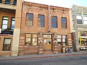
 The Copper Queen Library and Bisbee Post Office . The building which both the library and the post office share was the original location of a corner grocery. The post office was established in 1900 and the library in 1907. They are located in 4-6 Main Street.
 -
 The Old City Hall (originally the Bisbee City Fire Hall) was built in 1902 and is located at 110-112 Naco Road. The bell which was located in the tower warned of dangers from fires and cave-ins to Apache attacks.
 -
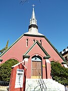 The Presbyterian Church was built in 1902 and is located in 19 Howell Street.
 -
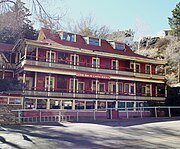
 The Copper Queen Hotel was built in 1902 and is located 11 Howell Street. President Teddy Roosevelt and actor John Wayne had been guests in the hotel. It is the oldest continuously operating hotel in Arizona.
 -
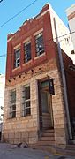
 The Phelps Dodge Clinic (now known as the Bisbee Review Building) was built in 1902 and is located in 12 Main Street.
 -
 The Bisbee Women’s Club House was built in 1902 and is located in 74 Quality Hill. The house was listed in the National Register of Historic Places in January 31, 1985, reference #850000145.
 -
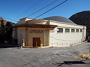
 The Bisbee Gym Building was built in 1903 and is located in 39 Howell Street.
 -
 The Python Castle was built in 1904 and is located in 29 OK Street.
 -
 The Stock Exchange Building was built in 1905 and is located in 15 Brewery Ave.
 -
 The Bisbee Grand Hotel was built in 1906 and is located on 61 Main Street.
 -
 The Walter Douglas House was built in 1908 and is located in 201 Cole Ave. The house was listed in the National Register of Historic Places in September 22, 2000, reference #00001125.
 -
 The Old Jail was built in 1909 is located in 9 OK Street.
 -
 The Old Bisbee High School was built in 1914 and is located in 104 Clawson Ave.
 -
 The Old Bisbee High School Gym was built in 1914 and is located in 104 Clawson Ave.
 -
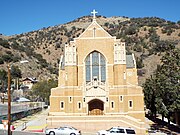 St. Patrick’s Roman Catholic Church was built in 1917. It is located in 100 Quality Hill. The church was listed in the National Register of Historic Places on September 7, 1995, reference #950001080.
 -
 The School House now the School House Inn was built in 1918 and is located in 818 Tombstone Canyon.
 -
 The Sheriff's Office and Justice Court Building was built in 1918 and is located in 116 Naco Road.
 -
 The Shattuck-Schmid Building.
 -
 The San Ramon Hotel.
 -
 St. Elmo Bar.
 -
 San Pedro Valley Railroad Overpass'
 -
 Copper Queen Mine equipment
 -
 The Mule Pass Tunnel was built in 1958 and is located on SR 80 in Cochise County and in the northern entrance to the town of Bisbee. The tunnel is 1,400 ft. long. It was the longest tunnel in Arizona until construction of the tunnel in Phoenix on Interstate 10 .


-
 The original ticket booth made of wood of theWarren Ballpark. The Warren Ballpark was built in 1909 and is located in the corner of Arizona Street and Ruppe Road. The ballpark is one of the oldest professional baseball stadiums in the United States. It has hosted baseball Hall of Famers John McGraw, Connie Mack and Honus Wagner and also some of the members of the Chicago White Socks involved in the 1919 Black Sox Scandal, such as Hal Chase, Chick Gandil and Buck Weaver. The ballpark was listed in the National Register of Historic Places on October 15, 2010 as part of the Bisbee Residential Historic District, reference #10000233.
 -
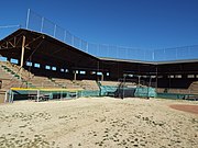 The concrete grandstand of the Warren Ballpark
 -
 Underneath the grandstand of the Warren Ballpark are housed the concrete dugouts, locker rooms, showers and manager’s office.
 -
 View of the concrete grandstand and home plate in the field of the Warren Ballpark.


-
 The Lavender Pit
 -
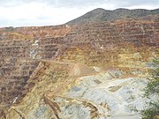 Different view of the Lavender Pit


_Welcome_to_Black_Canyon_City.jpg)

-
 Inside the Swilling residence
 -
 Different view inside the Swilling residence
 -
 Grave of Col. Jacob Snively
 -
 Wells Fargo Stage Stop - 1872
 -
 Wells Fargo Stage Stop office sign.
 -
 Maggie Mine Bridge - 1870's.
 -
 Maggie Mine Bridge over Black Canyon Creek.
 -
 Early Pioneer House - 1894.
 -
 Vernacular House - 1899.
 -
 Black Canyon City Bridge - 1925.
 -
 Abandoned Store Building - 1900.
 -
 The Rock Springs Hotel (now the "Rock Springs Cafe) - 1918.
 -
 Black Canyon City School House - 1926.
 -
 Front view of the Black Canyon City School House - 1926.
 -
 "A" Frame House (the "Jean Harlow Museuem") - 1950.
 -
 Jean Harlow's bed.
 -
 The Old Black Canyon Highway was a stagecoach route from Prescott to Phoenix built in 1860, that was known for its rough ride. Part of the highway in Black Canyon City has been paved
 -
 Black Canyon City Chamber of Commerce.
 -
 Bob Cothern of the Black Canyon City Chamber of Commerce


_Old_Black_Canyon_Hwy.jpg)


-
 lack Canyon City Dog Track building.
 -
 Stadium seating area.
 -
 Bar where the fatal drinks were served.
 -
 Betting area
 -
 Condition of stadium roof.
 -
 Structures where the Greyhounds were kept.


-
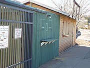
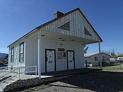
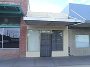
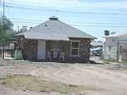
 902 Assay Building which now houses the Bouse Chamber of Commerce.
 -
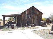 A 1908 Mining Work Shop.
 -
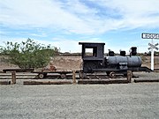 Small steam operated locomotive used in the mines
 -
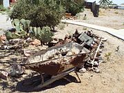 Bouse mining equipment.
 -
 Early Bouse structure.
 -
 1920s Bouse building.
 -
 Camp Bouse Historical Marker.
 -
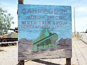 Camp Bouse sign..
 -
 Ruins of Camp Bouse.
 -
 More ruins of Camp Bouse.
 -
 "Sandy" the M60 Patton Tank, with her 105 MM main gun.
 -
 Patton training Tank.
 -
 World War II Military Vehicle.
 -
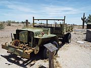 Another World War II Military Vehicle left behind.


-
 Thomas Bouse house ruins - 1892-1
 -
 Thomas Bouse house ruins - 1892-2
 -
 Thomas Bouse house ruins - 1892-3
 -
 Thomas Bouse house ruins - 1892-4


and the surrounding communities of Liberty, Arlington and Palo Verde

(National Register of Historic Places)
(Buckeye Valley Historical and Archaeological Society-listed)
-
 View of Historic Downtown Buckeye as seen from Monroe Ave.
 -
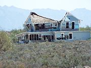 The Benson/Raney House which is in state of abandonment was built in 1895 and is located on Hazen Road and 4th Street.
 -
 H.E. Kell and Co. General Merchandise store 1890.
 -
 H.E. Kell and Co. General Merchandise store 1890.
 -
 The Joslin Building was built in 1909 and is located on the southeast corner of Monroe Ave. and 4th Street. Part of the building once served as a hotel while the rest served as a Pay Less Market Groceries and Meats.
 -
 The Ware Building was built in 1910 and is located on 104 South 4th Street.
 -
 Different view of the Ware Building. The corner pictured was occupied by the Buckeye Valley Bank in 1911.
 -
 The Old Courthouse and Jail was built in 1912 and is located at 218 S. 4th Street. Over the years the Courthouse and Jail has been used as a Hospital, the grade school auxiliary building, the town library and town food bank. The Buckeye Valley Food Bank was founded by Hugh M. Watson, Buckeye's first mayor. Listed as historical by the Buckeye Valley Historical and Archaeological Society.
 -
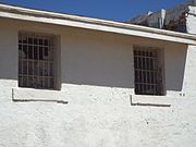 The Old Courthouse and Jail still has its original window jail bars.
 -
 The Buckeye Pharmacy building was built c.1920 and is located on Monroe Ave. in Buckeye, Arizona. Listed as historical by the Buckeye Valley Historical and Archaeological Society.
 -
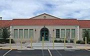 The Buckeye Union High School A-Wing was built in 1925 and is located at 902 E. Eason Ave. The school A- wing was listed in the National Register of Historic Places in December 30, 2009, reference #09001160.
 -
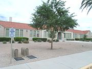 Different view of the historic Buckeye Union High School A-Wing.
 -
 The Roosevelt Irrigation District Building. This structure was built in 1929 and is located on 103 West Baseline Road.
 -
 The West Valley Academy Building was built in 1930 and is located at 827 E. Monroe Ave. It originally was used as a church. Listed as historical by the Buckeye Valley Historical and Archaeological Society.
 -
 The Buckeye Women's Club was built in June 6, 1935 and is located at 845 East Monroe Ave. Listed as historical by the Buckeye Valley Historical and Archaeological Society.
 -
 The May Building a.k.a. the Urwiller Building, was built in 1931 and is located on 824 East Monroe Ave.
 -
 Ganley’s Funeral Home was built in 1939 and is located on 104 East Baseline Road. It was on the second floor of this building that the planners of a town, which was to be named "Valencia", had their office.
 -
 The Millstone Café structure was built in 1944 and is located on 801 East Monroe Ave.
 -
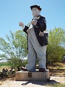 Hobo Joe was made in 1965 and is located in front of Gillums Meat & Locker Co. at 1015 East Monroe Avenue. There is a dispute as to if the sculptor is a person called Jim Casey or Marvin Ransdell. It is unknown and remains a mystery. The 25 foot tall statue is a landmark in Buckeye.
 -
 Old Historic Safe Marker.
 -
 1888 safe once used in the Southern Pacific Railroad Station in Buckeye.
 -
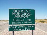 John C. Butler Memorial Field.
 -
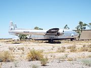 Fairchild C-119G Flying Boxcar N15501.
 -
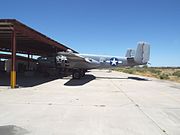 B-25C Mitchell Bomber
 -
 Liberty School was built in 1910 and is the oldest school in Arizona still in use.
 -
 Side view of Liberty School.
 -
 Liberty Cemetery was established in 1885 and is located on South 207 Ave. This is the final resting place of many of Buckeye’s pioneers.
 -
 Grave of William "Bob" R. Beloat (1861-1954) A-5-4. Beloat was instrumental in organizing the Buckeye Irrigation Company, and he and his brother John assisted in turning the first water into the company ditch.
 -
 Grave of Thomas Newton ("Newt") Clanton (1843-1926) B-8-5. Clanton was the founder of Buckeye. He was a native of Creston, Iowa who moved to Arizona for health reasons.
 -
 Grave of Joe Chicken (?-?) A-1-4.
 -
 The "Old Spain House" (now known as the Nardini Manor) was built in 1886 and remodeled in 1912. It is located on 5601 S 195th Ave.
 -
 Old abandoned farm house on the Joshua L. Spain homestead.
 -
 Liberty Methodist Church was built in 1903 and located located on South Liberty School Road.
 -
 Liberty Methodist Church Memorial Hall built in 1903.
 -
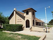 The Palo Verde Baptist Church was built in 1890 and is located on 29600 West Old Hwy. 80.
 -
 The Palo Verde Baptist Church Cemetery was established in 1903 and is located on 29600 West Old Hwy. 80.
 -
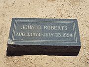 Grave of John G. Roberts (1874-1954)


-
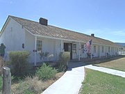
 The Little Red Schoolhouse -1947, Bullhead City's first school
 -
 Colorado River Historical Society & Museum -1947
 -
 Finger Rock


-
 Cameron Trading Post - 1916
 -
 Grand Canyon Hotel (now the Grand Canyon Motel) - 1928
 -
 Cameron Post Office-1916
 -
 Tradiing Post Warehouse - 1916
 -
 Plaque on Tanner's Suspension Bridge -1911
 -
 Tanner's Suspension Bridge- 1911
 -
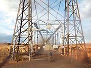 Different view of Tanner's Suspension Bridge.


-
 This "0" Mile General Crook Trail Marker
 -
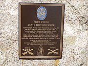 Historic State Park Marker
 -
 The Old Camp Verde Bell is located on the grounds of the historic 1916 George Hance House.
 -
 The main Administration Building of Fort Verde was built in 1871
 -
 Inside the Commanding officers office in the Administration Building of Fort Verde.
 -
 7th Cavalry Bugle
 -
 Display of uniforms in the Administration Building.
 -
 Buffalo soldiers exhibit
 -
 Military hats worn in Fort Verde
 -
 The historic Commanding Officer Quarters in Fort Verde was built in 1871
 -
 The historic Bachelor Officers’ Quarters in Fort Verde was built in 1871
 -
 The historic Doctor’s & Surgeons Quarters in Fort Verde was built in 1871
 -
 The George Hance House was built in 1916


-
 The Wingfields Mercantile Store.
 -
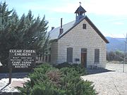 The Clear Creek Church.
 -
 The 1911 Wingfield Building.
 -
 The 1916 Wingfield Building.
 -
 The Wingfield, Hank and Myrtle, Homestead House, a.k.a." Crooked "H" Ranch House".
 -
 The Don Bell House.
 -
 This Camp Verde Bath House.
 -
 The Rock Jail.
 -
 The Boler's Bar.
 -
 The Montezuma Inn/Red Star Saloon.


(NRHP = National Register of Historic Places)
-
 Entrance sign of the Montezuma Castle National Monument which is located near Camp Verde, Arizona. The sign and its contents are the work of an employee of the Bureau of Land Management. Montezuma Castle National Monument is listed in the National Register of Historic Places, reference #66000082.
 -
 The Montezuma Castle is a historic cliff dwelling located in Montezuma Castle National Monument. The dwelling was built and used by the Pre-Columbian Sinagua people. It was occupied from approximately 1100–1425 AD, and occupation peaked around 1300 AD. Early European settlers believed that the builders were of the Aztec tribe and named the dwellings after Montezuma II, the Aztec emperor of Mexico. Listed in the National Register of Historic Places, reference #66000082.
 -
 Close up view of the Montezuma Castle.
 -
 The Cliff and cave dwellings of the Sinagua people next to the Montezuma Castle, located in Montezuma Castle National Monument.
 -
 Display which shows how the Pre-Columbian Sinagua people lived in Montezuma Castle. The display and its contents are the work of an employee of the Bureau of Land Management.


(NRHP = National Register of Historic Places)
-
 Montezuma Well is a detached unit of Montezuma Castle National Monument located near Rimrock and Camp Verde, Arizona. The Montezuma Well is a natural limestone sinkhole. It is listed in the National Register of Historic Places, reference #66000082.
 -
 Cliff dwellings of the Sinagua people in the area known as Montezuma Well.
 -
 Close up view of the Cliff dwellings of the Sinagua people.
 -
 Pit House ruins of Sinagua people, which dates back to 1050 AD, in the area known as Montezuma Well. The two largest holes in the dirt floor held the timber which supported the roof. The holes around the edge reveal the outline of the structure.
 -
 Tony "The Marine" Santiago posing in the Ruins of a Sinagua house, which dates back to 1050 AD.
 -
 Different view of the Ruins of a Sinagua house.


-
 The Carefree Town Hall located at 8 East Sundial Circle.
 -
 The Carefree Sundial Plaque.
 -
 The Carefree Sundial. The largest sundial in the United States is a giant copper-clad fixture located in Sundial Circle in the town of Carefree, Arizona. It was built in 1959 and stretches 62 feet and points to the North Star. The sundial is the third largest in the Western Hemisphere.
 -
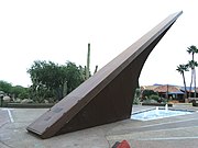 The Carefree Sundial.


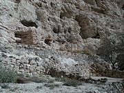
The prehistoric Hohokam's built villages and defensive fortifications. The Sears-Kay Ruin is one of the many forts built by the Hohokam. The ruins of this fort is located atop a desert foothill in the Tonto National Forest on the outskirts of the town of Carefree, Az. The fort was built around 1050 AD and later abandoned only to be discovered in 1867 by soldiers on patrol who were stationed in nearby Fort McDowell. The fort had 40 rooms which housed about 100 people. The area was named after two early homesteaders. The site was listed in the National Register of Historic Places on November 24, 1995, reference #95001310.

-
 Sears-Kay Ruin trail marker.
 -
 The starting point of "A Trail to the Past".
 -
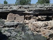
 Sears-Kay Ruin Fort Ruins.
 -
 Sears-Kay Ruin Fort wall.
 -
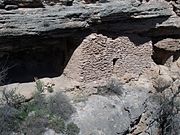
 Sears-Kay Ruin Fort rooms.
 -
 Sears-Kay Ruin Fort room.
 -
 Sears-Kay Ruin Mystery Room Marker
 -
 Sears-Kay Ruin Fort Mystery Room.
 -
 Sears-Kay Ruin Fort rock formation.
 -
 View from the top of the desert foothill where the Sears-Kay Ruin Fort is located.


(National Register of Historic Places)

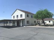
-
 The Cruz Trading Post was built in 1888 and is located at 200 W. Main St. It was listed in the National Register of Historic Places in 1985, reference #85000883.
 -
 The Casa Grande Hotel was built in 1898 and is located at 201 W. Main Ave. (behind the Southern Pacific Railroad Depot) It was listed in the National Register of Historic Places in 1985, reference #85000881.
 -
 The Johnson's Grocery Store was built in 1907 and is located at 301 N. Picacho St. It was listed in the National Register of Historic Places in 1985, reference #85000885.
 -
 The Ward's Variety Store was built in 1914 and is located at 112 N. Sacaton St. It was listed in the National Register of Historic Places in 1985, reference #85000898.
 -
 The Central Creditors Association Building was built in 1914 and is located at 118 N. Sacaton St. It was listed in the National Register of Historic Places in 1985, reference #85000882 .
 -
 The Casa Grande Union High School was built in 1920 and is located at 510 E. Florence Boulevard. The building now serves as the Casa Grande City Hall. The structure was listed in the National Register of Historic Places in 1986, reference #86000821.
 -
 The Casa Grande Garage was built in 1922 and is located at 117 N. Sacaton St. it is listed in the Casa Grande Historic Register.
 -
 The Pioneer Market was built in 1922 and is located at 119 N. Florence St. It was listed in the National Register of Historic Places in 1985, reference #85000919.
 -
 The Stone Warehouse was built in 1922 and is located in the rear of the building at 119 Florence St. It was listed in the National Register of Historic Places in 1985, reference #85000896.
 -
 The Building at 121 North Florence Street was built in 1923 and is located at 121 N. Florence St. It was listed in the National Register of Historic Places in 2002, reference #02000737.
 -
 The Casa Grande Woman's Club Building was built in 1924 and is located at 407 N. Sacaton St. It was listed in the National Register of Historic Places in 1979, reference #79000425.
 -
 The Southern Pacific Railroad Depot was built in 1925 and is located at 201 W. Main St. The Casa Grande Hotel Building, built in 1898, is located behind the depot The depot was listed in the National Register of Historic Places in 2002, reference #02000734.
 -
 The Casa Grande Stone Church (now known as Heritage Hall) was built in 1927 and is located at 110 W. Florence Boulevard. It was listed in the National Register of Historic Places in 1978, reference #78000567.
 -
 The Fisher Memorial Home was built in 1927 and is located at 300 E. 8th St. The combination house/funeral home was built in 1927. It was listed in the National Register of Historic Places in 1985, reference #85000884.
 -
 The Casa Grande Hospital was built in 1928 and is located at 601 N. Cameron Ave. It was listed in the National Register of Historic Places in 2002, reference #02000740.
 -
 The Prettyman's Meat Market and Grocery/Brigg's Jeweler structure was built in 1929 and is located at 110 W. Main Ave. It was listed in the National Register of Historic Places in 1985, reference # 85000891.
 -
 The Paramount Theatre was built in 1929 and is located at 420 N. Florence St. It was listed in the National Register of Historic Places in 1999, reference #990001067.
 -
 The Casa Grande Dispatch Building was built in 1929 and is located at 109 E. 2nd St. It was listed in the National Register of Historic Places in 2002, reference #02000747.
 -
 The Southside Elementary School was built in 1930 and is located at 501 S. Florence St. It is listed in the Casa Grande Historic Register.
 -
 The Rebecca Dalis School House was built in 1934 and is located at 110 W. Florence Blvd. It is listed in the Casa Grande Historic Register.
 -
 Saint Anthony's Church was built in 1935 and is located at 215 N. Picacho St. It was listed in the National Register of Historic Places in 1985, reference #85000892.
 -
 Saint Anthony's Church Rectory was built in 1935 and is located at 201 N. Picacho St. It was listed in the National Register of Historic Places in 1985, reference #85000892.
 -
 The Mandell and Meyer Building was built in 1937 and is located at 211 N. Florence St. It was listed in the National Register of Historic Places in 2002, reference #02000736.
 -
 The First Baptist Church was built in 1938 and is located at 218 E. 8th St. It was listed in the National Register of Historic Places in 2002, reference #02000751.
 -
 The Lincoln Hospital was built in 1940 and is located at 112 N. Brown Ave. It was listed in the National Register of Historic Places in 2002, reference #02000741.
 -
 The S.S. Blinky Jr. Building was built in 1946 and is located at 465 W. Gila Bend Highway. It was listed in the National Register of Historic Places in 2002, reference #02000748.
 -
 The V.W. Kilcrease Building was built in 1948 and is located at 139 W. 1st St. It was listed in the National Register of Historic Places on November 20, 2002, reference #02000754.
 -
 The William Cox Building was built in 1948 and is located at 501 N. Marshall St. It was listed in the National Register of Historic Places in 1999, reference #99001068.
 -
 The Church of the Nazarene was built in 1949 and is located at 305 E. 4th St.. It was listed in the National Register of Historic Places in 2002, reference #02000750.
 -
 The Valley National Bank building was built in 1950 and is located at 221 N. Florence St. It was listed in the National Register of Historic Places in 2002, reference #02000733.
 -
 The Building at 400 East Third Street (once the Church of Christ) was built in 1950 and is located at 400 E. 3rd St. It was listed in the National Register of Historic Places in 2002, reference #02000749.


-
 The Bien/McNatt House was built in 1880 and is located at 208 W. 1st St. It was listed in the National Register of Historic Places in 1985, reference #85000880.
 -
 The Judge William T. Day House was built in 1886 and is located at 306 W. 1st St. It was listed in the National Register of Historic Places in 1985, reference #85001624.
 -
 The Shonessy House was built in 1900 and is located at 115 W. Main Ave. It was listed in the National Register of Historic Places in 1985, reference #85000894.
 -
 The Meehan/Gaar House was built in 1903 and is located at 200 W. 1st St. Fanne Gaar bought the house in 1920. She became mayor of Casa Grande in 1927, a first for a woman in Arizona. Gaar lived in the house until her death in 1971. It was listed in the National Register of Historic Places in 1985, reference #85000890.
 -
 The BeDillions House built in 1917 and located at 800 Park Ave. It is listed in the Casa Grande Historic Register.
 -
 The House at 323 West Eighth St. was built in 1918 and is located at 323 W. 8th St. It was listed in the National Register of Historic Places in 2002, reference #02000744.
 -
 The House at 736 North Center Avenue was built in 1919 and is located at 736 N. Center Ave. It was listed in the National Register of Historic Places in 2002, reference #02000738.
 -
 The House at 320 West Eighth Street a.k.a. The Stone Barber Shop was built in 1920 and is located at 320 W. 8th St. It was listed in the National Register of Historic Places in 2002, reference #02000745.
 -
 The Wilbur O. Bayless/Grasty House which was built in 1920 and is located at 221 N. Cameron St. It was listed in the National Register of Historic Places in 1985, reference #85000879.
 -
 The Gus Kratzka House (now the Casa Grande Art Museum) was built in 1929 and is located at 319 W. 3rd Street. It was listed in the National Register of Historic Places in 1985, reference #85000886.
 -
 The Henry and Anna Kochsmeier House was built in 1929 and is located at 403 W. 2nd Ave. It was listed in the National Register of Historic Places in 2002, reference #02000746.
 -
 The Stone Bungalow was built in 1921 and is located at 515 E. 3rd St. It was listed in the National Register of Historic Places in 1985, reference #85000995.
 -
 The Earl Bayless House which was built in 1922 and is located at 211 N. Cameron St. It was listed in the National Register of Historic Places in 1985, reference #85000878.
 -
 Extension of the Earl Bayless House which was used as a store and which is located at 211 N. Cameron St. It was listed in the National Register of Historic Places in 1985, reference #85000878.
 -
 The House at North Lehmberg Avenue a.k.a. Spanish Eclectic House was built in 1925 and is located at 1105 N. Lehmberg Ave. It was listed in the National Register of Historic Places in 2002, reference
 -
 The Period Revival House was built in 1927 and is located at 905 N. Lehmberg St. It was listed in the National Register of Historic Places in 1985, reference #850001623.
 -
 The Vasquez House was built in 1927 and is located at 114 E. Florence Boulevard. It was listed in the National Register of Historic Places in 1985, reference #85000897.
 -
 The House at 59 North Brown Avenue a.k.a. Fieldstone House was built in 1928 and is located at 59 N. Brown Ave. It was listed in the National Register of Historic Places in 2002, reference #02000742.
 -
 The Benjamin Templeton House was built in 1929 and is located at 923 N. Center Ave. It was listed in the National Register of Historic Places in November 20, 2002, reference #02000739
 -
 The House at 317 East Eighth Street was built in 1929 and is located at 317 E. 8th St. It was listed in the National Register of Historic Places in 2002, reference #02000753.
 -
 The House at 222 West Ninth St. was built in 1920 and is located at 222 W. 9th St. It was listed in the National Register of Historic Places in 2002, reference #0200073.
 -
 The Dr. H. B. Lehmberg House was built in 1929 and is located at 929 N. Lehmberg St. It was listed in the National Register of Historic Places in 1985, reference #85000888.
 -
 The White House was built in 1929 and is located at 901 N. Morrison. The house was listed in the National Register of Historic Places in 1985, reference #85000899.
 -
 The C. J. (Blinky) Wilson House was built in 1929 and is located at 223 W. 10th St. It was listed in the National Register of Historic Places in 1985, reference #85000900.
 -
 The Walter Wilbur House was built in 1939 and is located at 904 E. 8th St. It was listed in the National Register of Historic Places in 2002, reference #02000752.
 -
 Historic Casa Grande Fire Department Engine #1 a 1928 American La France vehicle in display in the Casa Grande Historical Society Museum at 110 W Florence Blvd, Casa Grande, AZ.


-1929.JPG)


_Wilson_House-1929-2.JPG)


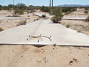
The Corona Satellite Calibration Targets refer to two hundred and seventy two concrete markers, built in the 1960s in the desolate Arizona desert, in and around Casa Grande, Arizona that helped to calibrate satellites of the Corona spy satellite program. They are large concrete crosses in the ground with a resemblance of a large Maltese Cross. The targets are only visible if one walked up to them or passed over them from a great height, like space.
Each of the targets has a manhole with a cement cover and rebar handles. The manhole is located on the west arm of the cross. According to Gary Morgan, member of the Cold War Museum in Warrenton VA., the 6 pieces of rebar, which protrude at an equal distance from each other, may have been used to hold laser lighting to give a more accurate fix on each target.
The targets were abandoned following the end of the program in 1972. Most of the targets were either destroyed or demolished. Pictured are two of the remaining targets which have survived. The first one pictured (Y47) is located on the southeast corner of South Montgomery and West Cornman Roads and the second (Y4-) one on the northeast corner of West Cornman Road and Carmel Blvd.
-
 This Corona Satellite Calibration Target (Y47) is located on the southeast corner of South Montgomery and West Cornman Roads.
 -
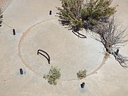
 Manhole cover of the first Corona Satellite Calibration Target with a cement cover and rebar handles.
 -
 A close-up view of the first Corona Satellite Calibration Target manhole cover. Around the cover protrudes 6 equal distant pieces of rebar.
 -
 The first Corona Satellite Calibration Target U.S. Corps of Engineers 1967 Survey Mark.
 -
 Close-up view of the first Corona Satellite Calibration Target U.S. Corps of Engineers 1967 Survey Mark.
 -
 The second Corona Satellite Calibration Target (Y4-) is located on the northeast corner of Corman Road and Carmel Blvd.
 -
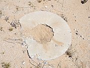
 The second Corona Satellite Calibration Target manhole cover.
 -
 Close-up view of the second Corona Satellite Calibration Target manhole cover.
 -
 The U.S. Corps of Engineers Survey Mark was once located here.


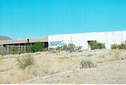
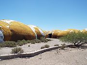
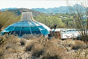
The Casa Grande Domes, located on South Thornton Road, were built in the 1970s for the manufacturing of computers, but were never completed. The Domes were completely abandoned. Some of the Domes resemble flying saucers and others look like giant caterpillars.

-
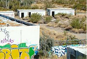
 Round Dome.
 -
 Another round Dome.
 -
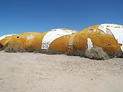 Some Domes resembled caterpillars.
 -
 Caterpillar Domes.
 -
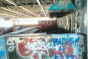
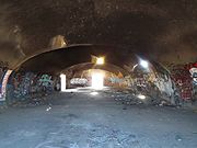 Inside one of the Domes.
 -
 Graffiti inside a Dome.


(National Register of Historic Places)
-
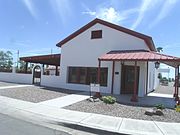
 Cave Creek Town Hall located at 37622 N. Cave Creek Rd.
 -
 Dome in the Desert House "NRHP"
 -
 Dome in the Desert House "NRHP"
 -
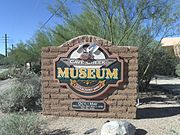 Cave Creek Museum Entrance Marker
 -
 The Cave Creek Museum located at 6140 E. Skyline Drive. The museum opened its doors in 1970 by the historical society. The society itself was established in 1968. Among its outside exhibits are Tubercular Cabin, listed in the National Register of Historic Places, the First Church of Cave Creek and Golden Reef Stamp Mill.
 -
 The Cave Creek Museum Lizard Bench.
 -
 The Tubercular Cabin was one of the cabins belonging to the Desmount Sanitarium built in 1920. It was originally located where the Cave Creek Road curve. The cabin was donated to the Cave Creek Museum.
 -
 Inside the Tubercular Cabin .
 -
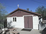 The First Church of Cave Creek , also known as the First Episcopal Church of Cave Creek, was built in 1948 and is located on the grounds of the Cave Creek Museum. The church continues to be active for weddings and memorial services.
 -
 Inside the First Church of Cave Creek .
 -
 The original bell of the First Church of Cave Creek ,
 -
 The Golden Reef Stamp Mill was built in 1880 in California for the Golden Reef Mine in Cave Creek, Arizona. The Mine folded in 1913 and the stamp mill was donated to the Cave Creek Museum.
 -
 Another view of the Golden Reef Stamp Mill .
 -
 The Cave Creek Bandshell was originally located in downtown Cave Creek, Arizona. It is now located on the grounds of the Cave Creek Museum.
 -
 A pre-1913 Golden Reef Mine Tramway Car . It is located on the grounds of the Cave Creek Museum. Arizona.
 -
 A Miner’s Arrastre. The arrastre, which in Spanish means “to drag, was built in 1900. It was a crude crushing mill run by burro or oxen.
 -
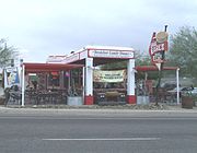 The Cave Creek Service Station was built in 1925 and is located at 6141 Cave Creek Rd. The service station was converted into a restaurant. It was listed in the National Register of Historic Places in September 22, 2000, reference #00001126.
 -
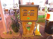 A Cave Creek Service Station 1947 gas pump.
 -
 Location where the Cave Creek Inn was built in 1920. The structure is located at 37645 N. Cave Creek Rd. It is Cave Creek’s longest running commercial building and is now occupied by a restaurant.
 -
 Frontier Town is mostly replicas from Cave Creek’s old west days of cowboys and gold miners. It is located in 6245 E. Cave Creek Rd.
 -
 The former Leather Mill building is located in Frontier Town. It was built in the late 1880s and is one of the original buildings still standing in Cave Creek.
 -
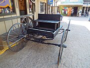 A 19th century wagon in Frontier Town.
 -
 One of many 19th century wagons in Frontier Town.
 -
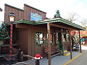 Different view of the former Leather Mill building.
 -
 A 1936 “WPA” outhouse used as an attraction in Cave Creeks Frontier Town.
 -
 Harold’s Cave Creek Corral was built in 1935 and is located at 6895 E. Cave Creek Road. It originally started as the Corral Bar.
 -
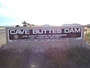 The Cave Buttes Dam marker.
 -
 The Cave Buttes Dam is an earthen dam located near Cave Creek, Arizona. Built in 1979, by the U.S. Army Corps of Engineers, the dry dam was built to replace the nearby Cave Creek Dam.
 -
 Road leading to the Cave Buttes Dam


Major General George S. Stoneman was the commanding officer of the U.S. Cavalry stationed in Camp McDowell (later renamed Fort McDowell) in what was then the United States Territory of Arizona. He wanted to establish a trail which would serve as a short cut between Camp McDowell and Fort Whipple in Prescott, Arizona. In 1865, he investigated an old Native-American trail which cut through the McDowell Mountains, a chain of extinct volcanic mountains and the Black Mountain of the modern day Cities of Fountain Hills and Cave Creek. The trail was named the “Stoneman Military Trail”.
-
 Road sign indicating where the Stoneman Military Trail ran through.
 -
 Cave Creek's Black Mountain.
 -
 Black Mountain sign.
 -
 Stoneman Military Trail.
 -
 Ruins along the Stoneman Military Trail.


(NRHP = National Register of Historic Places)
(CHS=Chandler Historical Society)

-
 San Marcos Hotel - The grand opening of the Hotel San Marcos took place on November 22, 1913. Among the 500 guests present were Governor George P. Hunt and Vice President Thomas Marshall. It now named the Crowne Plaza San Marcos Hotel.
 -
 San Marcos Hotel extension whose basement served as a speakeasy during the prohibition era (1920-1933).
 -
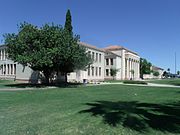 Chandler High School built in 1900 and located in 350 N. Arizona Ave. The building is listed in the National Register of Historic Places. Reference #07000836
 -
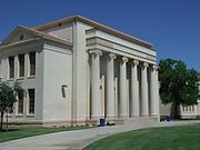 Close-up view of the Chandler High School built in 1900 and located in 350 N. Arizona Ave. The building is listed in the National Register of Historic Places. Reference #07000836
 -
 Bank of Chandler built in 1913 and located at 8 San Marcos Plaza.
 -
 McCullough-Price House built in 1925 and located at 300 S. Chandler Village Dr.. List in the National Register of Historic Places. Reference #09000311
 -
 Suhwaro Hotel built in 1900 and located in 58 W. Buffalo St. in Chandler, Arizona. Architectural Style: Mission/Spanish Revival. The building is listed in the National Register of Historic Places. Reference #94000575.
 -
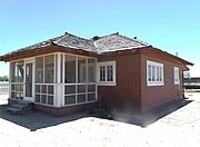 The Edwards House is the "Maples" model from the 1913 Aladdin Company catalog. The house is located at Tumbleweed Park at 2250 S. McQueen Road. It is listed as historic by the Chandler Historical Society.
 -
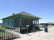 The McCroskey House was built by George Edwards in 1917 and was originally near Pecos and Dobson Roads. The house was sold to the McCroskey family and is located at Tumbleweed Park at 2250 S. McQueen Road. It is listed as historic by the Chandler Historical Society.
 -
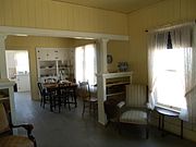 Inside the McCroskey House.
 -
 The McCormick Building was built in 1928 and is located at 149 West Boston Street. It originally housed the I.O.O.F. (Independent Order of Odd Fellows) Hall and Armory. The building is listed as historical by the Chandler Historical Society.
 -
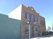 Different view of the McCormick Building which was built in 1928 and is located at 149 West Boston.
 -
 Goodyear Cotton Ranch House
 -
 The Arrow Pharmacy Building was built in 1918 and is located at 11 West Boston Street. John B. “Doc” Weber, the town’s pharmacist operated Weber’s Arrow Pharmacy for years. The building is listed as historical by the Chandler Historical Society.
 -
 The Reliable Hardware Store Building was built in 1919.Alva Morgareidge, a town councilman and member of the school board, opened for business December 8, 1919. The building is located at 17 West Boston Street. The building is listed as historical by the Chandler Historical Society.
 -
 The 1st. National Bank Building was built in 1919. The building is located at 35 West Boston Street. The building is listed as historical by the Chandler Historical Society.
 -
 The Esber Store Building was built in 1919. The building is located at 51 East Boston Street. The building is listed as historical by the Chandler Historical Society.
 -
 The O.S. Stapley Hardware Store Building was built in 1947. The O.S. Stapley Hardware Company was a prominent company in the Salt River Valley, with branches in Mesa, Glendale, and Phoenix. In Chandler, many families purchased their farm equipment. The building is located at 63 East Boston Street. The building is listed as historical by the Chandler Historical Society.
 -
 The Friedberg Building was built in 1919. The building is located at 67 West Boston Street. Joseph Friedberg, a dry goods merchant and owner of the building, got his start with a storeroom in the San Marcos Hotel. The building is listed as historical by the Chandler Historical Society.
 -
 The Gilbert Building was built in 1919. The building is at 71 West Boston Street. Dr. Gilbert came to Chandler in 1913 and set up his practice in a tent. For years he was Chandler’s only physician. In 1918, he purchased this lot with the financial assistance of John H. Dobson. The following year, Gilbert’s permanent office was constructed here. The building is listed as historical by the Chandler Historical Society.
 -
 The Menhennet/Rowena Theater Building was built in 1920. The building is located at 81 West Boston Street. This theater building was equipped with all the most modern amenities available in 1920, seating 600 patrons and complete with a heating and cooling system. Bill Menhennet opened this theater as the Chandler Theater in 1922, and also was the proprietor of the original theater in the Monroe building. The building is listed as historical by the Chandler Historical Society.
 -
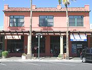 The Monroe Building was built in 1912. The building is located at 28 San Marcos Place. The Chamber met upstairs and the lower floors were leased to stores. Merchant E.W. Monroe, after whom the building is named, leased the first floor for the Monroe Hardware Company, Chandler’s first hardware company. In 1915, the top floor space was converted into Chandler’s first movie theater, where silent pictures were shown. In 1919, the second floor became offices for Chandler’s first attorney Arthur E. Price, after whom Price Road is named. The building is listed as historical by the Chandler Historical Society.
 -
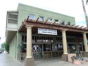 The Hotel Chandler Building was built in 1914. The building is located at 98 San Marcos Place. Chandler’s first elected mayor, David A. Jacobson, financed the construction of this building. The bottom floor was leased out for stores, and the second story was a reasonably priced hotel, an affordable alternative to the San Marcos Resort. Many prominent Chandler businessmen, especially those working downtown, kept permanent residence in rooms at the Hotel. The building is listed as historical by the Chandler Historical Society.
 -
 The Price Building was built in 1814 and is located at 80 S. San Marcos Place. It is named for Arthur E. Price, who owned it at one time. Price, Chandler’s first attorney, drafted Chandler’s incorporation charter in 1920. Price Road is named after him. The building is listed as historical by the Chandler Historical Society.
 -
 The Andersen Building was built in 1814 and is located at 72 S. San Marcos Place. Town Attorney Arthur Price spent time playing dominoes here and had his mail forwarded here. The building is listed as historical by the Chandler Historical Society.
 -
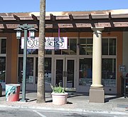 The Dobson Building was built in 1912 and is located at 64 S. San Marcos Place. John H. Dobson, who first homesteaded in the Mesa area in the 1890's, was one of the most instrumental men in Chandler’s early history, financing many private and public ventures, as well as establishing the First National Bank in 1919. Dobson Road is named after him. The building is listed as historical by the Chandler Historical Society.
 -
 The Morrison Grocery Building was built in 1912 and is located at 40 S. San Marcos Place. The Morrison Brothers, Ernest and Leroy, were perhaps the first grocers in Chandler. Arthur Price bought the building in 1937 and it was later occupied by the Chandler Electric Company. The building is listed as historical by the Chandler Historical Society.
 -
 The Arrow Pharmacy building was built in 1918 and is located at 11 W Boston St.. John B. “Doc” Weber operated Weber’s Arrow Pharmacy for years. After over 85 years of service to the Chandler community, the doors closed for the first time in July 2005. The building is listed as historical by the Chandler Historical Society.
 -
 Winn School
 -
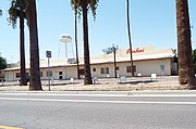 First Basha's Grocery Store
 -
 The historic Goodyear-Ocotillo Cemetery was a small plot of land was designated a cemetery by the Goodyear Tire and Rubber Company of Akron, Ohio. Goodyear owned and farmed the surrounding acreage from 1916 until 1943. Goodyear workers and their families are buried here. The Cemetery is located South Iowa Street 0.1 miles south of Fulton Ranch Blvd in Chandler, Az..
 -
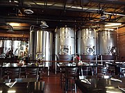 Inside the San Tan Brewery.


The Arizona Railway Museum was founded and incorporated in 1983 as a non-profit, educational and historical organization. It houses the Southern Pacific Railroad Locomotive No. SP 2562 and Tender No. 8365, the Railroad Steam Wrecking Crane and Tool Car and the Tucson, Cornelia & Gila Bend Caboose No. 15, all of which are listed in the National Register of Historic Places.

(NRHP = National Register of Historic Places)
-
 The Arizona Railway Museum building and gift shop.
 -
 One of many exhibits inside the Arizona Railway Museum.
 -
 Wheels from Engine Tender #013. The Engine Tender was destroyed in a wreck in 1907 on a bridge over Village Creek between Silsbee and Beaumont, Texas.
 -
 Southern Pacific Railroad Locomotive No. SP 2562 and Tender No. 8365 was built in 1900. It is on exhibit in the Arizona Railway Museum. The locomotive is a Model: BLW 2-8-0, built as: SP 2562 (2-8-0) by the Baldwin Locomotive Works, Serial Number: 29064. The locomotive and tender are listed in the National Register of Historic Places. Reference #09000511.
 -
 Inside the Southern Pacific Railroad Locomotive Sp 2562 which is listed in the National Register of Historic Places. Reference #09000511.
 -
 Magma Railroad Baldwin #10 Locomotive. The Baldwin Locomotive Works built this locomotive in 1950 as a DRS 6-6-1500, diesel for the McCloud River Railroad as #29.
 -
 C&NW E8 Locomotive operated by the Chicago and North Western Transportation Company and built in 1950.
 -
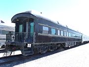 Southern Railway Business Car built in 1897 for the Southern Railway Company. The car, nicknamed the "Desert Valley", served as the President's Car on the South Carolina & Georgia Railroad in 1901.
 -
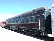 Different view of the Southern Railway Business Car built in 1897.
 -
 The Federal #98 Pullman Private Car. This Pullman Private Car, which was available for lease, was built by the Pullman Company in 1911.
 -
 The Santa Fe Business Car #405, also known as the Superintendent's Car, was one of eighteen cars built in 1927 by the Pullman Company as part of the fourth order of business cars for division superintendents.
 -
 Santa Fe Coach Car built in 1910.
 -
 The Santa Fe "Diablo Canyon" Coach Car #3079 was built by the Budd Company in 1937.
 -
 Visitors pose inside the Santa Fe "Diablo Canyon" Coach Car #3079.
 -
 Santa Fe "Plaza Taos" Dome Car built in 1950.
 -
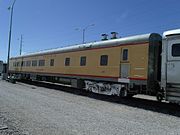 Union Pacific Diner Car, named "The City of Chandler", built in 1949 by the A C & F Railroad CO. and operated by the Union Pacific Railroad.
 -
 Railroad Steam Wrecking Crane and Tool Car. Also known as Southern Pacific Railroad Nos.: SPMW 7130/SPMW 7131 was built in 1900 by the Bay City Industrial Works. The wrecking crane and tool car are listed in the National Register of Historic Places. Reference #07001301.
 -
 Tank Car UTLX #7682 (PDAX #1057). This single Dome Tank Car was built by the Union Tank Car Company for Southern Pacific in 1942. It has a riveted tank body.
 -
 The Tuscon, Cornelia & Gila Bend Caboose No. 15. It was built in the late 1890's, when the Phelps-Dodge Copper Company sought to connect their New Cornelia Copper Mine in Ajo (pronounced "AY-ho") with smelters in Tuscon. It was listed in the NRHP on May 7, 2018, reference# 100001660.
 -
 The G.R.Y.X. 799 tank Car is a three dome, three compartment, outside riveted tank car which was built for the W. R. Grace Company in 1938. The three separate compartments were used to carry chemicals or solvents.
 -
 Log Car built in 1917 by Bettendorf Co. for the Southwest Forest Industry.
 -
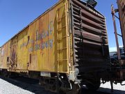 Refrigerator Car built in 1920 by American Car & Foundry for the Santa Fe Railroad Co.
 -
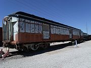 Southern Pacific Horse Car built in 1937 by the St. Louis Car Company for the Southern Pacific Transportation Company.
 -
 Toronto Transit Street Car built in 1930.


Santa Fe "Plaza Taos" Dome Car

-
 Stairs leading to the "Dome" of the Santa Fe "Plaza Taos" Dome Car which was built in 1950.
 -
 Inside view of the Santa Fe "Plaza Taos" Dome Car's dome, built in 1950.
 -
 Inside view of the Santa Fe "Plaza Taos" Dome Car's "Lounge Room" which was built in 1950.


-
 Abandoned Commercial Building-1924
 -
 Granite Creek Vineyards Barn-1917


-
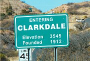 Welcome to Clarkdale
 -
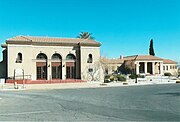 Clark Memorial Clubhouse.
 -
 Historic marker on Broadway Bridge.
 -
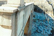 Broadway Bridge over Bitter Creek.
 -
 Different view of the Broadway Bridge.
 -
 Clarkdale Public Works Building.
 -
 Clarkdale High School.
 -
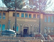 Clarkdale High School close-up.
 -
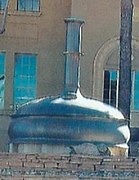 Giant Copper Beer Kettle built in Belgium in 1931.
 -
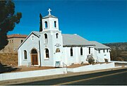 St. Cecilia Catholic Church.
 -
 St. Cecilia’s Catholic Church Bell located in the Copper Art Museum.
 -
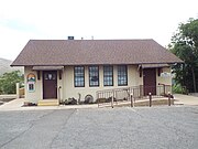 Old Clarkdale Medical Clinic
 -
 Old Elementary School
 -
 Brick Building
 -
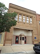 Grand Theatre
 -
 Old Sidewalk Café


-
 Verde Canyon Railroad engine.
 -
 John Bell Railroad Museum's 1869 display "Looks West"
 -
 John Bell Railroad Museum's 1869 display "Ricochet"
 -
 Abandoned Verde Canyon Railroad cars.


-
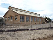 Smelter Machine Shop -1913
 -
 Smelter Superintendent House -1916
 -
 Roundhouse -1900
 -
 Depot ruins -1895
 -
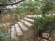 Depot ruins -1895
 -
 Trestle bridge -1910
 -
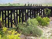 Trestle bridge -1910
 -
 Miller Wholesale Warehouse building.


-
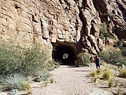 Claypool Tunnel - 1926
 -
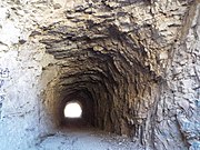 Different view of the Claypool Tunnel
 -
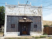 Old Store-1900
 -
 Old Buikding - 1901
 -
 Abandoned Arizona Eastern Railway Depot - 1885


-
 Historic Chase Creek Street
 -
 Alley between Chase Creek Street and Palacio Dr.
 -
 Granny's Attic - 1930
 -
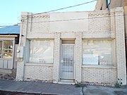 Restaurant/Shoe Repair - 1910
 -
 Woodmen of the World building - 1910
 -
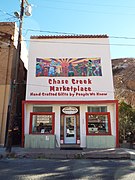 Chase Creek Marketplace - 1890
 -
 The Hollywood Shop - 1950
 -
 Zorrilla's Meat Market - 1893
 -
 Billard Hall/Brothel - 1893
 -
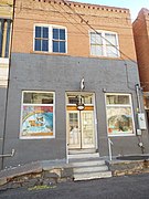 La Feria - Rafael Valdz - 1906
 -
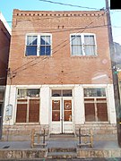 Saloon - 1913
 -
 Jewelry Store - 1904
 -
 J.C. Penney Store
 -
 Dry Goods Store/Farmer's Market
 -
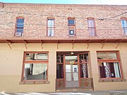 Front view of the Dry Goods Store/Farmer's Market
 -
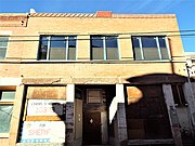 Gatti Meat Market - 1914
 -
 Cascarelli Building - 1913
 -
 Cascarelli Building
 -
 Lyric Theater ruins
 -
 ABC Market
 -
 Eagle Hall-Greenlee Historical Museum Building - 1913
 -
 Eagle Hall
 -
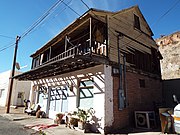 Villesca's House - 1918
 -
 Zappia Bakery flour warehouse
 -
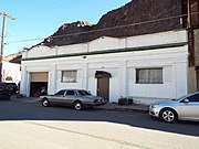 Picken-Anderson Overland Car Agency
 -
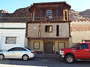 Antonio Spezia's Hay & Grain Store - 1913
 -
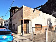 Laundromat/Drug Store - 1913
 -
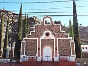 Sacred Heart Catholic Church - 1917
 -
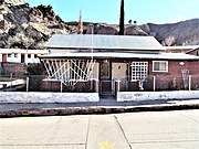 Hooker House - 1896
 -
 Antonio Spezia House - 1918
 -
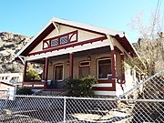 Different view of the Antonio Spezia House - 1918
 -
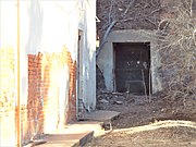 Ambrose Spezia's "Cave Bar" - 1911
 -
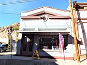 Doctor Harle's Office/Mexican Consulate - 1918
 -
 Clifton Social Club - 1913
 -
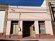 Clifton Union Hall - 1916
 -
 Drug Store/Law Office - 1913
 -
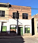 Old Buffet Bar - 1897
 -
 Greenlee Restaurant - 1907
 -
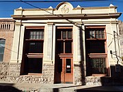 Jim Sing's Chop House - 1907
 -
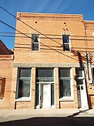 Storefront and living quarters - 1906
 -
 Palacio House - 1917
 -
 Different view of the Palacio House
 -
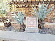 Freddy Fritz Youth Park established in 1984
 -
 180 pound copper sheet in Case Creek Street
 -
 Stone with "1884 Stevens" chiseled


.jpg)


-
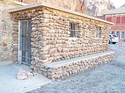 Clifton Cliff Jail main entrance
 -
 inside the jail main entrance
 -
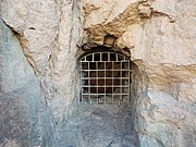 Clifton Cliff Jail Air hole
 -
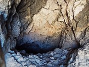 View inside the air hole


-
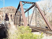 Railroad Bridge - 1901
 -
 Park Avenue Bridge (Zorilla Street Bridge) - 1918
 -
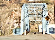 Different view of the Park Avenue Bridge (Zorilla Street Bridge)
 -
 Clifton Smelter ruins and Cave
 -
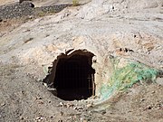 Clifton Smelter Cave
 -
 Inside the Clifton Smelter Cave
 -
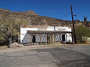 Clifton Casa Grande - 1894
 -
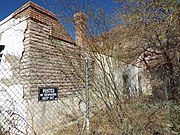 Side view of the Clifton Casa Grande
 -
 Blue Door Sanctuary - 1912
 -
 Town Hall - 1920
 -
 Flood alarm system
 -
 Clifton Amphitheater - 1913
 -
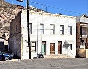 Hampton Block Building - 1890
 -
 Pascoe Undertaking and Funeral Parlor - 1917
 -
 Clifton Hotel - 1881
 -
 Clifton Hot Springs & Spa - 1929
 -
 Rear view of the Clifton Hot Springs & Spa - 1929
 -
 James Colquhoun House - 1900
 -
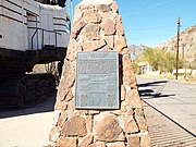 P & H Model 1800 Excavator Shovel #11 marker
 -
 P & H Model 1800 Excavator Shovel #11 - built in 1959


-
 Flood Gates
 -
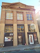 People Bank and Trust - 1917
 -
 People Bank and Trust
 -
 Arizona Copper Company Offices - 1904
 -
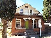 Old House - 1910
 -
 Different view of Old House - 1910
 -
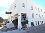 Hotel Reardon - 1913
 -
 Hotel Reardon sign


-
 Clifton Railroad Depot - 1913
 -
 Clifton Railroad Depot - 1913


-
 Greenlee County Courthouse - 1912
 -
 Greenlee County Jail - 1912
 -
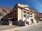 Clifton High School Sports Complex - 1917
 -
 Clifton Grocery Store - 1900
 -
 Storage and Livery - 1890
 -
 Different view of the Storage and Livery
 -
 Old Arizona Copper Co. Smelter Power House - 1897
 -
 Mares Bluff Veterans Memorial Flags


-
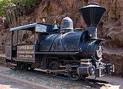 Copperhead “Number 8” locomotive - 1897
 -
 Front of Copperhead
 -
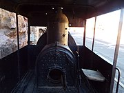 Inside Copperhead


Cool Springs, Arizona
edit-
 1920 original pillar of the Cool Springs service station
 -
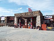 Rebuilt Cool Springs camp and service station
 -
 Narrow Route 66 stone bridge leading to Oatman
.jpg)


-
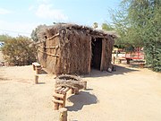 Early Cocopah dwelling
 -
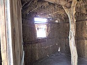 Inside the Cocopah dwelling


-
 Main entrance to the Casa Grande Ruins National Monument located at Ruins Drive in Coolidge. Listed in the National Register of Historic Places in 1966, and reference #66000192.
 -
 The Casa Grande Ruins are located at Ruins Drive in Coolidge, Az. Built by the Hohokam, the Casa Grande was abandoned around 1450 C.E. Written historic accounts of the Casa Grande begin with the journal entries of Padre Eusebio Francisco Kino when he visited the ruins in 1694. Listed in the National Register of Historic Places in 1966, and reference #66000192.
 -
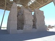 Back view of the Casa Grande Ruins.
 -
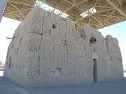 Side view of the Casa Grande Ruins.
 -
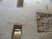 Inside the Casa Grande Ruins.
 -
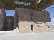 Different view of the Casa Grande Ruins National Monument located at Ruins Drive in Coolidge. Listed in the National Register of Historic Places in 1966, and reference #66000192.
 -
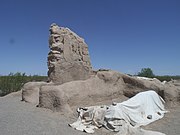 Different view of the Casa Grande Ruins National Monument.
 -
 Different view of the Casa Grande Ruins National Monument.
 -
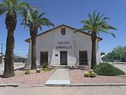 The Coolidge Woman's Club (Building) was built in 1925 and is located at 240 W. Pinkley Ave., Coolidge, Arizona. The building was listed in the National Register of Historic Places in 1990, reference #900015924.
 -
 The original Coolidge High School was built in 1939 and is located at 450 N. Arizona Blvd. in Coolidge Arizona The building now houses the offices of the Coolidge Unified School District #23.
 -
 Different view of Coolidge High School.


listed in the National Register of Historic Places.

-
 Smelter Machine Shop
 -
 UVX Smelter Operations Complex #1
 -
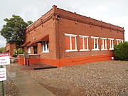 UVX Smelter Operations Complex #2
 -
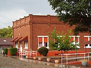 UVX Smelter Operations Complex #3
 -
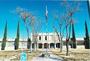 Front view Clemenceau Public School
 -
 Clemenceau Public School
 -
 Superintendent Residence
 -
 Master Mechanic's House
 -
 Building on 826 Main Street
 -
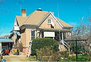 Mary Willard's House
 -
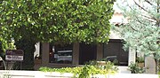 Edens House


-
 Bank of Clemenceau
 -
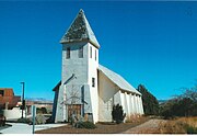 Old Church
 -
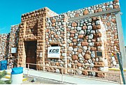 Cottonwood Civic Center
 -
 Carlson's 5 & 10 Store
 -
 Sprouse & Reitz 5 & 10 Store
 -
 Cottonwood Hotel
 -
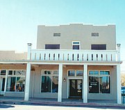 Front view of the Cottonwood Hotel
 -
 Historic town Fire Bell - 1925
 -
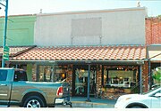 Joe Hall's House
 -
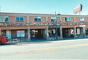 Grove-Hanshon Grocery
 -
 Mark Willard Building
 -
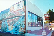 Stemmer's Store
 -
 County Jail
 -
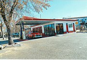 Black Bert's Service Station


-
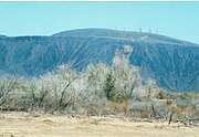 Oatman Mountain.
 -
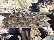 Mormon Battalion Trail - 1846.
 -
 Oatman Family Massacre site.
 -
 Oatman family grave marker.
 -
 Oatman Family grave.
 -
 Medjool Date Palms in Dateland
 -
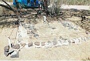 The Fourr Family Cemetery
 -
 Ruins of the Southern Overland Trail stage stop station.
 -
 Ruins of the Southern Overland Trail stage stop station built by William Fourr
 -
 Fourr family house on Oatman Flat.
 -
 Oatman Flats Ranch entrance.
 -
 Abandoned Oatman Flats Ranch House.
 -
 Camp Hyder flagpole.
 -
 Camp Hyder 1890's structures.
 -
 Camp Hyder structures.
 -
 1890's Camp Hyder structures.
 -
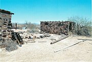 Camp Hyder structures.
 -
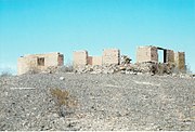 Ruins of the Nate Salsbury house.
 -
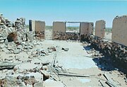 Inside the Nate Salsbury house ruins.
 -
 Fallen wall with "Cody" scratched on it.
 -
 Inside the ruins of the Nate Salsbury house.
 -
 Nate Salsbury house floor.
 -
 Nate Salsbury Corral.
 -
 Nate Salsbury corral.
 -
 Dateland Army Air Field plaque.
 -
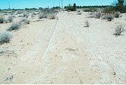 Dateland Army Air Field foundation.
 -
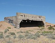 Army Air Field Concrete Bunker used to sight the machine guns of the B-25 Mitchell bomber.
 -
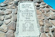 Camp Horn Monument
 -
 Hyder Divisional Camp-Camp Horn Divisional Camp plaque.
 -
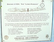 The "Lone Ranger crash site memorial plaque.


-
 19th Century town buildings on Prescott St.
 -
 Historic Old Black Canyon Hwy
 -
 19th Century Stagecoach in Dewey
 -
 Dewey Original Town site
 -
 Dewey Original Town site
 -
 Building in the Dewey Original Town site
 -
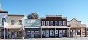 Dewey Original Town site
 -
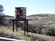 Iron King Mine Water Tower-1906
 -
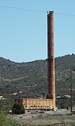 Iron King Mine Smelter-1906
 -
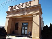 Humboldt Bank Building-1918
 -
 Humboldt Hotel-1917
 -
 Humboldt Post Office-1910
 -
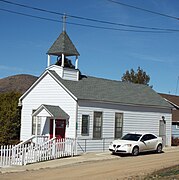 Humboldt Agua Fria Christian Church-1907
 -
 Humboldt Commercial Building-1910
 -
 Ruins of King Woolsey's ranch-1864
 -
 Different view of the ruins of King Woolsey's ranch
 -
 Different view of the ruins of King Woolsey's ranch


-
 Dos Cabezas (RIP)
 -
 Town ruins
 -
 Dos Cabezas Pioneer Cemetery


-
 Pan American Avenue
 -
 El Paso and Southwestern Railroad Passenger Depot
 -
 El Paso and Southwestern Railroad YMCA
 -
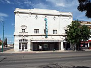 Grand Theatre
 -
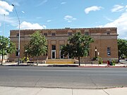 US Post Office and Customs House
 -
 Douglas Brophy Building
 -
 'Hotel on 9th Street
 -
 Commercial Building
 -
 Masonic Lodge Building
 -
 Avenue Hotel
 -
 Avenue Hotel adition
 -
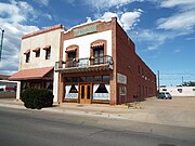 Two 19 Century hotels in G Street
 -
 Dinky Motor built by the Copper Queen Reduction Works built in 1906


-
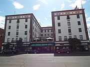 Hotel Gadsden
 -
 Hotel entrance
 -
 Hotel lobby
 -
 Different view of the hotel lobby and marble columns.
 -
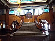 Solid white Italian marble staircase
 -
 Old shoe shine and telephone booths
 -
 Tiffany & Co. 42 foot Stained Glass Mural
 -
 Oil painting by Audley Dean Nichols
 -
 Original 1907 Otis Lift (Elevator)


-
 Slaughter Ranch entrance.
 -
 National Historic Landmark marker
 -
 Main Ranch house
 -
 Different view of the main ranch house
 -
 Barn
Barn -
 Ice house
 -
 Meat house
 -
 Garage
 -
 Slaughters' 1915 Ford Model T
 -
 Commissary
 -
 House
House -
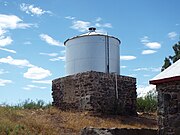 Water Tank
 -
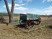 Wagon
Wagon -
 Mormon Battalion marker
 -
 Grave of John Horton and Cora Viola Slaughter in the Calvary Cemetery-Plot F-082-7


-
 Benjamin F. Billingsley House - 1900
 -
 Simpson Hotel (former Hotel Hobbs) - 1914
 -
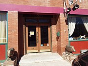 Simpson Hotel
 -
 Freiheit Building - 1913
 -
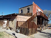 Freiheit Building
 -
 Country Store - 1909
 -
 Duncan Restaurant - 1909
 -
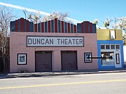 Duncan Theater - 1921
 -
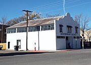 River Front Lounge (former Bonnie Heather Bar/Pool Hall) - 1925
 -
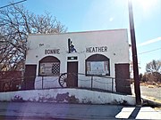 Bonnie Heather Inn - 1920
 -
 First Duncan School Building - 1908
 -
 Hotel Duncan - 1920
 -
 Lonesome Dove Mercantile - 1860
 -
 Saint Mary's Catholic Church - 1936
 -
 Saint Mary's Catholic Church corner block
 -
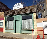 Bank of Duncan - 1908
 -
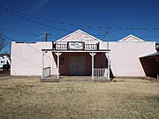 Duncan Opera House - 1920
 -
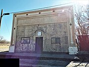 S & L Enterprises - 1896
 -
 Bart Tipton's Saloon - 1905
 -
 Greenlee County Building - 1890
 -
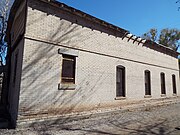 Greenlee County Building
 -
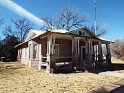 House on 211 Railroad Ave. - 1920
 -
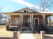 House on 211 Railroad Ave.
 -
 Germaine store - 1900
 -
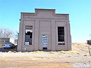 Knights of Pythias lodge #27 - 1900
 -
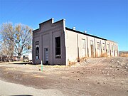 Knights of Pythias lodge #27
 -
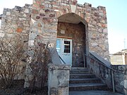 Duncan Church of Christ - 1914
 -
 Duncan Stage Stop - 1890
 -
 Antique town clock
 -
 1950 Chevrolet 6400 2 ton fire truck


-
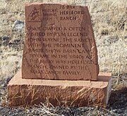 26 Bar Hereford Ranch Marker
 -
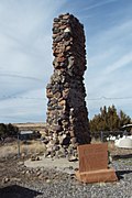 Amity School Ruins
 -
 Benjamin B. Crosby Home
 -
 Colter Ranch Marker
 -
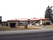 Eagar Elementary School
 -
 Harry Colter Home
 -
 Joseph Udall Barn
 -
 Oscar Jepson Home
 -
 Rencher Home
 -
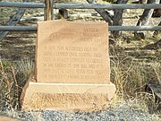 Snyder-Cavanaugh Shoot Out Marker
 -
 Snyder-Cavanaugh Shoot Out grave
 -
 William LeSueur Home


.jpg)
-
 General Store
 -
 Mercado de Amigos Meat Market sign
 -
 Old Meat Market
 -
 Old Ehrenberg Community Church
 -
 The Blythe-Ehrenberg-Pipeline suspension bridge
 -
 Different view of the Blythe-Ehrenberg-Pipeline suspension bridge
 -
 Ehrenberg Pioneer Cemetery Marker
 -
 Ehrenberg Pioneer Cemetery Monument
 -
 Unmarked graves in the Ehrenberg Pioneer Cemetery
 -
 Remains of an old wagon in the Ehrenberg Pioneer Cemetery


-
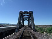 The historic "Agua Fria River Bridge” was built over the Agua Fria River by the Santa Fe Railroad in 1895. It is located on the right side of Grand Ave. if traveled from Phoenix to Wickenburg, close to 111 Ave. in El Mirage, Az.
 -
 Different view of the historic "Agua Fria River Bridge”.
 -
 El Mirage Motel was built out of fieldstone in 1937 and is located at 12229 NW Grand Ave. in El Mirage, Az. This is the office of the motel which was used by motorist who traveled through Grand Ave. The property is in state of abandonment.
 -
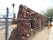 Different view of the office of El Mirage Motel.
 -
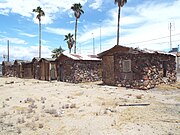 El Mirage Motel. These are the individual rooms of the motel which was used by motorist who traveled through Grand Ave. The property is in state of abandonment.
 -
 Different view of the individual rooms of El Mirage Motel.
 -
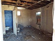 The rooms of El Mirage Motel, such as this one, are in a state of total abandonment.
 -
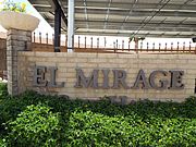 Front of the El Mirage City Hall complex.
 -
 El Mirage City Hall located at 12145 NW Grand Ave.


-
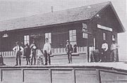 The railroad depot in Fairbank, c.1900.
 -
 Railroad Depot Ruins
 -
 Railroad Depot Ruins
 -
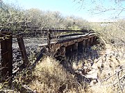 Fairbank Railroad Bridge
 -
 On top of the Fairbank Railroad Bridge
 -
 General store, post office - 2020
 -
 Post Office
 -
 Stable
 -
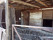 Inside the stable
 -
 Outhouse
 -
 Inside the outhouse
 -
 Fairbank Cemetery sign
 -
 The Fairbank Cemetery, badly overgrown with creosote..
 -
 Grave
Grave -
 Grave
Grave -
 Fairbank Water Tower and Pump House
 -
 Inside the Pump House
 -
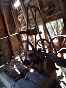 Machinery inside the Pump House
 -
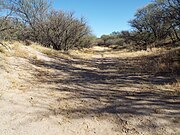 Dried up San Pedro River - 2020


(National Register of Historic Places)

-
 The Arizona Lumber and Timber Company Office was built in 1900 and is located on 1 Riordan Rd. It was listed in the National Register of Historic Places April 30, 1986, Ref. #86000900.
 -
 The Bank Hotel was built in 1887 and is located on Route 66 and Leroux Street. It was listed in the National Register of Historic Places December 7, 1977, Ref. #77000232.
 -
 The Weatherford Hotel was built in 1887 by John W. Weatherford. The hotel is located at 23 N. Leroux Street. It was listed in the National Register of Historic Places March 30, 1978, Ref. #78000543.
 -
![The Monte Vista Hotel was built in 1926 and is located at 100 N. San Francisco Street. The hotel was host to notable figures such as Jane Russell,Gary Cooper, Spencer Tracy, ]]John Wayne]], Bing Cosby and Harry S. Truman.](//upload.wikimedia.org/wikipedia/commons/thumb/9/93/Flagstaff-Monte_Vista_Hotel-1926.jpg/180px-Flagstaff-Monte_Vista_Hotel-1926.jpg) The Monte Vista Hotel was built in 1926 and is located at 100 N. San Francisco Street. The hotel was host to notable figures such as Jane Russell,Gary Cooper, Spencer Tracy, ]]John Wayne]], Bing Cosby and Harry S. Truman.
The Monte Vista Hotel was built in 1926 and is located at 100 N. San Francisco Street. The hotel was host to notable figures such as Jane Russell,Gary Cooper, Spencer Tracy, ]]John Wayne]], Bing Cosby and Harry S. Truman. -
 The Coconino County Superior Courthouse was completed in 1894 and enlarged in 1925. It is located at 200 N. San Francisco Street.
 -
 The C & M Garage was built in 1925 and is located at 204 S. Mikes Pike. It was listed in the National Register of Historic Places April 30, 1986, Ref. #86000908.
 -
 The Ice House was built in 1946 and is located at 201 E. Birch Ave. It was listed in the National Register of Historic Places April 8, 2009, Ref. #09000174.
 -
 The La Cuidad de Mexico Grocery building was built in 1900 and is located at 217 S. San Francisco Street. It was listed in the National Register of Historic Places April 30, 1906, Ref. #86000906.
 -
 The South Beaver School was built in 1936 and is located at 506 S. Beaver Street. The South Beaver Elementary School was a segregated school for Hispanic students and later for African-American students until the 1950s. It was listed in the National Register of Historic Places August 6, 1987, Ref. #87001342.
 -
 The Flagstaff Armory was built in 1920 and is located at 503 W. Clay Ave. It is now a grocery store. It was listed in the National Register of Historic Places April 30, 1986, Ref. #86000903.
 -
 The Babbitt Brothers Building.
 -
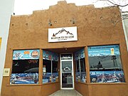 The Coconino Chop House.
 -
 The Rickets and Brooks Building.
 -
 The Verchamp Building.
 -
 The Telephone/Exchange Building.
 -
 The Aubineau-Andreates Building.
 -
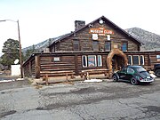 The Dean Eldredge Museum.
 -
 Old Flagstaff Post Office
 -
 The Two Spot Logging Train was built in 1911 and is now on exhibition by the Junction of San Francisco Street and BNSF Railroad. It purchased by the Arizona Lumber and Timber Company in 1917. It was retired from service in 1966. It was listed in the National Register of Historic Places September 14, 1999, Ref. #99001066.
 -
 The 1890 Flagstaff Station
 -
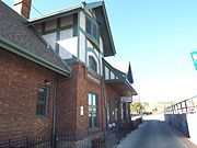 The Flagstaff Station was built in 1926. It is located at 1 East Route 66. The station is located within the boundaries Railroad Addition Historic District which was listed in the National Register of Historic Places in January 18, 1983, Ref. #83002989.
 -
 Different view of the Flagstaff Station which was built in 1926. It is located at 1 East Route 66.
 -
 The First Baptist Church was built in 1939 and is located at 123 S. Beaver Street. It was listed in the National Register of Historic Places December 23, 1991, Ref. #91001576.
 -
 The La Iglesia Metodista Mexicana El Divino Redentor was built in 1892 and is located at 319 S. San Francisco Street. It was listed in the National Register of Historic Places January 30, 1985, Ref. #85000147.
 -
 The Our Lady of Guadalupe Church was built in 1888 and is located at 302 S. Kendrick Street. It was listed in the National Register of Historic Places April 30, 1986, Ref. #86000907.
 -
 The Methodist Episcopal Church was built in 1906 and is located at 400 W. Aspen Ave. It was listed in the National Register of Historic Places in 1991.
 -
 The Brannen-Devine House
 -
 The J.M. Clark House.
 -
 The Ashurst House was built in 1892 and is located at 421 W. Aspen Ave. The house belonged to Henry F. Ashurst, one of the first two Senators from Arizona. It was listed in the National Register of Historic Places November 29, 1984, Ref. #84000529.
 -
 The H.E. Campbell House was built in 1890 and is located at 215 N. Leroux Street. Hugh E. Campbell began his career as a sheepherder in 1885. He was one of the owners of the firm named Campbell-Francis and Co., the largest sheep ranchers in Arizona. It was listed in the National Register of Historic Places April 30, 1986, Ref. #86000910.
 -
 The House at 310 S. Beaver Street was built in 1945 and is located at the same address. It was listed in the National Register of Historic Places April 30, 1986, Ref. #86000913.
 -
 The Milligan House was built in 1900 and is located at 323 W. Aspen. This was the home of J.C. Milligan, a former Justice of the Peace and owner of a local brickyard. It was listed in the National Register of Historic Places November 29, 1984, Ref. #84000389.
 -
 The Riorden Mansion


![The Monte Vista Hotel was built in 1926 and is located at 100 N. San Francisco Street. The hotel was host to notable figures such as Jane Russell,Gary Cooper, Spencer Tracy, ]]John Wayne]], Bing Cosby and Harry S. Truman.](/wiki/File:Flagstaff-Monte_Vista_Hotel-1926.jpg)


-
 Lowell Observatory gate.
 -
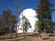 18” LENEOS Astrograph Dome.
 -
 McAllister Dome.
 -
 The Clark Telescope Dome on Mars Hill.
 -
 Stone Water Tank built in 1901


-
 Grave of Commodore Perry Owens
 -
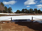 Mass Grave of those who perished in the 1956 TWA disaster
 -
 Plaque honoring those who perished in the 1956 TWA disaster


-
 Baldwin Locomotive #12 - 1929
 -
 Coconino County Hospital Building - 1908
 -
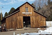 Pioneer Barn - 1910
 -
 Emerson High School Bell - 1886


_Marker-1070_to_1275.jpg)
-
 Elden Pueblo Archaeological sign
 -
 Elden Pueblo Structure
 -
 Room
Room -
 Mud Mortar Room
 -
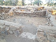 Mud Mortar Rooms
 -
 Mud Mortar Room
 -
 Early Pit House
 -
 Community Room –
_Marker-1070_to_1275.jpg)


(National Register of Historic Places)
(Florence Historic District Advisory Commission.}

-
 The Ruins of Levi Ruggles House. The house was built in 1866 and the ruins are located in Ruggles St. between Quartz and Willow Streets. American Civil War veteran Levi Ruggles, the founder of Florence, came to Arizona Territory in 1866 as a U.S. Indian Agent. Recognizing the agricultural potential of the valley, he found an easily fordable crossing on the Gila River and surveyed a townsite here. In 1869, he built his first family home. With the aid of Governor R.C. McCormick, he secured a post office in August of the same year. Ruggles held numerous public offices including that of Territorial Legislator. Listed as Historic by the Historic District Advisory Commission.
 -
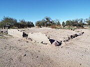 The Ruins of Levi Ruggles House..
 -
 The Granville Wheat Outback House was built in 1871 and is located in 125 Ruggles St. (next to the George Brown house). Listed as Historic by the Historic District Advisory Commission.
 -
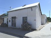 The Elena Llescas House was built in 1872 and is located in 175 Bailey St. Listed as Historic by the Historic District Advisory Commission.
 -
 The James S. Melquides E. Douglas House was built in 1874 and is located in 850 S. Park St. It was listed in the National Register of Historic Places in 204; reference #04000486.
 -
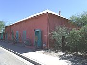 The Jesus Martinez House was built in 1875 and is located in 321 Bailey St. In 1886, Pinal County converted part of the building into the first County Hospital. It had six beds. Each had a horsehair mattress and a wool blanket. By 1890, the house was used as a meat market, store and residences. Listed as Historic by the Historic District Advisory Commission.
 -
 The Ross/ Fryer-Cushman House was built in 1876 and is located in 364 N. Grant St. Roderick Ross, one of Florence's first blacksmiths, W.C. Smith was the second owner. Pauline Cushman (born Harriet Wood), an American actress and a spy for the Union Army during the American Civil War and her husband Jere Fryer, later purchased the house. Tom Mix was a tenant there in the 1930s. Listed as Historic by the Historic District Advisory Commission.
 -
 The Walker-Oury House was built in 1877 and is located in 255 Ruggles St. John D. Walker was an agent and physician to the Pima Indians at Sacaton. This building was used as courtroom and county offices during his terms as justice of the peace, county surveyor and probate judge. Walker was an early investor in the Vekol Mine and wrote the first Pima grammar text. Here Pauline Cushman, a Union Army American Civil War spy and actress, wed Jere Freyer. The building was purchased (1886) by Granville Henderson Oury, delegate to the Confederate Congress, Arizona territorial legislator and attorney general, district court judge, and delegate to the U.S. Congress. Listed as Historic by the Historic District Advisory Commission.
 -
 The John Clum House was built in 1878 and is located in 180 N. Granite St. The home was built by John Clum, an Indian agent, editor and publisher of Florence's first newspaper, the Arizona Citizen. He also was the founder and editor of the Tombstone Epitaph and was Tombstone's first mayor. This building appears to have housed the Citizen's office and press. A later owner, William Guild, built the telegraph line from the Silver King Mine to Casa Grande. Listed as Historic by the Historic District Advisory Commission.
 -
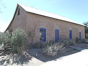 The Isabelle Cosgrove House was built in 1878 and is located in 191 Bailey St. Frank Cosgrove was born in Ireland. He immigrated to the US and became a blacksmith. He lived in this house with his wife Isabelle. Listed as Historic by the Historic District Advisory Commission.
 -
The James S. Melquides E. Douglas House was built in 1874 and is located in 850 S. Park St. It was listed in the National Register of Historic Places in 204; reference #04000486.
-
 The George Brown House was built in 1878 and is located in 125 Ruggles St. The home was occupied by George A. Brown, Florence's first Wells Fargo agent (1877-1903). Listed as Historic by the Historic District Advisory Commission.
 -
 The Jesus Preciado de Luna/ Bernardina Lorona House was built in 1880 and is located in 115 E. 11th St. Listed as Historic by the Historic District Advisory Commission.
 -
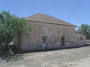 The Fields House was built in the 1880s and is located in 423 9th St. It was listed in the National Register of Historic Places in 1986; reference #86003858.
 -
 The John Nicolas Residence was built in 1880 and is located adjacent to the “John Nicola New Beer Saloon” at 180 Bailey St. It is listed as Historic by the Historic District Advisory Commission.
 -
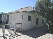 The Sam Kee House was built in 1880 and is located in 171 Pinal St. Sam Kee was a Chinese immigrant who settled in Florence. Listed as Historic by the Historic District Advisory Commission.
 -
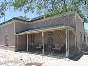 The Harvey-Niemeyer House was built in 1880 and is located in 250 (once 1613) S. Main St. Physician William Harvey was known as an "Angle of Mercy" during a smallpox epidemic and was on scene at the aftermath of the 1888 Pete Gabriel-Joe Phy shootout. Later resident Charles Niemeyer was Clerk of the Pinal County Board of Supervisors for 25 years and also served as local postmaster. Listed in the National Register of Historic Places on August 1, 1986, reference #86002627.
 -
 The Emma Monk Guild House was built in 1880 and is located in 171 Willow St. Emma Monk Guild taught school in Florence off and on from 1885 to 1897 and was the first Florence principal. She also taught in Red Rock, Casa Grande and was an instructor at the University of Arizona Preparatory in Tucson and a principle at Clifton. She is considered one of Arizona's mothers of education. Listed as Historic by the Historic District Advisory Commission.
 -
 The Elmer Coker House was built in 1881 and is located in 100 S. Main St. Elmer Coker was a delegate to the Arizona Constitutional Convention and is considered "Father of the Arizona Corporation Commission. Listed as Historic by the Historic District Advisory Commission.
 -
 The William Clark House was built in 1884 and is located in 190 Main St. This house was built for Silver King mining engineer William Clarke and his wife Ella. The house later served as the residence of Richard E. Sloan , Arizona’s last Territorial Governor. Listed as Historic by the Historic District Advisory Commission.
 -
 The Andronico Lorona House was built in 1886 and is located in 324 Silver St. Listed in the National Register of Historic Places on August 1, 1986, reference #86002631.
 -
 The Carmen Mecha House was built in 1887 and is located in 240 Ruggles St. Listed as Historic by the Historic District Advisory Commission.
 -
 The Truman Randall House was built in 1887 and is located in 550 (once was 2010) S. Main St. W.C. Truman was the sheriff who in 1889 captured Pearl Heart, the first woman to rob a stagecoach. Listed in the National Register of Historic Places on July 13, 1987, reference #87001594.
 -
 The Jacob Suter House was built in 1888 and is located in 270 Pinal St. Jacob Suter was a Swiss born tinsmith. Listed as Historic by the Historic District Advisory Commission.
 -
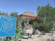 The John Keating House was built in 1888 and is located in 234 Willow St. John Keating was a pioneer stage driver. He served in the Territorial legislature, Florence town councilman and mayor of Florence. He was owner of the "Tunnel Saloon", site of the 1888 Pete Gabriel-Joe Phy shootout. Listed as Historic by the Historic District Advisory Commission.
 -
 The Albert T. Colton/ H. H. Freeman House was built in 1889 and is located in the Southwest corner of Butte and Willow Streets. Listed in the National Register of Historic Places on August 1, 1986, reference #86002615.
 -
 The C.D. Henry House was built in 1889 and is located in 144 (once 1520) S. Willow St. The Henry house is considered one the earliest fired brick residences remaining In Florence. Listed in the National Register of National Places on August 1, 1986, reference #86002628.
 -
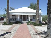 The W.Y. Price House was built in 1900 and is located at 1612 Willow St. Listed in the National register of historic Places in 1986; reference #86002632.
 -
 The Ines and Davis Littlefield Bea House was built in 1900 and is located in 1913 S. Elizabeth St. It was listed in the National Register of Historic Places in 1986; reference #86002630.
 -
 The George Brockway House (also known as the Araiza House - 2017 Central St.) was built in 1900 and is located in 501 S. Central Ave. George Brockway was the first mayor of Florence. Listed in the National Register of Historic Places on May 26, 2004, reference #04000485
 -
 The Carminatte-Parham House was built in 1910 and is located in 350 E. 6th St. Listed in the National Register of Historic Places on August 1, 1986, reference #86002624.
 -
 The Ignacio Manjares House was built in 1910 and is located in 351 Silver St. Ignacio Manjares was a charter member of the Pinal County Cattle Growers Association. Listed in the National Register of Historic Places on August 6, 1987, reference #87001591.
 -
 The Adrian Pierson House was built in 1912 and is located in E. 6th St. and U.S. Route 79. It was listed in the National Register of Historic Places in 1987; reference#87001593.
 -
 The Joseph Spinas Rental House was built in 1913 and is located in 221 Bailey St. Joseph Spinas, a prominent cattle rancher, was born in Switzerland. With his two brothers, he built one of the first irrigation ditches in the Florence area on the north side of the Gila River. Listed as Historic by the Historic District Advisory Commission.
 -
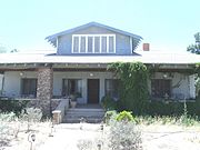 The George Huffman House was built in 1919 and is located in 425 Butte Ave. Listed in the National Register of Historic Places on August 1, 1986, reference #86002629.
 -
 The Thomas Fulbright House was built in 1925 and is located in 75 Matilda St. Thomas (Tom) Fulbright wrote a book titled "Cow Country Counselor". He was involved in the cases of Winnie Ruth Judd and Eva Dugan. Listed in the National Register of Historic Places on October 4, 1996, reference #96001955.
 -
 The John Zellinger House was built in 1929 and is located in 191 Willow St. Listed as Historic by the Historic District Advisory Commission.
 -
 9th, Willow and Central Street. According to the late A. W. Gressinger, president of the Pinal County Historical Society, Levi Ruggles was buried in the premises of his second house which was located at 9th St., between Willow Street and Central Ave. in 1889. The house itself was on the southwest corner of the lot, with much if the rest of the land occupied by fruit trees. By the time Ruggles died in his home in 1889, he had lost his wife, the former Cynthia Tharp, and three of their children years earlier. Their tombstones vanished and a developer built an apartment complex over their graves.


(National Register of Historic Places)
(Florence Historic District Advisory Commission.)<ref>

-
 The E.N. Fish and Co. Store Building was built in 1867 and is located in 420 Quartz St. The mercantile firm of E.N. Fish & Co., with Joseph Collingwood as partner and local manager, opened Florence’s first store in this building in 1868. Listed as Historic by the Historic District Advisory Commission.
 -
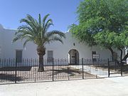 The Chapel of the Gila was built in 1870 and is located in 306 E. 8th St. Listed as Historic by the Historic District Advisory Commission.
 -
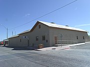 The Second E.N. Fish and Co. Building was built in 1874 and is located in 520 Main St. The second site of the E.N. Fish & Co. Mercantile Store became the Joseph Collingwood & Co. Store and Wells Fargo Office in 1877. As chief produce buyer, E.N. Fish & Co. was responsible for providing the economic foundation of the town’s early success as an agricultural trading center. The firm played a role during Florence’s mining booms by extending credit to the Silver King Mine. The west wing contained hotel rooms and an office. A saloon and dining room were in the south wing. From early statehood until the mid-1940s, the west wing contained dwellings and became the American Legion Post headquarters in 1944. Listed as Historic by the Historic District Advisory Commission.
 -
 The Charles Rapp Saloon Building was built in 1875 and is located in 361 Main St. Chicago-born Charles Rapp advertised the building as featuring an "Elegant Club & Reading Room in Connection with the Bar." The building was the first location of John Keating’s famous "Tunnel Saloon" from 1886 to 1888. Listed as Historic by the Historic District Advisory Commission.
 -
 The Silver King Hotel was built in 1876 and is located in 24 W. 6th St. The building was an L-shaped adobe building with a gable roof and walls that were not plastered. The hotel was built for William Long, a partner in the Silver King Mine. Listed as Historic by the Historic District Advisory Commission.
 -
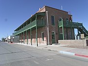 Different view of the Silver King Hotel which was built in 1876 and which is located in 24 W. 6th St. Listed as Historic by the Historic District Advisory Commission.
 -
 The Jean Baptiste Residence/ Lone Star Store was built in 1878 and is located in 220 Ruggles St. Jean Baptiste was a farmer from the French region of Burgundy and former artilleryman with Maximilian’s occupation army in Mexico. Listed as Historic by the Historic District Advisory Commission.
 -
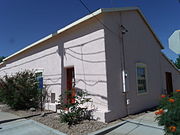 The John Nicolas New Beer Hall was built in 1880 and is located in 180 Bailey St. The north portion of the house was became Nicolas’s "New Beer Hall". It has also been used as a newspaper printing office. Listed as Historic by the Historic District Advisory Commission.
 -
 The Jean Avenenti Building was built in 1886 and is located in 289 Main St. Italian immigrant Juan Avenenti purchased this property in 1886 from Frank M. Griffen. Previously, it had belonged to Florence pioneers Levi Ruggles and Charles Douglas. Avenenti, a grocer, butcher and rancher, built the present structure for a meat market. Listed as Historic by the Historic District Advisory Commission.
 -
 Florence High School was built in 1887 and is located in 1000 S. Main St. Listed in the National Register of Historic Places on June 22, 1987, reference #87001306.
 -
 Different view of Florence High School.
 -
 The John Nicolas Saloon was built in 1889 and is located in 46 E. 11th St. Designed by prominent Arizona architect James M. Creighton, this is the oldest standing fired-brick building in Florence. French-born rancher farmer John Nicholas moved his saloon to this building soon after its construction in 1889. Listed as Historic by the Historic District Advisory Commission.
 -
 The Conrad Brunenkant City Bakery Building was built in 1890 and is located in 291 Bailey St. The two story red brick building was built for Conrad Brunenkant, a Dutch-born baker and grocer. Listed as Historic by the Historic District Advisory Commission.
 -
 Gentry’s Florence Market was built in 1890
 -
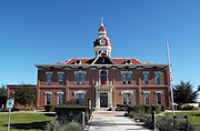 The Second Pinal County Courthouse was built in 1891 and is located in 135 Pinal St. The Courthouse is the most important architectural landmark in Florence and the most outstanding surviving example of the American-Victorian Style in Central Arizona. The building was designed by Arizona architect James M. Creighton, who was among the Territory’s first architects. Three notorious women were presented before this court. They were Pearl Heart, Eva Dugan and Winnie Ruth Judd. Listed in the National Register of Historic Places in August 2, 1978, reference #78000568.
 -
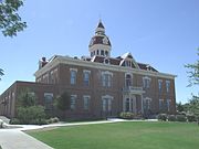 Different view of the Second Pinal County Courthouse which was built in 1891 and which is located in 135 Pinal St. Listed in the National Register of Historic Places in August 2, 1978, reference #78000568.
 -
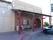 La Paloma Bar was built in 1912 and is located in 255 Main St. Originally a saloon, the building served as a pool hall during statewide Prohibition. Listed as Historic by the Historic District Advisory Commission.
 -
 The Second Catholic Church was built in 1912 and is located in 221 E. 8th St. Listed as Historic by the Historic District Advisory Commission.
 -
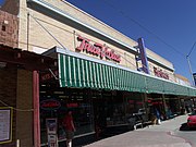 The White and McCarthy Lumber and Hardware Building was built in 1914 and is located in 290 Main St. Listed as Historic by the Historic District Advisory Commission.
 -
 The Popular Store/ Mandells Dept. Store Building was built in 1915 and is located in 291 Main St. It belonged to C.G. Powell’ whose "The Popular Store," were specialists in ready-to-wear clothing. Kaufmann Mandell purchased the building in 1919 and operated the Mandell’s Department Store. Listed as Historic by the Historic District Advisory Commission.
 -
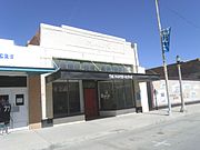 The Mauk Building was built in 1925 and is located in 360 Main St. This building was one of three built by early movie-house mogul and later U.S. Marshal, George Mauk. A portion of the Isis Theater was located on the same site. Listed as Historic by the Historic District Advisory Commission.
 -
 The Florence Women’s Club Building was built in 1929 and is located in 231 Willow St. Listed as Historic by the Historic District Advisory Commission.
 -
 The First Presbyterian Church of Florence was built in 1931 and is located in 225 Butte Ave. Listed as Historic by the Historic District Advisory Commission.
 -
 The Florence Town Hall Building was built in 1948 and is located in 130 Main St. The town hall also served as a police and fire station. The Town Hall was relocated in the 1980s. Listed as Historic by the Historic District Advisory Commission.
 -
 Blue Mist Motel built in 1946 and located at 40 S. Pinalway.
 -
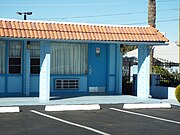 Room 22 (122) of the Blue Mist Motel.


-
 The Queen Creek Bridge - 1916
 -
 Different view of the Queen Creek Bridge
 -
 Historic Florence Bridge over the Gila River rebuilt in 1909.
 -
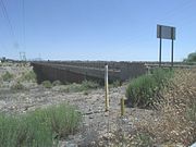 Bridge over the Gila River.
-1916.jpg)
-1916-2.jpg)


-
 County Recorder’s Office
 -
 Fireplace in First Pinal County Courthouse
 -
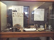 German POW artifacts


-
 Main entrance of the Pinal County Historic Society & Museum located at 715 S. Main St.
 -
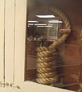 The noose used to hang Eva Dugan on February 21, 1930, on exhibit.
 -
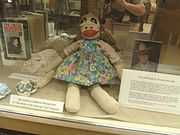 Doll made by Winnie Ruth Judd, the Trunk Murderess, while imprisoned in the Arizona State Prison. It is on display in the Pinal County Historic Society & Museum located at 715 S. Main St. On February 20, 2014, the doll and the story of Judd’s crime were featured in a episode of Mysteries at the Museum TV show titled the “Blonde Butcher”.
 -
 The bullet ridden window pane of the Tunnel Saloon in Florence as a result of the Pete Gabriel – Joe Phy shootout in 1888.
 -
 Pinal County Historic Society & Museum located at 715 S. Main St. 1870s Florence Ice Wagon on exhibit.


-
 Entrance of the Florence Cemetery located at Salazar Road just south of Highway 79.
 -
 The Tombstone of Josephus “Joe” Phy, who died in the Tunnel Saloon Gabriel-Phy shootout of 1888. The inscription on the tombstone reads: “In Memory of Josephus Phy Born May 22, 1844; Died June 1, 1888.” “Farewell dear brother we mourn your loss” It is located in the Florence Cemetery at Salazar Road.
 -
 Bear Down Marker in Honor of John “Button” Salmon.
 -
 Pyramid Tomb of Charles Debrille Poston, known as The Father of Arizona, due to his efforts lobbying for creation of the territory. Poston was also Arizona Territory's first Delegate to the U.S. House of Representatives. The tomb is located on Primrose Hill, renamed Poston Butte.
 -
 Tom Mix Monument. Location where Tom Mix, a megastar of the silent film industry, died in 1940. The inscription reads as follows: “Jan. 6, 1880 – Oct. 12, 1940. In Memory of Tom Mix whose spirit left his body on this spot, and whose characterization and portrayals in life served to better fix memories of the Old West in the minds of living men” The monument is located in Arizona highway 79 about 20 miles from Florence, Az.


-1892-1.jpg)
-
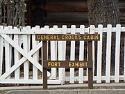 General Crooks Cabin sign
 -
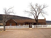 First Commanding Officer's Quarters (General Crook's Cabin)-1871
 -
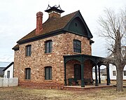 Commanding Officer's Quarters-1892
 -
 Captain's Quarters (102)-1891
 -
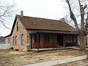 Captain's Quarters (103)-1891
 -
 Officer's Quarters-1883
 -
 Girl's Dormitory-1931
 -
 Boy's Dormitory-1932
 -
 Bureau of Indian Affairs Club House-1930
 -
 Different view of the Bureau of Indian Affairs Club House-1930
 -
 Theodore Roosevelt School-1923
 -
 Theodore Roosevelt School Cafeteria-1948
 -
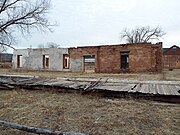 Barracks ruins-1875
 -
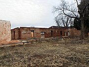 Barracks Row ruins-1875
 -
 Fort ruins-c. 1880s
 -
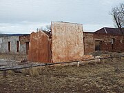 Fort ruins-c. 1880s
 -
 Fort ruins-c. 1880s

-1871-General_Crooks_Cabin.jpg)
-1892-2.jpg)
-1891.jpg)
-1891.jpg)
-1883.jpg)
_Native-American_Girls%27_Dormitory_(120)-1931.jpg)
-1932.jpg)
-1930-1.jpg)
-1930-2.jpg)
-1923.jpg)
-1948.jpg)
-1875.jpg)


-
 Landmark sign on the Brown Parade Field.
 -
 Pershing House.
 -
 Original Fort Headquarters.
 -
 Carleton House .
 -
 Old Post Barracks.
 -
 Leonard Wood Hall.
 -
 Ordnance Warehouse.
 -
 Ordnance Warehouse marker.
 -
 Hangman's Warehouse.
 -
 Rodney Hall .
 -
 Sam Kee Hall.
 -
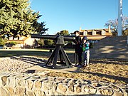 Children posing with a Parrott Rifle (Parrott Gun).


-1880.jpg)

-1885.jpg)


-
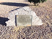 Buffalo Soldier Legacy Plaza Marker.
 -
 Buffalo Soldier Legacy Plaza Marker.


-
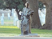 Mourning Hearts Statue.
 -
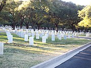 Graves.
 -
 Graves.


-
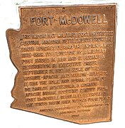 Marker which indicates where the historic Fort McDowell was located.
 -
 The remaining ruins of the Fort McDowell officers quarters located in Ba Hon Nah Road.
 -
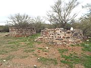 Fort McDowell ruins located in Fort Loop Road.
 -
 The ruins of one of the buildings which belonged to the original Fort McDowell.
 -
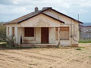 Abandoned house where Fort McDowell was located.
 -
 Fort McDowell Church located in Fort Loop Road.
 -
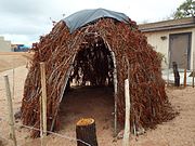 An early hut which served as a home of a Yavapai family.
 -
 Yavapai resting area located in N. Fort McDowell Road.
 -
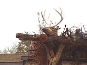 Deer Head on top of the Yavapai resting area.
 -
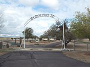 Entrance of the as "Ba Dah Mod Jo" Cemetery also known as the Fort McDowell Yavapai Nation Cemetery.
 -
 Fort McDowell Yavapai Reservation sign in the cemetery.
 -
 The grave of Carlos Montezuma or Wassaja in "Ba Dah Mod Jo" Cemetery. Montezuma was a Yavapai-Apache Native American,activist and a founding member of the Society of American Indians. His birth name Wassaja, means "Signaling" or "Beckoning" in his native tongue.
 -
 The grave of Mike Burns, whose real name was Hoo-moo-thy-ah. He was the cousin of Carlos Montezuma. When he was a child he led the US Calvary to Skeleton Cave where he witnessed the massacre of his people.
 -
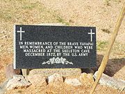 Grave dedicated to the men, women and children who were massacred by the soldiers of the US Army in Skeleton Cave.
 -
 Unidentified graves of the Yavapai who perished during the "Indian Wars".
 -
 Dr. Carlos Montezuma plaque.
 -
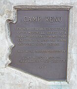 Marker which indicates where the historic Camp Reno was located.
 -
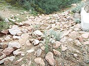 Camp Reno ruins.


-
 1864 Southern Pacific Railroad Depot ruins


-
 Fort Tyson Ruins
 -
 Fort Tyson Ruins
 -
 Fort Tyson Ruins
 -
 Fort Tyson Ruins
 -
 Tyson's Well
 -
 Tyson's Well Stage Station
 -
 Watering well in Tyson's Stage Station
 -
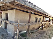 Oasis Hotel Replica
 -
 Oasis Hotel Replica


-
 The “Famous World Fountain” is the world's fourth tallest fountain. The fountain does not operate in Windy Days. It is located in Fountain Park 12925 N Saguaro Boulevard
 -
 Fount Rushmore with statues of George Washington, Thomas Jefferson, Abraham Lincoln, Theodore Roosevelt, Franklin D. Roosevelt and Ronald Reagan. The World Famous Fountain is in the background. Fount Rushmore is located in Fountain Park, 12925 N. Saguaro Boulevard in Fountain Hills, Arizona.
 -
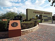 Veterans Memorial in Fountain Park of the town of Fountain Hills.
 -
 A Howitzer located in the Veterans Memorial in Fountain Park of the town of Fountain Hills.


Major General George S. Stoneman was the commanding officer of the U.S. Cavalry stationed in Camp McDowell (later renamed Fort McDowell) in what was then the United States Territory of Arizona. He wanted to establish a trail which would serve as a short cut between Camp McDowell and Fort Whipple in Prescott, Arizona. In 1865, he investigated an old Native-American trail which cut through the McDowell Mountains, a chain of extinct volcanic mountains and the Black Mountain of the modern day Cities of Fountain Hills and Cave Creek. The trail was named the “Stoneman Military Trail”.
-
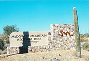 McDowell Mountain Regional Park entrance.
 -
 Sign which indicates where the Stoneman Trail a.k.a. Stoneman Wash Trail passed through in the McDowell Mountains of Fountain Hills.
 -
 Stoneman Trail a.k.a. Stoneman Wash Trail.


-
 The Stout Hotel was built in 1927 and is located at 113 East Pima Street. Known as “The Jewel of the Desert” the hotel ceased its operations in the 1980s. The hotel is listed as historical by the Henry C. Trost Historic Organization.
 -
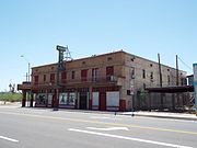 Different view of the Stout Hotel.
 -
 The Stout Hotel sign.
 -
 Main door.
 -
 Front view.
 -
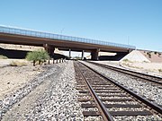 The Gila Bend Overpass. The overpass was built in 1933-34 and is located on the Arizona Highway 84 over the Southern Pacific Railroad. The overpass was listed in the National Register of Historic Places in September 30, 1988, reference #88001607.
 -
 Different view of the Gila Bend Overpass.
 -
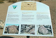 Painted Rock Petroglyph Site.
 -
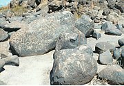 Painted Rock Petroglyph Site.
 -
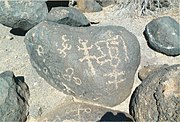 Painted Rock Petroglyph Site.
 -
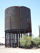 The Gila Bend Steam Locomotive Water Stop was built in 1900 and is located close to Murphy Street.
 -
 Entrance of the Gila Bend Municipal Airport.
 -
 Retired Arizona National Guard Aircraft in the main entrance of the Gila Bend Municipal Airport.


-
 Pinto Creek Bridge built in 1949
 -
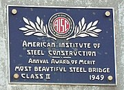 Pinto Creek Bridge "Most Beautiful Bridge" plaque


-
 Gila River Memorial Airport Terminal (abandoned). The airport was built for the Army Air Corps during WW II in 1942.
 -
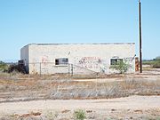 Airport building
 -
 Abandoned DC-4, known in WW II as a C-54 Skymaster.
 -
 Four abandoned DC-4s
 -
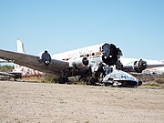 Abandoned DC-4
 -
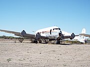 Abandoned DC-4
 -
 Abandoned Lockheed PV-2D Ventura.


(NRHP = National Register of Historic Places)
(GHD=Gilbert Heritage District)
-
 Gilbert Elementary School was built in 1913 .located at 10 S. Gilbert Rd.. It now house’s the Gilbert Historical Museum. It is listed in the National Register of Historic Places.
 -
 Gilbert High School was built in 1920. It now house’s the Gilbert Public School District Office. The structure is listed as historical by the Gilbert Heritage District.
 -
 The Gilbert Water Tower was built in 1925. The structure is listed as historical by the Gilbert Heritage District.
 -
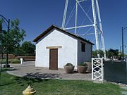 Gilbert’s first jail house was built in 1918 and later was used as a pump house. The structure is listed as historical by the Gilbert Heritage District.
 -
 The Tone Building was built in 1929 and now house’s Joe’s Real BBQ. The structure is listed as historical by the Gilbert Heritage District.
 -
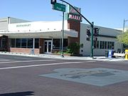 The Liberty Market was built in 1936. Liberty Market was established by the Dong family. The Neon sign which is still on display was designed by Mae Ong, the wife of Ben Ong who purchased the market in 1943. The structure is listed as historical by the Gilbert Heritage District.
 -
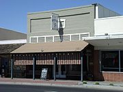 The Creed building was built in 1918. It now house’s the Farmhouse Restaurant. The structure is listed as historical by the Gilbert Heritage District.
 -
 The Attaway Phelps-Blakely Building was built in 1910. It now house’s the Norwood Furniture store. The structure is listed as historical by the Gilbert Heritage District.
 -
 The Bank of Gilbert was built in 1917. It now house’s an Insurance company. The structure is listed as historical by the Gilbert Heritage District.
 -
 The Clare’s Metal Shop was built in 1918. It now house’s a. Coffee shop The structure is listed as historical by the Gilbert Heritage District.
 -
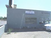 The Clement's Garage was built in 1934. The structure is listed as historical by the Gilbert Heritage District.
 -
 The Hale Theatre, built in 2002.
 -
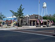 The American Legion Post 39 was built in 1950.


-
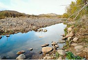 The Agua Fria River on the border edge of Gillett.
 -
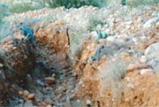 Irrigation ditch in Gillett.
 -
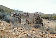 The ruins of the 1878 Burfind Hotel in Gillett.
 -
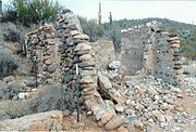 Different view of the ruins of the Burfind Hotel.
 -
 Different view of the ruins of the Burfind Hotel.
 -
 Different view of the ruins of the Burfind Hotel.
 -
 Relics of Gillett’s past life as a mining town.

-Gillett_irrigation_ditch.jpg)


(NRHP = National Register of Historic Places)
(GAHS=Glendale Arizona Historical Society)

-
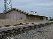 Santa Fe Railroad Depot, built in 1895. The building serves as the offices of BNSF-MOW (Burlington Northern Santa Fe - Maintenance of Way). It is listed in the Glendale Arizona Historical Society.
 -
 Humphrey and Davidson Building built in 1895. It is the second oldest brick commercial building in Glendale. It is listed in the Glendale Arizona Historical Society.
 -
 The Glendale Memorial Park Cemetery Caretakers’ House was built in 1895 and is located inside the Glendale Memorial Park Cemetery at 7844 N. 61st Ave. The Memorial Park Cemetery is Glendale’s first cemetery. It is listed in the Glendale Arizona Historical Society.
 -
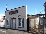 This building was built in the late 19th century and was where the Glendale Blacksmith Shop was located. It is located in 6713 N. 57th Drive. Renovations were made to the building and it now houses the Desert Rose Cigar Lounge & Club. It is listed as historical by the Glendale Historical Building Survey.
 -
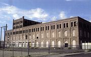 Beet Sugar Factory Building, built in 1906. The one million dollar Beet Sugar Factory was built by the Arizona Sugar Company, founded by William John Murphy. It produced sugar until 1913. The building is listed in the National register of Historic Places.
 -
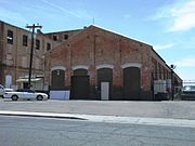 Boiler house, lime kiln house and repair shop of the historic Beet Sugar Factory. The building is listed in the National register of Historic Places.
 -
 The Hoghe Bunkhouse, is located at the intersection of Lamar Road and North 53rd Avenue. It was built by Leo M. Hoghe in 1906. The Hoghe Bunkhouse is the only remaining example of workers housing associated with the Beet Sugar Factory in Glendale. It is listed in the Glendale Arizona Historical Society.
 -
 Beet Sugar Factory Warehouses built in 1906. It is listed in the Glendale Arizona Historical Society.
 -
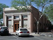 First National Bank of Glendale, built in 1906. It is listed in the National Register of Historic Places.
 -
 C. L. Gillett Building which once housed the Glendale State Bank, built in 1909. It is listed in the Glendale Arizona Historical Society.
 -
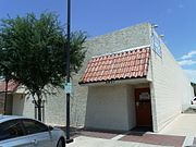 Glendale’s first mortuary, built in 1912 and located at 6821 N 58th Ave, now serves as the American Legions Post 29 Bingo Hall. It is listed in the Glendale Arizona Historical Society.
 -
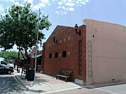 This was the location of Glendale’s first Fire Station in N. 57th Drive. The structure was built in 1912. It was later used as the towns’ municipal court and is now occupied by the Glendale Information Technology. It is listed in the Glendale Arizona Historical Society.
 -
 Glendale Woman's Club, structure built in 1912. It is listed in the National Register of Historic Places.
 -
 Sine Brothers Hardware Store, built in 1912. It is listed in the Glendale Arizona Historical Society.
 -
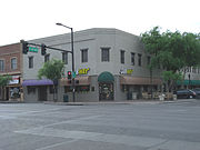 Hine Building built in 1913 which now houses various businesses. It is listed in the Glendale Arizona Historical Society.
 -
 The Two Story Adobe House was built in 1918 and is located at 6738 N. 54th Drive. It is the largest adobe building in Glendale and listed as historical by the Glendale Historic Building Survey.
 -
 Robert W. Cole Building which once housed the Sprouse and Reitz 5 and 10 Cent Store, built in 1919 (GAHS). The building houses "Zola Bell's", an antique store. It is listed in the Glendale Arizona Historical Society.
 -
 Landmark Middle School built in 1920
 -
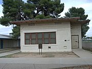 Glendale Grammar School One-Room Class Building, built in 1920. This particular unit is known as "Room 35". It is listed in the National Register of Historic Places.
 -
 The building where the Glendale Herald and Valley Printers were located was built in 1920. The structure is located at 5430 Glendale Ave. The "Glendale Herald" began operations in 1926 and continued to do so until 1963 when it ceased to operate. It was the towns’ second newspaper and started as the “Saturday Shopper”. The building now houses a used car sales business. It is listed in the Glendale Arizona Historical Society.
 -
 This historic building was once the “El Rey Theatre”. It was built in the 1920s and is located at 7009 N. 58th Ave. The theatre is now gone, however the structure houses (2013) the Pink House Boutique. It is listed in the Glendale Arizona Historical Society.
 -
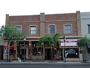 Sine Building, built in 1926 by the Sine Brothers. It is listed in the Glendale Arizona Historical Society.
 -
 Inside the Sine Building.
 -
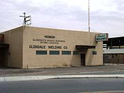 The Glendale Welding Company building was built in the early 1900s and is located at 6725 N 57th Dr. The welding company was established in 1937 and claims to be Glendale’s oldest business in one location. The building is listed in the Glendale Historic Building Survey of 1980.
 -
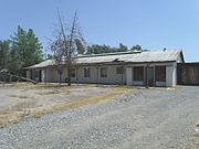 The Glendale Tract Community Center was built in 1937 and is located at the axial terminus of Sands Road on a large parcel that occupies the Southeast corner of the historic Glendale Tract District. The district was listed in the National Register of Historic Places on January 11, 2006, reference #05001506.
 -
 Location of Historic Filers Bakery (GAHS), founded in 1939. The Bakery was established in the Robert W. Cole building, built in 1919, which once housed the Sprouse and Reitz 5 and 10 Cent Store. It is listed in the Glendale Arizona Historical Society.
 -
 Inside Coyotes Oaties location which once housed the Historic Filers Bakery (founded in 1939) (GAHS), founded in 1939. Posing is co-owner Annette.
 -
 Glendale High School Auditorium, built in 1939. It is listed in the National Register of Historic Places.
 -
 The Glendale High School Auditorium is the only remaining original high school building.
 -
 Coury Building built in 1940 (GAHS)
 -
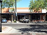 Woolworth's Building
 -
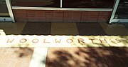 Woolworth's sidewalk
 -
 This historic structure, located at 5625 W Glendale Ave., was built in the 1940s. It once housed Glendale Pharmacy and Post Office. (notice the old pharmacy sign on top of the building). It now houses Auntie Em's Miniature and Smilin' Jack's Pedal Car store. It is listed in the Glendale Arizona Historical Society.
 -
 Close-up view of the Glendale Pharmacy historic structure, located at 5625 W Glendale Ave., which was built in the 1940s and once also housed a Post Office. (notice the old pharmacy sign) (GAHS).
 -
 Joe's Market built in 1942 and located at 6705 N. 54th Ave.. Once used as a grocery store. Listed as historical by the Glendale Arizona Historical Society.
 -
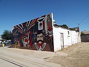 Different view of Joe's Market.
 -
 This historic structure, built in 1951 and located at 5734 W Glendale Ave., once housed Basha's Supermarket. The school offices of Glendale school district were once located in the second floor of the building. It was once the home of The Mad Hatters Antique Store. It is listed in the Glendale Arizona Historical Society.
 -
 This is the original building of Pratt’s Feed and Supply. Emerson Wilcken Pratt (1901–2001) worked here when it was known as the "Farmers Cooperative". Pratt's brought the business and in 1953 established Pratt’s Feed and Supply. The structure is located at Glendale and 52 Aves. In the background is a mill which Emerson Wilcken Pratt had built to mix different feeds. The building is now used for other business ventures. The property is listed in the Glendale Historic Building Survey, City of Glendale, 1980.
 -
 The Pratt Mill which Emerson Wilcken Pratt had built in the 1950s to mix different feeds for his business, Pratt’s Feed and Supply located at Glendale and 52 Aves.. It is listed in the Glendale Historic Building Survey, City of Glendale, 1980.
 -
 The original Fire Station #151, Glendale’s first modern fire Station, built in 1960 and located at 55th Ave. and Orangewood Ave. A new, modern fire station, replacing this one, was built in 6851 N. 52nd Avenue.
 -
 Cerreta Candy Co. founded in 1968 in Glendale, Arizona. In 2002 was named a West Valley Treasure. It was originally built as a Safeway grocery store.
 -
 Original building where the "Northwest Hospital" was located at 61st and Northern Aves. Eventually the hospital was moved to a new location at 5555 W. Thunderbird Road and was renamed "Banner Thunderbird Medical Center". The building was built in 1960 and now houses the "Salvation Army Corps Community Center".


(NRHP = National Register of Historic Places)
(GAHS=Glendale Arizona Historical Society)
-
 First Methodist Episcopal Church of Glendale Sanctuary, built 1926 (NRHP)
 -
 The first Russian Molokans Church (Spiritual Christians) in Glendale built in 1950 and located at 7402 Griffin Ave. The structure was re-addressed as 6404 75th Ave. The first members of this religion arrived in Glendale in 1911. It was at one time the spiritual center for 200 families.
 -
 Old (c. 1920) abandoned First Southern Baptist Church Building (GAHS). The building was demolished.


Before and after its’ restoration
Myrtle Avenue Residential Historic District
Listed in the National Register of Historic Places Places ref: 08001345.
-
 Morcomb's Service Station, built in 1930 and located at in the corner of Grand and Myrtle Aves. as it looked in 2010 before its restoration.
 -
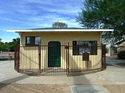 The restored historic Morcomb's Service Station. The property was restored by the Glendale Historical Society in 2013. It is located within the Myrtle Avenue Residential Historic District which is listed in the National Register of Historic Places ref: 08001345.
 -
 Back side of Morcomb's Service Station before restoration.
 -
 Back side of the historic Morcomb's Service Station after its’ restoration.


(NRHP = National Register of Historic Places)
-
 National Register of Historic Places Marker in Manistee Ranch.
 -
 Main mansion of the Manistee Ranch, built in 1897.
 -
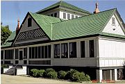 Different view of the Manistee Ranch main mansion.
 -
 Different view of the Manistee Mansion.
 -
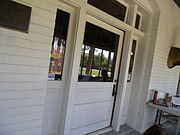 Main door and entrance of the Manistee Mansion.
 -
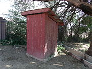 Manistee Ranch Outhouse.
 -
 Garage in the ranch built in 1912.
 -
 Farm equipment once used at the ranch.
 -
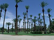 Palm trees at the ranch, some over 100 years old.
 -
 Granary Barn built in 1890.
 -
 Manistee Ranch office built in 1924, and used as such by the Sands family, until 1947.


-
 Fireplace in the living room of the Manistee Mansion .
 -
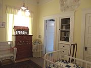 Children’s room in the Manistee Mansion .
 -
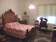 Main bedroom of the Manistee Mansion .
 -
 Bedroom in the first floor of the Manistee Mansion .
 -
 19th century kitchen of the Manistee Mansion .
 -
 Staircase leading to the second floor of the Manistee Mansion .


(NRHP = National Register of Historic Places)
-
 National Register of Historic Places Marker in Sahauro Ranch.
 -
 Entrance to Historic Sahuaro Ranch.
 -
 Main mansion of the Sahuaro Ranch, built in 1886 (NRHP)
 -
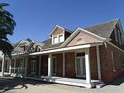 Different view of Main mansion of the Sahuaro Ranch, built in 1886 (NRHP)
 -
 Sahuaro Ranch Foreman's House, built in 1890 (NRHP)
 -
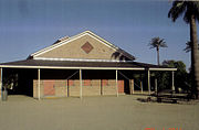 Feed and Storage House in Sahuaro Ranch, built in 1890 (NRHP)
 -
 Adobe house – the first house built in Sahuaro Ranch
 -
 Saguaro Ranch Dairy Barn
 -
 Saguaro Ranch Blacksmith Shop (1890).
 -
 Saguaro Ranch Outhouse (1890).
 -
 Case Steam Engine used in Sahuaro Ranch.
 -
 Saguaro Ranch Farm machinery and 1890s Horse Stable (in background).
 -
 1901 Saguaro Ranch Pump House.
 -
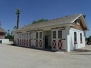 1905 Saguaro Ranch Wagon and auto garage.
 -
 Saguaro Ranch Well House (1920).


-
 The Smith bedroom on the second floor of the main mansion.
 -
 Small study in the hallway of the second floor of the main mansion.
 -
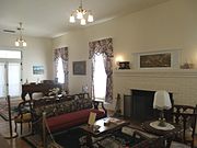 Living room in the first floor of the main mansion.
 -
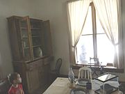 The inside of the old Adobe house, the first structure built in the Sahuaro Ranch.


-
 An abandoned late 19th century farm located in 63rd Ave. between Northern and Olive Aves.
 -
 Another view of the abandoned late 19th century farm.
 -
 The abandoned barn
 -
 The abandoned farm house.


(NRHP = National Register of Historic Places)
(GAHS=Glendale Arizona Historical Society)
-
 The Forney House, built in 1893, is the second oldest house in Glendale, Arizona. It is located at 7534 North 61st Avenue. The oldest house in Glendale is the Adobe house located in Sahuaro Ranch.
 -
 Jonas McNair House was built in 1897 and is located at 5919 W. Myrtle Avenue (NRHP)
 -
 C.C. Burkholder House was built in 1898 and is located at 7402 N. 61st Ave. C.C. Burkholder was a pioneer and the minister for the River Brethren Church. The house is listed as historical by the Glendale Historical Society.
 -
 E.C. Bunch House was built in 1898 and is located at 5602 West Lamar Road (NRHP)
 -
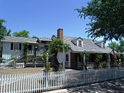 The McDaniels House is an early 1900's house which was owned by the McDaniels family in 1951. It is located at 7123 W. 58th Ave. The house has been used as a restaurant and other commercial ventures.
 -
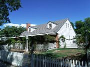 Different view of the McDaniels House.
 -
 The William Weigold House was built in 1910 and is located at 6101 W. Palmarie Ave. W. Weigold was one of the first directors of the Glendale State Bank. The property is listed in the “Glendale Historic Building Survey”, City of Glendale, 1980.
 -
 The Ray Wiegold House was built in 1910 and is located at 6115 W. Palmarie Ave. Ray Weigold was a building contractor. His brother William was one of the first directors of the Glendale State Bank. The property is listed in the “Glendale Historic Building Survey”, City of Glendale, 1980.
 -
 The W.C. Welsh Rental House was built in 1912 and is located at 7304 61st Ave. Welsh came to Glendale in 1906 and built several rental houses. The property is listed in the “Glendale Historic Building Survey”, City of Glendale, 1980.
 -
 The Nunez House whose original structure was built in 1912. The house is located at 6701 N. 55th Drive. It was amongst the first houses built in what was known as “Mexican Town” in Glendale, Arizona. “Mexican Town” came about as a result of the migration of people from Mexico and of Mexican descent who settled in that section of Glendale with the opening of the Beet Sugar Factory in 1906. The property is listed in the “Glendale Historic Building Survey”, City of Glendale, 1980.
 -
 C.H. Tinker House was built 1913 and is located at 6838 N. 59th Drive (NRHP)
 -
 The First Baptist Church Parsonage House was built in 1919 and is located at 7141 N. 57th Ave. Reverend C.M. Northrup was the first pastor to reside in the house. Listed as historic by the “Glendale Historic Building Survey”.
 -
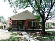 Methodist Church Parsonage House
 -
 The Dominic Sanita House was built in 1924 and is located at 7102 N. 55th Drive. Dominic Sanita was a prominent businessman in Glendale, Arizona. The property is listed in the “Glendale Historic Building Survey”, City of Glendale, 1980.
 -
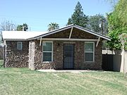 George O'Dowdy Rental Cottage was built in 1926 and is located at 6818 N. 60th Avenue (NRHP)
 -
 The Collins House was built in 1930 and is located at 5803 W. Northview Ave. The house is listed in the “Glendale Historic Building Survey” of 1980.
 -
 The Cook-Chisum House was built in 1931 and is located at 5962 W. Northview Avenue. The Dutch Colonial Revival style of the house popularized by Dutch colonists in parts of New York and New Jersey in the early 1900s. The house is located in the Floralcroft Historic District which was listed in the National Register of Historic Places on April 6, 2006, reference: #05001505.
 -
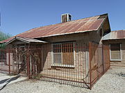 Morcomb's Family House, built in 1936 and located at in the corner of Grand and Myrtle Aves.(GAHS)
 -
 The Jack Shawver House, now known as the Keist Office Building, was built in 1952 and is located at 7508 North 59th Avenue, in the 59th Ave.. This Ranch style home was built outside any platted subdivision by Jack Shawver, partner of the Shawver Brothers Tillage Company. It is in the Northfield Historic District which was listed in the National Register of Historic Places on May 10, 2010, reference: #10000234.
 -
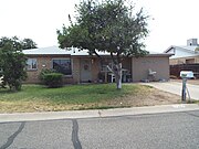 The Melvin E. Sine House built in 1957 and located at 7307 N. 50th Drive.
 -
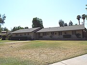 The Evan Mecham House was built in 1960 and is located at 5741 West Harmont Drive. Evan Mecham served as the 17th Governor of Arizona from January 5, 1987 to April 4, 1988 when he was impeached. The house is located in the Thunderbird Estates/ McDonald Addition Historic District.


(NRHP = National Register of Historic Places)
(GAHS=Glendale Arizona Historic Society-listed)
-
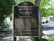 National Register of Historic Places "Catlin Court Historic District" Marker.
 -
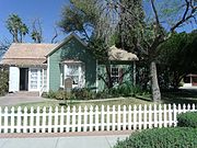 Victor Messinger House, built in 1897 is located at 7141 N. 59th Avenue. Messinger was Glendle's first city clerk and founder of the town's first library. .
 -
 Victor Messinger House NRHP plaque.
 -
The McDaniels House is an early 1900s house which was owned by the McDaniels family in 1951. It is located at 7123 W. 58th Ave. The house has been used as a restaurant and other commercial ventures.
-
 Glendale’s historic Methodist Church parsonage house, built in 1898, was moved to 7142 N. 58th Avenue and is now an antique store. The house is also known as the C. E. Allen House. The Allen family occupied the house in 1924.
 -
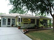 The Bears & More House was built 1920 and is located at 7146 N. 58th Avenue.
 -
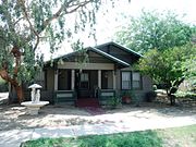 The W.W. Ireland House was built in 1919 and is located at 7213 N. 58th Avenue. W.W. Ireland was a local tin smith and sheet metal worker. The property is listed in the Glendale Historic Building Survey, City of Glendale, 1980.
 -
 The Collins Stone House built in the early 1900s and located on 7214 N 58th Ave.
 -
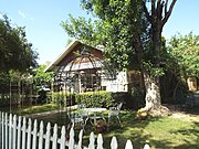 The Verne Whitney House built in 1919 and located in 7162 N. 58th Ave. Whitney was a rural mail carrier.
 -
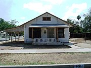 The J.F. Eberle Rental House was built in 1921 and is located at 7221 N. 58th Avenue. J.F. Eberle was an early pioneer who was involved in Glendale’s dry goods and grocery business.
 -
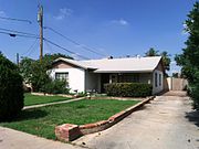 The W.G. Bell House was built in 1940 and is located at 7240 N. 58th Avenue.
 -
 The C.H. Keaton House was built in 1920 and is located at 7308 N. 58th Avenue. The property is listed in the Glendale Historic Building Survey, City of Glendale, 1980.
 -
 Frank Carden House built in 1936 is located at 7149 N. 58th Drive. Frank Carden operated a men's clothing store downtown, and he also became a justice of the peace.
 -
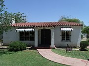 Phillip Marshall House built in 1930 is located at 7153 N. 58th Drive. Philip Marshall was co-owner of the Marshall Brothers Barber Shop.
 -
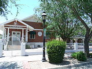 Christian Church Bungalow built in 1917 is located at 7154 N. 58th Drive. Now known as Manor at Catlin Court, it is the only bungalow church in Arizona.
 -
 Harry Madison House built in 1920 is located at 7157 N. 58th Drive. Harry H. Madison owned a bakery in Glendale.
 -
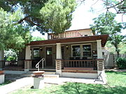 Floyd Holmes Sine House built in c. 1917 is located at 7163 N. 58th Drive. Floyd was the first of the Sine brothers to move to Glendale. Together with his brothers he founded the "Sine Hardware Store.
 -
 The C.M. Wood House was built in 1919 and is located at 7222 N. 58th Drive. It belonged to G. W. Protzman and later to Mr. Wood a prominent Glendale pharmacist.
 -
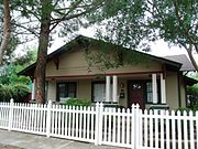 The E.J. Barnes/Sharp House was built in 1919 and is located at 7229 N. 58th Drive.
 -
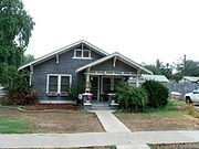 The Delbert Lower/ J.A. Ireland House was built in 1918 and is located at 7230 N. 58th Drive.
 -
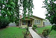 The Appleby/McRuer House was built in 1917 and is located at 7248 N. 58th Drive. The house belonged tp G. A. Appleby, president of the Commerce Bank and later to Duncan McRuer, principal of Glendale High School.
 -
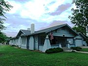 The Green McAbee/ J.C. Kenton House was built in 1918 and is located at 7302 N. 58th Drive. Listed in the Glendale Arizona Historic Society.
 -
 The C.E. Walker House was built in 1928 and is located at 7321 N. 58th Drive.
 -
 The Meyer House built in the early 1900s and located on 7138 N 57th Dr.
 -
 The First Baptist Church Parsonage House built in the early 1900s and located at 7150 N 57th Ave.
 -
 The Apartments built in the early 1900s and located at 7153 N 57th Dr.
 -
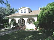 The Julio Sancet House (aka, The Hickman House) was built in 1919 and is located at 7158 North 57th Avenue. It was the home of Julio Sancet, a local rancher, from 1919 through the 1930s.
 -
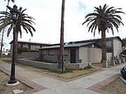 The Myrtle Apartments built in the early 1900s located on the corner of Myrtle & 57th Dr.
 -
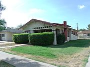 The F.M. Staggs House was built in 1919 and is located at 5804 W. Myrtle Ave. Frank M. Staggs was a local carpenter and contractor.
 -
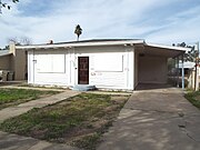 The Kenneth L. Alien House built in the early 1900s and located on 5808 W. Myrtle Ave.
 -
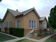 The Wadia Daou/ Mansour Daou House was built in 1935 and is located at 5824 W. Myrtle.
 -
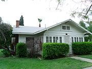 The Otto Hansen House was built in 1917 and is located at 5834 W. Myrtle. The house belonged to Otto Hansen originator of the Catlin Court subdivision.
 -
 House built in the early 1900s and located on 5808 W. Northview Ave.
 -
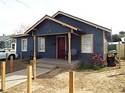 The Eberle Rental House built in the early 1900s and located on 5819 W. Northview Ave.
 -
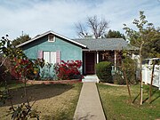 The Monterey Style House built in the early 1900s and located on 5820 W. Northview Ave. Catlin Court Historic District of Glendale, Az. Reference #92000680 and extended reference #07001088.
 -
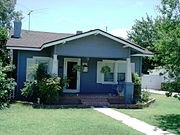 The Louis Myers House was built in 1918 and is located at 5803 W. State Ave. Louis Myers was the president of the Glendale State Bank who played a major role in the establishment and development of the Catlin Court District in Glendale.
 -
 The David Roberts House was built in 1920 and located at 5808 W. State. The house was built for Reverend Roberts, an Englishman who served as minister of the Glendale First Methodist church in 1921.
 -
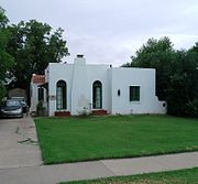 The Kalas House was built in 1927 and is located at 5811 W. State St. The house was the residence of Dr. William Kalas who once served as mayor of Glendale.
 -
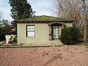 The Roberts House built in the early 1900s and located on 5812 W. State Ave.
 -
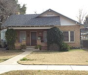 The Earl Smith House built in the early 1900s and located on 5819 W. State Ave.
 -
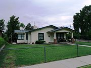 The Isaac Imes House was built in 1920 and is located at 5823 W. State St. Isaac Imes was a teacher and school principal. One of Glendale’s elementary schools is named after him.
 -
 The C.A. Jemison House was built in 1919 and is located at 5824 W. State St. The house was once the residence of C.A. Jemison, a cashier for the First National Bank of Glendale.
 -
 The J.D. Howell House was built in 1919 and is located at 5854 W. State Ave. John David Howell was a building contractor who was responsible for the design and construction of the first Glendale High School.
 -
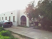 The William E. Argo House built in the early 1900s and located on 5811 W. Gardenia Ave.
 -
 The Russell Carr House built in the early 1900s and located on 5808 W. Gardenia Ave.


-
 Griffith Ave., a dead end street, is the only remaining street of the once Russian (Molokan) Farmers Village.
 -
The first Russian Molokans Church (Spiritual Christians) in Glendale built in 1950 and located at 7402 Griffin Ave. The structure was re-addressed as 6404 75th Ave. The first members of this religion arrived in Glendale in 1911. It was at one time the spiritual center for 200 families. It is listed as historical by the Glendale Arizona Historical Society.
-
 Molokan house which once belonged to Harry P. Tolmachoff.
 -
 Molokan house in Griffin Ave


-
 Entrance to the Tomachoff farms established in 1912 by the Tolmachoff family, who were among the early Russian families who immigrated and settled in Glendale, Arizona. The farm is located at 5726 N. 75th Avenue in Glendale..
 -
 A Steel Star open back-geared steel windmill located in the historic Tolmachoff Farm. It was manufactured by Flint & Walling Manufacturing Co., Kendallville, IN., circa 1910.
 -
 A 1927 Chevrolet Truck once used in the historic Tolmachoff Farm.
 -
 Children farming in the Tolmachoff Farm.
 -
 Tolmachoff Farm pumpkin patch.


-
 Thunderbird Pilots Memorial Marker
 -
 Thunderbird Pilots Memorial dedicated to the pilots who trained there during WW II.
 -
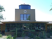 The historic Thunderbird Control Tower was built in 1941 and served as the Air Control Tower and Officers' quarters during the operation of the Thunderbird 1 Army Air Field, in Glendale. There American, British, Canadian and Chinese pilots trained during WWII. The air field was deactivated in 1945 and is now occupied by the Thunderbird School of Global Management which is located southeast of the intersection of West Greenway Road & North 59th Avenue in Glendale, Arizona (GAHS).
 -
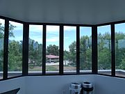 View from the inside of the historic Thunderbird Control Tower station.
 -
 Different view of the historic Thunderbird Control Tower. The tower and officer quarters were built in 1941 and served the Thunderbird 1 Army Air Field, in Glendale during WW II (GAHS).
 -
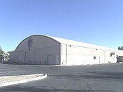 The historic Thunderbird 1 Army Air Field Airplane Hanger was built in 1941 (GAHS).
 -
 Thunderbird 1 Army Air Field barracks used during World War II by the pilots.
 -
 Thunderbird 1 Army Air Field barracks.


The Glendale Memorial Park Cemetery is a historic cemetery located at 7844 North 61st Ave. in Glendale, Arizona. The cemetery was originally called Glendale memorial Park.

-
The Caretakers’ House (built in 1895).
-
 Historical 1895 Marker.
 -
 L/Cpl.Jose Francisco Jimenez (1946-1968)
 -
 Grave of Ova Darling Betts (1868-1950) and Mamie Betts
 -
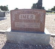 Grave of Issac Imes (1892-1956) and Harriette Imes (1894-1952)
 -
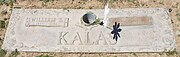 Grave of William E. Kalas (1884-1968) and Olga Kalas (1896-1991)
 -
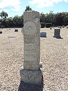 Grave of Emitt Marlow (1900-1919)
 -
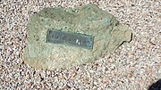 John Maxwell Pearson (1885-1934)
 -
 Grave of Julio Sancet (1880-1961)
 -
 Grave of Louis Sands (1875-1941)
 -
 Grave of Louis Sands Jr. (1908-1975)
 -
 Grave of Melvin E. Sine (1907-1987) and Eva Sine (1910-2002)
 -
 Grave of Tucker J. Sine (1879-1942) and Mary Grace Sine (1881-1966)
 -
 Albert J. Straw (1858-1935)
 -
 Elizabeth Straw (1860-1952)
 -
 Grave of William Weigold (1852-1923)
 -
 Grave of William F. Weigold (1886-1954)
 -
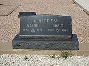 grave of Verne Whitney (1896-1971) and Ada M. Whitney (1901-1981)
 -
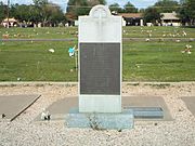 Monument dedicated to the 1959 Bus Crash.
 -
 Graves of the bus crash victims.


The Russian Spiritual Christians Cemetery, sometimes referred to as the Molokan Cemetery, was established in 1911 shortly after the Molokan's, arrived to buy farmlands in Glendale, Arizona. The Molokans, known as the Spiritual Christians, was a religious group which broke away from the Russian Orthodox Church because they believed that the Russian Government was going to force their youth to serve in the military. This was against their believes. They arrived and established a community in California. Some of these families, among them the Tomachoffs and the Popoffs moved to Glendale, and established a Russian Village. One of the factors which benefited them was the sugar beet factory of that town. The Sugar Beet Factory closed in 1913 and the demand for their agricultural products declined, that and the climate of the area convinced many families to return to California. The cemetery is considered to be a historical site.
(Sometimes referred to as the Molokan Cemetery)
(GAHS=Glendale Arizona Historic Society-listed)
-
 The historic Russian Spiritual Christians Cemetery, sometimes referred to as the Molokan Cemetery, was established in 1911 and is located in 75th Ave. close to Maryland Ave.
 -
 The old posts which stick out of the ground in the historic Russian Spiritual Christian Cemetery are of the deceased whose families could not afford a grave marker. It is unknown who are buried there.
 -
 Some graves belonging to the Popoff family.
 -
 Graves of some of the members of the Tomachoff family.
 -
 Graves of Nellie and Peter Popoff with Russian inscription.


West Resthaven Park Cemetery And Funeral Home was founded in 1947 and is located at 6450 West Northern Avenue. Among the notable people which are interned are the founders of the City of Surprise and the founder of Wittmann. Also, interned is a Medal of Honor recipient.

-
 Grave of Homer C. Ludden (1880-1958) Arizona State Legislator and Founder of the City of Surprise, Arizona.
 -
 Grave of Flora May Gillett Ludden (1890-1953) Co-founder of the city of Surprise, Arizona.
 -
 Grave of William Hovey Griffin (1875 - 1956) founder of the town of Nadaburg (Wittmann, Arizona).
 -
 Grave of Ada Ellen Griffin (1889 – 1957) wife of William Hovey Griffin.
 -
 Grave-site of Silvestre S. Herrera located in West Resthaven Park Cemetery, Section 26; Block 16; Lot 1. Hererra was awarded the Congressional Medal of Honor in World War II.


(NRHP = National Register of Historic Places)
(GAHS=Glendale Arizona Historical Society)
-
 Grave-site of William John Murphy, founder of Glendale.
 -
 Murphy Park named after William John Murphy, founder of Glendale. The town clock (pictured) was dedicated in 1987 to the memory of Thelma Renick Heatwole (1912-1991), who covered life in the Glendale community for more than 40 years as a newspaper reporter. The park is located at 58th & Glendale Avenues and has a public library.
 -
 Glendale's Fire Bell. When Glendale established its first all Volunteer fire department in 1912, this bell alerted the volunteers, which was made up of the local business owners. The bell was originally located on the towns’ water tank behind the Sine Hardware store at 58th Drive. The bell is now located at Fire Station #151 in Glendale where it serves as a reminder of that departments pioneer days.
 -
 This 1917 Nash Fire Truck was the first motorized fire truck of the Glendale Fire Department. It is Model #3017, Truck #98745. Its maximum speed is 16 mph and has a normal freight load capacity of 4000 lbs. The normal weight allowance is 1500 lbs. and the normal weight of the chassis is 3850 lbs. The truck was manufactured by the “Nash Motors Company” and is on exhibit at the Glendale Training Center located at 11330 W. Glendale Ave.
 -
 Emblem of the historic 1954 American La France-Foamite 700 Series (California Historical Vehicle 622S).
 -
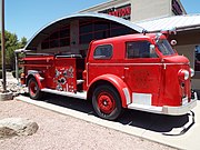 Historic 1954 American La France-Foamite 700 Series (California Historical Vehicle 622S) located at 57th Ave. and Bell Road in Glendale, Az.
 -
 Police Car – This 1947 Plymouth police car was restored and is used in special events. The car is on exhibit at the Glendale Training Center located at 11330 W. Glendale Ave.
 -
 Gasoline pumps used at Morcomb's Service Station, including an 1918 visi-bowl gas pump (left) (GAHS)
 -
 The Glendale Veteran’s Memorial is located at 5959 West Brown Street in Glendale, Arizona. The City of Glendale acquired historical artifacts that were salvaged from the USS Arizona and the USS Arizona Memorial in Pearl Harbor. The rusted metal pieces are from a portion of the potato locker in the ship's galley. The steel rings were cut from the USS Arizona Memorial flagpole. Legislation passed during the administrations of Presidents Dwight D Eisenhower and John F Kennedy designated the remains a national shrine. This is an image of an artifact or piece of a structure that is listed on the National Register of Historic Places in the United States of America. Its reference number is 66000994.
 -
 Another view of the Glendale Veteran’s Memorial.
 -
 This Porter 0-4-0 is an 18" gauge locomotive that was once used as a copper mining locomotive. Built in Pittsburgh, Pennsylvania in 1887, this locomotive was operated by the Detroit Copper Company at their Morenci, Arizona mine. The locomotive is located at 23280 N 43rd Ave.
 -
 Japanese Internment Camp Houses from Leupp, Flagstaff. These houses were built in 1943 and are now located in the grounds of the Sahuaro Central Railroad Museum.
 -
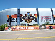 The 2017 NCAA Final Four played in the University of Phoenix Stadium in Glendale.


_located_at_57th_Ave._and_Bell_Road_in_Glendale,_Az.jpg)


-
 Old Dominian Copper Company smelter complex
 -
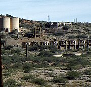 Old Dominian Copper Company smelter complex
 -
 1900 Chilean (Burrstone) Mill
 -
 Eastern and Southern Pacific Railroad Depot
 -
 Back side of the Eastern and Southern Pacific Railroad Depot
 -
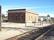 Eastern and Southern Pacific Railroad Freight Depot now used as a Restaurant/YMCA
 -
 Holy Angels Church
 -
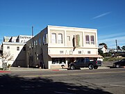 Upton’s Confectionary
 -
 Wagenen/Fisk Building
 -
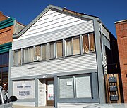 The Residence
 -
 Banks Paints
 -
 Gila County Courthouse
 -
 Federal Building
 -
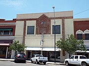 Odd Fellows Lodge Building
 -
 Sultan/Woolworth Building
 -
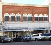 Hamil Building
 -
 Masonic Temple
 -
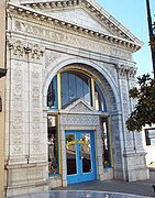 Gila Valley Bank and Trust Building
 -
 United States Post Office
 -
 Globe Jail Building
 -
 St. John’s Episcopal Church
 -
 Family Fellowship Church
 -
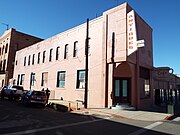 Butler Building
 -
 Elks Building
 -
 Murphy Hotel (Tonto Hotel)
 -
 Ardon Hotel/Globe Bakery
 -
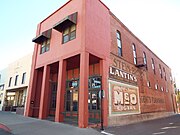 Cubito Jewelry Company
 -
 International House
 -
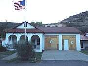 Gila Mine Rescue Station
 -
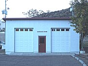 Gila Mine Rescue Station Carriage House
 -
 Teepee
 -
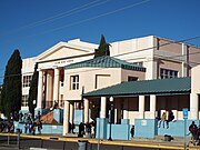 Globe High School
 -
 El Rey Motel
 -
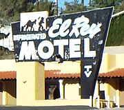 Vintage 1938 El Rey Motel sign
 -
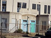 Hill Street School main entrance
 -
 Hill Street School
 -
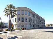 Hill Street School
 -
 Noftsger Hill School
 -
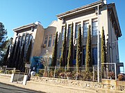 Noftsger Hill School
 -
 Victorian House
 -
 Historic Steam Engine #1774
 -
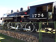 Steam Engine #1774
 -
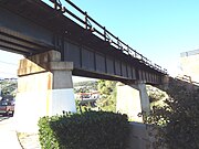 North and Broad Street Overpass
 -
 North and Broad Street Overpass


_Mill-1330_Broad_Street-1900.jpg)


-corner_of_Broad_and_Mezquite_Streets-1916.jpg)


-
 Goldfield Ghost Town. Goldfield was a mining town established in 1893 next to the Superstition Mountain. When the mine vein faulted, the grade of ore dropped and the town eventually became a ghost town. The town and its historic buildings were revived as a tourist attraction. The ghost town is located at 4650 N, Mammoth Mine Road in the town of Apache Junction, Az.
 -
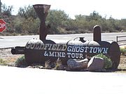 Entrance to the Goldfield Ghost Town.
 -
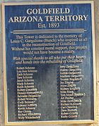 1893 Goldfield Arizona Territory Plaque.
 -
 The 19th century “Tower” used in the Goldfield mine.
 -
 The 19th Century Railroad Station of Goldfield.
 -
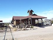 Different view of the 19th Century Railroad Station of Goldfield.
 -
 View from the only narrow-gauge railroad train in operation in Arizona.
 -
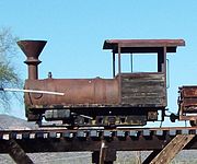 1890 Porter 0-4-0 once used in the gold mines of Goldfield.
 -
 Goldfield’s Main Street.
 -
 A different view of Goldfield’s Main Street.
 -
 A different view of Goldfield’s Main Street.
 -
 Another view of Goldfield’s Main Street.
 -
 A 19th Century abandoned building in Goldfield.
 -
 A 19th Century building in Goldfield.
 -
 Bordello
 -
 Building
 -
 Abandoned house
 -
 Livery
 -
 Goldfield Museum
 -
19th Century abandoned building.
-
19th Century building in Goldfield.
-
 Saloon.
 -
 Church in Goldfield.
 -
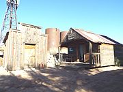 Church at the Mount Sunday School, Nursery and Fellowship Hall.
 -
 Water Tank.
 -
 Cantina-Bakery.


.JPG)


-
 Landing Strip L288 with its original markings
 -
 Diffwerent view of the landing Strip L288 with its original markings.
 -
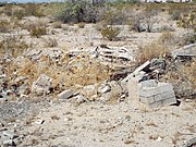 USAAF building ruins.
 -
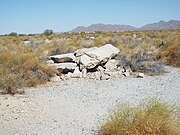 More USAAF building ruins.
 -
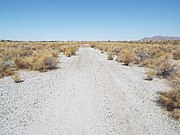 Luke Field Auxiliary #6 landing strip.
 -
 Front of the Phoenix Trotting Park. The structure was built in 1965 and is located at 1068 N Cotton Lane. The harness racing facility closed in December 1966. At about 20 miles from downtown Phoenix, the park's remote location was a major factor in the low rates of attendance.
 -
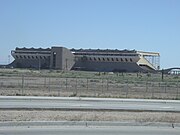 A different view of the front of the Phoenix Trotting Park.
 -
 The grandstand of thePhoenix Trotting Park.
 -
 A close up view of a corner detail of a balcony of the Phoenix Trotting Park.
 -
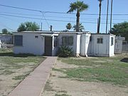 This Wingfoot House, located in Greenleaf Lane in the town of Goodyear, was built by a Southwest Cotton factory at Litchfield Airport in 1943. Called the "home of the future," the Wingfoot Houses were 8 feet wide. Once on site, the bedroom wings were pulled out like drawers to yield a "T"-shaped, flat-roofed house. It had 255 square feet of living area.
 -
 Another Wingfoot House in Goodyear. Although most have now been remodeled, the basic structure is a Wingfoot.
 -
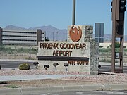 Entrance to the Phoenix Goodyear Airport (formerly Goodyear Municipal Airport). The airport was built in 1941 during World War II as a naval air facility, NAF Litchfield Park, then upgraded to naval air station status and renamed NAS Litchfield Park. In 1968, the city of Phoenix purchased the airport as a general aviation reliever airport for Phoenix Sky Harbor International Airport.
 -
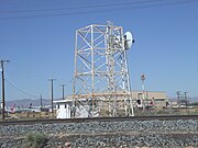 Old World War ll Radar Tower built in 1941 and located in the Phoenix Goodyear Airport (formerly Goodyear Municipal Airport).The airport served as a naval air facility during World War II.
 -
 Phoenix-Goodyear Airport "bone-yard" where planes that are no longer in use are kept.


-
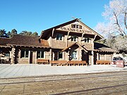 Canyon Railroad Depot
 -
 Different view Canyon Railroad Depot
 -
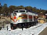 Grand Canyon Diesel Engine No. 6776-Alco FPA-4 built in 1958
 -
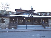 El Tovar Hotel
 -
 El Tovar Stables
 -
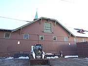 El Tovar Stables
 -
 AT& SF Employee residence
 -
 The Grand Canyon Power House
 -
 The Bright Angel Lodge
 -
 The Hopi House
 -
 William “Buckey” O’Neil's Cabin
 -
 The Look-Out Studio
 -
 The Kolb Studio
 -
 Verkamp’s Curio Store
 -
 Horace M. Albright Training Center


-
 Welcome to Guadalupe
Bienvenidos a Guadalupe -
 City Ordinance which forbids the taking of pictures and alcoholic beverages during the celebration of religious festivals.
 -
 Our Lady of Guadalupe Catholic Church.
 -
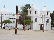 Side view of Our Lady of Guadalupe Catholic Church. The church was built in 1914 and is located at 5445 Calle San Angelo.
 -
 The rectory of Our Lady of Guadalupe Catholic Church .
 -
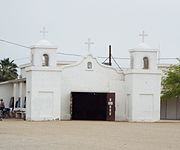 Santa Lucia Pascua Yaqui Temple built was built in 1914 and is located at 5445 Calle San Angelo.
 -
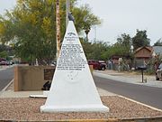 Guadalupe Veterans Monument in the Avenida del Yaqui.
 -
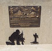 Memorial dedicated to all Veteran's located in the Avenida del Yaqui.
 -
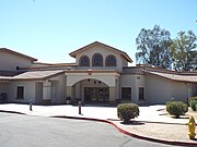 Guadalupe City Hall.
 -
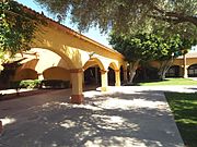 Mercado de Guadalupe.
 -
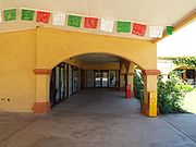 Different view of the Mercado de Guadalupe.
 -
Mercado de Guadalupe Wall Mural.
-
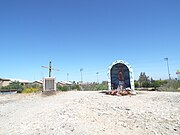 The Cerrito (small Hill).
 -
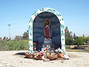 Our Lady of Guadalupe on the "Cerrito".
 -
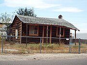 Abandoned 1920's house.
 -
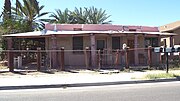 Early Guadalupe house which reflects the traditional Mexican western style.
 -
 Avenida del Yaqui.
 -
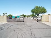 The Guadalupe Cemetery was established in 1904 in the original Guadalupe townsite. Eventually the City of Tempe purchased the land where the cemetery is located.
 -
 Graves in the Guadalupe Cemetery. The cemetery continues to be administered by the Town Clerk's office of Guadalupe.
 -
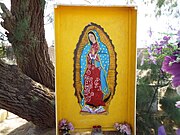 Grave with the image of Our Lady of Guadalupe.


-
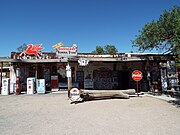 Hackberry General Store
 -
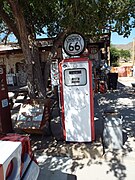 Mobilgas Fuel Pump
 -
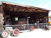 Hackberry Garage-1934
 -
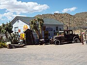 Hackberry Shell Station-1934
 -
 Hackberry Music Hall
 -
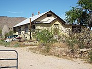 Hackberry Motel-1935
 -
 Hackbery Café-1920
 -
 Automobile abandoned in Route 66
 -
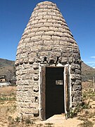 1920 Charcoal Kiln
 -
 Inside the 1920 Charcoal Kiln


-
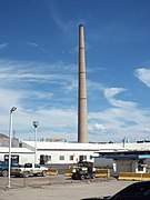 The 1,000' tall Hayden Smelter
 -
 Welcome to Hayden
 -
 1912 Valley National Bank (now Police Dept.)
 -
 Rex Theater
 -
 Methodist Church
 -
 Elementary school
 -
 Gila Furniture Store
 -
 Hayden High School
 -
 1911 Hayden Hotel
 -
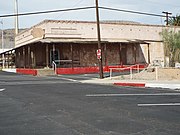 Supermarket
 -
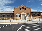 Union Hall
 -
 Abandoned Building
 -
 Abandoned Building
 -
 Charred and derelict pit of a former home
 -
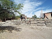 Another charred and derelict pit of a former home


-
 Globally Important Bird Area
 -
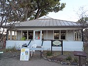 San Pedro House-1930
 -
 Brunckow's Cabin-1892
 -
 Different view of Brunckow's Cabin-1892
 -
 1880s Water Tower
 -
 Large Cottonwood Tree on the San Pedro Riparian National Conservation Area


-
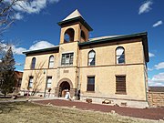 Navajo County Courthouse
 -
 Wigwam Motel
 -
 Wigwam Motel Tepee
 -
 Inside a Wigwam Motel Tepee room
 -
 Sidney Sapp House
 -
 Methodist Church Holbrook
 -
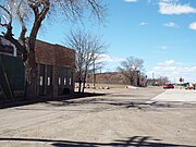 South Central Avenue Commercial Historic District
 -
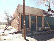 Bucket of Blood Saloon
 -
 Robinson & Co. Drug Store
 -
 The Scorse Mercantile and the Pioneer Saloon
 -
 The Young T Company Warehouse
 -
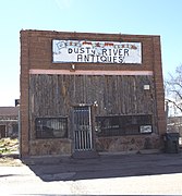 The Dusty River Grocery Store
 -
 The Horsehead Crossing Deli and Ice Cream Parlor
 -
 The Arizona Rancho Inn
 -
 Different view of the Arizona Rancho Inn
 -
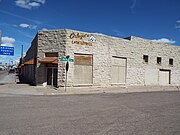 A & B Schuster Mercantile Company
 -
 Historic Wagon Road marker
 -
 Atlantic and Pacific Railroad Depot
 -
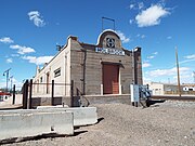 Santa Fe Railroad Depot
 -
 Santa Fe Railroad Depot
 -
 The Holbrook Bridge
 -
 The Holbrook Bridge
 -
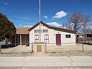 The Blevins House
 -
 Holbrook Cemetery
 -
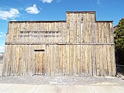 The Navajo County Sheriff office


-
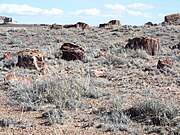 Petrified wood in the Petrified Forest National Park
 -
 Petrified Wood
 -
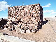 Agate House
 -
 The Agate House
 -
 Agate House window
 -
 Roof entrance
 -
 Where the meals were cooked
 -
 Wall inside the Agate House
 -
 Rainbow Forest Museum
 -
 Skull of a Triassic Period dinosaur found in the Petrified Forest National Park
 -
 Another exhibit of a Triassic Period dinosaur found in the Petrified Forest National Park
 -
 Two more skeletal remains of Triassic Period dinosaurs found in the Petrified Forest National Park
 -
 The Rainbow Forest Museum's Blue Room.


-
![Vintage Pow Wow Motel sign on Route 66]]](//upload.wikimedia.org/wikipedia/commons/thumb/d/dd/Holbrook-Building-Pow_Wow_Trading_sign-1917.jpg/135px-Holbrook-Building-Pow_Wow_Trading_sign-1917.jpg) Vintage Pow Wow Motel sign on Route 66]]
Vintage Pow Wow Motel sign on Route 66]] -
 Masonic Lodge
 -
 Holbrook Commercial Building
 -
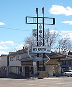 Holbrook Inn
 -
 Joe & Aggie's Café
 -
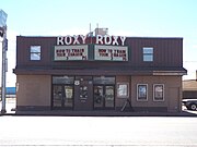 Roxy Theater
 -
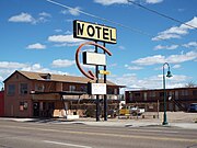 Woods Inn
 -
 Brad's Desert Inn
 -
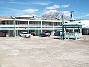 Sea Shell Motel (Roseway Inn)
 -
 Mobil Service Station
 -
 Plainsman Restaurant
![Vintage Pow Wow Motel sign on Route 66]]](/wiki/File:Holbrook-Building-Pow_Wow_Trading_sign-1917.jpg)


-
 UVX Mine building.
 -
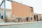 Ruins of the Barlett Hotel.
 -
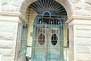 One entrance of the Barlett Hotel.
 -
 The Douglas Mansion.
 -
 The Hotel Conner.
 -
 The Hotel Conner.
 -
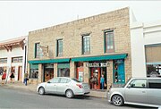 Jennie's Place.
 -
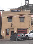 Jerome City Hall.
 -
 Jerome Grand Hotel.
 -
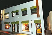 Jerome Palace.
 -
 J.C. Penney building.
 -
 Liberty Theater.
 -
 The Little Daisy Hotel.
 -
 Paul & Jerry's Saloon.
 -
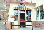 Reese and Amster Garage.
 -
 The Surgeon’s Mansion.
 -
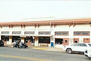 The New State Motor Building.
 -
 The Mine Museum/Fashion Saloon and the Whitten Printers building.
 -
 Sullivan Apartments
 -
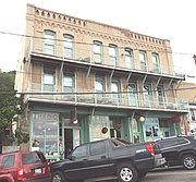 Boyd Hotel
 -
 Garcia House
 -
 Haskins House/Haskins Apartments
 -
 Grocery Store ruins
 -
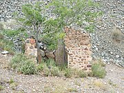 Mine Guard House ruins
 -
 Old Jerome High School
 -
 The Details of the Old High School entrance.
 -
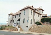 The Haven Methodist Church.
 -
 The Jerome Episcopal Christ Church.
 -
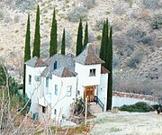 The Powder Box Church.


-
 The Sliding Jail.
 -
 Sliding Jail cell.
 -
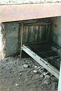 Sliding Jail bunk.
 -
 Sliding Jail cell gate.


-
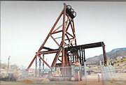 The Audrey Shaft Headframe.
 -
 Audrey Shaft and UVX Operations cage
 -
 Audrey Shaft and UVX Operations cage
 -
 Husband's Alley.
 -
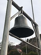 The Town Fire Alarm Bell.
 -
 Fire fighting equipment.
 -
 The Jerome Blast Furnace.
 -
 Mining car.
 -
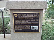 Main Street Primary School marker
 -
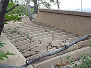 Main Street Primary School third floor stairs
 -
 Laura Williams Memorial Park
 -
 Irving Turbine and Generator
 -
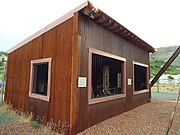 Irving Turbine and Generator shed
 -
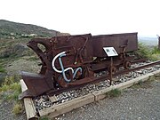 Rocket Shovel and Dragline


-
 Gold King Mine Ghost Town structures
 -
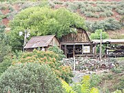 Gold King Mine Ghost Town farm
 -
 Gold King Mine Ghost Town brothel
 -
 Gold King Mine Ghost Town grave diggers house


-
 1910 house on Main Street
 -
 The St. Joseph Bridge a.k.a. the Lost Pratt Pony Truss Bridge built in 1912
 -
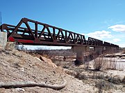 The St. Joseph Bridge
 -
 The St. Joseph Bridge
 -
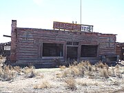 Ella's Frontier Trading Post
 -
 Ella's Frontier Trading Post warehouse
 -
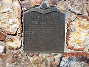 Old Fort marker
 -
 Old Fort ruins and marker


-
 Porter Air Locomotive
 -
 Porter Air Locomotive built in 1925
 -
 Different view of the Porter Air Locomotive
 -
 Rail and Copper Park
 -
 Mining Cars in the Rail and Copper Park
 -
 The Jake Jacobson Caboose in the Rail and Copper Park


-
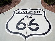 Historic Route 66
 -
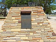 Beale Wagon Road Monument
 -
 Beale Wagon Road Monument marker


-
 Steam Engine #3759
 -
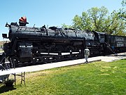 Steam Engine #3759
 -
 1954 Chevrolet Bel Air police car #1 a.k.a. "Jingles".


-
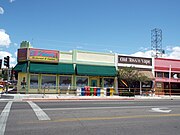 Luthy Block
 -
 Historical contributing structures on Andy Divine Ave.
 -
 Additional historical contributing structures on Andy Divine Ave.


-
 Armour and Jacobson Building-1921
 -
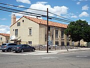 AT and T Building-1930
 -
 Brunswick Hotel-1909
 -
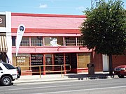 Building on 409 Andy Divine Ave.-1908
 -
 Central Commercial Building-1917
 -
 Desert Water and Power Co-1907
 -
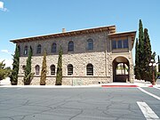 Elk's Lodge #468-1903
 -
 Gruninger Building-1921
 -
 H. Lovin Building-1906
 -
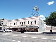 Hotel Beale-1900
 -
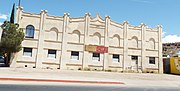 IOOF Building-1912
 -
 Masonic Temple-1939
 -
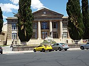 Mohave County Courthouse and Jail-1909
 -
 Old trails Garage-1915
 -
 Ed Thompson's Saloon -1915
 -
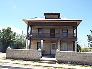 G. H. Sullivan Lodging House-1911
 -
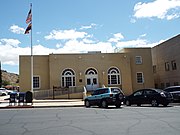 U.S. Post Office in Kingman-1935
 -
 Santa Fe Depot-1907
 -
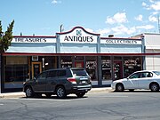 Van Marter Building-1921
 -
 Watkins Pioneer Drugstore-1888


-
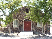 Assembly of God Church -1939
 -
 Saint John's Methodist Episcopal Church -1917
 -
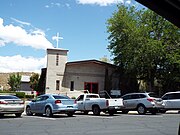 Trinity Episcopal Church
 -
 St. Mary's Catholic Church -1906
 -
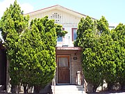 St. Mary's Catholic Church Rectory -1906


-
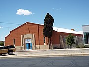 The Mohave Union High School Gymnasium-1936
 -
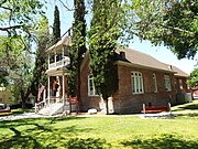 Little Red Schoolhouse-1896
 -
 Palo Christi School originally Kingman Grammar School-1928


-
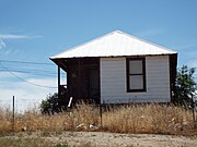 House on 202 E. Park St-1910
 -
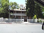 Bonelli House-1900
 -
 Cohenour House-1911
 -
 House on 843 E. Andy Divine Ave.-1935
 -
 Lefever House-1900
 -
 Mrs. M. P. Sergent House-1897
 -
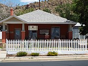 R.L. Anderson House-1915
 -
 Ross Blakeley House - 1897
 -
 Ross E. Householder House- 1916/19223
 -
 S.T. Elliot House - 1917
 -
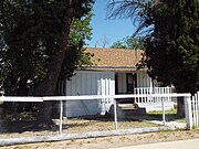 Tyrell House-1897
 -
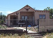 W. H. Taggart Home-1883
 -
 William G. Blakeley House-1887
 -
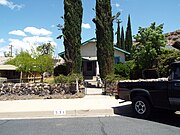 E.B. Williams House-1887
 -
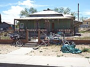 House at 536 East Park St-1906


The London Bridge in Lake Havasu was the last project of engineer John Rennie Sr. and was completed by his son, John Rennie Jr. in 1831. It was purchased by Robert P. McCulloch from the City of London. McCulloch had exterior granite blocks from the original bridge numbered and transported to America and the bridge was rebuilt in 1971 on McCulloch Blvd. and crosses over the Bridgewater Channel Canal in Lake Havasu City. The lamps which were emplaced on the London Bridge in 1831, were made from the melted-down cannons of Napoleon Bonaparte’s defeated army.

-
 The London Bridge.
 -
 Different view of the London Bridge.
 -
 Details of the London Bridge.
 -
 Under the London Bridge.
 -
 Above the London Bridge.
 -
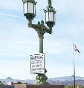 Lamp made from Bonaparte's cannons.
 -
 Different style lamp.
 -
 London Bridge fence with locks.
 -
 Plaza on the NE end of the bridge.
 -
 The Trafalgar Square Fountain in the English Village theme area.
 -
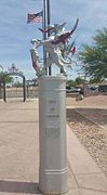 The English Village theme area.


-
 Welcome to Litchfield Park.
 -
 One of two original Litchfield Elementary School buildings which date back to 1917.
 -
 The second of two original Litchfield Elementary School buildings.
 -
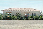 Litchfield Train Station now in the town of Goodyear.
 -
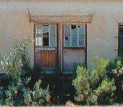 The deterioting condition of the Litchfield Train Station.
 -
 St Thomas Mission Church cornerstone.
 -
 St Thomas Mission Church built in 1919.
 -
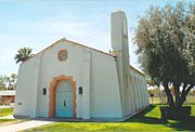 Different view of the St Thomas Mission Church.
 -
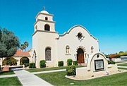 The Church at Litchfield Park built in 1938
 -
 Different view of The Church at Litchfield Park.
 -
 Wigwam Hotel built in 1918 and expanded in 1929.
 -
 Wigwam Hotel entrance.
 -
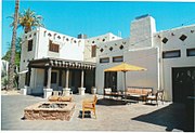 Different view of the Wigwam Hotel.
 -
 The original Organizational House built in 1918.
 -
 Lobby inside the Wigwam Hotel.
 -
 Aunt Mary's House is now the home of the Litchfield Historic Society and Museum.
 -
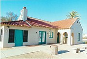 Aunt Mary's House.
 -
 Different view of Aunt Mary's House.


-Mayer_welcome_sign.jpg)
-Historic_Mayer_Business_Block_marker.jpg)
-
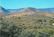 The Bradshaw Mountains
 -
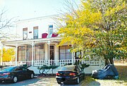 The The Mayer Hotel.
 -
 Close-up of the Mayer Hotel
 -
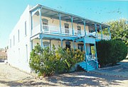 The Central Hotel.
 -
 Prescott and Eastern Railroad Depot.
 -
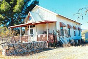 Pioneer House.
 -
 The General Market Store.
 -
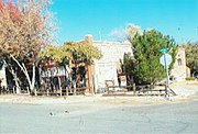 Historic Mayer Business Block.
 -
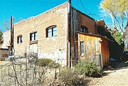 Different view of the General Market Store.
 -
 The Mayer Saloon and Dance Floor.
 -
 The Barber Shop and Bath House.
 -
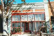 Mayer Mercantile.
 -
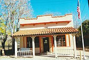 The original Mayer Post Office.
 -
 Mayer Apartment #1 once a brothel.
 -
 Mayer Apartment #2.
 -
 The Mayer Red Brick Schoolhouse.
 -
 Rear view of the Mayer Red Brick Schoolhouse.
 -
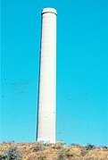 The Mayer Smokestack.
 -
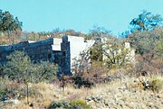 The Smelter ruins.
 -
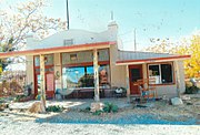 The Mayer Bank building.
 -
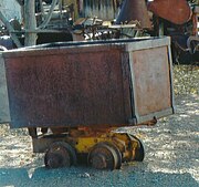 Mine-cart which was used in the Bradshaw Mountains in the 1890's.
 -
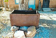 Abandoned mine-cart.
 -
 1940 Ford Howard Cooper Fire Truck which once serviced Mayer.


-Historic_Mayer_Business_Block-1902.jpg)


(NRHP = National Register of Historic Places)
(MHP = Mesa Historic Properties)

-
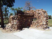 Mormon Pioneer ruins (1878)
 -
 Pomeroy Building (1891)
 -
 The historic Alhambra Hotel was originally built in 1893 and reconstructed in 1922. It was listed in the National Register of Historic Places on July 31, 1991.
 -
 Abell, Wilbur and Company Warehouse (1898)
 -
 Nile Theater (1924)
 -
 Mesa Women's Club, built in 1931 (NRHP) Historic Significance: Event, Area of Significance: Social History, Period of Significance: 1925-1949.
 -
 Historic Post Office/Federal Building, built in 1937, (MHP).
 -
 The Buckhorn Baths Motel was built in 1939 and is located at 5900 Main St. in Mesa. The Buckhorn Baths Motel is a complex consisting of fourteen buildings including a bathhouse, a main office building, and individual room units. The motel was listed in the National Register of Historic Places on May 10, 2005, reference number #05000421.
 -
 Some of the individual room units of The Buckhorn Baths Motel which was built in 1939 is and located at 5900 Main St. in Mesa. The Buckhorn Baths Motel was listed in the National Register of Historic Places on May 10, 2005, reference number #05000421.
 -
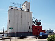 Grain Elevator (1938)
 -
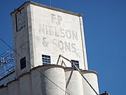 Grain Elevator Nielson & Sons sign
 -
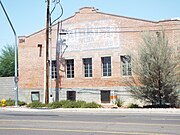 Citrus Growers Warehouse (1930)
 -
 Full view of the Citrus Growers Warehouse (1930)
 -
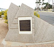 The Falcon Field World War II Aviation Hangers Plaque
 -
 Falcon Field World War II Aviation Hanger - 1941 - (East Hanger)
 -
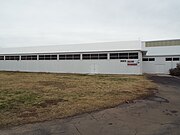 Falcon Field World War II Aviation Hanger - 1941 - (West Hanger).
 -
 The Information Technology Department Building was built in 1959 and is located at 59 E. 1st St. It was built as the Mesa Public Library, it is an early example of post-World War II modern formalism architecture. It is listed in the Mesa Historic Property Register.


-
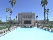 The Mesa Arizona Temple built in 1919.
 -
 The First United Methodist Church was built in 1894.
 -
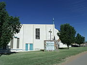 The Mount Calvary Baptist Church was built in 1918.
 -
 The historic Queen of Peace Church was built in 1947.


-
 Replica of the original Lehi School built in 1880 (MHP).
 -
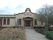 Lehi School, built in 1913 (NRHP) Historic Significance: Architecture/Engineering, Event, Architect, builder, or engineer: WPA, Architectural Style: Moderne, Mission/Spanish Revival, Area of Significance: Architecture, Community Planning And Development, Entertainment/Recreation, Education. Period of Significance: 1950-1974, 1925-1949, 1900-1924.
 -
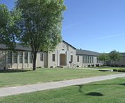 Irving School was built in 1936 and it is located at 155 N. Center St. The Irving School is a rare surviving example of Federal Modern style architecture applied to an elementary school. The school was listed in the National Register of Historic Places om November 8, 2000, reference number 00001323.
 -
 Different view of the Irving School .


-
 Sirrine House (1896)
 -
 Sirrine House (1896)
 -
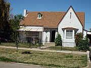 Dr. Kent House (1900)
 -
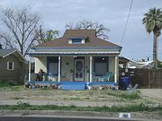 Angulo-Hostetter House (1902)
 -
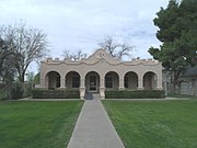 Strauch-Fuller House (1906)
 -
 Max Viault House (1908)
 -
 The Robert Scott House (1909)
 -
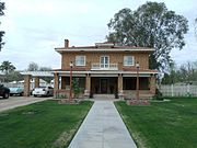 Spangler-Wilbur House (1915)
 -
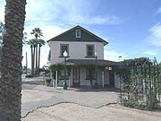 James A. Macdonald House (1916-1918)
 -
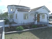 Dr. Lucius Charles Alston House (1920)
 -
 Different view of the Dr. Lucius Charles Aston House.
 -
 Mesa Journal--Tribune FHA Demonstration Home (1925) also known as Charles A. Mitten Home.
 -
 Tibshraeny House (1932)
 -
 The Fitch Farm House (1933)
 -
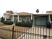 Drew House (1935)
 -
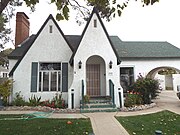 Ellsworth House (1938)
 -
 Killian House (1940)
 -
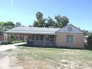 The Ramon Mendoza House (1944)
 -
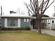 Farnsworth House (1951).
 -
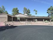 The Ponderosa II House (1960) a.k.a. the Lorne Greene house.
 -
 Different view of the Ponderosa II House


-
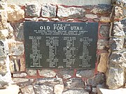 Old Fort Utah marker
 -
 1884 Lehi School Bell
 -
 1884 Lehi School Bell marker


-
 Southern Pacific 2355
 -
 Southern Pacific 2355
_2355_-1912-3.jpg)
_2355_-1912-2.jpg)

-
 B-29 Super Fortress Propeller
 -
 World War II Hanger
 -
 3 inch Mark 33 Deck Gun
 -
 World War II aviators jackets
 -
 Lt. A Park Shaw exhibit
 -
 Robert P. Moore exhibit
 -
 Douglas C-47 Skytrain Dakota “Old Number 30”
 -
 Douglas C-47 Skytrain Dakota “Old Number 30” door
 -
 C-47 Skytrain cockpit
 -
 Douglas A-26 Invader
 -
 Royal Aircraft Factory S.E. 5A
 -
 Douglas SBD Dauntless in Mechanics Hangar
 -
 Nieuport 17 in Mechanics Hangar.
 -
 McDonnell Douglas F-4 Phantom II
 -
 McDonnell Douglas F-4 Phantom II cockpit
 -
 Hungarian MiG-21 PF
 -
 Nieuport 28
 -
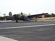 British Lockheed PV-2 Harpoon
 -
 North American B-25 Mitchell in the Mechanics Hangar.
 -
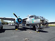 North American B-25 Mitchell-Maid in the Shade
 -
 North American P-51D Mustang
 -
 Grumman TBF Avenger Torpedo Bomber
 -
 Inside the Grumman TBF Avenger Torpedo Bomber
 -
 Bell OH BT-13/47 Helicopter “Mash Helo”
 -
 Sikorsky H-19 Chickasaw S-55.


.jpg)
.jpg)


.jpg)


(NRHP = National Register of Historic Places)
(MHP = Mesa Historic Properties)
-
 Housing Storage Supply Warehouse at Williams Air Force Base (now Arizona State University at the Polytechnic campus). The housing supply warehouse was constructed in December 1941 by Del E. Webb Construction Company. The housing supply warehouse is significant for its association with the initial development and construction at Williams Air Force Base. Listed in the National Register of Historic Places – 1995. Reference 95000746
 -
 Water Tower at Williams Air Force Base (now Arizona State University at the Polytechnic campus). The water tower was constructed in the winter of 1941-1942 by the Del E. Webb Construction Company. The water tower possesses the associative quality that connects it to the history of Williams Air Force Base. Listed in the National Register of Historic Places – 1995. Reference 95000745
 -
 The Flagpole was built in December 1941, the Base Flagpole is significant as an object for its important symbolic and traditional associations with the origins and history of Williams Air Force Base (now Phoenix-Mesa Gateway Airport). The pole was erected by Del E. Webb Construction Company. Listed in the National Register of Historic Places – 1995 Reference 95000744.
 -
 Marker of the historic flagpole.
 -
 Demountable Hangar located at the North Apron, Phoenix-Mesa Gateway Airport (formally Williams AFB), Mesa, Arizona. Built in 1925 and designed by Webb, Del E., Construction Company to resemble an enlisted aviator badge of the Army Air Force. Listed on the National Register of Historic Places in 1995, ref. #95000743.
 -
 Ammo Bunker (S-1007), SW of Vosler Dr. (formerly Alaska Dr.), at Arizona State University at the Polytechnic campus (Formally Williams AFB), Mesa, Arizona. Built in 1925 by Webb, Del E., Construction Company. Listed in the National Register of Historic Places ref: 95000748.
 -
 Sealed entrance of Ammo Bunker (S-1007).
 -
 Ammo Bunker (S-1008), SW of Vosler Dr. (formerly Alaska Dr.) , at Arizona State University at the Polytechnic campus (Formally Williams AFB), Mesa, Arizona. Built in 1925 by Webb, Del E., Construction Company. Listed in the National Register of Historic Places ref: 95000759.
 -
 Sealed entrance of Ammo Bunker (S-1008).
 -
 Civil Engineering Maintenance Shop also known as S-735, located in Unity Ave. (Jct. of 11th and A Sts.), at Arizona State University at the Polytechnic campus (Formally Williams AFB), Mesa, Arizona. Listed in the National Register of Historic Places in 1995, ref: #95000747.


-1.JPG)
_Sealed_entrance-5.JPG)
-2.JPG)
_Tony_the_Marine_-3.JPG)


(NRHP = National Register of Historic Places)
(MHP = Mesa Historic Properties)
-
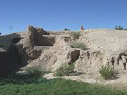 The Mesa Grande Temple Mound is located in the Mesa Grande Cultural Park at 1000 N. Date St. Built by the Hohokam in 1100 AD. The walls are made of “caliche”, the calcium carbonate hardpan that forms under the desert soils. The mound is longer and wider than a modern football field (note: U.S. Football) and is 27 feet high. The Mesa Grande Cultural Park was listed in the National Register of Historic Places in November 21, 1978, reference number 78000549.
 -
 Different view of the Mesa Grande Temple Mound, built c. 1100 AD and located in the Mesa Grande Cultural Park at 1000 N. Date St. The Mesa Grande Cultural Park was listed in the National Register of Historic Places in November 21, 1978, reference number 78000549.
 -
 A large plaza in front of the Mesa Grande Temple Mound which was enclosed by a large adobe wall. The plaza is located in the Mesa Grande Cultural Park at 1000 N. Date St. The Mesa Grande Cultural Park was listed in the National Register of Historic Places in November 21, 1978, reference number 78000549.
 -
 One of the two largest networks of irrigation canals created in the prehistoric Americans by the Hohokams. It is located in the Mesa Grande Cultural Park at 1000 N. Date St. The Mesa Grande Cultural Park was listed in the National Register of Historic Places in November 21, 1978, reference number 78000549.
 -
 Replica of the Mesa Grande Hohokam Ballcourt . The ballcourt, which is located at 1000 N. Date St., is an open-air structure where the Hohokam played ballgames using a rubber ball made from a local plant. The Mesa Grande Cultural Park was listed in the National Register of Historic Places in November 21, 1978, reference number 78000549.


(NRHP = National Register of Historic Places)
(MHP = Mesa Historic Properties)
-
 Park of the Canals National Register of Historic Places Marker.
 -
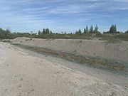 This is an ancient Hohokam canal cleaned out by the Mormon pioneers in 1875 in Park of the Canals.
 -
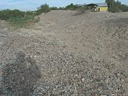 This is a prehistoric canal built by the Hohokams in the Park of the Canals.


-
 Pioneer Park Monument
 -
 1926 Town Center Clock
 -
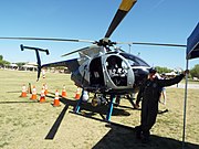 Mesa Police Helicopter #N507MO


established in 1891
-
 Grave site of Lucius C. Alston (1892-1958). Dr. Alston was the first African-American doctor to serve Mesa. His house is listed in the National Register of Historic Places.
 -
 Grave of Charles Crimson(1805-1890), one of the four founding fathers of Mesa.
 -
 Grave site of Oscar Virgil Crimson (1909-1985) and Helen H. Crimson (1917-2006). O. V. Crimson served as Mayor of Mesa from 1950-1952.
 -
 Grave site of George Nicholas Goodman (1885-1959) and Clara Platt Goodman (1898-1994). G. N. Goodman served as Mayor of Mesa from 1952-1956.
 -
 Grave site of Pedro Warner Guerrero (1896-1995) was the founder of the the Guerrero-Lindsey Sign Company. In 1946, with R.G. Scarborough and Ann Encke, he founded the Rosarita Mexican Foods Company. It has become a national brand. Mesa's Pedro Guerrero Rotary Park is named for him.
 -
 Grave site of Collins Rowes Hakes (1837-1916) and Mabel Ana Morse Hakes (1840-1909). The Hakes were the first to discover gold in the Goldfield area by the Superstition Mountains.
 -
 Grave site of Waylon Jennings (1937-2002). Jennings was an American singer, songwriter, musician, and actor. Jennings gave up his seat on the ill-fated flight that crashed and killed Holly, J. P. Richardson, Ritchie Valens, and pilot Roger Peterson. In 2001, he was inducted into the Country Music Hall of Fame.
 -
 Grave of Daniel Webster Jones (1830-1915) – Jones was commissioned by Brigham Young to start a Mormon settlement in the Salt River Valley of Arizona. The settlement was originally called Jonesville and later renamed Lehi. Lehi was eventually incorporated into Mesa.
 -
 John L. Lee a.k.a. "Powder River Jack" (1874-1846) - Lee was a cowboy who was known for setting cowboy poems to music. He was an entertainer in Buffalo Bill Cody’s Wild West Show. Across the Great Divide, The Cody Stampede and the Song of the San Marcos are among the many songs which he wrote. His wife Kitty Lee (1868-1955) is buried alongside of him.
 -
 Grave site of William Johnson LeBaron (1856-1929) and Zina S. LeBaron. W. J. LeBaron served as Mayor of Mesa from 1888 to 1896.
 -
 Grave site of Ramon G. Mendoza (1914-1999) and Mary Robles Mendoza. R. G. Mendoza was the first Hispanic police chief in Mesa.
 -
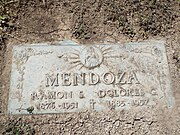 Grave of Ramon Somoza Mendoza (1876-1951), and his wife Dolores Mendoza (1885-1957). Ramon S. Mendoza was the first Hispanic police officer in Meza. The Mendoza Elementary School is named in his memory.
 -
 Grave of Ernesto Arturo Miranda (1941-1976). Miranda was a laborer whose conviction on kidnapping, rape, and armed robbery charges based on his confession under police interrogation was set aside in the landmark U.S. Supreme Court case (Miranda v. Arizona), which ruled that criminal suspects must be informed of their right against self-incrimination and their right to consult with an attorney before being questioned by police. This warning is known as the Miranda Rights.
 -
 Grave site of Ralph Fleetwood Palmer (1875-1954). Dr. Palmer served as Mayor of Mesa from 1910-1912.
 -
 Grave of Zora B. Folley, Jr. (1931 – 1972) - Folley was the last man to face Ali before Ali's three-year exile from boxing in 1967.
 -
 Grave of Francis Martin Pomeroy(1822-1882), one of the four founding fathers of Mesa.
 -
 Grave site of Charles Innes Robson (1837-1894), one of the four founding fathers of Mesa.
 -
 Grave of George Warren Sirrine (1818-1902), one of the four founding fathers of Mesa. The Sirrine house is listed in the National Register of Historic Places.
 -
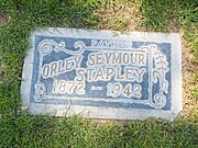 Grave of Orley Seymour Stapley(1872-1942), Stapley served in the Arizona State Senate in the early 1920s. He established a chain of hardware stores throughout the state.
 -
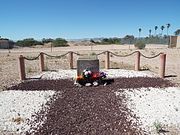 Memorial dedicated to the unknown people buried there during the Great Depression era.
 -
 The unknown buried of the Great Depression era memorial marker.


-
 Manuel Verdugo Mendoza a.k.a. "Arizona Kid" (1922-2001) - Mendoza was posthumously awarded the Medal of Honor for his actions on Mt. Battaglia, Italy on October 4, 1944. President Barack Obama presented the medal to Mendoza’s widow at the White House on March 18, 2014.
 -
 Manuel Verdugo Mendoza Medal of Honor Plaque.


-
 Nina and John posing in front of the skeleton of a Columbian Mammoth in the museum’s lobby.
 -
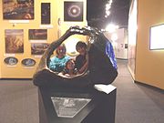 Nina, Jaydon and Ana Lisa, posing behind the Tucson Meteorite on exhibit in the “Origins Hall”
 -
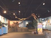 The skeleton of a Pterosaurs on display in the Arizona Museum of Natural History in Mesa Arizona.
 -
 An adult and baby Probactrasarus
 -
 Dinosaur Hall display.
 -
Dinosaur Mountain exhibit.
-
 Arizona's First Mission exhibit.
 -
 17 Century Spanish Blunderbuss
 -
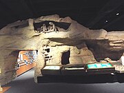 Arizona Native-American exhibit
 -
 Jaydon, Ana Luisa and Nina in the gold panning interactive exhibit.
 -
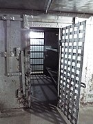 1884 Mesa Territorial Jail Cell.


-
 Historic Sullivan Street
 -
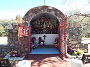 Virgin Mary Shrine
 -
 Historic Keystone Stairs
 -
 Sykes Alley
 -
 Miami Ave. Bridge
 -
 Inspiration Ave. Bridge
 -
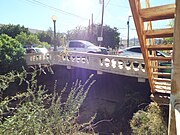 Keystone Ave. Bridge
 -
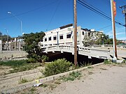 Cordova Ave. Bridge
 -
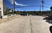 Over Cordova Ave. Bridge
 -
 Reppy Ave. Bridge
 -
 Unique Theater
 -
 Gila Valley Bank and Trust Co.
 -
 Bullion Plaza School
 -
 Wilton’s Paint and Wallpaper
 -
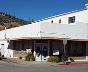 Gem Theatre
 -
 Soderman Building
 -
 Our Lady of the Blessed Sacrament
 -
 YMCA Building
 -
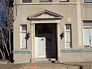 YMCA entrance.
 -
 Commercial Building
 -
 Miami Community Church
 -
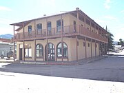 Fritzpatrick Building The first building in Miami.
 -
 Kelly’s Photography Building
 -
 Kelly's Photography 1912 sign
 -
 Price Brothers Building
 -
 Price Brothers 1913
 -
 Travelers Hotel
 -
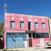 Firehouse Building
 -
 Abandoned First Baptist Church
 -
 Bank of Miami
 -
 Dry Cleaning Business Building
 -
 Mobil Gas Station
 -
 Mobil Gas Station
 -
 1915 building The first two-story building in Miami.
 -
 Miami Townsite building
 -
 Miami Townsite building
 -
 Central Drug Co.
 -
 Bloody Tanks Wash


(NRHP = National Register of Historic Places)
-
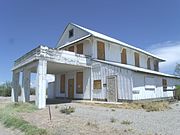 The historic Morristown Hotel/Store was built in 1899 and is located at U.S. Route 89 NW Castle Springs Road, Morristown, Arizona. The hotel was built by Frank Murphy, brother of the territorial governor Nathan Oakes Murphy. The building was listed in the National Register of Historic Places on August 12, 1991, reference # 91001003.
 -
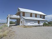 Different view of the Morristown Hotel /Store.
 -
 Back view of the Morristown Hotel /Store.
 -
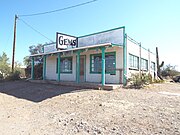 Commercial building built in 1920 located on US 60 in Morristown.


-
 The front gate the historic Wranglers Roost Stagecoach Stop located in 2500 West New River Road in New River, Arizona. This was where the New River stagecoach stop was located in the late 1800’s. The current owners, Reid and Heidi Stewart, use the location, which was rebuilt in 1930, for weddings and as a resort.
 -
 The entrance of the Wranglers Roost Stagecoach Stop .
 -
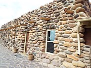 The main building of the Wranglers Roost Stagecoach Stop
 -
 A different view of the main building of the Wranglers Roost Stagecoach Stop.
 -
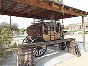 Stagecoach located in the grounds of the Wranglers Roost Stagecoach Stop.
 -
 Wagon located in the grounds of the Wranglers Roost Stagecoach Stop.
 -
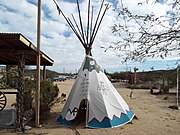 Replica a of a Native American Tee Pee located in the grounds of the Wranglers Roost Stagecoach Stop.
 -
 Replica of the ruins of an late 1800s structure located in the in the grounds of the Wranglers Roost Stagecoach Stop.
 -
 The Jack Ass Acres Service Station is an old abandoned 1930s gas station and convenience store located on the frontage road just off I-17 in New River, Arizona. The structure has been abandoned for years.
 -
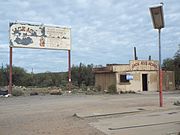 Full view of the Jack Ass Acres Service Station.
 -
 The Jack Ass Acres Service Station sign.
 -
 Inside the Jack Ass Acres Service Station.
 -
 Another view of the inside of the Jack Ass Acres Service Station.
 -
 The Station was a historic saloon in New River which was built in 1940 and which is located at 46202 New River Road in New River, Arizona. The location was once used as a restaurant.
 -
 Logo of The Station.
 -
 A late 1800s Store located in 3240 W. New River Road in New River, Arizona.
 -
 Gavilan Peak location of 1870 battle between US Calvary and Apaches.


-
 Old Nogales City Hall and Fire Station
 -
 George B. Marsh Building
 -
 A.S. Noon Building
 -
 Bowman Hotel
 -
 Nogales Electric Light, Ice & Water Company Power House
 -
 S.H. Kress & Co. Building
 -
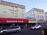 Montezuma Hotel
 -
 F. L. Woolworth & Co. Building
 -
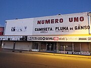 Jose Piscorski Building
 -
 Hotel Blanca
 -
 Hotel Blanca (1917)
 -
 U.S. Custom House
 -
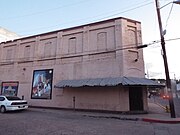 Nogales Steam Laundry Building
 -
 U.S. Post Office and Immigration Station
 -
 Theodore Gebler Memorial Building
 -
 Theodore Gebler Memorial Building (1930)
 -
 Elks Lodge Building (BPO6)
 -
 Santa Cruz Bridge No. 1
 -
 Different view of the Santa Cruz Bridge No. 1
 -
 Building on 465 Walnut Street (1900)


-1930.jpg)


-
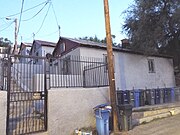 10 Cottages on Short Street
 -
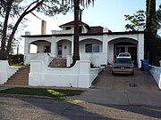 George Dunbar House
 -
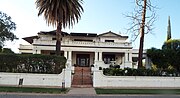 W.G. Bowman House
 -
 Frank F. Cranz House
 -
 Mediterranean Style House on 215 Walnut Street
 -
 Mediterranean Style House on 245 Walnut Street
 -
 House at 365 Walnut Street
 -
 House at 459-465 Walnut Street
 -
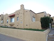 Three Mediterranean Cottages on Pajarito Street
 -
 Hugo Miller House
 -
 House at 565 Morley Avenue
 -
 Senator James A. Harrison House


-
 Old Nogales High School
 -
 Santa Cruz Schoolhouse
 -
 Santa Cruz Schoolhouse


-
 Sacred Heart Church
 -
 Inside Sacred Heart Church
 -
 Virgin Mary monument
 -
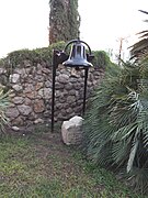 Sacred Heart Church 1910 Bell


_______________________________________________________________________________
- View "Part II of My Pictures of Historic Properties", which include Oatman, Oracle, Paradise Valley, Parker, Patagonia, Payson, Peach Springs, Pearce, Peoria, Picacho, Pima, Pinal County, Pine-Strawberry, Prescott, Prescott Valley, Quartzsite, Queen Creek, Roll, Sacaton, Safford, Sahuarita, Salome, San Carlos, San Jose, San Luis. Santan, Scottsdale, Sedona, Seligman, Sentinel (Ghost town), Shumway, Snowflake, Solomon, Somerton, Sonoita, Sun City, Superior, Surprise, Taylor, Thatcher, Tempe, Tombstone, Tonalea, Tonopah, Topock, Tortilla Flat, Tuba City, Tubac, Tucson, Tumacacori, Twin Arrows (Ghost town), Two Guns (Ghost town), Valentine, Valle, Vulture City (Ghost town), Vulture Mine, Wellton, Whiteriver, Wickenburg, Wikieup, Willcox, Williams, Winkelman, Winslow, Wintersburg, Wittmann, Yavapai-Prescott Tribe Reservation, Yuma, Puerto Rico and other places, plus some images which are important, but not historical.
Back to "Articles and photo galleries of historical interest"