Upsalquitch is an unincorporated community in Restigouche County, New Brunswick, Canada.[1] The town is located in the northern part of the province, near the Quebec border, south of Route 17.
Upsalquitch | |
|---|---|
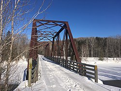
 International Appalachian Trail on old rail road bridge in Upsalquitch | |
| Coordinates: 47°50′00″N 66°53′00″W / 47.833333°N 66.883333°W | |
| Country | |
| Province | |
| County | Restigouche |
| Parish | Eldon |
| Electoral Districts Federal | Madawaska—Restigouche |
| Provincial | Campbellton-Restigouche Centre |
| Government | |
| • Type | Local service district |
| Time zone | UTC-4 (AST) |
| • Summer (DST) | UTC-3 (ADT) |
| Postal code(s) |
|
| Area code | 506 |
| Access Routes | Upsalquitch River Road via |
Upsalquitch comes from the Mi'kmaq word Apsětkwĕchk which means "small river."[2]
History
editNotable people
editSee also
editRobinsonville, Squaw Cap, Dawsonville, Glencoe, Glenlevit, Flatlands.
References
edit- ^ New Brunswick Provincial Archives - Upsalquitch
- ^ Rand, Silas Tertius (1875-01-01). A First Reading Book in the Micmac Language: Comprising the Micmac Numerals, and the Names of the Different Kinds of Beasts, Birds, Fishes, Trees, &c. of the Maritime Provinces of Canada. Also, Some of the Indian Names of Places, and Many Familiar Words and Phrases, Translated Literally Into English. Nova Scotia Printing Company. p. 102.
