Latest comment: 4 years ago by Գարիկ Ավագյան in topic Map
This is an archive of past discussions. Do not edit the contents of this page. If you wish to start a new discussion or revive an old one, please do so on the current talk page.
He recently created two maps File:Azerbaijan map comparison.jpg and File:Azeri lost lands.jpg and inserted them into two articles. I removed both when I noticed it and today he re-added one of them rv vandalism by Eupator. I also noticed another imaginary map that he craetd and inserted: File:Azerbaijan Democratic Republic 1918-1920 Map.jpg The maps that he created are displaying territories claimed by the ADR and DRA as part of ADR (Karabakh), territories which were in total and recognized control of DRA (like Nakhichevan and Zangezur) as part of ADR etc. This is highly disruptive and provocative. --ΕυπάτωρTalk!!19:46, 31 January 2009 (UTC)
On what ground do you accuse these maps of being imaginary? Its based on sources and historical maps. Your personal ambitions are invaled reasons to remove these maps. Baku87 (talk) 17:18, 9 February 2009 (UTC)
It cannot be based on credible sources and accurate historical maps. It is a work of propaganda. Comparison with the map cited by Eupator clearly shows how your map has distorted reality to a serious extent. For many of the distortions, there is not the slightest doubt of their existence. For example, and to take a detail that has nothing to do with Armenia or Azerbaijan, your 1918 map has the present-day borders of Turkey and Georgia; those borders were different in 1918. Meowy01:53, 11 February 2009 (UTC)
But how do you know that Eupator's map is accurate? The thing is that in 1920 neither Armenia, nor Azerbaijan had internationally recognized borders. The issue was to be discussed at the Paris Peace Conference, but it never happened, as by that time Soviet Russia started moving into the region. So both maps represent wishful thinking by the leaders of the 2 states. For instance, Armenia had no control over Nakhichevan, yet Eupator's map shows it as a part of Armenia. Grandmaster05:49, 11 February 2009 (UTC)
I mentioned the errors in the borders of Turkey and Georgia to avoid getting bogged down in discussion over Armenia and Azerbaijan. You surely are not disputing the existence of those errors? And at least Eupator's map marks territory as being disputed, unlike Baku's map. Meowy17:08, 11 February 2009 (UTC)
You speak of credible sources but if Azeri sources are to be regarded inreliable then why is it that Armenian sources are welcomed? Your trying to apply double-standards here. I'll give you some examples in the Armenia article there are a few maps: The first map comes directly from an Armenian websource; armenica.org; you can even note the Armenica.org label in the lower-right corner. And the second map which as you note from the lower-right corner is also from the Armenian source; Armenica.org. I can name you a few more maps from Armenian sources such as: A and B both again from Armenica.org and by this I also want to note just how legit are the copyrights in the last 4 maps really? So why is it that you can demand the removal of my map which is based on a Azeri source but still insist on keeping the Armenian-sources maps? This is highly unfair and even shows double-standards. Baku87 (talk) 13:56, 11 February 2009 (UTC)
The comparison is improper. Those maps of Armenica.org are reprinted from "Armenia: A Historical Atlas" of the American scholar Robert Hewsen. However it is not the problem where the maps come from. The boundaries of Armenia in the 4th c., the Erivan Khanate, the Armenian Oblast are not contested. The Democratic Republic of Azerbaijan was not de-jure recognised and had no de-jure or de-facto existing boundaries as the two other short-lived republics of the TRanscaucasia. --Vacio (talk) 06:34, 14 February 2009 (UTC)
Armenia had no de-jure recognition, and Azerbaijan did have de-facto borders, which included Nakhichevan. So the maps of Armenica are incorrect. And the map of Azerbaijan also has a source: [1] So there's no reason for deletion of Azerbaijani map, it as good as that of Armenia. Btw, I think we should continue this discussion elsewhere and not waste space at Moreschi's talk. Grandmaster09:57, 14 February 2009 (UTC)
Neither Armenia (DRA) nor Azerbaijan (ADR) had de-jure borders in 1918-1920. The self-invented maps of Baku87 are not acceptable because they show territories which were disputed between Azerbajian and Armenia, and between Georgia and Azerbaijan, as part of the latter. The source Grandmaster refers to says absolutely nothing about the de-facto borders of ADR that those maps could be based on it. --Vacio (talk) 11:38, 14 February 2009 (UTC)
Eupator's map doesnt show the disputed areas of Naxcivan and Zangezur, if this comes from Armenica.org its certainly questionable how objective this source really is. You have nominated both the maps of ADR for deletion while you perfectly know we are discussing their usage here and yet the Armenian version is not nominated for deletion, does this mean that map is perfectly acceptable for you? Baku87 (talk) 19:31, 15 February 2009 (UTC)
Off topic! That map shows the WW1 period - territory ceded to Turkey (NOT Azerbaijan!). Those treaties became void after Turkey's surrender. Meowy22:14, 17 February 2009 (UTC)
As far as I know the maps of Armenica.org are copies from R. Hewsen's "Atlas". If indeed the map of DRA in quiestion corresponds to that of Hewsen, it is reliable. Anyhow the upload and use of it not be an argument to use the maps created by Baku87. The latter are nominated for deletion in accordance with WP rules. Also, I can't find in the source, Baku87 and Grandmaster refer to, a clear statement as if Gegharkunik, Syunik, Vayots Dzor, Tavush, Nagorno-Karabakh, Nakhichevan, Belakan-Zakatala were de-facto under Azerbaijani rule in 1918-1920. --Vacio (talk) 06:07, 17 February 2009 (UTC)
If you look carefully at this map: [2], you'll see that it includes both Zangezur and Nakhichevan. And Hewsen is not a specialist on modern history, he specializes on ancient one. In any case, the map supported by a reliable source cannot be removed, so the map by Baku87 must remain. Grandmaster06:30, 17 February 2009 (UTC)
Please, take a look at the Map of Armenia as defined by President Woodrow Wilson, or so called Wilsonian map of Armenia, cited by the Armenian source - [3]. Atabəy (talk) 07:50, 17 February 2009 (UTC)
By nominating every ADR map for deletion while its still being discussed here and yet not doing anything about the Armenica.org map versionl; Its pretty clear that Vacio is POV and leading an anti-Azerbaijan campaign here. There are clear sources for this map and thus is simply cannot be removed. Baku87 (talk) 13:45, 17 February 2009 (UTC)
The "Armenica.org map" appears to be based entirely on map 229 "The First Armenian Republic 1918-1920" on page 236 of Hewsen's Atlas of Historical Armenia. Map 229 also indicates the existence of the "Arasdayan Republic" on the territory of Nakhichevan with the words "26th Jan 1919 - 19 May 1919, then passed to Armenia". Map 226 in the same volume shows the internal provinces of the Armenian Republic - all of Nakhichevan and Zanzegour are within its bounderies and they are not in the parts of the map that are indicated as claimed by Armenia but not held by it. Maps 230, 231 and 232 show the Armenian, Georgian and Azeri territorial claims respectively. Based on the Hewsen maps, the map produced by Baku matches neither the actual territory controlled by Azerbaijan in 1918-1920, or the territory claimed by Azerbiajan and not held by it. It is, as I wrote earlier, a work of propaganda. Azeri territorial claims against Georgia are not shown on Baku's map, presumably because Azerbaijan currently enjoys reasonable diplomatic relations with Georgia. Also not shown are Azeri claims on what is now Turkish territory, for the same reason. Nor are the extreme nature of those claims (they extend all the way to the Black Sea and include most of Armenia) indicated - I guess because they would appear to readers of the article to be laughably extreme. Meowy21:24, 17 February 2009 (UTC)
Hewsen's map is inaccurate. He is an expert on ancient history, but not on modern one. He probably mentioned there, which sources he used, and they are most probably the Armenian ones. Zangezur together with Karabakh was placed under Azerbaijani jurisdiction by the British command. Thus, Armenia could not control it either de-jure or de-facto. See:
Upon the Ottoman withdrawal, General Andranik made an attempt to extend Armenian rule over this disputed territory, but on December 1 Thomson asked him to cease his military operations. Furthermore, as of mid-January 1919, the British general put Nagorno-Karabagh together with the neighboring Zangezur uezd under provisional Azerbaijani administration. Armenian reactions became even more heated when Thomson confirmed the nomination of Khosrow Sultanov as governor of the two areas. Thomson's comment was that the British occupation was not an opportunity for revenge.
For all the protests that greeted him, Sultanov succeeded over the next several months in getting the Armenian Assembly in Nagorno Karabagh to formally accept Azerbaijani rule, an act that recognized the realities of geography, economy, and transportation that linked this ethnic enclave with Azerbaijan rather than with Armenia beyond the mountains. This major breakthrough remained subject to some conditions restricting the size and deplacement of Azerbaijani garrisons in peacetime.
Tadeusz Swietochowski, Russia and Azerbaijan: A Borderland in Transition. ISBN: 0231070683
Furthermore, if you read here: [4] you'll see that within one month the regular army of Azerbaijan republic kicked the Armenian army out of Nakhchivan. Thus, Armenia had no control over the region. The map from atlas (which I haven't seen so far, btw) conflicts other maps and sources, and therefore is not reliable. Grandmaster07:38, 18 February 2009 (UTC)
Conflicts between sources and maps is a matter-of-course given that there were no stable de-facto borders at the time. The map of Hewsen however corresponds largely to this map of Tadeusz Swietochowskimap whom you quoted above. As for Karabakh, it was never de-jure or de-facto part of the ADR, the provisional agrement between the Karabakh Assembly stated that it's definitive status would be determined in the Paris Peace Conference. Furthermore:
In August 1919, the Karabagh National Council entered into a provisional treaty agreement with the Azerbaijani government. Despite signing the Agreement, the Azerbaijani government continuously violated the terms of the treaty. This culminated in March 1920 with the Azerbaijanis' massacre of Armenians in Karabagh's former capital, Shushi, in which it is estimated that more than 20,000 Armenians were killed. In this light, the Ninth Karabagh Assembly nullified the treaty in whole and pronounced union with Armenia.
From 1918 to 1920 Nagorno Karabagh possessed all necessary attributes of statehood, including an army and legitimate authorities. The League of Nations and the leading world powers recognized the disputed status of Nagorno Karabagh. The League of Nations neither recognized the sovereignty of the Azerbaijan Republic over Karabagh nor accepted the Azerbaijan Republic as its member-state.
Btw. now I see what Baku87 actually tried to do: removing a map from the article which shows the aforecited regiones as disputed areas between ADR and DRA with a self-made one which shows them as implicitly part of ADR [5]. Subsequently placing an other self-made map in the Azerbaijan article which shows the same areas as "Azeri lost lands". --Vacio (talk) 10:13, 18 February 2009 (UTC)
Furthermore, general Thomson was not authorized to decide the status of Zangezur or Nagorno-Karabakh. And the motivations underlying the attempts of the British Mission to solve territoral disputes:
Arslanian quotes
General George Milne, responsible for British military operations in South Caucasia,
They [the local nationalities] are certainly not worth the life of one British soldier. The Georgians are merely disguised Bolsheviks … The Armenians are what the Armenians have always been, a despicable race. The best are the inhabitants of Azerbaijan, though they are in reality uncivilized.
It therefore does not seem far-fetched that the awarding of Nagorno-Karabakh to Azerbaijan,
while intended only as a temporary phenomenon, was caused by British condescension for
Armenians.
Svante E. Cornell. The Nagorno-Karabakh Conflict. Report no. 46, Department of East European Studies, Uppsala University, 1999
Get your facts straight this map is not merely self made but based upon source which you keep ignoring. ADR was de-facto regonized by several allies states, we can mention this in the map? Baku87 (talk) 13:13, 21 February 2009 (UTC)
I feel uncomfortable with your sinsulting language towards me Eupator. This map is provided by sources which are provided in the map summary. But I will note them again [9][10] So this map is allowed for usage. Baku87 (talk) 11:13, 23 February 2009 (UTC)
This has already been answered by Eupator. And even if it was true (which it is not), you would probably have a copyright problem, wouldn't you ? Sardur (talk) 13:13, 23 February 2009 (UTC)
You cant just spam and try to pro-long its usage, there are no copyright issues. It is you who has to reach a consensus to remove it, not the other way around. Baku87 (talk) 14:30, 23 February 2009 (UTC)
Funny reasonning. Either the map is unsupported by these two sources (and you still have to answer on what has been said on this), or what you have done is a close derivative work and therefore raises copyright issues. Sardur (talk) 14:33, 23 February 2009 (UTC)
As I said on the talk page of this map, this source cannot support the map : you directly see that Armenia SW and NE boundaries are not the same. Some people are clearly inserting an inaccurate file here. Sardur (talk) 15:13, 23 February 2009 (UTC)
Users like GM and Baku/Baki are living in the realm of fantasy land. That's why there are crap articles on the Azerbaijani Wikipedia that identify the city of Artashat as a part of "Western Azerbaijan" and similarly don't even mention a single word about the Armenian presence (i.e., kingdoms) in Nakhichevan unless it pertains to the mass "migration" of the 19th century. This fabricated map requires a speedy delete lest the English Wikipedia begins to repeat the same nonsense on the Azeri Wiki.--Marshal Bagramyan (talk) 16:04, 23 February 2009 (UTC)
How so? Robert Hewsen created the map. His work has been cited dozens of times on Wikipedia articles, with the backing of Armenian and Azeri users. Does anyone care to explain how Hewsen, a historian, or more accurately a cartographer, loses his credibility here? --Marshal Bagramyan (talk) 01:02, 24 February 2009 (UTC)
Hewsen is an expert on ancient history of the region, but not the modern one. He never published any work about the history of the region in the 20th century, as far as I know. And WP:Civil is a good rule to observe. Grandmaster06:40, 24 February 2009 (UTC)
That has to be the lamest excuse I have heard. I'll make sure to mention that the whimsical little diddy to the mediators next time they come into arbitrate conflicts. And don't you dare patronize me again.--Marshal Bagramyan (talk) 07:34, 24 February 2009 (UTC)
I have to say, I find the non-CIA-type map, with the different colors and explanations of things, far more useful than the one that is being editwarred. Having said that, I am now unable to protect the article to end this war. I will find someone to do it for me. --Golbez (talk) 22:27, 24 February 2009 (UTC)
The map that is presently included in the article is nothing but a self-made map, taken from some personal website. It is not supported by any reliable source. The map of Baku87 at least relied on published third party sources. Grandmaster06:25, 25 February 2009 (UTC)
I do not want to go into a discussion of the origins of the map currently included in the article, but I can confirm that this map matches in main essentials the map of the Azerbaijan Republic in 1918-1920 published in Artur Tsutsiev, Atlas of Ethnopolitical History of the Caucasus (1774-2004), "Evropa" Publishing House, Moscow, 2006, map 18, p. 54. For copyright reasons I cannot upload Tsusiev's map to Commons, but I will be pleased to e-mail a file with a scanned copy to any interested Wikipedian for perusal. The map is in Russian with a detailed legend, and perhaps a skilled cartographer will be able to use it as a basis for drawing a new properly sourced map. --Zlerman (talk) 06:42, 25 February 2009 (UTC)
We are digressing, but this is what Tsutsiev writes about the Mughan Soviet Republic (p. 55): "In spring 1919 the Talysh-Mughan Soviet Republic is created here, whose 'national base' is the Russian and Talysh population." I do not not think that your statement above is consistent with this quote from Tsutsiev. --Zlerman (talk) 07:18, 25 February 2009 (UTC)
Compare with memoirs of Dunsterville, and you'll see that he is wrong. It was not even called "Talysh-Mughan Soviet Republic" back in 1919, so Tsutsiev has no idea what he is talking about. But the thing is that the map by Baku87 is suppoted by 3 third party sources: [12][13][14] Plus, the map that is presently included in the article, also contradicts the map of Armenian Republic: [15] which claims Nakhichevan as part of Armenia, while in fact Armenia never had any control over the region. So we have a number of confliting maps, and I see no reason why the map of ADR created by Baku87 should be removed despite being supported by a number of reliable sources, while the other ones kept. Grandmaster07:49, 25 February 2009 (UTC)
It is those weak sources that you post that do not match Baku87's map. There is no inconsistency between Hewsen's and Andersen's map, Andersen's map is just more detailed. The legend on the latter clearly states "Lost to Armenia by 30.04.1920".--ΕυπάτωρTalk!!11:48, 25 February 2009 (UTC)
That's inaccurate information. Armenia never had any control over the region. Even Hovanissian admits that. Grandmaster05:46, 5 March 2009 (UTC)
The one that shows disputed areas. Nakhichevan, Qazakh, and even Karabakh were under stable control of Azerbaijan. Grandmaster05:43, 5 March 2009 (UTC)
Well that's a good one to start with. =p However, according to all three articles, it seems no one really had stable control over the full regions before the Soviets rolled in. How do you reconcile that with the three articles? --Golbez (talk) 06:06, 5 March 2009 (UTC)
That's a totally inaccurate information from Grandmaster, Nakhichevan and Karabakh were never under stable Azerbaijani controll. --Vacio (talk) 06:09, 5 March 2009 (UTC)
There is something partly wrong with the "Lost to Armenia by 30.04.1920" part of the caption on the Andersen map. Some of the indicated territory was actually lost by Armenia by 30.04.1920. But on the whole the Andersen map does successfully illustrate the complexity and the nuances of the reality on the ground (which the Baku87 map deliberately doesn't do). Meowy17:01, 5 March 2009 (UTC)
Golbez, are you trying to mediate again? :) Anyways, the map in question is against this map [16], claimed by Armeniapedia to be made by State Department. And yes, there is nothing to try from "different angle here". Andersen is not a scholar, he is a blogger. He tried to teach but was fired from his job at University of Victoria for anti-Muslim racism. Every single one of his maps is biased pro-Armenian and non-neutral. His other maps are also disputed by at least one party in Caucasus, and hence NOT neutral by definition. Atabəy (talk) 18:38, 5 March 2009 (UTC)
I think I gave up my ability to mediate this one when I said I didn't like Baku's map. =p And if we're going to say "the author is not a scholar and not neutral", then I think we can throw out Baku's map as well, yes? --Golbez (talk) 18:44, 5 March 2009 (UTC)
Golbez, it's impossible to mediate on a subject where one can't be neutral. And seem's like Baku's map was actually even a bit more favorable to Armenian POV than Wilsonian one on Armeniapedia? :) Andersen map is out of question, we have this problem all over Wikipedia, he is unscholarly, unreliable and non-neutral. Atabəy (talk) 19:24, 5 March 2009 (UTC)
So is Baku. Delete both! Let's make our own! I'm good at mapmaking, I daresay even neutral mapmaking. Feed me sources and we'll see what I can do. :) Gosh, wouldn't that be amazing? The first map of the pre-Soviet Caucasus formed by consensus from all sides? (... hey, I'm in a good mood, winter's over here finally, I can be optimistic!) Not that I'm a scholar but I come with absolutely no nationalist or even scholarly baggage; I know nothing about pre-Soviet Azerbaijan and Armenia. I am a blank slate. Write on me. --Golbez (talk) 21:48, 5 March 2009 (UTC)
You're in a good mood and Atabəy is telling jokes (his map of Wilsonian Armenia doesn't have an Eastern border). Life is beautiful ^^ Sardur (talk) 22:09, 5 March 2009 (UTC)
Nakhchivan, Zangezur and Karabakh were not under Armenian control during ADR. Khosrov Sultanov was appointed the Governor in Shusha when Ottomans left in December 1918, here is referenced information [18]. In fact, NK Armenians even signed an agreement recognizing Azerbaijani jurisdiction as well, in the same reference quoting Swietochowski. The fact of control, is also affirmed by Armenian reference [19]. So were Britons in support of Azerbaijani jurisdiction over Karabakh, as Tom De Waal suggests, and the Wilsonian map from State Department clearly shows that half of present-day Armenia has Azerbaijan label over it, and Wilson laid Armenian claims primarily on Eastern Anatolia. Atabəy (talk) 00:50, 6 March 2009 (UTC)
I didn't say I was a scholar; however, I have scholarly faith in the collective effort of us all using reputable sources. If I were saying I was a scholar, I would have just made it. :P As for the comments above, I don't withdraw them, but I realize they were also out of line. I don't know why, but back then, in my experience people representing the Azeri point of view seemed to take the issue extremely personally, more personally than those representing the Armenian point of view. Maybe AA2 has fixed that a bit by pruning the more radical elements from both sides. Avruch (not "admins") suggested I withdrew, and if I recall, I generally did, though not because of him; thanks to AA2, I haven't really had or wanted to insert myself into the fight neary as much. Just a few blocks here and there. According to the history of Talk:Nagorno-Karabakh, I didn't engage in any form of mediation from December 2007 (when Avruch made his comment) until an outburst in June 2008. And not much after that. (Though I did do some in Talk:Shusha) And I don't really consider this mediation, I'm trying to be an avenue for all sides to help make a map. Give me sources, give me feedback, and I'll do what I can. I'm not really trying to mediate a conflict; by your own logic, both maps must go. I think Baku's map should go, and if Andersen's map is inaccurate, it should go too. I'm just trying to make a map. Like my map of the provinces of Nagorno-Karabakh; so far as I know, both sides like it, as it represents the claims from both sides. (though it is outdated, considering the NKR is apparently administering the occupied rayons, and it lacks a line of control) As for your second paragraph, And my admitted slight sympathy for Karabakh is irrelevant, since that has entirely to do with their present situation; I don't care who owned or controlled or claimed them before the Soviet Union came across, as that should be simple fact to look up. ... but as we all know, if that were the case, then there'd be little to fight over. So I have to look over the sources, and see who seems reputable to a neutral observer. So maybe it is mediation. But in this case, it's not over an article. It's over a new creation. Nothing to get riled over. No harm in trying. I come to it clean, ready to accept evidence and arguments from either side.
The thing is that Baku87's map is supported by at least 3 third party sources, so it is not his invention. The reason why some people representing the Armenian POV want it deleted is because it contradcits the territorial claims of Armenia. If Baku87's map should go, then so should this one: [20] I know that its supporters will say that it comes from a reliable source, but so does Baku87's map. The truth is that neither Armenia, nor Georgia or Azerbaijan had internationally recognized borders at the time, as they all had only de-facto recognition. Therefore any map depicting borders is represeneting the POV of one of the sides. The general idea of Andersen is correct, but implementation is not. He uses sources very selectively, and generally is very pro-Armenian. I wrote him and asked him a couple of questions, but he never responded to me. So ideally there should be one map, showing the territories disputed, and the territories not claimed by anyone other than the state that controlled it, and such map should be used in all articles about 1918 - 1920. Grandmaster06:38, 6 March 2009 (UTC)
"Therefore any map depicting borders is represeneting the POV of one of the sides. " So you will changing your "strong keep" vote, then? =p When you say the 'general idea' is correct, what do you mean? The idea of trying to show the nuances? --Golbez (talk) 07:05, 6 March 2009 (UTC)
Grandmaster, which third party sources do you mean? Baku87 contends that his map is based on this map ([21]) which however shows quite different boundaries. I guess you mean these two maps ([22][23]), the first of which is Official map Issued by the Azerbaijan Democratic Republic and the second Official map of the Azebaijan Democratic Republic 1920. I don't think that they are third party sources. Anyhow, let's compare the latter with Baku87s map. The caption of the first reads:
Gentlemen, do you know what those three Governorates were? Administrative divisions of the Russian Empire untill 1917. Therefore when one looks at the Official map of the Azebaijan Democratic Republic 1920, he immediately knows that it shows areas claimed by the ADR. The CIA-like map of Baku87 makes the impression that they were owned by the ADR, given the fact that CIA maps show internationally recognized borders of states. Moreover, the Official map shows the Sumalu Province as Disputed Area with Armenia and Kvemo Kartli with a part of Kakheti as Disputed Area with Georgia. Thus it does not support the map of Baku87 even if the latter should represent the official map of the ADR. --Vacio (talk) 08:06, 7 March 2009 (UTC)
Map!
Latest comment: 15 years ago31 comments6 people in discussion
So I've decided to work on a map. Really, it had to be done eventually, since it dovetails into my eventual work to make a map of the territorial evolution of Russia. So a simple question: Is File:Gubernias_del_Caucaso.png an accurate representation of the governorates? I haven't been able to find any other maps of the governorates, but I'm guessing their borders were probably not very fluid and therefore not a point of conflict. --Golbez (talk) 07:05, 6 March 2009 (UTC)
Maybe what is needed is map showing the overlapping territorial claims of all three republics. Meowy04:01, 8 March 2009 (UTC)
Oh, absolutely, that's what I was thinking, but first I need to know the situation before it all split up. The Russian governorates, etc. And then I need to know which were claimed by whom and when. It's not going to be an easy project. It will be a complex map. --Golbez (talk) 05:14, 8 March 2009 (UTC)
I wonder if the map might become too complicated if you start to show the Russian governorates. I'm not sure if the governorates/oblasts had any strong bearing on what the various territorial claims were - the Russians don't seem to have defined these governorates/oblasts according to their ethnic populations - in fact, in some places they had a divide and rule policy. There is a set of three (small scale, unfortunately) maps in Hewsen's "Armenia an Historical Atlas" which illustrates the territories that each country was laying claim to - "claimed in Paris, 1919" according to the maps keys, so they would appear to be official claims. In most cases the territorial claims don't follow the former provincial boundaries. The only common factors between them are the international borders with the Ottoman and Persian empires - i.e the maps and the claims deal only with the division of territory within the former Russian empire. Meowy17:20, 8 March 2009 (UTC)
It's not necessarily that I wanted to show the governorates; I just wanted a good starting point for the map, since particular governorates were claimed by particular governments. So it would be a way of creating the baseline for the map, but not necessarily something that would be in the final product. And yes, I was wondering as well if the Ottoman or Persian borders changed at all, very helpful that they did not. I knew Persian but I wasn't sure about the Ottoman borders. --Golbez (talk) 20:18, 8 March 2009 (UTC)
Azerbaijan was an ally of the Ottoman Empire, and was supported by it, so it did not have any territorial claims against the Ottoman Empire. In fact, for much of the territory claimed by Azerbaijan, Azerbaijan was actually acting as a proxy for Turkey, as a way of maintaining Turkish control over those territories even though Turkey was by then defeated. Meowy16:34, 9 March 2009 (UTC)
The borders of the governorates are shown on this map: [24] You can see that the territories of Azerbaijan that were formerly within a particular governorate are highlighted in different colors. Grandmaster06:29, 9 March 2009 (UTC)
Golbez, you admitted above that you have sympathies, hence your "mediation" is unwarranted by one side which you're trying to mediate. You can, of course, spend your time preparing maps, however, these would not be deeded neutral regardless of content, simply because you're not impartial in the treatment of conflict in first place.
In general, I don't see any resolution to map issue on ADR or DRA page. The border was never delineated, two countries never recognized each other, neither their borders were recognized by outside world. So any attempt to depict it would be POV, unless we just let Azerbaijani claim map to be on ADR page, and Armenian claimed map to be on DRA page. Atabəy (talk) 01:46, 8 March 2009 (UTC)
Actually, they would be deeded neutral if everyone decided to help and everyone signed off on the product. If you choose not to be involved, then please don't harp on about it not being neutral; if you don't like it, it will be entirely your fault. I hope to accommodate every single view here. And actually it is quite possible to make a map; just mark the disputed areas as disputed. Yes? --Golbez (talk) 05:13, 8 March 2009 (UTC)
And my minor "sympathies" only apply to the post-Soviet era, not the pre- or Soviet era. If you're going to call me out on my minor admitted sympathies, at least get them right. --Golbez (talk) 16:06, 8 March 2009 (UTC)
First, I think we should keep the official map of Azerbaijan in 1918, it is a historical document. Second, we can create another map reflecting the territorial claims. We can do it by taking the map of ADR, putting it together with the map of DRA [25] and highlighting the overlapping areas. It can be used in addition to the official maps in both articles, and maybe even the one for Georgia, if no one minds. Grandmaster07:07, 8 March 2009 (UTC)
If that map is going to be included in the article it must clearly state that it is the official map of ADR otherwise it's just going to inflame more edit wars. Currently there isn't a single map of DRA that shows all of its official borders, Hewsen's map does not depict the full extent of DRA's borders in the east but a new one should be uploaded shortly.--ΕυπάτωρTalk!!15:35, 8 March 2009 (UTC)
I think both should be labeled as the official maps of the countries. Third party sources are contradictory about which territories those 2 countries actually controlled. Grandmaster06:17, 9 March 2009 (UTC)
The article can be unprotected now. The map was kept. A better version of that map will be available shortly. Hopefully, there will be another one showing territorial disputes for inclusion in both articles. Grandmaster06:32, 9 March 2009 (UTC)
The map was kept, but it will not be included in this article without consensus. My demands are: first, an official map of the ADR must not have misleading layout, in particluar it must not be a pseudo-CIA map. Second, it must be exactly coinciding with the official map it represents, selectively use of various maps is not acceptable.
And for Golbez, here an offical map of the DRA ([26]). Please also note that unlike Azerbaijan, Armenian had de-jure borders in 1920 recognized by the Treaty of Sevres ([27][28][29]). --Vacio (talk) 09:04, 9 March 2009 (UTC)
There's no consensus for inclusion of Hewsen's map in the article about DRA, but it is there. So I see no reason why this article should not have a map based on 3 reliable sources. As for the Treaty of Sevres, it never came to effect and was soon annulled and replaced with the Treaty of Lausanne. It was not worth more than the the paper it was written on. Grandmaster05:59, 10 March 2009 (UTC)
I think it says a lot that neither of the maps, the Armenian Republic or Azerbaijan republic, are available on the internet in their original form as presented to the Paris peace conference. Meowy16:43, 9 March 2009 (UTC)
Interesting comment; it inspired me, and I may have found a single copy of the one for Armenia on Google Books, [30]. Haven't hunted for one of the ADR yet. --Golbez (talk) 18:35, 9 March 2009 (UTC)
Kurds were different. Unlike ADR and DRA, which both had de-facto recognition from the allies, Kurds were represented not as a state, but as people. Grandmaster06:05, 10 March 2009 (UTC)
I was just posting it as an example of what we really need for Azerbaijan, Armenian and Georgia. Meowy01:05, 12 March 2009 (UTC)
I've vaguely started; here's my notes so far:
Governorates:
Chernomore: Claimed by DRG, now part of Russia
Kutaisi: Claimed by DRG, now western Georgia
Tiflis: Claimed by DRG, now eastern Georgia
Erivan: Claimed by DRA, now Armenia and Nakhichevan
Elizavetpol: Claimed by ADR, now western Azerbaijan and Zangezur in Armenia
Baku: Claimed by ADR, now the eastern half of Azerbaijan
Zaqatali Okrug: Claimed by DRG, now the northern leg of Azerbaijan
Kars Oblast: Claimed by ADR and DRG, now nearly entirely part of Turkey
Batum Oblast: Claimed by DRG, now Adjara and part of Turkey
Sukhumi Oblast: Claimed by DRG, now equivalent to Abkhazia
That's why I wanted to know the governorates, so I could create a basic baseline to work from. So, now that I've figured all that out, let's discuss ... Let's start simple. Baku Governorate. This was claimed without any challenge by the ADR, yes? --Golbez (talk) 11:02, 11 March 2009 (UTC)
Here's the basic outline with borders and governorates, and nothing else. The colors mean nothing except as a very basic guideline. So I guess the next step is finding sources saying what governorates were claimed by which countries - I want every inch of this map sourced. Then the next step is finding the actual line of control in places like Elizabethpol and Kars. --Golbez (talk) 20:35, 11 March 2009 (UTC)
The map is nice to look at, but I think you are going down the wrong road here. The governorates do not have any bearing on the overlapping claims of the various parties, nor was there such a thing as a fixed line of control. What time-period are you proposing to show on this map - 1918, 1919, 1920? And how are you going to confront the arguments of POV bias if you chose the situation, say, in 1918 rather than 1919 or 1920? I think what is needed is either a single map (or three separate maps) showing the claims of each party, and showing the modern borders. you want I can scan and upload the 3 maps from the "Armenian an Historical Atlas" showing the claims Meowy00:18, 12 March 2009 (UTC)
I'm not even sure the governorates will be in the final version; as I said, they are just a crutch for me to stand on to find out the general idea of the borders of the day. (And it's useful for things like Zakatala) And I was hoping for all three time periods, with shifting lines if needed; if it becomes too complex then I'll split it accordingly, and make a 'fuzzy' version for the infobox (i.e. solid lines where there was solid control, fuzzy area for permanent dispute). So let's start with 1918, right after independence. I want to know what areas the countries claimed, what they actually controlled, and what was actively disputed. (i.e. a country may have claimed an area that it didn't control, but made no military move to actually control it) I'm not sure if this is going to be a successful project anyway but we can at least try. :) As for modern borders, eh, I guess for this region that makes sense, since the reverberations are still making an impact. Any input would help. --Golbez (talk) 00:23, 12 March 2009 (UTC)
Honestly, I think what you are proposing doing is going to be too complex. Maybe it would be feasable if it were an animated Flash map, with a scroll-bar to control the time period, but that sort of thing can't be used on Wikipedia (and would take ages to create anyway). Let's think more about what the map is going to be used for. OK, we can't have a Baku87-type map showing Azerbaijan (or Armenia or Georgia) with fixed borders as if it controlled everything it claimed ownership of, because the borders weren't static and what they each controlled fell far short of what they each claimed. But I don't think you can feasibly create a map that shows the amount of detail you are proposing showing. I'll scan those 3 maps tomorrow and post them somewhere - I've only a photocopy of the page but even in B&W it is OK for showing the extent of the claims. Meowy01:02, 12 March 2009 (UTC)
Before I go any further, I need to find out where the current Andersen map is incorrect. Note: Him 'not being a scholar' or him being 'racist' has nothing to do with the accuracy of the map. If it turns out it is, in fact, correct (the only time I recall an inaccuracy being pointed out was quickly refuted, since GM said all three areas were under solid control of Azerbaijan, and other sources disagree...) then there's no point for this project. --Golbez (talk) 01:16, 12 March 2009 (UTC)
The Andersen map doesn't show all of the territorial claims, nor even all of the territory disputed over by armed forces. And who controls what will depend on the time period. For example, from what I can gather, in 1918, after the breakup of the Transcaucasian Federation, Ottoman Turkey invaded and occupied Nakhchivan, but (after its surrender) was required to withdraw to the 1914 border. However, Turkey together with Azerbaijan set up a proxy regime there called the Aras Republic, Armenian forces then advanced and gained control of all of Nakhchivan to start with, but later lost control of most of it to Azerbaijan, then regained control of most (or all) of it again in 1920. Meowy02:51, 12 March 2009 (UTC)
Golbez, do you have non-Armenian sources proving that Karabakh or, especially, Nakhchivan, were under Armenian control during 1918-1920? Just as a clarification, to avoid further confusion, I am responding to you as to a party representing the position of one of the sides on the map conflict, not as to the mapmaker or mediator. Thanks. Atabəy (talk) 01:40, 12 March 2009 (UTC)
If you aren't speaking to me as me being a mapmaker, then we have nothing to discuss pertaining to the map, do we. But because I'm charitable, a response: I have no sources at all so far, that's why I've been hoping you fine people will supply me with some. I'm concerned that if I start picking them, I'll run into a preference bias and pick what appears to be the best or most comprehensive but in reality is constructed by someone totally biased. That's why I have you biased folks, to filter it for me! --Golbez (talk) 02:42, 12 March 2009 (UTC)
I think the best way of doing it is to take the official maps of ADR and DRA, put them together and highlight the overlapping areas. You have the official ADR map. The new map should be called "territorial disputes in the South Caucasus". --Grandmaster10:43, 12 March 2009 (UTC)
Status check
Latest comment: 15 years ago34 comments9 people in discussion
I protected this article based on a request at WP:RFPP. It has been about a month, and I wanted to check on the progress here. The talk page has been quiet for 10 days. Is there any consensus on the map issue yet? I understand that this whole subject area is one in which there is some disagreement, and that it applies to more than one article. Still, I'd just as soon permit editing here if things have calmed down. XymmaxSo let it be writtenSo let it be done15:38, 23 March 2009 (UTC)
Unfortunately, the disputed map is still on the page. And here is an interesting reference from 1920 New York Times issue, in light of prior discussion that Karabakh and Zangezur were NOT under control of Armenia during 1918-1920:
thus could not be legally "disputed" between Armenia and Azerbaijan. The provinces were under control of Azerbaijan and acknowledge so by Ottoman Turks and later British forces under Allied Powers in the region.
Moreover, the current map, pushed by POV and edit warring of one side, and invented by Andrew Andersen, a blogger, claims "Republic of Azerbaijan: 1919-1920". Though Republic of Azerbaijan existed from 1918 till 1920, not from 1919. Atabəy (talk) 23:40, 26 March 2009 (UTC)
Atabek don't be lazy and quote the whole thing.
Doubt Armenia is Invaded.
Near East Relief Officials Explain Reports of Red Moves There.
Reports of Bolshevist penetration to Armenia, which have emanated recently from Constantinople, are discredited by the Near East Relief, 1 Madison Avenue, which yesterday issued a statement showing why it considered the reports to be misleading. Word has come of the invasion of Armenia through the Provinces of Karabakh and Zangezoor, where the Bolshevists set up Soviet governments.
"The two provinces in question are largely inhabited by Armenians, according to this statement," says the Near East Relief, "but have never been under the Government or Republic of Armenia. They consist of a mountainous region, which is said to be the richest mineral district of the Near East, known to possess gold, copper, sulphur, iron and zinc mines, but which is cut off from contact with the rest of the Armenian Republic by lack of roads and means of communication."
If there were no roads and means of communication that would mean that Armenian inhabited Zangezur and Karabakh were not under control of Azerbaijan either. P.S you get a "B-" for not replacing the map with Baku87's imaginary map. VartanM (talk) 01:14, 27 March 2009 (UTC)
You missed the contradiction. It says "is cut off from contact with the rest of the Armenian Republic", if there is a "rest of" then the writer is saying that Zangezur and Karabakh were parts of the Armenian Republic! Meowy21:06, 27 March 2009 (UTC)
I added a new version of the official map. It is described as the official map of ADR, i.e. representing the official position of the country. We may need to have another map showing the lands claimed by both Armenia and Azerbaijan for use in the articles about the ADR and DRA. I'll see if I can get such a map. --Grandmaster11:11, 27 March 2009 (UTC)
So you think you can add a map just because the map says "Map of the Azerbaijan Democratic Republic" on it! It does not represent anything resembling reality. Meowy21:12, 27 March 2009 (UTC)
Actually I was in favor of including an official map from back then so long as it had a caption on the image itself clearly stating that it's a product of ADR's wet dreams. But wtf is this? This is clearly a modern, irredentist concuction.--ΕυπάτωρTalk!!21:29, 27 March 2009 (UTC)
Yeah, an official map, regardless of 'reality', would be very useful. Example: The map of the Republic of China as Taipei sees it. However, I don't know if what was put up was either an official map or directly based off one. --Golbez (talk) 22:13, 27 March 2009 (UTC)
Meowy, VartanM, Eupator - the reference from NY Times says the territory was NOT under the Government of Armenia. That's a factual statement made by Near East Relief based on contemporary information. Whether Near East Relief thought it was cut off from rest of Armenia or whether it thought that Armenia spread from Pacific to Atlantic embracing Eurasian continent is irrelevant as Near East Relief was not an authoritative body to make such conclusions. I am not sure why you keep pushing the same map, which has no relevance and is already deemed POV. Atabəy (talk) 02:33, 28 March 2009 (UTC)
Besides, this text from the NY Times has a context and reading the entire thing from top to bottom and adding a little knowledge of the period in question will help you see the entire picture. This is from August 1920, just few days before to the Treaty of Sevres. Wilson prepared the map of Armenia and could not secure any American mandates for Armenia and never drew any borders for the East because he did not know the full extent of Bolshevik expansion. Recognition of eastern border would mean a clash with the Russian army which was advancing. Not being able to have the full support for an American mandate the US never signed the treaty for those same exact reasons (not ignoring the Kemalist advance from the West and Armenia being sandwiched). The NY Times was playing in the hand of the US government by dismissing an invasion of Armenia by claiming that those invaded territories were never controlled by the Armenian government anyways and decreasing the size of Armenia which they needed to secure, they were backpedaling before they totally ignored the mandate they have promised. Those Russian advances during the negotiations killed everything. This is the reason why you are not allowed to use primary sources because they are open to interpretation, and those interpretations are left for the secondary sources make. VartanM (talk) 08:52, 28 March 2009 (UTC)
The map included by me is based on this source: [31] It says that this map was made by Information department of Azerbaijani MFA in 1919. I described it as an official map of ADR. Whether or not it was accurate is another issue. I don't mind inclusion of another map showing the territorial disputes in Transcaucasia. I already proposed that we use both the official maps of ADR and DRA, and another one showing where they overlap. --Grandmaster06:30, 28 March 2009 (UTC)
The date looks more like 1990 rather than 1919. I very much doubt that map was made in 1919 with a mix of Russian and English captions.--ΕυπάτωρTalk!!15:05, 28 March 2009 (UTC)
Consensus on what? The map was kept and is Ok for use in wikiarticles. No one seeks a consensus for use of this map in DRA article, even though Tsutsiyev considers it to be far from any reality, same as ADR map: [32]. However the map of ADR is a historical document, and thus is a valuable info. Grandmaster07:31, 28 March 2009 (UTC)
Exactly, VartanM, if NY Times/Near East Relief says Karabakh and Zangezur were not under government of Armenia, and you claim that it does not mean it was under Azerbaijan (although there was no one else in between), then the map by Andersen is false by default, as the territory could not have been disputed in any case. In this condition, the only neutral and meaningful step is to remove Andersen map, as it's simply an indoctrination, just like his other maps in Wikipedia. He is not a scholar but a blogger sympathetic of Armenia and hateful of Muslims. So I am not sure why your solution is to return the same map, while disputing the facts? Why can't you just keep it without the map until the consensus is reached, if you believe your edit is neutral? Atabəy (talk) 23:03, 28 March 2009 (UTC)
The NY Times article does sayy that Karabakh and Zangezur are part of Armenia. It says they are "cut off from contact with the rest of the Armenian Republic", if there is a "rest of" then the writer is saying that Zangezur and Karabakh were parts of the Armenian Republic. Meowy01:37, 4 April 2009 (UTC)
To be precise, it says that those two regions never were a part of Armenia:
The two provinces in question are largely inhabited by Armenians, according to this statement," says the Near East Relief, "but have never been under the Government or Republic of Armenia.
And also, I don't think it is a good idea to remove the map supported by 3 reliable sources and replace it with a map by some Andrew Anderson, who is not a published scholar, but a person who maintains a website. --Grandmaster10:26, 4 April 2009 (UTC)
It also says they are "cut off from contact with the rest of the Armenian Republic" - as I said earlier, the article contradicts itself. I'm not going to rehash your Andrew Andersen hangups again. If you are claiming that there are specific inaccuracies in that map that make it unsuitable for use, then please state them. Meowy20:04, 4 April 2009 (UTC)
Meowy, just because a map is the "best available for Wikipedia" doesn't mean it should be used if there are genuine concerns with it. We don't put something up that many people think may be false just because there's no other option. --Golbez (talk) 20:01, 4 April 2009 (UTC)
What "genuine concerns"? What specific inaccuracies arethere in that map that make it unsuitable for use? Meowy20:05, 4 April 2009 (UTC)
And how is your map progressing, if at all, btw? Did you download the three territorial claims maps? Meowy20:07, 4 April 2009 (UTC)
I agree. The map in DRA is no good either, even if it was created by Hewsen, who is an expert on ancient history. It contradicts others sources, such as Hovanissian, NYT, etc. NYT clearly says that Zangezur never been under the Government or Republic of Armenia. The part about "the rest" is just a bad choice of words by the editors. I think as a compromise it is better to create a map that showed all 3 regions as claimed by both countries, and include official maps alongside with them. --Grandmaster07:04, 5 April 2009 (UTC)
I think we already agreed that no map should appear until consensus is achieved. Moreover, the map, as proven by facts from NY Times 1920 article, is an invention of blogger Andersen. So Meowy, please, discuss and achieve consensus, before reinserting a piece of POV invention into the page. Atabəy (talk) 07:14, 5 April 2009 (UTC)
The map by Anderson is not inaccurate, Vartan explained the context of the NY Times news just above and as usual you did not read what he wrote. You brought this NY Times report on 26 March and here Adil's friends news page we have this info on 29 March, including with Baku87's prepared map. And thanks again for the cherry picking, here's another example from the same news source claiming Karabakh to be part of Armenia. This was what was reported months prior by those relief organizations. Again, Karabakh in Armenia. Here it writes about the penetration of Armenia by the Bolsheviks when it speaks about Karabakh and Zankezour. It also provides a context. - Fedayee (talk) 02:36, 6 April 2009 (UTC)
This report of 24 July, claiming Karabakh to be part of Armenia, is refuted by this one of 4 August, saying that Karabakh and Zangezur have never been under the Government of Republic of Armenia. And again, Andersen is not a published source. Grandmaster05:19, 6 April 2009 (UTC)
Vartan above explained the context, also the article that you use uses the words the rest which contradicts your insinuations. One more information, if you checked the rest of the articles, one of those present the claims of the Azerbaijan republic at the conference, which according to the article was as far as the Black Sea. In short, I don't see how you can use NY archives, when they support Anderson's map and support the fact that the maps you guys have been using are inaccurate, as even the claims of the Azerbaijan republic of the time are not accurate since the NY archives support what Meowy has been saying and other authors about their claims being as West as the Black Sea. - Fedayee (talk) 15:53, 8 April 2009 (UTC)
these sentences are russia propoganda: 'In 1920 Soviet government established a strong relationship with the new Turkish government headed by Mustafa Kemal. The Soviets were ready to supply Turkey with armaments to get in change Turkish military support in Azerbaijan. Turkey particularly suggested using military bodies formed in Dagestan to occupy Baku and to avoid exploding its petrol storage reservoirs. Turkish support played an important role and attracted to the Bolsheviks the sympathies of the Muslim population in Azerbaijan.' resource:russian
MAP
Latest comment: 14 years ago58 comments14 people in discussion
I am not sure what negotiation is being tried here. Anderson map is out of question, it's a non-neutral nonsense (along with anything else this blogger published) trying to draw border which did not exist and was never demarcated. The most meaningful thing is to insert Azerbaijani-claimed map on ADR page, and Armenian-claimed map on DRA page and be through with it, instead of engaging in argument over things that cannot be proven. Atabəy (talk) 15:24, 5 May 2009 (UTC)
I'm fine with a map that depicts official (emphasis added) Azeri claims regardless of relaity but that map goes well beyond ADR's claims which is why I removed it. --ΕυπάτωρTalk!!15:30, 5 May 2009 (UTC)
And that makes it what? (For people who know about Azeri official sources, that would be a guarantee that there is barely a line on it that is accurate!) There are only two sort of maps that are acceptable - one that shows the complete extent of the territorial claims of Azerbaijan during the existence of the republic, or one that indicates the (often fluctuating) territory it actually controlled. The map that Atabəy and Baku87 want inserted is neither of those - it is a work of propaganda, a fiction. So far, only the Andersen map has come close to being acceptable for the latter purpose (indicating the fluctuating territory). Meowy16:33, 8 May 2009 (UTC)
I'm still sceptical about this map, the source that Baku presented in support is a barely discernible map hanging in some museum. Surely there is an actual map of some sort of the period within a government site. I don't read Azeri otherwise I would have looked for it myself.--ΕυπάτωρTalk!!18:03, 8 May 2009 (UTC)
It's a work of fiction. It deliberately doesn't make an accurate attempt to distinguish between territory claimed, and territory Azerbaijan actually controlled. The "Disputed Area with Armenia" caption suggest actual physical dispute - which is inaccurate as Azeri armed forces were never in this region. And of course the light green "half of Irvan province" and much of the dark green "Zangezur" and "Karabakh" was under actual dispute (and fluctuating control) by the armed forces of both Armenia and Azerbaijan - something the key ignores, deceptively indicating that those areas were under the "borders of Azeri Rep.". Meowy01:56, 9 May 2009 (UTC)
It is the official map published by Azerbaijani MFA in 1919. No one says that it is an accurate presentation of situation, just that this was the official map, representing the position of ADR. Also, the map in the article about DRA is not accurate too, but none of the people objecting to inclusion of this map objects to the inclusion of Hewsen's map. I suggested to create a new map, showing the territories claimed by both countries, but no progress on this so far. Grandmaster05:21, 9 May 2009 (UTC)
Just to be sure I'm reading you right, you don't mean the one being put into the article is the official map, right? Just that it's based on an official map, among other sources. --Golbez (talk) 05:44, 9 May 2009 (UTC)
Re: a map "showing the territories claimed by both countries", I suggested that to Golbez ages ago when he said he was working on a map - "Maybe what is needed is map showing the overlapping territorial claims of all three republics" - but nothing seems to have come of it. Meowy15:06, 9 May 2009 (UTC)
I mean that the official maps for both countries can be kept, as historical documents, but in addition to them we can take the 2 official maps, put them together and mark the overlapping areas in a different colors to show the areas in dispute. This would be a second map that could be used in both articles. Grandmaster12:57, 10 May 2009 (UTC)
Except that this map is not an official map. Nobody has been able to provide a single government map that depicts borders and claims that are even remotely akin to this map. This map represents modern irredentist propaganda.--ΕυπάτωρTalk!!14:02, 10 May 2009 (UTC)
Also if this was an official map, it would not have included disputed territories. In addition, if those territories are disputed, than that means that the rest are not right. But we all know that it wasn't the case. This alone proves that the map itself is an irredentist concoction not an official map of ADR.--ΕυπάτωρTalk!!00:44, 11 May 2009 (UTC)
I posted this link a few times on this page, and it is included in the map description: [33] Read what it says in description and legend. Grandmaster04:49, 11 May 2009 (UTC)
The map you are placing in the article is not that one. The map you are placing in the article may be based on it, but that does not make it the official map you continue to claim it is. --Golbez (talk) 06:00, 11 May 2009 (UTC)
The young republic declares, in an elaborate statement prepared by its delegation to the Paris Peace Conference, that its natural boundaries extend all the way across the Caucasus to Batum on the Black Sea and that its population, under the law of self-determination, would amount to nearly 5,000,000, and its territory to 130,000 square kilometers. Its spokesmen also admit that they hope to see the day when the adjoining province of northwest Persia of the same name and practically the same ethnographic makeup will be allowed to add its 2,000,000 inhabitants to the Azerbaijan Republic. (New York Times, "Land of Eternal Fires. So the Little Republic of Azerbaidjan Is Called--Its Territorial Dispute with Armenia,"October 19, 1919.)
Those were what was claimed by Azerbaijan (dismissing the map you want introduced), this map is not credible. As mentioned, the fact that it claims 'disputed' shows that this map was created after the claims. It comes from a Soviet Azerbaijan source and by now we all know about Hewsen's warnings on using such obscure material. In fact, the map is supposed to represent the Azerbaijani claims; disputed means both claims merged. If that map indeed represents the Azerbaijani claims, everything disputed would be in an Azerbaijani map... part of Azerbaijan. On the other side, everything claimed by Armenians would be part of Armenia in a map prepared by the Armenians and not marked as disputed. The word disputed would only be used by the third party presenting the claims made by at least two parties for the same land. The fact that the words are used and there are buffer territories shows and exposes this map as being an irredentist one.
In fact, the official claims of Azerbaijan, as shown above, included territories now part of Turkey... these are not brought up now because of the good relations between Turkey and Azerbaijan. Instead we have another creation replacing the other one which dismisses entirely the claims Azerbaijan had. - Fedayee (talk) 21:52, 12 May 2009 (UTC)
The map is from 1920. It says on it that it was published by Azerbaijan republic, not Azerbaijan SSR. Muslim people of Kars wanted to join Azerbaijan, and so wanted even Muslims of North Caucasus. That does not mean that Azerbaijan officially claimed those lands. Armenia on the other hand wanted the territories from Black to Caspian sea, and Hewsen's map of 1920 Armenia is not accurate. Armenia never had control over Nakhichevan, and even Richard Hovanissian admits that. So what's wrong with inclusion of the map representing the official claims of Azerbaijan, especially considering that we have a similar one included for Armenia? Grandmaster12:23, 14 May 2009 (UTC)
At least you've stopped the canard about it being the 'official map'. A 'map representing the official claims' is much better. Yes, it's semantics. Yes, it matters. --Golbez (talk) 13:56, 14 May 2009 (UTC)
From the wording in the NYT article, it seems clear that Azerbaijan did officially claim those lands: the "republic declares, in an elaborate statement prepared by its delegation to the Paris Peace Conference, that its natural boundaries extend all the way across the Caucasus to Batum on the Black Sea." Meowy20:32, 14 May 2009 (UTC)
They did claim Batumi. And Igdir, and Kars, and Ardahan, and Artvin, and a lot more besides. Meowy22:29, 20 May 2009 (UTC)
No they did not claim it on any map, document or statement. Please kindly provide an official reference by an ADR official to prove otherwise. Also, the ADR map is official, not official claims, which is POV. It was official, because it was released officially, because it was presented at the Peace Conference in Paris, because ADR was de facto recognized, and because the majority population of those contiguous to the rest of Azerbaijan lands were Muslims who wanted to be with/in ADR. --Goldorack (talk) 11:51, 22 May 2009 (UTC)
Do you have an inability to read what been said above? The map is a work of fiction. I have already supplied Golbez with a map that is based on the ADR map presented at the Paris Peace Conference, and it is not at all similar to the map you falsely claim is "official". It is not "official" and it does not represent the "official claims". Meowy15:39, 22 May 2009 (UTC)
the map is the official map of ADR as it was presented at the Paris Peace Conference in 1920 (there is also a copy of a map presented in 1919, when the peace talks began, in French [34]. The fact that it also includes shaded territories on which Azerbaijanis were majority, is normal for a post-war post-colonization peace conference in Paris where new borders are being drawn and decided upon - the map was presented before the de facto and de jure recognition, and as we know, ADR was de facto recognized by the League of Nations in January 1920, one week before Armenia, in the non-shaded borders. So the map is official both as 1) denoting the territories that ADR considered its own and got de facto recognition for from the League of Nations (and de jure from several individual states), and as 2) denoting lands that ADR claimed that should be it's own, or at least, for educational purposes to show former Russian empire lands where it had legitimate claims due to majority of population. The map should stay in the box, but of course we can change the wording to make it more precise. --Goldorack (talk) 19:18, 24 May 2009 (UTC)
The image page itself says that it is a creation based on four different maps. You can say it's based on an official map, but stop calling it a scan of the actual official map. --Golbez (talk) 19:40, 24 May 2009 (UTC)
did I ever call it a "scan of an actual official map"? I never said so. All I said is that it is an official map, that can be used in Wikipedia, albeit we can change the caption or its legend to give more precise information (which I also proposed, supported, and never opposed - just for the record). Also, who said it is a creation based on four different maps? Here's the translated into English map that was originally done in Russian in 1920, on which it is based [35] and [36], the 4-5 sources listed in the map above are RS sources that have/use the same map in their books. --Goldorack (talk) 20:09, 24 May 2009 (UTC)
The current map is grossly inaccurate and should be removed until a factually accurate one has been created. Serouj (talk) 18:14, 25 May 2009 (UTC)
The map has a source. It is based on 4 reliable sources. It cannot be removed, as it represents the official position of ADR. Also, Golbez, if I ask the creator to make it on the basis of just one map, the official one, will it be acceptable to you? Grandmaster04:55, 26 May 2009 (UTC)
The map is ridiculous to say the least. The Syunik region was completely under Armenian control as was the area of Vayots Dzor and teh area around Lake Sevan. The map shown on the Wikipedia page should not be that of the ADR's "official position" but what was factually accurate at the time. Serouj (talk) 05:39, 26 May 2009 (UTC)
The map in the article about Armenia shows Nakhichevan as part of it, while DRA never had a control over the region. Obviously, it represents the official position of DRA, and not reality. If it is Ok for the article about DRA to demonstrate the official position of the country, why is it not Ok here? Grandmaster06:30, 26 May 2009 (UTC)
If that is the case, then both should be removed. The issue of the Armenian map should be raised in the DRA article. Serouj (talk) 06:40, 26 May 2009 (UTC)
Here is a more accurate map of both, showing the areas in dispute that were partially controlled by Armenia. File:DRGMap.pngA more accurate map of ADR and DRA. Serouj (talk) 22:43, 26 May 2009 (UTC)
Serouj, we already have a discussion over the irrendentist maps by blogger Andrew Andersen. What I am questioning though is if you're opposed to showing maps on DRA and ADR page, why are you removing the map on ADR page, while reinstating the irrendentist unrecognized map on DRA page? Atabəy (talk) 18:22, 27 May 2009 (UTC)
Yep, I've removed them both. We should use the map I cited above as a basis for both country's maps. For the Armenia map, particular attention needs to be paid to Nakhichevan which was under de facto Azeri control. For the Azeri map, Syunik, Vayots Dzor, and Lake Sevan region need to be taken care to show that they were under Armenian control. Serouj (talk) 19:08, 27 May 2009 (UTC)
It is good that both maps are removed. They were subject to criticism: [37] The question is now what to use instead? I think we need to create a new map which would show territories claimed by both countries. Grandmaster19:24, 27 May 2009 (UTC)
I think we should distinguish between territories that are "claimed" and territories that were under "control" by the respective parties. Azerbaijan may claim all of Armenia; and Armenia may claim all of Azerbaijan. I don't know how useful it would be to include such maps; if they are included, then they should take second place to maps that shows the territories under actual control by each. Serouj (talk) 19:33, 27 May 2009 (UTC)
In September 2008 I visited Azerbaijan, when I was in Gabala I visited the regional history museum, about Azerbaijani History, they had interesting things about Caucasian Albania and also about Azerbaijan Democratic Republic, I took a photo of the map of ADR there, see the photo to the right. I hope this can be of any use. RetlawSnellac (talk) 10:07, 7 July 2009 (UTC)
I already provided Golbez with a scan of that map. Or, rather, I provided him with a url to a scan of the map - whether he downloaded it or not I don't know. His "oohh neat" comment suggests he didn't. Meowy18:57, 7 July 2009 (UTC)
If you mean the ones you put on Rapidshare, I got those, though they aren't identical to this one. The "ooh, neat" was more like "You got an actual photo of it from an actual museum, neat. And it's kind of pretty, too." --Golbez (talk) 19:48, 7 July 2009 (UTC)
But you wrote "this is a good example of what the ADR claimed" - when actually it is not, and the whole point of the discussion here is that it is not accurate in showing the ADR territorial claims (the map in that museum being essentially the same as the one posted earlier in this discussion [38]). Meowy21:10, 7 July 2009 (UTC)
... but ... if the map - which is in a museum and appears to be vintage - is not showing the ADR's claims, then what IS it showing? --Golbez (talk) 21:16, 7 July 2009 (UTC)
Good question. This map is a forgery. Note the 1920. you're telling me the makers of this map in 1920 predicted that the borders they claim to represent ADR wont last beyond 1920? The presence of that date proves beyond a shadow of a doubt that the map is of a later creation. This later revision might have something to do with the fact that the actual borders claimed by ADR (extending to the Black Sea) also included parts of modern Turkey which today is the closest ally of Azerbaijan.--ΕυπάτωρTalk!!02:43, 8 July 2009 (UTC)
You can clearly see the borders of DRA and ADR in the Wilsonian map. The map of ADR is also presented in that mussuem photo and many other sources presented already and yet we see no source for the so called Armenian version of Azerbaijan in 1920, which is supposed to fantasticly expands from the Black Sea to Caspian Sea in hope to turn ADR into a joke, much like the Greater Armenia map. Neftchi (talk) 19:20, 9 August 2009 (UTC)
If you had bothered to read earlier posts you would have seen that the Black Sea to Caspain Sea claims of Azerbaijan were clearly detailed in that 1919 NY Times article, quote "The young republic declares, in an elaborate statement prepared by its delegation to the Paris Peace Conference, that its natural boundaries extend all the way across the Caucasus to Batum on the Black Sea". The joke is Atabey attempting to make out that his tiny thumbnail maps were the same maps used by that delegation at the Paris conference! Meowy21:07, 9 August 2009 (UTC)
The NY Times article seems to be much like this one in which MSNBC claims Azerbaijan to be a central asian republic. So why shouldn't we stick at this one also, considering for a journalist collecting information about a topic now is billion time easier than it would be in 1918... ZitterbewegungTalk04:17, 27 August 2009 (UTC)
??? You think a 2009 TV news report "seems to be much like" a 1919 newspaper article? What are you on about? What are you on? Meowy 16:04, 27 August 2009 (UTC
In one line comment you used 6 question marks. I can imagine you shouting at your pc's screen. If you calm down and read the comment once again, you will have the answer for your question(s). Also, most probably according to Wikipedia:Requests for arbitration/Armenia-Azerbaijan 2 you must not remove the map unless there is a consensus here. I am out of this discussion. ZitterbewegungTalk17:04, 27 August 2009 (UTC)
You were never in this discussion! Placing strange, off-topic messages does not count towards being in a discussion. You cannot insert the map here or anywhere until you disprove the evidence that the map is a fake. Meowy01:59, 29 August 2009 (UTC)
It is funny that the article Democratic Republic of Armenia doesn't have any map showing its borders. Seems such map would overlap with the one that you are removing from this article. By the way, the official map issued by the Azerbaijan Democratic Republic can be found in The Azerbaijani Turks: power and identity under Russian rule By Audrey L. Altstadt ISBN0-8179-9182-4 p.88. It is precisely the map which you removed from the article. ZitterbewegungTalk02:19, 31 August 2009 (UTC)
Look at the borders of DRA and ADR in the Wilsonian map and its worth mentioning that the ADR map is provided by several sources. The dubious statement that ADR claimed borders from Caspian Sea to Black Sea is mixed with the nationalist-Armenian dream of Greater Armenia.Neftchi (talk) 10:29, 31 August 2009 (UTC)
The farcical map that you and other users have been incessantly trying to insert by citing a mish-mashing of partisan sources is naturally unacceptable. The map perhaps can be moved below to show what Azerbaijan's territorial claims were (although it has carefully omitted Batum and Kars as well) but even then, it has its own share of problems: for some reason the Azerbaijani orthography is being used in areas which never were a part of Azerbaijan to begin with (Iravan, instead of Yerevan; Lake Gokcha, for Lake Sevan; Gorus, for Goris, etc.)
The most wisest move would have been to have used Robert Hewsen's map found in Armenia: A Historical Atlas (found here [39], a source which is heavily used throughout English Wikipedia. Unfortunately, users such as Grandmaster have long practiced an absurd game of double standards: Robert Hewsen is only correct when he speaks about ancient history; when it comes to modern history, he's an Armenian nationalist and cannot be trusted. Third party opinion might be useful to finally put this issue to rest. In the meantime, that fake map of Azerbaijan should not be added again.--Marshal Bagramyan (talk) 20:49, 31 August 2009 (UTC)
Someone just added it back without a summary; I deleted it because I figure it's still disputed. I apologize for not having worked on a map, but I'm just one person. Is there still a dispute about the map? --Golbez (talk) 19:00, 9 February 2010 (UTC)
That was a transwiki move, and I also reverted on WP:fr. This map is a PoV forgery, as has been explained here. Sardur (talk) 21:16, 9 February 2010 (UTC)
Latest comment: 13 years ago1 comment1 person in discussion
In the section about Persia , the name of the representative of Azerbaijan to the Iran is given as "Adil Khan Ziatkhan" . He is one of the members of Javad khan Ziyad oghlu Qajar family (the khan of Ganja khanate)and his name should be written as Adil Khan Ziyad khan (or Ziyadkhanouv) with a link to Javad Khan clan . The family members of Javad Khan has very good image in Iran and choosing him was a positive sign to Iran . After the Russian recapture of Azerbaijan Democratic Republic , Iran did anything to save Adil Khan and Ismail khan from soviet execution and saved Adil khan , but Ismail khan (brother of Adil khan who was former member of Russian parliament ) has been executed by Soviets .Adil Khan remained in Iran .--Alborz Fallah (talk) 09:16, 19 February 2011 (UTC)
Discussion on Map 1918-1920
Latest comment: 13 years ago11 comments6 people in discussion
That map completely ignores the political situation of the time, and simply shows what Azerbaijanis claimed. You are assuming that Azerbaijan controlled all of the regions it claimed. That map is simply a proposal for the Azerbaijani state, issued by the government of Azerbaijan. Using this map is like Armenians using Wilsonian Armenia (simple because Armenians claimed it). At least my map for the democratic republic of armenia shows more than simply what Armenia claimed. It shows the regions that were under Armenian control, and the regions under Azerbaijani control. Please be objective. Kentronhayastan (talk) 15:31, 12 October 2010 (UTC)
The map is backed by sources, you cannot remove it. Unlike the map of Armenia, which is based on original research, it is now alloed. [40]Neftchi (talk) 19:22, 17 October 2010 (UTC)
Kentronhayastan, check the maps at Democratic Republic of Armenia page which show the claimed not recognized territory of DRA. There is no verifiable record that DRA was in control of claimed territories, whilst Azerbaijan most definitely was, as British recognized the ADR authority over Karabakh, Nakhchivan and other areas claimed by Armenians.Atabəy (talk) 05:42, 20 October 2010 (UTC)
You would think that after so much discussion, all of which appears to have been ignored by those wishing fake maps of the Azerbaijan Democratic Republic to be placed in the article, someone would have had the initiative to obtain a copy of the only real map that shows Azerbaijan's territorial claims, that map being the map Azerbaijan submitted to the Paris Peace Conference. 93.97.143.19 (talk) 23:37, 3 December 2010 (UTC)
I restored the map, as there appears to be one on DRA page. If the one there exists, there is no reason why this one should be removed. Atabəy (talk) 00:39, 26 January 2011 (UTC)
THe difference is that the maps in the DRA article are based on reality, and even include an actual period map (http://en.wikipedia.org/wiki/File:Armenia_1919.jpg). The same cannot be said for the maps on this article. If you are genuinely interested in getting a real map for this article, why don't you try to obtain a scan of the equivalent Azerbaijani Paris Peace Conference map? Scribblescribblescribble (talk) 03:17, 6 February 2011 (UTC)
Why in the text it's written, that Azerbaijan Democratic Republic had 2,000,000 population, and in the infobox is written, that Azerbaijan Democratic Republic had 4 million population.Aram-van--Aram-van (talk) 12:25, 6 February 2011 (UTC)
The map on Democratic Republic of Armenia doesn't pretend that Armenians controlled all of what it claimed. It attributes the territories Azerbaijan claimed and controlled to Azerbaijan. However, the Azerbaijani map doesn't. The Azerbaijani map pretends that all of what the "D.R. Azerbaijan" claimed was safely under Azerbaijani control. Please be fair. Remember, Georgian, Armenian and Azerbaijan governments were recognized, but the borders we're still being discussed and warred over when the Soviet Union absorbed the South Caucasus. For this reason, we mustn't be biased and portray maps that fancy our political agenda, but rather, portray the political/territorial situation of the time. Please understand this.Kentronhayastan (talk) 16:35, 6 March 2011 (UTC)
Kentronhayastan, the map attributed to Democratic Republic of Armenia claims borders of Armenia (indicated in yellow) in the same exact way as Azerbaijan Democratic Republic map claims the borders of Azerbaijan (indicated in red). There is no difference in interpretation, hence either both maps should be present or both maps should be removed from the relevant pages. Since the maps exists on DRA page, I do not see the reason for your removal from ADR page. Atabəy (talk) 15:44, 7 March 2011 (UTC)
And by the way, there is a neutral map of Sevres treaty, which clearly shows the territory of Azerbaijan and which is closer to Azerbaijani-claimed map rather than Armenian-claimed one. You may also check the famous Wilsonian map which indicates extents of Azerbaijan over all territories it claimed. Moreover, Armenian Republic had no control of Karabakh, Nakhchivan and half of Erivan governorate, in fact current Armenian capital, Irevan was grated to Armenian Republic based on the decision of Azerbaijani government on May 29, 1918, to establish a capital. Atabəy (talk) 15:52, 7 March 2011 (UTC)
Unrelaible?
Latest comment: 12 years ago1 comment1 person in discussion
Vacio, first of all, explain your deletion of two sources. Secondly, if you are so concerned about reliablity of sources, you can:
express your concern here instead of removing the square mileage of the territory of ADR;
start by removing unreliable sources in Democratic Republic of Armenia. Sources 3 and 4 in that article are quite attractive.
Latest comment: 10 years ago1 comment1 person in discussion
I replaced the picture of 1920 to the more appropriate for this period picture (army of Azerbaijan in 1918). In this section we don't describe the events of 1920. And the picture of the destroyed part of the city in 1920 is not related to the section about "Establishment". Please don't revert and don't try to start edit war. First try to reach consensus. --Interfase (talk) 10:41, 22 March 2014 (UTC)
Source regarding the red flag with white crescent
Latest comment: 7 years ago6 comments2 people in discussion
Can anyone provide a source to back the claim up that the initial ADR flag, represented this flag? It was added on all Wikipedia languages (incl. here on this article) by a certain user not too long ago, but he has not cited/added any source that confirm that this was in fact the first ADR flag. Bests - LouisAragon (talk) 01:13, 13 September 2016 (UTC)
It's insertion also contradicts the current content of the various articles it had been placed in, so I think it should not remain in this article for much longer without a source to back it up. I would delete it from the article and place it here instead. Tiptoethrutheminefield (talk) 23:22, 17 September 2016 (UTC)
First flag of the Azerbaijan Democratic Republic (till November 9, 1918)[citation needed]
And its back [41], with a source. But the source as currently presented doesn't seem sufficient. The page number is unclear (is the C 188 in Cyrillic referring to the page number), and if the source really is a record of legislation passed (as its title suggests), then that particular bit of legislation would have a proper record or reference number (such as a date, or citation number). The claim being made for this flag goes against other sources, so strong sourcing is needed to back up the claim, stronger than what is currently presented (and which is being presented without any talk page engagement or even an edit summary). Tiptoethrutheminefield (talk) 15:50, 8 October 2016 (UTC)
This [42] which is very dubious as a RS, but which is probably accurate for this piece of content, says that the flag in question is actually the Ottoman flag, flown by combined Ottoman and ethnic Tatar (Azeri) forces as part of the Caucasian Islamic army during WW1. From page 11: "...on June 21, 1918 the government established the national flag of the Azerbaijan Republic a flag of the Ottoman Empire" ... "The acceptance of the Turkish flag by Azerbaijan, being at the stage of state formation then, can be explained by a difficult historical, political and military situation created in Ganja during that period." Tiptoethrutheminefield (talk) 16:06, 8 October 2016 (UTC)
- Yeah, the "C" means "page" (abbreviation of "страница" - stranitsa; page).
- I concur that better sources are really needed. I mean, this would be a pretty big deal if the ADR basically accepted an Ottoman flag for several months, to put it euphemistically. One would expect at least numerous reliable sources to be backing this up, other than literally only Azerbaijan-published sources, wouldn't they? And that on top of your already mentioned concerns. I made a brief search, and I couldn't find anything myself about this. With respect to English-language sources, so far only that confirmed non-RS PDF file seems to be backing up the claim, which is simply and obviously not enough. - LouisAragon (talk) 01:56, 11 October 2016 (UTC)
External links modified
Latest comment: 7 years ago1 comment1 person in discussion
Hello fellow Wikipedians,
I have just modified 3 external links on Azerbaijan Democratic Republic. Please take a moment to review my edit. If you have any questions, or need the bot to ignore the links, or the page altogether, please visit this simple FaQ for additional information. I made the following changes:
When you have finished reviewing my changes, please set the checked parameter below to true or failed to let others know (documentation at {{Sourcecheck}}).
This message was posted before February 2018. After February 2018, "External links modified" talk page sections are no longer generated or monitored by InternetArchiveBot. No special action is required regarding these talk page notices, other than regular verification using the archive tool instructions below. Editors have permission to delete these "External links modified" talk page sections if they want to de-clutter talk pages, but see the RfC before doing mass systematic removals. This message is updated dynamically through the template {{source check}} (last update: 5 June 2024).
If you have discovered URLs which were erroneously considered dead by the bot, you can report them with this tool.
If you found an error with any archives or the URLs themselves, you can fix them with this tool.
Latest comment: 7 years ago1 comment1 person in discussion
Hello fellow Wikipedians,
I have just modified 2 external links on Azerbaijan Democratic Republic. Please take a moment to review my edit. If you have any questions, or need the bot to ignore the links, or the page altogether, please visit this simple FaQ for additional information. I made the following changes:
When you have finished reviewing my changes, you may follow the instructions on the template below to fix any issues with the URLs.
This message was posted before February 2018. After February 2018, "External links modified" talk page sections are no longer generated or monitored by InternetArchiveBot. No special action is required regarding these talk page notices, other than regular verification using the archive tool instructions below. Editors have permission to delete these "External links modified" talk page sections if they want to de-clutter talk pages, but see the RfC before doing mass systematic removals. This message is updated dynamically through the template {{source check}} (last update: 5 June 2024).
If you have discovered URLs which were erroneously considered dead by the bot, you can report them with this tool.
If you found an error with any archives or the URLs themselves, you can fix them with this tool.
Latest comment: 4 years ago1 comment1 person in discussion
Map of Azerbaijan proposed at the Paris Peace Conference is NOT the same as the real territories of the country. Check the maps proposed at the Paris Peace Conference by Armenia and Georgia.
![[3]](http://www.armeniapedia.org/images/d/dd/Wilsonian.jpg)
![[27]](http://www.armeniangenocide.com/photos/data/500/map-armenia-sevres-rep-1920-soviet.jpg)
![[28]](http://www.hipkiss.org/data/maps/london-geographical-institute_the-peoples-atlas_1920_europe-after-the-great-war-1919_3992_3012_600.jpg)
![[29]](http://www.hipkiss.org/data/maps/london-geographical-institute_the-peoples-atlas_1920_asia-south-western_3992_3012_600.jpg)
![[35]](http://www.azerb.com/az-adr-1920.jpg)
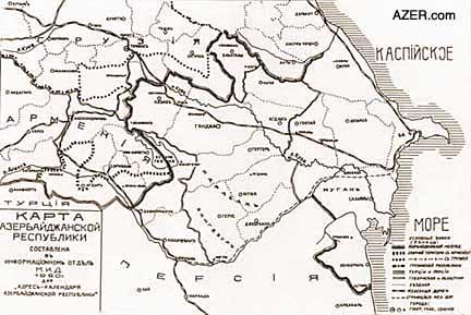
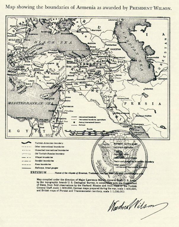
![[40]](https://en.wikipedia.org/wiki/File:D_R_Armenia.png)
.svg)
.svg)