Samsø (Anglicized: "Samso" or "Samsoe") is a Danish island in the Kattegat 15 kilometers (9.3 mi) off the Jutland Peninsula. Samsø is located in Samsø municipality. The community has 3,724 inhabitants[1] (2017) (January 2010:4,010) called Samsings and is 114 km² in area. Due to its central location, the island was used during the Viking Age as a meeting place. The etymology of the island's name is unknown.
Nickname: "The island in the middle" | |
|---|---|
 An old map of Samsø, Denmark | |
 | |
| Geography | |
| Location | Kattegat |
| Coordinates | 55°52′00″N 10°37′00″E / 55.86667°N 10.61667°E |
| Area | 112 km2 (43 sq mi) |
| Highest elevation | 64 m (210 ft) |
| Highest point | Ballebjerg |
| Administration | |
Denmark | |
| Region | Central Denmark Region |
| Municipality | Samsø Municipality |
| Largest settlement | Tranebjerg (pop. 829) |
| Demographics | |
| Population | 3,724 (2017) |
| Pop. density | 33/km2 (85/sq mi) |
In 1997, Samsø won a government competition to become a model renewable energy community. Now 100% of its electricity comes from wind power and biomass.[1][2]
Etymology edit
The name Samsø is of unknown origin.[3] The name is known from 1075 as Samse. This word is a simplex and the addition of -ø, Danish for 'island', is thus a later compounding,[4] known in toponymy as epexegesis.
Geography edit
Ballen's beach and village are popular with visitors. The island is served by a bus service which runs around the island, including the two ferry terminals in Sælvig and Ballen. In clear weather, the peninsula of Helgenæs to the north is visible. Geographically, the island divides into three areas:
- the North Island
- the Stavns Fjord
- the South Island
The soil and geology of the northern part of the island is made up of sand and gravel deposited during the deglaciation, while the southern part is made of both areas of boulder clay (Danish: moræneler) and outwash plains (Danish: smeltevandsslette).[5]
The North Island is divided from the South Island by the artificial Kanhave canal. Here a larger part of the countryside is uncultivated and it presents a wavy landscape of meadows and small patches of woodland and heath. Like the rest of Samsø, the coastline is characterized by steep cliffs and stony beaches, with some sandy beaches in between suited for bathing. Issehoved is Samsø's northernmost point and presents what have been described as a miniature of Skagens "Grenen". The small towns of Nordby, Mårup and Langør is situated on the North Island. Just north of Nordby is the world's biggest permanent labyrinth named 'Labyrinten', founded in the year 2000. It comprise a 60,000-square-metre (645,835-square-foot) patch of conifer woodland, grown on a previous christmas tree plantation.[6] Northwest of Nordby, is the hill of Ballebjerg, Samsøs highest point, reaching 64 m. Near the village of Mårup is the harbour of Mårup Havn. In the summer months (17 June to 22 August) the old wooden freight-ship M/S Tunø, ferry passengers back and forth from here to the island of Tunø just west of Samsø, two days a week. Other two days of the week, the same boat is offering seal-safaris from Langør at Stavns Fjord.[7]
Stavns Fjord edit
The shallow lagoon Stavns Fjord houses most of the smaller islands of Samsø municipality. The largest of them is Hjortholm and most of the rest are just small islets really, but have been named individually. The lagoon is separated from the sea of Kattegat by the 7 km long sandbar of Besser Rev. It is possible to walk on the reef all the way to the tip at low tide (ebb), except when the birds are breeding here. It is important to be aware of the tides, as there can be strong and dangerous currents at the reefs junction to Samsø during high tide (flow). East of Stavns Fjord, in Kattegat, lies a group of small islands (Kyholm, Lindholm, Rumpen, Vejrø) with a couple of sandbars. The entire area is to be protected.
South Island edit
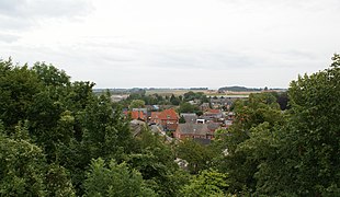
The South Island is home to the seat of the mayor and Samsø's largest town Tranebjerg, but there are many other hamlets and villages (18 in all) spread across the countryside. The village of Ballen, lies on the east coast and is also home to the Energy Academy. Most of the land on the South Island is cultivated, but there are spots of nature like the forest Brattingsborg Skov and the cliffs, shrubs and beach meadows on the southcoast. Just south of the Kanhave canal is Samsø Airport.
History edit


People have lived and hunted on Samsø from the earliest of times, when the ice receded at the end of the last Ice Age. Samsø first became an island approximately 9,000 years ago and there are several traces like dolmens, burial mounds, passage graves, kitchen middens, etc. from the Stone Age and Bronze Age cultures across the landscape. Excavations at Tønnesminde and Endebjerg, for example, show evidence of human habitation from the Stone Age through the Viking Age.
Norse mythology edit

On this island, Saxo Grammaticus relates that there was a legendary battle, when the Swedish champion Hjalmar and his friend Orvar-Odd fought against the twelve sons of the Swedish berserker Arngrim. This battle was once famous, since it also figures in Faroese ballads, in Orvar-Odd's saga and in Hervarar saga.[8]
According to the Hervarar saga and the Waking of Angantyr, the mounds of the slain berserkers were haunted. This did not stop Arngrim's granddaughter Hervor from approaching the mounds and demanding the enchanted sword Tyrfing from her father Angantyr.
"Samsey" (-ey being an earlier Norse form of -ø) is the island upon which Odin, under the name Jalk, learned Seid magic.[9]
Kanhave canal edit
At its narrowest place, a canal was dug across the island. The canal was about 500 m long and 11 m wide and could in its time be navigated by vessels with a draught of up to 1 m. It was dug and clad with wooden linings in the years 726-729 AD; the last part of the Scandinavian Iron Age. Kanhave canal is one of the largest known engineering projects of the Vikings and it is a sign of the centralized power of the time. Kanhave canal is thought of as instrumental to dominating the sea of Kattegat. There are plans to dig out the canal again. [10]
Medieval fortresses edit
All the known sources suggests, that the island was the property of the Crown throughout medieval times, but it was an age of conflict and insecurity nevertheless, as a total of five fortresses were built on Samsø in the Middle Ages; Vesborg where the lighthouse is nowadays, Gammel Brattingsborg where the town of Tranebjerg is now, Hjortholm on the islet of the same name in the Stavns Fjord lagoon, Bisgård at the bishop's palace (official residence) in the parish of Onsbjerg and the small fortification of Blafferholm in the garden of Brattingsborg manor. None of them are left standing today. Only the castle hills and the archaeological excavations of the foundations remains. The National Museum of Denmark initiated thorough archaeological investigations of the fortification sites a few years ago and the field work terminated in 2012. [11][12][13]

The quarantine of Kyholm edit
From 1831-1857 there was a plague- and cholera-quarantine on the tiny island of Kyholm just east of Samsø. Here, ships returning from long voyages had to dock, if they had disease on board. There is an abandoned cemetery of around 100 graves on the island. Kyholm is accessible year round, but it is advised not to be around when the birds are breeding.
German occupation edit
The strategic location of Samsø led it to become a Wehrmacht outpost during the German invasion of Denmark (1940). During this time, an American B-17 Flying Fortress safely crash-landed in Alstrup after being forced down by a German fighter.[14] Navigator Carl Groesbeck was almost immediately captured by Germans but other members of the plane, including Co-Pilot Miles McCormack, were hidden by locals for some time until they too were eventually captured. All the crew members survived the ordeal and the war, except tail-gunner Douglas Farris who was killed in action while in the air.[15]
Agriculture and sustainable production edit

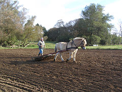
Agriculture has been the primary occupation on Samsø for millennia and nearly all of the island comprise cultured landscapes. Nowadays, farming is still an important business and the biggest contributor to the islands economy, but compared to the rest of Denmark, it has developed in its own direction. Free range farming is very prominent, and the agricultural produce comprise mostly potatoes, various other vegetables and berries as well as some animal husbandry. In the 2000s, especially the vegetable and berry production has increased, as the Samsø brand has become more widely known and popular. At the same time, packaging and industrial processing is increasingly taken care of on the island before shipping, again increasing the local revenue of the farming trade overall. Close to 16% of the islanders work in the fishing and farming sector, not including derived labour, compared to 3.5% countrywide.[16]
In Denmark, Samsø is well known for its early harvest of new potatoes. The first few pounds of these potatoes usually fetch prices around £100, and are considered a great delicacy.[16] Samsø is popular among French, Welsh and Irish people for strawberry picking during the months of June and July every year.[citation needed] Ecological agriculture and production is significant on Samsø, with a broad network of cooperating associations. It comprise farming of a large variety of vegetables, grains and fruits, livestock meat and products (lambs, sheep, yarn, cows, pigs, horses, donkeys, goats, chickens, eggs), a dairy, a brewery, restaurants and cafés, candy production, permaculture and forest garden experiments. There are several plans for extending the overall ecological production and broaden the industry (a slaughterhouse, orangery, forest gardens and education), with a wish for creating more jobs and stimulate settlements on the island.[17]
Renewable energy edit

In 1997, Samsø won a government competition to become a model renewable energy community. At the time, Samsø was entirely dependent on oil and coal, both imported from the mainland.[1] Therefore, Samso became the worlds first renewable energy island.[18]
Many different projects were started to realize the plan. An onshore wind farm comprising 11 turbines were built. The first turbine was erected and on-line in 2000. In addition to that, 10 offshore turbines (making a total of 21 altogether including land-based windmills), were completed in 2007, funded by the islanders.[19] The people of Samsø heat their homes straw burned in a central heating system and they power some vehicles on biofuel which they also grow. The island has four district heating plants in total. Now 100% of the island's electricity comes from wind power, with surplus electricity exported to the mainland grid, and 75% of its heat comes from local solar power and biomass energy.[20] An Energy Academy has opened in the town of Ballen. It is a community hall for energy concerns and a meeting place for energy and local development. The academy is currently working towards making Samsø 100% fossil fuel free until 2030, which is 20 years earlier than the national goals.[21]

Notable people edit
- Tyge (d. 1272 on Samsø) Bishop of the Diocese of Aarhus 1261-1272
- Ulrik Christian Gyldenløve, Count of Samsø (1678 in Brattingsborg – 1719) a Danish navy Admiral and Governor of Iceland; acknowledged illegitimate son of King Christian V of Denmark and his royal mistress Sophie Amalie Moth
- Carl Frederik Sørensen (1818 in Besser, Samsø – 1879) was a Danish artist who specialized in marine painting.
- Lotte Glob (born 1944 in Samsø) is a Danish ceramic artist, lives in the north of Scotland, the daughter of Peter Glob
- Anne Marie Løn (born 1947), novelist
- Nicolas Michaux (1984-), Belgian singer and songwriter.
Gallery edit
-
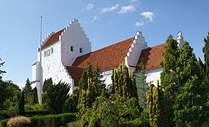
 Nordby Church.
 -
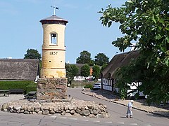 The village bell in Nordby
 -
 Ballebjerg (Nordby Bakker), the highest point on Samsø.
 -
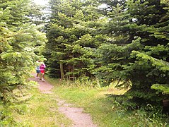 Inside Labyrinten, the largest permanent maze in the world.
 -
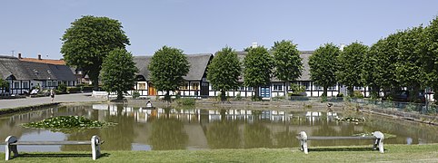 Village pond in Nordby
 -
 Stavns Fjord
 -
 Langør across Stavns Fjord
 -
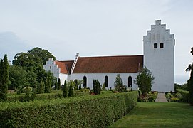
 Tranebjerg church
 -
 Tranebjerg
 -
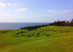
 View from Dyret, the highest hill on the South Island.
 -
 Kolby church
 -
 Kolby grain mill (Museum Samsø)
 -
 Museum Fredensdal
 -
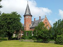 Brattingsborg Manor
 -
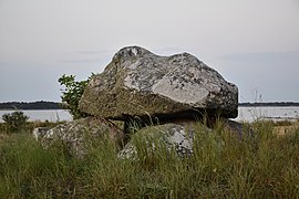 Alstrup Jættestue
.JPG)


See also edit
References edit
- ^ a b c "Denmark's Wind of Change". Time.com. Archived from the original on January 5, 2013. Retrieved 2013-11-14.
- ^ Kolbert, Elizabeth (30 June 2008). "The Island in the Wind". Newyorker.com. Retrieved 2013-11-14.
- ^ Politikens nudansk ordbog (1992), entry: Samsø (in Danish)
- ^ Samsø municipality Gyldendals Open Encyclopedia. (in Danish)
- ^ Houmark-nielsen, Michael (2021). Istiden i det danske landskab (in Danish). 209-210: Lindhardt og Ringhof. ISBN 978-87-11-98479-6.
{{cite book}}: CS1 maint: location (link) - ^ The Guinness certificate from 2000 Labyrinten's own homepage
- ^ M/S Tunø The ferry's homepage
- ^ Phillip Pulsiano and Kirsten Wolf (1993). Medieval Scandinavia - An Encyclopedia. Routledge. p. 283.
- ^ Poetic Edda, Lokasenna: 24.
- ^ Kanhave vikingage canal across Samsø Danske Fortidsminder (Denmark's Cultural-heritage Association) (in Danish)
- ^ Vesborg - Samsø's castles 1001 stories of Denmark. Danish Ministry for Culture.
- ^ The Medieval castles on Samsø National Museum of Denmark, retrieved 28.11.2013 (in Danish)
- ^ The National Museum of Denmark is excavating Medieval castles on Samsø The National Museum of Denmark (in Danish)
- ^ Staarup, Anders. "Navigator found Samsø again after 50 years" (PDF). Airmen.dk.
- ^ "42-37718B-17 FLYING FORTRESS". American Air Museum in Britain.
- ^ a b "Landbruget [Agriculture]" (in Danish). Samsø Municipality. Retrieved 1 August 2017.
- ^ Ecological producers The association 'Økologisk Samsø'.
- ^ "Doing green right".
- ^ Melissa McNamara (8 March 2007). "Danish Island Is Energy Self-Sufficient". CBS News. Retrieved 13 October 2017.
- ^ "Danish Island Is Energy Self-Sufficient". CBS News. Retrieved 2013-11-14.
- ^ "Video about Samsø's use of energy". Youtube.com. Retrieved 2013-11-14.
Further reading edit
- Gudrun Krüger: "Tourism in the Kattegat area - Analyzing the travel behavior of Samsø tourists to enhance the tourism potential of the island". Saarbrücken: VDM Verlag, 2009. ISBN 3-639-14849-5.
External links edit
- Official website
- The Energy Academy The academy's homepage.
- Nordby The towns own homepage. (in Danish)
- Labyrinten The labyrinths homepage.
- Melissa McNamara (8 March 2007). "Danish Island Is Energy Self-Sufficient". CBS News. Retrieved 4 September 2015.
- Elizabeth Kolbert (7 July 2008). "The Island in the Wind". The New Yorker. Retrieved 4 September 2015.