Samern is a community in the district of Grafschaft Bentheim in Lower Saxony, Germany.
Samern | |
|---|---|
Location of Samern within Grafschaft Bentheim district 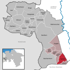 | |
 Samern  Samern | |
| Coordinates: 52°19′00″N 07°15′00″E / 52.31667°N 7.25000°E | |
| Country | Germany |
| State | Lower Saxony |
| District | Grafschaft Bentheim |
| Municipal assoc. | Schüttorf |
| Government | |
| • Mayor | Gerhard Schepers |
| Area | |
| • Total | 25.99 km2 (10.03 sq mi) |
| Elevation | 36 m (118 ft) |
| Population (2022-12-31)[1] | |
| • Total | 796 |
| • Density | 31/km2 (79/sq mi) |
| Time zone | UTC+01:00 (CET) |
| • Summer (DST) | UTC+02:00 (CEST) |
| Postal codes | 48465 |
| Dialling codes | 0 59 23 |
| Vehicle registration | NOH |
Geography edit
Location edit
Samern lies between Nordhorn and Steinfurt on the boundary with North Rhine-Westphalia. The community belongs to the Joint Community (Samtgemeinde) of Schüttorf whose administrative seat is in the like-named town.
Politics edit
Mayor edit
The community’s honorary mayor is Gerhard Schepers.
Culture and sightseeing edit
The Mansbrügge watchtower, or in the local speech the Piggetörnken, was once, according to local lore, a mint belonging to a count in the 14th century. Newer findings, however, show that this building was only ever used as a customs post.
Sport edit
Samern has a sport club, SV Suddendorf-Samern 1959 e.V.
Economy and infrastructure edit
Transport edit
The Autobahn A 31 runs directly through the community of Samern.