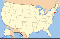
Connecticut (/kəˈnɛtɪkət/ kə-NET-ik-ət) is the southernmost state in the New England region of the Northeastern United States. It borders Rhode Island to the east, Massachusetts to the north, New York to the west, and Long Island Sound to the south. Its capital is Hartford, and its most populous city is Bridgeport. Connecticut lies between the major hubs of New York City and Boston along the Northeast Corridor, where the New York metropolitan area, which includes six of Connecticut's seven largest cities, extends well into the southwestern part of the state. Connecticut is the third-smallest state by area after Rhode Island and Delaware, and the 29th most populous with slightly more than 3.6 million residents as of 2020, ranking it fourth among the most densely populated U.S. states.
The state is named after the Connecticut River, the longest in New England which roughly bisects the state and drains into the Long Island Sound between the towns of Old Saybrook and Old Lyme. The name of the river is in turn derived from anglicized spellings of Quinnetuket, a Mohegan-Pequot word for "long tidal river". Before the arrival of the first European settlers, the region was inhabited by various Algonquian tribes. In 1633, the Dutch West India Company established a small, short-lived settlement called House of Hope in Hartford. Half of Connecticut was initially claimed by the Dutch colony New Netherland, which included much of the land between the Connecticut and Delaware Rivers, although the first major settlements were established by the English around the same time. Thomas Hooker led a band of followers from the Massachusetts Bay Colony to form the Connecticut Colony, while other settlers from Massachusetts founded the Saybrook Colony and the New Haven Colony; both merged into the former by 1664. (Full article...)
