Oud-Zevenaar (Dutch pronunciation: [ˌʌutˈseːvənaːr]) is a village in the municipality of Zevenaar in the province of Gelderland, the Netherlands. It is located to the south of Zevenaar
Oud-Zevenaar | |
|---|---|
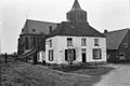
 View on Oud-Zevenaar | |
 Oud-Zevenaar Location in the Netherlands  Oud-Zevenaar Oud-Zevenaar (Netherlands) | |
| Coordinates: 51°54′54″N 6°04′53″E / 51.9149°N 6.0815°E | |
| Country | Netherlands |
| Province | Gelderland |
| Municipality | Zevenaar |
| Area | |
| • Total | 0.52 km2 (0.20 sq mi) |
| Elevation | 11 m (36 ft) |
| Population (2021)[1] | |
| • Total | 600 |
| • Density | 1,200/km2 (3,000/sq mi) |
| Time zone | UTC+1 (CET) |
| • Summer (DST) | UTC+2 (CEST) |
| Postal code | 6905[1] |
| Dialing code | 0316 |
The village was first mentioned in 1047 as Subenhara. The etymology is unclear. It uses oud (old) to distinguish from Zevenaar which was known as Nieu-Zeventer in 1725, but has reverted to plain Zevenaar.[3] The village developed along the Oude Rijn.[4] In 1487, Zevenaar received city rights,[3] and became the economic centre. The development of Oud-Zevenaar remained limited.[4] The Catholic St.Martinuskerk was first mentioned in 1276. In 1572, the tower burnt down. The church was restored in 1616.[4] Grist mill De Hoop was built in 1850.[5]
Gallery edit
-
 St.Martinuskerk
 -
 Windmill De Hoop
 -
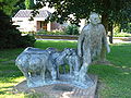 Shepherd with sheep statue
 -
_St.Martinuskerk.JPG)
_Korenmolen_De_Hoop.JPG)
_Sculptuur_herder_met_schapen.JPG)

References edit
- ^ a b c "Kerncijfers wijken en buurten 2021". Central Bureau of Statistics. Retrieved 26 March 2022.
- ^ "Postcodetool for 6905AA". Actueel Hoogtebestand Nederland (in Dutch). Het Waterschapshuis. Retrieved 26 March 2022.
- ^ a b "Zevenaar - (geografische naam)". Etymologiebank (in Dutch). Retrieved 26 March 2022.
- ^ a b c Ronald Stenvert & Sabine Broekhoven (2000). "Oud-Zevenaar" (in Dutch). Zwolle: Waanders. ISBN 90 400 9406 3. Retrieved 26 March 2022.
- ^ "De Hoop". Molen database (in Dutch). Retrieved 26 March 2022.
This Gelderland location article is a stub. You can help Wikipedia by expanding it. |