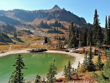
Naches Peak is a 6,452-foot (1,967 m) mountain summit located on the shared border of Mount Rainier National Park and William O. Douglas Wilderness. It is also on the shared border of Pierce County and Yakima County in Washington state. Naches Peak is situated on the crest of the Cascade Range and immediately southeast of Chinook Pass. Its nearest higher neighbor is Tahtlum Peak, 1.45 mi (2.33 km) to the east.[1] The name Naches Peak was proposed by the Yakima Chamber of Commerce and approved by Asahel Curtis in 1927.[3] The Naches Peak Loop Trail is a popular 3.5 mile trail encircling the peak. Precipitation runoff from the west side of Naches Peak drains into Chinook Creek, which is a tributary of the Ohanapecosh River, whereas the east side drains into tributaries of the American River.
| Naches Peak | |
|---|---|
 Naches Peak seen from Highway 410 | |
| Highest point | |
| Elevation | 6,452 ft (1,967 m)[1] |
| Prominence | 692 ft (211 m)[1] |
| Parent peak | Tahtlum Peak (6,567 ft)[2] |
| Isolation | 1.45 mi (2.33 km)[2] |
| Coordinates | 46°52′04″N 121°30′28″W / 46.867741°N 121.507694°W |
| Geography | |
 Naches Peak Location of Naches Peak in Washington  Naches Peak Naches Peak (the United States) | |
| Country | United States |
| State | Washington |
| County | Pierce / Yakima |
| Protected area | Mount Rainier National Park William O. Douglas Wilderness |
| Parent range | Cascades |
| Topo map | USGS Chinook Pass |
| Climbing | |
| Easiest route | Scrambling class 4 |
Climate edit
Naches Peak is located in the marine west coast climate zone of western North America.[4] Most weather fronts originating in the Pacific Ocean travel northeast toward the Cascade Mountains. As fronts approach, they are forced upward by the peaks of the Cascade Range (orographic lift), causing them to drop their moisture in the form of rain or snow onto the Cascades. As a result, the west side of the Cascades experiences high precipitation, especially during the winter months in the form of snowfall.[4] Because of maritime influence, snow tends to be wet and heavy, resulting in high avalanche danger.[4] During winter months, weather is usually cloudy, but due to high pressure systems over the Pacific Ocean that intensify during summer months, there is often little or no cloud cover during the summer.[4] The months of July through September offer the most favorable weather for viewing or climbing this peak.
See also edit
Gallery edit
-
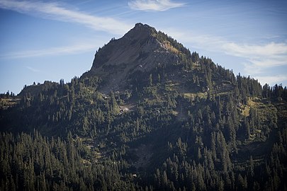 Naches Peak from north
 -
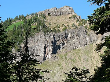 West aspect
 -
 East aspect
 -
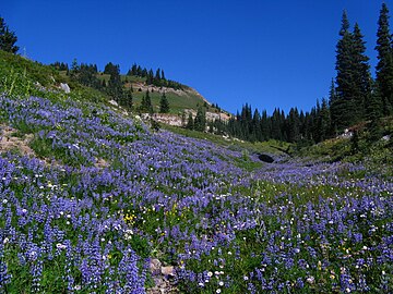 Lupine wildflowers along loop trail
 -
 Indian paintbrush along loop trail
 -
 Fern along loop trail
 -
 Sitka Mountain-ash

.JPG)

.jpg)
.jpeg)
_(7993253369).jpg)
_(7967518190).jpg)
References edit
- ^ a b c "Naches Peak, Washington". Peakbagger.com.
- ^ a b "Naches Peak - 6,452' WA". listsofjohn.com. Retrieved 2020-08-24.
- ^ "Naches Peak". Geographic Names Information System. United States Geological Survey, United States Department of the Interior. Retrieved 2018-08-09.
- ^ a b c d Beckey, Fred W. Cascade Alpine Guide, Climbing and High Routes. Seattle, WA: Mountaineers Books, 2008.
External links edit
- Naches Peak weather forecast
- National Park Service web site: Mount Rainier National Park
- National Forest Service web site: William O Douglas Wilderness