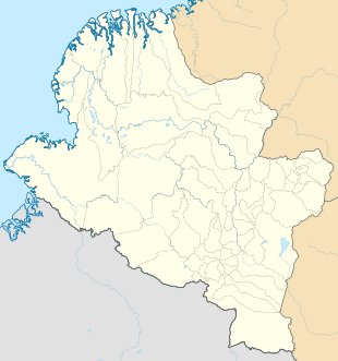
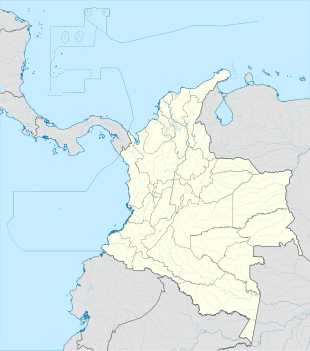
Monopamba is a settlement in Puerres Municipality, Nariño Department in Colombia.
Monopamba | |
|---|---|
| Coordinates: 0°48′20.9448″N 77°18′17.874″W / 0.805818000°N 77.30496500°W | |
| Country | |
| Department | Nariño |
| Municipality | Puerres municipality |
| Elevation | 5,827 ft (1,776 m) |
| Population (2005) | |
| • Total | 440 [1] |
| Time zone | UTC-5 (Colombia Standard Time) |
Climate
editAt about 1,700 metres or 5,600 feet above sea level, Monopamba has a warm, very wet and very cloudy subtropical highland climate (Köppen Cfb).
| Climate data for Monopamba | |||||||||||||
|---|---|---|---|---|---|---|---|---|---|---|---|---|---|
| Month | Jan | Feb | Mar | Apr | May | Jun | Jul | Aug | Sep | Oct | Nov | Dec | Year |
| Mean daily maximum °C (°F) | 20.9 (69.6) |
20.9 (69.6) |
21.3 (70.3) |
21.1 (70.0) |
20.7 (69.3) |
19.3 (66.7) |
18.8 (65.8) |
19.7 (67.5) |
21.1 (70.0) |
21.8 (71.2) |
21.9 (71.4) |
21.6 (70.9) |
20.8 (69.4) |
| Daily mean °C (°F) | 16.9 (62.4) |
17.0 (62.6) |
17.1 (62.8) |
17.1 (62.8) |
16.8 (62.2) |
16.1 (61.0) |
15.6 (60.1) |
15.9 (60.6) |
16.5 (61.7) |
17.1 (62.8) |
17.3 (63.1) |
17.2 (63.0) |
16.7 (62.1) |
| Mean daily minimum °C (°F) | 13.5 (56.3) |
13.7 (56.7) |
13.7 (56.7) |
13.9 (57.0) |
14.1 (57.4) |
13.7 (56.7) |
12.9 (55.2) |
12.9 (55.2) |
13.0 (55.4) |
13.3 (55.9) |
13.6 (56.5) |
13.7 (56.7) |
13.5 (56.3) |
| Average rainfall mm (inches) | 200.9 (7.91) |
189.0 (7.44) |
199.6 (7.86) |
269.5 (10.61) |
342.6 (13.49) |
417.6 (16.44) |
428.0 (16.85) |
363.1 (14.30) |
245.5 (9.67) |
179.1 (7.05) |
153.9 (6.06) |
192.6 (7.58) |
3,181.4 (125.26) |
| Average rainy days | 24 | 22 | 25 | 27 | 28 | 27 | 28 | 27 | 25 | 25 | 23 | 24 | 305 |
| Average relative humidity (%) | 90 | 89 | 89 | 90 | 90 | 91 | 91 | 91 | 89 | 88 | 88 | 89 | 90 |
| Mean monthly sunshine hours | 83.7 | 59.3 | 49.6 | 51.0 | 52.7 | 39.0 | 40.3 | 46.5 | 60.0 | 80.6 | 96.0 | 89.9 | 748.6 |
| Mean daily sunshine hours | 2.7 | 2.1 | 1.6 | 1.7 | 1.7 | 1.3 | 1.3 | 1.5 | 2.0 | 2.6 | 3.2 | 2.9 | 2.1 |
| Source: [2] | |||||||||||||
References
edit- ^ "Monopamba (Puerres, Nariño, Colombia) - Population Statistics, Charts, Map, Location, Weather and Web Information".
- ^ "Data". www.ideam.gov.co. Retrieved 2020-06-21.

