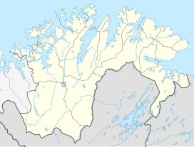
Komagaksla (or Vatnafjellet) is the highest mountain on the island of Sørøya in Hammerfest Municipality in Finnmark county, Norway. The 659-metre (2,162 ft) tall mountain sits along the southern shore of the island, along the Sørøysundet.[2]
| Komagaksla | |
|---|---|
| Highest point | |
| Elevation | 659 m (2,162 ft) |
| Prominence | 659 m (2,162 ft) |
| Coordinates | 70°32′27″N 22°52′54″E / 70.5407°N 22.8816°E[1] |
| Geography | |
| Location | Finnmark, Norway |
| Topo map | 1836 III Sørøya and 1836 II Sørøysundet |
References edit
- ^ "Komagaksla, Hammerfest (Finnmark)" (in Norwegian). yr.no. Retrieved 2018-06-17.
- ^ Store norske leksikon. "Sørøya" (in Norwegian). Retrieved 2013-01-28.

