The Iezer Mountains (Romanian: Munții Iezer / Munții Iezer-Păpușa) are a mountain range in the Southern Carpathians in Romania. It is part of the Făgăraș Mountains group. Its total area is 535 km2 (207 sq mi). Its highest elevation is 2,470 m (8,100 ft), at Roșu Peak.[1]
| Iezer Mountains | |
|---|---|
 Iezerul Mic (2409 m) | |
| Highest point | |
| Peak | Roșu Peak |
| Elevation | 2,470 m (8,100 ft) |
| Dimensions | |
| Area | 535 km2 (207 sq mi) |
| Naming | |
| Native name | Munții Iezer (Romanian) |
| Geography | |
 Iezer Mountains | |
| Country | Romania |
| Range coordinates | 45°28′N 24°57′E / 45.467°N 24.950°E |
Location
editThe Iezer Mountains are located between the Făgăraș Mountains to the northwest and the Piatra Craiului Mountains to the east. The rivers Dâmbovița and Râul Târgului take their source in the Iezer Mountains. The range lies completely within Argeș County.
Peaks
edit- Roșu 2,470 m
- Iezerul Mare 2,462 m
- Păpușa 2,391 m
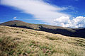
Gallery
edit-
 Iezer Păpușa - Papau mountain
 -
 Lake Iezer and the nearby shelter
 -
 The main ridge
 -
 The main ridge of Iezer Păpușa
 -
 Iezer Păpușa
 -
 Iezer – Păpuşa, 3D


References
edit- ^ a b Popescu, R. (2018). "Permafrost investigations in Iezer Mountains, Southern Carpathians". Revista de Geomorfologie. 20: 102–122. doi:10.21094/rg.2018.033.
- ^ 2017 Romanian Statistical Yearbook, p. 11