Astghashen (Armenian: Աստղաշեն) or Dashbulag (Armenian: Դաշբուլաղ; Azerbaijani: Daşbulaq) is a village in the Khojaly District of Azerbaijan. The village had an ethnic Armenian-majority population in 1989.[2] The village is famous for its unique star-shaped stones, which the village derives its name from.[3] It was under the de facto control of breakaway Republic of Artsakh until the Azerbaijani takeover of the region in 2023.[4]
Astghashen / Dashbulag
Աստղաշեն / Դաշբուլաղ | |
|---|---|
 | |
 Astghashen / Dashbulag  Astghashen / Dashbulag | |
| Coordinates: 39°55′37″N 46°42′17″E / 39.92694°N 46.70472°E | |
| Country | |
| • District | Khojaly |
| Elevation | 772 m (2,533 ft) |
| Population (2015)[1] | |
| • Total | 507 |
| Time zone | UTC+4 (AZT) |
Toponymy
editThe village was historically known as Karaghbyur (Armenian: Քարաղբյուր).[5] The name Astghashen means "village of stars", with the word Astgh (Armenian: Աստղ) meaning "star" in Armenian, referring to the famous star-shaped fossils of the village.
History
editThe village is known for its star-shaped fossils. The fossils originate from small marine animals that lived in the Tethys Ocean that covered the area millions of years ago. There are also many other types of fossils in the area.[6]
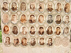
During the Soviet period, the village was a part of the Askeran District in the Nagorno-Karabakh Autonomous Oblast of Azerbaijan SSR. The village has been administered by the Republic of Artsakh as a part of its Askeran Province since the First Nagorno-Karabakh War.
After the 2020 Nagorno-Karabakh war, Artsakh launched the construction of a new settlement for IDPs close to Astghashen, on the road towards the neighboring village of Patara, for people displaced from the villages of Sghnakh, Jraghatsner, Madatashen and Moshkhmhat in the Askeran Province.[7][8][9]
Historical heritage sites
editHistorical heritage sites in and around the village include burial sites from the 2nd–1st millennia BCE, a 14th-century tomb about 4 km southwest of the village, St. George's Church (Armenian: Սուրբ Գևորգ եկեղեցի, romanized: Surb Gevorg Yekeghetsi) built in 1898, with two 16th/17th-century khachkars, and a spring monument from 1930.[10][1]
Economy and culture
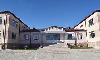
editThe population is mainly engaged in agriculture and animal husbandry. As of 2015, the village has a municipal building, a secondary school, a house of culture, two shops, and a medical centre. The Astghashen Art School is also located in the village.[1]
Demographics
editThe village had 520 inhabitants in 2005,[11] and 507 inhabitants in 2015.[1]
Gallery
edit-
 St. George's Church in Astghashen
 -
 Inside St. George's Church
 -
 Monument to the victims of the Great Patriotic War (WWII)
 -
 Closeup of monument to the victims of the Great Patriotic War (WWII)
 -
 Municipal building in Astghashen
 -
 School entrance
 -
 The famous star-shaped fossils of the village


References
edit- ^ a b c d Hakob Ghahramanyan. "Directory of socio-economic characteristics of NKR administrative-territorial units (2015)".
- ^ Андрей Зубов. "Андрей Зубов. Карабах: Мир и Война". drugoivzgliad.com.
- ^ Khachatrian, Vahagn (2023-08-10). "Astghashen: Mysterious Village of Artsakh". The Armenian Weekly. Retrieved 2023-11-03.
- ^ Nagorno-Karabakh’s breakaway government says it will dissolve itself, The Guardian, 28 Sep 2023, archieved on 15 Nov 2023
- ^ Վահրամ Բալայան (2002). Արցախի պատմությունը հնադարից մինչեւ մեր օրերը.
- ^ "Mysteries of Astghashen". Armenian Geographic.
- ^ Armenpress (2021-02-16). "Construction of new residential settlement for displaced citizens launched in Artsakh".
- ^ Siranush Ghazanchyan (2021-02-13). "New settlement being established in Artsakh's Askeran region". Public Radio of Armenia.
- ^ Tirayr Muradyan & Saro Baghdasaryan (2021-07-12). "New Artsakh Village to House IDPs". hetq.am.
- ^ Kiesling, Brady; Kojian, Raffi (2019). Rediscovering Armenia: An in-depth inventory of villages and monuments in Armenia and Artsakh (3rd ed.). Armeniapedia Publishing.
- ^ "The Results of the 2005 Census of the Nagorno-Karabakh Republic" (PDF). National Statistic Service of the Republic of Artsakh.