Capá is a barrio in the municipality of Moca, Puerto Rico with a population of 3,747 in 2010.[3][4][5]
Capá | |
|---|---|
Barrio | |
 PR-111 and PR-421 in Capá | |
 Location of Capá within the municipality of Moca shown in red | |
 Capá Location of Puerto Rico | |
| Coordinates: 18°22′07″N 67°02′58″W / 18.36854°N 67.049323°W[1] | |
| Commonwealth | |
| Municipality | |
| Area | |
| • Total | 2.22 sq mi (5.7 km2) |
| • Land | 2.22 sq mi (5.7 km2) |
| • Water | 0 sq mi (0 km2) |
| Elevation | 217 ft (66 m) |
| Population (2010) | |
| • Total | 3,747 |
| • Density | 1,687.8/sq mi (651.7/km2) |
| Source: 2010 Census | |
| Time zone | UTC−4 (AST) |
History edit
Capá was in Spain's gazetteers[6] until Puerto Rico was ceded by Spain in the aftermath of the Spanish–American War under the terms of the Treaty of Paris of 1898 and became an unincorporated territory of the United States. In 1899, the United States Department of War conducted a census of Puerto Rico finding that the population of Capá barrio was 898.[7]
| Census | Pop. | Note | %± |
|---|---|---|---|
| 1900 | 898 | — | |
| 1910 | 906 | 0.9% | |
| 1920 | 1,031 | 13.8% | |
| 1930 | 1,181 | 14.5% | |
| 1940 | 1,395 | 18.1% | |
| 1950 | 1,638 | 17.4% | |
| 1960 | 1,595 | −2.6% | |
| 1970 | 1,603 | 0.5% | |
| 1980 | 2,127 | 32.7% | |
| 1990 | 2,297 | 8.0% | |
| 2000 | 3,354 | 46.0% | |
| 2010 | 3,747 | 11.7% | |
| U.S. Decennial Census 1899 (shown as 1900)[8] 1910-1930[9] 1930-1950[10] 1960[11] 1980-2000[12] 2010[13] | |||
Gallery edit
-
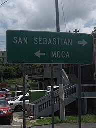 To San Sebastián or Moca, sign on PR-421, fronting PR-111 in Capá

See also edit
References edit
- ^ a b "US Gazetteer 2019". US Census. US Government.
- ^ U.S. Geological Survey Geographic Names Information System: Capá barrio
- ^ Picó, Rafael; Buitrago de Santiago, Zayda; Berrios, Hector H. Nueva geografía de Puerto Rico: física, económica, y social, por Rafael Picó. Con la colaboración de Zayda Buitrago de Santiago y Héctor H. Berrios. San Juan Editorial Universitaria, Universidad de Puerto Rico,1969.
- ^ Gwillim Law (20 May 2015). Administrative Subdivisions of Countries: A Comprehensive World Reference, 1900 through 1998. McFarland. p. 300. ISBN 978-1-4766-0447-3. Retrieved 25 December 2018.
- ^ Puerto Rico: 2010 Population and Housing Unit Counts.pdf (PDF). U.S. Dept. of Commerce, Economics and Statistics Administration, U.S. Census Bureau. 2010.
- ^ "Anuario del comercio, de la industria, de la magistratura y de la administración. 1881". Biblioteca Nacional de España (in Spanish). p. 1614. Retrieved 4 April 2023.
- ^ Joseph Prentiss Sanger; Henry Gannett; Walter Francis Willcox (1900). Informe sobre el censo de Puerto Rico, 1899, United States. War Dept. Porto Rico Census Office (in Spanish). Imprenta del gobierno. p. 160.
- ^ "Report of the Census of Porto Rico 1899". War Department Office Director Census of Porto Rico. Archived from the original on 16 July 2017. Retrieved 21 September 2017.
- ^ "Table 3-Population of Municipalities: 1930 1920 and 1910" (PDF). United States Census Bureau. Archived (PDF) from the original on 17 August 2017. Retrieved 21 September 2017.
- ^ "Table 4-Area and Population of Municipalities Urban and Rural: 1930 to 1950" (PDF). United States Census Bureau. Archived (PDF) from the original on 30 August 2015. Retrieved 21 September 2014.
- ^ Census of Population, 1960: Number of Inhabitants, General Population Characteristics, General Social and Economic Characteristics, and Detailed Characteristics. Characteristics of the population. U.S. Bureau of the Census. 1963. pp. 97–101. Retrieved 10 June 2023.
- ^ "Table 2 Population and Housing Units: 1960 to 2000" (PDF). United States Census Bureau. Archived (PDF) from the original on 24 July 2017. Retrieved 21 September 2017.
- ^ Puerto Rico: 2010 Population and Housing Unit Counts.pdf (PDF). U.S. Dept. of Commerce Economics and Statistics Administration U.S. Census Bureau. 2010. Archived (PDF) from the original on 20 February 2017. Retrieved 2 August 2019.
This Moca, Puerto Rico location article is a stub. You can help Wikipedia by expanding it. |