Boelenslaan (West Frisian: Boelensloane) is a village in Achtkarspelen municipality in Friesland province in the northern Netherlands.
Boelenslaan
Boelensloane | |
|---|---|
Village | |
.jpg) Little white church | |
 Flag  Coat of arms | |
 Boelenslaan Location in the Netherlands  Boelenslaan Boelenslaan (Netherlands) | |
| Coordinates: 53°09′43″N 06°08′41″E / 53.16194°N 6.14472°E | |
| Country | |
| Province | |
| Municipality | |
| Area | |
| • Total | 6.99 km2 (2.70 sq mi) |
| Elevation | 2 m (7 ft) |
| Population (2021)[1] | |
| • Total | 1,295 |
| • Density | 190/km2 (480/sq mi) |
| Time zone | UTC+1 (CET) |
| • Summer (DST) | UTC+2 (CEST) |
| Postal code | 9233[1] |
| Dialing code | 0512 |
As of January 2017, Boelenslaan has 1141 inhabitants[3]
The village is in the "Friese Wouden" in the Frisian forests.
History
editThe village was first mentioned in 1899 as Boelenslaan, and means (dead-end) road to the settlement of the Boelens family.[4] The Boelens family used to be grietman (mayors) who owned large parcels of land. Boelenslaan was originally a peat excavation settlement. In 1852, a church was built. The white church is a chapel of the Continued Reformed Church.[5]
The Flag of Boelenslaan
edit
The color red refers to the heathland and the severability fight of the population, the color yellow refers to the Sandgrounds. The color green refers to Friese Wouden, from the village area. The silver rose is the coat of arms of the noble family Boelens, after whom it was named.[6]
Gallery
edit-
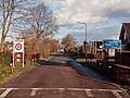 Welcome to Boelenslaan
 -
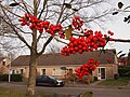 Berries
 -
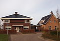 House in Boelenslaan
 -
 Bicycle factory


References
edit- ^ a b c "Kerncijfers wijken en buurten 2021". Central Bureau of Statistics. Retrieved 29 March 2022.
two entries
- ^ "Postcodetool for 9233KA". Actueel Hoogtebestand Nederland (in Dutch). Het Waterschapshuis. Retrieved 29 March 2022.
- ^ Villages Archived 2017-04-22 at the Wayback Machine - Achtkarspelen (in Dutch)
- ^ "Boelenslaan - (geografische naam)". Etymologiebank (in Dutch). Retrieved 29 March 2022.
- ^ "Boelenslaan". Plaatsengids (in Dutch). Retrieved 29 March 2022.
- ^ friesland-digitaal.eu In Dutch language, about the history of Boelenslaan
External links
edit![]() Media related to Boelenslaan at Wikimedia Commons
Media related to Boelenslaan at Wikimedia Commons