Xuguantun Subdistrict (Chinese: 徐官屯街道; pinyin: Xúguāntún Jiēdào) is a subdistrict in Wuqing District, Tianjin, China. It shares border with Nancaicun and Dajianchang Towns in the north, Caozili and Meichang Towns in the east, Yunhexi and Yangcun Subdistricts in the south, and Dongpuwa Subdistrict in the west. Its population was 16,981 according to the 2010 Chinese census.[1]
Xuguantun Subdistrict
徐官屯街道 | |
|---|---|
 Entrance of Wuqing Development Zone in the southern part of Xuguantun | |
 Xuguantun Subdistrict  Xuguantun Subdistrict | |
| Coordinates: 39°23′52″N 117°04′41″E / 39.39778°N 117.07806°E | |
| Country | |
| Municipality | Tianjin |
| District | Wuqing |
| Village-level Divisions | 4 communities 9 villages |
| Area | |
| • Total | 15.27 km2 (5.90 sq mi) |
| Elevation | 7 m (23 ft) |
| Population (2010) | |
| • Total | 16,981 |
| • Density | 1,100/km2 (2,900/sq mi) |
| Time zone | UTC+8 (CST) |
| Postal code | 301722 |
| Area code | 022 |
The subdistrict was named after Xuguantun (Chinese: 徐官屯; lit. 'Xu's Official Hamlet') Village, where the seat of the local government is located.[2]
Geography
editXuguantun Subdistrict is located on the south of Beijing Paiwu River, with the Grand Canal passing through its middle. The National Highway 103 crosses the western portion of the subdistrict. Its average elevation is seven meters above the sea level.[3]
History
edit| Years | Status | Part of |
|---|---|---|
| 1982 - 1983 | Within Yangcun People's Commune | Wuqing County, Tianjin |
| 1983 - 1984 | Yangcun Township | |
| 1984 - 2000 | Xuguantun Township | |
| 2000 - 2001 | Wuqing District, Tianjin | |
| 2001 - present | Xuguantun Subdistrict |
Administrative divisions
editAs of the year 2022, Xuguantun Subdistrict has 13 subdivisions, including 4 residential communities and 9 villages. They are listed below:[4]
Residential communities
edit- Xinli (新丽)
- Caoyuan (曹园)
- Kongguantun (孔官屯)
- Jingrui Huayuan (景瑞花园)
Villages
edit- Xue Zhuang (薛庄)
- Fei Zhuang (费庄)
- Shagudui (沙古堆)
- Baojiaying (宝稼营)
- Ma Zhuang (马庄)
- Chu Zhuang (褚庄)
- Duan Zhuang (段庄)
- Xiaoxin Zhuang (小辛庄)
- Xinliu Zhuang (新刘庄)
Galleries
edit-
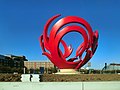 Monument along the National Highway 103
 -
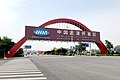 Wuqing Development Zone
 -
 Tianjin Tianshi College
 -
 Headquarter of Tiens Group
.jpg)


See also
editReferences
edit- ^ "China: Tiānjīn Municipal Province (Districts and Townships) - Population Statistics, Charts and Map". www.citypopulation.de. Retrieved 2023-05-08.
- ^ a b Zhonghua Renmin Gongheguo zheng qu da dian. Tianjin juan (Di 1 ban ed.). 2020. ISBN 978-7-5087-6215-9. OCLC 1351675957.
- ^ "徐官屯街道 topographic map, elevation, terrain". Topographic maps. Retrieved 2023-05-08.
- ^ "2022年统计用区划代码和城乡划分代码" [2022 Statistical Division Codes and Urban-rural Differentiation Codes]. www.stats.gov.cn (in Chinese). Archived from the original on 2023-03-21. Retrieved 2023-05-07.