test delink: Siege of Barrancas: (First Seminole War): May 1818. The Spanish surrender Pensacola.

Nashville
Mobile
Ft. Barrancas
St. Marks
New
Orleans
Orleans
Pensacola
Horseshoe Bend
Emuckfaw and
Enotachopo Creek
Enotachopo Creek
Talladega


Map of Narborough Road, Leicester

500m
550yds
550yds
City of Leicester
Blaby, Leics Boundary
Blaby, Leics Boundary
WESTERN
PARK
PARK
Narborough Road
Police Station
Leisure Centre
BRAUNSTONE
FRITH
FRITH
ROWLEY
FIELDS
FIELDS
Health Centre
Fullhurst
Community
College
Community
College
Winstanley
House
House
BRAUNSTONE
PARK
PARK
BRITE
Centre
Centre
.svg)
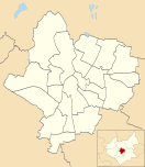
Map of Braunston Park and Rowley Fields ward, Leicester
Suburbs and districts of Leicester (ancient villages now incorporated into the city are shown in bold)
- Abbey Rise
- Ashton Green
- Aylestone
- Beaumont Leys
- Bede Island
- Belgrave
- Blackfriars
- Braunstone
- Braunstone Frith
- Bradgate Heights
- City Centre
- Clarendon Park
- Crown Hills
- Dane Hills
- Evington
- Evington Valley
- Eyres Monsell
- Frog Island
- Goodwood
- Hamilton
- Highfields
- Horston Hill
- Humberstone
- Humberstone Garden
- Kirby Frith
- Knighton
- Mowmacre Hill
- Netherhall
- Newfoundpool
- New Parks
- North Evington
- Northfields
- Rowlatts Hill
- Rowley Fields
- Rushey Mead
- Saffron
- Southfields
- South Knighton
- Spinney Hills
- Stocking Farm
- Stoneygate
- St. Matthew's
- St. Mark's
- St. Peters
- Thurnby Lodge
- West End
- West Knighton
- Western Park
- Woodgate