Telegraph Hill (267 metres, 876 feet high[2]) is a hill about 1 mile northwest of Minterne Magna and about 10 miles north of Dorchester in the county of Dorset, England. Its prominence qualifies it as one of the so-called HuMPs.[2]
| Telegraph Hill | |
|---|---|
 View east along the northern slope of Telegraph Hill overlooking the Blackmore Vale | |
| Highest point | |
| Elevation | 267 m (876 ft) |
| Prominence | 121 m (397 ft) |
| Parent peak | Lewesdon Hill[1] |
| Listing | HuMP |
| Coordinates | 50°50′37″N 2°30′23″W / 50.8436°N 2.5064°W |
| Geography | |
| Location | Dorset, England |
| Parent range | Dorset Downs |
| OS grid | ST644050 |
| Topo map | OS Landranger 194 Explorer 117W |
There is a transmission mast about 600 metres away on the spur to the northeast at High Stoy. Writing in 1906, Sir Frederick Treves described High Stoy as "the most engaging of all Dorset hills—a hill of 800 feet, made up of green slopes, a cliff, and a mantle of trees."[3] Opposite High Stoy is Dogbury Hill, another bastion of the chalk escarpment.
A Franciscan friary lies in the hamlet of Hilfield beneath the hill to the west.
Films
editThe area of Minterne, Dogbury Hill and High Stoy was the setting for Thomas Hardy's novel, The Woodlanders, Minterne House being referred to as Great Hintock House. The 1990s TV film of Hardy's Tess of the d'Urbervilles was made on Dogbury Hill.[4]
Sport
editTelegraph Hill is a popular paragliding spot.[5]
Gallery
edit-
 Early morning sun rising through woods on south side of Telegraph Hill
 -
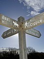 Bridlepath sign near Telegraph Hill


References
edit- ^ Jackson, Mark (2009). More Relative Hills of Britain, Marilyn News Centre, UK. E-book Archived 2013-10-12 at the Wayback Machine.
- ^ a b Telegraph Hill at Database of British and Irish Hills. Accessed on 22 Mar 2013.
- ^ Sir Frederick Treves (1906). Highways and Byways in Dorset. Macmillan & Co Ltd. p. 326.
- ^ A familiar haunt for film companies at minterne.co.uk. Accessed on 29 Mar 2013.
- ^ Where We Are at www.flyingfrenzy.com. Accessed on 22 Mar 2013.
This Dorset location article is a stub. You can help Wikipedia by expanding it. |