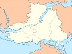
Nyzhni Sirohozy (Ukrainian: Нижні Сірогози; Russian: Нижние Серогозы) is a rural settlement in Henichesk Raion, Kherson Oblast, southern Ukraine. It is located inland, between Melitopol and Kherson. Nyzhni Sirohozy hosts the administration of Nyzhni Sirohozy settlement hromada, one of the hromadas of Ukraine.[1] It has a population of 4,451 (2022 estimate).[2]
Nyzhni Sirohozy
Нижні Сірогози | |
|---|---|
 Tank monument of Nyzhni Sirohozy | |
| Coordinates: 46°50′31″N 34°22′36″E / 46.84194°N 34.37667°E | |
| Country | |
| Oblast | Kherson Oblast |
| Raion | Henichesk Raion |
| Hromada | Nyzhni Sirohozy settlement hromada |
| Population (2022) | |
| • Total | |
| Time zone | UTC+2 (EET) |
| • Summer (DST) | UTC+3 (EEST) |
History
editUntil 18 July, 2020, Nyzhni Sirohozy was the administrative center of Nyzhni Sirohozy Raion. The raion was abolished in July 2020 as part of the administrative reform of Ukraine, which reduced the number of raions of Kherson Oblast to five. The area of Nyzhni Sirohozy Raion was merged into Henichesk Raion.[3][4]
Until 26 January 2024, Nyzhni Sirohozy was designated urban-type settlement. On this day, a new law entered into force which abolished this status, and Nyzhni Sirohozy became a rural settlement.[5]
Climate
edit| Climate data for Nyzhni Sirohozy (1981–2010) | |||||||||||||
|---|---|---|---|---|---|---|---|---|---|---|---|---|---|
| Month | Jan | Feb | Mar | Apr | May | Jun | Jul | Aug | Sep | Oct | Nov | Dec | Year |
| Mean daily maximum °C (°F) | 1.0 (33.8) |
1.8 (35.2) |
7.7 (45.9) |
16.2 (61.2) |
22.7 (72.9) |
26.8 (80.2) |
29.8 (85.6) |
29.2 (84.6) |
23.2 (73.8) |
15.8 (60.4) |
7.4 (45.3) |
2.3 (36.1) |
15.3 (59.5) |
| Daily mean °C (°F) | −2.1 (28.2) |
−1.9 (28.6) |
2.8 (37.0) |
9.8 (49.6) |
15.9 (60.6) |
20.2 (68.4) |
23.0 (73.4) |
22.3 (72.1) |
16.6 (61.9) |
10.1 (50.2) |
3.6 (38.5) |
−0.7 (30.7) |
10.0 (50.0) |
| Mean daily minimum °C (°F) | −4.9 (23.2) |
−5.2 (22.6) |
−1.2 (29.8) |
4.2 (39.6) |
9.4 (48.9) |
14.0 (57.2) |
16.3 (61.3) |
15.5 (59.9) |
10.6 (51.1) |
5.3 (41.5) |
0.3 (32.5) |
−3.5 (25.7) |
5.1 (41.2) |
| Average precipitation mm (inches) | 29.4 (1.16) |
31.3 (1.23) |
29.7 (1.17) |
39.2 (1.54) |
41.9 (1.65) |
59.5 (2.34) |
42.5 (1.67) |
44.9 (1.77) |
38.4 (1.51) |
29.8 (1.17) |
42.3 (1.67) |
35.6 (1.40) |
464.5 (18.29) |
| Average precipitation days (≥ 1.0 mm) | 6.7 | 5.7 | 6.1 | 5.8 | 6.5 | 6.8 | 4.7 | 4.1 | 4.7 | 4.3 | 6.1 | 7.1 | 68.6 |
| Average relative humidity (%) | 87.0 | 84.1 | 78.9 | 68.8 | 64.7 | 65.9 | 60.2 | 58.7 | 66.4 | 75.6 | 86.2 | 88.2 | 73.7 |
| Source: World Meteorological Organization[6] | |||||||||||||
Economy
editTransportation
editNyzhni Sirohozy has access to the Highway M14, connecting Kherson with Mariupol via Melitopol. Another road connects it with Henichesk and Velyka Lepetykha.
The closest railway station is in Sirohozy, about 10 kilometres (6.2 mi) north of the settlement, on a railway connecting Mykolaiv with Melitopol.
See also
editReferences
edit- ^ "Нижнесерогозская громада" (in Russian). Портал об'єднаних громад України.
- ^ Чисельність наявного населення України на 1 січня 2022 [Number of Present Population of Ukraine, as of January 1, 2022] (PDF) (in Ukrainian and English). Kyiv: State Statistics Service of Ukraine. Archived (PDF) from the original on 4 July 2022.
- ^ "Про утворення та ліквідацію районів. Постанова Верховної Ради України № 807-ІХ". Голос України (in Ukrainian). 2020-07-18. Retrieved 2020-10-03.
- ^ "Нові райони: карти + склад" (in Ukrainian). Міністерство розвитку громад та територій України.
- ^ "Что изменится в Украине с 1 января". glavnoe.in.ua (in Russian). 1 January 2024.
- ^ "World Meteorological Organization Climate Normals for 1981–2010". World Meteorological Organization. Archived from the original on 17 July 2021. Retrieved 17 July 2021.

