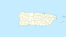
Patillas Airport, (Spanish: Aeropuerto de Patillas) (FAA LID: X64) was a public airport 1.5 miles (2.4 km) south of the small town of Patillas, in Puerto Rico.
Patillas Airport Aeropuerto de Patillas | |||||||||||
|---|---|---|---|---|---|---|---|---|---|---|---|
 The runway, viewed from above | |||||||||||
| Summary | |||||||||||
| Airport type | Closed | ||||||||||
| Owner | Puerto Rico Ports Authority | ||||||||||
| Location | Patillas, Puerto Rico | ||||||||||
| Elevation AMSL | 10 ft / 3 m | ||||||||||
| Coordinates | 17°58′56″N 66°01′10″W / 17.98222°N 66.01944°W | ||||||||||
| Map | |||||||||||
| Runways | |||||||||||
| |||||||||||
The airport is located on a 16-acre property owned by the Puerto Rico Ports Authority. During operation, the airport charged a non-commercial landing fee of an unspecified amount. For a 12 month period during operations lasting from July 15th, 1994 to July 15th, 1995, there were 2300 aircraft operations at the airport, with an average of 6 per day. There were 10 planes based out of Patillas at the time, 7 single-engine and 3 ultralight planes. The runway has a length of 2,000 feet (610 m) and a width of 50 feet (15 m).[2]
Google Earth Historical Imagery (12/12/2014) shows an east-west 2,000 feet (610 m) asphalt runway. The (7/14/2015) image shows the runway marked closed. Imagery from 2018 (1/1/2018) shows the runway area used for industrial storage, which has since been removed.
See also
editReferences
edit- ^ "Patillas Airport". Google Maps. Google. Retrieved 5 June 2018.
- ^ a b "AirportIQ 5010". web.archive.org. 2007-10-09. Retrieved 2024-06-17.
External links
edit
