Nuevo Colón is a town and municipality in the Colombian Department of Boyacá, part of the subregion of the Márquez Province. The urban centre is located at an altitude of 2,500 metres (8,200 ft) on the Altiplano Cundiboyacense, at a distance of 34 kilometres (21 mi) from the departmental capital Tunja. Nuevo Colón borders Boyacá, Boyacá, Ventaquemada and Jenesano in the north, Tibaná and Turmequé in the south, Tibaná in the east and Turmequé and Ventaquemada in the west.[1]
Nuevo Colón
Chiriví | |
|---|---|
Municipality and town | |
 Central square of Nuevo Colón | |
.svg) Flag  Seal | |
 Location of the municipality and town of Nuevo Colón in the Boyacá Department of Colombia | |
| Coordinates: 5°21′N 73°28′W / 5.350°N 73.467°W | |
| Country | |
| Department | Boyacá Department |
| Province | Márquez Province |
| Founded | 15 October 1783 |
| Government | |
| • Mayor | Héctor Wilson Castelblanco Rodríguez (2020-2023) |
| Area | |
| • Municipality and town | 0.28582 km2 (0.11036 sq mi) |
| • Urban | 0.04492 km2 (0.01734 sq mi) |
| Population (2015) | |
| • Municipality and town | 6,559 |
| • Urban | 1,300 |
| Time zone | UTC-5 (Colombia Standard Time) |
| Website | Official website |
Etymology
editNuevo Colón was first called Chiriví, after the name of the area in the time before the Spanish conquest, when it was inhabited by the Chibcha-speaking Muisca. Chiriví means "our".[2] It received the name Nuevo Colón in 1907.[1]
History
editChiriví was part of the domains of the hoa of Hunza before the conquest. Conquistador Gonzalo Jiménez de Quesada passed through Nuevo Colón in 1537, when he was crossing the Tenza Valley to discover the emerald mines of Somondoco, on his way to Hunza. Chiriví, as Nuevo Colón was called, after the foundation of Tunja, became part of the encomienda of Gonzalo Suárez Rendón. Nuevo Colón was visited by the first evangelisers in 1556, the first church was constructed in 1776 and modern Nuevo Colón was founded on October 15, 1783. The colour orange in the coat of arms of the municipality refers to the skin colour of the indigenous Muisca.[1]
Climate
editNuevo Colón has a subtropical highland climate (Köppen: Cfb)[3] with mild temperatures. April to November are cool, with frequent precipitation, while December to March are warmer and drier.
| Climate data for Nuevo Colón, elevation 2,438 m (7,999 ft), (1981–2010) | |||||||||||||
|---|---|---|---|---|---|---|---|---|---|---|---|---|---|
| Month | Jan | Feb | Mar | Apr | May | Jun | Jul | Aug | Sep | Oct | Nov | Dec | Year |
| Mean daily maximum °C (°F) | 21.9 (71.4) |
22.1 (71.8) |
21.8 (71.2) |
20.6 (69.1) |
19.7 (67.5) |
18.0 (64.4) |
17.2 (63.0) |
17.5 (63.5) |
18.8 (65.8) |
19.8 (67.6) |
20.5 (68.9) |
20.9 (69.6) |
19.9 (67.8) |
| Daily mean °C (°F) | 14.7 (58.5) |
14.8 (58.6) |
15.1 (59.2) |
15.0 (59.0) |
14.6 (58.3) |
13.9 (57.0) |
13.3 (55.9) |
13.4 (56.1) |
13.9 (57.0) |
14.4 (57.9) |
14.7 (58.5) |
14.6 (58.3) |
14.4 (57.9) |
| Mean daily minimum °C (°F) | 9.1 (48.4) |
9.7 (49.5) |
10.3 (50.5) |
10.9 (51.6) |
11.0 (51.8) |
10.5 (50.9) |
10.0 (50.0) |
9.9 (49.8) |
9.5 (49.1) |
10.0 (50.0) |
10.3 (50.5) |
9.6 (49.3) |
10.1 (50.2) |
| Average precipitation mm (inches) | 16.1 (0.63) |
28.6 (1.13) |
54.1 (2.13) |
84.0 (3.31) |
108.7 (4.28) |
115.3 (4.54) |
124.3 (4.89) |
102.8 (4.05) |
76.1 (3.00) |
96.3 (3.79) |
71.6 (2.82) |
31.0 (1.22) |
908.7 (35.78) |
| Average precipitation days (≥ 1.0 mm) | 6 | 9 | 12 | 18 | 24 | 24 | 26 | 25 | 20 | 20 | 17 | 10 | 208 |
| Average relative humidity (%) | 79 | 79 | 79 | 82 | 85 | 87 | 88 | 88 | 85 | 84 | 83 | 81 | 83 |
| Mean monthly sunshine hours | 195.3 | 158.1 | 151.9 | 111.0 | 105.4 | 87.0 | 89.9 | 99.2 | 126.0 | 136.4 | 150.0 | 186.0 | 1,596.2 |
| Mean daily sunshine hours | 6.3 | 5.6 | 4.9 | 3.7 | 3.4 | 2.9 | 2.9 | 3.2 | 4.2 | 4.4 | 5.0 | 6.0 | 4.4 |
| Source: Instituto de Hidrologia Meteorologia y Estudios Ambientales[4] | |||||||||||||
Economy
editAround 80% of the economy of Nuevo Colón is based on agriculture of fruits. Main products cultivated are prunes, pears, apples, peaches, and the typical Colombian fruits curuba, tree tomato, papayuela, feijoa, granadilla and uchuva. Additionally potatoes, beans and maize are grown.[1]
Gallery
edit-
 Central square
 -
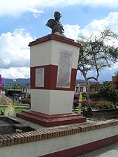 Bust of Simón Bolívar
 -
 Monument to the farmer
 -
 Fruit cultivation
 -
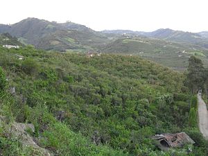 Fruit cultivation


References
edit- ^ a b c d (in Spanish) Official website Nuevo Colón
- ^ (in Spanish) El significado del nombre Boyacá y sus pueblos
- ^ "Table 1 Overview of the Köppen-Geiger climate classes including the defining criteria". Nature: Scientific Data. 23 October 2023.
- ^ "Promedios Climatológicos 1981–2010" (in Spanish). Instituto de Hidrologia Meteorologia y Estudios Ambientales. Archived from the original on 15 August 2016. Retrieved 3 June 2024.