Monte Stello (or Monte Stellu) is a mountain in the department of Haute-Corse on the island of Corsica, France. It is the second highest point in the Monte Stello massif, which forms the backbone of Cap Corse.
| Monte Stello | |
|---|---|
| Monte Stellu | |
 Monte Stellu | |
| Highest point | |
| Elevation | 1,306 m (4,285 ft) |
| Prominence | 347 m (1,138 ft) |
| Parent peak | Cima di e Follicie |
| Isolation | 5.1 km (3.2 mi) |
| Coordinates | 42°47′19″N 9°25′07″E / 42.78861°N 9.41861°E |
| Geography | |
 Monte Stello | |
| Country | France |
| Department | Haute-Corse |
| Geology | |
| Formed by | Fold and thrust belt |
| Orogeny | Alpine orogeny |
| Age of rock | Cretaceous |
| Type of rock | Ophiolite |
Location edit
The peak is roughly at the intersection of the borders of the communes of Olcani to the northwest, Olmeta-di-Capocorso to the west and Brando to the east. It is east of the village of Olmeta-di-Capocorso and west of the village of Erbalunga on the east coast.[1]
Physical edit
Monte Stello has a prominence of 347 metres (1,138 ft) and an elevation of 1,306 metres (4,285 ft). It is isolated by 5.1 kilometres (3.2 mi) from the 1,324 metres (4,344 ft) Cima di e Follicie to the north northwest.[2]
Monte Stello consists of Cretaceous ophiolites that were formed during the Alpine orogeny.[3]
Hiking edit
The trail from the hamlet of Pozzo has a total ascent of about 1,000 metres (3,300 ft). It is long and takes about six and a half hours to complete, but is well-marked and not technically demanding. It runs through maquis shrubland. From the summit there is an excellent panorama of the north of Corsica.[4]
Gallery edit
-
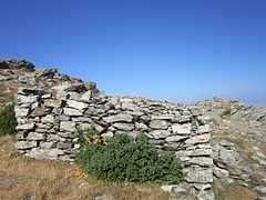 Shelter near the summit of Monte Stellu
 -
 Monte Stellu seen from Cima à e Follicce
 -
 Hamlet of Silgaggia and crestline of Monte Stellu


Notes edit
Sources edit
- "Atlas thématique de la Corse. BASTIA 1/50.000." (PDF), brgm.rf (in French), BRGM - Service Géologique Régional Bastia, 1996, retrieved 2021-12-10
- "Monte Stello in Corsica", Hiking and Cooking in the South of France, retrieved 2021-12-08
- "Monte Stello, France", Peakbagger, retrieved 2021-12-08
- "Node: Monte Stello (1321573465)", OpenStreetMap, retrieved 2021-12-08