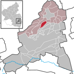
Battenberg (officially Battenberg (Pfalz)) is an Ortsgemeinde – a municipality belonging to a Verbandsgemeinde, a kind of collective municipality – in the Bad Dürkheim district in Rhineland-Palatinate, Germany.
Battenberg | |
|---|---|
Location of Battenberg within Bad Dürkheim district  | |
| Coordinates: 49°31′55″N 08°08′18″E / 49.53194°N 8.13833°E | |
| Country | Germany |
| State | Rhineland-Palatinate |
| District | Bad Dürkheim |
| Municipal assoc. | Leiningerland |
| Government | |
| • Mayor (2019–24) | Hans-Peter Schmidt[1] (Ind.) |
| Area | |
| • Total | 5.45 km2 (2.10 sq mi) |
| Highest elevation | 330 m (1,080 ft) |
| Lowest elevation | 300 m (1,000 ft) |
| Population (2022-12-31)[2] | |
| • Total | 382 |
| • Density | 70/km2 (180/sq mi) |
| Time zone | UTC+01:00 (CET) |
| • Summer (DST) | UTC+02:00 (CEST) |
| Postal codes | 67271 |
| Dialling codes | 06359 |
| Vehicle registration | DÜW |
| Website | www |
Geography
editLocation
editThe municipality lies in the Rhine-Neckar urban agglomeration on the seam between the Haardt and the Upper Rhine Plain. Standing together 300 m above sea level, high above the river Eckbach's banks are the small village and the like-named castle, Burg Battenberg, to the east. Battenberg belongs to the Verbandsgemeinde of Leiningerland, formed in 2018, whose seat is in Grünstadt, although that town is itself not in the Verbandsgemeinde.
History
editBattenberg Castle, which was owned since the Middle Ages by the Counts of Leiningen, to whom belonged the Leiningerland, controlled together with the other castle across the dale to the north (1 400 m away as the crow flies), Neuleiningen Castle, the entrance to the valley, the Eckbach valley. On 7 September 1966, the municipality was given the epithet “(Pfalz)”. Until 1969, the municipality belonged to the now abolished district of Frankenthal (Landkreis Frankenthal).
Politics
editMunicipal council
editThe council is made up of 8 council members, who were elected by majority vote at the municipal election held on 7 June 2009, and the honorary mayor as chairman.[3]
Coat of arms
editThe municipality's arms might be described thus: Per fess azure an eagle displayed wings elevated argent armed and langued gules, and argent a greyhound courant sinister sable.
Battenberg's arms developed out of the link between the Counts of Leiningen and Murbach Abbey in Alsace. The “greyhound” here is called the “Hound of Murbach” in the German blazon.
See also
edit- Battenberg Castle
- House of Leiningen
- Battenberg, Hesse, the town linked with the name Mountbatten.
References
edit- ^ Direktwahlen 2019, Landkreis Bad Dürkheim, Landeswahlleiter Rheinland-Pfalz, accessed 3 August 2021.
- ^ "Bevölkerungsstand 2022, Kreise, Gemeinden, Verbandsgemeinden" (PDF) (in German). Statistisches Landesamt Rheinland-Pfalz. 2023.
- ^ Kommunalwahl Rheinland-Pfalz 2009, Gemeinderat
External links
edit- Municipality’s official webpage (in German)
- Private webpage about Battenberg (in German)
- Battenberg in the collective municipality’s Web pages (in German)


