Maps I create from requests. PS: I'm also busy with other project, so provide an accessible and reliable source, and put your request shortly and clearly.
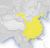
Animated China Map - Urgently Needs Replacing
edit

- This map urgently needs replacing with something more historically accurate. It is currently in use on no less than 38 unique language editions of Wikipedia. (In October the original author promised to do this by spring however this has not happened. It is now summer, and 38 language editions of Wikipedia are still pushing out what could be construed as erroneous, uncited propaganda in lieu of cited fact.)
- Because any serious map of China's historical borders is going to be a highly politically charged endeavour with many cross-claims, and because each layer of the animation represents a complex project worth tracking in detail and Mediawiki does not support this adequately, I have started a 'github' project for the map to manage each layer (ie: each specific period), the history of the manipulation of each of those layers, issues with each of those layers, and the automatic building of an animated 'final version'. (GitHub allows anyone to fork the project including all of its history and source files, which should prevent situations like that we see now where change is halted by a single individual becoming unresponsive.)
- I propose maintaining discussion on a talk page here (anyone care to make one?), and duplicating any such issues through as GitHub issues where appropriate.
- In order to start, I need a good quality plain raster topographic (black and white gradient is fine, as per current image but much higher resolution please - we can scale down as appropriate when generating finished output) covering the region of modern China. Could anyone provide this please? I am on a GPRS link in India right now and do not have the bandwidth to download elevation data and mapping software to generate one myself. Thanks. (PS: Please post a note to my talk page, thanks!)
Sincerely prat (talk) 18:41, 24 July 2011 (UTC)
- I'm on it (too) as a series of SVG files for Autumn/Winter 2011. I already made the Spring and Autumn Period map (see rightside), made using one source, QGis, the QGis tutorials, Inkscape, and the map conventions. I recently booked an academic "Atlas of Chinese History" (Chinese edition) to push further. My atlas will be delivered to my house around August 20th. Wait some more weeks and I will push further this series. Wait some months and the full gif will be available, based on this authorative source. I'm also interested to explore your solution, while I don't understand it clearly yet. Yug (talk) 22:02, 24 July 2011 (UTC)
- Just read your project description. I want to be your friend. : ] I agree with you about the Chinese-centric POV of antic history, that why my onw map use "Chinese plain" rather than the modern concept of China (modern country). I avoid to display the modern borders, which are supportive of the modern definition of China as the norm. In short, as a mapmaker and mapmaker for the Chinese history, I love your project. Yug (talk) 22:45, 24 July 2011 (UTC) (through I keep focus on my own project for now, for time consuming reason)
- I will output the large topographic background for you tomorrow, something like this. Then let's our project compete ! Yug (talk) 22:49, 24 July 2011 (UTC)
- Thanks a lot Yug! Can you please ensure it's black and white on land with a fixed gradient (ie: dark to light, or light to dark) along the elevations, instead of coloured (ie: instead of the current green-yellow-brown)? This should make it easier to overlay different coloured territories on the map and make out topography clearly when the map is scaled down. prat (talk) 05:44, 25 July 2011 (UTC)
Delivery 1
editDelivery ! : ]
- media:Chinese history large - 51E146W, 14N52N-color topography.png
- media:Chinese history large - 51E146W, 14N52N-color topography & borders.png
- media:Chinese history large - 51E146W, 14N52N-grey topography, borders, labels.png
- media:Chinese history large - 51E146W, 14N52N-grey topography.png
- media:Chinese history large - 51E146W, 14N52N-grey topography & borders.png
Right click and save as to download. Licensed under under CC-by-sa, but I discourage sharing for these ones which are 'quickly made'. The projection is equirectangular, maps limits being: 51E, 146W, 52N, 14N. The good point is : that ease georeferencing (automatically adding a city/place/coordinate on the map). The bad point is: the deformation is misleading, the northern areas look bigger (more important/powerful?) than what they actually are. I'm still exploring QGis and will look for a better projection. I have no clue for a better projection for a such large area yet, and how to do it, but I will find for Autumn. It stay, this projection have its advantages and can allow the prof of concept for your new files approach, which is, for reliability / academic reasons, need. I sincerely wish you good luck and smooth work for your project. Cheer, Yug (talk) 14:17, 26 July 2011 (UTC)


Thanks a lot Yug. A few points...
- I am downloading the grey one without borders as I agree with your view about the misleading approach of imposing modern borders.
- The map possibly extends too far to the west (far west of the modern border) which is not necessary as far as I know (being that other than limited expeditions to the west Chinese control of the area known as East Turkestan was pretty fervently independent for a large part of history, housing at first the great kingdoms of Kucha and Khotan, occasionally (from memory) coming under external (eg: Tibetan or Soghdian(?)) domination and later Islamic conquest. The British Museum includes all Arabic-script coins (of which I believe I have photographs, somewhere) that were minted in the region as late as 1910! See also Kazakh exodus from Xinjiang for further modern history. There were, however, definitely limited Chinese garrisons in sporadic military intervention throughout the area but Chinese cultural influence (as distinct from trade, which was more significant) is very much not at the forefront of the region's history.
- A few points I note about the colouring on the greyscale imagery you produced vs. the original:
- The correct distinction between the southwest plateaux (Yunnan-Guizhou Plateau) and neighbouring geography is highly significant in Chinese history (this is my area of interest). I note that the original map implies that this is similar terrain to the rest of China and thus more connected. Your version is a distinct improvement.
- I believe that the East Turkestan / Xinjiang region (Tarim Basin) is actually below sea level. However, the colouring on your map suggests otherwise: the colour of the area is lighter than that of coastal regions, when in fact is should (if below sea level) be darker. Not sure what to do here.
- The images you sent include sea borders but not land borders. It would be preferable to include either land but not sea, or no borders at all. Sea borders are sort of arbitrary to any ancient historical discussion...
- I agree that a projection that preserved spatial equality would be better. See if you can find one. I am sure QGis can do it ...
- I'm sort of feeling like I should download and skill up on QGis as well, otherwise precision for plotted areas going forward (when we get more precise sources) will suffer. I am trying to do that now (though GPRS in India is very low bandwidth, this will take awhile!).
- I have just noticed that there are dynasty-specific images by the original author as well that we should endeavour to update and keep ins-sync with the animation. One example is:
Western Jin Dynasty - I have invited one of the more detailed/properly cited historical Chinese map authors on Wikipedia, User:Yeu Ninje to join in. I note that you had previously contacted him via his talk page
- I think the image needs to be higher resolution. We can reduce for output ... but to ensure accurate input it would be good to have a high resolution raster as a base. Could you generate one with say twice the size? What is the maximum resolution available in your elevation dataset?

Thanks again, I am sure that this image will be a great resource for everyone. prat (talk) 01:36, 27 July 2011 (UTC)
- Borders: I think your system should use without border background, BUT should be able to switch to with-border, colored, and with labeled background for reference.
- Frame: Some few expeditions when that far westward, that why I include this area. Your project will 95% of time focus on smaller area, I agree. But when need, this western area should be available (in my opinion). If you want to include vassal states, same, should be available (Eastern Tujue)
- New greyscale map
- Happy to see you appreciate the work, I was careful to generate this differences between the Chinese plain, the southern hills, the Sichuan basin, and other key reliefs. (My possibilities being reduced since I use greyscales, and can't use black or dark grey.)
- The Tarim basin's altitude is clearly positive, these data come from the NASA, we can trust them without any doubt. Only a small area East of the Tianshan, the Turfan depression, goes under the sea level.
- Sea and lad border': don't understand clearly. Sea border = the dark blue coastline (just a wikipedia convention, not compulsory). Land border = ?
- Projection: I failed until now to produce suitable projection.
- QGis tutorials: QGis is just some MB, but GIS layers need are about 5 GB altogether. The tutorials will speed up your learning, don't include all my tips (I'm busy in real life), so still need several evenings tinkering around. Since you have coding skills, should be better carefully collect your needs, request me maps, and use your coding skills than none else can provide.
- Former dynasty maps available: good, need to check sources.
- Yeu Ninje: he stopped to be active in 2007. Contact him by email, hoping he will answer.
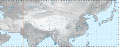
- Higher resolution: My project aim is to create 3 standard, georeferenced, frames preserving spatial equality for Chinese history, namely 1. Chinese history large going far west-north-south ; 2. Chinese history medium - Han populated area ; 3. Chinese history small - the former Chinese plain for pre-Qin periods. Then, upon this solid basis, to recreate all historical maps with those 3 frames and associates backgrounds. Your request come 1~2 month earlier, I haven't found yet the suitable 3 frames, neither the suitable projection, so I can't output the definitive background yet (still digging... slowly).
The equirectangular backgrounds I shared with you is not the definitive background / projection / layers-set yet. That's why I prefer to provide a simply good enough resolution, discouraging spreading / duplicating into many specific maps. I can for sure output you an higher resolution of this temporary equirectangular background for prof concept, but be aware that these backgrounds are for proof of concept testing, not the final version. Yug (talk) 07:00, 27 July 2011 (UTC)
Delivery 2
editNew delivery : ![]() Done ! Same frame, higher resolution, right click on the same links + "save as".
Done ! Same frame, higher resolution, right click on the same links + "save as".
For the frames change, please download media:Chinese history frames - 51E146W, 14N52N-color topography, borders, coordinates.svg. I added visible coordinates, and 4 key frames (orange) as a proposal according to my experience. One of the middle frames may be deleted. Just download, open in Inkscape, and add in 4 or less blue frames for the frames your need according to your experience of Chinese history. Then upload to commons so I understand better your needs (frames). PS: please note that I'm running short of time and will move to other real life projects, one more delivery and I leave. Yug (talk) 11:17, 27 July 2011 (UTC)
-
 Base made using QGis tutorials + some tips.

.png)
- Looks good. Could you do one final high resolution grey (and colour, if you want the option to generate a coloured output) background for the second largest frame (ie: the one that spans between approximately Kyrgyzstan to Vladivostok)? This should be perfect. If possible also please remove the grey lines on the water, for example you can see one heading south from the western edge of Bangladesh, and there is one through Japan as well - thanks. I am still trying to get QGIS installed... sources are 100s of MB! prat (talk) 16:54, 27 July 2011 (UTC)
Delivery 3
edit![]() In progress : 60E134E, 14N52N. Yug (talk) 18:40, 27 July 2011 (UTC)
In progress : 60E134E, 14N52N. Yug (talk) 18:40, 27 July 2011 (UTC)
- Delivery 3 :
 Done.
Done. - media:Chinese history medium (3) - 60E134E, 14N52N-grey topography.png
- media:Chinese history medium (3) - 60E134E, 14N52N-color topography.png
- media:Chinese history medium (3) - 60E134E, 14N52N-color topography, borders, labels.png
- Finished for me, switch to you now. I guess you now have to focus on coding and the integration of 2 semantic layers with areas, icons, labels, legend for 2 dynasties, one small (Spring and Autumn Period), and one large dynasty (Tang dynasty) to create the proof of concept, and improve it accordingly. For the background, no need to be too picky... this is temporary: the frame, projection, and layers (lakes, rivers, Huanghe) need to be improve. Yug (talk) 19:07, 27 July 2011 (UTC)
- Thanks! Downloading now. Feel free to watch the github project to see how things are going. Right now still haven't got QGIS working. If you or anyone else feel like brainstorming on the open questions outlines in the README then let me know your thoughts. I will reproduce them below. prat (talk) 01:20, 28 July 2011 (UTC)
Open Questions
editOpen questions reproduced from the the github project:
- Degree of control: What is the best way to indicate varying levels of Chinese control and influence?
- Degree of reliability: What is the best way to indicate varying degrees of sources, ie: varying degrees of certainty as to our depiction?
- Foreign dominations: What about periods in which the dominant forces were not Chinese, ie: the Chinese themselves were under foreign domination?
- Technical approach: What is the best way to structure the project technically?

- Prat, there is the direction I'm taking.
- Degree of control: 1. Controled by Sinic administrations ; 2. de facto submission, obey to sinic will, allow sinic military to travel, provide military support ; 3. nominal submission, declare vassalage but not really visible (total autonomy). Three discrete colors such as dark yellow, yellow, light-white yellow + opacity 50% (?). Blur borders. And always use doted borders, never line borders (cf Yue Ninjie's maps) since the reliability of our modern source is never certain.
- Degree of reliability: hidden value in SVG layer's property, such in path id => "Tibets (reliability: 1/5)". But this may be a fake question : it's up to us to base our work upon the best available academic sources (Chinese books, Cambridge).
- Foreign dominations: What is foreign ? is former Qin (V c. BC), Wei (V c. CE) foreign ? for 'more likely': Qidan, Jurchen, Yuan, Qing (to expand)
- Technical approach: don't know. Yug (talk) 06:56, 28 July 2011 (UTC)
Update 2011-08-14
edit- Finally have QGis installed (now in China - internet is better than in rural India!)
- Learning QGis and thinking about the best mechanism for supporting vector and bitmap combination, without sacrificing the potential for automated image generation, with a view towards potentially integrating any developed code in to the Mediawiki codebase to support wiki-style user associated revisions, revision comments, revision difference visualisation, etc.
prat (talk) 03:05, 14 August 2011 (UTC)
- Pratye, If I understand well, you are trying to manages versions of a map by collecting semantic layers + sources on one side (ie: Qin, Tang, Ming, Qing), and background on the other side to generate animations.
- Languages versions: Please keep an eye on collecting languages layers (not background, not icons, but labels). The Map workshop have hundreds maps duplicated in several language de, fr, en, es, etc which are a core pain for managing and reliability (mistakes spread and are not corrected in all versions).
- QGis: I started a QGis tutorial on wiki, you are aware of it I think. It's not finished, but it will allow you to move faster for the first moves. They, you will have to explore yourself.
- Online Map editing ?: please keep me aware of your progress, I'm also supporting an user creating an online GIS map editing tool compatible with wiki, in flash. While it seems better to let each of you focus on his own project for now, at the end, it may be nice to integrate your 2 tools : manage versions (you) ; design maps (Jakub). Yug (talk) 10:19, 14 August 2011 (UTC)
- Prat, some news ? One French user is willing to create a script completely generating localization / topographic maps. Yug (talk) 11:56, 30 August 2011 (UTC)
- Unfortunately I have been swamped with my resettlement to China and various paid work and have not yet had the chance to move ahead further. However, I have not forgotten. Prompted by the coding challenge banner, today I applied for a paid position with the Wikimedia Foundation as a programmer and hope that if they select me I can focus on this tool full time. Otherwise, I hope to spend some time on it soon, but can't promise anything timewise. Right now I'm losing time due to travel - I'm in Bangkok and being flooded! prat (talk) 06:07, 21 October 2011 (UTC)
- Prat, some news ? One French user is willing to create a script completely generating localization / topographic maps. Yug (talk) 11:56, 30 August 2011 (UTC)
LlywelynII comments on project and specific maps
edit- First, thank you guys for the work that you're doing.
- Thanks ; )
- Point 2
- Second, if you can figure out how to use QGIS to crop images, please let me know on my talk page: I've got the program and the world data and can't figure out how to create regional maps without resorting to other programs. Surely there must be a way to do it within QGIS itself but the help is largely nonexistant. Your own cropping needs a little bit of work: the proposed base maps above leave out giant chunks of Manchuria that would be needed for appropriate Qing era maps. Meanwhile, they include far, far too much of India.
- a. Need a crooping tutorial. b. Chinese history maps claimed too large (India) -> We have to go that southward because of Vietnam. Yug (talk) 12:30, 23 October 2011 (UTC)
- Oh, ok.
- Except, no, you still don't, because – despite its name – China never controlled Cochinchina. You hardly even need the map to go as far south as Hue. Again, mho.
- Point 3
- a. Need a crooping tutorial. b. Chinese history maps claimed too large (India) -> We have to go that southward because of Vietnam. Yug (talk) 12:30, 23 October 2011 (UTC)
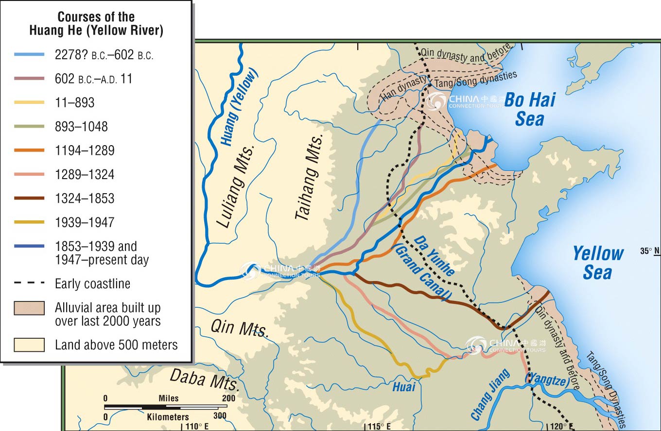
- Third – and here's the hard one, – please remember as you go to adjust your maps to the appropriate time. To go to all this effort to improve Wiki's Chinese maps and then still leave the Yellow River or the coast line exactly where it is today is senseless. Shanghai used to be on the sea; the Yellow River flowed south of Shandong for centuries, etc. Some sources – although you might need to muck around on JSTOR to verify the details or shore up your citation – are here and here and here. The Spring and Autumn map above – while beautiful – forgets this and (mho) leaves in far, far too many modern cities. Possibly Beijing's present location should be distinguished from Ji's old one, but really why not leave that for Ji's page? Looking at the map, every reader will initially think that Wuhan was an ancient city of China. After realizing their mistake, they'll just wonder why such unhelpful, misleading information was included on a historical map in the first place, esp. given that the confluence of the Han and Yangtze R. must have had a settlement at the time with a completely different name.
- Answers
- a. Geology and history, the shoreline and river lines are changing across history. Yes, I'm was myself the creator of the section Huanghe#History. We easily can use Qgis/Inkscape to move a major river over the map since sources are available and precise (such as "In year XXXX, the Huang he was going westward in the RRR river's pathway"). However, it is far harder to know where was the full shoreline in 620, 1000, or 1500, 1950, since precise sources are clearly missing. If I remember well, the Sping and Autumn map include the Huanghe difference, not the coastline difference (no source know). b. My source map included both historical cities, and some few modern cities as references for comparison. The legend is here, it's to the reader to look at a map legend. Yug (talk) 12:30, 23 October 2011 (UTC)
- My point was even if you want to include modern cities (which I personally would argue against), you included too many and made them look too similar to the period towns. Think fade, think italics, think thinner font, etc. (Or, y'know, think removal =)...)
- Point 4
- Finally, I assume "China-Grand_canal,_Sui_and_Tang.svg" at Grand Canal (China) is yours and be a little more careful about overlapping text on the thumbnail the pages use. (In fact, that specific overlapping text is highly questionable for a map including the Yangtze which is perfectly fine for navigation. Points like that shouldn't be made on the map, but simply on the page in question or at most in the caption.) The map also redraws some rivers but not others, misspells "lacke", doesn't explain the administrative distinction or population cut-off for "major city", and again uses the modern coastline for the past. If we could use era-appropriate names for rivers and seas, that would also be better, but that's less necessary. Finally, including a lower-case r is worse than nothing: if the rivers have a distinctive typeface, you can just say "Huai", "Yangtze", &c. If you want to include "River", you really ought to include the whole word and/or capitalize it. — LlywelynII 21:49, 21 October 2011 (UTC)
- Answer
- "China-Grand_canal,_Sui_and_Tang.svg" was mine, yes. Your fix request is visible in my User:Yug/Map workshop. I'm not in a map making period now, but I will fix most of your request one day in the coming months. Other real life and QGIS tutorials are more needed. Yug (talk) 20:00, 22 October 2011 (UTC)
- Sure, I know it's a hobby thing. And though I'm carping from up here in the peanut gallery, thanks again for y'all's work so far. — LlywelynII 06:53, 23 October 2011 (UTC)