User:Stepan Sychev (Baldi)/Nozhovka, Chastinsky District, Perm Krai
Nozhovka
Ножовка | |
|---|---|
| Coordinates: 57°05′52″N 54°44′54″E / 57.09778°N 54.74833°E | |
| Country | Russia |
| Federal subject | Perm Krai |
| Administrative district | Chastinsky District |
| Founded | 1740 |
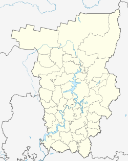
Nozhovka (Russian: Ножовка ) is a rural locality (a selo) and the administrative center of Chastinsky Municipal District[2] of Perm Krai, Russia.
Geographical position
editThe village is located on the right bank of the Votkinsk reservoir at a distance of about 25 kilometers in a straight line to the south-west from the village of Chastye.
History
editFounded in 1740 at the Christmas ironworks, launched in 1744. Subsequently, the number of Rozhdestvensky factories increased to four (not counting a separate nickel production, which operated in 1874-1876). In administrative-territorial terms, the village belonged to the Okhansky Uyezd of the Perm Governorate.
Due to low competitiveness, the Christmas factories stopped working by 1890[3]. After the closure of the factory, handicrafts, the production of matting sacks and leather shoes, were developed in the village.
In the Soviet period of history there were collective farms named after. Molotov, "40 years of October", "The Testaments of Ilyich" and, finally, the state farm "Nozhovsky", which existed from 1965 to 1991. In the vicinity of the village, oil is produced at the Nozhovskoye field, discovered in 1966[4].
Until 2020, it was the center of the Nozhovsky rural settlement of the Chastinsky district[2].
Climate
editThe climate is temperate continental, with cold and long winters and warm short summers. The average annual air temperature is 1.9 °C. The warmest month is July (18.7 °C), the coldest is January (-14.6 °C), the absolute maximum reaches 38 °C, the absolute minimum is -48 °C. The last spring frosts occur on average on May 23, the first autumn frosts on September 18. The duration of the frost-free period is 117 days. Snow cover is established on average by November 6-9, the first appearance of snow was recorded on October 14-20. The average long-term snow cover height reaches 55 cm. The snow cover lasts for 161 days. Snow melting is observed in late April - early May[5].
Infrastructure
editAgricultural enterprise LLC "Nozhovsky", Krasnokamsky oil production site of CJSC "LUKOIL-Perm", housing and communal services enterprises, "Perm-gosles" branch, small businesses, weather station. There is a secondary school and a special (correctional) boarding school of the VIII type (for teaching mentally retarded children), a house of culture, a library[4].
Population
editResident population was 1991 (97% Russians) in 2002[6], 1765 people in 2010[7].
References
editNotes
- ^ Cite error: The named reference
2010Censuswas invoked but never defined (see the help page). - ^ a b "Закон Пермского края от 2 марта 2020 года N 513-ПК «Об образовании нового муниципального образования Частинский муниципальный округ Пермского края»". Archived from the original on 2020-06-11. Retrieved 2020-06-11.
- ^ А. Б., Кудымов (2003). "Рождественские железоделательные заводы XVIII-ХІХ вв.: краткий исторический очерк" [Christmas ironworks of the 18th-19th centuries: a brief historical outline] (PDF). Ural industrial. Bakunin Readings: Materials of the V Regional Scientific Conference, December 2002 (in Russian) (Урал индустриальный. Бакунинские чтения: материалы V региональной научной конференции, декабрь 2002 ed.). Yekaterinburg: 54–57. Archived from the original (PDF) on 2018-05-05.
- ^ a b Е. Н., Шумилов. "НОЖОВКА, ЧАСТИНСКИЙ РАЙОН, СЕЛО" [NOZHOVKA, CHASTINSKY DISTRICT, SELO]. Пермский край. Энциклопедия. Archived from the original on 2020-11-09. Retrieved 2020-06-11.
- ^ "Частинский муниципальный район Пермского края. Схема территориального планирования. Том 2" [Chastinsky municipal district of the Perm Territory. Scheme of territorial planning. Volume 2]. Federal State Information System of Territorial Planning. 2010.
- ^ Коряков, Ю.Б. "База данных "Этно-языковой состав населённых пунктов России"" [Database "Ethno-linguistic composition of settlements in Russia"]. Archived from the original on 2017-11-16. Retrieved 2020-06-11.
- ^ "Численность населения городских округов, муниципальных районов, городских и сельских поселений, городских населенных пунктов, сельских населенных пунктов Пермского края по итогам Всероссийской переписи 2010 года" [Population of urban districts, municipal districts, urban and rural settlements, urban settlements, rural settlements of the Perm Territory according to the results of the 2010 All-Russian Census]. Permstat. 2012. Archived from the original on 2020-06-26.

