Indiana State Highway Commission (1924). State Highway System of Indiana(PDF) (Map). Indianapolis: Indiana State Highway Commission – via Indiana University Bloomington Libraries.
Rand McNally (1926). Road Map of Indiana (Map). Chicago: Rand McNally – via Broer Map Library.
1926s
Rand McNally (1926). Road Map of Indiana (Map). Chicago: Rand McNally – via Broer Map Library.
1927
Indiana State Highway Commission (1927). State Highway System of Indiana(PDF) (Map). Indianapolis: Indiana State Highway Commission – via Indiana University Bloomington Libraries.
1928
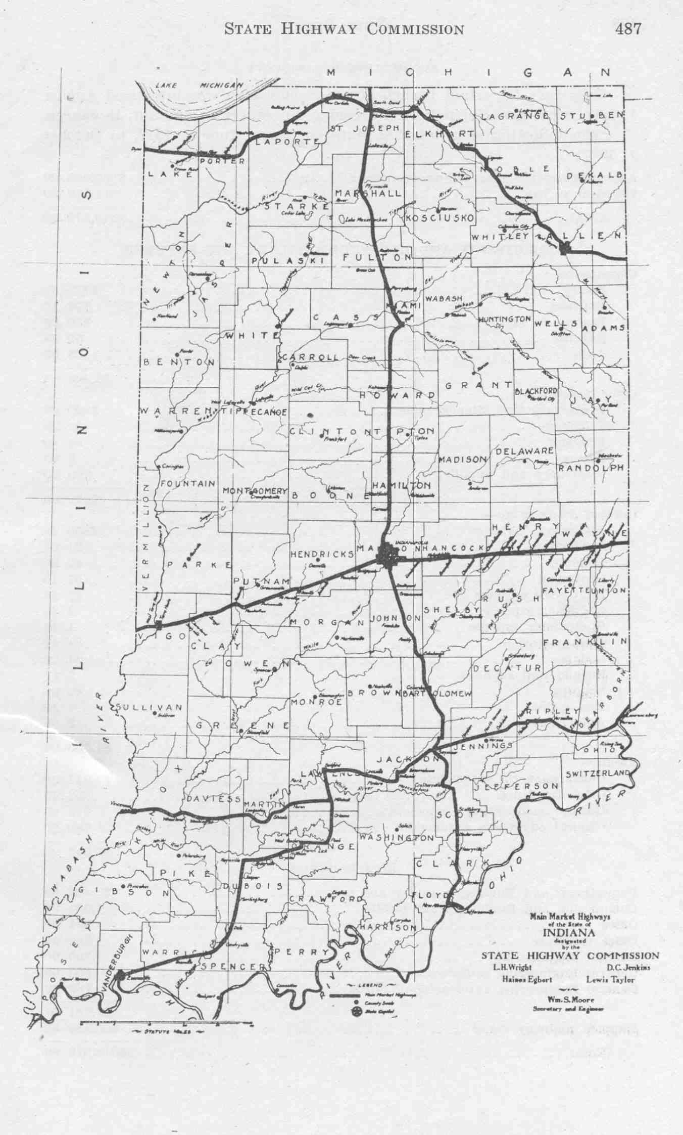
Indiana State Highway Commission (1928). State Highway System of Indiana(PDF) (Map). 1:795,000. Indianapolis: Indiana State Highway Commission. OCLC31119707, 190592752 – via Indiana University Bloomington Libraries.
1928a
Indiana State Highway Commission (September 1928). State Highway System of Indiana(PDF) (Map). 795,000. Indianapolis: Indiana State Highway Commission. OCLC31119707, 190592752 – via Indiana University Bloomington Libraries. {{cite map}}: Cite has empty unknown parameter: |1= (help)
1929-1
Indiana State Highway Commission (1929). State Highway System of Indiana (Map). Indiana State Highway Commission – via Indiana State Library and Historical Bureau.
1929-9
Indiana State Highway Commission (September 30, 1929). State Highway System of Indiana(PDF) (Map). Indianapolis: Indiana State Highway Commission – via Indiana University Bloomington Libraries.
1930-1
Indiana State Highway Commission (1930). State Highway System of Indiana (Map). Indiana State Highway Commission – via Indiana State Library and Historical Bureau.
1930-8
Indiana State Highway Commission (August 1, 1930). State Highway System of Indiana (Map). Indiana State Highway Commission – via Indiana State Library and Historical Bureau.
1930-9
Indiana State Highway Commission (September 30, 1930). State Highway System of Indiana(PDF) (Map). Indianapolis: Indiana State Highway Commission – via Indiana University Bloomington Libraries.
1931
Indiana State Highway Commission (September 30, 1931). State Highway System of Indiana(PDF) (Map). Indianapolis: Indiana State Highway Commission – via Indiana University Bloomington Libraries.
Indiana State Highway Commission (September 30, 1931). State Highways in the Federal Aid System(PDF) (Map). Indianapolis: Indiana State Highway Commission – via Indiana University Bloomington Libraries.
1932-1
Indiana State Highway Commission (January 1, 1932). State Highway System of Indiana (Map). 1:660,000. Indianapolis: Indiana State Highway Commission. OCLC53092152 – via Indiana State Library and Historical Bureau.
1932-9
Indiana State Highway Commission (September 30, 1932). State Highway System of Indiana(PDF) (Map). Indianapolis: Indiana State Highway Commission – via Indiana University Bloomington Libraries.
1933
Indiana State Highway Commission (February 1933). State Highway System of Indiana (Map). 1:618,000. Indiana State Highway Commission. OCLC53355434 – via Indiana State Library and Historical Bureau.
1934
Indiana State Highway Commission (January 1934). State Highway System of Indiana (Map). 1:600,000. Indianapolis: Indiana State Highway Commission. OCLC63673890 – via Indiana State Library and Historical Bureau.
1935
Indiana State Highway Commission (January 1935). State Highway System of Indiana (Map). 1:615,000. Indiana State Highway Commission. OCLC63899341 – via Indiana State Library and Historical Bureau.
1936
Indiana State Highway Commission (January 1936). State Highway System of Indiana (Map). 1:630,000. Indianapolis: Indiana State Highway Commission. OCLC63897436 – via Indiana State Library and Historical Bureau.
1937
Indiana State Highway Commission (1937). State Highway System of Indiana (Map). Indiana State Highway Commission – via Indiana State Library and Historical Bureau.
1938
Indiana State Highway Commission (1938). State Highway System of Indiana (Map). 1:630,000. Indiana State Highway Commission. OCLC64017142 – via Indiana State Library and Historical Bureau.
1939
Indiana State Highway Commission (January 1934). State Highway System of Indiana (Map). 1:600,000. Indianapolis: Indiana State Highway Commission. OCLC63673890 – via Indiana State Library and Historical Bureau.
1940
Indiana State Highway Commission (1940). State Highway System of Indiana (Map). 1:633,600. Indiana State Highway Commission. OCLC64590527.
1941
Indiana State Highway Commission (1941). State Highway System of Indiana (Map). 1:633,600. Indiana State Highway Commission. OCLC64574634 – via Indiana State Library and Historical Bureau.
1942
Indiana State Highway Commission (1942). State Highway System of Indiana (Map). 1:720,000. Indiana State Highway Commission. OCLC64382867 – via Indiana State Library and Historical Bureau.
1945
Indiana State Highway Commission (1945). State Highway System of Indiana (Map). 1:633,600. Indiana State Highway Commission. OCLC123132182 – via Indiana State Library and Historical Bureau.
1946
Indiana State Highway Commission (1946). State Highway System of Indiana (Map). 1:620,000. Indiana State Highway Commission. OCLC64382726 – via Indiana State Library and Historical Bureau.
1947
Indiana State Highway Commission (1947). State Highway System of Indiana (Map). 1:620,000. Indiana State Highway Commission. OCLC865083739 – via Indiana State Library and Historical Bureau.
1948
Indiana State Highway Commission (1948). State Highway System of Indiana (Map). 1:620,000. Indiana State Highway Commission. OCLC64382516 – via Indiana State Library and Historical Bureau.
1949
Indiana State Highway Commission (1949). State Highway System of Indiana (Map). 1:630,000. Indiana State Highway Commission. OCLC64558508 – via Indiana State Library and Historical Bureau.
1950
Indiana State Highway Commission (1950). State Highway System of Indiana (Map). 1:656,700. Indiana State Highway Commission. OCLC53353668 – via Indiana State Library and Historical Bureau.
1951
Indiana State Highway Commission (1951). State Highway System of Indiana (Map). 1:660,000. Indiana State Highway Commission. OCLC64558142 – via Indiana State Library and Historical Bureau.
1952
Indiana State Highway Commission (1952). State Highway System of Indiana (Map). 1:660,000. Indiana State Highway Commission. OCLC55533635 – via Indiana State Library and Historical Bureau.
1953
Indiana State Highway Department (1953). State Highway System of Indiana (Map). 1:660,000. Indiana State Highway Department. OCLC64574685 – via Indiana State Library and Historical Bureau.
1956
Indiana State Highway Department (1956). State Highway System of Indiana (Map). 1:660,000. Indiana State Highway Department. OCLC64383090 – via Indiana State Library and Historical Bureau.
1957
Indiana State Highway Department (1957). State Highway System of Indiana (Map). Indiana State Highway Department. OCLC78547924 – via Indiana State Library and Historical Bureau.
1958
Indiana State Highway Department (1958). State Highway System of Indiana (Map). 1:660,000. Indiana State Highway Department. OCLC64271139.
1959
Indiana State Highway Department (1959). State Highway System of Indiana (Map). 1:680,000. Indiana State Highway Department. OCLC64590481 – via Indiana State Library and Historical Bureau.
1960
Indiana State Highway Department (1960). State Highway System of Indiana (Map). 1:700,000. Indiana State Highway Department. OCLC489761071 – via Indiana State Library and Historical Bureau.
1961
Indiana State Highway Commission (1961). State Highway System of Indiana (Map). 1:680,000. Indiana State Highway Commission. OCLC55533640 – via Indiana State Library and Historical Bureau.
1962
Indiana State Highway Commission (1962). State Highway System of Indiana (Map). 1:680,000. Indiana State Highway Commission. OCLC65195920 – via Indiana State Library and Historical Bureau.
1963
Indiana State Highway Commission (1963). Indiana State Highway System (Map) (1963–1964 ed.). 1:633,600. Indiana State Highway Commission. OCLC883418455 – via Indiana State Library and Historical Bureau.
1963
Indiana State Highway Commission (1963). Indiana State Highway System (Map) (1963–1964 ed.). 1:633,600. Indiana State Highway Commission. OCLC883418455 – via Indiana State Library and Historical Bureau.
1964
Indiana State Highway Commission (1964). Indiana State Highway System (Map). 1:640,000. Indiana State Highway Commission. OCLC65195866 – via Indiana State Library and Historical Bureau.
1965
Indiana State Highway Commission (1965). Indiana State Highway System (Map) (1965–1966 ed.). 1:630,980. Indiana State Highway Commission. OCLC53370381 – via Indiana State Library and Historical Bureau.
1966
Indiana State Highway Commission (1966). Indiana State Highway System (Map) (1966–1967 ed.). 1:640,000. Indiana State Highway Commission. OCLC65209231 – via Indiana State Library and Historical Bureau.
1967
Indiana State Highway Commission (1967). Indiana State Highway System (Map) (1967–1968 ed.). 1:640,000. Indiana State Highway Commission. OCLC65221593 – via Indiana State Library and Historical Bureau.
1968
Indiana State Highway Commission (1968). Indiana State Highway System (Map) (1968–1969 ed.). 1:640,000. Indiana State Highway Commission. OCLC65221736 – via Indiana State Library and Historical Bureau.
1969
Indiana State Highway Commission (1969). Indiana State Highway System (Map). 1:631,000. Indiana State Highway Commission. OCLC314731307 – via Indiana State Library and Historical Bureau.
1970
Indiana State Highway Commission (1970). Indiana State Highway System (Map) (1970–1971 ed.). 1:640,000. Indiana State Highway Commission. OCLC65221477.
1971
Indiana State Highway Commission (1971). Indiana State Highway System (Map) (1971–1972 ed.). 1:640,000. Indiana State Highway Commission. OCLC65221419.
1972
Indiana State Highway Commission (1972). Indiana State Highway System (Map) (1972–1973 ed.). 1:640,000. Indiana State Highway Commission. OCLC65333830.
1973
Indiana State Highway Commission (1973). Indiana State Highway System (Map) (1973–1974 ed.). 1:633,900. Indiana State Highway Commission. OCLC501330315, 65333444.
1974
Indiana State Highway Commission (1974). Indiana State Highway System (Map) (1974–1975 ed.). 1:640,000. Indiana State Highway Commission. OCLC65332954.
1975
Indiana State Highway Commission (1975). Indiana State Highway System (Map) (1975–1976 ed.). Indiana State Highway Commission.
1976
Indiana State Highway Commission (1976). Indiana State Highway System (Map). 1:640,000. Indiana State Highway Commission. OCLC35172400, 11218443.
1977
Indiana State Highway Commission (1977). Indiana State Highway System (Map). 1:633,900. Indiana State Highway Commission. OCLC184938563, 11216462, 53344313, 11924099.
1978
Indiana State Highway Commission (1978). Indiana State Highway System (Map). 1:633,600. Indiana State Highway Commission. OCLC10684718.
1979
Indiana State Highway Commission (1979). Indiana State Highway System (Map). 1:640,000. Indiana State Highway Commission. OCLC65221535.
1980
Indiana State Highway Commission (1980). Indiana State Highway System (Map). 1:640,000. Indiana State Highway Commission. OCLC64223827, 5673147, 489761072.
1981
Indiana Department of Highways (1981). Indiana State Highway System (Map) (1981–1982 ed.). 1:640,000. Indiana Department of Highways. OCLC64223136.
1982
Indiana Department of Highways (1982). Indiana State Highway System (Map) (1982–1983 ed.). 1:640,000. Indiana Department of Highways. OCLC64223425.
1984
Indiana Department of Highways (1984). Indiana State Highway System (Map). 1:640,000. Indiana Department of Highways. OCLC64223268.
1985
Indiana Department of Highways (1985). Indiana State Highway System (Map). 1:640,000. Indiana Department of Highways. OCLC64222923.
1986
Indiana Department of Highways (1986). Indiana State Highway System (Map). 1:633,900. Indiana Department of Highways. OCLC13321556.
Indiana Department of Highways (1988). Indiana State Highway System (Map). 1:640,000. Indiana Department of Highways. OCLC65387294, 35825437, 315293246.
1989
Indiana Department of Transportation (1989). Indiana State Highway System (Map). 1:633,600. Indianapolis: Indiana Department of Transportation. OCLC26685029, 65387544.
1989 Rand McNally
Rand McNally (1989). Road Map of Indiana (Map). Chicago: Rand McNally – via Broer Map Library.
1990
Indiana Department of Transportation (1990). Indiana State Highway System (Map). 1:640,000. Indianapolis: Indiana Department of Transportation. OCLC65387008, 47836307.
1991
Indiana Department of Transportation (1991). Indiana State Highway System (Map) (1991–1992 ed.). 1:633,600. Indianapolis: Indiana Department of Transportation. OCLC25483579, 80128837, 872557094, 220912931.
1993
Indiana Department of Transportation (1993). Indiana State Highway System (Map) (1993–1994 ed.). 1:633,600. Indianapolis: Indiana Department of Transportation. OCLC25483579, 80128837, 872557094, 220912931.
1995
Indiana Department of Transportation (1995). Indiana Transportation Map (Map) (1995–1996 ed.). 1:633,600. Indianapolis: Indiana Department of Transportation. OCLC46648036.
1997
Indiana Department of Transportation (1997). Indiana Transportation Map (Map) (1997–1998 ed.). 1:633,600. Indianapolis: Indiana Department of Transportation. OCLC40102780.
1999
Indiana Department of Transportation (1999). Indiana Transportation Map (Map). 1:633,600. Indianapolis: Indiana Department of Transportation. OCLC47737740.
2000
Indiana Department of Transportation (2000). Indiana Transportation Map (Map). 1:650,000. Indianapolis: Indiana Department of Transportation. OCLC70269263.
2001
Indiana Department of Transportation (2001). Indiana Transportation Map (Map). 1:560,000. Indianapolis: Indiana Department of Transportation. OCLC51801692, 58420424, 48158494.
2002
Indiana Department of Transportation (2002). Indiana Transportation Map (Map). 1:560,000. Indianapolis: Indiana Department of Transportation. OCLC51445799.
2003
Indiana Department of Transportation (2003). Indiana Transportation Map (Map). 1:560,000. Indianapolis: Indiana Department of Transportation. OCLC55201262.
2004
Indiana Department of Transportation (2004). Indiana Transportation Map (Map). 1:560,000. Indianapolis: Indiana Department of Transportation. OCLC61670491.
2005
Indiana Department of Transportation (2005). Indiana Transportation Map (Map) (2005–2006 ed.). 1:560,000. Indianapolis: Indiana Department of Transportation. OCLC62999357.
2007
Indiana Department of Transportation (2007). Indiana Transportation Map (Map) (2007–2008 ed.). 1:560,000. Indianapolis: Indiana Department of Transportation. OCLC173288699.
2010
Indiana Department of Transportation (2010). Indiana Transportation Map(PDF) (Map) (2009–2010 ed.). 1:560,000. Indianapolis: Indiana Department of Transportation. OCLC654100248. Archived from the original(PDF) on July 15, 2010.
2012
Indiana Department of Transportation (2012). Indiana Transportation Map(PDF) (Map) (2011–2012 ed.). 1:550,000. Indianapolis: Indiana Department of Transportation. OCLC765461296.
Indiana Department of Transportation (2016). Indiana Roadway Map 2016(PDF) (Map). 1:550,000. Indianapolis: Indiana Department of Transportation. OCLC925532510.
2017
Indiana Department of Transportation (2017). Indiana Roadway Map 2017(PDF) (Map). 1:550,000. Indianapolis: Indiana Department of Transportation. OCLC976397802.
2018
Indiana Department of Transportation (2018). Indiana Roadway Map 2018(PDF) (Map). 1:550,000. Indianapolis: Indiana Department of Transportation.